蓝藻水华是湖泊水体富营养化的重要特征之一,不同水华蓝藻类群形成的水华特征、危害及其治理方法差异显著.因此,如何快速、准确地掌握不同蓝藻类群的时空分布特征成为实施富营养化湖泊污染治理与生态恢复、蓝藻生态灾害预测预警中一个亟待解决的科学问题.本研究基于纯藻种实验室培养和室内光学控制实验,在微囊藻(Microcystis)、鱼腥藻(Dolichospermum)、束丝藻(Aphanizomenon)3种主要水华蓝藻固有光学特性的基础上,通过甄别不同水华蓝藻的吸收、散射和后向散射光谱的特征波段,构建了基于吸收和散射特性的5种水华蓝藻类群的非线性最优化定量识别模型,其中,基于440、620和675 nm 3个波段吸收的a-CIM440,620,675具有较为稳定的定量识别能力;并基于野外实测光学特性数据,实现了巢湖主要水华蓝藻类群的定量监测,初步分析了巢湖主要水华蓝藻类群的时空分布特性.研究表明,巢湖的水华蓝藻以鱼腥藻、微囊藻为主,束丝藻较少,鱼腥藻主要出现在温度较低的季节,微囊藻在夏季的西部湖区占优势;巢湖水华主要为微囊藻藻华和鱼腥藻藻华,且浓度较高的蓝藻主要存在于水体表面以下20 cm范围内;微囊藻和鱼腥藻在非藻华断面垂向上均匀分布.本研究可为富营养化湖泊蓝藻水华预测预警以及相关管理部门决策提供重要的理论依据和科学支撑.
Due to the difference of vertical distribution of algae in lakes, it is necessary to carry out remote sensing estimation of algal biomass based on the vertically heterogeneous distribution of chlorophyll in order to improve the accuracy of biomass inversion. A new algorithm is proposed and validated to measure algal biomass in Lake Chaohu based on the Moderate Resolution Imaging Spectrometer (MODIS) images. The algal biomass index (ABI) is defined as the difference in remote-sensing reflectance (R-rs, sr(-1)) at 555 nm normalized against two baselines with one formed linearly between R-rs(859) and R-rs(469) and another formed linearly between R-rs(645) and R-rs(469). Both theory and model simulations show that ABI has a good relation with the algal biomass in the euphotic zone (R-2 = 0.88, p < 0.01, N = 50). Field data were further used to estimate the biomass outside the euphotic layer through an empirical algorithm. The ABI algorithm was applied to MODIS Rayleigh-corrected reflectance (R-rc) data after testing the sensitivity to sun glint and thickness of aerosols, which showed an acceptable precision (root mean square error < 21.31 mg and mean relative error < 16.08%). Spectral analyses showed that ABI algorithm was immune to concentration of colored dissolved organic matter (CDOM) but relatively sensitive to suspended particulate inorganic matter (SPIM), which can be solved by using Turbid Water Index (TWI) though in such a challenging environment. A long-term (2012-2017) estimation of algal biomass was further calculated based on the robust algorithm, which shows both seasonal and spatial variations in Lake Chaohu. Tests of ABI algorithm on Sentinel-3 OLCI demonstrates the potential for application in other remote sensors, which meets the need of observation using multi-sensor remote sensing in the future. (C) 2021 Elsevier B.V. All rights reserved.
The largest blue-green infrastructures in industrialized, urbanized and developed regions in China are often multiuse wetlands, located just outside growing urban centers. These areas have multiple development pressures while providing environmental, economic, and social benefits to the local and regional populations. Given the limited information available about the tradeoffs in ecosystem services with respect to competing wetland uses, wetland managers and provincial decision makers face challenges in regulating the use of these important landscapes. In the present study, measurements made by citizen scientists were used to support a comparative study of water quality and wetland functions in two large multiuse wetlands, comparing areas of natural wetland vegetation, tourism-based wetland management and wetland agriculture. The study sites, the Nansha and Tianfu wetlands, are located in two of the most urbanized areas of China: the lower Yangtze River and Pearl River catchments, respectively. Our results indicated that the capacity of wetlands to mitigate water quality is closely related to the quality of the surrounding waters and hydrological conditions. Agricultural areas in both wetlands provided the lowest sediment and nutrient retention. The results show that the delivery of supporting ecosystem services is strongly influenced by the location and use of the wetland. Furthermore, we show that citizen scientist-acquired data can provide fundamental information on quantifying these ecosystem services, providing needed information to wetland park managers and provincial wetland administrators.
Optical complexity and various properties of Case 2 waters make it essential to derive inherent optical properties (IOPs) through an appropriate method. Based on field measured data of Lake Chaohu between 2009 and 2018, the quasi-analytical algorithm (QAA) was modified for the particular scenario of that lake to derive absorption coefficients based on the moderate-resolution imaging spectroradiometer (MODIS) bands. By changing the reference wavelength to longer ones and building a relationship between the value of spectral power for particle backscattering coefficient (Y), suspended particulate matter (SPM), and above-surface remote-sensing reflectance (Rrs), we improved the accuracy of the retrieval of total absorption coefficients. The absorption coefficients of gelbstoff and non-algal particulates (adg) and absorption coefficients of phytoplankton (aph) in Lake Chaohu were also derived by changing important parameters according to Lake Chaohu. The derived aph tend to be bigger than measured aph in this study, while derived adg tend to be smaller than measured data. We also used the corrected MODIS surface reflectance product (MOD09/MYD09) to calculate the aph(443), aph(645), and aph(678) by the model proposed in this study. It shows that in summer and autumn, aph tended to be higher in the northwestern part of Lake Chaohu, and were relatively lower in the spring and winter, which is similar to previous studies. Overall, our study provides an algorithm that is effectively used in the case of Lake Chaohu and applicable to the data obtained by MODIS, which can be used for further study to investigate the change law of absorption coefficients in long time series by applying MODIS data.
Algal blooms in eutrophic lakes have been a global issue to environmental ecology. Although great progress on prevention and control of algae have been made in many lakes, systematic research on long-term temporal-spatial dynamics and drivers of algal blooms in a plateau Lake Dianchi is so far insufficient. Therefore, the algae pixel-growing algorithm (APA) was used to accurately identify algal bloom areas at the sub-pixel level on the Moderate Resolution Imaging Spectroradiometer (MODIS) data from 2000 to 2018. The results showed that algal blooms were observed all year round, with a reduced frequency in winter–spring and an increased frequency in summer–autumn, which lasted a long time for about 310–350 days. The outbreak areas were concentrated in 20–80 km2 and the top three largest areas were observed in 2002, 2008, and 2017, reaching 168.80 km2, 126.51 km2, and 156.34 km2, respectively. After deriving the temporal-spatial distribution of algal blooms, principal component analysis (PCA) and redundancy analysis (RDA) were applied to explore the effects of meteorological, water quality and human activities. Of the variables analyzed, mean temperature (Tmean) and wind speed (WS) were the main drivers of daily algal bloom areas and spatial distribution. The precipitation (P), pH, and water temperature (WT) had a strong positive correlation, while WS and sunshine hours (SH) had a negative correlation with monthly maximum algal bloom areas and frequency. Total nitrogen (TN) and dissolved oxygen (DO) were the main influencing factors of annual frequency, initiation, and duration of algal blooms. Also, the discharge of wastewater and the southwest and southeast monsoons may contribute to the distribution of algal blooms mainly in the north of the lake. However, different regions of the lake show substantial variations, so further zoning and quantitative joint studies of influencing factors are required to more accurately understand the true mechanisms of algae in Lake Dianchi.
 Minqi Hu合作论文数5
 Yuchao Zhang (张玉超)合作论文数Nangjing Institute of Geography & Limnology, Chinese Academy of Sciences;University of Chinese Academy of Sciences5
 Ronghua Ma (马荣华)合作论文数中国科学院大学中国科学院南京地理与湖泊研究所4
 Yuanyuan Jing合作论文数4Yi-xuan ZHANG (张壹萱)合作论文数1Wang Qian合作论文数1
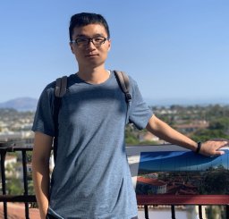 Zhigang Cao (曹志刚)合作论文数Nanjing Institute of Geography and Limnology, Chinese Academy of Sciences1
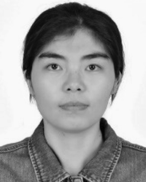 Kun Xue合作论文数Nanjing Institute of Geography and Limnology, Chinese Academy of Sciences1
 Steven Arthur Loiselle合作论文数Dipartimento di Biotecnologie, Chimica e Farmacia, Università degli Studi di Siena1




