The paleoclimate and paleoenvironmental conditions of Crimea are scarcely known due to the lack of high-resolution archives in this area. Crimean speleothems have a high potential of providing valuable information and filling the knowledge gap on the paleoclimate in the northern part of the Black Sea area.We acquired six well-dated stalagmite records from Crimean caves which grew during different intervals of the Holocene and MIS 3 with a good overlap, spanning from 2.7 (± 0.1) to 58.0 (± 0.0) ka BP. Records of δ18O and δ13C show some resemblance to the Sofular record from the southern Black Sea coast. However, based on our knowledge of the modern pathways of moisture supply to Crimea (with only ca. 14 % of moisture originating from the Black Sea surface[1]), it can be expected that the controls of stalagmite δ18O values may be different in the south and north of the Black Sea. δ13C records show larger shifts than the δ18O records on the millennial time scale (e.g., Heinrich events) especially during MIS 3. None of the speleothems grew during MIS 2, probably reflecting arid and cold climate conditions.These records are being analyzed and compared with other paleoclimate records to better understand: (1) the local hydrological dynamics and climate history during the Holocene and MIS 3, (2) the differences in climate conditions between the southern and northern Black Sea regions, and (3) the spatio-temporal teleconnection between the North Atlantic realm and the study area. [1] Langhammer et al. (2021) doi: 10.1029/2021EA001727
A three-component mixing model with the use of geochemical tracers was adapted to experimental basins of karst aquifer systems in the Mountain Crimea. As a result, the following stable recharge sources were identified: epikarstic water, forming mostly in the near-surface fractured and weathered zone of karstifying rocks; surface–slope water with different formation mechanisms; base flow karstic water, including a mixture of groundwater in the aeration zone of karst massifs below epikarst and phreatic water, forming the low-water part of runoff hydrograph. Epikarstic water contributes much to the runoff of karst aquifer systems (>30
Introduction. Assessment of groundwater vulnerability to contamination is an effective tool for scientific substantiation of the sanitary protection zones for drinking water sources. Karst ground waters of the Mountain Crimea form the main resources for water supply in the Crimean Peninsula. This study has a purpose to perform the assessme nt and mapping of karst ground waters resource vulnerability to contamination on such representative massifs of the Crimean Mountains as Chatyrdag, Dolgorukovsky, Karabi and Ay-Petri . Materials and methods. Assessment of karst ground waters vulnerability is conducted by use of Mountain -Crimean method. It has been developed on the base of some wide-tested European methods (COP-method and Slovene approach) with methodological modification and adaptation to regional conditions of the Mountain Crimea. The input data for assessment is spatial information about ground waters vulnerability factors: protective layers in vadose zone, flow concentration by streams, sinkholes and caves, precipitation regime etc. The collected spatial information was converted into attributed geo data layers, which were subsequently subjected to overlay operations in Arc GIS 10 software according to assessment scheme. Results. According to the assessment results, approximately 34 and 14% of the Chatyrdag massif area gained the category of high and very high vulnerability, on the Karabi massif – 14 and 17%, on the Dolgorukovsky massif – 14 and 2%, on the Ay-Petri massif – 19 and 7% of total area respectively. The result ing vulnerability maps demonstrate significant mosaics and contrast, which is associated with discrete distribution of protective covers and high differentiation of ground water recharge conditions within the catchments of karst massifs. Discussion. Analysis of the resulting vulnerability maps have revealed that the leading factors determining areas of high and very high vulner ability of karst waters are runoff concentration factors, while the factors of protective cover mainly determine the areas with low vulnerability. The zones of high vulnerability on the Chatyrdag and Karabi massifs are mainly coincide with areas of high density of karst forms (sinkholes and caves), while high vulnerability zones of the Ay-Petri and Dolgorukovsky massifs are predominantly associated with areas near permanent and temporary watercourses. In general, the obtained maps of groundwater vulnerability are quite consistent with the known data on the hydro-geological conditions of the assessed massifs. Conclusions. The identified differences in the area ratio and spatial distribution of ground waters vulnerability categories between the assessed massifs are a consequence of local geological, geo-morphological and hydrological features. The obtained results confirm high applicability of the Mountain-Crimean regional method for groundwater vulnerability assessment, at least for the karst massifs of the Mountain Crimea. Suggestions for practical application and direction for future research. The produced groundwater vulnerability maps create a scientific basis for delineation of water protection zones, assessing the risks of groundwater pollution and developing the territorial planning schemes within studied areas. The next stage of study is an assessment of groundwater source vulnerability for individual karst springs used in water supply.
Water runoff components were evaluated for experimental river basins in the Mountain Crimea based on a two-tracer mixing model with three recharge sources. The identified recharge sources for river runoff in karstified catchments were found to include: epikarstic waters, soil-slope waters, and baseflow waters, circulating at the contact with underlying impermeable rocks. Epikarstic waters account for a considerable portion of the runoff of small rivers. Their proportions in the outlet sections increase during floods and steadily increase with an increase in water discharge, obeying logarithmic relationships. The proportions of baseflow water decrease compared with those of epikarstic waters.
The results of generalization of field studies of the ionic composition of natural waters in the river basins of the Crimean Mountains during hydrological and hydrochemical expedition surveys in 2021–2022 are presented. The boundaries of catchment areas and their recharge areas have been estimated and five main types of water circulating in the river basins have been identified. The main patterns of change in ion concentrations in the water with change in runoff in the outlet sections of the Kuchuk-Uzenbash and Tonas rivers and karst aquifer systems (Karstovyi and Ayan springs and Kizil-Koba Cave (Red Cave)) have been identified. The typification of underground spring waters by chemical composition and altitudinal position of their discharge onto the surface of the catchment areas demonstrates their vertical hydrochemical zonality on the scale of a small river basin.
The data of long-term monitoring (2012–2023) of hydrological (levels) and physicochemical (temperature, specific conductance) characteristics of karst water of the Skelskaya Cave are analyzed. Parallel observations in opposite parts of the cave (Western and Eastern lakes) revealed synchronous level variations but different dynamics of the temperature, specific conductance, and isotopic composition of water. The difference between the physicochemical parameters can be most clearly seen in flood events, which indicates the input into the cave of two karst water flows from different catchments. These were identified to be the Karadagskii and Tarpanbairskii recharge areas, which lie at different elevation levels and carry their waters along the Karadagskii fault towards Western and Eastern lakes of the cave, respectively. The comparison of water level variations in the cave with the discharge dynamics of the Skelskii spring, as well as the physicochemical and isotope characteristics during floods revealed a strong correlation between them. Therefore, the Skelskii spring is the main discharge site (drain) of the karst aquifer system of the Skelskaya Cave.
Материалы Общероссийской научно-практической конференции «Изучение опасных природных процессов и геотехнический мониторинг при инженерных изысканиях», г.Москва, 17 марта 2023 г. 13 Причем сдвиговые разломы северо-восточного простирания имеют левостороннюю кинематику, а северо-западного -правую.Сделанные выводы совпадают с ранее опубликованными данными для многих месторождений Западной Сибири [20] и, по всей видимости, носят региональный характер, обусловленный едиными глобальными эндогенными причинами.Сопоставление результатов тренд-анализа по абсолютным отметкам кровли сеноманских отложений с сетью линеаментов приведено на рис
The Crimean Peninsula, with 84% of its territory composed of soluble rocks, is a region of wide occurrence and diverse manifestations of karst. Practically all groundwater of Crimea is related to karst aquifers, which have some hydrogeological features: the high velocities of groundwater flow and the high concentrations of dissolved substances in it; the spotty character of its discharge, the disagreement between subsurface and surface drainage areas, etc. The article shows the main problems of karst hydrogeology in the Crimean Peninsula, including the identification of evolution-genetic types of karst, the determination of the buffer function of the epikarst zone, the identification of the drainage boundaries of large karst sources, the evaluation of the rates of submarine discharge of karst water and its use, the substantiation of the zone of sanitary protection for karst water intakes, and the problems in the numerical geohydrological simulation under karst conditions. A combination of works is proposed for solving such problems, including systematic experiments for multitrassing karst water, monitoring studies in recharge areas and discharge boundaries of karst water-bearing systems. An obligatory condition for the correct interpretation of the obtained data is the use of the modern speleogenetic concepts.
The work is devoted to studying the conditions of karst formation and assessing the potential karst hazard at the construction site of the Tavrida federal highway between the settlements of Zuya and Donskoye in connection with the opening of the largest karst cavity in Piedmont Crimea, which threatens the safe operation of a transport facility
This study documents ferruginous accumulations in hypogene karst cavities in the Eocene limestones of central-eastern Crimean Piedmont, including unusual quartz-goethite tubes in Tavrida Cave, and aims to reveal their origin and significance to the problem of iron source for the adjacent Kerch-Taman iron ore province. We employed speleological, petrographic, mineralogical, and geochemical (including REE analysis) methods. Ferruginous materials dominated by goethite precipitated in open cavities, although metasomatic replacement of the host rock also occurred. Although the formation of conduits/cavities enclosing ferruginous materials clearly predated the main phase of hypogene speleogenesis in Tavrida Cave, both speleogenetic phases were controlled by the same cross-formational flow paths. Geochemical characteristics of the studied materials in all sites are largely similar, pointing to their genetic affinity. REEY patterns in most of the samples are remarkably similar to those found in iron formations worldwide, for which significant hydrothermal contribution is established. We show that these accumulations had been formed from acidic, reduced, hydrothermal fluids rising from a deep source and intruding oxidizing environment of the karstified Eocene aquifer, where goethite had been precipitated at the boundary of the iron reduction/oxidation zone. This mechanism is consistent with the hypogene origin of host karst conduits. These findings have implications to the origin of iron ores in the adjacent Kerch-Taman province, where deposits are closely associated with mud volcanoes operating there since at least the Middle Miocene. Although the marine sedimentary (hydrogenetic) origin of these deposits is universally accepted, the source of iron is a matter of debate. Revealing of the deep fluid source of iron for the ferruginous accumulations in hypogene caves in Piedmont suggests that the deep fluid system associated with mud volcanism in the Kerch-Taman region could have been a significant, if not the major, supplier of iron for ore deposits in the Cimmerian basin.
Karst springs in the Main Range of the Crimean Mountains and the Crimean Piedmont show a restricted range of values (delta O-18 = -10.5 to -8.0 parts per thousand, delta H-2 = -72 to -58 parts per thousand), somewhat more negative than the weighted mean of meteoric precipitation. This suggests preferential recharge at higher elevations during winter months. Groundwater tapped by boreholes splits in three groups. A first group has isotopic properties similar to those of the springs. The second group shows significantly lower values (delta O-18 = -13.3 to -12.0 parts per thousand, delta H-2 = -95 to -82 parts per thousand), suggesting recharge during colder Pleistocene times. The third group has high isotope values (delta O-18 = -2.5 to +1.0 parts per thousand, delta H-2 = -24 to -22 parts per thousand); the data points are shifted to the right of the Local Meteoric Water Line, suggesting water-rock exchange processes in the aquifer. These boreholes are located in the Crimean Plains and discharge mineralized (ca. 25 g L-1) thermal (65 degrees C) water from a depth of 1600-1800 m. Groundwater associated with mud volcanoes on the Kerch peninsula have distinct isotope characteristics (delta O-18 = -1.6 to +9.4 parts per thousand, delta H-2 = -30 to -18 parts per thousand). Restricted delta H-2 variability along with variable and high delta O-18 values suggest water-rock interactions at temperatures exceeding 95 degrees C.
The formation conditions of the Bishuli thermomineral waters from the Crimean Plain were determined by a complex of isotopic methods. The absence of tritium (3H 0.1 TU) and considerable radiocarbon age ( = 28 3 ka) are in line with the light isotopic composition of the mineral water (18O = 13.4 and 2H = 96), which is strongly different from that of the recent precipitation, river water, and groundwater of the region (18O from 7.4 to 8.7 and 2H from 50 to 62). The formation of the mineral waters should be assigned to the Dnestr pluvial interstadial of the last glaciation, which reached the maximum in the region approximately 27 ka ago. The recharge zone is probably located on the northern slope of the Crimean Mountains (at a distance of ~60 km), which, together with the absence of tritium, indicates that the mineral waters are protected from an anthropogenic impact.
Для установления условий формирования месторождения термоминеральных вод «Бишули» в Равнинном Крыму был использован комплекс изотопных методов. Отсутствие трития ( 3 H < 0.1 ТЕ) и значительный радиоуглеродный возраст (τ = 28±3 тыс. лет) согласуются с легким изотопным составом минеральной воды (δ 18 O = -13.4 ‰ и δ 2 Н = -96 ‰), резко отличающимся от современных осадков, речных и грунтовых вод района месторождения (δ 18 O = -7.4…8.7 ‰ и δ 2 Н = -50…-62 ‰). Формирование минеральных вод следует отнести к днестровскому плювиальному межстадиалу последнего этапа похолодания, имевшему в данном регионе максимум около 27 тыс. лет назад. Область питания месторождения, по-видимому, расположена на северных склонах Крымских гор (на удалении около 60 км), что в сочетании с отсутствием трития указывает на защищенность минеральных вод от антропогенного воздействия.
A first systematic study of the isotopic composition of precipitation on the Crimean Peninsula was carried over the period of 58 months at two stations located on the Crimean Piedmont (Simferopol, 290 m a.s.l.) and on the northern slope of the Main Range of the Crimean Mountains (Chatyr-Dag, 980 m a.s.l.). Oxygen and hydrogen isotope values of these stations yielded a Crimean Local Meteoric Water Line: delta H-2 = 7.3 delta O-18 + 4.8; r(2) = 0.97. The isotopic composition of precipitation at the two stations is partly (25% and 39%, respectively) correlated with the local air temperature, but the degree of this correlation shows large temporal variability. No correlation between isotopic composition and precipitation amount was observed. Far-field controls, such as changing sources, supplying moisture for the Crimean precipitation, or varying strength of the North Atlantic Oscillation do not influence the isotopic composition of precipitation in Crimea on these short time scales.
 сергей викторович токарев合作论文数13
 Boris Vakhrushev合作论文数9
 Alexander Klimchouk合作论文数Institute of Geological Sciences;National Academy of Science;Institute of Geological Sciences, National Academy of Science9Sergey V. Tokarev合作论文数7
 Yuri Dublyansky合作论文数Institute of Geology and Paleontology, Universität Innsbruck7е и тимохина合作论文数6а б климчук合作论文数5
 Christoph Spötl合作论文数Institute of Geology, University of Innsbruck5I. V. Tokarev合作论文数Intitute of Precambrian Geology, RAS 199164 St.Petersburg Russia5
 Tatiana Gubareva合作论文数4Boris I. Gartsman合作论文数4Lukas Langhamer合作论文数2elizaveta tymokhina合作论文数2
 Vsevolod M. Moreido合作论文数2с и болысов合作论文数1c spoetl合作论文数1а в бредихин合作论文数1С. С. Потапов合作论文数1
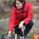 Olga Chervyatsova合作论文数1
 Elena Drobinina合作论文数1С. А. Буланов合作论文数1
 Hai Cheng (程海)合作论文数Institute of Global Environmental Change, Xi'an Jiaotong University;School of Human Settlements and Civil Engineering, Xi'an Jiaotong University1
 Sergey Shvarev合作论文数1A. N. Makkaveyev合作论文数1
 D. V. Kiseleva合作论文数Institute of Geology and Geochemistry, UB RAS Pochtovy per.1




