Marine imagery is a comparatively cost-effective way to collect data on seafloor organisms, biodiversity and habitat morphology. However, annotating these images to extract detailed biological information is time-consuming and expensive, and reference libraries of consistently annotated seafloor images are rarely publicly available. Here, we present the Antarctic Seafloor Annotated Imagery Database (AS-AID), a result of a multinational collaboration to collate and annotate regional seafloor imagery datasets from 19 Antarctic research cruises between 1985 and 2019. AS-AID comprises of 3,599 georeferenced downward facing seafloor images that have been labelled with a total of 615,051 expert annotations. Annotations are based on the CATAMI (Collaborative and Automated Tools for Analysis of Marine Imagery) classification scheme and have been reviewed by experts. In addition, because the pixel location of each annotation within each image is available, annotations can be viewed easily and customised to suit individual research priorities. This dataset can be used to investigate species distributions, community patterns, it provides a reference to assess change through time, and can be used to train algorithms to automatically detect and annotate marine fauna.
Meteoric-Be-10 has become a popular proxy for assessing glacial environments and processes around Antarctica, such as meltwater discharge or ice shelf environments. Despite applications in recent paleostudies, little testing of the mechanisms driving the deposition of Be-isotopes into marine sediments has been conducted. We used chemical leach procedures to sequentially or partially extract Be-10 and Be-9 from bulk sediments to assess the possible sources and depositional processes affecting them. Additionally, we leached the reactive phase of five different grainsize splits to determine whether Be-10/Be-9 ratios normalise for grainsize effects acting upon the Be-10 concentration. Reactive Be-isotopes are primarily situated in the oxide phases of sediments, with the amorphous oxide (Am-Ox) phases consisting of much higher Be-10/Be-9 ratios (similar to 7-10 x 10(-8)) than the crystalline oxides (similar to 1-3 x 10(-8); X-Ox), indicating that the Am-Ox phase better represents authigenic oxide production and a circumpolar deep water source, which is contrary to most of the current literature. Published leach procedures targeting the reactive phase of sediment consist of ratios in between the Am-Ox and X-Ox phases (similar to 3-7 x 10(-8)), indicating that they target both phases to some degree. The fractionation of Be-isotopes in Antarctic sediment samples shows that circumpolar deep water is the primary source of Be-10, and that the "reactive" signatures from different leach steps targeting the reactive phase are not the same.
Beryllium-10 (10Be) is proposed to be a potential proxy for investigating ice shelf presence and absence, or meltwater discharge in coastal polar environments. However, the sources and distribution of atmospherically produced meteoric-10Be in the Antarctic marine realm are yet to be fully characterized. We present a dataset of 9Be and 10Be concentrations, and 10Be/9Be ratios in seafloor surface sediments from the Antarctic continental shelf to assess the sources and processes contributing Be-isotopes to ice-sheet proximal marine settings. We show that upwelling waters (e.g. Circumpolar Deep Water) are a significant source of 10Be to continental shelf sediments. This limits the use of 10Be/9Be as a proxy for ice shelf environment or meltwater discharge, but instead provides a potential proxy for reconstructing Circumpolar Deep Water incursions onto Antarctic continental shelves.
The rapidly melting Totten Glacier of East Antarctica drains a basin containing ~3.5 m sea-level rise equivalent of ice, but the Totten Glacier dynamics and interaction with the Southern Ocean since the Last Glacial Maximum is not well understood. To better understand the response of the glacier to present and future climate changes, an accurate reconstruction of the retreat history of the Totten Glacier is needed. Hence, this study uses a multiproxy approach in analyzing beryllium isotopes, the first such record from this location, and grain size of a sediment core collected from the continental slope adjacent to Totten Glacier. The results, when evaluated together with nearby proxy records, reveal that the initial deglaciation of the Totten Glacier sector of the East Antarctic Ice Sheet began at ~18 ka BP. The rapid deglaciation from ~9 ka BP that followed is assumed to be caused by the intrusion of modified Circumpolar Deep Water to the grounding zone of the Totten Glacier. This intrusion may also be coupled with a weaker Antarctic Slope Current and southward shift of Antarctic easterlies. This result contributes to the body of knowledge regarding the dynamical response of marine-terminating glaciers to climate variability during the last deglaciation.
Antarctic Bottom Water (AABW) is the densest water mass in the world and drives the lower limb of the global thermohaline circulation. AABW is formed in only four regions around Antarctica and Cape Darnley, East Antarctica, is the most recently discovered formation region. Here, we compile 40 years of oceanographic data for this region to provide the climatological oceanographic conditions, and review the water mass properties and their role in AABW formation. We split the region into three sectors (East, Central and West) and identify the main water masses, current regimes and their influence on the formation of Cape Darnley Bottom Water (CDBW). In the eastern sector, Prydz Bay, the formation of Ice Shelf Water preconditions the water (cold and fresh) that flows into the central sector to similar to 68.5 degrees ${\sim} 68.5{}<^>{\circ}$E, enhancing sea ice production in Cape Darnley Polynya. This produces a high salinity variant of Dense Shelf Water (DSW) (up to 35.15 g/kg) that we coin Burton Basin DSW. In contrast, the western sector of the Cape Darnley Polynya produces a low salinity variant (up to 34.85 g/kg) we coin Nielsen Basin DSW. The resultant combined CDBW is the warmest (upper temperature bound of 0.05 degrees ${}<^>{\circ}$C) AABW formed around Antarctica with an upper bound salinity of similar to ${\sim} $34.845 g/kg. Our findings will contribute to planning future observing systems at Cape Darnley, determining the role that CDBW plays in our global oceanic and climate systems, and modeling past and future climate scenarios.
Seabed morphology maps and data are critical for knowledge-building and best practice management of marine environments. To facilitate objective and repeatable production of these maps, we have developed a number of semi-automated, rule-based GIS tools (Geoscience Australia's Semi-automated Morphological Mapping Tools - GA-SaMMT) to operationalise the mapping of a common set of bathymetric high and bathymetric low seabed Morphological Features. The tools have a graphical user interface and were developed using Python scripts under the widely-adopted proprietary ArcGIS Pro platform. The utility of these tools was tested across nine case study areas that represent a diverse range of complex bathymetric and physiographic settings. Overall, the mapping results are found to be more consistent than manual mapping and allow for capture of greater detail across a range of spatial scales. The mapping results demonstrate a number of advantages of GA-SaMMT, including: 1) requirement of only a bathymetry grid as sole data input; 2) flexibility to apply domain knowledge to user-defined tool parameters, or to instead use the default parameter settings; 3) repeatability and consistency in the mapping outputs when using a consistent set of tool parameters (user defined or default); 4) high-degree of objectivity; and 5) efficiency in mapping a large number (thousands) of seabed morphology features in a single dataset. In addition, GA-SaMMT can comprehensively quantify the characteristics of individual seabed bathymetric high and low features, respectively generating 34 and 46 metrics for each type of feature. Our results indicate that attribute metrics are invaluable in the interpretation and modelling of mapped Morphology Features and provide insights into their formative processes and habitat potential for marine communities.
Deciphering how the Antarctic Ice Sheet has responded to past climate warming is critical to understanding its sensitivity and role in current and future climate change. In this context, knowledge of the evolution of the Antarctic Ice Sheet in catchments with large potential sea-level contributions plays a key role. The Sabrina Coast of East Antarctica lies seaward of the second largest, but least known, subglacial basin on Earth, the Aurora Subglacial Basin. It is part of the East Antarctic Ice Sheet and drains to the Sabrina Coast via the Totten Glacier, the third largest drainage system in East Antarctica. Our refined, comprehensive seismic stratigraphic analysis of a large multichannel seismic data set collected in this sector of the Antarctic margin shows that sediments deposited on the continental slope and rise of the Sabrina Coast retain a well-preserved record of variations in glacial and oceanographic dynamics. Isobath and isopach maps evidence a complex, asymmetric evolution of the Sabrina slope and rise, with the western sector being the main sediment depocenter since the emplacement of the East Antarctic Ice Sheet, as indicated by the up to 4-km-thick glacial-related sequences and inferred sedimentation rates of up to 300 m/m.y. However, significant sediment accumulation also occurs in the eastern area, particularly in the western levees of the canyons. Our findings highlight the potential of this region for deep ocean drilling that will provide an unprecedented history of the dynamics of the marine-based ice sheet in the Aurora Subglacial Basin and its sensitivity to climate change under different background climate conditions.
Antarctic climate warming and atmospheric CO 2 rise during the last deglaciation may be attributed in part to sea ice reduction in the Southern Ocean. Yet, glacial–interglacial Antarctic sea ice dynamics and underlying mechanisms are poorly constrained, as robust sea ice proxy evidence is sparse. Here, we present a molecular biomarker-based sea ice record that resolves the spring/summer sea ice variability off East Antarctica during the past 40 thousand years (ka). Our results indicate that substantial sea ice reduction culminated rapidly and contemporaneously with upwelling of carbon-enriched waters in the Southern Ocean at the onset of the last deglaciation but began at least ~2 ka earlier probably driven by an increasing local integrated summer insolation. Our findings suggest that sea ice reduction and associated feedbacks facilitated stratification breakup and outgassing of CO 2 in the Southern Ocean and warming in Antarctica but may also have played a leading role in initializing these deglacial processes in the Southern Hemisphere.
Perth Canyon is Australia's second largest submarine canyon, and its shelf-incising morphology contrasts with the more prolific slope-confined canyons that typify Australia's passive continental margin. The canyon has a sinuous course that extends 120 km from the shelf break (~180 m depth) to its fan at the foot of the continental slope (~4500 m). Though the canyon initiates only 50 km offshore from a major city, its genesis and geomorphic stability have not been well understood. Bathymetry data acquired in 2015 by the Schmidt Ocean Institute enabled the application of a new two-part seafloor classification approach to objectively map the complexity of the system in unprecedented detail. Part 1 used a semi-automated approach to classify the seafloor bathymetry into morphological categories, and Part 2 defined these units as geomorphological features through the interpretation of sub-bottom and seismic images, sediment samples and acoustic backscatter datasets. The resulting geomorphic map reveals an array of aggradational (cyclic steps and sediment waves), incisional (entrenched canyon floor and nick-points) and mass movement (slump and slab failures) features that for the first time provide detailed insights into the canyon's formative processes. Large faults and the Cretaceous palaeobathymetry appear to have strong influence on the canyon's planform, its depth of incision, and the distribution and types of mass failure that characterise its flanks. These data also reveal the Perth Canyon to be a predominantly relict feature; a large Late Cretaceous infilled incised valley (subaerial) beneath the canyon headwall likely initiated the canyon's development and represents its initial and most active phase. Two more infilled incised valleys are stacked above the first, and demonstrate a progressive decrease in scale, and presumably also canyon activity. Each incised valley represents lowstand incisions of the palaeo-Swan River, and their timing is linked to pronounced Late Cretaceous to Cenozoic sea level regression events, palaeoclimatic change, and onshore catchment enlargement. The disconnection of the modern Perth Canyon from the present day Swan River, and the low rates of sediment accumulation on the adjacent shelf and slope, ensure low rates of sediment supply to the canyon, and only infrequent ignition of turbidity currents. Low rates of sediment supply can similarly account for the entrenched morphology of the modern fan and only minimal headwall movement coincident with seismic events in 2018. However, additional core and bathymetry data for the lower canyon reaches are required to conclusively determine the extent of recent canyon activity.
Repeat multibeam mapping of two slope-confined canyons on the northwest Australian margin provides new understanding of the processes that are active in shaping these environments. The Cape Range and Cloates canyons initiate on the mid to lower continental slope but are now known to be connected to the shelf via small channels and gullies. Both canyons have areas of steep walls, with evidence of slides, and large depressions on the canyon floors. These canyons were first mapped systematically with multibeam sonar in 2008 and were remapped in 2020 during a biodiversity survey that also collected high-resolution imagery and biological samples. Comparison of seabed features between these two time periods indicates active sliding, minor headwall retreat and continued excavation of deep depressions on the canyon floor. Significantly, intact blades of displaced seagrass imaged at various depths up to 4200 m throughout both canyons indicates that material sourced from the adjacent continental shelf is being transported through these canyon systems. Turbidity currents are actively modifying canyon walls and floor depressions, while also providing a sediment source that has resulted in minor accretion on the canyon floor. Sedimentation likely regulates benthic communities in these canyons, with imagery showing highest densities of sessile invertebrates in habitats protected from sedimentation (e.g. rock overhangs, cliff edges). Since steep canyon habitats are rare within these canyons, and support high benthic abundance, they likely represent biologically significant areas of the Gascoyne Marine Park. Repeat mapping provides an understanding of the dynamics of these canyons and a context for assessing and monitoring the stability of the seabed habitats within this marine reserve.
The Southern Ocean surrounding Antarctica is a region that is key to a range of climatic and oceanographic processes with worldwide effects, and is characterised by high biological productivity and biodiversity. Since 2013, the International Bathymetric Chart of the Southern Ocean (IBCSO) has represented the most comprehensive compilation of bathymetry for the Southern Ocean south of 60°S. Recently, the IBCSO Project has combined its efforts with the Nippon Foundation – GEBCO Seabed 2030 Project supporting the goal of mapping the world’s oceans by 2030. New datasets initiated a second version of IBCSO (IBCSO v2). This version extends to 50°S (covering approximately 2.4 times the area of seafloor of the previous version) including the gateways of the Antarctic Circumpolar Current and the Antarctic circumpolar frontal systems. Due to increased (multibeam) data coverage, IBCSO v2 significantly improves the overall representation of the Southern Ocean seafloor and resolves many submarine landforms in more detail. This makes IBCSO v2 the most authoritative seafloor map of the area south of 50°S.
Knowledge of life on the Southern Ocean seafloor has substantially grown since the beginning of this century with increasing ship-based surveys and regular monitoring sites, new technologies and greatly enhanced data sharing. However, seafloor habitats and their communities exhibit high spatial variability and heterogeneity that challenges the way in which we assess the state of the Southern Ocean benthos on larger scales. The Antarctic shelf is rich in diversity compared with deeper water areas, important for storing carbon (“blue carbon”) and provides habitat for commercial fish species. In this paper, we focus on the seafloor habitats of the Antarctic shelf, which are vulnerable to drivers of change including increasing ocean temperatures, iceberg scour, sea ice melt, ocean acidification, fishing pressures, pollution and non-indigenous species. Some of the most vulnerable areas include the West Antarctic Peninsula, which is experiencing rapid regional warming and increased iceberg-scouring, subantarctic islands and tourist destinations where human activities and environmental conditions increase the potential for the establishment of non-indigenous species and active fishing areas around South Georgia, Heard and MacDonald Islands. Vulnerable species include those in areas of regional warming with low thermal tolerance, calcifying species susceptible to increasing ocean acidity as well as slow-growing habitat-forming species that can be damaged by fishing gears e.g., sponges, bryozoan, and coral species. Management regimes can protect seafloor habitats and key species from fishing activities; some areas will need more protection than others, accounting for specific traits that make species vulnerable, slow growing and long-lived species, restricted locations with optimum physiological conditions and available food, and restricted distributions of rare species. Ecosystem-based management practices and long-term, highly protected areas may be the most effective tools in the preservation of vulnerable seafloor habitats. Here, we focus on outlining seafloor responses to drivers of change observed to date and projections for the future. We discuss the need for action to preserve seafloor habitats under climate change, fishing pressures and other anthropogenic impacts.
The seafloor beneath floating ice shelves accounts roughly a third of the Antarctic’s 5 million km 2 of continental shelf. Prior to this study, our knowledge of these habitats and the life they support was restricted to what has been observed from eight boreholes drilled for geological and glaciological studies. The established theory of sub-ice shelf biogeography is that both functional and taxonomic diversities decrease along a nutrient gradient with distance from the ice shelf front, resulting in a depauperate fauna, dominated by mobile scavengers and predators toward the grounding line. Mobile macro-benthic life and mega-benthic life have been observed as far as 700 km under an ice shelf. New observations from two boreholes in the Filchner-Ronne Ice Shelf challenge the idea that sessile organisms reduce in prevalence the further under the ice you go. The discovery of an established community consisting of only sessile, probably filter feeding, organisms (sponges and other taxa) on a boulder 260 km from the ice front raises significant questions, especially when the local currents suggest that this community is somewhere between 625 km and 1500 km in the direction of water flow from the nearest region of photosynthesis. This new evidence requires us to rethink our ideas with regard to the diversity of community types found under ice shelves, the key factors which control their distribution and their vulnerability to environmental change and ice shelf collapse.
Abstract. Understanding past retreat of Antarctic ice margins provides valuable insight for predicting how ice sheets may respond to future environmental change. This study, based on high resolution multibeam bathymetry from the nearshore region of the Windmill Islands, East Antarctica, reveals a style of retreat that has been rarely observed on the Antarctic margin. A suite of seafloor features record the final retreat stages of a relatively thin, and increasingly fractured tidewater glacier confined within narrow troughs and embayments, forming a suite of features more typical of warm-based ice, but occurring here in a region of cold-based ice with limited surface meltwater production. The pattern of moraines and crevasse squeeze ridges, reveals strong topographic and substrate control on the nature of ice sheet retreat. Topographic control is indicated by fine-scale variability in the orientation and distribution of glacial landforms, which show that the seabed topography influenced the shape of the ice margin, caused deflection of ice flow and led to the separation of flow downstream from topographic highs. The availability of water saturated marine sediments within the troughs and depressions also had a profound effect on the landform record, facilitating the construction of moraines and crevasse squeeze ridges within topographic lows, corresponding to areas of modern sediment accumulation. Surrounding areas of crystalline bedrock, by contrast, acted as sticky spots and lack a well-developed landform record. This seafloor glacial record emphasises the importance of understanding the bed topography and substrate when predicting the nature of ice margin retreat and provides new perspectives for understanding the stability of the East Antarctic margin.
This report updates the ‘Two-part Seabed Geomorphology classification scheme’ of Dove et al. (2016) and presents a new glossary ( Part 1 ) of Seabed Morphology features. This Morphology glossary is intended to provide marine scientists with a robust and consistent way to characterise the seabed. Each glossary entry includes a feature definition and a representative schematic diagram to support clear and accurate classification. Feature terms and definitions are primarily drawn from the International Hydrographic Organization (IHO) guide for undersea feature names, which are herein modified and augmented with additional terms to ensure the final feature catalogue and glossary encompasses the diversity of morphologies observed at the seabed, while also minimising duplication and/or ambiguity. This updated classification system and new glossary are the result of a collaboration between marine geoscientists from marine mapping programmes/networks in Norway (MAREANO), Ireland (INFOMAR), UK (MAREMAP), and Australia (Geoscience Australia) (MIM-GA). A subsequent report will present the ( Part 2 ) Geomorphology feature glossary.
The authors wish to thank the CSIRO Marine National Facility (MNF) for its support in the form of sea time on RV Investigator, support personnel, scientific equipment and data management. All data and samples acquired on the voyage are made publicly available in accordance with MNF Policy. This Project is supported through funding from the Australian Government’s Australian Antarctic Science Grant Program (AAS #4333). We thank the Marine National Facility, the IN2017-V01 scientific party-led by the Chief Scientists L.K. Armand and P. O’Brien, MNF support staff and ASP crew members led by Capt. M. Watson for their help and support on board the RV Investigator. Grain size analyses were carried out by Aziah Williamson at Geoscience Australia. Alix Post publishes with permission of the CEO, Geoscience Australia under creative commons.
Glaciated margins on the Antarctic continental shelf comprise a mixture of substrate types, with areas of hard bedrock exposed by glacial erosion, glacial diamict deposits comprising mixed clasts, and dropstones deposited during ice sheet retreat and iceberg melt. Soft sediments accumulate in deeply eroded glacial troughs and depressions. Seabed substrates clearly delineate benthic habitats on the Sabrina Coast shelf, with significant increases in taxa diversity, abundance, and biological cover observed on hard substrates such as dropstones and areas of exposed bedrock, compared to soft substrates. Some taxa, including the hexactinellid sponge Anoxycalyx joubini, branching hydrocorals, several gorgonians, and colonial ascidians, were found only in areas of hard substrates. The largely random distribution of dropstones across glaciated shelves creates fine-scale habitat heterogeneity that is important not only for the distribution of the seafloor biota, but also for their dispersal.
The rapidly thinning Totten Glacier on the Sabrina Coast, East Antarctica, is the primary drainage outlet for ice within the Aurora Subglacial Basin, which could destabilize under the current atmospheric warming trend. There is growing need for direct geological evidence from the Sabrina Coast to frame late twentieth century Totten melting in the context of past warm climate analogs. Addressing this need, sediment archives were recovered from two sites on the Sabrina Coast slope and rise that record changes in terrigenous sedimentation and primary productivity in the region over glacial cycles since the mid‐Pleistocene transition (MPT). This research presents physical properties, grain size, diatom abundance and assemblages, and geochemical analysis from the two sites to determine how the processes that control sedimentation change between glacial and interglacial phases. The stratigraphic sequences in both cores record cyclic variations in physical properties and diatom abundances, which radiocarbon and biostratigraphic chronologies reveal as 100 Kyr glacial‐interglacial cyclicity. During glacials, terrigenous sediment deposition is enhanced by advanced grounded ice on the shelf, while primary productivity is restricted due to permanent summer sea ice extending past the continental slope. During interglacials, pelagic sedimentation suggests high surface productivity associated with contractions of regional sea ice cover. Comparison with post‐MPT slope records from Wilkes Land and the Amundsen Sea shows that this pattern is consistent in slope sediments around the margin. The higher‐amplitude variations in Antarctic ice volume and sea ice extent post‐MPT ensure that these signals are pervasive around the Antarctic margin.
Shelf-incising canyons on the upper continental slope are important conduits for the export of dense, organic-rich shelf waters from the East Antarctic margin. This interaction of geomorphic features and oceanography plays an important role in controlling benthic community composition in this environment. Dense hydrocoral-sponge communities have been identified at new sites within a shelf-incising canyon on the upper continental slope (430-640 m) off George V Land, East Antarctica, adjacent to sites previously identified and declared Vulnerable Marine Ecosystems by the Commission for the Conservation of Antarctic Marine Living Resources. Sparse hydrocoral communities were also found at several sites along the continental slope receiving dense shelf waters. These findings provide further evidence of hydrocoral communities along the George V Land slope and support previous hypotheses regarding the importance of Antarctic Bottom Water export from the shelf providing an abundant food source for the benthos within shelf-incising canyons.
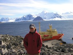 Amy Leventer合作论文数Department of Geology, Colgate University11
 Philip E. O'Brien合作论文数10P. E. O'Brien合作论文数9Martin J. Riddle合作论文数9
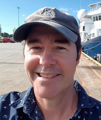 Robin Beaman合作论文数College of Science and Engineering, James Cook University9
 Leanne Armand合作论文数Research School of Earth Sciences, Australian National University8
 Huw James Griffiths合作论文数British Antarctic Survey8
 David Fink合作论文数Australian Nuclear Science and Technology Organization7
 Julian Gutt合作论文数Helmholtz Centre for Polar and Marine Research, Alfred Wegener Institute7
 Peter Harris合作论文数GRID-Arendal6
 Philippe Koubbi合作论文数LOV, CNRS6
 Duanne White合作论文数Department of Physical Geography, Macquarie University6
 Rachel A. Nanson合作论文数6
 Bradley N. Opdyke合作论文数Research School of Earth Sciences, The Australian National University6Yan Ropert-Coudert合作论文数5
 Eugene Domack合作论文数5
 Anton Pieter Van de Putte合作论文数5
 Marc Eléaume合作论文数Laboratory of Biology of Aquatic Organisms and Ecosystems, Museum National d'Histoire Naturelle;Department Origines et Évolution, Museum National d'Histoire Naturelle5
 Laura De Santis合作论文数Dipartimento di Geofisica della Litosfera, Istituto Nazionale di Oceanografia e Geofisica Sperimentale (OGS), B.go Grotta Gigante 42/c, 34010 Sgonico, Trieste, Italy5
 Elie Verleyen合作论文数Department of Biology, Section of Protistology and Aquatic Ecology, University of Ghent5
 Ben Raymond合作论文数Australian Antarctic Division, Department of Sustainability, Environment, Water, Population and Communities, Kingston 7050, Australia4Jodie Smith合作论文数4Graham W. Hosie合作论文数4Mike Craven合作论文数4
 Bruno Danis合作论文数Laboratoire de Biologie Marine (CP 160/15), Université Libre de Bruxelles4
 Gerhard Kuhn合作论文数Faculty of Geosciences, University of Bremen4Krista Simon合作论文数3katherine lilly合作论文数3
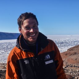 Richard Selwyn Jones合作论文数Securing Antarct Environm Future, Monash Univ3
 Ian Goodwin合作论文数Marine Climate Risk Group and Department of Environment and Geography, Macquarie University3
 Steve Rintoul合作论文数CSIRO Marine Research3Guillaume Massé合作论文数3Martin Jakobsson合作论文数3
 Wim Vyverman合作论文数Department of Biology, Ghent University3Hideki Miura合作论文数3Bernd Wagner合作论文数3
 Yusuke Yokoyama合作论文数3
 Angelika Brandt合作论文数Division of Marine Zoology, Senckenberg Research Institute and Natural History Museum3
 Craig Smith合作论文数Department of Oceanography, School of Ocean and Earth Science and Technology, University of Hawaii at Manoa3
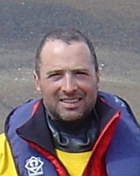 Dominic A. Hodgson合作论文数British Antarctic Survey, Natural Environment Research Council3Dan Zwartz合作论文数3
 Sonja Berg合作论文数Institute for Geology and Mineralogy, University of Cologne3
 Frank O. Nitsche合作论文数Lamont-Doherty Earth Observatory, Columbia University3
 Robert McKay合作论文数Antarctic Research Centre, Victoria University of Wellington3
 Tas Van Ommen合作论文数Institute for Marine and Antarctic Studies, University of Tasmania3
 Joana D L Gafeira Goncalves合作论文数University of Edinburgh;School of GeoSciences;British Geological Survey;School of GeoSciences, University of Edinburgh3Scott L. Nichol合作论文数Marine and Coastal Environment Group, Geoscience Australia3
 Xavier Crosta合作论文数Environnements et Paléoenvironnements Océaniques et Continentaux (UMR 5805), University of Bordeaux3
 Benjamin Keith Galton-Fenzi合作论文数Australian Antarctic Division, Australian Government;Department of Climate Change, Energy, the Environment and Water, Australian Government3




