A geoarchaeological study has been conducted on a medieval mound (Nids, France), The mound thickness is assessed combining geophysical and geotechnical soundings, An archaeogeophysical typology will be tested
Discovery of Romanesque remains under Saint-Paul cathedral, Li & egrave;ge-Belgium, simultaneous use of electrical resistivity, dielectric permittivity and GPR.
This chapter groups together information about the location and geographical context of the site, the history of its discovery and first test excavation in 2009, the excavation strategy, methods and techniques implemented from 2011 to 2016, the general organisation of the site and the nomenclature used for describing the different excavated areas. More specifically, this chapter reports on the different events that influenced and sometimes drastically changed the course of the excavation. This was especially true in 2013, when the plot owner prohibited access to the Central Sector, precluding completion of the excavation of the Communal building and its immediate surroundings. This forced the research to expand to the peripheral areas, namely Sectors B and F, where several unsuspected residential buildings were found and studied. For all these round buildings, the general excavation strategy consisted in mechanical surface stripping, followed by a careful stratigraphic excavation of their fills conducted in quadrant trenches separated from each other by berms, in order to preserve and study profiles. All the non-reworked sediments were water sieved, and additional flotation and fine-mesh sieving were implemented for subsamples from the most interesting structures or stratigraphic units.
Summary The recent developments of electromagnetic induction and electrostatic prospection devices dedicated to critical zone surveys in both rural and urban contexts necessitate improving the interpretation of electrical properties through complementary laboratory studies. In a first interpretation step, the various experimental results obtained in the 100 Hz–10 MHz frequency range can be empirically fitted by a simple six‐term formula. It allows the reproduction of the logarithmic decrease of the real component of the effective relative permittivity and its corresponding imaginary component, the part associated with the direct current conductivity, one Cole–Cole relaxation and the real and imaginary components of the high‐frequency relative permittivity. For elucidating physical phenomena contributing to both the logarithmic decrease and the observed Cole–Cole relaxation, we first consider the Maxwell–Wagner–Sillars polarization. Using the method of moments, we establish that this continuous medium approach can reproduce a large range of relaxation characteristics. At the microscopic scale, the possible role of the rotation of the water molecules bound to solid grains is then investigated. In this case, contrary to the Maxwell–Wagner–Sillars approach, the relaxation parameters do not depend on the external medium properties.
Albert Hesse was one of the pioneers in archaeometry in France. He has developed the electrical methods, and more specifically the continuous electrical surveying methods and focused very early on urban archaeology and geophysics. This paper focusses on his work, showing specific interactive maps to highlight the position of his different surveys world-wide.
Soil health assessment can be understood as a synthetic approach using complex indicators including a variety of soil physical and biological characteristics. The electrical/electromagnetic properties, whilst limited in number, are directly linked with some of the most relevant soil parameters characterizing soil health. Their measurement can be implemented through non-invasive techniques allowing to map with a fine mesh the whole surface in question and to recognize the vertical distribution of layers. They offer thus a 3D holistic approach. After a short summary of the soil health concern, the chapter recalls the definitions of the three relevant properties (conductivity, permittivity, magnetic susceptibility), and details the different electrical and electromagnetic techniques used in the soil domain. Two case studies in temperate and arid climates illustrate what can be obtained when using these techniques. A short discussion underlines the perspectives offered by a holistic approach to evaluate soil health characteristics from geophysical measurements.
L’outil géophysique est utilisé en archéologie pour décrire dans les trois dimensions la répartition spatiale d’une propriété physique de l’échelle métrique ou décamétrique, lorsque l’investigation porte sur le sous-sol, à l’échelle décimétrique lorsqu’elle porte sur du bâti en élévation. Les mesures sont réalisées sous plusieurs conditions : ne modifier en rien le milieu étudié, être reproductibles et rapides, montrer une variabilité suffisamment importante pour que l’on puisse différencier les matériaux archéologiques s’ils présentent un volume et un contraste suffisants. Trois propriétés physiques sont principalement utilisées : la résistivité électrique (par l’emploi des méthodes électrique, électrostatique ou électromagnétique basse fréquence, EMI), la susceptibilité magnétique (méthodes magnétiques et EMI) et la permittivité diélectrique (Radar-sol ou GPR en haute fréquence). En milieu urbanisé, l’existence de nombreuses sources de perturbation et l’état des surfaces étudiées conduisent à privilégier le Radar-sol et la méthode électrostatique.Les constructions offrent en général des contrastes suffisants pour que l’outil géophysique puisse être utilisé aussi bien pour le relevé du plan de l’ensemble d’une ville que pour l’analyse d’un bâtiment particulier ou d’éléments en élévation. Pour les monuments médiévaux en ville, les premières prospections ont été réalisées dans les années 70 notamment à Beauvais et à La Charité-sur-Loire par la méthode électrique. En milieu rural, de nombreux cas ont été traités comme les abbayes de tradition bénédictine. L’exemple de la ‘Grand-Place’ de Bruxelles montre tout l’intérêt qu’il y a à coupler les méthodes Radar-sol et électrostatique. À l’échelle décimétrique il est possible de mettre en évidence la structure interne d’un mur. L’identification de la nature des pierres utilisées et donc des choix des constructeurs a aussi pu être réalisée sur des édifices médiévaux et modernes encore en élévation.
Lutetian limestones of the Paris Basin have been largely used in monument building during medieval and modern periods. Electrical properties of rocks samples, extracted in quarries from the same layers as those used for ancient monuments, are measured in the [100 Hz -10 MHz] frequency range at ambient temperature and after heating at 600 degrees C and cooling back. The short link between electrical properties and mechanical ones allows to confirm that the stability observed for the first ones is true for the second ones and the interest of the electrostatic method for the assessment of the different facies of stones even after a fire.
Albert Hesse (1938-2022), directeur de recherche au CNRS, était un spécialiste de prospection géophysique, discipline dont il a été un des initiateurs en France et acteur tout au long de sa carrière. Il a été l’un des membres fondateurs de l’association GMPCA en 1976 et cette note est destinée à rendre hommage à sa carrière et ses engagements pour sa discipline et plus largement pour l’archéométrie.
Les pierres calcaires du Lutétien ont été largement utilisées aux époques médiévale et moderne pour la construction de monuments dans la partie centrale du bassin de Paris. On présente ici des mesures de leurs propriétés électriques en laboratoire dans la gamme de fréquence [100 Hz – 10 MHz] sur des échantillons extraits des mêmes lits. Les mesures réalisées d’une part à la température ambiante et d’autre part après une chauffe à 600 °C et retour à l’ambiante montrent que la dépendance avec la teneur en eau comme les variations en fréquence sont très peu modifiées. Ceci permet d’affirmer que les propriétés mécaniques seraient conservées après un incendie les ayant portées à cette température et confirme l’intérêt de l’utilisation in situ de la méthode électrostatique pour une caractérisation rapide des différents facies utilisés même après un incendie.
– Detection of kilns within pottery workshops.– Comparison of EM and magnetic results.– Detection with EM disturbances.
Summary Electrostatic profiling and mapping have been carried out in an urban context with two different geometries allowing the prospection of the first 3–4 meters. Despite the larger size of the prospection devices, compared to ground-penetrating radar (GPR), it has been successfully applied at almost all GPR locations in parallel within the same few days' survey. At an intermediate operating frequency of 15 kHz, the method provides information on both electrical resistivity and "low frequency" effective dielectric permittivity (mainly linked to polarization in clayey materials), and is therefore complementary to the GPR method primarily used in urban prospection.
– Electrical resistivity and dielectric permittivity mapping using an electrostatic survey device. – GPR delineation of probable ancient anchor point of the ancient bridge. – Combination of GPR and electrostatic surveys for urban archaeology.
– Geophysical survey in Notre-Dame de Paris Cathedral. – Ground-Penetrating Radar and electrostatic survey for urban archaeology. – Geophysical survey for archaeology in a complex and polluted environment.
Usually, in situ electrical polarization measurements (in geophysical prospection referred to as induced polarization or spectral induced polarization (SIP)) are carried out at frequencies below 1 kHz. These techniques have mainly been used for mining exploration, followed by a larger panel of environmental applications. However, in this ultra low and extremely low-frequency domain, the duration of each individual measurement is long, i.e., typically several tens of minutes for a single full SIP spectrum down to the mHz range. This restriction makes it unrealistic to implement high-density measurement mapping campaigns over large areas, which would otherwise be possible at higher frequencies. In the intermediate frequency range [3 kHz–3 MHz], laboratory studies of soil and rock samples have shown that they can be strongly polarized notably in the presence of clays, and this property has been confirmed by several in situ mapping experiments using electromagnetic induction in the time and frequency domains (FDEM and TDEM), as well as by an electrostatic method (often named capacitive-coupled resistivity or CCR). The present paper recalls these results in an effort to promote polarization measurements at intermediate frequencies and to emphasize the importance of measuring this phenomenon.
 Michel Dabas合作论文数UMR 7619, UPMC43
 Thiesson Julien合作论文数38
 Roger Guerin合作论文数UMR 7619 SISYPHE, Université Pierre et Marie Curie–Paris 631
 Isabelle Cousin合作论文数Unité de Science du Sol22
 Françoisxavier Simon合作论文数22
 Philippe Cosenza合作论文数Université Pierre et Marie Curie19
 Faycal Rejiba合作论文数UMR 7619 Sisyphe, Université Pierre et Marie Curie18
 Cyril Schamper合作论文数18
 Christophe Benech合作论文数Maison de l'Orient et de la Méditerranée17Y BENDERITTER合作论文数16
 Guy Richard合作论文数15Albert Hesse合作论文数12Cedric Panissod合作论文数12Anatja Samouelian合作论文数11
 Sebastien Flageul合作论文数10Christian Camerlynck合作论文数10Guillaume Hulin合作论文数9B. Souffaché合作论文数8
 Solene Buvat合作论文数7
 Pauline Kessouri合作论文数Department of Earth & Environmental Sciences, Rutgers University Newark7
 Ary Bruand合作论文数universite d'Orleans7A. Jolivet合作论文数7Guy Desvignes合作论文数6
 Henri Robain合作论文数6
 Patrick Andrieux合作论文数Laboratoire d’étude des Interactions Sol-Agrosystème-Hydrosystème, UMR LISAH INRA-IRD-SupAgro6
 Apostolos Sarris合作论文数Department of History and Archaeology, University of Cyprus6eric marmet合作论文数5Abdo Mounir合作论文数5Jean Paul Decriaud合作论文数5Bruno Cheviron合作论文数5Jeanne Tabbagh合作论文数5h a baker合作论文数4Mohammed Djeddi合作论文数labophyt, M’hamed Bougara of Boumerdes4
 Yujun Cui合作论文数Laboratoire Navier, Ecole des Ponts ParisTech4
 Hocine Bourennane合作论文数4Marc Descloitres合作论文数Indo-French Cell for Water Sciences (IRD-IISc Joint Laboratory),, Indian Institute of Science4
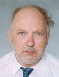 Nicolas Florsch合作论文数Dpt of Mathematics and Applied Mathematics, University of Cape Town4
 Jean Canou合作论文数4
 H. Boizard合作论文数4
 Jean-Claude Dupla合作论文数4Alain Jolivet合作论文数4C. Finco合作论文数3Maud Séger合作论文数3m seger合作论文数3claire brinon合作论文数3Krzysztof Misiewicz合作论文数3
 Rawaz Dlawar Muhammed合作论文数Laboratoire Navier, Univ. Gustave Eiffel3




