Species distribution patterns at range edges can reveal effects of landscape and climate changes which can drive population expansions or contractions. Southern flying squirrel (Glaucomys volans Linnaeus, 1758) populations are common in eastern United States and southeastern Canada, and extend westwardly into the Great Plains. Space-use patterns within their range interior are well documented, though it is unclear if patterns are similar along western range edges. We tracked 10 southern flying squirrels in southeastern Kansas, USA to estimate home-range sizes and patterns in nest-site and tree selection. Forest structure and composition at western range edges differ compared to forest habitat at range interiors, and we predicted differences in home-range sizes and nest-site and tree selection patterns in Kansas compared to previous research. Mean home-range size was 1.55 ha (95% minimum convex polygon) and 5.44 ha (95% kernel density), similar to some populations in the interior of their range. Greater tree genera richness and average tree diameter (diameter at breast height (DBH)) increased probability of nest-site use. Nonhard mast species and greater tree DBH increased nest-tree selection probabilities. Maintaining forest diversity while allowing all tree species to reach maturity could increase available nesting habitat for southern flying squirrels on their western range periphery.
ABSTRACT Although once abundant, gray foxes ( Urocyon cinereoargenteus ) are purported to be experiencing a population decline in the central Great Plains, calling for the need for spatially explicit maps for targeted sampling and conservation action. Using public and state data sources, we developed a habitat suitability model across six central US states to examine distributions of relative habitat suitability and land cover associations for the gray fox. Suitable habitat was discontinuous, with numerous small patches predicted across our study area. Gray fox relative habitat suitability increased with Simpson's diversity of land cover composition and decreased with row crop cover. Our model forecasted an apparent range restriction of the gray fox in comparison to historical maps, with suitable habitat only representing 2% of its historical distribution. Our findings add to the growing body of evidence regarding the purported regional declines of gray foxes.
ABSTRACT Natural history accounts have long suggested that coyotes ( Canis latrans ) and American badgers ( Taxidea taxus ) cooperatively hunt, yet this behavior has rarely been evaluated at broad spatial scales. We used a 3‐year camera‐trap network spanning western Kansas, USA, to test whether spatial and temporal detection patterns were consistent with coordinated hunting. Because camera traps cannot directly confirm cooperative events, we assessed whether such behavior was common enough to generate non‐random regional co‐detection patterns. We quantified spatial association using a detection‐conditioned co‐detection ratio (CDR), estimated diel activity overlap (Δ 4 ) from kernel density functions, and evaluated short‐term (≤ 30 min) temporal proximity and directional responses using permutation and lag analyses. Coyotes were detected on 72.9% of site‐days and badgers on 31.7%, but both species were detected at the same site on only 4.6% of days, five times less than expected under independence (CDR = 0.20, χ 2 = 2604.3, p < 0.001). Despite reduced same‐site, same‐day co‐detection, diel activity overlap was high (Δ 4 = 0.94). Sequential detections showed no excess proximity or directional bias. Collectively, results indicate limited fine‐scale spatiotemporal overlap rather than population‐level coordinated hunting.
"Conservationist" and "environmentalist" are two prominent environmental social identities often perceived as conflicting, particularly on wedge issues like hunting. While these groups may hold differing philosophies, their beliefs could overlap, revealing opportunities for collaboration in conservation. We examined environmental identities among U.S. college students across 22 states (n = 17,203) from 2018 to 2020, assessing identity, wildlife values, and positions on polarizing issues. Students were classified into four groups: conservationists (8 %), environmentalists (9 %), pluralists (59 %) who expressed both identities, and eco-agnostics (24 %) who expressed neither. Environmentalists, the most diverse group demographically, exhibited mutualistic wildlife value orientations, while conservationists, the least diverse, expressed domination-centered value orientations. Conservationists broadly supported hunting and gun rights, while environmentalists favored animal rights. Despite these differences, both groups scored equally high on conservation caring, and all groups-including ecoagnostics-broadly approved of hunting for altruistic reasons (e.g., ecological benefits, reducing crop damage). Our findings highlight distinct yet overlapping environmental identities shaped by demographic and value-based factors. These identities, while appearing polarized, share relational values (e.g., conservation caring, altruistic motivations) that present opportunities for collaboration. Although based in the U.S., these findings have global relevance and reflect the impact of broader trends (e.g., urbanization) on shifting wildlife values. Understanding environmental identities offers a framework to align conservation efforts across diverse cultural contexts, promoting a more inclusive and unified approach to global conservation challenges.
ABSTRACTMotivationSNAPSHOT USA is an annual, multicontributor camera trap survey of mammals across the United States. The growing SNAPSHOT USA dataset is intended for tracking the spatial and temporal responses of mammal populations to changes in land use, land cover and climate. These data will be useful for exploring the drivers of spatial and temporal changes in relative abundance and distribution, as well as the impacts of species interactions on daily activity patterns.Main Types of Variables ContainedSNAPSHOT USA 2019–2023 contains 987,979 records of camera trap image sequence data and 9694 records of camera trap deployment metadata.Spatial Location and GrainData were collected across the United States of America in all 50 states, 12 ecoregions and many ecosystems.Time Period and GrainData were collected between 1st August and 29th December each year from 2019 to 2023.Major Taxa and Level of MeasurementThe dataset includes a wide range of taxa but is primarily focused on medium to large mammals.Software FormatSNAPSHOT USA 2019–2023 comprises two .csv files. The original data can be found within the SNAPSHOT USA Initiative in the Wildlife Insights platform.
Apex carnivores influence subordinate carnivores through intraguild competition. Landscape composition and configuration may mediate interactions between sympatric carnivores though intervening landscape‐level effects on these interactions are relatively unknown. We used three years of detection data (2018–2020) from 381 sites in Kansas, USA, and Bayesian two‐species occupancy models to evaluate how the proportion of Conservation Reserve Program (CRP) easements may influence spatial and temporal interactions between coyotes ( Canis latrans ), an apex carnivore, and swift foxes ( Vulpes velox ) in human‐modified landscapes. Because both intraguild competition with, and predation by, coyotes may affect swift fox distributions, we also assessed how coyote presence influenced site occupancy, colonization, and persistence by swift fox at varying proportions of CRP around sites. Median site occupancy, colonization, and persistence by swift foxes was lower at sites where coyotes were present (0.013 [95% credible intervals {CrI} = 0.008–0.020]; 0.001 [95% CrI = 0.001–0.003]; 0.402 [95% CrI = 0.129–0.862]) than at sites where coyotes were absent (0.096 [95% CrI = 0.062–0.138]; 0.016 [95% CrI = 0.003–0.057]; 0.535 [95% CrI = 0.242–0.874]). The coefficient of temporal overlap between coyotes and swift foxes at sites where the proportion of CRP easements was ≥0.10 was significantly different (95% CIs did not overlap 95% CI of other measured activity) from the coefficient of overlap where CRP easements were <0.10. Swift foxes were influenced by coyotes through space and time only at sites surrounded by low proportions of CRP (≤0.04). Swift foxes and coyotes co‐occurred more than would be expected by chance only when the proportion of CRP near a site was low (≤0.04). Swift foxes appear to avoid coyotes in areas where encounter risks are increased. Results from our study indicate that landscapes, and their inherent structure and composition, may influence intraguild interactions between canids in multiuse, agro‐prairie ecosystems.
AbstractResource distribution, habitat structure, and predators greatly influence spatial and temporal landscape use by prey species. The “risky places” hypothesis establishes prey will proactively respond to predators' presence based on habitat cues, whereas the “risky times” hypothesis predicts prey will reactively respond by increasing vigilance in the presence of predators regardless of habitat cues. We fit a multiscale, Bayesian species interaction occupancy model with detection/non‐detection data to evaluate black‐tailed jackrabbit (Lepus californicus) and eastern cottontail rabbit (Sylvilagus floridanus) habitat use in the presence and absence of coyotes (Canis latrans), American badgers (Taxidea taxus), and swift foxes (Vulpes velox). We also evaluated how species‐specific predator presence modified temporal activity patterns of prey. Jackrabbits decreased habitat use in areas with greater forage and opted to use areas with greater visibility when coyotes or swift foxes were present. However, cottontails used habitat in open areas with greater visibility when American badgers were present and all other predators absent, suggesting dissimilar habitat‐use patterns dictated by predator‐specific risks. Both lagomorph species are nocturnal with segregated peaks of activity compared with predators, suggesting fine‐scale temporal use partitioning. Our results provide insights into predator–prey dynamics across heterogenous landscapes in a multi‐predator system.
Declines in hunter numbers across the United States make hunter recruitment, retention, and reactivation (R3) a high priority for wildlife management. As wildlife management agencies and nongovernmental organizations seek to reach new audiences, college campuses present a unique opportunity to cultivate nontraditional path hunters. Despite recent proliferation of R3 initiatives, little research has evaluated effects of hunting programs on knowledge, attitudes, and behaviors of new hunters. We designed and implemented Getting Started Outdoors: Hunting 101 workshops specifically targeting college students without previous hunting experience, and we assessed workshop efficacy with a theoretically-grounded approach to workshop evaluation. Using quantitative and qualitative analysis of surveys conducted before, shortly after, and 12-18 months after workshops, we assessed impacts of R3 efforts at large public universities in 16 different U.S. states. Across all states, 19 workshops attracted 314 total participants, with 255 completing both pre- and post-workshop assessments and 133 completing the follow-up surveys. Workshops significantly increased participants' confidence in hunting, reduced barriers related to inadequate knowledge and skills, and fostered positive views of hunters and hunting. Immediately after workshops, most participants said they would definitely (50%) or probably (34%) hunt in the future; 82% said they would likely (or very likely) purchase a hunting license. Over one year after the workshops, 34% of workshop participants reported having hunted, and another 45% said they would probably hunt in the future. Overall, workshops attracted a diverse population of potential hunters, increased interest in future hunting, and created hunting advocates. Findings highlight the potentially powerful impact that R3 programs focused on diverse college students can have on the future of hunting across the United States.
Undergraduate students enrolled in ecology courses read peer-reviewed, scientific literature to learn how hypotheses are tested and to understand conclusions from research. This technical material can be difficult to understand for many students, thus inhibiting learning processes and reducing interest in courses or associated content. Using creative methods to teach science-based material can improve student-learning outcomes, though students’ perceptions on learning have not been fully evaluated. We qualitatively compared changes in students’ perceived understanding of peer-reviewed literature before and after poetry writing assignments. Students were asked to read a randomly assigned peer-reviewed paper focused on waterfowl and/or wetland management and rate their understanding of the (1) results and conclusions and (2) management implications from research described in the paper. We then asked students to read another randomly assigned paper, complete two poems (one haiku and one villanelle) about the paper, and then again rate their understanding of both metrics. With our small sample, we found students rated their perceived understanding of peer-reviewed literature higher after creating student-generated poetry, and they generally appreciated the assignment. Our qualitative results underscore potential merits of incorporating poetry into science learning, and we provide testable hypotheses to further our understanding of how integrating poetry into science-based courses may enhance student learning.
Human-driven environmental changes shape ecological communities from local to global scales. Within cities, landscape-scale patterns and processes and species characteristics generally drive local-scale wildlife diversity. However, cities differ in their structure, species pools, geographies and histories, calling into question the extent to which these drivers of wildlife diversity are predictive at continental scales. In partnership with the Urban Wildlife Information Network, we used occurrence data from 725 sites located across 20 North American cities and a multi-city, multi-species occupancy modelling approach to evaluate the effects of ecoregional characteristics and mammal species traits on the urbanization-diversity relationship. Among 37 native terrestrial mammal species, regional environmental characteristics and species traits influenced within-city effects of urbanization on species occupancy and community composition. Species occupancy and diversity were most negatively related to urbanization in the warmer, less vegetated cities. Additionally, larger-bodied species were most negatively impacted by urbanization across North America. Our results suggest that shifting climate conditions could worsen the effects of urbanization on native wildlife communities, such that conservation strategies should seek to mitigate the combined effects of a warming and urbanizing world.
Carnivore communities occurring in human-modified landscapes are structured through multiple direct and indirect pathways. Carnivore richness in agro-prairie ecosystems is enhanced with greater water availability, prey abundance, and coverage of native prairie land cover. Surprisingly, carnivore richness is also positively influenced by greater coverage of agriculture on the landscape, though carnivore communities in these areas are notably lacking prairie-obligate species and more representative of synanthropic species. Many carnivore populations have experienced substantial declines and are at increased risk of extinction, mainly due to negative interactions with humans and biological traits that make them susceptible to habitat loss and fragmentation, often driven by agricultural expansion. Carnivore community richness is likely influenced by many direct and indirect factors, though it is unclear how carnivore communities are structured in prairie landscapes that are considered one of the most imperiled ecosystems worldwide. Our goal was to identify landscape-scale effects driving carnivore community richness in a contemporary agro-prairie ecosystem. We used 3 years of presence data (2018-2020) from camera-trap sites (n = 381) distributed across western Kansas, United States and developed a structural equation model (SEM) to test a priori hypotheses explaining carnivore richness. Measures of water availability, native prairie, and agriculture-as well as sampling effort (i.e., days cameras were active)-were all positively associated with carnivore richness. Additionally, our index of rabbit abundances at sites had a direct positive effect on our measure of carnivore richness. Our SEM explained 42% of the variance in carnivore richness (chi(2) = 8.76, d.f. = 21, P = 0.99) in this human-dominated landscape. Our results suggest that carnivore communities in agro-prairie landscapes are structured through multiple direct and indirect landscape-scale pathways. Contemporary agro-prairie mosaics may act as filters for the agricultural tolerance of carnivores, with species more vulnerable to native prairie loss becoming locally extirpated.
The objective of this study was to determine the impact of combinations of management practices on the sustainability of rangelands in different ecoregions across the Great Plains. Six study sites were selected in Kansas, Nebraska, Wyoming, Montana, and South Dakota, encompassing the Flint Hills, High Plains, and Sandhills ecoregions. Twelve rangeland management scenarios were developed from combinations of stocking density (light, moderate, heavy), grazing management (continuous, rotational), and fire regime (no burn, spring burn) along with a no-management scenario. Each scenario was simulated at each site using established computer models: Agricultural Policy/Environmental eXtender model, Integrated Farm System Model, and Impact Analysis for Planning. Additionally, human-edible nutrient conversion was computed. A sustainability index was developed to encompass the three sustainability pillars (i.e., environmental, economic, and social) into a single value. Unmanaged rangelands generally had less soil (20%), nitrogen (30%), and phosphorus (50%) losses, although this was not consistent across ecoregions, and similar or greater soil carbon deposition than grazed rangelands. There was an interaction among stocking density, grazing management, fire regime, and ecoregion for many indicators of soil health, greenhouse gas emissions, economic activity, and human-edible nutrient conversion. The scenarios with the greatest overall sustainability index value had moderate to high index values for each of the three pillars (people, planet, profit). In conclusion, the ranking of rangeland management practices based on sustainability indicators was inconsistent across ecoregions, indicating that the optimal management system to improve sustainability of rangelands is not the same for all ecoregions.
Grasslands are among the most widely distributed, but most imperiled, biomes on Earth. North American grasslands once covered-162 million ha prior to European colonization, but only-30 % of this landcover currently remains due to continued human-modified landscape changes. Strategic conservation of remaining grassland landcover, which considers species-specific habitat requirements, is critical for the persistence of grassland species and has become a global priority. Intact grassland landcover is critical for swift fox (Vulpes velox), a facultative prairie carnivore, and we sought to strategically identify areas where grassland conservation would most impact population persistence in an agro-prairie ecosystem. We modeled site (n = 381) occupancy by swift foxes using three years of camera-trap data (2018-2020) from western Kansas, USA, and integrated known-fate survival information to identify priority native grassland conservation areas. Additionally, we evaluated ownership of our identified priority conservation lands to determine strategies for conservation delivery. Our grassland assessment of two thresholds of predicted swift fox occupancy (>= 0.09 [priority] and >= 0.18 [high priority]) identified 2,377,193 ha and 84,420 ha for conservation in Kansas, respectively. Identified conservation areas were overwhelmingly located on privately owned working lands (98 % [priority and high priority]), rather than federal, state, or non-governmental organization owned lands (2 % [priority and high priority]), and highlight the need for using conservation easements and incentive-based programs to promote grassland con-servation to private landowners.
Anthropogenic activities since the European colonization of the North American Great Plains have drastically altered landscape composition and configuration, subsequently affecting native biodiversity. These contemporary human-modified landscapes may affect mammal species' distributions, diel activity patterns, habitat use, and interspecific interactions, though a better understanding of these effects on mammals occurring in remaining prairie landscapes is needed. To fill this gap, we surveyed 381 randomly selected sites in 2018, 2019, and 2020 using motion-sensing camera traps across the western part of the US state of Kansas (7,160,077 ha). Sites were separated by ≥2 km ( x ¯ $$ \overline{x} $$ = 8.16 km, SD = 3.61), and cameras were secured to a metal post 40 cm above ground and randomly oriented toward the north or south. We placed an olfactory attractant (mixture of skunk essence and petroleum jelly) on a wooden stake 3 m in front of each camera. Cameras were in place at each site for 28 consecutive days for each year. We manually identified all mammal species detected at each site, collating these data into a database that included taxonomic information for 14 families of mammals (Antilocapridae, Bovidae, Canidae, Cervidae, Cricetidae, Dasypodidae, Didelphidae, Erethizontidae, Felidae, Heteromyidae, Leporidae, Mephitidae, Mustelidae, Procyonidae, Sciuridae, and Muridae) comprising 28 total species. We recorded 31,178 mammal photographs (nonindependent events) over 27,954 camera trap nights during 2018 (n = 10,351), 2019 (n = 9478), and 2020 (n = 8125). Additionally, we included the time and date of each photocapture. Moreover, we gathered survey-specific data useful for modeling species-specific detection along with site-level habitat composition data taken at each site each year. These data will be useful for examining habitat use, species distributions, diel activity patterns, and spatiotemporal interactions between species and across guilds of mammals occurring in a rapidly changing agro-prairie ecosystem. There are no copyright restrictions, but we ask researchers to cite this paper when using these data for publication.
Time is a fundamental component of ecological processes. How animal behavior changes over time has been explored through well-known ecological theories like niche partitioning and predator-prey dynamics. Yet, changes in animal behavior within the shorter 24-hr light-dark cycle have largely gone unstudied. Understanding if an animal can adjust their temporal activity to mitigate or adapt to environmental change has become a recent topic of discussion and is important for effective wildlife management and conservation. While spatial habitat is a fundamental consideration in wildlife management and conservation, temporal habitat is often ignored. We formulated a temporal resource selection model to quantify the diel behavior of 8 mammal species across 10 US cities. We found high variability in diel activity patterns within and among species and species-specific correlations between diel activity and human population density, impervious land cover, available greenspace, vegetation cover, and mean daily temperature. We also found that some species may modulate temporal behaviors to manage both natural and anthropogenic risks. Our results highlight the complexity with which temporal activity patterns interact with local environmental characteristics, and suggest that urban mammals may use time along the 24-hr cycle to reduce risk, adapt, and therefore persist, and in some cases thrive, in human-dominated ecosystems.
Human-modified landscapes can structure species’ distributions and supplant traditional biotic range-limiting processes. Understanding the direction and scale of these processes is necessary to enhance species conservation efforts. We investigated how the distribution of a prairie-obligate carnivore, swift fox (Vulpes velox), is influenced by landscape pattern at the eastern edge of their used range. We also assessed the effects of a popular conservation effort, the conservation reserve program (CRP), on swift fox distributions. We used three years of detection/non-detection data (2018–2020) from camera traps at 381 sites to evaluate the spatial distribution of swift foxes at the eastern edge of their extant range in Kansas, USA. We used Gaussian Kernel functions to identify optimal scales of effect for measured landscape covariates and multiseason use models to reveal potential range-limiting constraints. Swift foxes were more likely to occur at sites with moderate landcover diversity within 254.47 ha, greater proportion of shortgrass prairie (7.07 ha) and loamy soil types (0.79 ha), and lower proportions of CRP landcover (78.54 ha). Swift foxes were more likely to colonize sites with less diverse landcover, a greater proportion of loamy soil types, and lower proportions of CRP landcover. Swift foxes were insensitive to the proportion of row-crop agriculture surrounding sites (3.14 ha). Loamy soils and distribution of shortgrass prairie ecosystems may shape the periphery of the distribution for swift foxes. Landscape-scale use of CRP may constrain swift fox distributions at their range edge because managed vegetation structure of CRP does not mimic native shortgrass prairie.
 edward j heske合作论文数12
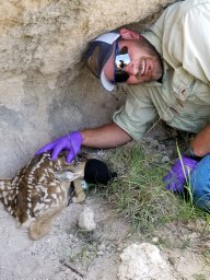 Andrew Ricketts合作论文数Department of Horticulture and Natural Resources, Kansas State University11
 Mason Fidino合作论文数Lincoln Pk Zoo, Urban Wildlife Inst10
 Travis Gallo合作论文数Conservat & Sci Dept, Urban Wildlife Inst9
 Robert Schooley合作论文数Department of Evolution, Ecology, and Behavior, School of Integrative Biology, College of Liberal Arts and Sciences, University of Illinois at Urbana-Champaign8
 Elizabeth Lehrer合作论文数7
 Seth Magle合作论文数Department of Fish, Wildlife, and Conservation Biology, Colorado State University7
 Ty Werdel合作论文数6
 Heather A. Sander合作论文数University of Minnesota6
 Theodore Stankowich合作论文数Animal Behavior Graduate Group;Department of Psychology, University of California;Animal Behavior Graduate Group, University of California6
 Ryan L. Sharp合作论文数6Craig A. Miller合作论文数5Colleen W. Piper合作论文数5
 Julia Angstmann合作论文数Dept Biol Sci, Butler Univ5
 Christine Anhalt-Depies合作论文数Department of Natural Resources, Wisconsin5Jacque Williamson合作论文数5Brandon MacDougall合作论文数5
 Minfeng Tang合作论文数Beef Cattle Inst, Kansas State Univ5Kelly Simon合作论文数5
 Phillip Lancaster合作论文数Department of Clinical Sciences, Kansas State University5
 Murray Maureen合作论文数5
 Deann Ricks Presley合作论文数5
 Dustin L. Pendell合作论文数5
 Carmen M. Salsbury合作论文数5
 Travis J. Ryan合作论文数Division of Biological Sciences;University of Missouri;Ecology Laboratory;Ecology Laboratory, University of Missouri5
 Steve Windels合作论文数National Park Service5Bryce T. Olson合作论文数4Walt Fick合作论文数4Matthew S Peek合作论文数4
 David Drake合作论文数Department of Forest and Wildlife Ecology, College of Agricultural and Life Sciences, University of Wisconsin-Madison4
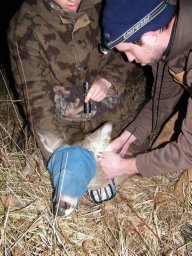 Matthew T. Springer合作论文数Dept Forestry & Nat Resources, Univ Kentucky4Samuel J. Keith合作论文数4
 Benjamin Ghasemi合作论文数Human Dimens Nat Resources Lab, Texas A&M Univ4
 Chelsie Romulo合作论文数Univ Northern Colorado, Environm & Sustainabil Studies, Greeley, CO 80639 USA4
 Christopher Schell合作论文数Univ Chicago, Comm Evolutionary Biol, Chicago, IL 60637 USA4
 KangJae Jerry Lee合作论文数Dept Pk Recreat & Tourism Management, North Carolina State Univ4
 Richard Stedman合作论文数Department of Natural Resources and Environment, College of Agriculture and Life Sciences, Cornell University4
 Mark Mitchell合作论文数Department of Veterinary Clinical Sciences, School of Veterinary Medicine, Louisiana State University4
 Belaire J Amy合作论文数Department of Biological Sciences, University of Illinois at Chicago4
 Rodriguez Shari合作论文数4
 Zellmer Amanda J合作论文数Department of Biological Sciences, Louisiana State University4
 Colleen Cassady St. Clair合作论文数Department of Biological Sciences;University of Alberta;Department of Biological Sciences, University of Alberta4
 Ashley A. Dayer合作论文数Virginia Polytechnic Institute and State University4
 Neelam Poudyal合作论文数Warnell School of Forestry and Natural Resources, University of Georgia4
 Kyle Maurice Woosnam合作论文数Warnell School of Forestry and Natural Resources, University of Georgia4
 Lincoln R. Larson合作论文数Daniel B. Warnell School of Forestry and Natural Resources, University of Georgia4
 Mark D. Needham合作论文数Department of Forest Ecosystems and Society, Oregon State University4Mark J. Jordan合作论文数3Maximilian L. Allen合作论文数3




