The Pantanal wetland, located in the Upper Paraguay River Basin, is the world's largest tropical wetland and a key region for understanding fluvial system responses to Late Quaternary climatic changes. This study investigates the geomorphological evolution of the Paraguay-Corumbá Fluvial Plain (PCFP; approximately 18.3°S to 19.4°S and 57.0°W to 57.8°W) using remote sensing, sedimentological analysis, and OSL dating. We identified three main geomorphological compartments: (1) a floodbasin with topographically elevated channels; (2) an abandoned meander belt; and (3) the active meander belt (floodplain) of the Paraguay River. Sedimentary and chronological data indicate that the floodbasin and its topographically elevated channels developed prior to the Last Glacial Maximum (>23 ka), under conditions of high sediment supply and variable discharge. A meandering system (paleomeander belt) was active during the late Pleistocene to early Holocene (ca. 10–9 ka OSL), with its initial formation possibly occurring earlier under wetter late Pleistocene conditions. A final avulsion event near Castelo Bay around 2–1.5 ka resulted in the current meander belt. These changes reflect primarily variations in hydro-sedimentary dynamics, likely driven by regional climatic shifts during the Late Quaternary. Our results provide new insights into the complex evolution of large tropical floodplains and highlight the role of sediment supply and discharge regimes in controlling fluvial style in the Pantanal.
The Pantanal, the world's largest tropical wetland and a globally significant centre of biodiversity, has been increasingly threatened by fire. The extreme fire season of 2019-20, which caused enormous environmental damage, was linked to drought. However, predicting the future of fire in this region is challenging because of complex interactions among topography, seasonal flooding, and diverse vegetation. Here, we investigate climatedriven changes to fire regimes across five distinctive vegetation types by integrating millennial-scale histories of fire and climate with high-resolution monitoring and remote sensing data from the last two decades. We show that the impacts of climate change on fire activity varies depending on vegetation. In savannahs, fire occurrence is highly correlated to biomass availability, while seasonally dry tropical forest burns only under extreme drought conditions. The seasonally flooded vegetation mosaic is observed to be highly flammable under low rainfall and protracted dry seasons. This study highlights that new fire threats to low-lying flooded vegetation are emerging as human impact and climate change reshape fire regimes in the Pantanal.
Global climate change, particularly altered precipitation patterns, has significantly impacted tropical ecosystems like floodplain lakes that are highly sensitive to fluctuations in riverine discharge. Here, we investigate the effects of interannual hydrological changes in the Upper Paraguay River on floodplain lake ecosystems in the Pantanal, the largest tropical wetland on Earth. Our analysis includes a time series of river levels (1985-2023), Landsat imagery, and lake sediment geochemistry datasets that untangle connections among river hydrology, lake basin morphology, and the proliferation of aquatic vegetation. Our results found that Lakes C & aacute;ceres, Vermelha, Uberaba, and Negra have significant temporal variations in open water habitats. They are particularly vulnerable to hydroclimatic changes because of their flat lake beds and shallow bathymetry, which promote rapid replacement of open water habitats with dense aquatic macrophyte cover during droughts. Lakes Ga & iacute;va and Mandior & eacute; are more resistant to changes in the Upper Paraguay River level, with a dominance of open water habitats even during severe drought events. Our time series analysis shows the severe drought of 2019-2020 as a tipping point in the Pantanal's floodplain lake ecosystems, with the analyzed lakes experiencing marked reductions in open water habitat and expansion of aquatic vegetation. Predictive climate models indicate that more frequent, extended drought may result in floodplain lake ecosystem transformations in the coming decades. Low river levels drive transitions in tropical floodplain lakes, leading to macrophyte and terrestrial vegetation expansion and increased fuel accumulation. These changes elevate wildfire risk, reduce aquatic biodiversity, and threaten local livelihoods that depend on fisheries and other ecosystem services.
Hydro-geomorphological dynamics in the Pantanal wetlands remain poorly understood, requiring more comprehensive investigations. Geomorphological compartmentalization has been particularly useful in this endeavor, although such approach presents limitations in terms of analytical scale. Here, we proposed the geomorphological segmentation of a reach of Upper Paraguay River, between Porto da Manga and Porto Murtinho (Mato Grosso do Sul, Brazil) as a framework to better understand the hydro-geomorphological processes in the Pantanal wetlands. Our study integrates multiple geomorphological, hydrological, and geological criteria to define six geomorphological segments in the Paraguay River meander belt, named after local toponym, i) Porto Esperança, ii) Forte Coimbra, iii) Bahia Negra, iv) Barranco Branco, v) Fecho dos Morros, and vi) Porto Murtinho. Remote sensing data, digital elevation models (DEMs), and previous geomorphological mappings were combined here through geoprocessing and manual vectorization techniques. The results reveal that fluvial dynamics along the Upper Paraguay River are highly heterogeneous and influenced by structural controls, geomorphological variability, and channel–floodplain interactions. Hydraulic bottlenecks exert a strong influence on flow regulation and discharge redistribution as the abrupt shifts in channel orientation, sinuosity, and meander-belt width reflect the interplay among hydro-sedimentary processes and tectonic lineaments. This segmentation framework enhances our understanding of the Paraguay River morpho-hydrodynamics and provides a valuable contribution for improving environmental and water resources management in the Pantanal basin, home of the world’s largest tropical wetland.
The Pantanal Basin is a low-gradient back-bulge analog for distal depozones associated with retroarc foreland basin systems in the geological record. Extensive lowland environments including fluvial megafans, floodplains, wetlands, and lakes make up the Pantanal Basin today, with detrital sediment sources located along basin-margin plateaus and remnants of ancient orogenic belts. Here, we examine the chemical composition and mineralogy of modern fine-fraction fluvial sediments using X-ray methods to assess the influence of chemical weathering on sediment composition in this tropical basin. The abundance of clay minerals follows the rank order pattern of kaolinite > vermiculite > illite > smectite. Kaolinite is more abundant in river muds from the north-central than the southern Pantanal, suggesting strong extant chemical weathering plus the potential for clays inherited from siliciclastic parent lithologies that formed under Mesozoic greenhouse conditions. Illite occurs in sediments draining the North Paraguay Belt and limited parts of the South Paraguay Belt, and it reflects the influence of mechanical weathering of the metamorphic facies. In the southeastern Pantanal, vermiculite is a dominant constituent of the Miranda River watershed, which drains dacitic parent rocks and rhodic ferralsols. The geochemistry of the sediments reveals the interplay of quartz addition and clays inherited from the parent rocks. The most quartzose sediments are encountered at the confluence of the Paraguay River and the Taquari River megafan, where the cumulative effect of the 2 – 3-month flood pulse maximizes chemical weathering. Clay plus silt in back-bulge basins are controlled by climate > soils > parent rocks.
O descarte adequado dos resíduos produzidos pela sociedade constitui uma preocupação constante. No Brasil, muitos municípios descartam o lixo produzido em lixões a céu aberto, ao passo que a construção de aterros sanitários tem apresentado grandes dificuldades. Neste contexto, o presente trabalho teve como objetivo elaborar uma análise geográfica, em ambiente SIG, dos parâmetros de ordem legal, ambiental e logística que possam ser implementados por entes públicos para a seleção de áreas mais favoráveis à instalação de um aterro sanitário, tendo como recorte espacial os municípios de Corumbá e Ladário, no Pantanal Sul-Matogrossense. Esse trabalho se desenvolveu por meio de três etapas: a restrição, a qualificação e a análise pormenorizada, a qual apontou as áreas mais aptas para a implantação de um aterro sanitário. Dada as dificuldades impostas pela localização dos municípios, as áreas identificadas como aptas para a implantação de um aterro sanitário representam 403,45 km², isto é, apenas 0,62% da área combinada dos dois municípios (64.792,62 km²). Dessas áreas aptas, a análise pormenorizada revelou que apenas quatro apresentam particularidades potencialmente positivas, como distância de até 25 km do centro gerador, acesso por estradas de boa qualidade, declividades satisfatórias, distância de aglomerados humanos, entre outras.
Sedimentological processes are underexplored in retro-arc basin segments of source-to-sink systems, particularly in the distal back-bulge depozone. The extant Pantanal Basin of Latin America is a large sub-tropical continental back-bulge for which the boundary conditions on riverine sedimentation (tectonics, climate, phytogeography) are reasonably understood. Here, we use a new database of riverbed sand samples (n = 97) to investigate the modern provenance of the Pantanal Basin. Petrographic analysis of grain-mounted thin sections and Gazzi-Dickinson point counting were used to assess the framework composition of the sands, and a pour point analysis based on geographic information systems (GIS) defined the hinterland geological environment for each sample. Six provenance domains were defined: (a) lowlands, (b) Amazon craton, (c) Rio Apa craton, (d) plateau, (e) South Paraguay Belt, and (f) North Paraguay Belt. Most Pantanal samples are quartzose non-orogenic detritus (Qt88\F5\L7). Rivers draining the Paraguay Belt highlands carry more lithic grains derived from carbonate parent rocks. The occurrence of plagioclase grains is rare. However, river sands where >30% of the total assemblage was K-feldspar were present downstream of foliated metamorphic outcrops of the Rio Apa craton. Sand relatively rich in fine K-feldspar grains in the medial Taquari River megafan were attributed to channel avulsion, incision, and reworking of floodplain deposits. Statistical analysis suggests that bedrock lithology and average annual rainfall are important controls on fluvial sands in the Pantanal Basin, with watershed slope, temperature, and dilution playing secondary roles in the spatial distribution of dominant grain types. This study provides new actualistic data that aim to improve interpretations of the geological record.
The resurgent navigation project known as the Hidrovia Paraguay-Paraná threatens the integrity of the Pantanal, the world's largest wetland, which is considered a biome of its own. Intensive barge navigation is intended to transport crops (soybean, sugar, corn) and cement, iron and manganese from areas of production in Brazil, Paraguay and Bolivia to the oceanic ports of the Plata River. This short communication assembles the information available on the potential impacts of the planned deepening of the natural channel of the Paraguay River in its ~700 km-long upper section. These river channel alterations would disconnect the river from its floodplain, shorten the inundation period, and shrink the wetland area, resulting in severe degradation of the globally outstanding biological and cultural diversity of the Pantanal. The river sediments are mostly sandy and would require perpetual dredging. The reaches needing the most intensive dredging are those of the highest ecological value, protected as a National Park, UNESCO World Heritage and Biosphere Reserves, and various Indigenous reserves and Ramsar sites. Climate change is projected to increase the occurrence of low water periods. Between 2019 and 2021, navigation was impossible even in the already-deepened reaches of the Paraguay River between Corumbá and Asuncion during long periods of the year. Thus, despite considerable financial and technical efforts, the success of the navigation project is doubtful, whereas enormous environmental, cultural, and social impacts can be anticipated. For these reasons, the Brazilian government had already turned down the project in 2000. We suggest alternative, less impactful modes of transport of commodities, e.g., via railway.
A Política Nacional de Defesa (PND) recomenda que a Marinha do Brasil (MB) adense sua presença nas vias navegáveis, principalmente nas bacias fluviais do Rio Amazonas e a do sistema Paraguai-Paraná. O objetivo foi descrever as formas de atuação da Marinha do Brasil nas águas internacionais do Rio Paraguai. A metodologia empregada consistiu na análise qualitativa da literatura sobre Defesa e Segurança Nacional e qualitativa das atividades militares desenvolvidas. A análise permitiu compreender como a atuação do Comando do 6.º Distrito Naval intensifica a presença do Estado e contribui para a Defesa e Segurança Nacional no rio Paraguai.
In the southern highlands of the Upper Paraguay River watershed, hundreds of small and shallow ponds exist, but little is known about their origins or potential to record hydroclimate signals in their sediments. Here, we present a multi-proxy evidence that reveals details about the paleolimnological evolution of these shallow tropical lakes. The available data support the conclusion that pond formation resulted from Late Holocene environmental changes that affected the regional hydro-geomorphology. Biological proxies suggest that two distinct environmental phases shaped the regional landscape. In the older phase, sponge spicules and phytoliths are absent, and the sediment geochemistry suggests that karstification processes within the subsurface helped to facilitate topographic closure and doline formation. Sediments of the younger depositional phase are characterized by abundant grass and palm phytoliths. Sponge spicules are also present in these deposits, including the freshwater species Dosilia pydanieli Volkmer-Ribeiro1992, Metania spinata (Carter, 1881), Radiospongilla amazonensis Volkmer-Ribeiro and Becker Maciel, 1983, and Tubella variabilis Bonetto and Ezcurra de Drago1973. These microfossils, especially D. pydanieli, are suggestive of perennial lentic ecosystems. The elemental geochemistry of the youngest sediments is dominated by Si, P, and S; a positive correlation between microfossil content and wt. % S may reflect a linkage between nearshore plant biomass and offshore organic sedimentation. Our results suggest an aquatic transition favoring the formation of stable doline ponds with abundant supra-littoral vegetation occurred over the last millennium, most likely the result of a wetter climate in this region of midwestern Brazil.
Shallow lakes in tropical floodplains provide significant ecosystem services that can be altered by natural and anthropogenic forces. Despite their importance, little is known about the infill patterns and timescales and the magnitude of these changes in tropical floodplain lakes. Here, we present a global meta-analysis of sediment core-derived accumulation rate data for shallow floodplain lakes in tropical lowlands to quantify the timescales of basin infill. Environmental variables (e.g., sediment accumulation rates, bathymetry, surface area) were compiled from the literature or derived from remote sensing imagery, resulting in a database ( n = 76 lakes ) that includes various lake morphologies. Our results show an exponential increase in sediment accumulation rates in many of these lakes over the past 50 years, which we interpret as a response to growing human populations and deforestation, particularly in topographically steep watersheds with pronounced seasonal rainfall. Over centennial periods, tropical floodplain lakes accumulate sediment faster than many other extratropical lakes. The dataset suggests that complete infill of some tropical floodplain lakes will occur in as little as a few centuries. Our findings also reveal the critical environmental and human factors that influence sediment accumulation patterns and affect ecosystem services in shallow tropical floodplain lakes. These findings have important implications for water and sediment management in low latitude watersheds, many of which are located in densely populated and/or developing nations.
O objetivo do trabalho foi avaliar a utilização dos limites naturais para estabelecer a fronteira entre Brasil e Paraguai. A metodologia utilizada foi: revisão bibliográfica e imagens de satélites. Os resultados mostram que o rio Paraguai altera o seu curso por questões naturais e é possível observar a partir de imagens de satélite que a fronteira hoje em alguns pontos não representa o critério utilizado para a delimitação do território. Outro resultado alcançado é em relação a Isla Margarita onde o rio Paraguai pode mudar o seu curso e a ilha que pertence ao Paraguai ser anexada ao território brasileiro.
The Pantanal wetland is a mosaic of landscapes that brings together rich biodiversity with the valuable activities of fishing, tourism and ranching. Human occupation and land use in the headwaters have intensified the rate of channel avulsions in the lower reaches of the largest megafan on the Taquari River. This study evaluates the long-term changes of landscapes in the active depositional lobe of the Taquari megafan from the perspective of local communities of pantaneiros. Maps derived from multiple decades of multispectral Landsat data have proven useful for studying land cover changes through the relationship between dry (terrestrial vegetation and soil/dry pastures) and humid landscapes (open waters, aquatic macrophytes and wet soils), as well as through Sankey diagrams and spatiotemporal mapping with Boolean operations according to the rate of dryland recovery. We found that dryland recovery associated with an older and smaller avulsion (known as Zé da Costa) is analogous to that of a most recent and much larger avulsion (known as Caronal), which is still ongoing and has greater importance due to the scale of the impacts. Land value and fish capture depreciate as the partial Caronal avulsion still evolves, increasing the likelihood of environmental conflicts. While pantaneiros no longer profit from ecosystem services of provision (e.g., livestock or fishing), dryland recovery may deliver quantifiable ecosystem services of regulation. The strengthening of partnerships among stakeholders and the implementation of environmental compensation mechanisms are central for the best management of the Pantanal's megafans that ensure quality of life for all pantaneiros.
ativamente da construção dos respectivos manuscritos, preferencialmente na: a) Concepção do estudo, e/ou aquisição de dados, e/ou análise e interpretação de dados; b) Elaboração do artigo ou revisão com vistas a tornar
 Mario Luis Assine合作论文数Universidade Estadual Paulista31
 McGlue Michael M合作论文数University of Kentucky27
 José Cândido Stevaux合作论文数Universidade Federal do Mato Grosso do Sul - Campus de Tres Lagoas20
 Hudson De Azevedo Macedo合作论文数Universidade Estadual de Maringá (UEM),19
 Ivan Bergier合作论文数Laboratory of Biomass Conversion, Embrapa Pantanal, Brazil.19
 Hiran Zani合作论文数Divisão de Sensoriamento Remoto, Instituto Nacional de Pesquisas Espaciais—INPE18
 Sidney Kuerten合作论文数Laboratory of Paleoenvironmental Studies, State University of Paraná13
 Giliane Gessica Rasbold合作论文数Dept Earth & Environm Sci, Univ Kentucky12
 Leandro Domingos-Luz合作论文数Dept Earth & Environm Sci, Univ Kentucky11
 Mauro Parolin合作论文数Faculdade Estadual de Ciências e Letras de Campo Mourão10
 Fabrício A. Corradini合作论文数8
 Fabiano Pupim合作论文数Dept Ciencias Ambientais, Univ Fed Sao Paulo7Edward L. Lo合作论文数6Edward Lo合作论文数6
 Sandra Mara Neves合作论文数6Eder Renato Merino合作论文数6
 Edvard Elias De Souza Filho合作论文数6
 Beatriz Lima de Paula Silva合作论文数5
 Rômullo O Louzada合作论文数5
 frederico dos santos gradella合作论文数Federal University of Mato Grosso do Sul5
 Andrew S. Cohen合作论文数5
 Kevin M. Yeager合作论文数4Ronaldo José Neves合作论文数3Edson Rodrigo dos Santos da Silva合作论文数3
 Catia Urbanetz合作论文数Empresa Brasileira de Pesquisa Agropecuária - Embrapa Pantanal3
 Edward Limin Lo合作论文数3
 Pierre Girard合作论文数Biosciences Institute, Federal University of Mato Grosso3Zilca Campos合作论文数CPA-Pantanal/EMBRAPA, Laboratório de Vida Selvagem, CP-109 Corumbá, MS 79320-900, Brazil3
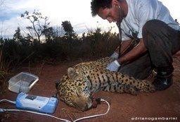 Ronaldo Morato合作论文数Instituto Pró-Carnívoros Atibaia São Paulo3
 Leticia Couto Garcia合作论文数3
 Vitor Matheus Bacani合作论文数3
 Fabio de Oliveira Roque合作论文数3
 Fernando Rodrigo Tortato合作论文数3
 Reinaldo Lourival合作论文数School of Integrative Biology, University of Queensland3
 Lucia Mateus合作论文数3
 Walfrido Moraes Tomas合作论文数Embrapa Pantanal3
 Geoffrey Ellis合作论文数Energy Resources Program, U.S. Geological Survey3Guilherme Mourão合作论文数Laboratório de Vida Selvagen, EMBRAPAlCentro de Pesquisa Agropecuária do Pantanal3
 Danilo Bandini Ribeiro合作论文数Ctr Ciencias Biol & Saude, Univ Fed Mato Grosso do Sul3Jerry Penha合作论文数2Edgley Pereira da Silva合作论文数2tayrine pinho de lima fonseca合作论文数2Balbina Maria Araujo Soriano合作论文数2Sandra Baptista da Cunha合作论文数2
 Alexandre Ebert合作论文数2Márcia Divina de Oliveira合作论文数2M. R. Oliveira合作论文数2Carlos R. Padovani合作论文数2
 Solange Ikeda合作论文数Mato Grosso State University2




