The Dharali debris flow on 5 August 2025, in Uttarakhand, India, was a catastrophic disaster that occurred in Kheer Gad, a tributary of the Bhagirathi river. It claimed approximately 60 lives and covered an estimated 3 hectares of apple orchards under debris. The damage also included at least 25-30 animals and a market comprising 65 hotels, over 30 resorts, and homestays. The present study involved the geomorphic characterisation of Kheer Gad to assess the debris flow potential of the catchment and debris flow simulation to ascertain the source, potential flow dynamics, and reconstruction. Findings reveal that the 17 km2 Kheer Gad catchment is inherently unstable, as suggested by Melton's ruggedness number of 0.8, significantly above the 0.6 debris-flow threshold. The trigger was not a single event, but an antecedent rainfall of similar to 195 mm/30 days, which saturated glacial and landslide-derived source materials. Debris flow simulation revealed 60 kPa flow pressure, velocities of 5-10 m/s, flow height of 5-10 m, spread area of similar to 18 hectare, and volume estimate of 995,580 +/- 200,000 m3-1,285,260 +/- 126,000 m3. These values are validated against field observations. Notably, the disaster was exacerbated by human vulnerability, given the doubling of built-up structures between 2011 and 2025, despite prior warnings in 2013. The present study provides a transferable methodology for assessing similar high-risk, glaciated basins to prevent such avoidable disasters.
Glaciers worldwide, including those in the Himalaya, are retreating under climate change, often leading to the formation and expansion of glacial lakes and an increased risk of Glacial Lake Outburst Floods (GLOFs). This study examines the evolution of the proglacial Bhilangana Lake (similar to 0.37 km(2); similar to 4750 m asl) and the associated glacier changes, including thinning and retreat, between 1968 and 2025 using satellite imagery, field measurements and hydrodynamic modelling. Results show lake expansion from similar to 0.12 km(2) in 2001 to similar to 0.37 km(2) in 2025, with an estimated volume of similar to 10.7 x 10(6) m(3), indicating exponential growth over time. A potential GLOF could release peak discharge of 3645 m(3)/s, with average flow velocity similar to 12 m/s, inundating similar to 6.8 km(2) and threatening hydropower projects, settlements and infrastructure downstream. Rising mean, maximum and minimum air temperatures at rates of 0.028, 0.052 and 0.05 degrees C/year, respectively, are identified as the primary drivers of lake expansion and accelerated melt, particularly in July-August. The zero-degree isotherm is shifting to higher elevations, and bias-corrected ERA5 data show good agreement at such altitudes, making it reliable for climate change analysis. Several over-deepening sites were also mapped as potential future lakes, with CMIP6 projections (similar to 0.8 degrees C/decade) indicating substantial glacial and hydrological changes, further elevating GLOF risk by the century's end.
Glacier changes in the Himalaya are unequivocal under changing climate, making them susceptible to water availability in the future. Given the significance of glaciers for hydrology and the dangers they pose, the current study examines the state of the only glacier (i.e., Birahi Glacier) in the Birahi Ganga Catchment (BGC), Alaknanda Basin, Uttarakhand, from 1968 to 2020. It is observed that the glacier retreated 329 +/- 15 m at an average rate of 6.3 +/- 0.3 m a(-1),and vacated an area of similar to 5000 m(2) a(-1) from 1968 to 2020. Based on satellite images, glacier separation began in 1994, as demonstrated by the small patches exposing the bedrock. It eventually grew and detached the lower debris cover zone from the upper clean ice zone in 2019. The recent satellite image reveals that snow and ice avalanches occasionally feed the lower, disconnected debris-covered portion. At present, the lower zone with an area of 0.59 +/- 0.03 km(2) behaves differently than the rest of the 3.6 +/- 0.06 km(2) clean glacier zone. Detachment of the glacier is attributed to topography; the steep slope along the glacier's central flow line; the upward movement of the snowline and enhanced melting in the transition zone of debris-covered ice and clean ice. During the period between 1994-2020, the glacier shows pronounced shifting of snout elevation from similar to 3910 to similar to 4000 m asl (similar to 90 m; 2.8 m a(-1)) and snowline from 5143 to 5335 m asl (192 +/- 17 m; 7.3 +/- 0.65 m a(-1)). Deglaciation in BGC may pose an alarming situation for water availability downstream for drinking, agriculture, and a hydroelectric power project in the future.
The Himalayan river basins offer great potential for hydropower development, but they are also vulnerable to various hazards such as debris flows, landslides, flash floods, glacial lake outburst floods (GLOFs), and landslide lake outburst floods (LLOFs). Despite the regional and global significance of these hazards, there is a lack of information and data on different aspects, including meteorology, hydrology, geology, and seismology. Many hazards often go unnoticed or receive little attention until they start affecting humans and their activities like damage to buildings, infrastructure, and other human-made structures. It is important to recognize that hazards can have severe and long-lasting impacts on society, even when they do not directly affect humans. For example, flash floods can disrupt ecosystems, destroy habitats, and threaten biodiversity and the complexity of climatic influences on both regional and local scales cannot be overlooked. Therefore, we highlight the importance of basin-wise and basin-wide continuous long-term monitoring in the Himalaya. It is also recommended that the highest hydropower projects in the basins should have their network of hydro-meteorological observatories at different altitudes with a provision of real-time data transmission and deployment of a multi-hazard warning system (IMWS) for flash floods.
The study investigates a shallow ice core (IND–25/B5) drilled near Humboldt Mountain in Dronning Maud Land (DML) region, during the 25th Indian Antarctic Expedition (2005-2006), to understand the variability in microparticle input to the region, and their characterization under the Scanning Electron Microscope-Electron Dispersive Spectroscopy (SEM-EDS). Also, the volcanic chronology of the ice core was established using the presence of volcanic shards at various depths of the ice core. The results suggest that the dust input to the study area has drastically increased since 1980, indicating changes in the atmospheric circulation pattern, local environmental conditions, increased global aridity and/or expansion of the ice-free oasis in the DML region. Silica (Volcanic and Mineral dust), Carbon (Calcareous and Organic) and other microparticles are three major types of particles observed in the ice core. Volcanic ash microparticles are observed at various depths, which depict glassy structures with conchoidal fractures and high SiO2 concentrations (>50
Study region: The study region includes two glaciers from Alaknanda and Bhagirathi river basins in Central Himalaya. Study focus: The study focuses on the analysis of high-resolution isotopic data sets of different components of the streamflow with ground-based meteorological observations from Automatic Weather Stations (AWSs) at two glaciers (similar to 4000 m asl). New hydrological insights for the region: The glaciers in the Himalaya are difficult to access due to their topography and climate and require complicated logistics to work in the region. Hence, the understanding of hydrological processes in this region is limited. The debris cover (sublimation of surface ice), orientation and microclimatic conditions (temperature, wind and rain) of the two glaciers control the isotope signatures of the glacier surface ice in the Himalayan region, indicating heterogeneity and complexity in the isotopic compositions. The studies estimating the contribution of different components to the streamflow downstream using generalized values of stable isotopes (glacier ice, snow) are complicated, as several glaciers contribute to the total runoff in large basins. The stable isotopes of streamflow indicate the contribution of snow and ice melt during early ablation (May-Jun.); rainfall and ice melt during the ISM (Jul.-Aug.) and ice melt during late ablation (Sep.-Oct.). The contribution of snow-glacier melt and rainfall for the ablation season (Jun.-Oct.) was 89% and 11%, respectively. The separation of the hydrograph is complex, site and time-specific, which needs attention.
The meltwater runoff characteristics of the glacierized basins are different from those of purely rain-fed basins. Understanding the hydrological response of Himalayan glaciers, where significant rainfall occurs in addition to snow and glaciers, becomes very complex. Large variability has been observed in the meteorological conditions over glacierized regions, with rainfall being the most variable. Meltwater runoff from snow and glaciers is the most important source of runoff for mountain streams during the early ablation season (May and June). The discharge from the glacierized basins is highly regulated by the drainage and meltwater storage characteristics of the glacier. The interannual variability in the discharge for the glaciers is low as compared to the diurnal variability. The availability of dependable flows and suitable heads provides excellent conditions for hydropower generation and has resulted in extensive development of hydropower projects in the Himalaya. However, still, a large potential is yet to be harnessed in Uttarakhand (~ 70%) and other Himalayan states. To develop this potential under the threat of frequent disasters in the state and the absence of hydrometeorological data in glacierized basins, integrated continuous long-term monitoring of glaciers is essential.
Hydrological studies of glaciers in the Indian Himalaya are very important for understanding the melting processes and assessing the influences of climate change. The diurnal variation in the melt-runoff is controlled by the glacial drainage system. To understand the response of such systems continuous monitoring of hydrological and meteorological data is essential. In the present paper, we have studied the high-resolution data for the assessment of hydrological response of Dokriani Glacier in the upper Ganga basin of Garhwal Himalaya. The data were collected for a period of two years (2011–2012) by establishing an Automatic Weather Station (AWS) and discharge gauging site with the provision of automatic water level recorder (AWLR) near the snout of the glacier. A considerable amount of runoff has been observed at nighttime during the glacial ablation with maximum discharge in the evening and minimum in the morning. The depletion of snow from the glacier surface results into exposure of glacier surface ice and reduction in the holding capacity of water in the glacier. Such variations in the physical condition of a glacier attribute to the changes in the hydrological response of the glacier over time. The effect on the hydrological response has also been studied by analyzing diurnal hydrographs for each ablation month. The hydrological response of the glacier becomes faster with the advancement of the ablation season. Significant changes in the hydrological response of the Glacier are observed over a decade.
The Karakoram has a large concentration of surge-type glaciers, including 69 tributary glaciers, compared to 152 surge-type main or trunk glaciers. The paper addresses the interactions between tributary and trunk glaciers using digital elevation models (DEMs), surface displacement, field and archival reports. In particular, it explores the behavior and impacts of 13 tributary glacier surges on three trunk glaciers, namely the Hispar, Braldu and Panmah. Observations include five surge tributaries of Panmah, five of Braldu, and three of Hispar. We observed ASTER DEMs can help in some cases to detect surge signature where automated surface displacement does not detect the surge. We also observed substantial differences in surge dimensions, timing and histories of the main trunk glacier and their tributaries. East Braldu III tributary surged between 2000 and 2003, whereas East Braldu IV surged from 2003 to 2006, but in these periods, no other tributary shows surge signature. Between 2013 and 2016, Braldu trunk Glacier surged along with four tributaries out of five except West Braldu I. Volumes and geometry of ice transferred from tributary to trunk glaciers are unique to each case, but the surging ice melted rapidly in about 2 to 4 years for some cases such as Little Skamri and Drenmang. The tributary ice modified all studied trunk glacier dynamics, morphology, distribution of debris and hypsography. The ice transferred from tributaries such as Little Skamri and Drenmang blocked the flow of trunk Nobande Sobonde Glacier from 2004 to 2006. Such ice transfer by surge tributaries to the main trunk glacier is referred here as surge-modified ice. It introduces indirect and post-surge effects and complicates or delay in tracking glacier responses to climate change. Also, mass balance in surge-type and surge-modified glaciers differ from systematic direct responses to climate in non-surge-type glaciers. Therefore, more research and monitoring are required to address the distinct responses of such glaciers and individual tributaries to better understand the heterogeneity of surging glaciers in Karakoram.
A ground-based and heliborne survey was conducted immediately after the disaster that took place on 7th February, 2021 in the Chamoli district of Uttarakhand. Based on these observations and freely available Google Earth imagery, we have arrived at plausible causes of this catastrophe as detachment of a sizeable rock mass and overlying hanging glacier in the Raunthi catchment that dammed the Rishiganga River and led to the devastation of roads, bridges and hydropower projects in downstream.
The geothermal systems in the Himalaya are complex, and their genesis, circulation pattern and processes of sustenance are largely unknown. The present study aims to systematically analyse the characteristics of oxygen and hydrogen isotopes, major ion data and strontium ratio (87Sr/86Sr) of geothermal systems, river waters and rainwater to understand the movement of groundwater and the mechanisms for the formation of geothermal systems in the region. Further, the strontium isotope was also used to understand the fluid source of geothermal systems. Field observations show that the geothermal waters have a higher temperature, hydraulic pressure and elevated δD and δ18O values than river waters. Thus, large river systems are not the principal recharge source of geothermal systems. Meteoric water (rain and snowmelt) in high mountains can infiltrate and circulate deep down the active tectonic belts or sutures and recharge geothermal systems. The cold surface water evolves into high-temperature thermal water after deep circulation and is discharged as a geothermal spring at the surface, under a high water-head difference. Therefore, the large-scale geothermal systems in the Garhwal Himalaya develop and are maintained by rapid groundwater circulation and interaction with a heat source. Further, the water temperatures of these systems in Garhwal Himalaya have remained the same over the period 1975–1994 (Geological Survey of India) and 2010–2016 (this study) with an error of < 5%.
On 7 February 2021 at 10:30 am, a huge amount of slurry material flooded the Rishiganga catchment, resulting in excessive flow along the valley. The main cause of this flood was the dislocation of a huge rock mass approximately 540 m wide and 720 m long from the main rock body, which slipped down towards the Raunthi Gadera valley floor, causing massive devastation in the areas such as Raini, Tapovan, and Vishnuprayag. This event was not expected and was the first event in history when a flash flood occurred in winter. In this study, we tried to answer two major questions which are not been explained so far that are related to this disaster. These questions are (i) why did this event occur in winters? (ii) where did so much debris and water come from?. This study clearly answers these questions based on field observations.
Glaciers in the Indian Himalayan Region (IHR) are sensitive to climatic changes. Rivers originating from Himalaya have higher water yields in the ablation season due to large inputs from the melting of snow and glaciers, which is critical for sustaining downstream ecosystem, agricultural practices, hydroelectric power generation, and urban water supplies. Integrated investigations are frequently unavailable at a regional scale over a longer period, which is hampered due to the non-availability of data caused by harsh weather conditions, difficult terrain, as well as difficulty in maintaining the instruments at such high altitudes (> 3000 m asl). The hydrological understanding of melting processes from glacierized basins requires a network of reliable meteorological and hydrological observations. In absence of such reliable meteorological data, most of the hydrological simulation studies are forced to extrapolate air temperature from nearby basins, lower elevations, or consider satellite-based observations, which often deviate or differ from the actual ground conditions and lead to large uncertainty in model outputs. Therefore, an integrated approach for collecting hydrological and meteorological data along with other data like snow-cover, suspended sediment transfer and stable isotopic signatures of different components of the hydrograph were conceptualized for glacierized river basins in Garhwal Himalaya (Bhagirathi and Alaknanda). Our results suggest that the annual distribution of temperature lapse rates (TLR) established exhibits a bimodal pattern and the TLR’s are significantly lower than the adiabatic lapse rate. The major components of the streamflow are derived from snow and glacier melt, while rainfall contributes little during the Indian Summer Monsoon (ISM). Westerlies significantly feed the glacier with snow, while rainfall is dominant during the Indian Summer Monsoon (ISM). Precipitation and temperature are the dominant meteorological factors controlling melting processes and sediment delivery. Climate and topography control the distribution of seasonal snow cover/ snowline in the region. Extreme events like heavy rainfall, flash floods, glacial lake outbursts floods, etc. can be traced using hydrometeorological and isotopic data at high altitude stations. Therefore, in light of the challenges and potential research gaps, the study produces actionable knowledge in the Garhwal Himalaya for better understanding and modeling of glacio-hydrological processes by incorporating ground-based observations.
Integrated long-term hydro-meteorological investigations are not frequently available in Indian Himalaya Region (IHR), especially near the glacier terminus. Collection and analysis of integrated hydro-meteorological observations help in understanding the weather conditions, glacier melting pattern and other flow-generation processes. Changes in local precipitation, snow cover pattern and glacier storage are likely to affect discharge in terms of volume and its variability. Hence, there is a need to establish a linkage between glacio-hydrological processes with the climate. The current study involves a time series analysis of hydro-meteorological records collected near the terminus of some glaciers in Garhwal Himalaya for available consecutive ablation seasons. The time series analysis has been utilized for determining correlations and Auto-correlation (ACF). Changes in correlations between meltwater discharge and meteorological variables are discussed. The analysis suggests a very high discharge auto-correlation for each year and the combined data series of individual glaciers. The substantial storage of meltwater in the glacier body and its delayed response to the runoff is attributed to the high dependency of a particular day's discharge on its previous day's discharge. Variations in the physical features of the glacier, weather conditions, precipitation and its distribution with time over the basin account for changes in correlations. A comparison of correlations between discharge and temperature, and discharge and rain shows that temperature has a better correlation with discharge for all the years. In the early stages of the ablation period, poor drainage networks and stronger storage characteristics are observed in the glaciers due to the presence of seasonal snow cover. The impact of such meltwater storage and delaying characteristics of glaciers on hydropower projects being planned and/or developed on glacier-fed streams in Garhwal Himalaya are highlighted.
Himalayan glaciers exert considerable influence on basin hydrology and its response to climate change. Melt-runoff generated from ungauged Himalayan basins (UHB) requires an understanding of snow and ice cover extent along with prevailing meteorological conditions. Therefore, an estimation of seasonal snow cover distribution, topographic (elevation, aspect, and slope) and climatic variability was carried out using satellite data and meteorological observations from three automatic weather stations (AWSs) located at different elevations in an UHB (Chorabari Glacier). Results suggest that the topography and the meteorological conditions of the basin influence the dynamics of snow cover and the corresponding processes responsible for the melt-runoff generation. The snow cover area (SCA) has high variability in the elevation range of 3799-5000 m, indicating that as glacier ablation begins, SCA below this elevation primarily contributes to the melt-runoff. Likewise, the eastern aspect and the slopes (0-10 degrees and 70-80 degrees) show higher variability. Further, the annual distribution of air temperature gradients (dT/dZ) or temperature lapse rates (TLRs) exhibits a bimodal pattern. The mean annual TLR for the basin is 6.0 degrees C km(-1), which is lower than the traditionally used adiabatic or environmental lapse rate (6.5 degrees C km(-1)) We also established the role of TLRs in the dynamics of SCA, which is an important parameter used for the computation of melt-runoff. The 0 degrees C isotherm established indicates that the elevation zone above 5000-5500 m has persistent snow cover throughout the year and snow cover below this zone contributes to the melt-runoff during the ablation season. Therefore, validating the equilibrium line altitude (ELA) of Chorabari Glacier lies within this zone. Since the TLR and SCA vary with space and time, our study in an ungauged glacierized basin of river Ganga could be useful for policymakers as well as other researchers working on the regional hydrology.
In 2017–2019 a surge of Shispare Glacier, a former tributary of the once larger Hasanabad Glacier (Hunza region), dammed the proglacial river of Muchuhar Glacier, which formed an ice-dammed lake and generated a small Glacial Lake Outburst Flood (GLOF). Surge movement produced the highest recorded Karakoram glacier surface flow rate using feature tracking (~18 ± 0.5 m d −1 ) and resulted in a glacier frontal advance of 1495 ± 47 m. The surge speed was less than reports of earlier Hasanabad advances during 1892/93 (9.3 km) and 1903 (9.7 km). Surges also occurred in 1973 and 2000–2001. Recent surges and lake evolution are examined using feature tracking in satellite images (1990–2019), DEM differencing (1973–2019), and thermal satellite data (2000–2019). The recent active phase of Shispare surge began in April 2018, showed two surface flow maxima in June 2018 and May 2019, and terminated following a GLOF on 22–23 June 2019. The surge likely had hydrological controls influenced in winter by compromised subglacial flow and low meltwater production. It terminated during summer probably because increased meltwater restored efficient channelized flow. We also identify considerable heterogeneity of movement, including spring/summer accelerations.
O-18 has long been a useful tool to understand the physical processes operating in hydrosphere and used as geothermometer to estimate paleotemperature. According to the literature review of this research there is no such reported experimental approach, which records O-18 fractionation pattern in liquid water system when there is no phase change involved but temperature gradient exist. In this experimental approach, an attempt has been made to fractionate O-18 with response to known temperature gradient by simulating a gently dipping confined aquifer system in controlled laboratory condition. The experimental apparatus was designed in such a way that it replicates an impermeable confined aquifer boundary. Initial condition of the model was homogeneous distribution of different isotopomers of water before imposing the temperature gradient. As temperature gradient imposed on the experimental apparatus O-18 and O-16 will fractionate as per their preferred thermal regime. Depending on the vibrational frequency of O-16-O-18 and O-16-O-16 it is likely that O-18 will concentrate at lower temperature regime where as O-16 will concentrate at higher temperature regime leading to isotopic stratification. Milli-Q water was used for the experiment to fractionate O-18 with known temperature gradient. The experiment was to generate a good dataset, which satisfies the physical fractionation of O-18 in real life situation in liquid water system with imposed temperature gradient when there is no phase change of water involved. Keeping the findings of this experiment in mind, we can make an inference that for a gently dipping confined aquifer system O-18 stratification occurs identifying heat as the primary cause. This temperature dependent O-18 fractionation in liquid water system can be farther used to estimate the groundwater temperature with reference to 25 degrees C benchmark temperature.
 Amit Kumar合作论文数School of Hydrology and Water Resources, Nanjing University of Information Science & Technology22
 Rakesh Bhambri合作论文数Central Soil Salinity Research Institute14
 Sameer K. Tiwari合作论文数Acad Sci & Innovat Res AcSIR12
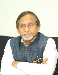 Kalachand Sain合作论文数National Geophysical Research Institute (Council of Scientific and Industrial Research), Uppal Road, Hyderabad, 500 606 India11
 Anil Kumar Gupta合作论文数Department of Geology and Geophysics, Indian Institute of Technology Kharagpur9
 Manish Mehta合作论文数6
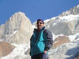 Dwarika Prasad Dobhal合作论文数Wadia Institute of Himalayan Geology6
 Santosh Rai合作论文数Harish-Chandra Research Institute6Anshuman Misra合作论文数Ctr Glaciol, Wadia Inst Himalayan Geol4
 Umesh K. Haritashya合作论文数Department of Earth Sciences, Indian Institute of Technology4Pawan Patidar合作论文数3
 p kawishwar合作论文数Chhattisgarh Council of Science and Technology3
 Pritam Chand Sharma合作论文数School of Environment and Earth Sciences, Central University of Punjab3
 Bhanu Pratap合作论文数Dept. of Electr. Eng., M.N.Nat. Inst. of Technol.;c3
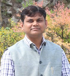 Kapil Kesarwani合作论文数3
 Kenneth Hewitt合作论文数Cold Regions Research Centre, Wilfrid Laurier University;Department of Geography and Environmental Studies, Wilfrid Laurier University;University of Toronto;Rutgers University, New Jersey3Sameer Kumar Tiwari合作论文数2Shipika Sundriyal合作论文数Environmental and Hydrology Division, National Institute of Hydrology2siddharth swaroop合作论文数2
 Vinit Kumar合作论文数Wadia Institute of Himalayan Geology2
 Rajeev Saran Ahluwalia合作论文数1
 Arjun Shahi合作论文数1
 Jairam Singh Yadav合作论文数Wadia Institute of Himalayan Geology1
 Suneet Naithani合作论文数Sch Environm & Nat Resources, Doon Univ1
 Somenath Ganguly合作论文数Department of Petroleum Engineering & Earth Sciences, University of Petroleum & Energy Studies1
 Dr UDAY Bhan合作论文数University of Petroleum and Energy Studies1A. K. L. Asthana合作论文数1Anupam Anand Gokhale合作论文数1
 Purushottam Kumar Garg合作论文数Ladakh Regional Centre, National Institute of Himalayan Environment1
 C. Scott Watson合作论文数School of Earth and Environment, University of Leeds1
 Vipin Kumar合作论文数1
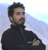 Rahul Devrani合作论文数Jindal Global University1
 Himanshu Govil合作论文数Department of Applied Geology, National Institute of Technology Raipur1
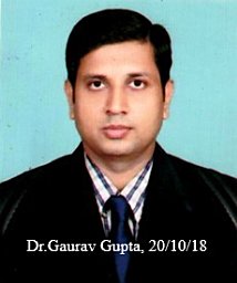 Gaurav Gupta合作论文数1
 Jeffrey S. Kargel合作论文数University of Arizona1
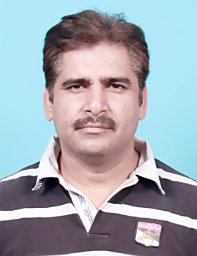 Naresh Kumar合作论文数Wadia Institute of Himalayan Geology1
 Saurabh Mittal合作论文数Institute of Cardiology, J.L.N. Medical College Ajmer1
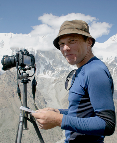 Marcus Nüsser合作论文数Department of Geography, University of Heidelberg1
 Nawal Kishore合作论文数Non-Crystalline Semiconductor Laboratory, Maharshi Dayanand University1
 Vikram Gupta合作论文数Department of Computer Science and Engineering, University of California, Riverside1
 Yaspal Sundriyal合作论文数Department of Geology;Garhwal University;Department of Geology, Garhwal University1Rajeev Upadhyay合作论文数1
 Rajiv Sinha合作论文数Department of Earth Sciences, Indian Institute of Technology Kanpur1
 Pradeep Srivastava合作论文数Department of Geology;Garhwal University;Wadia Institute of Himalayan Geology;Wadia Institute of Himalayan Geology, Garhwal University1




