Upslope (anabatic) winds during the day and downslope (katabatic) winds during the night are common features of boundary layers in mountainous terrain during clear and calm weather conditions. A milestone in the theory of slope flows is the Prandtl solution of the viscous/diffusive equations of motion and thermal energy for the flow of a stably stratified fluid over a uniformly heated planar slope of infinite extent. The model was originally developed for the steady state. In this study we consider the class of unsteady Prandtl-like flows arising from an abrupt change of slope buoyancy from one value (possibly zero) to another. This sudden change is an idealization of rapidly changing thermal conditions on real slopes, such as occurs around sunrise/sunset or when the sun appears/disappears from behind a cloud deck. The solution of the unsteady Prandtl model equations is used to estimate the times for the wind and buoyancy fields to attain specified percentages of their final steady-state values. The response times are calculated as functions of height, Prandtl number, and slope angle. The analysis is exact for a Prandtl number of 1, and approximate for Prandtl numbers near 1. The response times can provide a basis for establishing, for a given case, whether a quasi-steady state is even physically realizable within the daytime or nighttime phase of the diurnal cycle.
We revisit the classical problem of a laminar plume arising from a point source of heat on a horizontal boundary of infinite extent in an otherwise motionless neutrally stratified environment. The Boussinesq equations of motion and thermal energy for a steady axisymmetric plume are approximated separately for the plume interior and exterior, with the two regions connected via pressure continuity and use of the transverse (radial) equation of motion, an equation that has not been used in previous theoretical analyses of laminar plumes. An analysis of the governing equations yields a simple relation between the azimuthal vorticity and buoyancy, two variables of prime interest in studies of axisymmetric thermals, plumes, and jets. The relation states that when the Prandtl number is 1, the vorticity is equal to the buoyancy times radius divided by twice the kinematic viscosity. A more complex vorticity–buoyancy relation is obtained for arbitrary Prandtl numbers. The same vorticity–buoyancy relations are predicted for the plume interior and exterior. The relation for a Prandtl number of 1 is validated using output from a direct numerical simulation of a laminar plume induced by a small heat source on the lower boundary. The steady-state vorticity–buoyancy relation is confirmed in regions that have attained a steady state and also, remarkably, at earlier times, where the plume cap has passed, but the flow is still evolving.
This study extends the linear theory of Shapiro et al. (S18) for the onset of horizontal convergence and ascent in nocturnal boundary layers in baroclinic environments such as the U.S. Great Plains. In S18, the sudden decay of turbulence in a surface-based warm tongue at sunset triggers a surge of convergent inflow/ascent as well as a Blackadar-like nocturnal low-level jet. For conditions typical of broad warm-season surface-based baroclinic zones over the Great Plains, the S18 theory predicts that air parcels can rise 500 m–1 km before the onset of a descent phase. Such displacements may help sustain or initiate convection and play a role in the well-known nocturnal maximum in rainfall over the region. In this study, the Cloud Model 1 is used to examine the S18 predictions in a more realistic setting in which the nonlinear terms in the governing equations are retained, and the sudden shutdown of turbulence at sunset is replaced by a more gradual evening transition. A warm tongue arises in the simulated boundary layer over a 5-day period through a prescribed deficit in surface moisture which causes the greatest daytime heating in the domain center. As in S18, the simulations depict a surge of convergent flow, descent of the zone of peak ascent, replacement of the ascent zone by subsidence, peak vertical motion decreasing with latitude and warm tongue width, and the generation of free-atmosphere inertia–gravity waves. The divergence and vorticity fields are found to oscillate at the inertial frequency.
We introduce a quasi-analytical model of thermally induced fl ows in valleys with sloping fl oors, a feature absent from most theoretical valley wind studies. One of the main theories for valley winds the valley volume effect emerged from fi eld studies in the European Alps in the 1930s and 1940s. According to that theory, along-valley variations in the heating rate arising from variations in valley geometry generated the pressure gradient that drove the valley wind. However, while those early studies were conducted in valleys with relatively fl at (horizontal) fl oors, valleys with sloping fl oors are ubiquitous and presumably affected directly by slope buoyancy (Prandtl mechanism). Our model is developed for the Prandtl setting of steady fl ow of a stably stratified fl uid over a heated planar slope, but with the slope replaced by a periodic system of sloping valleys. As the valley characteristics do not change along the valley, there is no valley volume effect. The 2D linearized Boussinesq governing equations are solved using Fourier methods. Examples are explored for symmetric (with respect to valley axis) valleys subject to symmetric and antisymmetric heating. The fl ows are 2D, but the trajectories are intrinsically 3D. For symmetric heating, trajectories are of two types: i) helical trajectories of parcels trapped within one of two counterrotating vortices straddling the valley axis and ii) trajectories of environmental parcels that approach the valley horizontally, move under and then over the helical trajectories, and then return to the environment. For antisymmetric heating, three types of trajectories are identified.
AbstractExtreme rainfall events (EREs) caused by convection are a major prediction challenge and can lead to deadly flash flooding. This study investigates EREs from 2003 to 2023 over the central and eastern United States using high‐resolution (4‐km) Stage IV precipitation analyses. EREs were defined where 12‐hr accumulations exceeded the 10‐year average recurrence interval thresholds. Summertime (June–August) EREs exhibited pronounced interannual variability, but with statistically significant increasing trends in annual frequency, particularly among those caused by mesoscale convective systems. Significant relationships were also found between summertime convective EREs over the central United States and enhanced poleward moisture transport, consistent with a westward expansion of the climatological North Atlantic Subtropical High. This relationship may aid in medium‐ and long‐range forecasting. However, the spatial scale of EREs often included localized or narrow bands of extreme accumulations, revealing significant challenges in the accurate representation of EREs in weather and climate models.
Weak but persistent synoptic -scale ascent may play a role in the initiation or maintenance of nocturnal convection over the central United States. An analytical model is used to explore the nocturnal low-level jets (NLLJ) and ascent that develop in an idealized diurnally varying frictional (Ekman) boundary layer in a neutrally stratified barotropic environment when the flow aloft is a zonally propagating Rossby wave. Steady -periodic solutions are obtained of the linearized Reynolds -averaged Boussinesq -approximated equations of motion on a beta plane with an eddy viscosity that is specified to increase abruptly at sunrise and decrease abruptly at sunset. Rayleigh damping terms are used to parameterize momentum loss due to radiation of inertia-gravity waves. The model -predicted vertical velocity is (approximately) proportional to the wavenumber and wave amplitude. There are two main modes of ascent in midlatitudes, an afternoon mode and a nocturnal mode. The latter arises as a gentle but persistent surge induced by the decrease of turbulence at sunset, the same mechanism that triggers inertial oscillations in the Blackadar theory of NLLJs. If the Rayleigh damping terms are omitted, the boundary layer depth becomes infinite at three critical latitudes, and the vertical velocity becomes infinite far above the ground at two of those latitudes. With the damping terms retained, the solution is well behaved. Peak daytime ascent in the model occurs progressively later in the afternoon at more southern locations (in the Northern Hemisphere) until the first (most northern) critical latitude is reached; south of that latitude the nocturnal mode is dominant.
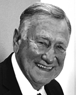
In this note, we celebrate the professional career of former Boundary-Layer Meteorology (BOUN) Editor-in-Chief, Evgeni Fedorovich (Fig. 1), highlighting his scientific achievements, career milestones, and impacts on those working on problems in boundary-layer meteorology and related disciplines.Evgeni Fedorovich served as the Editor-in-Chief of BOUN from 2014 to 2022.As a member of the editorial board and Editor-in-Chief of the journal, Evgeni knew almost everyone who works in this field, from students to professors.The opposite is also true-apparently everyone also knew Evgeni!Apart from his editorship of BOUN, Evgeni Fedorovich is best known for his research on entrainment in sheared and unsheared convective boundary layers, contaminant dispersal in urban settings, dynamics of nocturnal low-level jets, and turbulence and oscillations in slope flows (katabatic and anabatic flows).Evgeni is likely one of the few people in the field with a broad understanding of most of the topics of boundary-layer meteorology and atmospheric turbulence.Evgeni's research was characterized by creative use of wind tunnels, early adoption of the tools of large-eddy simulation and direct numerical simulation and, notably, its frequently collaborative nature with international participation by research scientists, engineers, faculty, and students.At the time of his retirement from the University of Oklahoma in 2021, Evgeni had
Phased array radars (PARs) are a promising observing technology, at the cusp of being available to the broader meteorological community. PARs offer near-instantaneous sampling of the atmosphere with flexible beam forming, multifunctionality, and low operational and maintenance costs and without mechanical inertia limitations. These PAR features are transformative compared to those offered by our current reflector-based meteorological radars. The integration of PARs into meteorological research has the potential to revolutionize the way we observe the atmosphere. The rate of adoption of PARs in research will depend on many factors, including (i) the need to continue educating the scientific community on the full technical capabilities and trade-offs of PARs through an engaging dialogue with the science and engineering communities and (ii) the need to communicate the breadth of scientific bottlenecks that PARs can overcome in atmospheric measurements and the new research avenues that are now possible using PARs in concert with other measurement systems. The former is the subject of a companion article that focuses on PAR technology while the latter is the objective here.
An analytical model is presented for the generation of a Blackadar-like nocturnal low-level jet in a broad baroclinic zone. The flow is forced from below (flat ground) by a surface buoyancy gradient and from above (free atmosphere) by a constant pressure gradient force. Diurnally-varying mixing coefficients are specified to increase abruptly at sunrise and decrease abruptly at sunset. With attention restricted to a surface buoyancy that varies linearly with a horizontal coordinate, the Boussinesq-approximated equations of motion, thermal energy, and mass conservation reduce to a system of one-dimensional equations that can be solved analytically. Sensitivity tests with southerly jets suggest that (i) stronger jets are associated with larger decreases of the eddy viscosity at sunset (as in Blackadar theory), (ii) the nighttime surface buoyancy gradient has little impact on jet strength, and (iii) for pure baroclinic forcing (no free-atmosphere geostrophic wind), the nighttime eddy diffusivity has little impact on jet strength, but the daytime eddy diffusivity is very important and has a larger impact than the daytime eddy viscosity. The model was applied to a jet that developed in fair weather conditions over the Great Plains from southern Texas to northern South Dakota on 1 May 2020. The ECMWF Reanalysis v5 (ERA5) for the afternoon prior to jet formation showed that a broad north-south-oriented baroclinic zone covered much of the region. The peak model-predicted winds were in good agreement with ERA5 winds and lidar data from the Atmospheric Radiation Measurement (ARM) Southern Great Plains (SGP) central facility in north-central Oklahoma.
Accurate vertical velocity retrieval from dual-Doppler analysis (DDA) is a long-standing problem of radar meteorology. Typical radar scanning strategies poorly observe the vertical component of motion, leading to large uncertainty in vertical velocity estimates. Using a vertical vorticity equation constraint in addition to a mass conservation constraint in DDA has shown promise in improving vertical velocity retrievals. However, observation system simulation experiments (OSSEs) suggest this technique requires rapid radar volume scans to realize the improvements due to the vorticity tendency term in the vertical vorticity constraint. Here, the vertical vorticity constraint DDA is tested with real, rapid-scan radar data to validate prior OSSEs results. Generally, the vertical vorticity constraint DDA produced more accurate vertical velocities from DDAs than those that did not use the constraint. When the time between volume scans was greater than 30 s, the vertical velocity accuracy was significantly affected by the vorticity tendency estimation method. A technique that uses advection correction on provisional DDA wind fields to shorten the discretization interval for the vorticity tendency calculation improved the vertical velocity retrievals for longer times between volume scans. The skill of these DDAs was similar to those using a shorter time between volume scans. These improvements were due to increased accuracy of the vertical vorticity tendency using the advection correction technique. The real radar data tests also revealed that the vertical vorticity constraint DDAs are more forgiving to radar data errors. These results suggest that vertical vorticity constraint DDA with rapid-scan radars should be prioritized for kinematic analyses.
Single-Doppler radar data are often missing in important regions of a severe storm due to low return power, low signal-to-noise ratio, ground clutter associated with normal and anomalous propagation, and missing radials associated with partial or total beam blockage. Missing data impact the ability of WSR-88D algorithms to detect severe weather. To aid the algorithms, we develop a variational technique that fills in Doppler velocity data voids smoothly by minimizing Doppler velocity gradients while not modifying good data. This method provides estimates of the analysed variable in data voids without creating extrema. Actual single-Doppler radar data of four tornadoes are used to demonstrate the variational algorithm. In two cases, data are missing in the original data, and in the other two, data are voided artificially. The filled-in data match the voided data well in smoothly varying Doppler velocity fields. Near singularities such as tornadic vortex signatures, the match is poor as anticipated. The algorithm does not create any velocity peaks in the former data voids, thus preventing false triggering of tornado warnings. Doppler circulation is used herein as a far-field tornado detection and advance-warning parameter. In almost all cases, the measured circulation is quite insensitive to the data that have been voided and then filled. The tornado threat is still apparent.
Techniques to mitigate analysis errors arising from the nonsimultaneity of data collections typically use advection-correction procedures based on the hypothesis (frozen turbulence) that the analyzed field can be represented as a pattern of unchanging form in horizontal translation. It is more difficult to advection correct the radial velocity than the reflectivity because even if the vector velocity field satisfies this hypothesis, its radial component does not-but that component does satisfy a second-derivative condition. We treat the advection correction of the radial velocity (upsilon (r)) as a variational problem in which errors in that second-derivative condition are minimized subject to smoothness constraints on spatially variable pattern-translation components (U, V). The Euler-Lagrange equations are derived, and an iterative trajectory-based solution is developed in which U, V, and upsilon (r) are analyzed together. The analysis code is first verified using analytical data, and then tested using Atmospheric Imaging Radar (AIR) data from a band of heavy rainfall on 4 September 2018 near El Reno, Oklahoma, and a decaying tornado on 27 May 2015 near Canadian, Texas. In both cases, the analyzed upsilon (r) field has smaller root-mean-square errors and larger correlation coefficients than in analyses based on persistence, linear time interpolation, or advection correction using constant U and V. As some experimentation is needed to obtain appropriate parameter values, the procedure is more suitable for non-real-time applications than use in an operational setting. In particular, the degree of spatial variability in U and V, and the associated errors in the analyzed upsilon (r) field are strongly dependent on a smoothness parameter.
This study used 20 years of Oklahoma Mesonet data to investigate the changes of near-surface water vapor mixing ratio q υ during the afternoon to evening transition (AET). Similar to past studies, increases in q υ are found to occur near sunset. However, the location, magnitude, and timing of the q υ maximum occurring during the AET are shown to be dependent on the seasonal growth and harvest of vegetation across Oklahoma in the spring and summer months. Particularly, the late spring harvest of winter wheat grown in Oklahoma appears to modify the relative contribution of local and nonlocal processes on q υ . By analyzing time series of q υ during the AET, it is found that the likelihood of a presunset q υ maximum is strongly dependent upon vegetation, soil moisture, wind speed, and cloud cover. Analysis also reveals that the increase in q υ during the AET can increase the parcel conditional instability despite the surface cooling produced by loss of insolation. Next to known changes in low-level wind shear, these changes in instability and moisture demonstrate new ways the AET can modify the presence of the key ingredients relevant to explaining the climatological increase in severe convective storm hazards around sunset.
Observation system simulation experiments are used to evaluate different dual-Doppler analysis (DDA) methods for retrieving vertical velocity w at grid spacings on the order of 100 m within a simulated tornadic supercell. Variational approaches with and without a vertical vorticity equation constraint are tested, along with a typical (traditional) method involving vertical integration of the mass conservation equation. The analyses employ emulated radar data from dual-Doppler placements 15, 30, and 45 km east of the mesocyclone, with volume scan intervals ranging from 10 to 150 s. The effect of near-surface data loss is examined by denying observations below 1 km in some of the analyses. At the longer radar ranges and when no data denial is imposed, the “traditional” method produces results similar to those of the variational method and is much less expensive to implement. However, at close range and/or with data denial, the variational method is much more accurate, confirming results from previous studies. The vorticity constraint shows the potential to improve the variational analysis substantially, reducing errors in the w retrieval by up to 30% for rapid-scan observations (≤30 s) at close range when the local vorticity tendency is estimated using spatially variable advection correction. However, the vorticity constraint also degrades the analysis for longer scan intervals, and the impact diminishes with increased range. Furthermore, analyses using 30-s data also frequently outperform analyses using 10-s data, suggesting a limit to the benefit of increasing the radar scan rate for variational DDA employing the vorticity constraint.
The frequency and intensity of the Great Plains nocturnal low-level jet (LLJ) are enhanced by baroclinicity over the sloped terrain of the region. A classical description of baroclinic-induced diurnal wind oscillations over the Great Plains considers differential heating of the slope with respect to air at the same elevation far removed from the slope, but with buoyancy constant along the slope (Holton mechanism). Baroclinicity can also occur due to differential heating of the slope itself, which creates a gradient in buoyancy along the slope. The relative prevalence of the two types of baroclinicity in this region has received scant attention in the literature. The present study uses 19 years of data from the Oklahoma Mesonet to evaluate the characteristics of along-slope buoyancy gradients over the region. A mean negative afternoon along-slope buoyancy gradient (east–west gradient) is found over Oklahoma. The sign of this afternoon buoyancy gradient is favorable for LLJ formation, as it results in the strongest southerly geostrophic wind near the ground around sunset, which is conducive to nocturnal jet formation via the inertial oscillation mechanism. The negative afternoon buoyancy gradient is at least partially created by an east–west gradient in diurnal heating and is stronger and more consistent in the summer months, which is when LLJs are most frequent. The contribution of the along-slope buoyancy gradient to the low-level geostrophic wind was found to be as important as the contribution of the Holton mechanism. Overall, these results indicate that along-slope buoyancy gradients should be accounted for in studies of LLJ dynamics over the Great Plains.
Multi-Doppler-radar network observations have been used in different configurations over the last several decades to conduct three-dimensional wind retrievals in mesoscale convective systems. Here, the impacts of the selected radar volume coverage pattern (VCP), the sampling time for the VCP, the number of radars used, and the added value of advection correction on the retrieval of the vertical air motion in the upper part of convective clouds are examined using the Weather Research and Forecasting (WRF) model simulation, the Cloud Resolving Model Radar SIMulator (CR-SIM), and a three-dimensional variational multi-Doppler-radar retrieval technique. Comparisons between the model truth (i.e., WRF kinematic fields) and updraft properties (updraft fraction, updraft magnitude, and mass flux) retrieved from the CR-SIM-generated multi-Doppler-radar field are used to investigate these impacts. The findings are that (1) the VCP elevation strategy and sampling time have a significant effect on the retrieved updraft properties above 6 km in altitude; (2) 2 min or shorter VCPs have small impacts on the retrievals, and the errors are comparable to retrievals using a snapshot cloud field; (3) increasing the density of elevation angles in the VCP appears to be more effective to reduce the uncertainty than an addition of data from one more radar, if the VCP is performed in 2 min; and (4) the use of dense elevation angles combined with an advection correction applied to the 2 min VCPs can effectively improve the updraft retrievals, but for longer VCP sampling periods (5 min) the value of advection correction is challenging. This study highlights several limiting factors in the retrieval of upper-level vertical velocity from multi-Doppler-radar networks and suggests that the use of rapid-scan radars can substantially improve the quality of wind retrievals if conducted in a limited spatial domain.
Abstract. Multi-Doppler radar network observations have been used in different configurations over the last several decades to conduct three-dimensional wind retrievals in mesoscale convective systems. Here, the impact of the selected radar volume coverage pattern (VCP), the sampling time for the VCP, the number of radars used, and the added value of advection correction on the retrieval of the vertical air motion in the upper part of convective clouds is examined using the Weather Research and Forecasting (WRF) model simulation, the Cloud Resolving Model Radar SIMulator (CR-SIM) and a three-dimensional variational multi-Doppler radar retrieval technique. Comparisons between the model truth (i.e., WRF kinematic fields) and updraft properties (updraft fraction, updraft magnitude, and mass flux) retrieved from the CR-SIM-generated multi-Doppler radar field are used to investigate these impacts. In overall, the VCP elevation strategy and sampling time is found to have a significant effect on the retrieved updraft properties above 6 km altitude. Retrievals conducted using a 2-min or shorter VCPs show small impacts on the updraft retrievals, and the errors are comparable to retrievals using a snapshot cloud field. Increasing the density of elevations angles and/or an addition of data from one more radar can reduce this uncertainty. It is found that the VCP with dense elevation angles appears to be more effective than the addition of data from the fourth radar, if the VCP is performed in 2 minutes. The use of dense elevation angles combined with an advection correction applied to the 2-min VCPs can effectively improve the updraft retrievals. For longer VCP sampling periods (5 min) the errors are considerably larger, and the value of advection correction is challenging due to the rapid deformation of the dynamical structures in the simulated mesoscale convective system. This study highlights several limiting factors in the retrieval of upper-level vertical velocity from multi-Doppler radar networks and suggests that the use of rapid-scan radars can substantially improve the quality of wind retrievals if conducted in a limited spatial domain.
A theory for gentle but persistent mesoscale ascent in the lower troposphere is developed in which the vertical motion arises as an inertia–gravity wave response to the sudden decrease of turbulent mixing in a horizontally heterogeneous convective boundary layer (CBL). The zone of ascent is centered on the local maximum of a laterally varying buoyancy field (warm tongue in the CBL). The shutdown also triggers a Blackadar-type inertial oscillation and associated low-level jet (LLJ). These nocturnal motions are studied analytically using the linearized two-dimensional Boussinesq equations of motion, thermal energy, and mass conservation for an inviscid stably stratified fluid, with the initial state described by a zero-order jump model of a CBL. The vertical velocity revealed by the analytical solution increases with the amplitude of the buoyancy variation, CBL depth, and wavenumber of the buoyancy variation (larger vertical velocity for smaller-scale variations). Stable stratification in the free atmosphere has a lid effect, with a larger buoyancy frequency associated with a smaller vertical velocity. For the parameter values typical of the southern Great Plains warm season, the peak vertical velocity is ~3–10 cm s −1 , with parcels rising ~0.3–1 km over the ~6–8-h duration of the ascent phase. Data from the 2015 Plains Elevated Convection at Night (PECAN) field project were used as a qualitative check on the hypothesis that the same mechanism that triggers nocturnal LLJs from CBLs can induce gentle but persistent ascent in the presence of a warm tongue.
We obtain an analytical model solution to an idealization of an urban heat island (UHI) circulation—the steady shallow convective flow of a viscous stably stratified fluid over a differentially heated lower boundary without system rotation (no Coriolis force) or background wind. The coupled linearized equations of motion and thermal energy are solved for flows in two-dimensional Cartesian (slab-symmetric) and axisymmetric geometries forced by laterally varying surface buoyancies considered as Gaussian and parabolic arch functions. The scaled problem is free of governing parameters, and the solutions are universal. In all cases the flow is dominated by an in-up-out circulation. The updraft is stronger in the axisymmetric case than in the slab-symmetric case, while the surrounding downdraft, and the inflow and outflow branches of the circulation are stronger in the slab-symmetric case. These differences are explained in terms of the response of the perturbation pressure to the thermal forcing in the different geometries. The scalings themselves provide insight into observations that daytime UHI circulations can be stronger than nighttime circulations despite the relative weakness of urban–rural temperature contrasts during the daytime.
 Evgeni Fedorovich合作论文数School of Meteorology, University of Oklahoma37
 Ming Xue合作论文数Center for Analysis and Prediction of Storms and School of Meteorology, University of Oklahoma36
 Jidong Gao (郜吉东)合作论文数National Severe Storms Laboratory;Cooperative Institute for Mesoscale Meteorological Studies, University of Oklahoma25
 Corey K. Potvin合作论文数NOAA, OAR/National Severe Storms Laboratory, Norman, OK, United States23
 Keith Brewster合作论文数16
 Alexander D. Schenkman合作论文数School of Meteorology, University of Oklahoma15
 Kelvin Droegemeier合作论文数University of Oklahoma13
 Tian-You Yu合作论文数School of Meteorology, University of Oklahoma/Advanced Radar Research Center, University of Oklahoma/School of Electrical and Computer Engineering, University of Oklahoma13
 Joshua G. Gebauer合作论文数c Earth Observing Laboratory, National Center for Environmental Research9
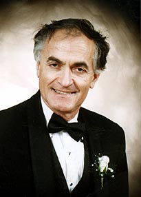 Dusan S. Zrnic合作论文数National Severe Storms Laboratory7
 Mark Yeary合作论文数School of Electrical and Computer Engineering, Gallogly College of Engineering, The University of Oklahoma;Advanced Radar Research Center, The University of Oklahoma7
 Louis (Lou) Wicker合作论文数Weather Research and Development Division, National Severe Storms Laboratory, OAR, NOAA;School of Meteorology, University of Oklahoma7
 Stephen S. Weygandt合作论文数Research - Forecast Systems Laboratory, NOAA6
 Petra Maria Klein合作论文数University of Utah, University of Nebraska at Kearney5
 Luther W White合作论文数5William Benner合作论文数4
 David Bodine合作论文数4
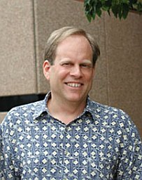 David B. Parsons合作论文数School of Meteorology, University of Oklahoma, Norman, Oklahoma4
 Michael Biggerstaff合作论文数University of Oklahoma4Jason A Milbrandt合作论文数Environment and Climate Change Canada4
 Daniel T. Dawson合作论文数School of Meteorology;University of Oklahoma;School of Meteorology, University of Oklahoma4
 Joshua Wurman合作论文数Iowa State University;Center for Severe Weather Research;Center for Severe Weather Research, Iowa State University4Ron Ferek合作论文数3James F. Kimpel合作论文数3
 douglas forsyth合作论文数3Jf Heimmer合作论文数3Mariko Oue合作论文数Sch Marine & Atmospher Sci, SUNY Stony Brook3
 Jeremy Alan Gibbs合作论文数Natl Severe Storms Lab, Ocean & Atmospher Res3
 Yadong Wang合作论文数3
 Qin Xu合作论文数National Severe Storms Laboratory;NOAA3Frederick H. Carr合作论文数Sch Meteorol, Univ Oklahoma3
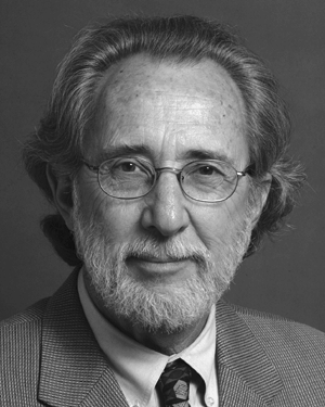 Jerry Crain合作论文数3Vince Wong合作论文数3
 Nathan Dahl合作论文数3Tom Mcnellis合作论文数3Bryan A. Burkholder合作论文数3
 Pavlos Kollias合作论文数School of Marine and Atmospheric Sciences, Stony Brook University – State University of New York3
 Richard J. Vogt合作论文数3Y. L. Kogan合作论文数2Daniel P. Betten合作论文数2Katherine M. Willingham合作论文数2
 Zachary B. Wienhoff合作论文数2 School of Meteorology, University of Oklahoma2
 Jana Houser合作论文数1 Department of Geography, Ohio University2
 Stefan Rahimi合作论文数Department of Atmospheric and Oceanic Sciences, University of California, Los Angeles2P. Robinson合作论文数2
 Xiao-Ming Hu (胡小明)合作论文数Center for Analysis and Prediction of Storms, University of Oklahoma;School of Meteorology, University of Oklahoma2
 Howard B. Bluestein合作论文数School of Meteorology, University of Oklahoma2William J. Martin合作论文数2
 Richard Doviak合作论文数2




