New high-speed trains will be provided in Egypt to compete with existing modes of transport, including conventional trains, airplanes, buses, and shared taxis. To analyze passengers’ responses to these trains, a cross nested mode-choice model was developed for long-distance trips using Biogeme software, based on questionnaire data. These data include passengers’ socio-economic characteristics, stated-preference options, and trip properties for each mode. The sensitivity analysis of the model resulted in raising the accessibility through high-speed access modes . The model was utilized to estimate the value of time, mode share, and future ridership. Social travelers prefer the high-speed trains of cost €3.75 per 100 km. For trips longer than 150 km, a maximum mode share of 45
A limited number of previous studies have focused on the selection of transportation routes considering sustainable development goals (SDGs). In this research, a methodology for selecting sustainable public transit (PT) routes is presented, consisting of generating a feasible initial route set, optimization, and assessment. Total welfare, road safety, and reduction in total emissions are indicators of the economic, social, and environmental dimensions, respectively. Based on the transportation model, the network structure, attributes, and emission rates are exported. The travel demand of PT is modified by modal share. Additionally, the safety performance function (SPF) is developed as a safety measure. Regarding optimization, the optimum routes are obtained by maximizing PT share and minimizing PT travel time. Then, the new routes are implemented, and the network is evaluated and compared with the existing scenario in light of sustainability indicators. The case study is Amman BRT. The results show that the new network is more sustainable than the existing BRT network and achieves better performance than the selected scenario of Amman city. The new network can reduce travel time by more than 13%, decrease total emissions by more than 17%, and alleviate the crash frequency by more than 14%.
Bus Rapid Transit (BRT) is a cost-effective public transport mode suitable for mega cities compared to other modes. In the planning process, route selection is a main target considering the available infrastructure, modes, land-use, and socio-economic characteristics. Additionally, the environmental, social, and economic objectives should be considered to achieve sustainability. In this research, a new multi-objective optimization algorithm for BRT route selection using Genetic Algorithm is presented. The proposed algorithm involves four stages: generating sufficient initial set of feasible routes, considering the more effective parameters, selecting the optimum route considering constraints and objective functions, and adopting the resulting optimum routes to select the following optimal route. New Cairo City, Egypt, through its VISUM transport model, was investigated as a case study where its road network is evaluated after considering the nominated BRT routes compared with the Do-Nothing scenario. The comparison shows 8% reduction in travel time in the city and 10% reduction in traffic emissions. Keywords: Bus Rapid Transit, Route Optimization, Genetic Algorithm, Visum DOI: https://doi.org/10.35741/issn.0258-2724.58.1.60
Traffic signal design requires experienced traffic engineers to decide on the phasing plans and then timing plans can be optimized. However, the available guidance provides general recommendations for phasing planning; while, commercial software optimizes the timing plans and corresponding operation performance (e.g., best performance index). Furthermore, the performance index excludes safety factors. This research aims to develop a framework that can deliver a phasing plan by enumerating all possible solutions and then selecting the phase plan that achieves the objectives. These objectives are to minimize the severity, average delay, and queue length. A program (i.e., software) has been developed to perform these stages and deliver a sorted list of phase plans based on the assessment criteria considering different traffic patterns, different intersection lane configurations, and operation types for left and right turns. A validation exercise was performed to assess the effectiveness and practicality of the developed software. It includes designing a phase plan for fifteen American, Canadian, and Chinese intersections and comparing them against their actual phasing design in terms of safety, average delay, and queue length. The results show that on average, the safety level is improved by 19%; however, the delay and queue length increased by 33% and 13%, respectively. The results encourage extending the proposed framework to consider the phasing sequence and coordination in future work. Finally, it is found that the framework provides practical phasing plans in terms of safety and other operational aspects. The results encourage extending the proposed framework to consider the phasing sequence and coordination in future work. Keywords: Traffic Signal Optimization, Phasing Plan, Highway Safety Manual, Queue Length DOI: https://doi.org/10.35741/issn.0258-2724.58.1.37
Volume-Delay Function (VDF) is a key input in several tasks including traffic assignment and trip distribution estimation. However, there is no clear framework to identify the VDF formula and parameters. Furthermore, the VDF performance in the oversaturated condition is uncontrolled. In this paper, most VDF-related aspects are investigated, including the key attributes, traffic model and VDF formulas, oversaturated condition assumptions, and optimization techniques. In each aspect, different methods are compared for best performance, while a new procedure is introduced, if necessary. The best traffic model and VDF formulas are nominated to satisfy a set of logic and statistical conditions, while a new optimization technique is presented. Furthermore, a new realistic assumption to control the VDF performance is discussed. This framework is applied on 32 worldwide roads of different categories and characteristics, which indicates accurate and realistic results. The results encourage for further investigation of the VDF performance in future work.
Around 28 million tons of municipal solid wastes (MSW) are annually generated in Egypt, with 40% in Greater Cairo Region (GCR). Although, the government aims at improving the MSW service coverage and collection efficiency, formal collection service is still limited and operates with low transportation efficiency resulting in illegal waste collection and dumping. This research aims at providing optimized collection systems to accommodate various housing levels and considering the available resources. As a case study, the collection routes in Al-Mostakbal City, are optimized by selecting the appropriate location and containers order. Meanwhile, the pick-up time is optimized using the appropriate vehicle type, fleet size, and rounds. In addition, dynamic routing is applied using developed production models. A simulation model is developed to assess various improvement scenarios and recommend the effective one for various schemes. The outcome is a highly-efficient framework; with potential to be extended to cover other urban areas.
Road design deficiencies and improper driver behavior at roundabout intersections may result in traffic bottlenecks, irregular traffic patterns, and potential crashes. Thus, road safety inspection is conducted to identify potential safety hazards and propose safety measures. The traditional safety inspection depends on unreliable traffic collision data visual data collection and superficial analysis. In this regard, surrogate safety assessment approaches are utilized to overcome the limitations found in traditional approaches. This paper employs an innovative surrogate approach for such a process by analyzing videos captured by a drone. A video processing technique is applied to determine the vehicle trajectories and extract conflict points. Accordingly, the conflict data are analyzed in terms of location, direction, and post-encroachment time (PET) as a safety measure to identify potential safety problems related to intersection geometry and driver behavior. This methodology is applied to an intersection case study in New Cairo City, Egypt. The findings of this study confirm the interaction between intersection geometry, drivers' behavior, and road safety on the examined safety measures.
Trip generation modelling is not a standard task as the relationship between the input and output variables is not exactly known and is often nonlinear. Furthermore, the input variables may have different types especially at the disaggregate levels. Accordingly, there is no single modelling technique that can be used for all trip generation cases. In this paper, a multiple piecewise regression technique is proposed to suit most trip generation cases. Thresholds can be identified at the discrete values in the case of categorical inputs; while, no thresholds are considered in the case of binary inputs. In addition, the locations of thresholds in case of continuous inputs are obtained to minimize the summation of squared errors and achieving the logical constraints. Thus, a broken hyperplane is determined using quadratic programming. The proposed technique is illustrated using a numerical example and then validated using three well-known examples. The results show that the proposed technique can fit the given data more accurately than the previous techniques. In addition, the proposed technique leads to more explicit and visualized models for practitioners. These findings will encourage researchers to apply the proposed technique in further applications such as trip distribution and mode choice models.
Due to budget limitation, the signalized intersections might be operated in fixed-time system, thus resulting in a low-performance operation. This paper attempts to introduce an economic adaptive traffic signal system that depends mainly on three simple techniques. The real-time delays are estimated using Google Maps. Accordingly, the timing plan is updated resulting in changing traffic light indication through a simple wireless communication module. Moreover, the timing plans would be displayed on two webpages: one to help in traffic surveillance and control and the other to help in selecting the best routes. The impact of the proposed system has been examined through a signalized intersection in Egypt using a microsimulation model. The results showed that the proposed system could decrease the traffic delays by 24%, compared to the fixed-time system. Future work is intended to thoroughly study the security perspectives and to validate the whole proposed system on real intersections.
Turning movements are one of the key inputs required for several traffic studies. Several methods have been developed to measure them. However, present techniques have high operational or capital costs, which motivate researchers to develop new techniques to estimate turning movements. However, there is neither a flexible technique available to make best use of different available information types, nor a framework that supports deciding additional data to achieve a target accuracy. This paper proposes a new methodology using all available data to identify the subspace containing all solutions and determine its centroid; thus, providing the most realistic and non-extreme solution. In addition, a framework, including scenarios with different data combinations, is developed with capability to evaluate the proposed solution and then locate further measurements to achieve the target accuracy. The framework is validated using a considerable set of intersections at Edmonton city, Canada. The results show that the proposed framework can achieve the target accuracy with minimum field measurements saving time, effort and cost.
Car-pooling is one of the solutions for the traffic problems in Greater Cairo Region (GCR). It leads to increase the average occupancy of autos, and consequently reduce the traffic volumes on GCR roads. Car-pooling implementation within organizations is expected to be more effective compared to car-pooling with non-work colleagues. The main objective of this research is to understand the factors affecting car-pooling deployment more deeply and how to maximize its share. A Stated-Preference Survey (SPS) has been conducted within the Faculty of Engineering at AinShams University (FOE-ASU) with a sample size of 1071 commuters. SPS data were used in calibrating different binary discrete choice logit models in order to estimate the share of car-pooling mode compared with current transport mode (public transport/private cars). This paper concluded that applying car-pooling within organizations in GCR as FOE-ASU is expected to be successful, in case of considering the factors affecting car-pooling service.
This paper aims at providing a comprehensive solution for the university bus routing problem based on the design of flexible routes that are proposed to minimize the walking distances for the students as well as the total trip time considering the traffic condition and study schedule. It seeks to plan an efficient schedule for a fleet of university buses where each bus picks up students from various bus stops and delivers them to their designated universities overcoming various predefined constraints. The proposed routing technique was validated on one of the university bus lines at the German University in Cairo (GUC). This exercise investigated the applicability of this technique as well as its efficiency to minimize the walking distance, waiting time, and the trip travel time as well.
Smartphone is progressively becoming a dominant platform for many transportation applications. This paper introduces a new application for using smartphones to measure traffic density and speed. The proposed system consists of two smartphones and two cars, with observer to count vehicles between the two cars. This count is utilized with tracking data to give “measured” density and “measured” speed. The travel speed and manual traffic counts were used to derive “calculated” density. Measured density was validated against calculated one, and statistical t-test confirmed that the mean difference between two densities is not significant at 5% level. Calculated flow rates were also comparable to actual counts, with an average error of 8.2%. The proposed system was then applied to measure density on 6 of October Elevated Road in Egypt, and the level of service was determined accordingly on 15 road sections studied on this road. Furthermore, actual speed-density data were fitted using exponential model with R2 of 0.85. Advantages of proposed system qualify it for potential applications in developing countries where available resources limit installation of more costly systems. The application of proposed system is limited to daytime, uninterrupted flow conditions, and traffic streams with less percentage of heavy vehicles.
Vehicle detection and tracking play an important role in traffic management and control. Among available techniques, Video Image Processing (VIP) is considered superior due to ease in installation, maintenance, upgrade, and visualizing results while processing recorded videos. In this paper, a multiple-vehicle surveillance model was developed, using Matlab programming language, for detecting and tracking moving vehicles as well as collecting traffic data such as traffic count, speed, and headways. The developed model was validated for different lengths of region of interest (ROI), ranging between 5 and 30 m. Validation was established using simulated video clips, designed in VISSIM, and traffic data obtained from model were compared with actual measurements reported by VISSIM. Vehicle counts (or detections) obtained from the model are identical to actual counts. Comparison of speeds confirmed the model validity, especially with 10 m and 15 m ROI lengths. For these lengths, the mean difference of speeds is not significant at 5% significance level. Validation headway measurements was also confirmed for ROI of 10 and 15 m. With such successful validation, the model features many applications. Beside traffic data collection, the model can be applied for incident detection, speed enforcement, intelligent transportation system, etc. However, the model was validated assuming no lane changes. Camera position was also set to avoid overlap of vehicles. Accordingly, the model validity is limited to these assumptions. Further research is currently in progress to extend model validity to lane changes and different camera positions.
Traffic turning movement counts at roundabouts is one of the key inputs required for roundabout assessment, control and management. Traditionally, a direct counting is conducted to track a vehicle from entering through circulation until exiting. This counting may be difficult and costly due to the size of roundabout, the vision obstacles, and the continuous traffic flow. Many researchers tried to avoid the tracking problem by counting only at entries and exits, then estimating the movements based on historical data which unfortunately affect the results. Other researchers reduced the tracking problem by counting some turning movements in addition to at entries and exits, then calculating mathematically the remaining movements. This approach is practical and accurate; however, it was applied on limited cases. In this paper, a generalized mathematical model was developed to calculate the most difficult movements based on the easiest movements determined based on the size of monitoring area. The developed model can be used to calculate the turning movements, including the u-turns, for roundabouts with any number of legs. The developed model was presented in O–D matrix forms to be practical and user-friendly. The model was validated against reference count data and the results were found to be satisfactory.
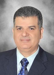 Ragab M. Mousa合作论文数3
 Ahmed Hassan合作论文数2
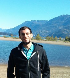 Ahmed Osama合作论文数Publ Works Dept, Ain Shams Univ2
 Khaled El-Araby合作论文数1
 Ahmed Mahmoud Darwish合作论文数1
 Mohamed Shawky Ahmed合作论文数1Mostafa Ahmed合作论文数1
 Abdulrazzaq Alkherret合作论文数Dept Civil Engn, Jerash Univ1Miroslava Mikusová合作论文数1
 Ibrahim Hassan Hashim合作论文数1
 Patrik Hrkút合作论文数1




