Dr Antony Ronald Orme (28 May 1936–30 May 2020), was the founding editor of Physical Geography. With his broad range of research interests from coastal geomorphology to pluvial lakes, Tony was comm...
Owens Lake has existed for most of the past 800,000 yr, but the sequence of interconnected lakes and streams of which it was often part, the Owens River cascade, last flourished during late Pleistocene time. A fluctuating, increasingly saline, terminal lake survived into the late Holocene until upstream water diversions to the Los Angeles Aqueduct began in 1913. Shoreline fragments and beach stratigraphy indicate that the lake reached its highest late Pleistocene level around 23.5 ka, during the Last Glacial Maximum, when it was fed by meltwaters from Sierra Nevada glaciers and spilled southward to Searles Lake and beyond. The lake then fell to relatively low levels after 16.5 ka before experiencing terminal Pleistocene oscillations related to hydroclimatic forcing, which involved changing regional precipitation regimes rather than major inputs from Sierra Nevada glaciers. Two major transgressions occurred. The first culminated around 14.3 ka and was probably related to a cooler, wetter regional climate. The second culminated around 12.8 ka and was linked to the earlier wetter phase of the Younger Dryas cold event. However, the high late Pleistocene shoreline is deformed, and the highest beach ranges in elevation from 1140 m to 1167 m above sea level. If the terminal Pleistocene lake overflowed, as suggested here, then its outlet has also been raised since 12.8 ka. This deformation appears to have involved uplift of the Coso Range magmatic complex relative to subsidence and faulting within the Owens Lake graben between the Sierra Nevada and Inyo Mountains frontal faults. Such deformation confounds simple hydroclimatic explanations of lake behavior and must be incorporated into models that seek to interpret the changing form and geochemistry of Owens Lake and the frequency of its spillage southward to Searles Lake.
Sediment records from two lakes in the east-central Sierra Nevada, California, provide evidence of cooling and hydrological shifts during the Younger Dryas stade (YD; similar to 12,900-11,500 cal yr BP). A chironomid transfer function suggests that lake-water temperatures were depressed by 2 degrees C to 4 degrees C relative to maximum temperatures during the preceding Bolling-Allerod interstade (BA; similar to 14,500-12,900 cal yr BP). Diatom and stable isotope records suggest dry conditions during the latter part of the BA interstade and development of relatively moist conditions during the initiation of the YID stade, with a reversion to drier conditions later in the YD. These paleohydrological inferences correlate with similar timed changes detected in the adjacent Great Basin. Vegetation response during the YD stade includes the development of more open and xeric vegetation toward the end of the YD. The new records support linkages between the North Atlantic, the North Pacific, and widespread YD cooling in western North America, but they also suggest complex hydrological influences. Shifting hydrological conditions and relatively muted vegetation changes may explain the previous lack of evidence for the YD stade in the Sierra Nevada and the discordance in some paleohydrological and glacial records of the YD stade from the western United States. (C) 2008 University of Washington. All rights reserved.
 Antony R Orme合作论文数2
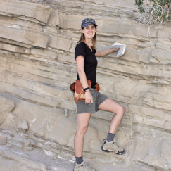 Devon A. Orme合作论文数Montana State University1
 Glen Sproul dit MacDonald合作论文数Department of Geography, University of California, Los Angeles;Institute of the Environment and Sustainability, University of California, Los Angeles1Amanda Petel合作论文数1
 Aaron P. Potito合作论文数Department of Geography, National University of Ireland1Amy M. Bloom合作论文数1
 David Porinchu合作论文数Department of Geography, The Ohio State University1
 Thomas Edwards合作论文数Department of Earth Sciences;University of Waterloo;Department of Earth Sciences, University of Waterloo1
 Brent B. Wolfe合作论文数Department of Geography and Environmental Studies, Wilfrid Laurier University1
 Katrina A. Moser合作论文数University of Utah;Department of Geography;Department of Geography, University of Utah1




