Glaciers lost 408 ± 132 Gt of mass during the hydrological year 2025, equivalent to 1.1 ± 0.4 mm sea-level rise. Since 1975, glacier mass loss has totalled 9,583 ± 1,211 Gt, equivalent to 26.4 ± 3.3 mm of sea-level rise, with six of the highest mass-loss years on record occurring in the past seven years.
Pizolgletscher, Swiss Alps, was already a very small glacier when the monitoring of length change was initiated 130 years ago. In situ mass balance measurements at seasonal resolution began in 2006. During the last 18 years, the glacier has lost 98% of its volume and is considered extinct since 2022. However, a tiny remnant of ice of a few thousand square metres is preserved under rockfall debris. The case of Pizolgletscher allows tracking the extinction of a glacier with a comprehensive long-term observational series. Furthermore, the vanished glacier has a touristic and cultural significance, as exemplified by a commemoration ceremony held in 2019. Here, detailed monitoring data sets (mass balance, area, volume, length) are presented that shed light on the processes of glacier disintegration before ultimate disappearance. Comparison to regional mass balance variations indicates that the signal from very small glaciers can remain representative at larger scales even during the final phase of a glacier's lifecycle.
Glaciers are retreating rapidly, altering ecosystem dynamics and increasing meltwater outflow into populated areas. Understanding microbial-virome interactions is crucial for predicting the consequences of this release. We sampled ice from four shallow pits in the weathering crust of the Rhonegletscher, Swiss Alps, and found a microbiome dominated by bacteria and microeukaryotes, alongside a metavirome infecting both groups. Viruses exhibited variable host specificity, with some targeting particular taxa and others showing a broader infectivity range. Variable genomic regions, including metagenomic and metaviromic islands, were enriched in genes related to replication, recombination, repair and transposable elements. Detected auxiliary metabolic genes were primarily involved in host coenzyme biosynthesis, uptake or utilization and in altering bacterial methylation patterns to evade detection. These findings underscore the major role of viruses in regulating microbial dynamics in glaciers and their potential downstream environmental impacts.
The Airborne Ice Radar of ETH Zurich (AIRETH) is a dual-polarization, helicopter-borne GPR system that was developed for glaciological applications. At the core of AIRETH are two pairs of commercial, orthogonally oriented, bistatic dipole antennas operating at a center frequency of 25 HMz or higher. The system has extensively been operated in the past, e.g. for collecting close to 2,500 km of GPR data for estimating the ice thickness of glaciers across the Swiss Alps.Here, we present a series of amendments that have recently performed to the AIRETH system in order to increase its versatility and operability. The corresponding work notably included:1. a re-design of AIRETH’s air-frame, aiming at decreasing the system’s overall weight, as well as at increasing the system’s stability and ease of operation;2. a newly developed positioning system, which is now based on the integration of information obtained from a set of four low-cost Global Navigation Satellite System (GNSS) sensors placed at the corners of the main air-frame in combination with an Inertial measurement unit (IMU); and3. an experimental antenna shielding based on low-cost materials, aiming at minimizing the ringing noise caused by the proximity of the GPR system to the carrying helicopter.The contribution will focus on the advances that were achieved compared to the previous AIRETH setup, and will point out the challenges faced during system re-design. The capabilities of the new system will, moreover, be illustrated by presenting some recent datasets acquired over Alpine glaciers.
Glacier collapse features, linked to subglacial cavities, are increasingly common on retreating Alpine glaciers. These features are hypothesized to result from glacier downwasting and subsurface ablation processes but the understanding regarding their distribution, formation and contribution to glacier mass loss remains limited. We present a Swiss-wide inventory of 223 collapse features observed over the past 50 years, revealing a sharp increase in their occurrence since the early 2000s. Using high-resolution digital elevation models, we derive a relationship between collapse feature area and ice ablation and estimate the Swiss-wide contribution of collapse features to glacier mass loss to be $19.8\times 10<^>6\,\text{m}<^>3$ of ice between 1971 and 2023. Based on extensive observations at Rhonegletscher, including surface displacement, ground-penetrating radar and drone-based elevation models, we quantify subsurface ablation rates of up to 27 cm d-1 and provide a detailed description of the collapse processes. We propose that glacier downwasting, enhanced energy supply through subglacial conduits and locally increased basal melt are key components to subglacial cavity growth. Our results highlight the importance of collapse features in the ongoing retreat of Alpine glaciers, stressing the need for further research to understand their formation and long-term implications for glacier dynamics under climate change.
This study presents the first nationwide assessment of vanished glaciers in Switzerland. By comparing the Swiss Glacier Inventories SGI1973 and SGI2016, we identify 1019 vanished glaciers, representing more than 40% of all glaciers inventoried in 1973 and accounting for 13% (47 +/- 3 km(2)) of total glacier area loss. Glacier disappearance was most widespread along the main Alpine divide, in regions with relatively low peak elevations. Most vanished glaciers were very small (<0.10 km2) and steep, south- or east-facing glaciers more often vanished with respect to the initial glacier distribution. In the 2300-2550 m elevation band, vanished glaciers contributed over 30% of total area loss. Regionally, the Rhine basin hosts the largest number of vanished glaciers (423), while the Po (39%) and Danube (55%) basins have the highest share of glaciers disappearing with respect to the initial number. These findings underscore the relevance of systematically including vanished glaciers in change assessments. With a new inventory underway and two extreme melt years in 2022 and 2023, this study provides a benchmark for tracking continued glacier extinction in the Swiss Alps.
Knowledge of how glaciations formed landscapes is particularly important as receding glaciers currently uncover subglacial landscapes that are prone to a series of natural hazards, but that also bring opportunities for hydropower or water resources. We present high-resolution (1 x 1 m) swath bathymetric data of a proglacial lake in front of the Rhonegletscher (Swiss Alps) that started to form in the early 2000s allowing a look into a freshly uncovered glacier bed and its characterized morphology in an overdeepened setting. The comparison of two surveys from 2015 and 2021 allows an unprecedented quantification of the accumulation and erosion processes in the central lake basin. This highly dynamic environment is characterized by iceberg calving, fluctuating outflow conduits, rapid sedimentation due to particle-laden meltwaters and dumped glacial debris. Assuming constant sediment yield, the Rhone Lake would persist for similar to 300 years. However, as intense glacier retreat continues in the coming decades, a chain of overdeepened lakes will be revealed that will act as long persisting sediment traps.
Ground penetrating radar (GPR) has been extensively used in glaciology to infer glacier's ice thickness, liquid water content, water drainage pathways, and other properties. The interpretation of such GPR data is not always straightforward and for temperate glaciers, the signal is often affected by strong scattering and attenuation. It has often been suggested that such effects originate from englacial water inclusions, since water and ice have a large contrast in their di-electric permittivity. To investigate such effects quantitatively, we perform an extensive numerical modeling study of GPR signals. By exploring how different liquid water contents (LWC) and water-inclusions size affect the GPR signal, we show that their effects are much larger than the potential presence of a wet snowpack or a heterogeneous distribution of ice permittivity. In particularly, we show that the presence of such water inclusions is a necessary and sufficient condition for reproducing the typical characteristics of GPR data acquired in the field. Further, we find that for 25 MHz GPR antennas, a bulk LWC $\gtrsim$ 0.2%, associated with decimeters-scale water inclusions already limits bedrock detectability for ice thicknesses $\gtrsim 100$ m. Since these values are typical for Alpine glaciers, they clarify why the quality of GPR data is often poor in such environments.
Cross-borehole seismic tomography is a powerful tool to investigate the subsurface with a very high spatial resolution. In a set of boreholes,comprehensive three-dimensional investigations at different depths can be conducted to analyse velocity anisotropy effects due to local changeswithin the medium. Especially in glaciological applications, the drilling of boreholes with hot water is cost-efficient and provides rapid access tothe internal structure of the ice. In turn, movements of the subsurface such as the continuous flow of ice masses cause deformations of theboreholes and complicate a precise determination of the source and receiver positions along the borehole trajectories. Here, we present a three-dimensional inversion scheme that considers the deviations of the boreholes as additional model parameters next to the common velocityinversion parameters. Instead of introducing individual parameters for each source and receiver position, we describe the borehole trajectory withtwo orthogonal polynomials and only invert for the polynomial coefficients. This significantly reduces the number of additional model parameters andleads to much more stable inversion results. In addition, we also discuss whether the inversion of the borehole parameters can be separated from thevelocity inversion, which would enhance the flexibility of our inversion scheme. In that case, updates of the borehole trajectories are onlyperformed if this further reduces the overall error in the data sets. We apply this sequential inversion scheme to a synthetic data set and a fielddata set from a temperate Alpine glacier. With the sequential inversion, the number of artefacts in the velocity model decreases compared to avelocity inversion without borehole adjustments. In combination with a rough approximation of the borehole trajectories, for example, fromadditional a priori information, heterogeneities in the velocity model can be imaged similarly to an inversion with fully correct borehole coordinates. Furthermore, we discuss the advantages and limitations of our approach in the context of an inherent seismic anisotropy of the medium and extend our algorithm to consider an elliptic velocity anisotropy. With this extended version of the algorithm, we analyse the interference between a seismic anisotropy in the medium and the borehole coordinate adjustment. Our analysis indicates that the borehole inversion interferes with seismic velocity anisotropy. The inversion can compensate for such a velocity anisotropy. Based on the modelling results, we propose considering polynomials up to degree 3. For such a borehole trajectory inversion, third-order polynomials are a good compromise between a goodrepresentation of the true borehole trajectories and minimising compensation for velocity anisotropy.
<p>Rapid climate modifications perturb the long-term dynamic equilibrium of many natural systems. Polar and high-altitude regions such as alpine environments represent locations where perturbations such as glacier collapse features, become visible. Glacier collapse features are characterized by a circular depressions on the ice surface, are bounded by low-angle crevasses and are the surface expression of a cavity developing most often over a subglacial channel, commonly occurring at the glacier snout. Understanding the physical processes governing the collapse feature dynamics is essential to assess hazards and processes related to them, such as, rapid glacier length variations, snout collapses and sudden blockage of the subglacial drainage system.</p> <p>Field observations from an on-going collapse feature developing at the snout of Rhonegletscher (Switzerland) in Summer 2022 suggest mechanical failure of ice lamellas from the underlying cavity roof to drive the collapse. In order to test this hypothesis, namely mechanical failure to drive glacier collapse features, we developed full-Stokes 2D and 3D mechanical models implementing a temperature and pressure dependent visco-elasto-plastic rheology. We use the extensive dataset from Rhonegletscher to constrain the numerical models to predict possible failure patterns as function of increasing cavity size. We use vertical displacement located in the centre of the collapse feature to validate our models. Preliminary results show the formation of tension failure patterns on the ice surface at locations coinciding with the low-angle circular crevasses. The model results will advance our understanding of the physics of collapse features and provide predictive tools to assess future occurrences and their related risks.</p>
<p>Ground penetrating radar (GPR) has been extensively used in glaciology to characterize englacial and subglacial properties such as ice thickness, liquid water content or water drainage pathways. However, GPR radargrams in temperate ice often appear blurred by undesirable noise, mostly appearing as highly scattered signal and strong attenuation. It is often suggested that this noise originates from englacial water inclusions, since water and ice &#160;have a large contrast in their di-electric permittivity. Here, we use the open-access software gprMax to forward-model a GPR signal in temperate ice and to quantitatively assess the role that water scatterers have as noise source. In particular, we explore how different liquid water contents (LWC) and water-inclusions size affect the GPR signal, and show that their effect is much larger than the potential presence of a wet snowpack or a heterogenous distribution of ice permittivity. This confirms previous hypotheses suggesting that water inclusions within the ice are the main factor for the typical noise seen in GPR data for temperate ice. For simulations referring to 25 MHz GPR antennas, we find that a bulk LWC&#160; equal or superior to 0.2 %, associated to decimeters-scale water inclusions, already constitute a limit in bedrock detectability for ice thicknesses larger than 100 m. These values of LWC and water-inclusion size are typical for Alpine field settings, clarifying why noisy signals are often encountered in such environments. Our numerical simulations for different LWC values also suggest than distinguishing between cold and temperate ice based on GPR scattering might be more difficult than previously assumed.</p>
The monitoring of glaciers in Switzerland has a long tradition, yet glacier changes during the 20th century are only known through sparse observations. Here, we estimate a halving of Swiss glacier volumes between 1931 and 2016 by mapping historical glacier elevation changes at high resolution. Our analysis relies on a terrestrial image archive known as TerrA, which covers about 86 % of the Swiss glacierised area with 21 703 images acquired during the period 1916–1947 (with a median date of 1931). We developed a semi-automated workflow to generate digital elevation models (DEMs) from these images, resulting in a 45 % total glacier coverage. Using the geodetic method, we estimate a Swiss-wide glacier mass balance of −0.52 ± 0.09 m w.e. a−1 between 1931 and 2016. This equates to a 51.5 ± 8.0 % loss in glacier volume. We find that low-elevation, high-debris-cover, and gently sloping glacier termini are conducive to particularly high mass losses. In addition to these glacier-specific, quasi-centennial elevation changes, we present a new inventory of glacier outlines with known timestamps and complete attributes from around 1931. The fragmented spatial coverage and temporal heterogeneity of the TerrA archive are the largest sources of uncertainty in our glacier-specific estimates, reaching up to 0.50 m w.e. a−1. We suggest that the high-resolution mapping of historical surface elevations could also unlock great potential for research fields other than glaciology.
Abstract. Glacier monitoring in Switzerland has resulted in some of the longest and most complete data series globally. Mass balance observations at individual locations, starting in the 19th century, are the backbone of the monitoring as they represent the raw and original glaciological data demonstrating the response of snow accumulation and snow/ice melt to changes in climate forcing. So far, however, the variety of sources of historic measurements has not been systematically processed and documented. Here, we present a new complete and extensive point glacier mass balance dataset for the Swiss Alps that provides attributes for data quality and corresponding uncertainties. Original sources were digitized or re-assessed to validate or to correct existing entries and to identify metadata. The sources of data are highly diverse and stem from almost 140 years of records, originating from handwritten field notes, unpublished project documents, various digital sources, published reports, as well as meta-knowledge of the observers. The project resulted in data series with metadata for 63 individual Swiss glaciers, including more than 60'000 point observations of mass balance. Data were systematically analyzed and homogenized, e.g. by supplementing partly missing information based on correlations inferred from direct measurements. A system to estimate uncertainty in all individual observations was developed indicating that annual point balance is measured with a typical error of 0.07 m water equivalent (w.e.), while the average error in winter snow measurements is 0.20 m w.e. Our dataset permits further investigating the climate change impacts on Swiss glaciers. Results show an absence of long-term trends in snow accumulation over glaciers, while melt rates have substantially increased over the last three decades.
Glaciers in Switzerland are shrinking rapidly in response to ongoing climate change. Repeated glacier inventories are key to monitor such changes at the regional scale. Here we present the new Swiss Glacier Inventory 2016 (SGI2016) that has been acquired based on sub-meter resolution aerial imagery and digital elevation models, bringing together topographical and glaciological approaches and knowledge. We define the process, workflow and required glaciological adaptations to compile a highly detailed inventory based on the digital Swiss Topographic Landscape model. The SGI2016 provides glacier outlines (areas), supraglacial debris cover and ice divides for all Swiss glaciers referring to the years 2013–2018. The SGI2016 maps 1,400 individual glacier entities with a total surface area of 961 ± 22 km 2 , whereof 11% (104 km 2 ) are debris-covered. It constitutes the so far most detailed cartographic representation of glacier extent in Switzerland. Interpretation in the context of topographic parameters indicates that glaciers with moderate inclination and low median elevation tend to have highest fractions of supraglacial debris. Glacier-specific area changes since 1973 show the largest relative changes for small and low-elevation glaciers. The analysis further indicates a tendency for glaciers with a high share of supraglacial debris to show larger relative area changes. Between 1973 and 2016, an area change rate of –0.6% a −1 is found. Based on operational data sets and the presented methodology, the Swiss Glacier Inventory will be updated in 6-yr time intervals, leading to a high consistency in future glacier change assessments.
Long-term glacier monitoring in Switzerland has resulted in some of the longest and most complete data series globally. Point mass balance observations, starting in the 19th century, are the backbone of the monitoring as they represent the raw and original data demonstrating the response of surface accumulation and melt to changes in climate forcing. Some of these time series on Swiss glaciers provide over 100 years of continuous measurements. In the past, the variety of sources of historic measurements has only been partially investigated and never been completely and systematically processed and documented. Therefore, a new format for a point mass balance database was developed that allows full traceability of all measurements back to their original source as well as indicators for the quality of the data and corresponding measuring uncertainties. All previously included data sources were transferred into the new data base format and the original sources were re-assessed to validate or correct the entries and identify metadata. Furthermore, newly investigated measurements were added to the data base. The sources of data include an extremely diverse field from over 140 years of measurements such as published reports or studies, unpublished documents from field projects, field notes, digital sources as well as metaknowledge of the observers. Currently, data series with complete metadata for about 60 individual glaciers are available, corresponding to almost 60.000 point observations, one third of which are newly added. In addition to extending the data base, this project also allowed us to systematically and homogenously fill in missing information such as estimates of the surface elevation of the measurement points and snow/firn density. In the past, these density values often had to be assumed without actual measurements but those assumptions could vary up to 20% within different projects and assumptions were rarely flagged as such. The newly added metadata now allows performing an analysis of all actually measured density values and a homogenous interpolation of missing values across all times series based on known values. Furthermore, a system to estimate uncertainties of the mass balance measurements based on the metadata was developed as the accuracy of measurements between different measuring techniques and projects with very differing scientific objectives over a time frame of 140 years can vary significantly and therefore needs to be assessed. This quality-checked and complete data base now permits the re-analysis of consistent time series of glacier-wide mass balance allowing further interpretation of the climate change impacts on Swiss glaciers.
Environments along the coast of Greenland are rapidly changing under the influence of a warming climate in the Arctic. To better understand the changes in the coastal environments, we performed researches in the Qaanaaq region in northwestern Greenland as a part of the ArCS (Arctic Challenge for Sustainability) Project. Mass loss of ice caps and marine-terminating outlet glaciers were quantified by field and satellite observations. Measurements and sampling in fjords revealed the important role of glacial meltwater discharge in marine ecosystems. Flooding of a glacial stream in Qaanaaq and landslides in a nearby settlement were investigated to identify the drivers of the incidents. Our study observed rapid changes in the coastal environments, and their critical impact on the society in Qaanaaq. We organized workshops with the residents to absorb local and indigenous knowledge, as well as to share the results and data obtained in the project. Continuous effort towards obtaining long-term observations requiring involvement of local communities is crucial to contribute to a sustainable future in Greenland.
Abstract. Hydrological systems of glaciers have a direct impact on the glacier dynamics. Since the 1950’s, geophysical studies have provided insights into these hydrological systems. Unfortunately, such studies were predominantly conducted using 2D acquisitions along a few profiles, thus failing to provide spatially unaliased 3D images of englacial and subglacial water pathways. The latter has likely resulted in flawed constraints for the hydrological modelling of glacier drainage networks. Here, we present for the first time 3D ground-penetrating radar (GPR) results that provide unprecedented high-resolution 3D images of an alpine glacier’s drainage network. Our results confirms a long-standing englacial hydrology theory stating that englacial conduits flow around glacial overdeepenings rather than directly over the overdeepening. Furthermore, these results also show exciting new opportunities for high-resolution 3D GPR studies of glaciers.
AbstractAccurate knowledge of the ice thickness distribution and glacier bed topography is essential for predicting dynamic glacier changes and the future developments of downstream hydrology, which are impacting the energy sector, tourism industry and natural hazard management. Using AIR-ETH, a new helicopter-borne ground-penetrating radar (GPR) platform, we measured the ice thickness of all large and most medium-sized glaciers in the Swiss Alps during the years 2016–20. Most of these had either never or only partially been surveyed before. With this new dataset, 251 glaciers – making up 81% of the glacierized area – are now covered by GPR surveys. For obtaining a comprehensive estimate of the overall glacier ice volume, ice thickness distribution and glacier bed topography, we combined this large amount of data with two independent modeling algorithms. This resulted in new maps of the glacier bed topography with unprecedented accuracy. The total glacier volume in the Swiss Alps was determined to be 58.7 ± 2.5 km3 in the year 2016. By projecting these results based on mass-balance data, we estimated a total ice volume of 52.9 ± 2.7 km3 for the year 2020. Data and modeling results are accessible in the form of the SwissGlacierThickness-R2020 data package.
With increasing anthropogenic greenhouse gas emissions and corresponding global warming, glaciers in Switzerland are shrinking rapidly as in many mountain ranges on Earth. Repeated glacier inventories are a key task to monitor such glacier changes and provide detailed information on the extent of glaciation, and important parameters such as area, elevation range, slope, aspect etc. for a given point or a period in time. Here we present the new Swiss Glacier Inventory (SGI2016) that has been acquired based on high-resolution aerial imagery and digital elevation models in cooperation with the Federal Office of Topography (swisstopo) and Glacier Monitoring in Switzerland (GLAMOS), bringing together topological and glaciological knowhow. We define the process, workflow and required glaciological adaptations to compile a highly accurate glacier inventory based on the digital Swiss topographic landscape model (swissTLM3D). The SGI2016 provides glacier outlines (areas), supraglacial debris cover, ice divides and location points of all glaciers in Switzerland referring to the years 2013-2018, whereas most of the glacier outlines have been mapped based on aerial images acquired between 2015-2017 (75% in number and 87% in area), with the centre year 2016. The SGI2016 maps 1400 individual glacier entities with a total glacier surface area of 961 km2 (whereof 11% / 104 km2 are debris-covered) and constitutes the so far most detailed cartographic representation of glacier extent in Switzerland. Analysing the dependencies between topographic parameters and debris-cover fraction on the basis of individual glaciers reveals that short glaciers with a moderate mean slope and glaciers with a low median elevation tend to have high debris fractions. A change assessment between the SGI1973 and SGI2016 based on individual glacier entities affirms the largest relative area changes for small glaciers and for low-elevation glaciers, whereas the largest glaciers show small relative area changes, though large absolute changes. The analysis further indicates a tendency for glaciers with a high share of supraglacial debris to show larger relative area changes. Despite of an observed strong glacier volume loss between 2010 and 2016, the total glacier surface area of the SGI2016 is somewhat larger than reported in the last Swiss glacier inventory SGI2010. Even though both inventories were created based on swisstopo aerial photographs, the additional data, tools, resources and methodologies used by the professional cartographers digitizing glacier outlines in 3D for the SGI2016, are able to explain the counter-intuitive difference between SGI2010 and SGI2016. A direct comparison of these two datasets is thus not meaningful, but an experiment where a representative glacier sample of the SGI2010 was re-assessed based on the approaches of the SGI2016 led to an upscaled total glacier surface area of 1010 km2 for the Swiss Alps around 2010. This indicates an area loss of 49 km2 between the two last Swiss glacier inventories. As swisstopo data products are and will be regularly updated, the SGI2016 is the first step towards a consistent and accurate data product of repeated glacier inventories in six-year time intervals that promises a high comparability for individual glaciers and glacier samples.
Ice mass loss from the Greenland ice sheet is the largest single contributor to sea level rise in the 21st century. The mass loss rate has accelerated in recent decades mainly due to thinning and retreat of its outlet glaciers. The diverse calving mechanisms responsible for tidewater glacier retreat are not fully understood yet. Since a tidewater glacier's sensitivity to external forcings depends on its calving style, detailed insight into calving processes is necessary to improve projections of ice sheet mass loss by calving. As tidewater glaciers are mostly thinning, their calving styles are expected to change. Here, we study calving behaviour changes under a thinning regime at Bowdoin Glacier, north-western Greenland, by combining field and remote-sensing data from 2015 to 2019. Previous studies showed that major calving events in 2015 and 2017 were driven by hydro-fracturing and meltundercutting. New observations from uncrewed aerial vehicle (UAV) imagery and a GPS network installed at the calving front in 2019 suggest ungrounding and buoyant calving have recently occurred as they show (1) increasing tidal modulation of vertical motion compared to previous years, (2) absence of a surface crevasse prior to calving, and (3) uplift and horizontal surface compression prior to calving. Furthermore, an inventory of calving events from 2015 to 2019 based on satellite imagery provides additional support for a change towards buoyant calving since it shows an increasing occurrence of calving events outside of the melt season. The observed change in calving style could lead to a possible retreat of the terminus, which has been stable since 2013. We therefore highlight the need for high-resolution monitoring to detect changing calving styles and numerical models that cover the full spectrum of calving mechanisms to improve projections of ice sheet mass loss by calving.
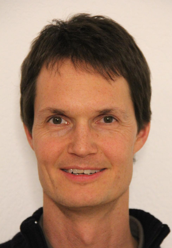 Matthias Huss合作论文数Versuchsanstalt für Wasserbau, Hydrologie und Glaziologie, Eidgenössische Technische Hochschule Zürich39
 Martin Funk合作论文数39
 Hansruedi Maurer合作论文数Institute of Geophysics, Department of Earth Sciences, Eidgenössische Technische Hochschule Zürich26
 Daniel Farinotti合作论文数Department of Civil, Environmental and Geomatic Engineering, ETH Zurich21
 Melchior Grab合作论文数Dept Earth Sci, Swiss Fed Inst Technol18Shin Sugiyama合作论文数15Lisbeth Langhammer合作论文数11
 Lasse Rabenstein合作论文数Alfred Wegener Institute for Polar and Marine Research11Andreas Linsbauer合作论文数Department of Geography, University of Zurich10Gregory Church合作论文数8
 Guillaume Jouvet合作论文数Department of Mathematics and Computer Science, Freie Universität Berlin8
 Elias Hodel合作论文数7Sebastian Hellmann合作论文数Dept Earth Sci, Swiss Fed Inst Technol7
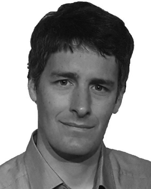 Schmid Lino合作论文数7
 Martin P. Lüthi合作论文数Versuchsanstalt für Wasserbau, Hydrologie und Glaziologie (VAW),, ETH Zürich7
 Regine Hock合作论文数University of Alaska Fairbanks, Uppsala University7
 Mauro Fischer合作论文数Inst Geog, Univ Bern6
 Mauro Werder合作论文数Laboratory of Hydraulics, Hydrology and Glaciology, ETH Zurich;Department of Civil, Environmental and Geomatic Engineering, ETH Zurich;Swiss Federal Institute for Forest, Snow and Landscape Research6
 Eef van Dongen合作论文数Lab Hydraul Hydrol & Glaciol VAW, Swiss Fed Inst Technol5Johanna Kerch合作论文数5
 Fabian Walter合作论文数Lab Hydraul Hydrol & Glaciol VAW, Swiss Fed Inst Technol5
 Jan Magnusson合作论文数WSL Institute for Snow and Avalanche Research SLF5Manfred Stähli合作论文数5
 Ilka Weikusat合作论文数Alfred Wegener Inst Polar & Marine Res5Patrick Riesen合作论文数5Yvo Weidmann合作论文数4Giovanni Kappenberger合作论文数4
 Christophe Ogier合作论文数4
 Ivano Brunner合作论文数Swiss Federal Institute for Forest, Snow and Landscape Research WSL4
 Federica Tamburini合作论文数4
 Edward Mitchell合作论文数Laboratory of Soil Biology, Institute of Biology, Faculty of Science, University of Neuchatel4Josef Zeyer合作论文数4
 Bernard Bourdon合作论文数Institute of Isotope Geochemistry and Mineral Resources, ETH Zurich4Heinz Blatter合作论文数4
 Jan Jansa合作论文数4
 Frank Hagedorn合作论文数Swiss Federal Institute for Forest, Snow and Landscape Research (WSL)4Emmanuel Lemarchand合作论文数4
 Stefano M. Bernasconi合作论文数4Tobias Jonas合作论文数4Monika Welc合作论文数4
 Irka Hajdas合作论文数Lab Ion Beam Phys, ETH4Ruth S. Hindshaw合作论文数4Iso Christl合作论文数4
 Peter Edwards合作论文数Institute of Geobotany, ETH Zurich;Dep. of Environmental Systems Science, ETH Zurich;Institute of Integrative Biology Zurich, ETH Zurich4Olaf Eisen合作论文数Hiljem töötas4
 Lukas Wacker合作论文数Institute for Particle Physics and Astrophysics, Department of Physics, Eidgenössische Technische Hochschule Zürich;Department of Earth and Planetary Sciences, Eidgenössische Technische Hochschule Zürich4
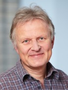 Gerhard Furrer合作论文数Department of Environmental Systems Science, Eidgenossische Technische Hochschule Zurich;Institute of Biogeochemistry and Pollutant Dynamics, Eidgenossische Technische Hochschule Zurich4
 Jan G. Wiederhold合作论文数Institute of Biogeochemistry and Pollutant Dynamics, CHN4
 Beat Frey合作论文数Swiss Federal Institute for Forest, Snow and Landscape Research4




