The development of a model requires clear agreement on its purpose and context, defined in consultation with relevant stakeholders. The process of achieving agreement is iterative, with continual refinement of the purpose and objectives as the modelers and stakeholders learn more about the system modeled and the scope for using the model. From there, conceptual models can be developed to guide the choice of model features and families and to help determine how model structure and parameter values are to be found. Performance criteria can then be developed, geared to the model purpose, context and structure, and available data. Once constructed, the model must be subjected to calibration, model testing, quantification of uncertainty, and evaluation of its effectiveness. At any point it may be necessary to revisit and revise earlier steps as new information becomes available. This article discusses a 10-step procedure for model development and evaluation in the context of two ecological models developed in parallel for an Australian wetland system. Adoption of minimum standards of model development, as outlined in this article, will lead to more purposeful and credible ecological models.
Modeling plays a vital role in understanding and managing complex environmental systems, but its credibility and quality depend heavily on a comprehensive set of defensible model activities and practices, especially when the system of interest is plagued with uncertainties and conflicting stakeholder perspectives. This paper proposes a catalogue of Do's and Don'ts to guide modelers in addressing the many pertinent considerations through the whole modeling cycle. This practical tool provides advice on approaching modeling effectively through adhering to good modeling practice. It emphasizes model choices that align with the model purpose and context, and the justification and documentation of modeling decisions and assumptions. Managing uncertainty is a core consideration. The identification, assessment and reporting of these uncertainties is important across the entire modeling process, which spans problem framing, technical design, implementation and application phases. Such good practices are critical for transparency and reliability of the modeling.
Water quality is essential for human and ecosystem health. In Australia and New Zealand, modelling of water quality is crucial for characterising and managing water resources and providing support for planning and regulation, yet current modelling practice does not meet these needs fully. This calls for re-thinking strategies and priorities for water quality modelling that include the broader modelling community (which encompasses practitioners, land-water managers who use model results, and those who collect data). There is little precedent of collaborative strategy development involving a broader modelling community. We therefore undertook a new initiative to develop long-term collaborative strategies and priorities for modelling water quality for Australia and New Zealand. Key findings from this process are presented in this commentary paper. Specifically, we convened a group of water quality modellers from different sectors (government, consulting, and academia) to collaboratively identify the current status and challenges, future visions and potential strategic areas of water quality modelling. Actions are proposed in the key areas of: making a stronger case for water quality modelling; community building; making data and models more available and accessible; and leveraging new and emerging technologies for data collection and modelling. Our process and findings are likely to resonate with modellers facing similar strategic challenges globally.
Evolutionary mechanisms enabled humans to profoundly transform Earth systems. Because the resulting Anthropocene systems are highly interdependent and dynamically evolving, often with accelerating rates of cultural and technological evolution, the ensuing family of societal challenges must be framed and addressed in a holistic fashion. An agile, evolutionary, system-of-systems, convergence paradigm, which is based on a partially quantifiable, scientifically falsifiable, formal theoretical framework, can be used to systematically identify, decompose, characterize, and then converge, a nested, evolutionary ensemble of geophysical, biophysical, sociocultural and sociotechnical systems. The paradigm includes individual organisms (spanning plants, fungi and animals) engaging in niche construction in a global meta-ecosystem that integrates the deep evolutionary history of all Anthropocene systems. To coherently span the vast range of scales, the paradigm is divided into a somatic realm (externally oriented with respect to individual organisms) that can be applied at global, regional, urban and local scales, as well as a visceral realm (internally oriented with respect to individual organisms) that includes organs, cells, organelles, genes and proteins. The visceral realm connects with evolutionary systems biology, biomedical engineering and systems medicine. The paradigm includes a causally coherent conceptual model based on a common language and reconciled ontology, with a hierarchical, extensible and scalable computational framework, an associated decision-support system and an educational pedagogy. The paradigm will require a major transformation in our national and global approach to science and engineering, enabling the creation of a meta-discipline that spans all the disciplines associated with the family of societal challenges of the Anthropocene.
Choices made in modeling matter and demand more explication since they determine how much we can trust modeling insights and predictions within their social, political and ethical contexts. Good Modeling Practice (GMP) is a key research area for strengthening and maturing the modeling field and community, through identifying, formulating and sharing knowledge about the craft of modeling. This craft represents the knowledge that modelers learn in practice about how they get things done, and how they adapt their practices to new situations. This Joint Special Issue is motivated by the importance of sharing good modeling practices from a whole modeling lifecycle viewpoint. We attempt to add conceptual clarity to this research area by defining the plethora of concepts and decision points used to characterize the choices to be made throughout the modeling process, and by synthesizing some of the existing efforts on GMP. We characterize a broad list of articles in the literature on GMP and identify a list of essential topics demanding more attention. This list is only a preliminary one as we anticipate that a more comprehensive list of knowledge gaps will be unearthed from the submissions to the Joint Special Issue collection on GMP, of which this is an introduction. We also propose a vision for GMP and suggest instrumental ways that good practice can become not just well-known but normal practice. This instrumentation focuses on journal standards, collective commitment and culture especially by research community societies, early career awards for advancing GMP, and legal requirements or accreditation. A vital instrument in all this is the design and development of a modeling curriculum that distills core requisite knowledge about modeling, as well as proven-to-work routines and practices that can be scaled up in different contexts.
The notion of convergent and transdisciplinary integration, which is about braiding together different knowledge systems, is becoming the mantra of numerous initiatives aimed at tackling pressing water challenges. Yet, the transition from rhetoric to actual implementation is impeded by incongruence in semantics, methodologies, and discourse among disciplinary scientists and societal actors. This paper confronts these disciplinary barriers by advocating a synthesis of existing and missing links across the frontiers distinguishing hydrology from engineering, the social sciences and economics, Indigenous and place-based knowledge, and studies of other interconnected natural systems such as the atmosphere, cryosphere, and ecosphere. Specifically, we embrace ‘integrated modeling’, in both quantitative and qualitative senses, as a vital exploratory instrument to advance such integration, providing a means to navigate complexity and manage the uncertainty associated with understanding, diagnosing, predicting, and governing human-water systems. While there are, arguably, no bounds to the pursuit of inclusivity in representing the spectrum of natural and human processes around water resources, we advocate that integrated modeling can provide a focused approach to delineating the scope of integration, through the lens of three fundamental questions: a) What is the modeling ‘purpose’? b) What constitutes a sound ‘boundary judgment’? and c) What are the ‘critical uncertainties’ and how do they propagate through interconnected subsystems? More broadly, we call for investigating what constitutes warranted ‘systems complexity’, as opposed to unjustified ‘computational complexity’ when representing complex natural and human-natural systems, with particular attention to interdependencies and feedbacks, nonlinear dynamics and thresholds, hysteresis, time lags, and legacy effects.
Artificial intelligence is rapidly being integrated into Earth science, but how Earth science may benefit artificial intelligence has been overlooked. We call for mutual balancing between the two disciplines and improving cross-disciplinary collaboration.
As hydrological systems are pushed outside the envelope of historical experience, the ability of current hydrological models to serve as a basis for credible prediction and decision making is increasingly challenged. Conceptual models are the most common type of surface water hydrological model used for decision support due to reasonable performance in the absence of change, ease of use and computational speed that facilitate scenario, sensitivity and uncertainty analysis. Hence, conceptual models in effect represent the current "shopfront" of hydrological science as seen by practitioners. However, these models have notable limitations in their ability to resolve internal catchment processes and subsequently capture hydrological change. New thinking is needed to confront the challenges faced by the current generation of conceptual models in dealing with a changing environment. We argue the next generation of conceptual models should combine the parsimony of conceptual models with our best available scientific understanding. We propose a strategy to develop such models using multiple hydrological lines of evidence. This strategy includes using appropriately selected physically resolved models as "Virtual Hydrological Laboratories" to test and refine the simpler models' ability to predict future hydrological changes. This approach moves beyond the sole focus on "predictive skill" measured using metrics of historical performance, facilitating the development of the next generation of conceptual models with hydrological fidelity (i.e., models that "get the right answers for the right reasons"). This quest is more than a scientific curiosity; it is expected by policy makers who need to know what to plan for.
Vegetation in semi-arid wetlands often serve as a critical habitat and refuge for a wide range of species. In many wetlands, on-ground monitoring of vegetation is either not comprehensive or unavailable, which impedes our understanding of the system. However, basic data on climate and hydrological variables, as well as remote sensing data, can often be acquired. The Narran Lakes system in the Lower Balonne catchment in New South Wales, Australia, is a Ramsar-listed wetland and an exemplar in terms of possessing such basic data. For the Narran Lakes we conducted correlation analysis between the anomaly of the Normalized Difference Vegetation Index (NDVI) as response variable and various climatic and hydrological factors as explanatory variables taking into account different time-lag and accumulative time-averaged effects. The generalized additive model framework was used to identify the contribution of the individual variables to NDVI and examine the nonlinear interactions of the hydro-climatic, water availability factors (soil moisture, precipitation and inflow in the study) on NDVI change within the Narran Lakes. We also undertook various cross-validation exercises to appreciate uncertainties in the results. The results show that: (1) Soil moisture is the primary factor influencing NDVI; and (2) Water availability factors interact in a complex manner to affect NDVI and, more specifically, these factors have a positive impact on NDVI, although the degree of impact differs; (3) The impact of the hydrological and climatic factors is highly variable between wet and dry resource states, both for the whole floodplain vegetation and its lignum community. Overall, the analysis improved our understanding of how the driving factors affect vegetation growth, thus supporting the monitoring and management of vegetation communities in the Narran Lakes. The methods can be applied to other wetlands with similar data availability.
A strong and close connection between science and practice in socio-environmental systems (SES) research and modelling is warranted to face complex and interdisciplinary socio-environmental challenges around issues such as sustainability and climate change. However, significant gaps and inadequate knowledge flow between the scientific and practical aspects of SES exist. This paper highlights several areas that require improvement, including reducing the lag time between scientific solutions and practical implementation, making academic research more relevant to practitioners and decision makers, enhancing the transfer and translation of scientific outputs into practice, improving the integration of practical studies and local knowledge into academia, and addressing the complexity of real-world problems more effectively.To bridge these gaps, we advocate for adopting a design science research (DSR) approach in socio-environmental research. DSR is a problem-solving paradigm that creates applied artifacts such as models, methods, and design theories to enrich knowledge and provide practical solutions. By applying DSR, we can reduce the time between identifying a problem and implementing a solution while facilitating the transfer and translation of research findings into practical applications. We demonstrate the value of artifacts in extracting solutions from practical studies and local knowledge and making them applicable to a broader range of socio-environmental research. DSR emphasises the design of solutions and learning about complex problems through the process of solving them. We demonstrate the merits of the DSR approach application in SES through two case studies to provide a first trial of DSR's practicality, value and challenges.Although DSR is not yet widely recognised or applied in socio-environmental research, this paper encourages its adoption as an overarching approach that complements traditional methods in SES research. By strengthening the connection between practice and science, DSR has the potential to address the existing gaps and improve the effectiveness of socio-environmental research and modelling. The paper therefore advocates that, for complex SES problems, DSR offers ways to not only strengthen but also escalate the overall value of SES modelling and practice to addressing earth's grand challenge problems. It contributes directly to the Joint Special Issue on good modelling practices, including developing Findable, Accessible, Interoperable and Reusable (FAIR) artifacts.
Recent years have witnessed a significant increase in the availability and number of geographic simulation models across various domains, leading to challenges in evaluating their relative value. Traditional model evaluations typically compare simulation results with measured data or other models. This report presents the application of the newly “Model Academic Influence Index (MAI)" method which focuses on evaluating a model's academic contributions. It offers both annual and lifetime index, and reflects the model's major application areas covered. The report evaluates the MAI of 205 models and 22 methods in 2022 from trusted digital repositories and emphasizes the importance of open-source models, providing URLs and licenses. Recognizing the complexity and importance of this task, we invite ongoing discussion and feedback from the modeling community. This report aims to support more informed decision-making in academia and the public and promote the development of a more open and scientific modeling profession and community.
Models play a pivotal role in advancing our understanding of Earth's physical nature and environmental systems, aiding in their efficient planning and management. The accuracy and reliability of these models heavily rely on data, which are generally partitioned into subsets for model development and evaluation. Surprisingly, how this partitioning is done is often not justified, even though it determines what model we end up with, how we assess its performance and what decisions we make based on the resulting model outputs. In this study, we shed light on the paramount importance of meticulously considering data partitioning in the model development and evaluation process, and its significant impact on model generalization. We identify flaws in existing data-splitting approaches and propose a forward-looking strategy to effectively confront the "elephant in the room", leading to improved model generalization capabilities.
Factor Fixing (FF) is a common method for reducing the number of model parameters to lower computational cost. FF typically starts with distinguishing the insensitive parameters from the sensitive and pursues uncertainty quantification (UQ) on the resulting reduced‐order model, fixing each insensitive parameter at a fixed value. There is a need, however, to expand such a common approach to consider the effects of decision choices in the FF‐UQ procedure on metrics of interest. Therefore, to guide the use of FF and increase confidence in the resulting dimension‐reduced model, we propose a new adaptive framework consisting of four principles: (a) re‐parameterize the model first to reduce obvious non‐identifiable parameter combinations, (b) focus on decision relevance especially with respect to errors in quantities of interest (QoI), (c) conduct adaptive evaluation and robustness assessment of errors in the QoI across FF choices as sample size increases, and (d) reconsider whether fixing is warranted. The framework is demonstrated on a spatially‐distributed water quality model. The error in estimates of QoI caused by FF can be estimated using a Polynomial Chaos Expansion (PCE) surrogate model. Built with 70 model runs, the surrogate is computationally inexpensive to evaluate and can provide global sensitivity indices for free. For the selected catchment, just two factors may provide an acceptably accurate estimate of model uncertainty in the average annual load of Total Suspended Solids (TSS), suggesting that reducing the uncertainty in these two parameters is a priority for future work before undertaking further formal uncertainty quantification.
Analyzing land use/land cover change is a fundamental tool for evaluating the environmental consequences of human activities. This research was conducted to detect and predict likely land use changes in the Gorganrud River basin, Iran, and to estimate past and future population growth as a driving force in land use change and degradation. First, land use maps for 1999, 2009, and 2017 were prepared. Then, the likely land use changes for 2030 and 2040 were predicted using the Land Change Modeler (LCM) in TERRSET software. Results indicate that the percentage of changes in agricultural and residential areas, bare lands, and semi-dense forests from 1999 to 2017 were +4.2, +0.62, +1.76, and +3.15, respectively, while the percentage of changes in rangelands, dense forests, and water bodies were -8.7, -0.37, and -0.63. Analysis of changes from 2017 to 2040 indicates that the percentage of changes in croplands, dense forests, and bare lands may reach -4.42, -2.35, and -2.74, respectively. Conversely, the area of rangelands, semi-dense forests, water bodies, and residential areas would likely increase by +7.78%, +1.02%, +0.04%, and + 0.7%, respectively. The population density in 2011 and 2016 was 94 and 97 persons/km(2), respectively, whereas the 5-year population growth rate was 3.5%. Better conservation practices to prevent deforestation and inappropriate growth of residential areas, in line with forest replantation to prevent the conversion of semi-dense forests into rangelands, are some of the management strategies required in the study area. Population control and redistribution are other prescribed actions based on the research findings.
Quantitative assessment of floodplain ecological response to flow regimes is challenging but essential for setting targets and estimating impacts for environmental water management. This paper proposes a model that takes long-term (90 years) and large-scale (9 million grid cells) flood maps as input to estimate the response of floodplain vegetation using infinitely differentiable functions. The model, named Floodplain Ecological Response Model (FERM), is calibrated against 1-D temporal Leaf Area Index (LAI) data from the WAVES energy and water balance model at a daily timestep, and validated on the entire floodplain using condition data of the Icon Sites of the Murray River aggregated to a yearly timestep. Results show that FERM can adequately simulate the response of different types of vegetation on the floodplain, while reducing the data requirements and runtime drastically compared to other approaches. The FERM modeling approach is a first step towards a quantitative modeling of floodplain forest ecosystems at large scale with realistic data and computation requirements. It is intended to indicate the potential of such an approach in semi-arid systems where data availability is limited, and to encourage the further research needed to improve our understanding of floodplain forests and our capacity to model the impact of floods on their ecological response.
There is a fundamental gap for water quality models of a type that do not demand the extensive data and resources typically required in process-based models, yet still provide adequate representations that support the evaluation of management practices at the right scales. This paper describes the development and testing of a hybrid model framework, Catchment constituent LOad Estimates (CLOE), to simulate constituent loads at catchment scales. The framework was inspired by SPARROW and the stock-flow conceptualization in many rainfall-runoff models to address deficiencies in data required for more complex models such as those of the distributed process type. Key components of the CLOE model framework lie in the soil and groundwater stores and associated five constituent loss pathways that represent the fluxes of constituents in the land to water delivery processes. The loss functions are based on empirical relationships between critical explanatory variables and delivery ratios, thus reducing data requirements typically seen in process-based models. An important advantage of the framework is its flexibility in conceptualizing different constituent sources and loss pathways for different applications, depending on system behaviors and data availability. A case study in the south-west of Western Australia, is presented to demonstrate the value of the framework where the constituent loads of concern are phosphorus. Results suggest that the hybrid model can provide acceptable predictions compared to observations and other reported phosphorus values.
Good modelling practice has many requirements. Above all, the process should be complete and transparent enough so that the credibility of its conclusions can be comprehended, or even assessed, by its intended audience. And the more complex, uncertain and cross-sectoral the problem being modelled, or potentially devastating its consequences may be, the more the need for good practice. Consequently, good modelling practice is essential in addressing not just climate change issues, but also cross-sectoral issues such as occurs with water, energy, agriculture and the socio-economy. Yet despite widespread acknowledgment of the grand socio-environmental challenges facing the planet, practices as seen in the major literature largely remain meagre, and most often are pathetically inadequate.The presentation begins with a list of specific technical complaints around poor practice, ones that could be easily remedied by modellers, to concede this unnecessary state of affairs. We argue for a suitable ontology around concepts for anchoring good modelling practice, including trustworthiness, assurance, robustness, reproducibility and credibility, along with fitness-for-purpose notions of usability, reliability and feasibility. We also emphasize the often-overlooked role of human factors in the modelling process, including assumptions and choices made by the modeller, and consider how consequent biases or uncertainties can be reduced. We then synthesize the steps in the modelling process as recognized in the scientific and grey literature, and provide examples of checklists of questions that merit addressing for each step. Many of these questions prompt consideration of methodological choices, especially around uncertainty and scale. Good modelling practice warrants greater transparency in documenting, justifying and, wherever possible, comparing methodological choices and related assumptions. We argue that the level of robustness to choices be made clearer.The modelling community must however address how to advance modelling so that good practice becomes not just well-known but common practice. Instruments for achieving this are posited around: regulation by journals in terms of standards that they require for relevant papers published; developing incentives for following good practice; promoting an institutional/community culture around it, and expanding education and capacity building in modelling that focusses from the start on good practice as being fundamental.
Models of socio-environmental or social-ecological systems (SES) commonly address problems requiring interdisciplinary scientific expertise and input from a heterogeneous group of stakeholders. In SES modelling multiple interactions occur on different scales among various phenomena. These scale phenomena include the technical, such as system variables, process detail, inputs and outputs, which most often require spatial, temporal, thematic and organisational choices. From a good practice and project efficiency perspective, the problem scoping and conceptual model formulation phase of modelling is the one to address well from the outset. During this phase, intense and substantive discussions should arise regarding appropriate scales at which to represent the different phenomena. Although the details of these discussions influence the path of model development, they are seldom documented and as a result often forgotten. We draw upon personal experience with existing protocols and communications in recent literature to propose preliminary guidelines for documenting these early discussions about the scale(s) of the studied phenomena. Our guidelines aim to aid modelling group members in building and capturing the richness of their rationale for scoping and scale decisions. The resulting transcripts are intended to promote transparency of modelling decisions and provide essential support for the justification of the final model for its intended use. They also facilitate adaptive modifications of the pathway of model development via retracing decisions and iterative reflection upon alternative scale options.
The Millennium drought which occurred around 1997–2009 throughout southeastern Australia has led to recorded low groundwater levels causing considerable economical losses. Improving the drought resilience of at-risk groundwater systems has been recognized as a priority for sustainable water resources management in the region. This study introduces the standardized groundwater discharge index (SGDI) based on groundwater discharge to river to assess groundwater drought performance at multi-timescales for catchments in the southeastern Murray-Darling Basin. The response time of groundwater drought to precipitation drought is found to be above 12 months according to the relationships between SGDI and the standardized precipitation index. The performance of groundwater drought, indicated by resilience and resistance, overall shows that catchments with higher drought resilience are often accompanied by lower drought resistance and vulnerability. Groundwater drought is found to be less resilient but more resistant than precipitation drought due to the buffer capacity of the groundwater system. The determinants of groundwater drought performance at different timescales are identified by a machine learning approach. The relationships between groundwater drought performance metrics and their determinants are found to be highly nonlinear and distinctly different among the timescales. Climate factors and catchment physical properties can explain up to 60
Earth system modelling (ESM) is essential for understanding past, present and future Earth processes. Deep learning (DL), with the data-driven strength of neural networks, has promise for improving ESM by exploiting information from Big Data. Yet existing hybrid ESMs largely have deep neural networks incorporated only during the initial stage of model development. In this Perspective, we examine progress in hybrid ESM, focusing on the Earth surface system, and propose a framework that integrates neural networks into ESM throughout the modelling lifecycle. In this framework, DL computing systems and ESM-related knowledge repositories are set up in a homogeneous computational environment. DL can infer unknown or missing information, feeding it back into the knowledge repositories, while the ESM-related knowledge can constrain inference results of the DL. By fostering collaboration between ESM-related knowledge and DL systems, adaptive guidance plans can be generated through question-answering mechanisms and recommendation functions. As users interact iteratively, the hybrid system deepens its understanding of their preferences, resulting in increasingly customized, scalable and accurate guidance plans for modelling Earth processes. The advancement of this framework necessitates interdisciplinary collaboration, focusing on explainable DL and maintaining observational data to ensure the reliability of simulations.
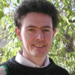 Barry Croke合作论文数Mathematical Sciences Institute, College of Science, The Australian National University94
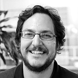 Joseph H. A. Guillaume合作论文数Fenner School of Environment and Society, The Australian National University36
 Sondoss El Sawah合作论文数School of Engineering & Information Technology, The University of New South Wales Canberra29
 rebecca letcher合作论文数25Rebecca Letcher Kelly合作论文数isNRM Pty Ltd24John P. Norton合作论文数22Lachlan T. H. Newham合作论文数19C. R. Dietrich合作论文数19Wendy Merritt合作论文数18
 John Taylor合作论文数Sch Med & Hlth Sci, Edith Cowan Univ17
 Baihua Fu合作论文数Fenner School of Environment and Society, College of Science, The Australian National University17
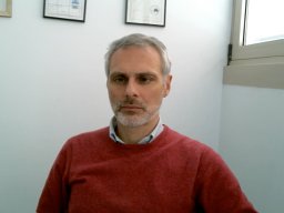 Andrea Emilio Rizzoli合作论文数IDSIA USI/SUPSI17
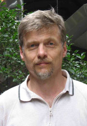 Alexey A. Voinov合作论文数Department of Geography and Environmental Engineering, Johns Hopkins University17
 Serena H. Hamilton合作论文数National Centre for Groundwater Research and Training, The Australian National University17F. Ghassemi合作论文数15
 Ioannis N. Athanasiadis合作论文数Information Technology group,Wageningen University14
 Susan M. Cuddy合作论文数Cooperative Research Centre for Catchment Hydrology, CSIRO Land and Water14
 Takuya Iwanaga合作论文数14
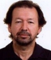 Michael McAleer合作论文数Department of Finance, College of Management, Asia University14R.W. Simpson合作论文数13
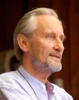 Peter C. Young合作论文数Lancaster Environment Centre, Lancaster University12L. T. H. Newham合作论文数12Jenifer L. Ticehurst合作论文数Integrated Catchment Assessment and Management Centre, Australian National University12G. A. Thomas合作论文数11Sy Schreider合作论文数9J. Bai合作论文数9Fateme Zare合作论文数9
 Suzanne A. Pierce合作论文数Jackson School of Geosciences, The University of Texas at Austin9
 Paul Whitehead合作论文数Oxford Molecular Biosensors Ltd;School of Geography and the Environment, University of Oxford8
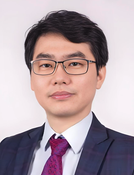 Min Chen (陈旻)合作论文数Key Laboratory of Virtual Geographic Environment, Ministry of Education of PRC, School of Geography, Nanjing Normal University8
 Holger Maier合作论文数School of Civil, Environmental and Mining Engineering, Faculty of Sciences, Engineering and Technology, University of Adelaide8Carmel A. Pollino合作论文数Water Studies Centre;Monash University;Water Studies Centre, Monash University8
 Ian G. Littlewood合作论文数8
 Xifu Sun合作论文数Australian Natl Univ, Fenner Sch Environm & Soc, Inst Water Futures, Canberra, ACT, Australia7
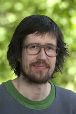 Matti Kummu合作论文数Department of Built Environment, Aalto University7
 Teemu Kokkonen合作论文数7
 Allan Lindsay Curtis (Allan Curtis)合作论文数Graham Centre for Agricultural Innovation, Department of Primary Industries, Charles Sturt University7
 Randall J Hunt合作论文数7
 Dan Ames合作论文数Department of Civil and Environmental Engineering, Ira A. Fulton College of Engineering, Brigham Young University7SG Beavis合作论文数7DA Post合作论文数6
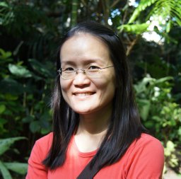 Wang Hsiao-Hsuan合作论文数Department of Wildlife and Fisheries Sciences;M University;Department of Wildlife and Fisheries Sciences, Texas A&M University6
 Andrew Ross合作论文数Fenner School of Environment and Society, Australian National University6Hedwig Van Delden合作论文数Research Institute for Knowledge Systems6
 Timothy R. Green合作论文数U.S. Department of Agriculture, USDA Agricultural Research Service6
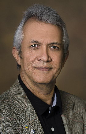 Hoshin V. Gupta合作论文数Department of Hydrology and Atmospheric Sciences, College of Science, University of Arizona6Ruirui Zhu合作论文数CAS Key Laboratory of Water Cycle and Related Land Surface Processes, Institute of Geographic Sciences and Natural Resources Research6
 Saman Razavi合作论文数School of Civil and Environmental Engineering, Amirkabir University6
 Michael Barton合作论文数School of Complex Adaptive Systems, Arizona State University;School of Human Evolution and Social Change, Arizona State University;Center for Social Dynamics and Complexity, Arizona State University5




