Fine-grained air quality monitoring using dense wireless sensor networks (WSNs) plays a critical role in environmental regulation and decision-making. However, the cost–reliability trade-off inherent to commercial inexpensive sensing devices makes them difficult to fully secure. Most existing security works focus on the digital and communication layers of sensor networks. As a result, the physical sensing layer at the single-node level is largely neglected, and its outputs are implicitly trusted, enabling adversaries to spoof sensor measurements. In this paper, we uncover previously unexplored vulnerabilities in air quality sensors that allow attackers to manipulate gas sensor readings through remote, non-invasive signal injection attacks. We show how off-the-shelf low-power lasers can manipulate pollution readings to trigger false alerts or mask pollution events. The attack exploits transient thermal effects overlooked by conventional sensor calibration methods. To address the identified vulnerabilities, we propose a defensive framework that leverages an auxiliary component typically unused in gas sensor design. Our defensive framework consists of a lightweight, real-time residual-based anomaly detection system, and a fast signal correction mechanism, namely, Adaptive Frequency-Based Filtering (AFBF). We evaluate our approach on a combination of real data and synthesized attack injections, demonstrating that AFBF recovers up to 90% of the original signal on average.
In this paper, we propose an efficient framework for monitoring pollution plumes using sensor-equipped drones. Our approach leverages the power of Reinforcement Learning and Mutual Information to strategically plan drone paths in order to maximize the informativeness of the data collected while minimizing communication costs. We propose a multi-agent Independent Q-Learning scheme, where drones act independently but share a global team reward. The reward is calculated based on both the reduction in plume estimation uncertainty and the communication costs. The proposed framework is adaptable to various problem instances, making it suitable for monitoring diverse physical phenomena. We conduct extensive simulations showing the effectiveness of our approach in achieving highquality plume monitoring, with an error in variance estimation ranging from 3% to 5% when compared with ground-truth value. Results also show that our solution offers good compromise between plume estimation and communication costs. This framework outperforms the random-walk approach up to 32.88% and genetic-based heuristics up to 4.2% in terms of total rewards under the proposed scenarios. The proposed framework is advantageous because it excels not only in providing a good solution but also in inferring it in a reasonable time especially compared to a solution provided by genetic-based heuristics.
The rapid rise of air pollution events necessitates accurate, real-time monitoring for informed mitigation strategies. Data Assimilation (DA) methods provide promising solutions, but their effectiveness hinges heavily on optimal measurement locations. This paper presents a novel approach for air quality mapping where autonomous drones, guided by a collaborative multi-agent reinforcement learning (MARL) framework, act as airborne detectives. Ditching the limitations of static sensor networks, the drones engage in a synergistic interaction, adapting their flight paths in real time to gather optimal data for Data Assimilation (DA). Our approach employs a tailored reward function with dynamic credit assignment, enabling drones to prioritize informative measurements without requiring unavailable ground truth data, making it practical for real-world deployments. Extensive experiments using a real-world dataset demonstrate that our solution achieves significantly improved pollution estimates, even with limited drone resources or limited prior knowledge of the pollution plume. Beyond air quality, this solution unlocks possibilities for tackling diverse environmental challenges like wildfire detection and management through scalable and autonomous drone cooperation.
Providing high-quality predictions is no longer the sole goal for neural networks. As we live in an increasingly interconnected world, these models need to match the constraints of resource-limited devices powering the Internet of Things (IoT) and embedded systems. Moreover, in the era of climate change, reducing the carbon footprint of neural networks is a critical step for green artificial intelligence, which is no longer an aspiration but a major need. Enhancing the energy efficiency of neural networks, in both training and inference phases, became a predominant research topic in the field. Training optimization has grown in interest recently but remains challenging, as it involves changes in the learning procedure that can impact the prediction quality significantly. This article presents a study on the most popular techniques aiming to reduce the energy consumption of neural networks’ training. We first propose a classification of the methods before discussing and comparing the different categories. In addition, we outline some energy measurement techniques. We discuss the limitations identified during our study as well as some interesting directions, such as neuromorphic and reservoir computing (RC).
In this article, we focus on the application of air quality monitoring where wireless sensor networks (WSNs) collect pollution measurements to estimate ground-truth pollution maps. We present UrMapSens, a novel WSN design strategy that aims to optimize the deployment locations of sensor nodes and the estimation of urban pollution maps. Unlike prior work, UrMapSens performs the optimization of both sensor deployment locations and pollution maps' estimation in a joint way. We design our UrMapSens approach based on data assimilation by combining physical models' simulations and expected sensor measurements in the estimation process of air pollution maps. We ensure a joint mapping-sensing design by determining the optimal number and locations of sensor nodes at the same time, in addition to finding the best way of assimilating the measurements that will be collected. Moreover, we use enhanced linearization techniques to provide a convex mathematical model based on mixed integer programming, which can be solved efficiently using numerical solvers. To validate UrMapSens in real-life scenarios, we designed an air pollution monitoring platform and used it to collect a dataset of nitrogen dioxide (NO2) concentrations in Lyon, France. Based on the experimentally collected dataset, we perform extensive evaluations of the proposed approach and show that our joint mapping-sensing design outperforms the prior work in which the optimization of sensor deployment locations and pollution maps' estimation are performed independently.
Mobile crowdsensing is a powerful paradigm that takes advantage of low-cost sensors and population density. It allows for large-scale deployments and collection of extensive data, offering a great advantage in multiple fields such as air pollution monitoring, which is a major concern worldwide. Given the mobile nature of the crowd, mobile crowdsensing platforms need to implement adequate route selection/planning solutions to better guide the crowd through the area of interest and maximize the quality of monitoring. In this paper, we propose two route selection algorithms that take into consideration the low accuracy of low-cost sensors in order to find the most informative routes. The similarity-based route selection algorithm aims to maximize spatial coverage by reducing overlaps between participant routes. The cluster-based route selection takes advantage of hierarchical clustering to build groups of similar points of the map according to explanatory variables. We compare the proposed solutions to baseline route selection algorithms, and the results show that our solutions allow for a better estimation while being efficient in terms of travel distance.
Monitoring pollution plumes is a key issue, given the harmful effects they cause. The dynamic of these plumes, which may be important due to meteorological conditions, makes their study difficult. Real-time monitoring in order to obtain an accurate mapping of the pollution dispersion is helpful and valuable to mitigate risks. In this work, we consider a fleet of cooperative drones carrying pollution sensors and operating in order to assess a pollution plume. The latter is assumed to follow a Gaussian Process (GP) with varying parameters. For this use case, we propose an efficient approach to characterize spatially and temporarily the plume while optimizing the path planning of drones. In our approach, drones are guided by a Deep Reinforcement Learning (DRL) model called Categorical Deep Q-Network (Categorical DQN) to maximize the plume coverage while considering budget constraints. Specifically, we develop a scalable Independent Q-Learning (IQL) scheme that shares team rewards based on each drone’s deployment relevance and therefore ensures cooperation. We evaluate the performance of the plume parameter estimation as well as the maps generated by the GP regression. By testing our framework on several plume scenarios, we show that it offers good results in terms of both estimation quality and run-time efficiency.
In this paper, we address the energy efficiency of neural networks training through data selection techniques. We first study the impact of a random data selection approach that renews the selected examples periodically during training. We find that random selection should be considered as a serious option as it allows high energy gains with small accuracy losses. Unexpectedly, it even outperforms a more elaborate approach in some cases.Our study of the random approach conducted us to observe that low selectivity ratios allow important energy savings, but also cause a significant accuracy decrease. To mitigate the effect of such ratios on the prediction quality, we propose to use a dynamic selectivity ratio with a decreasing schedule, that can be integrated to any selection approach. Our first results show that using such a schedule provides around 60% energy gains on the CIFAR-10 dataset with less than 1% accuracy decrease. It also improves the convergence when compared to a fixed ratio.
The training energy efficiency of deep neural networks became an extensively studied research topic in the last years. Some of the existing approaches seek to reduce the size of the architecture by either starting the training with a large network and pruning it, or by beginning with a seed architecture and then growing it. Instead of compressing the architecture, other approaches aim to reduce the number of training examples through data selection. While various approaches belonging to these two categories have been proposed, only a few works actually conduct energy measurements. Others merely mention potential gains in efficiency or rely on alternative evaluation metrics such as FLOPs. In this paper, we conduct a series of experiments both on a synthetic dataset and on image classification benchmarks in order to compare the impact of pruning, architecture growing and data selection on training energy consumption and prediction quality. Our results show that growing maintains a high prediction quality but brings limited energy gains when the size of the resulting architecture is large. Pruning can offer high gains, but also impacts accuracy, making it more suited for large models. Data selection provides energy gains correlated with the selectivity rate but causes an accuracy loss. We find that the effectiveness of every technique depends on its hyperparameters and on the architecture size.
Natural disasters of any kind can have catastrophic consequences for properties, infrastructure, and human lives. During large-scale calamities, two common problems are faced: (i) the partial or even complete destruction of communications infrastructure, and (ii) the difficulty of collecting accurate information on the disaster area and trapped victims. These two problems prevent a quick and accurate assessment of damage, leading to inefficient rescue operations and putting the lives of rescuers and victims in great danger. The LTE Proximity Services (ProSe) and the Internet of Things (IoT) are promising technologies that can offer an efficient solution to the aforementioned problems in the form of a rapidly established emergency network for post-disaster management. In this paper, we propose a solution for the establishment of an efficient emergency communications network for post-disaster situations based on the LTE Device-to-Device ProSe (D2D ProSe) technology and IoT devices. It facilitates fast and efficient service discovery that allows querying heterogeneous IoT devices such as health sensors, wireless cameras, smartwatches, or any other relevant devices or sensors. The goal is to allow rescuers to have access to information produced by various things available during the rescue operation. We take advantage of LTE ProSe to create a distributed D2D broadcast backbone that enables efficient and reliable message dissemination while reducing energy consumption and achieving high coverage. We then add a multipath forwarding mechanism, in which each service type of IoT device is ensured an optimal path for its traffic. Unlike previous works, we fully implemented our solution in the NS3 simulator and relied on realistic models (wireless channels, energy, and mobility) to evaluate its performance compared to previous solutions, which we also implemented on NS3. The obtained results show that our solution achieves significant improvement compared to those proposed in the literature. The entire code used in this project is freely available to the community through GitHub.1
We consider IoT networks where nodes are able to move to change the network topology and improve area coverage and network performance. We focus on the problem of global optimization where the nodes make use of the predictability of circumstances that affect network operations, such as the communication and sensing ranges, to anticipate future actions that need to be taken so that the correct operation of the network continues to be guaranteed with a minimum global cost. We provide a Mixed Integer Quadratic Program (MIQP)-based solution that minimizes the overall energy consumed over the entire deployment period while maintaining network connectivity and full area coverage. Results show that significant performance enhancement can be obtained when taking predictability into account compared to the case where nodes make decisions based only on their current observations.
Forecasting air pollution is considered as an essential key for early warning and control management of air pollution, especially in emergency situations, where big amounts of pollutants are quickly released in the air, causing considerable damages. Predicting pollution in such situations is particularly challenging due to the strong dynamic of the phenomenon and the various spatio-temporal factors affecting air pollution dispersion. In addition, providing uncertainty estimates of prediction makes the forecasting model more trustworthy, which helps decision-makers to take appropriate actions with more confidence regarding the pollution crisis. In this study, we propose a multi-point deep learning model based on convolutional long short term memory (ConvLSTM) for highly dynamic air quality forecasting. ConvLSTM architectures combines long short term memory (LSTM) and convolutional neural network (CNN), which allows to mine both temporal and spatial data features. In addition, uncertainty quantification methods were implemented on top of our model's architecture and their performances were further excavated. We conduct extensive experimental evaluations using a real and highly dynamic air pollution data set called Fusion Field Trial 2007 (FFT07). The results demonstrate the superiority of our proposed deep learning model in comparison to state-of-the-art methods including machine and deep learning techniques. Finally, we discuss the results of the uncertainty techniques and we derive insights.
The widespread use of low-cost environmental monitoring systems, together with recent developments in the design of Internet of Things architectures and protocols, has given new impetus to smart city applications. Such progress should, in particular, considerably improve the fine characterization of a wide range of physical quantities within our cities. Indeed, the cost-effectiveness of these emerging sensors combined with their reduced size allows for high-density deployments resulting in higher spatial granularity. In this article, we briefly present the 3M'Air project that aims to explore the potential of participatory citizen measures using low-cost sensors in order to improve the local knowledge of air quality and temperature and then bridge the gap between individual exposure and regional measurements. We then present the design, implementation, and evaluation of our low-cost, small-size wireless sensor network (WSN)-based participatory monitoring system. This system is composed of mobile sensing nodes measuring temperature, humidity, and a number of pollutants (NO2, PM1, PM2.5, and PM10). The collected data are sent to a server for analysis and building temperature and air quality maps. To validate our platform, we have carried out multiple tests to compare our sensor nodes to reference stations and to each other. We have also evaluated the energy consumption of our nodes under different configurations. The results are satisfactory and show that our nodes can be used in environmental participatory monitoring.
Monitoring air pollution plumes in emergency situations (industrial accidents, natural disasters, deliberate terrorist releases, etc.) becomes an issue of utmost importance in our society given the dramatic effects that the released pollutants can cause.Considering these situations, the pollution plume is strongly dynamic leading to a fast dispersion of pollutants in the atmosphere.Thus, the need for real-time response is very strong and a solution to get precise mapping of pollution dispersion is required to mitigate risks.However, monitoring and forecasting air quality in real time in such situations remains a highly challenging endeavour.In this paper, we suggest a systemic approach for monitoring dynamic air pollution based on aerial sensing (sensors mounted on UAVs).The proposed framework consists of a cycle with feedback loop which will constantly combine a spatio-temporal forecasting model based on a convolutional long short term memory (ConvLSTM) network with a data assimilation technique to get accurate pollution maps, while adjusting at each time the trajectories of drones following uncertainty forecasts.Our solution was evaluated and validated using a highly dynamic real world data set namely Fusion Field Trial 2007 (FFT07).The proposed strategy, together with the obtained evaluation results, are presented, and carefully analyzed.
Participatory sensing leverages population density and involves citizens in the collection of extensive data in multiple fields such as air pollution monitoring, enabling large-scale deployments and improving the knowledge of air quality. This study highlights the potential of low-cost sensors through a data analysis of pollutant concentrations collected during multiple sensing campaigns we co-organized using a participatory sensing platform we designed. We first compare the estimation quality of four statistical models and investigate the impact of sampling frequency on the quality of estimation and energy consumption of the nodes using an energy model based on the sensing duty cycle. In addition, we evaluate the capacity of regression models to recover missing data of one sensor based on the other sensors. Results are satisfactory and reveal that a small decrease in the sampling frequency slightly reduces the estimation quality, but in contrast, allows the nodes to operate on a longer period.
In a post-disaster situation, the construction of replacement communication infrastructure is crucial for the success of rescue operations. LTE Device-to-Device Proximity Services and IoT are considered as key enabling technologies for the construction of such replacement networks. Existing techniques rely on smartphones as relay stations to build a replacement broadcast-based network that connects available devices. In many cases, the using of such networks require querying a given type of IoT devices (e.g, surveillance cameras, heart-rate monitors, temperature sensors) depending on network users and service requirements. In such scenarios, incorporating all relays in the broadcast is inefficient and may lead to poor network performance. In this paper, we propose constructing for each service type a sub-network of relay stations that ensure connectivity among IoT devices providing the same service type. The resulting sub-networks ensure an efficient and robust message dissemination, avoiding transmission redundancy, and resulting in higher energy savings as well as high coverage. These properties have been validated by implementing our solution in NS-3 by extending the LTE D2D ProSe module provided by NIST. Obtained results show significant improvements in terms of energy consumption, and packet delivery ratio.
 Hervé Rivano合作论文数Project team Mascotte
INRIA Sophia Antipolis27
Hervé Rivano合作论文数Project team Mascotte
INRIA Sophia Antipolis27 Ahmed Boubrima合作论文数INRIA INSA Lyon, Université de Lyon Villeurbanne France16
 Yacine Challal合作论文数University of Doha for Science and Technology11
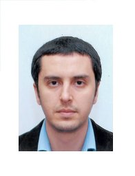 Abdelmalik Bachir合作论文数Grenoble Informatics Laboratory10
 Ichrak Mokhtari合作论文数6
 Mohamed Anis Fekih合作论文数INSA Lyon, Univ Lyon5
 Okba Tibermacine合作论文数5
 Lionel Soulhac合作论文数Laboratoire de Mécanique des Fluides et d'Acoustique;Université de Lyon;Ecole Centrale de Lyon;Laboratoire de Mécanique des Fluides et d'Acoustique, Université de Lyon5Sami Abdellatif合作论文数4Mohamed Sami Assenine合作论文数3Anais Boumendil合作论文数3Karima Benatchba合作论文数(benatchba@yahoo.fr) computer science institute of Algiers3Yasmine Belbaki合作论文数2Amjed Belkhiri合作论文数2Abdelmadjid Bouabdallah合作论文数Universit?? de Technologie de Compi??gne2Lou Herrmann合作论文数1
 Manoel Dahan合作论文数1
 Florent Pineau合作论文数1
 Mohammed Brahimi合作论文数Computer Science Department, Mohamed El Bachir El Ibrahimi University1
 Abdessamed Sassi合作论文数Comp Sci Dept, Oum El Bouaghi Univ1
 Zhambyl Shaikhanov合作论文数Rice University, USA1Lucille Alonso合作论文数1
 cyrille harpet合作论文数EHESP, Univ Rennes1
 Khaled Boussetta合作论文数University of California1
 Azzedine Boukerche合作论文数School of Information Technology and Engineering, University of Ottawa1
 Vahid Tarokh合作论文数Department of Electrical & Computer Engineering, Pratt School of Engineering, Duke University1
 Frederic Le Mouel合作论文数INRIA / INSA Lyon1
 Marco Fiore合作论文数Institute of Neurobiology and Molecular Medicine, CNR-European Brain Research Institute Rita Levi-Montalcini1Bencheikh, Ahlem Bencheikh合作论文数1Florent Renard合作论文数1
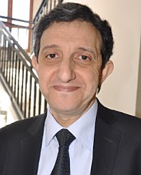 Mouloud Koudil合作论文数LMCS Laboratory, Ecole nationale Supérieure d’Informatique (ESI),1
 Fabrice Valois合作论文数Telecommunications Department, Inria Agora, CITI Research Lab, National Institute of Applied Sciences of Lyon1
 Malcolm A. Egan合作论文数1
 Anne Ruas合作论文数Institut Géographique National, COGIT Laboratory, 2-4 av. Pasteur, 94165 Saint-Mandé, France1
 Razvan Stanica合作论文数Telecommunications Department, INSA Lyon1Isabelle Augé-Blum合作论文数1
 Pierre-Edouard Portier合作论文数LyonTech Campus de la doua, INSA Lyon
LIRIS CNRS UMR 5205 -Equipe DRIM1
Pierre-Edouard Portier合作论文数LyonTech Campus de la doua, INSA Lyon
LIRIS CNRS UMR 5205 -Equipe DRIM1




