Increasing global insecurity for potable water has led to atmospheric water harvesting as a viable supplementary source. Passive dew water harvesting is simple to carry out but atmospheric conditions determine the frequency and amount of dew that can be collected, and up to 0.5 L/m2/night can be considered as an upper ceiling. Thus, active condensers using refrigeration and cooling systems have been developed to increase collection totals, requiring an electrical or solar power supply. In the last decade, adsorption/absorption techniques of water vapor have been studied to maximize collection, with the potential for low costs, portability, and high volumes, and they are operational even in arid regions with low humidity, islands, and remote regions. This could become a gamechanger in securing affordable potable water. Citizen Science is suggested for dew observation and collection data to increase observation points that could be used to improve the resolution/accuracy of local, regional, or global dew modelling. It would promote environmental and water literacy by engaging participants ranging from primary school communities to senior individuals. Teleconferencing now provides access to a worldwide audience and the inclusion of participants no matter their location.
Land-surface representations in weather and climate models simplify the characterization of vegetation as a single layer with bulk environmental conditions. This approach overlooks the vertical variability in leaf traits and environmental conditions within the canopy. This research explores the vertical variability of plant ecophysiology and environmental measurements within the Amazon tropical rainforest during daytime, specifically at the ATTO site, during the late dry season. To characterize the canopy and its vertical variability, we categorized the canopy into three layers: the top layer (approximately the upper third of the canopy, 18-27 m), the medium layer (approximately the medium third of the canopy, 9-18 m), and the low layer (approximately the lower third of the canopy, 0-9 m) where leaf gas exchange measurements were conducted. Utilizing these layers, we developed a multi-layer model representation that calculates water and CO2 fluxes based on within canopy on-site observations. We conducted sensitivity analyses of the rainforest multi-layer representation to discern the significance of capturing vertical variability in leaf traits and environmental conditions for deriving net fluxes of water and CO2 of the forest. Current results show that measured leaf traits exhibit vertical variation within the canopy, indicating larger productivity in the top layer compared to the medium and low layers. Environmental conditions, such as incoming radiation in the top layer, fluctuate due to cloud presence. Temperature peaks in the top layer and reaches a minimum at mid-canopy. This results in a non-uniform mixing of the canopy air, maintaining a stable layer within the forest canopy that can potentially affect the distribution of scalars within the canopy. Ongoing analyses explore the similarities and differences between the CO2 exchange between the multi-layer representation and CO2 fluxes from eddy covariance systems, as well as the sensitivity of the former to vertical variability in leaf traits and environmental conditions. By doing so, we aim to gain knowledge on the relevance (or irrelevance) of characterizing vertical variability in land-surface representations and on important processes that may not be well captured yet by land-surface representations.
The ratios of atmospheric tracers are often used to interpret the local CO2 budget, where measurements at a single height are assumed to represent local flux signatures. Alternatively, these signatures can be derived from direct flux measurements or using fluxes derived from measurements at multiple heights. In this study, we contrast interpretation of surface CO2 exchange from tracer ratio measurements at a single height versus measurements at multiple heights. Specifically, we analyse the ratio between atmospheric O2 and CO2 (exchange ratio, ER) above a forest canopy. We consider two alternative approaches: the exchange ratio of the forest (ERforest) obtained from the ratio of the surface fluxes of O2 and CO2, derived from their vertical gradients measured at multiple heights, and the exchange ratio of the atmosphere (ERatmos) obtained from changes in the O2 and CO2 mole fractions over time measured at a single measurement height. We investigate the diurnal cycle of both ER signals, with the goal to relate the ERatmos signal to the ERforest signal and to understand the biophysical meaning of the ERatmos signal. We combined CO2 and O2 measurements from Hyytiälä, Finland during spring and summer of 2018 and 2019 with a conceptual land-atmosphere model and a theoretical relationship between ERatmos and ERforest to investigate the behaviour of ERatmos and ERforest during different environmental conditions. We show that the ERatmos signal rarely directly represents the forest exchange, mainly because it is influenced by entrainment of air from the free troposphere into the atmospheric boundary layer. The resulting ERatmos signal is not the average of the contributing processes, but rather an indication of the influence of large scale processes such as entrainment or advection. We conclude that the ERatmos only provides a weak constraint on local scale surface CO2 exchange, because large scale processes confound the signal. Single height measurements therefore always require careful selection of the time of day and should be combined with atmospheric modelling to yield a meaningful representation of forest carbon exchange. More generally, we recommend to always measure at multiple heights when using multi-tracer measurements to study surface CO2 exchange.
We analyze the diurnal variability of atmospheric , , and CO2 above the canopies of two contrasting ecosystems: the Amazon tropical forest and the Loobos temperate forest. Using a coupled forest-atmosphere model constrained by tower-based and aircraft observations, we quantify the role of atmospheric processes-including entrainment, subsidence, and cloud ventilation-in shaping the diurnal amplitude, or diurnal range (DR), of carbon-cycle tracers. Our results show that atmospheric processes can contribute more than twice as much as surface processes to DR. Misrepresenting these influences leads to substantial errors in interpreting observations and modeling tracer variability. We propose using DR as a metric to evaluate atmospheric tracer transport models and to compare site-level measurements. We present a roadmap to identify which atmospheric or surface processes are poorly represented when modeled and observed DR diverge.
We analyze the diurnal variability of atmospheric , , and CO 2 above the canopies of two contrasting ecosystems: the Amazon tropical forest and the Loobos temperate forest. Using a coupled forest‐atmosphere model constrained by tower‐based and aircraft observations, we quantify the role of atmospheric processes—including entrainment, subsidence, and cloud ventilation—in shaping the diurnal amplitude, or diurnal range (DR), of carbon‐cycle tracers. Our results show that atmospheric processes can contribute more than twice as much as surface processes to DR. Misrepresenting these influences leads to substantial errors in interpreting observations and modeling tracer variability. We propose using DR as a metric to evaluate atmospheric tracer transport models and to compare site‐level measurements. We present a roadmap to identify which atmospheric or surface processes are poorly represented when modeled and observed DR diverge.
This year marks the end of the Shedding Light On Cloud Shadows project (SLOCS, 2019-2024). SLOCS aims to understand temporal, spatial, and spectral variability in surface solar irradiance driven by individual clouds from field observations and 3D cloud-resolving large-eddy simulations. In this contribution, we would like to present the highlights of the project and the most important conclusions.The reason for initiating SLOCS is that clouds trigger large fluctuations in solar surface irradiance, and therefore in surface heat fluxes, but there is still much to be learned about these fluctuations. The incoming radiation in shadows is almost an order of magnitude less than under clear sky, while peaks near clouds shadows can sometimes reach a 50% increase with respect to clear sky, due to scattering of sunlight on clouds. Performing cloud-resolving simulations with realistic surface solar irradiance patterns under broken clouds remains therefore a challenge, and current cloud-resolving models do not capture the radiation-cloud interactions well. The Shedding Light On Cloud Shadows (SLOCS) project addresses this challenge by i) performing spatial observations in a spatial grid fine enough (~50 m, 10 Hz) to capture individual clouds using a newly designed instrument, and ii) developing 3D radiative transfer models for cloud-resolving models with optimal balance between detail level and performance. The FESSTVaL, LIAISE, and CloudRoots campaigns provided unique opportunities to measure surface solar irradiance around cloud shadows in different climates. In the campaigns, we performed grid measurements of radiation, while benefiting from complementary boundary-layer and cloud observations.The most important lessons learned from the field observations are:1. Scales as small as meters and seconds contribute significantly to fluctuations in surface solar irradiance2. All broken cloud patterns generate strong peaks, but the underlying mechanisms vary greatly amoung cloud types3. Spectral variations (in colors of light) are mostly significant under cumulus clouds.We used those observations to set up a series of cloud-resolving simulations with MicroHH and to evaluate two newly-developed radiative transfer solvers: i) a ray tracer fast enough to be coupled to our cloud-resolving model and ii) a solver that post-processes the outcome of a 1D two-stream solver to emulate 3D effects. Also, we studied the impact of periodic and open lateral boundary conditions. The most important conclusions are:1. Capturing 3D interactions between clouds and radiation accurately leads to larger clouds with more liquid water compared to those in simulations with conventional 1D methods2. Post-processing conventional 1D radiation computations allows for simulating surface solar irradiance fields with realistic probability density functions, but inaccurate cloud shadow shape and location.3. Open lateral boundaries in large-eddy simulations are at least as important as correct radiation-cloud interactions in producing realistic cloud shadows in the range from hectometers to kilometers.
Research indicates that water in small water bodies has negligible cooling effects, but also that its surrounding environment can be designed to become cooler by applying the 'cooling urban water environments' concept. However, this concept was created for generic urban environments and not tested in practice. This study applies this concept to a specific urban environment, tests its micrometeorological performance and surveys how urban designers and landscape architects regard its usability. The results indicate that the 'cooling urban water environments' concept can lead to site-specific cooling effects and that there is willingness amongst practitioners to apply this concept.
Atmospheric tracers are often used to interpret the local CO2 budget, where measurements at a single height are assumed to represent local flux signatures. Alternatively, these signatures can be derived from direct flux measurements or by using fluxes derived from measurements at multiple heights. In this study, we contrast interpretation of surface CO2 exchange from tracer measurements at a single height to measurements at multiple heights. Specifically, we analyse the ratio between atmospheric O2 and CO2 (exchange ratio, ER) above a forest. We consider the following two alternative approaches: the exchange ratio of the forest (ERforest) obtained from the ratio of the surface fluxes of O2 and CO2 derived from measurements at multiple heights, and the exchange ratio of the atmosphere (ERatmos) obtained from changes in the O2 and CO2 mole fractions over time measured at a single height. We investigate the diurnal cycle of both ER signals to better understand the biophysical meaning of the ERatmos signal. We have combined CO2 and O2 measurements from Hyytiälä, Finland, during spring and summer of 2018 and 2019 with a conceptual land–atmosphere model to investigate the behaviour of ERatmos and ERforest. We show that the CO2 and O2 signals as well as their resulting ERs are influenced by climate conditions such as variations in soil moisture and temperature, for example during the 2018 heatwave. We furthermore show that the ERatmos signal obtained from single-height measurements rarely represents the forest exchange directly, mainly because it is influenced by entrainment of air from the free troposphere into the atmospheric boundary layer. The influence of these larger-scale processes can lead to very high ERatmos values (even larger than 2), especially in the early morning. These high values do not directly represent carbon cycle processes, but are rather a mixture of different signals. We conclude that the ERatmos signal provides only a weak constraint on local-scale surface CO2 exchange, and that ERforest above the canopy should be used instead. Single-height measurements always require careful selection of the time of day and should be combined with atmospheric modelling to yield a meaningful representation of forest carbon exchange. More generally, we recommend always measuring at multiple heights when using multi-tracer measurements to study surface CO2 exchange.
Surface solar irradiance varies on scales as small as seconds or meters due to scattering and absorption by the atmosphere. Clouds are the main driver of this variability, but moisture structures in the atmospheric boundary layer and aerosols have an influence too, and depend on wavelength. The highly variable nature of solar irradiance is not resolved by most atmospheric models, yet it affects most notably the land-atmosphere coupling, which in turn can change the cloud field, and the quality of solar energy forecasting. Spatially and spectrally resolved observational datasets of solar irradiance at such high resolution are rare, but they are required for characterising observed variability, understanding the mechanisms, and developing fast models capable of accurately resolving this variability. In 2021, we deployed a spatial network of low-cost radiometers at the FESSTVaL (Germany) and LIAISE (Spain) field campaigns, specifically to gather data on cloud-driven surface patterns of irradiance, including spectral effects, with the aim to address this gap in observations and understanding. We find in case studies of cumulus, altocumulus, and cirrus clouds that these clouds generate large spatiotemporal variability in irradiance, but through different mechanisms and at difference spatial scales, ranging from 50 m to 30 km. Spectral irradiance in the visible range varies at similar spatial scales, with significant blue enrichment in cloud shadows, most strongly for cumulus, and red enrichment in irradiance peaks, particularly in the case of semi-transparent clouds or near cumulus cloud edges. Under clear-sky conditions, solar irradiance varies significantly in water vapour absorption bands at the minute scale, due to local and regional variability in atmospheric moisture.
Land cover controls the land‐atmosphere exchange of water and energy through the partitioning of solar energy into latent and sensible heat. Observations over all land cover types at the regional scale are required to study these turbulent flux dynamics over a landscape. Here, we aim to study how the control of daily and midday latent and sensible heat fluxes over different land cover types is distributed along three axes: energy availability, water availability and exchange efficiency. To this end, observations from 19 eddy covariance flux tower sites in the Netherlands, covering six different land cover types located within the same climatic zone, were used in a regression analysis to explain the observed dynamics and find the principle drivers. The resulting relative position of these sites along the three axes suggests that land cover partly explains the variance of daily and midday turbulent fluxes. We found that evaporation dynamics from grassland, peatland swamp and cropland sites could mostly be explained by energy availability. Forest evaporation can mainly be explained by water availability, urban evaporation by water availability and exchange efficiency, and open water evaporation can almost entirely be explained by exchange efficiency. We found that the sensible heat flux is less sensitive to land cover type. This demonstrates that the land‐atmosphere interface plays an active role in the shedding of sensible heat. Our results contribute to a better understanding of the dynamics of evaporation over different land cover types and may help to optimize, and potentially simplify, models to predict evaporation.
Surface solar irradiance varies on scales down to seconds or meters due to clouds. This highly variable nature of irradiance is not resolved by atmospheric models, yet heterogeneity in surface irradiance impacts the overlying cloud field. The inability to resolve irradiance variability, aside from insufficient model resolution, is explained by our limited understanding of cloud-driven solar irradiance variability at short spatiotemporal scales and the lack of high resolution spatial observational data. Cloud resolving models utilizing ray tracing techniques are a useful research tool, but ultimately require validation against observations.In 2021, we gathered new observational data with a network of radiometers, specifically designed to gather data on cloud-driven surface patterns of irradiance. I will present results on various kinds of surface patterns in relation to cloud type and atmospheric conditions, based on these observations. Our radiometers sample surface solar irradiance at 10 Hz for 18 wavelengths, which we deployed in different setups in the FESSTVaL (Germany) and LIAISE (Spain) field campaigns. Our results highlight the complexity and wide range of regimes in spatiotemporal irradiance variability, but also provide insights into its driving mechanisms. These insights help guide the development of improved radiative transfer calculations, in order to move towards models that can accurately resolve irradiance variability in an operational setting.
Trees provide cooling services in urban areas in summer. Which tree species are suitable in cities in a future climate remains an open question. One of the criteria for tree species selection is winter hardiness. Winter hardiness is an indicator of the lowest temperatures that plants typically experience in an area. The United States Department of Agriculture (USDA) defines winter hardiness as the average annual minimum temperature. Hence, it is a straightforward and commonly used indicator to predict the likelihood of certain plants to experience frost damage in winter. The most recent winter hardiness map for Europe was made in 1984, and does not include the climate change from the past decades, and neglects the urban heat island effect (UHI) that causes warmer winters in urban areas, impacting winter hardiness. In this study, we developed an updated and downscaled version of the European winter hardiness maps using minimum temperature from the ECA&D E-OBS dataset version 26.0, and the European Local Climate Zone (LCZ) map with a 100x100m resolution. The new maps represent the winter hardiness for five standard normal periods between 1951 and 2020, and represent the years 2030, 2050, and 2085 for the Netherlands using four climate scenarios. These maps show how hardiness zones have moved to the north and east over the past decades. They show that roughly 60% of Europe is now in a different hardiness zone compared to the 1951-1980 average, potentially allowing new tree species to flourish here. They also indicate that the Netherlands can move up to three hardiness zones between the present and 2085. Furthermore, these maps show that many urban areas are in different winter hardiness zones compared to the rural surroundings, which has additional consequences for the tree species that are able to flourish in urban environments.
Vegetation and atmosphere processes are coupled through a myriad of interactions linking plant transpiration, carbon dioxide assimilation, turbulent transport of moisture, heat and atmospheric constituents, aerosol formation, moist convection, and precipitation. Advances in our understanding are hampered by discipline barriers and challenges in understanding the role of small spatiotemporal scales. In this perspective, we propose to study the atmosphere–ecosystem interaction as a continuum by integrating leaf to regional scales (multiscale) and integrating biochemical and physical processes (multiprocesses). The challenges ahead are (1) How do clouds and canopies affect the transferring and in‐canopy penetration of radiation, thereby impacting photosynthesis and biogenic chemical transformations? (2) How is the radiative energy spatially distributed and converted into turbulent fluxes of heat, moisture, carbon, and reactive compounds? (3) How do local (leaf‐canopy‐clouds, 1 m to kilometers) biochemical and physical processes interact with regional meteorology and atmospheric composition (kilometers to 100 km)? (4) How can we integrate the feedbacks between cloud radiative effects and plant physiology to reduce uncertainties in our climate projections driven by regional warming and enhanced carbon dioxide levels? Our methodology integrates fine‐scale explicit simulations with new observational techniques to determine the role of unresolved small‐scale spatiotemporal processes in weather and climate models.
The urban climate is substantially different from its rural counterpart. This study summarizes 10 years of monitoring the urban climate of Amsterdam. Amsterdam has a unique position in the sense it is located in a delta, and located close to a large lake in the east. Moreover the city is well known for its large amount of water bodies. A network of 24 weather stations has been employed observing temperature, humidity and wind speed at 4 m height across the city. This is complemented by radio soundings, and traverse observations using a tricycle equipped with a weather station recording temperature, humidity wind speed, and all radiation components within the urban canyon. The network also contains flux measurements of turbulent fluxes of heat, moisture, momentum, carbon dioxide and methane using eddy covariance observations. The latter are especially relevant for monitoring the greenhouse footprint of the city. In addition a microwave scintillometer has been installed to monitor the sensible and latent heat flux for a footprint over the city as a whole. We present spatial behaviour of temperature (urban heat island and urban cool island) and humidity as well as canyon wind speeds. Both a clear urban heat island (UHI) and cool island has been found. The UHI extends up to 90 m. In addition, the observations reveal a systematic signal of a moisture island effect too. We find a Bowen ratio of the summertime fluxes about 3.8. Finally results from indoor weather stations installed in 100 households to monitor and understand urban heat in bed and living rooms will be presented.
We developed a cost-effective Fast-Response Optical Spectroscopy Time-synchronized instrument (FROST). FROST can measure 18 light spectra in 18 wavebands ranging from 400 to 950 nm with a 20 nm full-width half-maximum bandwidth. The FROST 10 Hz measurement frequency is time-synchronized by a global navigation satellite system (GNSS) timing pulse, and therefore multiple instruments can be deployed to measure spatial variation in solar radiation in perfect synchronization. We show that FROST is capable of measuring global horizontal irradiance (GHI) despite its limited spectral range. It is very capable of measuring photosynthetic active radiation (PAR) because 11 of its 18 wavebands are situated within the 400-to-700 nm range. A digital filter can be applied to these 11 wavebands to derive the photosynthetic photon flux density (PPFD) and retain information on the spectral composition of PAR. The 940 nm waveband can be used to derive information about atmospheric moisture. We showed that the silicon sensor has undetectable zero offsets for solar irradiance settings and that the temperature dependency as tested in an oven between 15 and 46 degrees C appears very low ( 250 ppmK(-1)). For solar irradiance applications, the main uncertainty is caused by our polytetrafluoroethylene (PTFE) diffuser (Teflon), a common type of diffuser material for cosine-corrected spectral measurements. The oven experiments showed a significant jump in PTFE transmission of 2% when increasing its temperature beyond 21 degrees C. The FROST total cost (< EUR 200) is much lower than that of current field spectroradiometers, PAR sensors, or pyranometers, and includes a mounting tripod, solar power supply, data logger and GNSS, and waterproof housing. FROST is a fully standalone measurement solution. It can be deployed anywhere with its own power supply and can be installed in vertical in-canopy profiles as well. This low cost makes it feasible to study spatial variation in solar irradiance using large-grid high-density sensor setups or to use FROST to replace existing PAR sensors for detailed spectral information.
Numerical weather prediction models operate on grid spacings of a few kilometers, where deep convection begins to become resolvable. Around this scale, the emergence of coherent structures in the planetary boundary layer, often hypothesized to be caused by cold pools, forces the transition from shallow to deep convection. Yet, the kilometer-scale range is typically not resolved by standard surface operational measurement networks. The measurement campaign Field Experiment on Submesoscale Spatio-Temporal Variability in Lindenberg (FESSTVaL) aimed at addressing this gap by observing atmospheric variability at the hectometer-to-kilometer scale, with a particular emphasis on cold pools, wind gusts, and coherent patterns in the planetary boundary layer during summer. A unique feature was the distribution of 150 self-developed and low-cost instruments. More specifically, FESSTVaL included dense networks of 80 autonomous cold pool loggers, 19 weather stations, and 83 soil sensor systems, all installed in a rural region of 15-km radius in eastern Germany, as well as self-developed weather stations handed out to citizens. Boundary layer and upper-air observations were provided by eight Doppler lidars and four microwave radiometers distributed at three supersites; water vapor and temperature were also measured by advanced lidar systems and an infrared spectrometer; and rain was observed by a X-band radar. An uncrewed aircraft, multicopters, and a small radiometer network carried out additional measurements during a 4-week period. In this paper, we present FESSTVaL’s measurement strategy and show first observational results including unprecedented highly resolved spatiotemporal cold-pool structures, both in the horizontal as well as in the vertical dimension, associated with overpassing convective systems.
A total of 20 urban neighbourhood-scale eddy covariance flux tower datasets are made openly available after being harmonized to create a 50 site–year collection with broad diversity in climate and urban surface characteristics. Variables needed as inputs for land surface models (incoming radiation, temperature, humidity, air pressure, wind and precipitation) are quality controlled, gap-filled and prepended with 10 years of reanalysis-derived local data, enabling an extended spin up to equilibrate models with local climate conditions. For both gap filling and spin up, ERA5 reanalysis meteorological data are bias corrected using tower-based observations, accounting for diurnal, seasonal and local urban effects not modelled in ERA5. The bias correction methods developed perform well compared to methods used in other datasets (e.g. WFDE5 or FLUXNET2015). Other variables (turbulent and upwelling radiation fluxes) are harmonized and quality controlled without gap filling. Site description metadata include local land cover fractions (buildings, roads, trees, grass etc.), building height and morphology, aerodynamic roughness estimates, population density and satellite imagery. This open collection can help extend our understanding of urban environmental processes through observational synthesis studies or in the evaluation of land surface environmental models in a wide range of urban settings. These data can be accessed from https://doi.org/10.5281/zenodo.7104984 (Lipson et al., 2022).
Clouds cast shadows and locally enhance solar irradiance through absorbing and scattering sunlight, resulting in fast and large solar irradiance fluctuations on the surface. The resulting spatiotemporal variability poses a challenge for solar energy production amidst increasing need for reliable renewable energy. It furthermore influences biological processes and the exchange of water and energy. Yet, no numerical weather prediction model is able to reproduce the observed local properties of irradiance, due to the complexity of radiative transfer and its dependence on accurately resolved cloud fields. Improving the radiative transfer models, whether it involves running full Monte Carlo raytracing in academic setups or simplified paramerizations, ultimately requires observations for validation. However, dense spatial observation of irradiance on the scale of cloud shadows are rare. Even single 1D time series are rarely available at high enough temporal resolution to capture irradiance variability. In ongoing work, we provide those missing observations using a dense network of our custom, low-cost radiometers that we deployed at two field campaigns in summer 2021, FESSTVaL (Germany) and LIAISE (Spain). I will present our gathering and analyses of these new and detailed observations of surface irradiance to address knowledge gaps in our physical understanding and provide validation datasets for models. The instruments, which sample at 10 Hz, are able to closely match expensive conventional instruments, and combined with skyview imagery, the spatial observations are directly linked to observed clouds. Information about atmospheric water content can be retrieved using the information from water vapour absorption bands. To complement these short term spatial data, long-term statistics of irradiance variability are derived from a 10-year 1 Hz resolution dataset from the Baseline Surface Radiation Network station in Cabauw, the Netherlands. Distributions and typical spatio-temporal scales of cloud shadows and irradiance peaks can be related to cloud type and meteorological conditions. The gathering and study of these datasets will lead to a better understanding of the physics. E.g., whether the dominant mechanism driving irradiance peaks is either forward scattering in transparent parts of clouds or 'reflections' from cloud sides. Furthermore, these datasets will help validate models, and ultimately improve our ability to accurately forecast irradiance variability at the small scales.
Boundary-layer clouds trigger large fluctuations in solar surface irradiance and in surface heat fluxes. The incoming radiation in shadows is almost an order of magnitude less than under clear sky, while peaks near clouds shadows can sometimes reach a 50% increase with respect to clear sky, due to scattering of sunlight in cloud edges. Performing large-eddy simulation (LES) with realistic surface solar irradiance patterns under broken clouds remains a challenge. First, this is due to the absence of spatial radiation observations that capture individual cloud shadows at a typical LES resolution (~50 m), second, because cloud fields need to be accurate up to a very high detail level and, third, the 3D aspects of radiative transfer needs to taken into account. The Shedding Light On Cloud Shadows (SLOCS) project aims to overcome these challenges by i) gathering spatial observations in a spatial grid fine enough to capture individual clouds with a novel instrument, and ii) further developing 3D radiative transfer models for LES with optimal balance between detail level and performance. The FESSTVaL campaign in Lindenberg, Germany in early summer 2021 provided a unique opportunity for the SLOCS team to address those challenges. In FESSTVaL, we performed grid measurements of radiation, while benefiting from complementary boundary-layer and cloud observations of other research groups. In addition, FESSTVaL brought a boundary-layer modelling community together ranging from people working on NWP models to people working on fine-scale LES. This permitted comparison of the ability of different modelling techniques to capture surface irradiance variability driven by clouds. Here, we will present the design and the results of LES of four selected case studies based on FESSTVaL data: one clear sky case, two shallow cumulus cases with different cloud depths, and one deep convection case with cold pools. First, we will show how we have extended and accelerated the RTE+RRTMGP radiation model to take into account 3D interactions between clouds and radiation, to enable comparison against our grid observations near the Falkenberg measurement tower. Second, we will present the outcome of the LES of the four cases and evaluate simulated solar and turbulence surface fluxes, boundary layer structures and cloud properties against FESSTVaL observations. Third, we will show a comparison between our own 25 m resolution large-eddy simulations with GPU-accelerated MicroHH against 100 m resolution simulations of the ICON large-eddy model and 2 km resolution simulations of the ICON NWP model. In our analyses, we compare the different modelling techniques in their ability to reproduce the FESSTVaL cases. This comparison will address the balance between grid resolution and domain size as well as the necessity for lateral inflow and outflow boundary conditions in modelling accurate surface solar irradiance fluxes.
Surface irradiance variability is present on many spatio-temporal scales, but most strongly on the scale of minutes to seconds due to low broken clouds. Fast and large fluctuations, or spatial heterogeneity, of irradiance affects solar energy production. In idealised settings, let alone in operational forecasts, the modelling of realistic fields of surface irradiance in the presence of clouds is challenging. It relies on realistic cloud fields, is computationally demanding due to the nature of 3-d radiative transfer models, and ultimately requires observations for validation. Dense spatial observation of irradiance on the scale of cloud shadows or solar energy parks are rare, however. Even 1-d time series are often not available at high enough resolution. In ongoing work, we provide those missing observations. I will present our gathering and analyses of new and detailed observations of surface irradiance to address knowledge gaps in our physical understanding and provide validation datasets for models. In 2021, we deployed a dense network of custom, low-cost radiometers at two field campaigns, FESSTVaL (Germany) and LIAISE (Spain), to observe spatial patterns of irradiance driven by clouds. The instruments are able to closely match expensive conventional instruments, and combined with skyview imagery, the spatial observations are directly linked to observed clouds. To complement these short term spatial data, long-term statistics of irradiance variability are derived from a 10-year 1 Hz resolution data from the Baseline Surface Radiation Network station in Cabauw, the Netherlands. Distributions and typical spatio-temporal scales of cloud shadows and irradiance peaks can be related to cloud type and meteorological conditions. The gathering and study of these datasets will lead to a better understanding of the physics, help validate models, and ultimately improve our ability to accurately forecast irradiance variability at the small scales.
 Adrie F. G. Jacobs合作论文数35
 Gerard Johannes Steeneveld (Gert Jan Steeneveld)合作论文数Division of Meteorology and Air Quality, Department of Environmental Sciences, Wageningen University21simon m berkowicz合作论文数19
 Wouter B. Mol合作论文数13
 CC (Chiel) van Heerwaarden合作论文数Department of Environmental Sciences, Wageningen University & Research13
 A. A. M. Bert Holtslag (Bert Holtslag)合作论文数Department of Environmental Sciences, Wageningen University & Research12
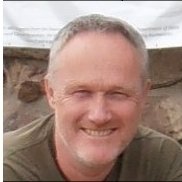 Cor M.J. Jacobs合作论文数Earth System Science and Climate Change Group, Wageningen UR10
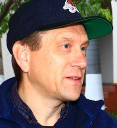 Oscar K. Hartogensis合作论文数Meteorol & Air Qual Grp, Wageningen Univ10
 L.W.A. Van Hove合作论文数Department of Meteorology and Air Quality, Wageningen University & Research;Department Water Systems and Global Change, Wageningen University & Research7Albert A. M. Holtslag合作论文数6Menno A. Veerman合作论文数Meteorol & Air Qual Grp, Wageningen Univ & Res6
 Jordi Vilà-Guerau De Arellano合作论文数Meteorology and Air Quality Group, Wageningen University and Research6
 Eddy Moors合作论文数Vrije Universiteit Amsterdam;IHE Delft Institute for Water Education6Raquel González Armas合作论文数5
 Joost Nieveen合作论文数5Elbers Jan A.合作论文数5Marc Muselli合作论文数Physic Department, Università di Corsica Pasquale Paoli5h a r debruin合作论文数4Daniel Beysens合作论文数4Arjan Droste合作论文数4Willy C. A. M. Hillen合作论文数4
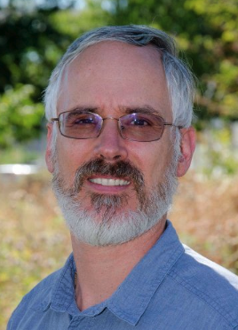 Valéry Masson合作论文数Centre National de Recherches Meteorologiques, Meteo France4
 Sanda Lenzholzer合作论文数Wageningen University4steven ate koopmans合作论文数3bert van hove合作论文数3Kim A. P. Faassen合作论文数3Ingrid T. Luijkx合作论文数3
 Mary Rose Mangan合作论文数3bart j h van stratum合作论文数Meteorol & Air Qual Grp, Wageningen Univ3
 Imme Benedict合作论文数Meteorol & Air Qual Sect, Wageningen Univ3
 Chao Ren (任超)合作论文数Division of Landscape Architecture, Faculty of Architecture, The University of Hong Kong3
 Remko Uijlenhoet合作论文数Department of Water Management, Faculty of Civil Engineering and Geosciences, Delft University of Technology3
 Stephanie Fiedler合作论文数Institute of Geophysics and Meteorology, University of Cologne3
 Allema A B合作论文数Farming Systems Ecology Group, Wageningen University3
 Wopke Van Der Werf合作论文数Centre for Crop Systems Analysis, Wageningen University & Research3
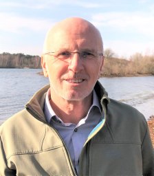 Rossing Walter合作论文数Biological Farming Systems, Wageningen University3
 Krijn Paaijmans合作论文数Meteorology and Air Quality Group, Wageningen University3
 Michiel K. Van der Molen合作论文数3A. F. G. Jacobs合作论文数3Wouter H. Knap合作论文数Royal Netherlands Meteorological Institute3Fred C. Bosveld合作论文数Royal Netherlands Meteorological Institute3
 Joop C. Van Lenteren (Joop Van Lenteren)合作论文数Department of Entomology, Wageningen University & Research3
 Tibor Bukovinszky合作论文数Laboratory of Entomology, Wageningen University3
 Sue Grimmond合作论文数Department of Meteorology, School of Mathematical & Physical Sciences, University of Reading3hove van b合作论文数2patrick parrish合作论文数2Mirjam Tijhuis合作论文数2Veronique Bouchet合作论文数2
 Stelios Kazadzis合作论文数2




