In underwater acoustic sensor networks (UASNs), energy awareness, best path selection, reliability, and scalability are among the key factors that decide information delivery to the sea surface. Existing protocols usually do not combine such performance-affecting factors in information routing. As a result, the performance of such protocols usually deteriorates if multiple performance factors are taken into account. To cope with such performance deterioration, this article proposes two routing protocols for UASNs: energy and path-aware reliable routing (EPRR) and cooperative EPRR (Co-EPRR). Compared with the counterpart systems, the proposed protocols have been designed to deal with the problem of long propagation delays and achieve network reliability. The EPRR scheme uses nodes’ physical distance from the surface with its depth, which minimized the delay of packet transmission. The channel interaction time has been reduced, therefore, reducing unwanted channel effects on the data. Furthermore, the density of the nodes in the upper part of the network prevents data loss and limits the rapid death of the nodes. The second proposed scheme, Co-EPRR, uses the concept of routing information from the source to the destination on multiple paths. In Co-EPRR routing, the destination node can receive more than one copy of the data packet. This reduces unfavorable channel effects during data delivery. Both the schemes show good performance in terms of packet delivery ratio, received packet analysis, and end-to-end delay.
In this paper we address the merging problem for Autonomous Vehicles (AVs) in presence of moving obstacles. The AV is required to follow a given desired path with a nominal (path-dependent) velocity profile, while keeping a desired safe distance with respect to moving obstacles. By using a new set of coordinates and a Virtual Target Vehicle (VTV) perspective, we propose a trajectory generation strategy to compute the (local) optimal collision-free trajectory that best approximates the desired one. In the proposed strategy, we exploit the extra degree of freedom of the VTV in order to generate a time parametrized reference, which helps to find the right space-time gap to perform a safe merging maneuver. We show the efficacy of the proposed strategy through a set of numerical computations and highlighting the main features of the generated trajectories.
This paper presents a synthesis of techniques enabling vision-based autonomous Unmanned Aerial Vehicle (UAV) systems. A full stack of computer vision processing modules are used to exploit visual information to simultaneously perceive obstacles and refine localization in a GPS-denied environment. An omni-directional stereo-vision based setup is used to build a 3D representation of the surroundings. A fully 3D local obstacle grid, maintained through multiple frames and updated accordingly to the UAV movement, is built accumulating multiple observations coming from the 360 stereo vision sensing suite. Visual data is also used to extract information regarding the drone attitude and position while exploring the environment. Sparse optical flow collected from both front and down facing stereo cameras is used to estimate UAV movement through multiple frames. The down-looking stereo pair is also used to estimate the drone height from the ground and to refine the pose estimation in a Simultaneous Localization and Mapping (SLAM) fashion. An improved A* planning algorithm exploits both the 3D representation of the surroundings and precise localization information in order to find the shortest path and reach the goal through a three dimensional safe trajectory.
The 2WIDE_SENSE (WIDE spectral band & WIDE dynamics multifunctional imaging SENSor Enabling safer car transportation) EU funded project is aimed at the development of a low-cost camera sensor for automotive applications able to acquire the full visible to Short Wave InfraRed (SWIR) spectrum, from 400 to 1700 nm.This paper presents the results obtained using this extended spectral responsivity sensor for a Road Status Monitoring application to inspect the vehicle's frontal area and detect layers of ice or water on the road surface.
The 2WIDE SENSE (WIDE spectral band & WIDE dynamics multifunctional imaging SENSor Enabling safer car transportation) EU funded project is aimed at the development of a low-cost camera sensor for Advanced Driver Assistance Systems (ADAS) applications able to acquire the full visible to Short Wave InfraRed (SWIR) spectrum from 400 to 1700 nm. This paper presents the first results obtained by investigating the SWIR contribution to pedestrian detection in difficult visibility conditions as haze and fog employing the wide-bandwidth camera developed within the project.
To extend the functionalities of Advanced Driver Assistance Systems (ADAS) and have a more accurate control on the parameters of sensors mounted on an intelligent vehicle, a tool that can classify the scenarios which the vehicle moves in, is needed.This article presents a comparison of three classification techniques (PCA, ANN and SVM) to obtain a fast and robust scene classifier based only on images. The systems presented in this paper have been trained on three different categories of traffic scenarios: urban, highway, and rural, on a total of more than 23 hours of driving in different countries.
In recent years the interest in autonomous vehicles has incrementally increased. After the DARPA Challenges new fields of application as agricultural, construction, mining, and also nautical are continuously opening up. In this paper a huge test is presented, the first of this kind in the history of vehicular robotics. A trip from Italy to China with four electric autonomous vehicles will be described focusing on all aspects of the challenge, from the managing issues to the most technical ones. A vehicle-following application (or virtual towing) is the system under test for a three consecutive months and 13,000 km long unique experience.
In developing a vision system for a vehicle, different setup constraints and issues must be considered.Space, wiring, or lighting are also typical issues to be also faced in industrial scenarios; nevertheless, when a vision system has to be deployed inside a vehicle they have to be more carefully studied and often drive the hardware selection.Moreover, cameras are to be installed on moving vehicles and this led to additional problems to be faced. In fact, camera movements, oscillations and vibrations, or different and even extreme illumination conditions have to be taken in account when developing machine vision software.
This article presents the VisLab solution for obstacle detection and navigation support for unmanned vehicles in industrial environments. Although the literature contains many examples to tackle this problem, this solution can be considered innovative as it improves traditional laser-based systems. The proposed system is composed by two sub-systems. The first one is an obstacle detection system, which also allows the detection of hanging obstacles, within a 3D monitored area. This solution outperforms the original laser scanner based system used for safety which was limited to bi-dimensional areas only. Another vision system is used for tracking a guideline on the ground, that solves problems of localizations and drifts that sometimes can happen using the laser and vehicle odometry only. After a long testing phase, the system is actually installed in a modern industrial warehouse in Parma in order to finally estimate its robustness and reliability.
This paper presents the preliminary results of VIAC, the VisLab Intercontinental Autonomous Challenge, a test of autonomous driving along an unknown route from Italy to China. It took 3 months to run the entire test; all data have been logged, including all data generated by the sensors, vehicle data, and GPS info. This huge amount of information has been packed during the trip, compressed, and transferred back to Parma for further processing. This data is now ready for a deep analysis of the various systems performance, with the aim of virtually running the whole trip multiple times with improved versions of the software. This paper discusses some preliminary figures obtained by the analysis of the data collected during the test. More information will be generated by a deeper analysis, which will take additional time, being the data about 40 terabyte in size.
This paper presents two different modules for the validation of human shape presence in far-infrared images. These modules are part of a more complex system aimed at the detection of pedestrians by means of the simultaneous use of two stereo vision systems in both far-infrared and daylight domains. The first module detects the presence of a human shape in a list of areas of attention using active contours to detect the object shape and evaluating the results by means of a neural network. The second validation subsystem directly exploits a neural network for each area of attention in the far-infrared images and produces a list of votes.
This document presents a new exciting effort in the intelligent vehicles arena which is going to set a new milestone in the history of vehicular robotics. Autonomous vehicles have been demonstrated able to reach the end of a 220 miles off-road trail (in the DARPA Grand Challenge), to negotiate traffic and obey traffic rules (in the DARPA Urban Challenge), but no one ever tested their capabilities on a long, intercontinental trip and stressed these systems for 3 months in a row. This paper presents the VisLab Intercontinental Autonomous Challenge that VisLab organized in 2010, during which 4 autonomous vehicles are driving from Italy to China with no human intervention. The challenge is taking place from July 26, 2010 to Oct 28, 2010, therefore being currently under execution, this paper can only describe the preparation and the technical details of the vehicles and the main challenges.
This chapter presents a tetravision (4-camera) system for the detection of pedestrians by means of the simultaneous Use Of two far infrared and visible camera stereo pairs. The main idea is to exploit the advantages of both far infrared and visible cameras to develop a system that combines the advantages of using far infrared or daylight technologies. Different approaches are used to process the two stereo flows in an independent fashion to produce a list of areas of attention that potentially contain pedestrians. Then, four different following approaches are used to refine and filter this list and to validate the presence of a pedestrian. Preliminary results show that the combined use of two vision systems as well as the use of different and independent validation steps enable the system to effectively detect pedestrians in different conditions of illumination and background.
This paper presents a system whose aim is to detect and classify road obstacles, like pedestrians and vehicles, by fusing data coming from different sensors: a camera, a radar, and an inertial sensor. The camera is mainly used to refine the vehiclespsila boundaries detected by the radar and to discard those who might be false positives; at the same time, a symmetry based pedestrian detection algorithm is executed, and its results are merged with a set of regions of interest, provided by a Motion Stereo technique.
This article presents a shape extraction and results of a preliminary validation stage for a pedestrian detection system based on the use of active contours. The complete system is based on the use of both far infrared and visible cameras to detect areas that potentially contain pedestrians; in order to validate and filter such result a refinement of the human shape by means of active contours is performed followed by a neural network based filtering.
This paper presents and discusses the results obtained by the GOLD (Generic Obstacle and Lane Detection) system as an automatic driver of ARGO. ARGO is a Lancia Thema passenger car equipped with a computer vision system that allows to extract road and environmental information from the acquired scene; it has been demonstrated to drive autonomously on a number of different road and environmental conditions. 1 The ARGO Autonomous Vehicle ARGO is the experimental autonomous vehicle developed at the Dipartimento di Ingegneria dell’Informazione of the University of Parma, Italy. It integrates the main results of the research conducted over the last few years on the algorithms and the architectures for vision-based automatic road vehicles guidance. ARGO, a Lancia Thema 2000 passenger car (figure 1), is equipped with a vision system that allows to extract road and environmental information from the acquired scene and to drive autonomously under different road conditions.
This article presents a tetra-vision (4 cameras) system for the detection of pedestrians by the means of the simultaneous use of one far infra-red and one visible cameras stereo pairs. The main idea is to exploit both the advantages of far infra-red and visible cameras trying at the same time to benefit from the use of each system. Initially, the two stereo flows are independently processed, then the results are fused together. The final result of this low-level processing is a list of obstacles that have a shape and a size compatible with the presence of a potential pedestrian. In addition, the system is able to remove the background from the detected obstacles to simplify a possible further high level processing. The developed system has been installed on an experimental vehicle and preliminarily tested in different situations
This paper presents a stereo vision system for the detection and distance computation of a preceding vehicle. It is divided in two major steps. Initially, a stereo vision-based algorithm is used to extract relevant three-dimensional (3-D) features in the scene, these features are investigated further in order to select the ones that belong to vertical objects only and not to the road or background. These 3-D vertical features are then used as a starting point for preceding vehicle detection; by using a symmetry operator, a match against a simplified model of a rear vehicle's shape is performed using a monocular vision-based approach that allows the identification of a preceding vehicle. In addition, using the 3-D information previously extracted, an accurate distance computation is performed.
This paper presents a robust method for obstacle detection with stereo cameras. Arbitrarily aligned cameras are calibrated using a dense grid; a direct mapping between image pixels and world points is made to remove lens distortion and perspective in the same pass. Cubic splines are used to recover unknown points not present in the grid. After the transformation phase, left and right images are compared and the differences are analyzed using a polar histogram to detect vertical structures and to reject noise and small objects. World coordinates of detected objects are recovered and fed to the sub-system for further processing and to take appropriate actions. According to experimental results, the proposed algorithm can be useful in different automotive applications, requiring realtime segmentation without any assumption on background. In particular the system has been tested to investigate presence of obstacles in blind spot areas around heavy goods vehicles (HGV). The system presented in this paper is currently installed in a Volvo truck
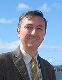 Alberto Broggi合作论文数Dipartimento di Ingegneria dell'Informazione, Universita di Parma;VisLab srl39
 Alessandra Fascioli合作论文数Dipartimento di Ingegneria dell'Informazione, Universita` degli Studi di Parma24
 Rean Isabella Fedriga合作论文数Dip. di Ingegneria dell'Informazione,Universita degli Studi di Parma6
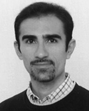 Paolo Grisleri合作论文数Artificial Vision and Intelligent Systems Laboratory, Università di Parma6
 Mirko Felisa合作论文数VisLab, Università di Parma6
 Abdelaziz Bensrhair合作论文数Laboratory of Computer Science, Information Processing, and Systems, Institut National des Sciences Appliquées de Rouen5
 Gianni Conte合作论文数Universita` degli Studi di Parma;Dipartimento di Ingegneria dell'Informazione5
 Pietro Cerri合作论文数Dipartimento di Ingegneria dell'Informazione,University of Parma5
 Paolo Medici合作论文数Information Engineering Department,VISLAB5
 Stefano Ghidoni合作论文数Department of Computer Engineering, University of Padova4S Mousset合作论文数3
 Toulminet, G.合作论文数3
 Pier Paolo Porta合作论文数3
 Paolo Zani合作论文数Dipartimento di Ingegneria,Informazione Universita degli Studi di Parma3
 Luca Bombini合作论文数VisLab spinoff company3
 Alessandro Coati合作论文数VisLab–Dip. di Ingegneria dell’Informazione,Universita degli Studi di Parma3Michael S. Del Rose合作论文数2Marco Panella合作论文数2
 Elena Cardarelli合作论文数Camlin Group2
 Stefano Cattani合作论文数Zoox2
 Monica Reggiani合作论文数Department of Management and Engineering, University of Padua2
 Stefano Debattisti合作论文数Dipartimento di Ingegneria dell'Informazione,Università degli Studi di Parma2
 Alessandro Tibaldi合作论文数Department of Earth and Environmental Sciences, University of Milan-Bicocca2M. Del Rose合作论文数2
 Thorsten Graf合作论文数2
 Paolo Lombardi合作论文数2
 Luca Mazzei合作论文数Department of Chemical Engineering, Faculty of Engineering Sciences, University College London2P. P. Porta合作论文数1j l reverchon合作论文数1Domenico Giaquinto合作论文数1
 Silvia Cattani合作论文数1M Meinecke合作论文数1
 Ubaid Ullah合作论文数1Francesco Laneve合作论文数1
 Luigi Musto合作论文数University of Parma1
 Munsif Ali合作论文数1
 Salman Iqbal合作论文数Department of Computer System & Technology, Faculty of Computer Science and Information Technology, University of Malaya, Kuala Lumpur, KL, Malaysia1Andrea Zinelli合作论文数University of Parma1Francesco Valenti合作论文数Dipartimento Ingn Informaz, VisLab Srl1
 Altowaijri, S.合作论文数1Sechi, M.合作论文数1Nichele, S.合作论文数1Lasagni, A.合作论文数1Lefee, D.合作论文数1Andreone, L.合作论文数1
 Nicola Bernini合作论文数Dipt. di Ing. dell'Inf., Univ. of Parma;c;Dipt. di Ing. dell'Inf., Univ. of Parma1
 Gianfabio Pimentel Franco合作论文数Universidade Federal de São Paulo1
 Agostino Poggi合作论文数Dipartimento di Ingegneria dell'Informazione, Università degli Studi di Parma1
 Marco Porta合作论文数Università di Pavia1




