In current conventional precise point positioning (PPP) processing strategies, the tropospheric zenith wet delay (ZWD) is usually dynamically estimated as a stochastic parameter. During the convergence period, ZWD estimates can appear to be negative or unrealistically large due to the low estimation precision, which adversely affects the estimation of other state parameters, especially the Up component of coordinates. To address this issue, we propose a method that incorporates physical constraints on ZWD in PPP processing. This method employs the inequality constrained least squares (ICLS), utilizing Karush–Kuhn–Tucker (KKT) conditions to add boundary conditions on ZWD. The boundary conditions of ZWD are calculated based on the relation between ZWD and relative humidity (RH). The use of physical constraints does not rely on external products or space state representation (SSR) corrections for ZWD during PPP processing and can improve the short-term accuracy of ZWD and coordinate Up component. The efficiency of this approach has been validated using GNSS data and products from GFZ operational networks. For real-time PPP solutions, there is a 30% improvement in short-term accuracy of Up component; for post-processing solutions, the short-term RMSE improvement is about 20% . After convergence, the ZWD upper bound is no longer applied as an ICLS constraint, but is instead used as a diagnostic indicator to identify ZWD anomalies. This indicator demonstrates high sensitivity and reliability under extreme weather conditions, highlighting its potential for application in meteorological hazard early-warning systems.
Abstract Real-time GNSS precise point positioning (PPP) is an essential tool for numerous applications in the Earth sciences, navigation, surveying, as well as in early warning systems for geo-hazards. It requires precise information about satellite orbits and clock offsets that have to be distributed to the user as correction streams with a delay of only a few seconds. While satellite orbits can be predicted with high precision for a few hours, satellite clocks have to be estimated from observation data in real-time. In this contribution, we introduce the new GFZ in-house real-time GNSS network analysis software. GPS, GLONASS, and Galileo satellite clocks are determined every 5 s with a recursive least-squares estimator, making use of a sequential scalar implementation of the Kalman filter. For the detection of cycle slips, the computationally efficient concept of single-receiver, single-channel integrity is applied. The generated products are evaluated by means of a comparison to the post-processed CODE rapid solutions and with real-time PPP examples. The new GFZ corrections streams are available through the Real-Time Service (RTS) of the International GNSS Service (IGS).
This paper presents a theoretical study on ionospheric reconstruction using GNSS data obtained from Low Earth Orbit (LEO) satellites in a PNT (Position, Navigation, and Timing) configuration, where the LEO satellites not only receive but also transmit GNSS signals, which can be tracked by ground or mobile receivers. The study is intended to pave the way for incorporating slant Total Electron Content (TEC) data from ESA's upcoming LEO-PNT into ionospheric reconstructions. We generate synthetic slant TEC for three observation scenarios: Ground-GNSS, ground-LEO, and LEO-GNSS links. As ground-truth, the IRI-20 model with the Ozhogin plasmasphere extension is used. An inversion to recover the electron density from slant TEC observations is performed using an Extended Kalman Filter (EKF) in the information-filter formulation for all possible combinations of observation scenarios. As the LEO constellation, we will utilize existing LEO satellites that were available in May 2020, including Swarm, COSMIC-2, GRACE-FO, Jason-3, Sentinel-1, Sentinel-2, and Sentinel-3, as well as several Spire satellites. They cover a variety of altitudes between 400 km and 1350 km. For this study, we assume they could transmit dual-frequency GNSS-like signals like a PNT mission, which is not the case for any of the satellites mentioned. We only consider relative slant TEC to be insensitive to calibration biases that may reach a few TEC units. Given a real global ground-station network, LEO and GNSS satellites, we show that 15-min reconstruction solutions, only containing ground stations, cannot compete with solutions including LEO satellites. Furthermore, our results show that the joint use of LEO-POD (Precise Orbit Determination Antenna) and LEO-PNT (RMSE at 500 km: 0 95 10 4 cm 3) provides superior performance compared to configurations where either is substituted by ground-based GNSS (ground-GNSS and PNT: 4 03 10 4 cm 3; Gound-GNSS and POD 1 18 10 4 cm 3). We also show that the reconstruction error roughly doubles when radio occultation measurements are omitted. The dependency of the error on the distribution of the ground stations is also shown. Areas with only a few or no ground stations show the lowest correlation between IRI-20 and the reconstructions, e.g., near Point Nemo, where the correlation drops to 0.5. (c) 2026 The Author(s). Published by Elsevier B.V. on behalf of COSPAR. This is an open access article under the CC BY license (http:// creativecommons.org/licenses/by/4.0/).
Global navigation satellite systems (GNSS) are used for various applications in the Earth and atmospheric sciences, navigation, surveying and mapping, as well as in early warning systems for geo-hazards. Solutions are often required to not only be of high accuracy, integrity, and continuity, but also to be available in real-time with a delay of only a few seconds. A prerequisite for real-time precise point positioning (PPP) are precise satellite orbit and clock products. While satellite orbits can be predicted with high precision, at least for a few hours, the satellite clocks have to be estimated using real-time GNSS data from a global network of reference stations and distributed via real-time data streams to the user. GFZ is operating a real-time GNSS analysis center, which is contributing to the Real-Time Service (RTS) of the International GNSS Service (IGS). In this contribution, we introduce the new GFZ in-house real-time GNSS network analysis software that is currently being developed and provide an initial assessment of the generated products.In the first development stage that is presented in this contribution, the generated products contain satellite orbits and satellite clocks referring to the ionosphere-free code observations. The orbits are taken from the predicted part of the operational GFZ IGS ultra-rapid GPS, GLONASS, and Galileo solution, which are updated every three hours. The associated satellite clocks are estimated every five seconds using a recursive least-squares estimator from globally recorded real-time dual-frequency code and phase observations, together with receiver clock parameters, tropospheric zenith delay parameters, inter-system biases, and carrier-phase ambiguities.Important aspects are the data cleaning to obtain high-quality results and an efficient implementation of the estimation filter to satisfy the delay requirements of the products – less than five seconds for the IGS. For the data cleaning and cycle-slip detection, the concept of single-receiver, single-channel integrity is used, in which the uniformly most powerful invariant test statistics are evaluated separately for each satellite-receiver link using its code and phase observations of two consecutive epochs. For the estimation filter, a sequential Kalman filter implementation using the standard covariance form is used. ‘Sequential’ refers to the strategy that the scalar observations of the same epoch are processed sequentially one at a time, leading to a more efficient operation of the filter compared to the case that the entire vector of measurements is processed at once. With this strategy, the processing time per epoch is around two seconds.An initial evaluation of this real-time satellite orbit and clock product will be presented by means of a direct comparison to post-processed multi-GNSS reference products and a comparison of PPP analyses using in addition also broadcast navigation data and real-time products of other analysis centers.
Abstract:Machine Learning (ML) is emerging as a powerful tool for data analysis. Anomaly detection based on classical approaches is sometimes limited in processing speed on big data, especially for massive datasets. Meanwhile, quantum algorithms have been shown to have the potential for optimization, scenario simulation, and artificial intelligence. Thus, this study combines quantum algorithms and ML to improve the binary classification performance of ML models for better sensitivity of surface deformation detection. We experimented with GNSS-InSAR combination data to identify significant deformation regions in Northern Germany. We classify the movement characteristics based on four main features: vertical movement velocities, root mean square errors, standard deviations, and outliers in the GNSS-InSAR time series. Our primary results reveal that the classification accuracy based on Quantum Machine Learning (QML) is outstanding compared to the pure ML technique. Specifically, on the same sample dataset, the classification performance of the neural network based on pure ML is only around 50 to 70%, while that of the QML technique can reach ~90%. The significant deformation regions are concentrated in the river basins of Elbe, Weser, Ems, and Rhine, where the average surface subsidence speed varies around -4.5 mm/yr. Also, we suggest dividing the surface movement features in Northern Germany into five classes to reduce the effect of the data quality variety and algorithm uncertainty. Our findings will advocate the development of quantum computing applications as well as promote the potential of the QML for deformation analyses. Keywords: Quantum Machine Learning, Binary Classification, GNSS-InSAR Data, Deformation Detection.
The International GNSS Service (IGS) requires advanced multi-GNSS orbit combination strategies to replace current GPS/GLONASS-focused operations with consistent products covering GPS, GLONASS, Galileo, and BDS. We developed an enhanced orbit combination methodology using a modified Förstner Variance Component Estimation (VCE) scheme that optimizes weighting strategies through data clustering approaches, including individual satellite weighting, satellite-type grouping, and machine-learning-generated clusters. Our novel approach incorporates a priori knowledge from Satellite Laser Ranging (SLR) orbit validations and sequential weight information from previous combinations to refine Analysis Center (AC) weights. Sequential weight estimation significantly reduces day boundary orbit misclosures and stabilizes temporal AC weight variability. The combined solutions demonstrate exceptional inter-consistency with RMS values below 3–5 mm for GPS and Galileo, while GLONASS and BDS show higher variability (10–15 mm), highlighting the importance of satellite grouping strategies. Intermediate grouping approaches based on IGS metadata or hierarchical clustering provide optimal balance between constellation-level oversimplification and satellite-specific day-to-day variability. SLR-based knowledge incorporation offers targeted improvements, particularly for challenging high and low β angle conditions, demonstrating the effectiveness of external validation in multi-GNSS orbit combination.
Combined precise satellite orbits and clocks stand as core contributions from the International GNSS Service (IGS), integrating the individual inputs of various Analysis Centers (AC). The availability and quality of multi-GNSS products developed by ACs within the IGS multi-GNSS Pilot Project propel IGS towards replacing combined GPS and GLONASS products with homogeneous combined products encompassing all GPS, GLONASS, Galileo, BeiDou, and QZSS systems. A primary challenge faced by the IGS lies in refining the combination algorithm for multi-GNSS orbits and clocks to provide users with the utmost quality products. This study delves into concepts aimed at enhancing the orbit combination algorithm, with a specific focus on adjusting the weighting scheme and detecting outlier observations. The core of the combination methodology adheres to the concept proposed by GFZ, employing a least-squares framework wherein weights used for combining AC orbits are determined through least-squares variance component estimation (VCE). Four distinct weighting strategies are introduced and compared in this study. These strategies involve utilizing either the constellation, satellite type, satellite type on the same orbital plane, or each satellite individually to form datasets used in determining weights for each AC. Furthermore, a novel approach is developed to correct the weights for individual ACs based on the results of Satellite Laser Ranging orbit validation. This serves as an additional factor in the combination, mitigating the impact of systematic AC-dependent orbit mismodeling issues. All proposed strategies underwent testing using multi-GNSS orbit solutions over a 10-month period in 2023. Firstly, the combination results show an agreement between the different AC’s input orbits around 15, 20, 30, 50, and 100 mm for GPS, GLONASS, Galileo, BeiDou, and QZSS, respectively. Regarding the AC weighting strategy, the constellation-specific weighting approach provides the most robust solution and allows for handling differences between AC-specific issues in the orbit modeling of individual constellations. The satellite-specific weighting approach offers better resilience against the adverse effects caused by the inhomogeneous quality of satellite blocks/types/generations within a constellation, especially for BeiDou. However, the satellite-specific weighting encounters problems related to the appearance of invalid negative variances/weights for individual satellites as the output of VCE, mainly for BDS-3 and QZSS. The negative variance component can be an important indication of defects in our variance component model. Grouping satellites of similar characteristics in a satellite-type-specific weighting approach increases redundancy and reduces the issue but not entirely. Ultimately, we demonstrate potential solutions to address this issue. This involves simplifying the iterated VCE or resorting to the legacy inverse mean square differences between the mean orbit and the AC’s orbits as weights, particularly in cases where the classic VCE proves ineffective.
Among the core products of the International GNSS Service (IGS) are precise satellite orbits and clocks, which are generated by the Analysis Center Coordinator (ACC) as a combination of the solutions provided by different Analysis Centers (AC). A strategic goal of the IGS is to facilitate multi-GNSS solutions, implying that the currently operational system-wise GPS and GLONASS combinations should be replaced by a consistent set of multi-GNSS products, eventually containing at least GPS, GLONASS, Galileo, BeiDou, and QZSS. Over the past years, the Satellite Precise Orbit and Clock Combination (SPOCC) software tool has been developed at GFZ. It provides a fully consistent multi-GNSS orbit and clock combination that covers all available and possible future constellations and is based on a well-defined unified least-squares framework. The resulting combined orbit and clock products are a weighted average of the individual AC solutions with weights determined through least-squares variance component estimation (VCE). A main objective is to support multi-GNSS precise point positioning (PPP) users. We will introduce the combination workflow, which essentially consists of alignments harmonizing the AC products followed by the VCE and the weighted averaging, and is complemented by quality checks such as outlier detection. For the orbit combination, the alignment consists of Helmert transformations applied to the AC orbits, which is iterated with the VCE-based weighted averaging until convergence. The clock alignments consist of a radial correction from the orbit differences between the AC solutions, a removal of the impact of different reference clocks in the AC solutions, as well as an adjustment of all non-GPS satellite clocks for different inter-system bias (ISB) references at the ACs. The combination can be configured for different weighting schemes, including AC specific weights, AC+constellation specific weights, up to satellite type or even satellite specific weights, and the Helmert transformations can be based on different sets of satellite orbits. The SPOCC software has been extensively tested with the operational IGS products, the IGS Multi-GNSS Experiment (MGEX) products, and the IGS repro3 products. Performance evaluations by means of a comparison of the combination with the input products and the official IGS combination, through a satellite laser ranging (SLR) validation, and with PPP results will be used to show that the software achieves reliable results that are suitable for the users’ high precision GNSS applications. SPOCC is implemented in Python and will be provided as open source software.
Satellites with dual-frequency Global Navigation Satellite Systems (GNSS) receivers can measure integrated electron density, known as slant Total Electron Content (sTEC), between the receiver and transmitter. Precise relative variations of sTEC are achievable using phase measurements on L1 and L2 frequencies, yielding an accuracy of around 0.1 TECU or better. However, CubeSats like Spire LEMUR, with simpler setups (e.g., patch antennas) and code noise in the order of several meters, face limitations in accuracy. Their precision, determined by phase observations, remains in the 0.1–0.3 TECU range. With a substantial number of observations and comprehensive coverage of lines of sight between Low Earth Orbit (LEO) and GNSS satellites, global electron density can be reconstructed from sTEC measurements. Utilizing 27 satellites from various missions, including Swarm, Gravity Recovery And Climate Experiment Follow-On, Jason-3, Sentinel 1/2/3, COSMIC-2, and Spire CubeSats, a cubic B-spline expansion in magnetic latitude, magnetic local time, and altitude is employed to model the logarithmic electron density. Hourly snapshots of the three-dimensional electron density are generated, adjusting the model parameters through non-linear least squares based on sTEC observations. Results demonstrate that including Spire significantly enhances estimates, showcasing exceptional agreement with in situ observations from Swarm and Defense Meteorological Satellite Program LEO satellites. The model outperforms contemporary climatological models, such as International Reference Ionosphere (IRI)-2020 and the neural network-based NET model. Validation efforts include comparisons with ground-based sTEC measurements, space-based vertical TEC from Jason-3 altimetry, and global TEC maps from the Center for Orbit Determination in Europe and the German Research Center for Geosciences (GFZ).
The International GNSS Service (IGS) provides combined satellite and station clock products, which are generated from the individual clock solutions produced by the analysis centers (ACs). Combinations for GPS and GLONASS are currently available, but there is still a lack of combined products for the new constellations such as Galileo, BeiDou, and QZSS. This study presents a combination framework based on least squares variance component estimation using the ACs’ aligned clock solutions. We present the various alignments required to harmonize the solutions from the ACs, namely the radial correction derived from the differences of the associated orbits, the alignment of the AC clocks to compensate for different reference clocks within each AC solution, and the inter-system bias (ISB) alignment to correct for different AC ISB definitions when multiple constellations are used. The combination scheme is tested with IGS MGEX and repro3 products. The RMS computed between the combined product and the aligned ACs’ solutions differ for each constellation, where the lowest values are obtained for Galileo and GPS with on average below 45 psec (13 mm) and reaching more than 150 psec (45 mm) for QZSS. The same behavior is repeated when the process is performed with the repro3 products. A clock and orbit combination validation is done using precise point positioning (PPP) that shows ionosphere-free phase residuals below 10 mm for all constellations, comparable with the AC solutions that are in the same level.
Ambiguity resolution enabled precise point positioning (PPP-RTK) immediately provides centimeter-level positioning information, once the carrier phase ambiguities are correctly resolved. With the ongoing GNSS development and modernization, a steadily growing number of satellites can be observed on multiple signal bands. The joint processing of multi-frequency multi-GNSS data leads to much stronger positioning models with shorter convergence times. However, we show that even when combining GPS, Galileo, BDS-2/3, and QZSS on up to five frequencies, instantaneous reliable ambiguity resolution is not feasible. Instead of fixing the ambiguities, we make use of the MSE-optimal best integer-equivariant estimator to investigate the limits of the positioning performance that can be achieved with the current constellations. A simulation-based analysis shows that instantaneous centimeter-level horizontal PPP-RTK results can indeed be expected when combining all four systems with three or more frequencies. Real-data experiments are used to confirm these findings. For an exemplary day, empirical instantaneous horizontal RMS positioning errors of 7–8 mm are observed when combining four systems and three or five frequencies.
Ambiguity resolution enabled precise point positioning (PPP-RTK) can provide fast, potentially even instantaneous, centimeter-level positioning results, given that the phase ambiguities are correctly resolved. A main problem for fast and reliable ambiguity resolution are the ionospheric delays in the user’s global navigation satellite systems (GNSS) observations. Without external ionospheric corrections, a time-to-first-fix the ambiguities of around 30 min is often reported for GPS-only solutions. Faster solutions are possible when ionospheric corrections are provided, but these have to be at the level of at most a few centimeters for a clear gain in terms of the convergence time. Such a precision is currently not possible with global ionospheric models but requires corrections from nearby reference stations, which limits the field of applications. In this contribution we investigate the capabilities of centimeter-level PPP-RTK without any a-priori ionospheric information. The key aspects are 1) the MSE-optimal best integer-equivariant estimator, which does not ‘fix’ the ambiguities to integers but rather weights different candidates, 2) a multi-GNSS solution using GPS, Galileo, BDS, and QZSS, and 3) a proper weighting of the satellite clock and bias corrections in order to obtain realistic observation models. Simulations are used to show that in an area with good visibility of BDS and QZSS, one can expect centimeter-level results with on average just slightly more than two observation epochs already with corrections from only a single reference station. We confirm this result with real GNSS data and show that centimeter-level horizontal positioning errors are reached within one and two epochs in 87.6% and 99.7% of the cases during an exemplary day, thereby demonstrating that almost-instantaneous PPP-RTK without atmospheric corrections is indeed possible with the current constellations.
<p>An ever-increasing fleet of low earth orbiting (LEO) satellites equipped with dual-frequency GNSS receivers can provide slant TEC observations of the topside ionosphere. If occultation measurements are included, the observed range is extended well below LEO altitude also covering the peak of the F2 layer. To reconstruct the topside electron density a large number of observations with good coverage across magnetic latitude and local time with a large variety of elevation angles are required.</p> <p>&#160;</p> <p>Apart from scientific missions like Swarm, GRACE-FO, Sentinel-1/2/3, Jason-3, and COSMIC-2 large fleets of LEO satellites operated by new-space companies like Spire Global help to increase the observation density. The Spire Lemur satellites are 3U cubesats, which carry dual-frequency GPS receivers and thus allow to compute slant TEC measurements.</p> <p>&#160;</p> <p>We will discuss the data quality of TEC measurements derived by both, the scientific and new-space cubesat satellite missions and include Spire GPS data into a three-dimensional ionospheric reconstruction together with GPS data from Swarm, GRACE-FO, Sentinel, Jason-3, and COSMIC-2. B-Splines are used to represent the electron density in magnetic latitude, magnetic local time and altitude. Code biases are co-estimated. Since the scientific satellite missions, apart from the low inclination COSMIC-2 satellites, are in polar obits, special emphasis will be put on the improvements in observation geometry provided by the Spire Lemur satellites.</p>
Over the past years, the International GNSS Service (IGS) has been putting efforts into extending its service by setting up and running the Multi-GNSS experiment and pilot project (MGEX). Several MGEX analysis centers (ACs) contribute by providing solutions containing not only GPS and GLONASS but also Galileo, BeiDou, and QZSS. As the current IGS combination software can only handle the orbits of one constellation at a time, it requires substantial modifications to obtain a consistent MGEX orbit product. In this contribution, we present a least-squares framework for a Multi-GNSS orbit combination, where the weights used to combine the ACs’ orbits are determined by least-squares variance component estimation. We introduce and compare two weighting strategies, where either AC-specific weights or AC and constellation-specific weights are used. An automated Z-score test is implemented yielding a common set of core satellites that are used to determine the weights. Both strategies are tested using MGEX orbit solutions for a period of two and a half years. They yield similar results with an agreement with the ACs’ orbits at the one centimeter level for GPS and up to a few centimeters for the other constellations. The 3D-RMS is generally slightly better with the AC and constellation weighting. A comparison of our combination approach with the official IGS combination using three years of GPS and GLONASS orbits shows an agreement of better than 5 mm and 12 mm for GPS and GLONASS, respectively, while the agreement of the official IGS combination with the ACs’ GPS solutions is only around $$15\,\textrm{mm}$$ . An external validation using satellite laser ranging shows that the mean residuals of our combined products are around $$-3\,\textrm{mm}$$ for Galileo, $$6\,\textrm{mm}$$ for GLONASS, $$-8\,\textrm{mm}$$ for BeiDou, and $$-31\,\textrm{mm}$$ for QZSS.
The deviations of the microwave signal transmitting point of Global Navigation Satellite Systems (GNSS) satellites with respect to the corresponding center-of-mass were and still are significant bias sources for GNSS-based terrestrial reference frames (TRF). Satellite phase center offsets (PCOs) and variations (PVs) are usually derived from GNSS observations from the tracking network of the International GNSS Service (IGS). Because of the strong correlation between the scale of the TRF and the satellite PCOs in the z-direction (z-PCOs), a no-net-scale (NNT) condition relative to, for instance, the International Terrestrial Reference Frame (ITRF) is commonly applied. One approach for estimating transmitter phase centers without constraining the scale is to consider space-based GNSS observations. Within this study, we estimate the satellite PCOs of the Global Positioning System (GPS) based on zero-difference ionosphere free observations from six low Earth orbiters (LEOs) and ground networks with different numbers of stations. The six LEOs are different in their orbits, GPS receiver equipment, and tracking characteristics. We jointly estimate orbits, station coordinates, and GPS satellite PCOs in an integrated processing. The horizontal offsets are shown to significantly benefit from the LEOs onboard observations by reducing the correlation between these offsets and the GPS satellite orbit and attitude. Without applying a no-net-scale condition to the ground network, the GPS z-PCOs are estimated. By adding six LEOs, the correlation coefficients between the GPS z-PCOs and the scale is reduced significantly (about from 0.85 to 0.3), consequently, the precision of estimation is improved. When including the six LEOs, the GPS z-PCOs estimated without applying NNS are very stable. The estimated GPS z-PCOs have a-231 mm difference in average to the values in igs14_2134.atx and the corresponding scale to IGS14 reference frame is +1.89 part per billion. The estimated GPS z-PCOs agree with previous studies based on Swarm satellites and Galileo. The improvement due to different numbers of LEOs and the impact of LEO z-PCO errors on the estimation are discussed.(c) 2022 COSPAR. Published by Elsevier B.V. All rights reserved.
<p>Regional Total Electron Content (TEC) Maps proffer better mitigation effects in ionospheric models which are needed to resolve ionospheric TEC gradient errors associated with space-based technologies such as Global Navigation Satellite Systems (GNSS) and Space-Based Augmentation Systems (SBAS). EGNOS (European Geostationary Navigation Overlay System) is a European SBAS system that provides integrity, accuracy, continuity and availability to critical GNSS applications like aviation and others over ECAC (European Civil Aviation Conference) area. The EGNOS Ionospheric model is built with the concept of the ordinary Planar fit technique. This paper focuses on modified Planar fit, ordinary Kriging and modified Kriging techniques to validate the EGNOS algorithm during different geophysical (geomagnetically quiet and disturbed) conditions. The structure of EGNOS was strictly adhered to during the study and only publicly available GNSS ground-based stations over the ECAC area are engaged in the study. The preliminary results obtained show that adapting modified Planar fit and Kriging techniques could improve the EGNOS services over the ECAC area, most especially the northern part near the high latitudes and the southern part near the low latitude regions.</p>
The deviations of phase center offsets (PCOs) of GPS satellites were and still are significant bias sources for GPS-based terrestrial reference frames (TRF). Because of the strong correlation between the scale of the TRF and the satellite PCOs in the z-direction (z-PCOs), a no-net-scale (NNT) condition relative to, for instance, the International Terrestrial Reference Frame (ITRF) is commonly applied. Based on the released Galileo metadata, the GPS z-PCOs have been calibrated without introducing a scale determined by other techniques in the third re-processing of the International GNSS Service (IGS). Another approach purely based on GNSS is by integrating low Earth orbiters (LEOs) into the estimation of the GPS z-PCOs and the realization of the scale. Within this study, we estimated the GPS z-PCOs based on zero-difference ionosphere-free observations from six low LEOs and ground networks with different numbers of stations in 2019 and 2020. Besides the study based on six LEOs in two years, a twelve-year-based estimation of GPS z-PCOs and scale realization is done by using the two satellites of the GRACE mission. We jointly estimate orbits (GPS and LEOs), station coordinates, z-PCOs of GPS satellites, and some other parameters in an integrated processing. The NNT condition on the ground network is not applied in the processing. By adding six LEOs, the correlation coefficients between the GPS z-PCOs and the scale is reduced significantly (from about 0.85 to 0.30). It means that the GPS z-PCOs and the scale have been decorrelated efficiently, and consequently the precision of the estimation is improved. For GPS satellites operated in 2019 and 2020, excluding GPS III, their estimated z-PCOs have an average difference of -231 mm compared to the values in igs14_2134.atx and the corresponding scale to the IGS14 reference frame is +1.89 part per billion. These results agree well with the solutions based on the metadata of Galileo. The improvement due to different numbers of LEOs and the impact of LEO z-PCO errors on the estimation is studied, where more LEOs decorrelate the GPS z-PCOs and the scale more efficiently. The accuracy of the LEO z-PCOs is critical to the solution. A one-millimeter accuracy of the z-PCOs of the LEOs is required to achieve a one-millimeter scale on the surface of the Earth. Thanks to the long-term available data of LEO missions in the last decade and even longer, the LEO-based method has an advantage on the real-data-based estimation of PCOs of former GPS satellites over the Galileo-based method. The z-PCOs of satellites of GPS blocks IIA, IIR, IIRM, and IIF are estimated by integrating the two GRACE satellites from 2004 to 2015. A twelve-year scale relative to the ITRF is realized simultaneously. The performance of the LEO-based method is shown by the long-time series.
Ambiguity resolution enabled precise point positioning (PPP-AR or PPP-RTK) without atmospheric corrections requires the user to estimate tropospheric and ionospheric delay parameters. The presence of the unconstrained ionosphere parameters impedes fast and reliable ambiguity resolution, so a time-to-first-fix of around 30 min for GPS-only solutions is generally reported, which can, to some extent, be reduced when combining multiple GNSS. In this contribution, we investigate the capabilities of almost instantaneous PPP-RTK, using only a few observation epochs at a sampling interval of 30 s, with the ionosphere-float model. The considered key elements are (a) the MSE-optimal best integer-equivariant estimator, (b) a combination of dual-frequency GPS, Galileo, BDS, and QZSS, (c) an area with good visibility of BDS and QZSS, and (d) a proper weighting of the PPP-RTK corrections. We provide a formal and simulation-based analysis of kinematic and static PPP-RTK with perfect, i.e., deterministic, clock and bias corrections as well as corrections computed from only a single reference station. The results indicate that, on average, one can expect centimeter-level positioning results with just slightly more than two epochs already with single-station corrections. This is confirmed with real four-system GNSS data, for which the availability of two-epoch centimeter-level horizontal positioning results is 99.7% during an exemplary day.
Over the past years, the International GNSS Service (IGS) has put efforts into reprocessing campaigns reanalyzing the full data collected by the IGS network since 1994. The goal is to provide a consistent set of orbits, station coordinates, and earth rotation parameters using state-of-the-art models. Different from the previous campaigns - namely: repro1 and repro2 - the repro3 includes not only GPS and GLONASS but also the Galileo constellation. The main repro3 objective is the contribution to the next realization of the International Terrestrial Reference Frame (ITRF2020). To achieve this goal, several Analysis Centers (AC) submitted their specific products, which are combined to provide the final solutions for each product type. In this contribution, we focus on the combination of the orbit products.We will present a consistent orbit solution based on a newly developed combination strategy where the weights are determined by a Least-Squares Variance Component Estimation (LSVCE). The orbits are combined in an iterative processing, first aligning all the products via a Helmert transformation, second defining which satellites will be used in the LSVCE, and finally normalizing the inverse of the variances as weights that are used to compute a weighted mean. Moreover, we will discuss the weight factors and their stability in the time evolution for each AC depending on the constellations. In addition, an external validation using a Satellite Laser Ranging (SLR) procedure will be shown for the combined solution.
 Benjamin Mannel合作论文数28
 Harald Schuh合作论文数Deutsches GeoForschungsZentrum (GFZ)(GeoForschungsZentrum Potsdam),Potsdam,Germany18
 Pierre Sakic合作论文数Univ La Rochelle, Lab Littoral Environm & Soc, La Rochelle, France12
 Gustavo Mansur合作论文数7Andre Brandt合作论文数4
 Markus Bradke合作论文数4Thomas Nischan合作论文数4
 Maorong Ge合作论文数Technical University of Berlin;German Research Center For Geosciences4
 Wen Huang合作论文数3
 Lucas Schreiter合作论文数3
 Radosław Zajdel合作论文数Wroclaw Univ Environm & Life Sci, Inst Geodesy & Geoinformat, Grunwaldzka 53, PL-50357 Wroclaw, Poland3
 Henkel, Patrick合作论文数Inst Commun & Nav, Tech Univ Munich3
 Jens Wickert合作论文数Berlin Institute of Technology;GFZ German Research Centre for Geosciences3Technische Universität Berlin合作论文数2C. Guenther合作论文数2Ankur Kepkar合作论文数2
 Oluwadare Temitope Seun合作论文数2
 Chinh Thai Nguyen合作论文数2Daniel Arnold合作论文数2
 Christoph Günther合作论文数Department of Aerospace and Geodesy, Technische Universität München2
 Zhibo Wen合作论文数Institute for Communications and Navigation, Technische Universität München;c2C. Arras合作论文数GeoForschungsZentrum Potsdam2Nhung Le合作论文数1Adrian V. Jaeggi合作论文数1Nikolaos Antonoglou合作论文数1
 Tzvetan Simeonov合作论文数Deutsch Wetterdienst DWD, Meteorol Observ Lindenberg1
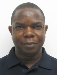 Oladipo E. Abe合作论文数Oye-Ekiti, Federal University1
 Sibylle Vey合作论文数GFZ German Research Centre for Geosciences,Potsdam,Germany1
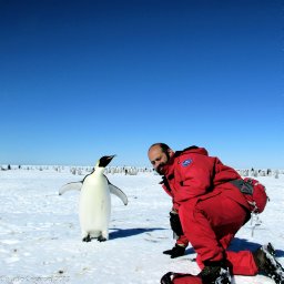 Claudio Cesaroni合作论文数Ist Nazl Geofis & Vulcanol1
 Milad Asgarimehr合作论文数German Res Ctr Geosci GFZ, D-14473 Potsdam, Germany1
 Karina Wilgan合作论文数Technische Universität Berlin1
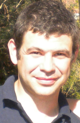 Yuri Shprits合作论文数Institute of Geophysics and Planetary Physics, University of California, Los Angeles;Department of Earth, Planetary, and Space Sciences, University of California, Los Angeles;University of Potsdam1Paul Rebischung合作论文数Institut Géographique National/LAREG and GRGS1
 Galina Dick合作论文数1
 Jan Dousa合作论文数1
 Florian Zus合作论文数1Adrian Jäggi合作论文数Astronomisches Institut, Philosophisch-Natur-Wissenschaftliche Fakultät, Universität Bern1
 Wolfgang Utschick合作论文数TUM School of Computation, Information and Technology, Technical University of Munich;Munich Data Science Institute, Technical University of Munich1
 Xingxing Li (李星星)合作论文数School of Geodesy and Geomatics, Wuhan University1
 Mahdi Motagh合作论文数GeoForschungsZentrum Potsdam (GFZ) Telegrafenberg1
 A. M. Semmling合作论文数1




