Groundwater monitoring at nuclear legacy sites in Ukraine is an important component of ensuring radiation safety of the population and the environment. A current challenge is the implementation of modern methodological approaches and instrumental methods in hydrogeological monitoring practice, using the best international experience. Our review of groundwater monitoring implementation at such nuclear legacy sites as Sellafield in the United Kingdom, Chalk River Nuclear Laboratories in Canada, and nuclear weapons material production sites in the United States associated with the Manhattan Project (Hanford, Savannah River) demonstrates the need for a systematic approach that combines clear definition of objectives, planning and implementation of monitoring, development of conceptual models of contaminated sites, optimization of monitoring networks, use of modern well designs, sampling and analytical methods, introduction of modern information technologies for data analysis and adaptive management, as well as integration of monitoring with hydrogeological process models. Significant attention is paid to measures of quality assurance and quality control of data, as well as openness of reporting and public information. Harmonization of Ukrainian regulations and standards in the field of monitoring with international approaches (IAEA, ISO, ASTM) and implementation of the best international practices is an indispensable direction for increasing the effectiveness of monitoring and ensuring environmental safety at nuclear legacy sites in Ukraine.
Abstract The architectural ensemble of the Kyiv-Pechersk Lavra monastery located in the city of Kyiv on the Right Bank of the Dnipro River, which represents historical and cultural heritage of world significance, suffers from a wide range of hazardous geological processes. The review and analysis of data of the long-term (since the 1990s) groundwater monitoring studies of the Kyiv-Pechersk Lavra shows that hydrogeological hazards caused by a complex combination of natural and anthropogenic factors (as well as sometimes by engineering miscalculations) have led to a significant number of emergency situations that threaten the heritage architectural monuments. Monitoring data illustrate a wide range of hydrogeological hazards (flooding, subsidence, landslides, suffusion), and emphasize the importance of consideration of hydrogeological aspects for safeguarding architectural monuments in the urbanized context. The paper also summarizes experience in engineering measures aimed at mitigating of hydrogeological hazards and discusses the pending research tasks
The extensive network of engineering protection of the territory of the Kyiv-Pechersk Lavra against the impact of hazardous processes (landslides, flooding) includes more than 5 km of retaining walls (brick, concrete, pile-based) and about 12 km of drainage networks (tunnel, gallery, and radial types). The effectiveness of the drainage adit systems (DAS) on the Upper Lavra and the radial drainage on the territory of the Guest Yard (Inn Courtyard) of the Lower Lavra was analyzed. The paper proposes an assessment of the efficiency of drainage adit systems according to such criteria as the specific flow rate q (m3/day) and the specific removal of sediments v (m3/year) into the tunnel, the efficiency is determined as poor (q=0.001...0.02, v=0.11...0.2), sufficient (q=0.021...0.1, v=0.017...0.1), or high (q=0.11...0.5, v=0.011...0.016). Patterns of groundwater supply, the lithological composition of the transported material, exogenous geological processes occurring in drainage areas, the amount of groundwater flow reaching the surface, and technical aspects of drainage system were analyzed. The results were obtained based on the analysis of the measured flow rates and data on sediment removal from 1980 to 1990. The efficiency of DAS-28 is assessed as sufficient and high. The effectiveness of radial drainage is measured as the flow rate of groundwater levels in monitoring boreholes and the reduction of moisture content in building structures. On the territory of Guest Yard, as a result of the work of radial drainage, the groundwater levels in monitoring boreholes dropped by 0.6-0.9 m, the moisture content of masonry walls reached the control level (4-6 %), periodic flooding with meltwater stopped. Monitoring observations for 2006-2023 were analyzed as well.
The Chernobyl Exclusion Zone (CEZ) contains the vast majority of radionuclides released by the accident in nuclear fuel particle form. We present and analyze groundwater measurements collected from the monitoring network in CEZ covering key aquifers over 35 years since the accident. These new data, together with a comprehensive analysis of historical data shows that 90Sr remains mobile in the subsurface environment, while groundwater concentrations of 137Cs, Pu isotopes and 241Am are relatively low, and are not of radiological concern. During the last two decades, 90Sr and 137Cs levels have declined or remained stable over time in the majority of monitoring locations. This is due to natural attenuation driven by gradual exhaustion of the fuel particle source, geochemical evolution of groundwater downstream from waste dumps and radionuclide retention in surface soil due to absorption and bio-cycling. Decommissioning of the cooling pond and construction of the ‘New safe confinement’ over Unit 4 (damaged reactor) also favored better protection of groundwater close to the Chernobyl plant site. Data from confined and unconfined aquifers, as well as rivers, evidence low radiological risks from groundwater contamination both outside the CEZ and to onsite “self-settlers”. Though several groundwater contamination “hot spots” remain in the vicinity of Unit 4, “Red Forest” waste trenches and surface water bodies with contaminated bottom sediments, the findings of this study support a monitored natural attenuation approach to groundwater management in the CEZ.
A review is presented of data on solid-liquid distribution coefficients (Kd-s) of the main radiologically important radionuclides of the Chernobyl release within geological deposits at the Chernobyl Nuclear Power Plant (ChNPP) Site. The Kd values for Sr, Cs and Pu for Quaternary sandy deposits that form sedimentary cover at Chernobyl fall within the range of parameters reported in international sorption databases. In agreement with general knowledge on radionuclide geochemical behavior and affinity to soils, Kd-s increase in the sequence: Sr < Cs < Pu. Alluvial and fluvioglacial sandy deposits are characterized by larger Kd values then deposits of eolian genesis due to higher content of clay minerals in fine fractions. For Sr, laboratory batch tests have given Kd values that are in a reasonable agreement with in situ measurements. At the same time, the Sr-90 Kd-s obtained from groundwater transport model calibrations were noticeably lower than experimentally determined values, thus showing potential limitations of the Kd-approach. Monitoring data on mobility of Sr-90, Cs-137 and Pu-239,Pu-240 in groundwater in the Chernobyl zone on a whole are consistent with the radionuclide Kd-s summarized in this article. The highest concentrations in groundwater (based on data for 2012-2014) were observed for Sr-90, while orders of magnitude lower concentrations were observed for Cs-137 and Pu-239,Pu-240. At the same time, detection of Cs-137 and Pu-239,Pu-240 in groundwater at sites with a relatively deep groundwater table suggests the possibility of facilitated transport of small amounts of these radionuclides in the form of non-retarded colloids or complexes. (C) 2019 Elsevier Ltd. All rights reserved.
Strontium-90 (90Sr) is the major long-lived radionuclide derived from the Chernobyl accident, and is still being detected in the heavily contaminated catchments of the Chernobyl Exclusion Zone. This study examines the long-term decrease in the dissolved-phase 90Sr concentration and the concentration–discharge (90Sr-Q) relationship in stream water since the accident. We show that the slow decline in 90Sr follows a double-exponential function, and that there is a clear relationship between 90Sr and Q. This study is the first to reveal that the log(90Sr)-log(Q) slope has been gradually decreasing since the accident. This trend persists after decay correction. Thus, it is not caused by the physical decay of 90Sr and environmental diffusion, but implies that the concentration formation processes in stream water have been changing over a long period. We propose a hydrochemical model to explain the time-dependency of the 90Sr-Q relationship. This paper presents a mathematical implementation of the new concept and describes the model assumptions. Our model accurately represents both the long-term 90Sr trend in stream water and the time-dependency of the 90Sr-Q relationship. Although this paper considers a small catchment in Chernobyl, the conceptual model is shown to be applicable to other accidental releases of radionuclides.
Two GPR surveys were conducted, the first one in May 2002 and the second one in September 2015, in a 100×200 m 2 area situated 2 km away from the Chernobyl nuclear power plant. Their purpose was to characterize the first 3 meters of the underground that has been devastated in the “cleaning” process that took place in the first year following the nuclear accident. These data contain many clear diffraction hyperbolas related to buried debris such as dead pine tree trunks. We determine an interface between the disturbed sandy soil and the original sand of alluvial and aeolian genesis. When possible the depth variations of this interface is successfully compared to the limits determined from observations and gamma-ray loggings performed into a hundred shallow boreholes drilled within this area. In the 2015 data, new waste burial trench limits are determined north of the previous studied trench.
After the explosion of the Chernobyl Nuclear Power Plant in April 1986, contaminated material was buried in shallow trenches within the exclusion zone. A (90)Sr plume was evidenced downgradient of one of these trenches, trench T22. Due to its conservative properties, (36)Cl is investigated here as a potential tracer to determine the maximal extent of the contamination plume from the trench in groundwater. (36)Cl/Cl ratios measured in groundwater, trench soil water and leaf leachates are 1-5 orders of magnitude higher than the theoretical natural (36)Cl/Cl ratio. This contamination occurred after the Chernobyl explosion and currently persists. Trench T22 acts as an obvious modern point source of (36)Cl, however other sources have to be involved to explain such contamination. (36)Cl contamination of groundwater can be explained by dilution of trench soil water by uncontaminated water (rainwater or deep groundwater). With a plume extending further than that of (90)Sr, radionuclide which is impacted by retention and decay processes, (36)Cl can be considered as a suitable tracer of contamination from the trench in groundwater provided that modern release processes of (36)Cl from trench soil are better characterized.
Following the reactor 4 explosion of the Chernobyl Nuclear Power Plant (ChNPP), at least 1019 Bq of radionuclides (RN) were released in the environment. In order to protect workers and prevent further atmospheric RN dispersion in the area adjacent to the ChNPP, contaminated wastes including fuel particles, topsoil layer and forest remains were buried in approximately 800 shallow trenches in the sand formation in the Red Forest waste dump site [1]. No containment measures were taken, and since then RN have leaked to the unsaturated zone and to the groundwater. Since 1999, migration of RN in the vicinity of the trench 22 at Red Forest site has been investigated within the frame of the EPIC program carried out by IRSN in collaboration with UIAR and IGS [2, 3]. A plume of 90Sr was shown downgradient from the trench 22 with activites reaching 3750 Bq/L [2]. In 2008, further studies were initiated through the TRASSE research group, based on a collaboration between IRSN and CNRS. These programs aim at combining groundwater dating with RN migration monitoring studies in order to constrain RN transport models [3]. Groundwater residence time was investigated based on 3H/He and CFC. Both tracers led to ages ranging from modern (1-3 y) at 2 m depth below the groundwater table to significantly higher apparent ages of 50-60 y at 27 m below the groundwater table [3]. 36Cl/Cl ratios 2 to 4 orders of magnitude higher than the theoretical natural ratio are measured in groundwater. Similarly, SF6 shows concentrations as high as 1200 pptv while natural concentrations are in the order of 6-7 pptv. Based on apparent groundwater ages, both contaminations are linked to the Chernobyl explosion. Hence those tracers show excellent potential to constrain conservative and reactive transport, respectively. In contrast, 238U/235U ratio down gradient from trench 22 remains similar to the natural ratio. This suggests that either most of the U contained in the trench is in a non soluble form, associated with U-Zr matrix fuel particles [5] and/or that migration of U is limited due to redox processes and/or microbial activity. The above described experience of post-Chernobyl studies shows that a combined analysis of radionuclides, natural and anthropogenic tracers provides an efficient research tool to better understand and quantify contaminant transport processes in the geo-sphere. Similar approaches can be applied to the study transport of RN in the subsurface, issued from both, diffuse (contaminated watersheds) and point (damaged NPP and fuel storage units) radioactive sources produced by the Fukushima accident. References [1] Dzhepo S. P., Skalskyy A., 2002, In Chernobyl disaster and groundwater, Shestopalov, V., Ed. A.A. Balkema: Lisse, pp 25-70. [2] Dewiere L., Bugai D. et al., 2004, J. Environ. Radioactiv., 74, (1-3), 139-150. [3] Van Meir N., Bugai, et al., 2009, in: Oughton, D.H., Kashparov, V. (Eds.), Radioactive Particles in the Environment. Springer Science+Business Media B.V., pp.197-208. [4] Le Gal La Salle C., Aquilina L., et al., 2012, Appl. Geochem., 27 1304-1319. [5] Kashparov V.A., Ahamdach N., et. al., 2004, J. Environ. Radioactiv., 72, 335-353.
This paper presents results of groundwater monitoring and screening modeling studies carried out in 2008–2010 for the uranium production legacy site Pridneprovsky Chemical Plant (Dneprodzerzhinsk city, Ukraine). The simulated offsite radiological risks caused by groundwater pathway are estimated to be low because of the long travel time to discharge contours (hundreds-thousands of years) and large dilution of contaminants in the Dnieper River system. The preliminary recommendation is stabilization and storage of tailings sites in-situ. Further groundwater monitoring and risk assessment studies are opportune.
Field experiments and laboratory studies were performed to investigate migration processes of plutonium isotopes in the aquifer at the experimental site. The objectives of these experiments were to characterize the spatial distribution and possible migration mechanisms of plutonium in the aquifer, and to obtain the parameters that determine radionuclide retardation. During 2005–2006 experimental investigations were carried out and spatial distributions of plutonium isotopes (239,240Pu, 238Pu), 90Sr and main dissolved ions in aquifer along the groundwater flow were obtained. Radionuclide specific activities in groundwater depended on the location of the piezometer and varied in the range of 1 ÷ 200 mBq/L for 239,240Pu, 0.5 ÷ 100 mBq/L for 238Pu and n·100 ÷ n·104 Bq/L for 90Sr. It was found that the spatial features of the specific activities distributions of plutonium and strontium in groundwater were similar, i.e., there was a correlation between the positions of the radionuclides activity maximums. The Pu isotopes' plume in the aquifer spreads about 10 m downstream of the radionuclides source. Characterization of the initial radionuclide composition of waste showed that all plutonium in the aquifer originated from the trench. Ratio of plutonium isotopes (239,240Pu/238Pu) was the same in waste material and in groundwater samples. In-situ ultrafiltration of several groundwater samples was carried out. Obtained size fractionation data on plutonium activities in collected colloids suggest that significant part of Pu (50–80%) was associated with low molecular weight fraction (<5 kDa).
The approach, methods and results of a sedimentological study of a near-surface stratum of Late Pleistocene-Holocene deposits in the near-zone (5–10 km radius) of the Chernobyl Nuclear Power Plant are presented. Sedimentological analyses are carried out at three levels of detail: regional-, local- and object-scale. The unsaturated zone and unconfined aquifer at the site are composed of two main genetic types of deposits, aeolian and alluvial, including several dynamic facies. Consideration of lithological properties leads to following ranking of the main genetic sediments facies with respect to radionuclide migration retardation potential: aeolian <alluvial channel <alluvial overbank <alluvial abandoned channel. Based on sedimentological interpretations, the geological environment is schematised into a set of typical geological sections possessing different radionuclide retardation potential.
Results are presented from multidisciplinary radiological and hydrogeological studies of process and parameters controlling 90 Sr releases from the shallow trench containing nuclear fuel particles and subsequent radionuclide transport in the underlying eolian and alluvial sand aquifer at Chernobyl Pilot Site located at 2.5 km distance from the Chernobyl NPP. Microscopic analyses of fuel particles separated from waste have identified two families of particles: U-O and Zr-U-O (~25% and 75% of the fuel particles respectively). The Zr-containing particles exhibits low dissolution rate, therefore radionuclide inventory in source term available for migration is significantly less than estimated before. The 90 Sr migration velocity in the eolian sand layer is estimated at ≈ 7% of real groundwater flow velocity (K d ≈ 3 ml/g). Alluvial sediments comprising the middle part of the aquifer have notably higher sorption capacity (K d ≈ 20 ml/g), and may represent essential natural sorption barrier to geo-migration. Radioactivity balance calculations show that 4 - 7% of initial trench inventory of 90 Sr has migrated by now to the geological environment. Presented results have important implications on safety assessment and remedial analyses of the radioactive waste dumps at ChNPP.
Abstract The paper reviews the findings of a recent international study to characterise the waste arising from the decommissioning of dumps in the Industrial Zone of the Chernobyl Nuclear Power Plant and the Exclusion Zone. Studied sites included the Industrial Zone outside the Sarcophagus, three engineered disposal sites (the so-called PZRO), non-engineered near surface trench dumps (PVLRO), contaminated soil and sites of ‘unauthorised’ disposal within the Exclusion Zone. The paper summarises the inventory of wastes, the management options, which have been considered for various dumps, and the resulting estimates of the volumes of waste streams, as well as the approach that was used in the decision-making process.
The paper discusses methodological problems related to groundwater monitoring in the Chernobyl exclusion zone. Data collected as part of a groundwater monitoring programme at Chernobyl have been of rather low reliability until recently due to the following shortcomings: contamination of bore holes during well installation, lack of monitoring well purging before sampling, and inappropriate monitoring well design. Based on the experience acquired, an advanced design of observation well has been developed, and changes have been introduced to the sampling protocol.
 Valery Alexandrovich Kashparov合作论文数Ukrainian Institute of Agricultural Radiology (UIAR), Mashinostroiteley Strasse 7, Chabany, Kiev Region 08162, Ukraine4
 Stella B. Shekhunova合作论文数Inst Geol Sci, Natl Acad Sci Ukraine3
 Jim Smith合作论文数School of the Environment Geography and Geosciences, Faculty of Science and Health, University of Portsmouth3
 Nathalie Van Meir合作论文数3S I Kireev合作论文数2Olivier Diez合作论文数2
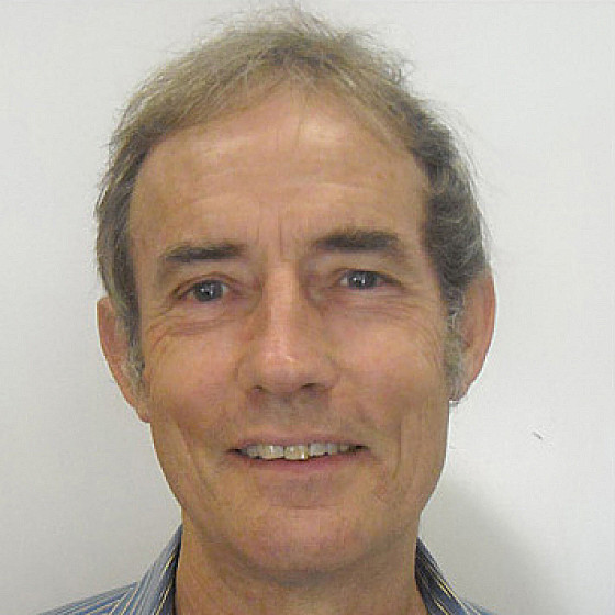 Keith Fifield合作论文数Department of Nuclear Physics, Research School of Physics, College of Science, The Australian National University2Bassot Sylvain合作论文数2Rodolfo Avila合作论文数2
 Mohammad A Hoque合作论文数2
 Gennady V Laptev合作论文数Ukrainian Hydrometeorological Institute2C. Simonucci合作论文数2Joël Lancelot合作论文数2Lionel Dewière合作论文数1Christophe Ardois合作论文数1Serhii Kirieiev合作论文数1paul lewtas合作论文数edith cowan university1M. I. Panasiuk合作论文数Institute for Safety Problems of Nuclear Power Plants, National Academy of Sciences of Ukraine1
 Tetiana Kril合作论文数Inst Geol Sci, NAS Ukraine1Hlib Lisovyi合作论文数1christelle courbet合作论文数1
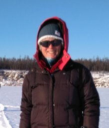 Albane Saintenoy合作论文数IDES, Univ. Paris Sud;c;IDES, Univ. Paris Sud1
 Sviatoslav Levchuk合作论文数1
 Shogo Taniguchi合作论文数1
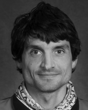 Emmanuel Léger合作论文数1Simler Roland合作论文数1Roux Céline合作论文数1
 Igarashi Yasunori合作论文数1
 Yuichi Onda (恩田裕一)合作论文数Department of Integrative Environmental Sciences, Faculty of Life and Environmental Sciences, University of Tsukuba;Center for Research in Isotopes and Environmental Dynamics, University of Tsukuba1
 T. Labasque合作论文数1
 Mark Zheleznyak合作论文数Institute of Mathematical Machine and System Problems, Prospekt Glushkova 42, Kiev 03187, Ukraine1
 Elise Fourré合作论文数Laboratory for Climate and Environmental Sciences1
 A.V. Konoplev合作论文数Center for Environmental Chemistry, Science Production Association “Typhoon”,1Philippe Jean-Baptiste合作论文数1Alexander Skalskyy合作论文数1
 Andrei Matoshko合作论文数1
 Luc Aquilina合作论文数OSUR-Géosciences Rennes, Université Rennes1—CNRS1Yoshifumi Wakiyama合作论文数1
 Vasyl Yoschenko合作论文数Ukrainian Institute of Agricultural Radiology1Yoko Fujikawa合作论文数1Sergei Dzhepo合作论文数1Jean-Luc Michelot合作论文数1L. Dewiere合作论文数1
 C. Le Gal La Salle合作论文数1Kenji Nanba合作论文数1Alexander Skal' Skij合作论文数1N Ahamdach合作论文数1




