Jackson, T., P. O’Neill, , S, Chan, R. Bindlish, A. Colliander, F. Chen, S. Dunbar, J. Piepmeier, M. Cosh, T. Caldwell, J. Walker, X. Wu, A. Berg, T. Rowlandson, A. Pacheco, H. McNairn, M. Thibeault, J. Martínez-Fernández, Á. González-Zamora, E. Lopez-Baeza, F. Uldall, M. Seyfried, D. Bosch, P. Starks, C. Holifield, J. Prueger, Z. Su, R. van der Velde, J. Asanuma, M. Palecki, E. Small, M. Zreda, J. Calvet, W. Crow, Y. Kerr, S. Yueh, and D. Entekhabi, December 15, 2016. Calibration and Validation for the L2/3_SM_P Version 4 and L2/3_SM_P_E Version 1 Data Products, SMAP Project, JPL D-56297, Jet Propulsion Laboratory, Pasadena, CA.
Atmospheric carbon dioxide (CO2) is steadily increasing as a result of the world’s increasing use of fossil fuels and wood biomass. However, the impact of increases in CO2 on the global carbon cycle is unclear. Semiarid grasslands comprise a large portion of the world’s rangeland ecosystem and may play a significant role in the carbon cycle. In a previous study, regional estimates of instantaneous net CO2 flux were obtained by using a Water Deficit Index (WDI) derived from satellite imagery over a five-year period (1996-2000) covering a grassland site in the Walnut Gulch Experimental Watershed (WGEW). In this study, a linear relationship (R = 0.95) was found to exist between instantaneous and daytime net CO2 flux estimates, where daytime is the period from 6 a.m. to 6 p.m. This linear relationship was used to convert instantaneous estimates of net CO2 flux to daytime estimates, and maps depicting spatially distributed daytime net CO2 flux were generated for WGEW. Remote sensing offers a viable means of obtaining regional estimates of daytime net CO2 flux in semiarid grasslands. Holifield is a Plant Physiologist, U.S. Department of Agriculture, Agricultural Research Service, Southwest Watershed Research Center, Tucson, AZ 85719. Email: cholifield@tucson.ars.ag.gov. Emmerich is a Soil Scientist, Moran is a Physical Scientist/Research Leader, Bryant is a Senior Research Specialist, and Verdugo is a Physical Science Technician, all at the U.S. Department of Agriculture, Agricultural Research Service, Southwest Watershed Research Center, Tucson, AZ 85719.
The National Aeronautics and Space Administration (NASA) Landsat program has been dedicated to sustaining data continuity over the 20-year period during which Landsat Thematic Mapper (TM) and Enhanced TM Plus (ETM+) sensors have been acquiring images of the Earth's surface. In 2000, NASA launched the Earth Observing-1 (EO-1) Advanced Land Imager (ALI) to test new technology that could improve the TM/ETM+ sensor series, yet ensure Landsat data continuity. The study reported here quantified the continuity of satellite-retrieved surface reflectance (/spl rho/) for the three most recent Landsat sensors (Landsat-4 TM, Landsat-5 TM, and Landsat-7 ETM+) and the EO-1 ALI sensor. The study was based on ground-data verification and, in the case of the ETM+ to ALI comparison, coincident image analysis. Reflectance retrieved from all four sensors showed good correlation with ground-measured reflectance, and the sensor-to-sensor data continuity was excellent for all sensors and all bands. A qualitative analysis of the new ALI spectral bands (4p: 0.845-0.890 /spl mu/m and 5p: 1.20-1.30 /spl mu/m) showed that ALI band 5p provided information that was different from that provided by the ETM+/ALI shortwave infrared bands 5 and 7 for agricultural targets and that ALI band 4p has the advantage over the existing ETM+ near-infrared (NIR) band 4 and ALI NIR band 4 of being relatively insensitive to water vapor absorption. The basic conclusion of this study is that the four sensors can provide excellent data continuity for temporal studies of natural resources. Furthermore, the new technologies put forward by the EO-1 ALI sensor have had no apparent effect on data continuity and should be considered for the upcoming Landsat-8 sensor payload.
The data from the Landsat program constitutes the longest record of the Earth's surface as seen from space. Landsat 1 was launched in 1972 with the Multi-Spectral Scanner sensor (MSS), which was specifically designed for land remote sensing. This sensor proved so valuable that it was used with four subsequent Landsat missions. In 1982, Landsat 4 was launched with two sensors, MSS and a new sensor called the Thematic Mapper (TM) which had significant improvements in resolution as well as additional bands. The same payload was launched on Landsat 5 in 1984. Landsat 6 was launched in 1993 but failed to reach orbit. Landsat 7 was launched in 1999 with an improved TM sensor called the Enhanced Thematic Mapper (ETM+). The Advanced Land Imager (ALI) was launched in 2000 on the EO-1 (Earth Observer-1) satellite to test technology that will be used for the next Landsat platform, Landsat 8. In comparison to Landsat 7 ETM+, EO1 ALI provides a greater signal to noise ratio, a pushbroom sensor, greater quantization, and additional wavelength bands. As technology evolved, newer Landsat sensors were modified slightly while keeping in mind the importance of historical data continuity. There is a keen interest in documenting data continuity over the different Landsat sensors. This study attempts to quantify (within the limits of available information) data continuity over the three most recent Landsat sensors and the EO-1 ALI sensor. The data set in this analysis includes images from Landsat 4, 5, and 7 TM beginning in 1989 and images from the EO-1ALI platform acquired in 2001. All the images used were received radiometrically corrected to NASA level 1.
D. C. Goodrich (1)*, A. Chehbouni (2), B. Goff (1), B. MacNish (3), T. Maddock (3), S. Moran (4), W.J. Shuttleworth (3), D.G. Williams (3), J.J. Toth (1), C. Watts (12), L.H. Hipps (5), D.I. Cooper (6), J. Schieldge(14), Y.H. Kerr (7), H. Arias (12), M. Kirkland (6), R. Carlos (6), W. Kepner (17), B. Jones (17), R. Avissar (19), A. Begue (8), G. Boulet (2), B. Branan (18), I. Braud (15), J.P. Brunel (2), L.C. Chen (9), T. Clarke (4), M.R. Davis (13), J. Dauzat (8), H. DeBruin (10), G. Dedieu (7), W.E. Eichinger (9), E. Elguero (2), J. Everitt (13), J. Garatuza-Payan (3), A. Garibay (12), V.L. Gempko (3), H. Gupta (3), C. Harlow (3), O. Hartogensis (10), M. Helfert (4), C. Holifield (4), D. Hymer (2), A. Kahle (14), T. Keefer (1), S. Krishnamoorthy (9), J-P. Lhomme (2), D. Lo Seen (8), D. Luquet (8), R. Marsett (1), B. Monteny (2), W. Ni (4), Y. Nouvellon (8), R. Pinker (20), C. Peters (3), D. Pool (16), J. Qi (4), S. Rambal (11), H. Rey (8), J. Rodriguez (12), E. Sano (3), S.M. Schaeffer (3), M. Schulte (3), R. Scott (3), X. Shao (6), K.A. Snyder (3), S. Sorooshian (3), C.L. Unkrich (1), M. Whitaker (3), I. Yucel (3)
 M.S. Moran合作论文数4
 Yann Kerr合作论文数Center for Hydrology - Hydrological Observatory, HOBE;CESBIO, CNES, CNRS, IRD, INRAE4J. Schieldge合作论文数2B Goff合作论文数2R Marsett合作论文数2S. Dunbar合作论文数2W Ni合作论文数2C Harlow合作论文数2
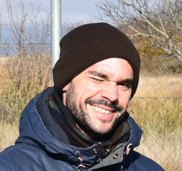 Angel Gonzalez-Zamora合作论文数Inst Hispano Luso Invest Agr CIALE, Univ Salamanca2
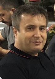 Ismail Yucel合作论文数Dept Civil Engn, Middle East Tech Univ2
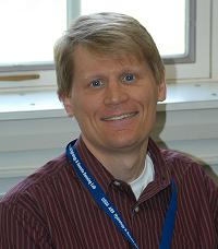 Wade Crow合作论文数USDA-ARS Hydrology and Remote Sensing Laboratory2
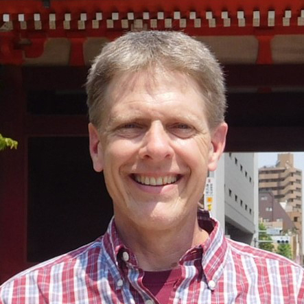 Kurtis John Thome合作论文数Goddard Space Flight Center, National Aeronautics and Space Administration2
 David Gerard Williams合作论文数Departments of Renewable Resources and Botany, University of Wyoming2
 A. Chehbouni合作论文数2
 Dara Entekhabi合作论文数Department of Civil and Environmental Engineering, School of Engineering, Massachusetts Institute of Technology;Department of Earth, Atmospheric, & Planetary Sciences, School of Science, Massachusetts Institute of Technology2
 Rajat Bindlish合作论文数Hydrol & Remote Sensing Lab, USDA ARS2
 David C. Goodrich合作论文数USDA-ARS, Southwest Watershed Research Center2
 Anna Pacheco合作论文数2
 Zhongbo Su (Bob)合作论文数Department of Water Resources, Faculty of Geo-Information and Earth Observation, University of Twente/ITC Netherlands2D. I. Cooper合作论文数Experimental Atmospheric and Climate Physics2Mark S. Seyfried (Mark Seyfried)合作论文数Northwest Watershed Research Center, United States Department of Agriculture-Agricultural Research Service2
 Ross Bryant合作论文数2Christopher J. Watts合作论文数Consultant Care Division and Research Service, VA Medical Center2John Prueger合作论文数Soil, Water and Air Unit, National Laboratory for Agriculture and The Environment, U.S. Department of Agriculture2
 Jeffrey R. Piepmeier合作论文数Instrument Systems and Technology Division, NASA’s Goddard Space Flight Center2Marek Zreda合作论文数Department of Hydrology and Water Resources, University of Arizona2
 Jun Asanuma合作论文数Graduate School of Life and Environmental Sciences, University of Tsukuba2
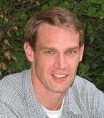 Aaron Berg合作论文数Department of Geography, Environment & Geomatics, College of Social and Applied Human Sciences, University of Guelph;Hydrology and Remote Sensing Lab, University of Guelph2
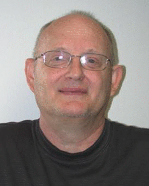 Patrick J. Starks合作论文数2
 Russ Scott合作论文数Southwest Watershed Research Center, U.S. Department of Agriculture-Agricultural Research Service2
 Jiaguo Qi (齐家国)合作论文数Center for Global Change and Earth Observations, College of Social Science, Michigan State University;Department of Geography, Michigan State University;NASA2
 Todd G. Caldwell合作论文数USGS Nevada Water Science Center2
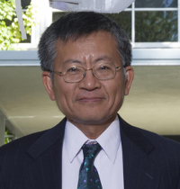 Simon Yueh合作论文数Jet Propulsion Laboratory, California Institute of Technology2
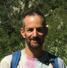 Eric Evan Small (Eric E. Small)合作论文数Department of Geological Sciences, College of Arts and Sciences, University of Colorado2
 Jose Martinez-Fernandez合作论文数Department of Geography, University of Salamanca2
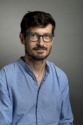 Gilles Boulet合作论文数IRD-U.M.R. CESBIO (CNES/CNRS/IRD/UPS),2
 Jean-Christophe Calvet合作论文数Centre National de Recherches Meteorologiques, Université de Toulouse2Gérard Dedieu合作论文数CESBIO2
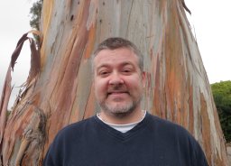 Sean M. Schaeffer合作论文数Biological Sciences Department, University of Arkansas2
 Michael A. Palecki合作论文数2
 Agnès Bégué合作论文数2
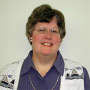 Peggy O'Neill合作论文数Hydrological Sciences Laboratory, Goddard Space Flight Center, NASA;Jet Propulsion Laboratory, NASA2
 Andreas Colliander合作论文数NASA Jet Propulsion Laboratory, California Institute of Technology2
 Ernesto Lopez-Baeza合作论文数Department of Earth Physics & Thermodynamics, Faculty of Physics, University of Valencia2Tomoaki Miura合作论文数2H McNairn合作论文数2T. Keefer合作论文数2A. Kahle合作论文数2
 Yann Nouvellon合作论文数2




