Task planning often suffers from severe efficiency bottlenecks when robots must reason over long-horizon action sequences under complex logical constraints, including object affordances, spatial relationships, and sequential action dependencies. Recent neuro-symbolic methods improve planning efficiency by learning object-importance scores to prune task-irrelevant objects, but they typically rely on fixed offline supervision generated from full search spaces. This creates a train-test mismatch: at deployment, the planner operates in pruned search spaces induced by the model's own imperfect predictions, leading to exposure bias and degraded planning performance. To address this challenge, we formulate object-importance learning for task planning as an imperative learning-based bilevel optimization problem. The upper level optimizes a neural scorer, while the lower level solves a symbolic planning problem in the score-pruned search space. To stabilize this learning process, we introduce a 3R strategy into the lower-level planning, using parallel Repair, Restart, and Rollback recovery to provide reliable and adaptive feedback for upper-level learning. Experiments on three challenging benchmarks demonstrate state-of-the-art performance, including an 80.04
This paper investigates a min-max routing problem with time windows (RTW), which seeks paths for multiple agents starting from a single depot to visit a set of target locations, each within a designated time window, while minimizing the maximum completion time among the agents. Most existing research either considers the min-sum objective (minimizing the sum of completion times) or ignores the time window constraints. Recent work explores data-driven approaches, such as reinforcement learning (RL), to address this challenge. However, it still struggles to generalize to unseen scenarios outside the training set. To address these challenges, we propose a neuro-symbolic method called NS-RTW, which combines learning-based and classical search techniques within a bi-level optimization framework, enabling end-to-end self-supervision and offering better generalization than existing methods. On synthetic datasets, our method is able to find feasible solutions for all instances, outperforming the RL baseline, which fails in complex scenarios. Among all baseline methods, ours finds the best-quality solution in 87.1% of commonly solved instances. Experiments on Solomon benchmark and real-world case further demonstrate the generalization capability and practical applicability of our method.
Deep stereo disparity estimation has long been dominated by a \textbf{matching-centric paradigm}, built on constructing cost volumes and iteratively refining local correspondences. Despite its success, this paradigm exhibits an intrinsic vulnerability: visual ambiguities from occlusion or non-Lambertian surfaces invevitably induce errorneous matches that refinement cannot recover. This paper introduces \textbf{DispViT}, a new architecture that establishes a \textbf{regression-centric paradigm}. Instead of explicit matching, DispViT directly regresses disparity from tokenized binocular representations using a single-stream Vision Transformer. This is enabled by a set of lightweight yet critical designs, such as a probability-based disparity parameterization for stable training and an asymmetrically initialized stereo tokenizer for effective view distinction. To better align the two views during stereo tokenization, we introduce a novel shift-embedding mechanism that encodes different disparity shifts into channel groups, preserving geometric cues even under large view displacements. A lightweight refinement module then sharpens the regressed disparity map for fine-grained accuracy. By prioritizing holistic regression over explicit matching, DispViT streamlines the stereo pipeline while improving robustness and efficiency. Experiments on standard benchmarks show that our approach achieves state-of-the-art accuracy, with strong resilience to matching ambiguities and wide disparity ranges. Code will be released.
Bridging the gap between embodied intelligence and embedded deployment remains a key challenge in intelligent robotic systems, where perception, reasoning, and planning must operate under strict constraints on computation, memory, energy, and real-time execution. In vision-language navigation (VLN), existing approaches often face a fundamental trade-off between strong reasoning capabilities and efficient deployment on real-world platforms. In this paper, we present a deployable embodied VLN system that achieves both high efficiency and robust high-level reasoning on real-world robotic platforms. To achieve this, we decouple the system into three asynchronous modules: a real-time perception module for continuous environment sensing, a memory integration module for spatial-semantic aggregation, and a reasoning module for high-level decision making. We incrementally construct a cognitive memory graph to encode scene information, which is further decomposed into subgraphs to enable reasoning with a vision-language model (VLM). To further improve navigation efficiency and accuracy, we also leverage the cognitive memory graph to formulate the exploration problem as a context-aware Weighted Traveling Repairman Problem (WTRP), which minimizes the weighted waiting time of viewpoints. Extensive experiments in both simulation and real-world robotic platforms demonstrate improved navigation success and efficiency over existing VLN approaches, while maintaining real-time performance on resource-constrained hardware.
Bundle adjustment (BA) is a critical technique in various robotic applications such as simultaneous localization and mapping (SLAM), augmented reality (AR), and photogrammetry. BA optimizes parameters such as camera poses and 3D landmarks to align them with observations. With the growing importance of deep learning in perception systems, there is an increasing need to integrate BA with deep learning frameworks for enhanced reliability and performance. However, widely-used C++-based BA libraries, such as GTSAM, g^2o, and Ceres, lack native integration with modern deep learning libraries like PyTorch. This limitation affects their flexibility, adaptability, ease of debugging, and overall implementation efficiency. To address this gap, we introduce an eager-mode BA library seamlessly integrated with PyTorch with high efficiency. Our approach includes GPU-accelerated, differentiable, and sparse operations designed for 2-order optimization, Lie group and Lie algebra operations, and linear solvers. Our eager-mode BA on GPU demonstrates substantial runtime efficiency, achieving an average speedup of 18.5×, 22×, and 23× compared to GTSAM, g^2o, and Ceres, respectively. The source code will be available at https://github.com/sair-lab/bae.
Long-horizon navigation in unstructured environments demands terrain abstractions that scale to tens of km^2 while preserving semantic and geometric structure, a combination existing methods fail to achieve. Grids scale poorly; quadtrees misalign with terrain boundaries; neither encodes landcover semantics essential for traversability-aware planning. This yields infeasible or unreliable paths for autonomous ground vehicles operating over 10+ km^2 under real-time constraints. CLEAR (Connected Landcover Elevation Abstract Representation) couples boundary-aware spatial decomposition with recursive plane fitting to produce convex, semantically aligned regions encoded as a terrain-aware graph. Evaluated on maps spanning 9-100 km^2 using a physics-based simulator, CLEAR achieves up to 10x faster planning than raw grids with only 6.7
Effective embodied exploration requires agents to accumulate and retain spatial knowledge over time. However, existing scene representations, such as discrete scene graphs or static view-based snapshots, lack post-hoc re-observability. If an initial observation misses a target, the resulting memory omission is often irrecoverable. To bridge this gap, we propose GSMem, a zero-shot embodied exploration and reasoning framework built upon 3D Gaussian Splatting (3DGS). By explicitly parameterizing continuous geometry and dense appearance, 3DGS serves as a persistent spatial memory that endows the agent with Spatial Recollection: the ability to render photorealistic novel views from optimal, previously unoccupied viewpoints. To operationalize this, GSMem employs a retrieval mechanism that simultaneously leverages parallel object-level scene graphs and semantic-level language fields. This complementary design robustly localizes target regions, enabling the agent to “hallucinate” optimal views for high-fidelity Vision-Language Model (VLM) reasoning. Furthermore, we introduce a hybrid exploration strategy that combines VLM-driven semantic scoring with a 3DGS-based coverage objective, balancing task-aware exploration with geometric coverage. Extensive experiments on embodied question answering and lifelong navigation demonstrate the robustness and effectiveness of our framework
Real-world task planning requires long-horizon reasoning over large sets of objects with complex relationships and attributes, leading to a combinatorial explosion for classical symbolic planners. To prune the search space, recent methods prioritize searching on a simplified task only containing a few “important” objects predicted by a neural network. However, such a simple neuro-symbolic (NeSy) integration risks omitting critical objects and wasting resources on unsolvable simplified tasks. To enable Fast and reliable planning, we introduce a NeSy relaxation strategy (Flax), combining neural importance prediction with symbolic expansion. Specifically, we first learn a graph neural network to predict object importance to create a simplified task and solve it with a symbolic planner. Then, we solve a rule-relaxed task to obtain a quick rough plan, and reintegrate all referenced objects into the simplified task to recover any overlooked but essential elements. Finally, we apply complementary rules to refine the updated task, keeping it both reliable and compact. Extensive experiments are conducted on both synthetic and real-world maze navigation benchmarks where a robot must traverse through a maze and interact with movable obstacles. The results show that Flax boosts the average success rate by 20.82% and cuts mean wall-clock planning time by 17.65% compared with the state-of-the-art NeSy baseline. We expect that Flax offers a practical path toward fast, scalable, long-horizon task planning in complex environments.
Resilient and robust odometry is crucial for autonomous systems operating in complex and dynamic environments. Existing odometry systems often struggle with severe sensory degradations and extreme conditions such as smoke, sandstorms, snow, or low-light conditions, threatening both the safety and functionality of robots. To address these challenges, we present Super Odometry, a sensor fusion framework that dynamically adapts to varying levels of environmental degradation. Super Odometry employs a hierarchical structure to integrate four core modules from lower-level to higher-level adaptability including adaptive feature selection, adaptive state direction selection, adaptive engine selection, and a novel learning- based inertial odometry. The inertial odometry, trained on over 100 hours of heterogeneous robotic platforms, captures comprehensive motion dynamics. Super Odometry elevates the inertial measurement unit (IMU) to equal importance with camera and LiDAR within the sensor fusion framework, providing a reliable fallback when exteroceptive sensors fail. Super Odometry has been validated across 200 kilometers and 800 operational hours on a fleet of aerial, wheeled, and legged robots, under diverse sensor configurations, environmental degradation, and aggressive motion profiles. It marks an important step towards safe and long-term robotic autonomy in all-degraded environments.
Autonomous ground robots operating in large-scale outdoor environments require both robust long-range navigation and fine-grained ”last-mile” exploration. Current advances in visual-language navigation (VLN) work well at short-range tasks, lacking geospatial grounding for long-distance missions. Some OpenStreetMap (OSM)-based methods relying on cloud-based Large Language Models (LLMs) are prone to factual hallucination and cannot conduct ”last-mile” exploration based on human instruction. To address these challenges, we present G-DRAGON, a retrieval-augmented framework for outdoor, open-world navigation. This framework maps natural-language commands to versioned, local OSM entities via generative retrieval based on lightweight LLM, yielding accurate coordinates for global route planning. A high-level planning module bridges global topological routes with the SLAM system, projecting geospatial waypoints into the robot's navigable frame. For the ”last mile," the framework transitions to frontier-based exploration and open-set semantic voxel mapping to localize open-vocabulary targets. Experimental results in simulation demonstrate our framework outperforms state-of-the-art baselines. Furthermore, we validate the system in unseen real-world urban environments on an Unmanned Ground Vehicle (UGV), successfully completing person-search missions with trajectories of up to 500m.
Low speed does not always guarantee safety in off-road driving. For instance, crossing a ditch may be risky at a low speed due to the risk of getting stuck, yet safe at a higher speed with a controlled, accelerated jump. Achieving such behavior requires path planning that explicitly models complex motion dynamics, whereas existing methods often neglect this aspect and plan solely based on positions or a fixed velocity. To address this gap, we introduce Motion-aware Traversability (MAT) representation to explicitly model terrain cost conditioned on actual robot motion. Instead of assigning a single scalar score for traversability, MAT models each terrain region as a Gaussian function of velocity. During online planning, we decompose the terrain cost computation into two stages: (1) predict terrain-dependent Gaussian parameters from perception in a single forward pass, (2) efficiently update terrain costs for new velocities inferred from current dynamics by evaluating these functions without repeated inference. We develop a system that integrates MAT to enable agile off-road navigation and evaluate it in both simulated and real-world environments with various obstacles. Results show that MAT achieves real-time efficiency and enhances the performance of off-road navigation, reducing path detours by 75
In this paper, we provide a comprehensive overview of existing scene representation methods for robotics, covering traditional representations such as point clouds, voxels, signed distance functions (SDF), and scene graphs, as well as more recent neural representations like Neural Radiance Fields (NeRF), 3D Gaussian Splatting (3DGS), and the emerging Foundation Models. While current SLAM and localization systems predominantly rely on sparse representations like point clouds and voxels, dense scene representations are expected to play a critical role in downstream tasks such as navigation and obstacle avoidance. Moreover, neural representations such as NeRF, 3DGS, and foundation models are well-suited for integrating high-level semantic features and language-based priors, enabling more comprehensive 3D scene understanding and embodied intelligence. In this paper, we categorized the core modules of robotics into five parts (Perception, Mapping, Localization, Navigation, Manipulation). We start by presenting the standard formulation of different scene representation methods and comparing the advantages and disadvantages of scene representation across different modules. This survey is centered around the question: What is the best 3D scene representation for robotics? We then discuss the future development trends of 3D scene representations, with a particular focus on how the 3D Foundation Model could replace current methods as the unified solution for future robotic applications. The remaining challenges in fully realizing this model are also explored. We aim to offer a valuable resource for both newcomers and experienced researchers to explore the future of 3D scene representations and their application in robotics. We have published an open-source project on GitHub and will continue to add new works and technologies to this project.
The detection of dynamic feature points presents a substantial challenge to dynamic scene analysis for simultaneous localization and mapping (SLAM). Conventional methods based on semantic segmentation, which are capable of producing complete object outlines, are expensive and not compatible with applications that run in real time. This study proposes a novel method combining YOLOv5 object detection information with motion consistency results to accurately differentiate between dynamic feature points and the corresponding states of predefined objects. To roughly distinguish background and dynamic objects within the object detection bounding boxes, a deep clustering approach is employed. The cluster centers have been optimized through iterative computation. In addition, a depth-based anomaly outlier filtering algorithm is employed to exclude stationary points in extremely close proximity to dynamic objects, thereby enhancing the capacity to distinguish between dynamic objects. The proposed method effectively minimizes the distortion resulting from dynamic feature points throughout pose estimation, which enhances the overall performance of the system while preserving a comparable quantity of feature points.
Trajectory planning in robotics aims to generate collision-free pose sequences that can be reliably executed. Recently, vision-to-planning systems have gained increasing attention for their efficiency and ability to interpret and adapt to surrounding environments. However, traditional modular systems suffer from increased latency and error propagation, while purely data-driven approaches often overlook the robot's kinematic constraints. This oversight leads to discrepancies between planned trajectories and those that are executable. To address these challenges, we propose iKap, a novel vision-to-planning system that integrates the robot's kinematic model directly into the learning pipeline. iKap employs a self-supervised learning approach and incorporates the state transition model within a differentiable bi-level optimization framework. This integration ensures the network learns collision-free waypoints while satisfying kinematic constraints, enabling gradient back-propagation for end-to-end training. Our experimental results demonstrate that iKap achieves higher success rates and reduced latency compared to the state-of-the-art methods. Besides the complete system, iKap offers a visual-to-planning network that seamlessly works with various controllers, providing a robust solution for robots navigating complex environments.
Path planning, which aims to find a collision-free path between two locations, is critical for numerous applications ranging from mobile robots to self-driving vehicles. Traditional search-based methods like A* search guarantee path optimality but are often computationally expensive when handling large-scale maps. While learning-based methods alleviate this issue by incorporating learned constraints into their search procedures, they often face challenges like overfitting and reliance on extensive labeled datasets. To address these limitations, we propose Imperative A* (iA*), a novel self-supervised path planning framework leveraging bilevel optimization (BLO) and imperative learning (IL). The iA* framework integrates a neural network that predicts node costs with a differentiable A* search mechanism, enabling efficient self-supervised training via bilevel optimization. This integration significantly enhances the balance between search efficiency and path optimality while improving generalization to previously unseen maps. Extensive experiments demonstrate that iA* outperforms both classical and supervised learning-based methods, achieving an average reduction of 65.7% in search area and 54.4% in runtime, underscoring its effectiveness in robot path planning tasks.
Large language models (LLMs), as a significant direction in the development of artificial intelligence in recent years, are becoming increasingly popular. These models demonstrate significant potential in applications such as personalized services, simulated dialogues, role-playing, and specific compliance requirements. However, with the continuous expansion of LLMs’ practical applications, selective knowledge management of the models—particularly the ability to make the models “forget” certain domain-specific or topic-specific knowledge without impacting their overall performance or knowledge in other areas—has emerged as a critical issue that demands resolution. We proposes an innovative knowledge domain forgetting method designed to enable models to selectively forget specified knowledge without the need for fine-tuning. The method identifies and removes steering vectors associated with specific knowledge domains, thereby achieving effective forgetting of specific knowledge. The proposed approach has been evaluated in several popular open-source LLMs. Experimental results show that this method achieves good knowledge forgetting effects across diverse scenarios and exhibits notable practical value.
Data-driven methods such as reinforcement and imitation learning have achieved remarkable success in robot autonomy. However, their data-centric nature still hinders them from generalizing well to ever-changing environments. Moreover, labeling data for robotic tasks is often impractical and expensive. To overcome these challenges, we introduce a new self-supervised neuro-symbolic (NeSy) computational framework, imperative learning (IL), for robot autonomy, leveraging the generalization abilities of symbolic reasoning. The framework of IL consists of three primary components: a neural module, a reasoning engine, and a memory system. We formulate IL as a special bilevel optimization (BLO), which enables reciprocal learning over the three modules. This overcomes the label-intensive obstacles associated with data-driven approaches and takes advantage of symbolic reasoning concerning logical reasoning, physical principles, geometric analysis, etc. We discuss several optimization techniques for IL and verify their effectiveness in five distinct robot autonomy tasks including path planning, rule induction, optimal control, visual odometry, and multi-robot routing. Through various experiments, we show that IL can significantly enhance robot autonomy capabilities and we anticipate that it will catalyze further research across diverse domains.
Point cloud (PC) processing tasks-such as completion, upsampling, denoising, and colorization-are crucial in applications like autonomous driving and 3D reconstruction. Despite substantial advancements, prior approaches often address each of these tasks independently, with separate models focused on individual issues. However, this isolated approach fails to account for the fact that defects like incompleteness, low resolution, noise, and lack of color frequently coexist, with each defect influencing and correlating with the others. Simply applying these models sequentially can lead to error accumulation from each model, along with increased computational costs. To address these challenges, we introduce SuperPC, the first unified diffusion model capable of concurrently handling all four tasks. Our approach employs a three-level-conditioned diffusion framework, enhanced by a novel spatial-mix-fusion strategy, to leverage the correlations among these four defects for simultaneous, efficient processing. We show that SuperPC outperforms the state-of-the-art specialized models as well as their combination on all four individual tasks. Project website: https://sairlab.org/superpc/.
Spatial reasoning is a critical capability for intelligent robots, yet current vision-language models (VLMs) still fall short of human-level performance in video-based spatial reasoning. This gap mainly stems from two challenges: a semantic-geometric misalignment that prevents consistent 3D understanding, and the absence of persistent memory to retain 3D representation and understanding over time. To address these limitations, we present VLM$^2$, a Vision-Language Model with persistent Memory for spatial reasoning with a view-consistent, 3D-aware representation purely from 2D video. Specifically, to enhance long-horizon reasoning, we incorporate a dual-memory module, consisting of a working memory that operates as a sliding window to focus on immediate context, and an episodic memory that consolidates and stores critical long-term information. This design enables efficient and long-horizon spatial reasoning with a fixed computational cost. Extensive experiments on multiple benchmarks show that VLM$^2$ achieves state-of-the-art performance among video-only models, significantly advancing the frontier of visual-spatial intelligence.
 Sebastian Scherer合作论文数AirLab, Robotics Institute, School of Computer Science, Carnegie Mellon University;Field AI31
 Lihua Xie (谢立华)合作论文数Centre for Advanced Robotics Technology Innovation, Nanyang Technological University;School of Electrical & Electronic Engineering, Nanyang Technological University29
 Yuheng Qiu合作论文数AirLab, Robotics Institute, Carnegie Mellon University14
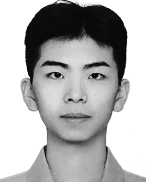 Taimeng Fu合作论文数11
 Bowen Li (李博文)合作论文数Robotics Institute, School of Computer Science, Carnegie Mellon University;Centaur AI Institute;Tongji University11
 Wenshan Wang (王雯珊)合作论文数Robotics Institute, Carnegie Mellon University11
 Kuan Xu合作论文数9
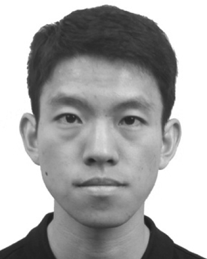 Shaoshu Su合作论文数8
 Pablo Cesar合作论文数Delft University of Technology;Centrum Wiskunde & Informatica8
 Thien-Minh Nguyen合作论文数Center for Advance Robotics Innovation Technology, Nanyang Technological University;School of Electrical and Electronic Engineering, Nanyang Technological University7
 Junsong Yuan (袁浚菘)合作论文数Visual Computing Lab, Department of Computer Science and Engineering, School of Engineering and Applied Sciences, University at Buffalo7
 Shenghai Yuan合作论文数Center for Advanced Robotics Technology and Innovation, Nanyang Technological University6
 Xu Fang (方旭)合作论文数School of Control Science and Engineering, Dalian University of Technology6
 Fan Yang合作论文数6
 Han Wang (王晗)合作论文数Nanyang Environment and Water Research Institute, Nanyang Technological University6
 Karthik Dantu合作论文数Distributed RObotics and Networked Embedded Sensing Lab, Department of Computer Science and Engineering, University at Buffalo, State University of New York6
 Shibo (Edward) Zhao (赵世博)合作论文数Field Robotics Center, Robotics Institute, School of Computer Science, Carnegie Mellon University;AirLab, Robotics Institute, School of Computer Science, Carnegie Mellon University5
 Zhipeng Zhao合作论文数5Tianhao Wu合作论文数5Zitong Zhan合作论文数5
 Cherie Ho合作论文数5
 Yafei (Jeffrey) Hu合作论文数Department of Electrical and Computer Engineering, Carnegie Mellon University;Robotics Institute, Carnegie Mellon University;Field AI5
 Junyi Geng合作论文数Sch Mech Engn Automat Teaching Res Sect Mech Design, Natl Univ Def Technol5
 Yaoyu Hu合作论文数5
 Nikhil Varma Keetha合作论文数The Robotics Institute, Carnegie Mellon University;Meta4Haonan He合作论文数4Dasong Gao合作论文数4
 Xiangyu Chen (陈翔宇)合作论文数Cornell University;Waymo4
 Katia Sycara合作论文数Advanced Agent-Robotics Technology Lab, Robotics Institute, School of Computer Science, Carnegie Mellon University;Center for Advanced Learning and Discovery, Carnegie Mellon University;Human-Computer Interaction Institute, Carnegie Mellon University4
 Ji Zhang合作论文数Field Robotics Center, The Robotics Institute, Carnegie Mellon University4
 Marco Hutter合作论文数Robotic Systems Lab, Eidgenössische Technische Hochschule Zürich;RAI Institute4
 Ramin Zabih合作论文数Department of Computer Science, Cornell University;arXiv4
 Seungchan Kim合作论文数Department of Electrical and Computer Engineering, Roy G. Perry College of Engineering, Prairie View A&M University;CRI Center for Computational Systems Biology, Prairie View A&M University4
 Souma Chowdhury合作论文数MAIDROC Laboratory, Florida International University4
 Zhongqiang Richard Ren (任中强)合作论文数Shanghai Jiao Tong University Global College3Can Xu合作论文数3Damanpreet Singh合作论文数3Haoxiang Sun合作论文数3Yuanjun Gao合作论文数3Rushan Jiang合作论文数3Yi Du合作论文数3Ian Higgins合作论文数3Xiao Lin合作论文数3John Keller合作论文数3
 Jiajun Wu (吴佳俊)合作论文数Computer Science Department, Stanford University3
 Luca Carlone合作论文数Laboratory for Information and Decision Systems, Department of Aeronautics and Astronautics, Massachusetts Institute of Technology;SPARK Lab, Massachusetts Institute of Technology3Tongfan Guan合作论文数The Chinese University of Hong Kong2
 Sifan Zhou合作论文数School of Automation, Southeast University2Warren Whittaker合作论文数2