As domestic robots become more integrated into everyday life, effective and socially attuned communication strategies are essential for enabling meaningful human–robot collaboration. Prior work has addressed robot errors, but less is known about handling user errors. This study investigates how domestic robots’ verbal coordination strategies shape user experiences when handling human speech errors. To establish the experimental framework, Communication Accommodation Theory (CAT) was applied to define two linguistic strategies (convergence vs. maintenance), and McGrath’s Group Task Circumplex Model was utilized to establish four task types (Generate, Choose, Execute, and Negotiate). We conducted a video-based experiment using a 2 × 4 × 2 mixed factorial design, varying CAT strategy, task type, and age group. Results revealed that while convergence was generally perceived more positively, its advantage was task-dependent. In Generate and Choose tasks, convergence was associated with greater trust, while maintenance was comparably effective in Execute and Negotiate tasks. Participants’ evaluations varied by both task type and age, suggesting that communication strategies should be tailored to context and user characteristics. This study contributes design insights for adaptive, socially responsive domestic robots.
Multi-robot localization is a crucial task for implementing multi-robot systems. Numerous researchers have proposed optimization-based multi-robot localization methods that use camera, IMU, and UWB sensors. Nevertheless, characteristics of individual robot odometry estimates and distance measurements between robots used in the optimization are not sufficiently considered. In addition, previous researches were heavily influenced by the odometry accuracy that is estimated from individual robots. Consequently, long-term drift error caused by error accumulation is potentially inevitable. In this paper, we propose a novel visual-inertial-range-based multi-robot localization method, named SaWa-ML, which enables geometric structure-aware pose correction and weight adaptation-based robust multi-robot localization. Our contributions are twofold: (i) we leverage UWB sensor data, whose range error does not accumulate over time, to first estimate the relative positions between robots and then correct the positions of each robot, thus reducing long-term drift errors, (ii) we design adaptive weights for robot pose correction by considering the characteristics of the sensor data and visual-inertial odometry estimates. The proposed method has been validated in real-world experiments, showing a substantial performance increase compared with state-of-the-art algorithms.
The purpose of this paper is to introduce an EMG-based real-time gait speed control algorithm embedded robot-assisted gait training (RAGT) system for gait rehabilitation of post-stroke hemiparetic patients and to verify its feasibility and safety. According to the previous researches, the gait speed of ongoing step is linearly proportional to the maximum value of Soleus electromyogram (EMG) waveform length (WL) in the prior gait cycle. This tendency was observed not only on healthy people or the nonparetic side leg of post-stroke hemiparetic patients, but also on the affected side leg. Therefore, we developed an algorithm that can control the gait speed according to the magnitude of Soleus EMG signal and embeded it to a lower-limb exoskeleton to design task-oriented RAGT to improve effectiveness of gait rehabilitation for hemipatic patients in subacute phase. Firstly, we applied it to post-stroke patients in chronic phase. A total of 30 patients were participated and divided into the following three groups: constant gait speed RAGT Group A, EMG-based gait speed-controlled RAGT Group B, and traditional gait training Group C. All subjects safely completed a total of 10 days of gait training protocol, approximately 30 min/day, 2–3 days apart. Gait performance was measured before and after the training. The result showed the EMG WL in Group B was significantly increased. In this study, we proposed a novel RAGT system with EMG-based gait speed feedback and verified. The results confirmed its applicability with safety and in future clinical research with patients who require gait rehabilitation after stroke.
Deployment of multiple robots in real-world scenarios requires simultaneous information exchange from all platforms to ensure effective task performance. The robot's relative position to its peers is an important data needed to predict collision between robots or task distribution. This paper introduces a robust and simple method for achieving cooperative localization among multiple robots, utilizing a single ultra-wideband (UWB) sensor for each platform. Each robot uses a visual-inertial odometry (VIO) system to track its own trajectory. Given the inherent drift associated with VIO systems, we leverage UWB data to estimate and correct this drift, enhancing each robot's localization accuracy. Our approach substantially improves the result compared with other cooperative localization methods and can even correct the VIO ego-motion.
Exoskeletons have been developed and widely used for medical, industrial, military applications. Since the exoskeletons are designed to provide the users with torques needed for the specific applications, it is important for the torques generated by either the users or the exoskeletons to be transmitted without any loss for their effectiveness. It is typical for the users to be attached to the exoskeletons using straps. However, it is inevitable for the straps to be loosened during a gait cycle due to compliance inherited in the tissues of skin and materials used for the straps, deformation of the muscles when activated, and misalignment of the joints. In this research, the pressures of strap on the user in an exoskeleton robot as well as the relative acceleration between the user and exoskeleton were measured. Experimental results showed higher pressures during the stance phase and larger relative motions in the swing phase. Furthermore, the relative motions were similar to each other regardless of the pressure settings.
In this paper, we introduce the Spectral Coefficient Learning via Operator Network (SCLON), a novel operator learning-based approach for solving parametric partial differential equations (PDEs) without the need for data harnessing. The cornerstone of our method is the spectral methodology that employs expansions using orthogonal functions, such as Fourier series and Legendre polynomials, enabling accurate PDE solutions with fewer grid points. By merging the merits of spectral methods - encompassing high accuracy, efficiency, generalization, and the exact fulfillment of boundary conditions - with the prowess of deep neural networks, SCLON offers a transformative strategy. Our approach not only eliminates the need for paired input-output training data, which typically requires extensive numerical computations, but also effectively learns and predicts solutions of complex parametric PDEs, ranging from singularly perturbed convection-diffusion equations to the Navier-Stokes equations. The proposed framework demonstrates superior performance compared to existing scientific machine learning techniques, offering solutions for multiple instances of parametric PDEs without harnessing data. The mathematical framework is robust and reliable, with a well-developed loss function derived from the weak formulation, ensuring accurate approximation of solutions while exactly satisfying boundary conditions. The method's efficacy is further illustrated through its ability to accurately predict intricate natural behaviors like the Kolmogorov flow and boundary layers. In essence, our work pioneers a compelling avenue for parametric PDE solutions, serving as a bridge between traditional numerical methodologies and cutting-edge machine learning techniques in the realm of scientific computation.
Despite extensive research in visual SLAM leveraging semantic segmentation techniques, many approaches primarily use semantic labels to handle only dynamic objects. Some recent methods have incorporated semantic segmentation into the SLAM system by quantifying semantic class differences. However, scoring differences is not straightforward and computationally expensive. Additionally, photometric noise caused by illumination changes and varying camera viewpoints can lead to false positives in feature matching and loop closing. To overcome these challenges, we present a robust visual-inertial state estimator named SSG-VINS, which integrates semantic segmentation throughout the algorithm to improve robustness and accuracy. Key contributions include efficient utilization of semantic segmentation for state estimation, a novel filter for reliable feature tracking, robust weighted optimization emphasizing long-persistent features, and a filter to reduce false positives in loop detection. We assess the accuracy of our framework using the uHuman2 dataset and compare its performance to another state-of-the-art algorithm. Results demonstrate that SSG-VINS consistently outperforms the leading method, providing more precise state estimation and reducing false positives in various environments.
Recently, security attacks occurring in edge computing environments have emerged as an important research topic in the field of cybersecurity. Edge computing is a distributed computing technology that expands the existing cloud computing architecture to introduce a new layer, the edge layer, between the cloud layer and the user terminal layer. Edge computing has the advantage of greatly improving the data processing speed and efficiency but, at the same time, is complex, and various new attacks occur frequently. Therefore, for improving the security of edge computing, effective and intelligent security strategies and policies must be established in consideration of a wide range of vulnerabilities. Intelligent security systems, which have recently been studied, provide a way to detect and respond to security threats by integrating the latest technologies, such as machine learning and big data analysis. Intelligent security technology can quickly recognize attack patterns or abnormal behaviors within a large amount of data and continuously respond to new threats through learning. In particular, knowledge-based technologies using ontology or knowledge graph technology play an important role in more deeply understanding the meaning and relationships between of security data and more effectively detecting and responding to complex threats. This study proposed a method for recommending strategies to respond to edge computing security incidents based on the automatic generation and embedding of security knowledge graphs. An EdgeSecurity–BERT model, utilizing the latest security vulnerability data from edge computing, was designed to extract entities and their relational information. Also, a security vulnerability assessment method was proposed to recommend strategies to respond to edge computing security incidents through knowledge graph embedding. In the experiment, the classification accuracy of security news data for common vulnerability and exposure data was approximately 86% on average. In addition, the EdgeSecurityKG applying the security vulnerability similarity improved the Hits@10 performance to identify the correct link, but the MR performance was degraded owing to the increased complexity. In complex areas, such as security, careful evaluation of the model’s performance and data selection are important. The EdgeSecurityKG applying the security vulnerability similarity provides an important advantage in understanding complex security vulnerability relationships.
This study investigated the effect of attribution and approach movement of the social robot when the user wrongly perceives an error as the robot's responsibility. The robot's responsibility attribution and approach movement strategies for the error recovery were examined in a situation where the robot was functioning normally, but the user misunderstood it as robot's fault. In the experiment participants were exposed to four different verbal and movement interaction scenarios with a social robot and then responded to a survey concerning emotions and trust. Results showed that people no longer trusted the robot that approached while attributing the responsibility to the user. The implication of this study is that a powerful self-serving bias is aroused when a robot attributes the responsibility to the user, and thus, it negatively impacts user experiences even if the event took place due to the user's misunderstanding. This study suggests empirical guidance for designing a social robot's attribution strategies and movement interactions.
In recent years, machine learning methods have been used to solve partial differential equations (PDEs) and dynamical systems, leading to the development of a new research field called scientific machine learning, which combines techniques such as deep neural networks and statistical learning with classical problems in applied mathematics. In this paper, we present a novel numerical algorithm that uses machine learning and artificial intelligence to solve PDEs. Based on the Legendre-Galerkin framework, we propose an unsupervised machine learning algorithm that learns multiple instances of the solutions for different types of PDEs. Our approach addresses the limitations of both data-driven and physics-based methods. We apply the proposed neural network to general 1D and 2D PDEs with various boundary conditions, as well as convection-dominated singularly perturbed PDEs that exhibit strong boundary layer behavior.
Because unmanned aerial vehicles (UAVs) have relatively free movement compared to unmanned ground vehicles (UGVs), they can be adopted for various tasks. However, low payload and short flight time are the major limitations in operating UAVs. Consequently, lightening UAVs and multi-UAV systems are being researched. With the aim of utilizing the multi-UAV system efficiently, the relative position of each UAV is needed. In this study, we propose a low-cost relative position estimation method for the lightened multi-UAV system that uses only the range data between the UAVs on the cyber-physical system. In addition, our method uses the filtered ultra-wideband (UWB) data with reduced outliers by utilizing the sliding window and a low pass filter on the UWB raw data.
Formation control is crucial for multi-unmanned aerial vehicle (UAV) system. We presents a novel formation control method for a multi-UAV system. Non-Line-of-Sight (NLOS) situations are predicted and the formation is adjusted accordingly through the sharing of obstacle information obtained from the leader UAV that is equipped with a stereo camera. The minimum snap trajectory for control efficiency to compose the motion primitive is used. In addition, the relative position is estimated using range data between UAVs and the estimated results are used as the position values of the follower UAVs. Three formations are considered; linear formation for passage through a narrow area, pentagonal formation for environmental information acquisition, and rectangular formation for escorting the lead UAV. The proposed method is verified in the simulation environment.
Multi-robot state estimation is crucial for real-time and accurate operation, especially in complex environments where a global navigation satellite system cannot be used. Many researchers employ multiple sensor modalities, including cameras, LiDAR, and ultra-wideband (UWB), to achieve real-time state estimation. However, each sensor has specific requirements that might limit its usage. While LiDAR sensors demand a high payload capacity, camera sensors must have matching image features between robots, and UWB sensors require known fixed anchor locations for accurate positioning. This study introduces a robust localization system with a minimal sensor setup that eliminates the need for the previously mentioned requirements. We used an anchor-free UWB setup to establish a global coordinate system, unifying all robots. Each robot performs visual-inertial odometry to estimate its ego-motion in its local coordinate system. By optimizing the local odometry from each robot using inter-robot range measurements, the positions of the robots can be robustly estimated without relying on an extensive sensor setup or infrastructure. Our method offers a simple yet effective solution for achieving accurate and real-time multi-robot state estimation in challenging environments without relying on traditional sensor requirements.
This study examines the case of Japan, which has systematically established policies related to companion animal protection measures, and derives policy implications. Companion animal protection measures in the case of a disaster in Japan are investigated, and the policy establishment process of evacuation with companion animals is analyzed step-by-step using the CAUSE model. The results showed that the formation of credibility established coexistence with companion animals as a basic attitude through continuous administrative measures after a large-scale disaster. In the risk awareness and understanding stages, the need for companion animal protection measures is recognized in accordance with social changes, and evacuation with companion animals is officially announced. The agreement stage of the solution and the implementation stage of the enactment were essentially based on the subjective responsibility of the partner. The administration provided support for what residents could not do, and the roles of the administration and residents for companion animal protection measures in the event of a disaster were clearly distinguished. This process clarified that the main feature was to enable the partner to demonstrate self-efficacy.
Unmanned Aerial Vehicles (UAVs) have drawn attention in recent years due to the wide spectrum of utilization. Out of those areas, autonomous aerial tracking is one of the fields that could be applied widely. The main purpose of this paper is to develop a novel trajectory planner for autonomous aerial tracking that is feasible even in areas where light is scarce. The poor lighting condition is handled by equipping and utilizing a thermal camera and a Time-of-Flight (ToF) camera on the UAV. In addition, minimum snap trajectory is adopted to track the target and kinodynamics of the UAV is considered at the same time, which is optimized by solving a quadratic programming with corridor constraints considering the noises of the cameras. Moreover, based on the former information, the proposed system predicts the future motion of the target considering dynamic constraints. The performance of the proposed approach is validated by intensive simulations and real-world experiments.
With the recent development of autonomous driving technology, attempts to apply autonomous mobile robots to security and surveillance have been continued. Algorithms such as localization, obstacle avoidance, and path planning are essential for indoor autonomous driving of mobile robots. Among them, in this study, we deal with the path planning algorithm of mobile robots. In particular, the goal is to generate a path that covers the entire area of the given map, focusing on patrolling and guarding. We propose an algorithm that divides the generated path into multiple paths and allocates it to multi-robots by clustering. In addition, we propose a path planning algorithm that considers weights assigned on the probability map. We evaluated the performance of robot path generation with a real-world map from a testbed at the Korea Institute of Robotics and Technology Convergence (KIRO) in Pohang, Korea. This study also presents the results of cases with and without importance weights.
Although a UAV itself is adaptable to variety of tasks, its low payload and short flight time limit its usage. As a way to overcome the limitations of a UAV, a multi-UAV system is being researched. In order to utilize the Multi-UAV system, it is essential to estimate the relative position of each UAV. In this paper, a relative position estimation method is proposed that requires only range measurements from each pair of UAV combinations. The positions of UAVs are estimated by minimizing the difference between the range measurements and the distance values which are calculated from each pair of estimated positions of UAVs. The performance of the proposed method is verified by five UAVs flight simulation. The range data are generated from the ground-truth positions of five UAVs and Gaussian noise added range data are used for the experiments.
Unmanned aerial vehicles (UAVs) have been widely used in complex applications, such as military, exploration, and rescue. Although there are many quadcopter applications, the bi-copter like a coaxial helicopter has apparent energy efficiency and scalability advantages. What makes the bi-copter challenging to use is difficulty in control because additional mechanical structures are essential for stable movement. This paper tackles this problem by proposing a novel bi-rotor design called M-BRIC with rotatable weight rods and reinforcement learning-based controller. Two weight rods that affect the model's center of mass (CoM) allow higher maneuverability in horizontal directions. The controller of the model is trained to reach the random target point reliably using Proximal Policy Optimization (PPO). To train and test M-BRIC, NVIDIA Isaac Gym is adopted, which is a state-of-the-art physics simulation and supports superfast parallel training. Finally, four reward functions with different characteristics are designed, and the tracking performances of the controller trained with each reward function are compared in the simulation.
 PanKoo Kim合作论文数Dept Comp Engn, Chosun Univ51
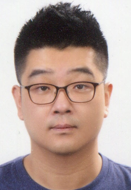 Chang Choi合作论文数Department of Computer Engineering, Gachon University34
 Jong-Seok Lee合作论文数School of Integrated Technology, Yonsei University;Department of Artificial Intelligence, Yonsei University19
 Sungchul Kang合作论文数Korea Institute of Science and Technology17Jinkoo Chung合作论文数17
 Hyun Myung (明鉉)合作论文数School of Electrical Engineering, Korea Advanced Institute of Science and Technology;Unmanned Swarm CPS Research Lab Center, Korea Advanced Institute of Science and Technology15
 Young-Sik Kim合作论文数Samsung Electronics Co. Ltd.13Seongmin Kim合作论文数12
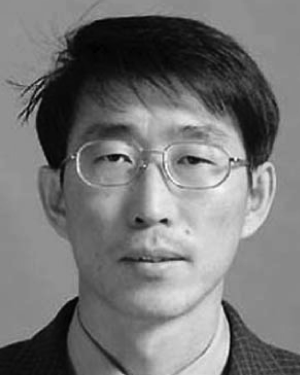 Cheolsun Park合作论文数10
 Joonho So合作论文数10
 Jun Hyuk Kim合作论文数Multimedia Computing and Machine Learning Group, Yonsei University10
 Yong-Hoon Kim合作论文数9Jong-Won Yang合作论文数9Seung-Jong Kim合作论文数9
 Dongjin Choi合作论文数Department of Metallurgical Engineering, Sungkyunkwan University9Sun-Phil Nah合作论文数8Choongik Choi合作论文数8
 Kwan H. Lee合作论文数GIST8Jaekook Ha合作论文数8
 Woosub Lee合作论文数korea institute of science and technology8
 Eungchang Mason Lee合作论文数Korea Adv Inst Sci & Technol, Sch Elect Engn, KI AI, KI R, Daejeon 34141, South Korea7Miyoung Cho合作论文数7Byeongkyu Ko合作论文数7
 Hoon Ko合作论文数7Yong Yi Lee合作论文数GIST7
 Choonghyun Son合作论文数Dept Elect & Electon Engn, Yonsei Univ6Eun-Mi Park合作论文数6Moon Gu Son合作论文数6
 Myunggwon Hwang合作论文数Dept. of Computer Science, Chosun University6
 Jin-Won Jeong合作论文数6Seok Kyu Oh合作论文数6Yong Hwi Kim合作论文数6
 Bilal Ahmed合作论文数5Myeongwoo Jeong合作论文数5Hyoungju Kim合作论文数5nari choi合作论文数5NJ Yoo合作论文数5Dongkwan Lee合作论文数Gangwon Institute5
 Jinwoo Shin合作论文数5Chun Min Ho合作论文数5Sang Jae Rhee合作论文数5
 Hyuk Park合作论文数Institut d'Estudis Espacials de Catalunya-UPC5
 Seongmin Pyo合作论文数Dept. of Inf. & Commun. Eng., Hanbat Nat. Univ.;c;Dept. of Inf. & Commun. Eng., Hanbat Nat. Univ.5
 Manri Cheon合作论文数Samsung Research5Kyeong Ho Yun合作论文数5
 Jong Hun Lee合作论文数5Jae-Won Lee合作论文数4Youngduk Park合作论文数4Younghun Lee合作论文数4




