Large earthquakes can disrupt river systems and produce abrupt, unforeseen changes in flood risk. Forward modelling of earthquake-related surface deformation and its influence on inundation extent, depth, and frequency enables pre-emptive assessment of exposure to this compound hazard. This study presents a novel paired fault-dislocation and hydrodynamic modelling framework to assess near-fault Increased Flooding Vulnerability (IFV), defined as an increase in flood depth due to earthquake induced ground deformation. We apply this framework to simulate rupture scenarios for the real-world case study of the Titri fault in Otago, New Zealand to evaluate changes in flood risk within the Taieri Basin, where the Lower Taieri Flood Protection Scheme currently modulates flood risk. Results reveal zones of heightened exposure to coseismic and post-seismic flooding and demonstrate how deformation could undermine key flood defenses. At 2.6 m of single-event displacement on a 60° dipping fault, Dunedin International Airport is exposed to flooding during a 2 - 5% annual exceedance probability flood event, with depths averaging ≥0.5 m at the terminal and ≥1.5 m near the runway. Fault uplift also obstructs the basin’s sole drainage outlet, while footwall subsidence reduces infiltration and may facilitate coseismic lake formation. Early identification of areas facing increased flooding vulnerability provides an evidence base for long-term risk assessment and land-use planning in regions exposed to both seismic and flood hazards. The need for this is crucial as coastal subsidence, liquefaction and riverine floods compromise flood protection and comprise an underestimated global risk.
Aims. We investigate the photometric characteristics of a sample of intermediate-luminosity red transients (ILRTs), a class of elusive objects with peak luminosity between that of classical novae and standard supernovae. Our goal is to provide a stepping stone in the path to reveal the physical origin of such events, thanks to the analysis of the datasets collected. Methods. We present the multi-wavelength photometric follow-up of four ILRTs, namely NGC 300 2008OT-1, AT 2019abn, AT 2019ahd, and AT 2019udc. Through the analysis and modelling of their spectral energy distribution and bolometric light curves, we inferred the physical parameters associated with these transients. Results. All four objects display a single-peaked light curve which ends in a linear decline in magnitudes at late phases. A flux excess with respect to a single blackbody emission is detected in the infrared domain for three objects in our sample, a few months after maximum. This feature, commonly found in ILRTs, is interpreted as a sign of dust formation. Mid-infrared monitoring of NGC 300 2008OT-1 761 days after maximum allowed us to infer the presence of similar to 10(-3)-10(-5) M-circle dot of dust, depending on the chemical composition and the grain size adopted. The late-time decline of the bolometric light curves of the considered ILRTs is shallower than expected for 56Ni decay, hence requiring an additional powering mechanism. James Webb Space Telescope observations of AT 2019abn prove that the object has faded below its progenitor luminosity in the mid-infrared domain, five years after its peak. Together with the disappearance of NGC 300 2008OT-1 in Spitzer images seven years after its discovery, this supports the terminal explosion scenario for ILRTs. With a simple semi-analytical model we tried to reproduce the observed bolometric light curves in the context of a few solar masses ejected at few 10(3) km s(-1) and enshrouded in an optically thick circumstellar medium.
Symbiotic stars are binaries in which a cool and evolved star of luminosity class I-III accretes onto a smaller companion. However, direct accretion signatures like disc flickering and boundary layer X-rays are typically outshone or suppressed by the luminous giant, shell burning on the accreting white dwarf, and the illuminated wind nebula. We present a new way to find symbiotics that is less biased against directly detectable accretion discs than methods based on narrow-band H alpha photometry or objective prism plate surveys. We identified outliers in SkyMapper survey photometry, using reconstructed uvg snapshot colours and rapid variability among the three exposures of each 20-min SkyMapper Main Survey filter sequence, from a sample of 366 721 luminous red objects. We found that SkyMapper catalogue colours of large-amplitude pulsating giants must be corrected for variability, and that flickering is detectable with only three data points. Our methods probed a different region of parameter space than a recent search for accreting-only symbiotics in the GALAH survey, while being surprisingly concordant with another survey's infrared detection algorithm. We discovered 12 new symbiotics, including four with optical accretion disc flickering. Two of the optical flickerers exhibited boundary-layer hard X-rays. We also identified 10 symbiotic candidates, and discovered likely optical flickering in the known symbiotic V1044 Cen (CD-36 8436). We conclude that at least 20 per cent of the true population of symbiotics exhibit detectable optical flickering from the inner accretion disc, the majority of which do not meet the H alpha detection thresholds used to find symbiotics in typical narrow-band surveys.
We present an ultraviolet to infrared search for the electromagnetic (EM) counterpart to GW190425, the second ever binary neutron star merger discovered by the LIGO-Virgo-KAGRA Collaboration. GW190425 was more distant and had a larger localization area than GW170817, so we use a new tool, Teglon , to redistribute the GW190425 localization probability in the context of galaxy catalogs within the final localization volume. We derive a 90th percentile area of 6688 deg ^2 , a ∼1.5× improvement relative to the LIGO/Virgo map, and show how Teglon provides an order-of-magnitude boost to the search efficiency of small (≤1 deg ^2 ) field-of-view instruments. We combine our data with a large, publicly reported imaging data set, covering 9078.59 deg ^2 of unique area and 48.13% of the LIGO/Virgo-assigned localization probability, to calculate the most comprehensive kilonova (KN), short gamma-ray burst (sGRB) afterglow, and model-independent constraints on the EM emission from a hypothetical counterpart to GW190425 to date under the assumption that no counterpart was found in these data. If the counterpart were similar to AT 2017gfo, there would be a 28.4% chance of it being detected in the combined data set. We are relatively insensitive to an on-axis sGRB, and rule out a generic transient with a similar peak luminosity and decline rate as AT 2017gfo to 30% confidence. Finally, across our new imaging and publicly reported data, we find 28 candidate optical counterparts that we cannot rule out as being associated with GW190425, finding that four such counterparts discovered within the localization volume and within 5 days of merger exhibit luminosities consistent with a KN.
Aims. We investigate the spectroscopic characteristics of intermediate-luminosity Red Transients (ILRTs), a class of elusive objects with peak luminosity between that of classical novae and standard supernovae. Our goal is to provide a stepping stone in the path to unveiling the physical origin of these events based on the analysis of the collected datasets. Methods. We present the extensive optical and near-infrared (NIR) spectroscopic monitoring of four ILRTs, namely NGC 300 2008OT-1, AT 2019abn, AT 2019ahd and AT 2019udc. First we focus on the evolution of the most prominent spectral features observed in the low-resolution spectra. We then present a more detailed description of the high-resolution spectrum collected for NGC 300 2008OT-1 with the Very Large Telescope equipped with UVES. Finally, we describe our analysis of late-time spectra of NGC 300 2008OT-1 and AT 2019ahd through comparisons with both synthetic and observed spectra. Results. Balmer and Ca lines dominate the optical spectra, revealing the presence of slowly moving circumstellar medium (CSM) around the objects. The line luminosity of H alpha, H beta, and Ca II NIR triplet presents a double peaked evolution with time, possibly indicative of interaction between fast ejecta and the slow CSM. The high-resolution spectrum of NGC 300 2008OT-1 reveals a complex circumstellar environment, with the transient being surrounded by a slow (similar to 30 km s(-1)) progenitor wind. At late epochs, optical spectra of NGC 300 2008OT-1 and AT 2019ahd show broad (similar to 2500 km s(-1)) emission features at similar to 6170 & Aring; and similar to 7000 & Aring; which are unprecedented for ILRTs. We find that these lines originate most likely from the blending of several narrow lines, possibly of iron-peak elements.
Fault geometry and the connectivity between faults at depth are both important controls on the nucleation, propagation and arrest of earthquake rupture, so modelling these parameters accurately is essential to models of the earthquake cycle. However, simulations involving complex three-dimensional (3D) fault systems rarely explore the sensitivity of results to uncertainties in geometry and connectivity — either in terms of modelled earthquake characteristics or impacts such as ground shaking and surface deformation. In many cases, geometry-related sensitivity testing is limited because it is challenging to construct a suite of alternative fault models that span the range of plausible fault geometries, intersections and connections; such alternative models are especially difficult to construct for systems where faults truncate or cross-cut each other at depth. We present a new, semi-automated method that simplifies creation of 3D models of networks of tens or hundreds of faults, combining open-source python tools with the meshing capabilities of Leapfrog(TM) software. The new workflow reduces the time to create a fault model of 113 faults in central Aotearoa New Zealand by ~80%, from 25 hours to 5 hours of human input. This improvement significantly decreases the effort required to create multiple alternative fault geometries, making detailed sensitivity analyses more feasible. The applicability of the workflow is demonstrated for the creation of three alternative models of fault geometries for central Aotearoa New Zealand.
We developed an approach to quantify road infrastructure exposure to fault displacement hazard (FDH) that adopts Fault Displacement Hazard Analysis (FDHA) principles and addresses regionalscale challenges for emergency management and network planning. FDH results from ground deformation in surface-rupturing earthquakes and can damage nearby infrastructure. This study assesses New Zealand's road network exposure and vulnerability to FDH by generating displacement fields around faults based on historical earthquake data and physics-based models. Relative hazard is quantified as the product of 1D strain resolved along roads and normalised fault slip-rate, and was mapped at the regional scale. Vulnerability is assessed using geomorphon land class, or the road's position in the landscape, as a proxy for susceptibility to damage and repairability. Four areas emerged as potentially having higher risk: Wellington, the Eastern North Island, the West Coast, and the Upper South Island. We reviewed the local factors that influenced these measurements of hazard, exposure, and vulnerability. The Wellington Region is particularly vulnerable where roads intersect the Hutt Valley and Wairarapa Faults, and sections of State Highway 6 along the Alpine Fault in the West Coast are at heightened risk. This analysis underscores the need for regional approaches to fault displacement hazard and for targeted mitigation, such as fault avoidance, engineering solutions, and planning for rapid post-event repair. Our findings provide insights into horizontal infrastructure resilience planning for transport and other critical systems in seismically active areas.
Large earthquakes can trigger cascading flood hazards that can influence societal risk and loss; however, the mechanisms driving coseismic river response (CRR) in seismogenic regions have not been fully characterized. This review synthesizes data from fifty-two global cases of CRR where surface deformation affected rivers and identifies the key physical and environmental parameters that control riverine flood hazard in earthquakes. We identify four primary CRR classes, ranging from channel-confined ponding to overbank flooding and avulsion, wherein a river shifts into an enduring new course within the floodplain. CRR susceptibility governs the likelihood, spatial extent, and longevity of CRR, and links back to the characteristics of the surface deformation, river planform, and host environmental setting. Dip-slip fault ruptures, with a large vertical separation at the surface capable of damming river channels, are the primary driver of CRR. Multi-meter dip-slip offsets are also linked to fault-block tilting, which reduce or reverse the gradients of overlying channels. These tilted fault blocks can induce coseismic flooding or avulsion away from the principal fault, with cases documented up c. 10 km upstream from the fault-river intersection. Lateral offsets can amplify or modulate CRR but are generally less effective than vertical offsets at causing them. Two-thirds of CRR cases occurred in single-thread rivers, the majority of which are meandering systems occupying intermontane or lowland basins. Liquefaction-prone substrates in these floodplains exacerbate CRR impacts through ground deformation that disrupts river channel profiles and the local water table. Overbank flooding, lake formation, and prolonged surface flooding are common outcomes near meandering channels and may occur away from the principal fault. Confined braided rivers with high width-to-depth ratios are more resistant to overbank flow and avulsion. In unconfined settings, erodible substrates, and low lateral bank stability amplify the potential for channel scour and rapid avulsion. Braided floodplains often host dense networks of paleochannels within their floodplain, and in any environment, paleochannels enhance the potential for, and geographic extent of flooding and avulsion. High discharge conditions elevate the potential for overbank flow and avulsion, and the hazard posed by CRR may be higher in regions where the climate is perennially or seasonally wet. The risk posed by CRR during earthquakes is heightened in areas where population expansion and land reclamation in flood and liquefaction-prone zones is commonplace. A method to assess CRR risk in advance is required, and a probabilistic framework incorporating uncertainties in fault behaviour, recurrence intervals, and flood-rating curves may offer a way to evaluate absolute hazard in areas where faults and rivers intersect. Site-specific hydrodynamic modelling can further quantify potential changes in flood patterns in high-hazard, high-exposure areas, paving the way for assessing societal and economic risks. We suggest the need is urgent in places such as India and Bangladesh's GangesBrahmaputra-Meghna delta. This densely populated region, home to similar to 150 million people, is underlain by a locked plate boundary and active faults. Historic earthquakes in the region suggest that future large seismic events could trigger widespread changes in flood hazard, exacerbating the existing risk posed by flooding.
New Zealand's vulnerability to seismic hazards highlights the need for systems capable of providing earthquake early warning (EEW) alerts or rapid notice of strong shaking. Large offshore earthquakes along the subduction zone east of the North Island could also trigger catastrophic tsunamis, inundating coastal communities in under an hour. Although New Zealand operates a robust seismic and geodetic network capable of monitoring moderate-to-large earthquakes, the limited observational record of large earthquakes poses challenges for EEW design and response. This study evaluates magnitude estimation from G-FAST, an early warning algorithm that uses Global Navigation Satellite System (GNSS) data to characterize earthquake sources. We analyze synthetic rupture scenarios along the Hikurangi subduction margin generated by the earthquake simulator RSQSim. For each rupture, GNSS displacements are generated at each site and compared with Peak Ground Displacement (PGD) scaling relationships to test whether they replicate real earthquakes. While we also assess PGD values from rupture scenarios produced with simpler semi-stochastic kinematic modeling, those from RSQSim yield ground motions more consistent with expected values. Given these results, synthetic displacement data from RSQSim ruptures were ingested into G-FAST to evaluate performance for rapid earthquake characterization, finding that PGD-based estimates capture moment magnitude in 90% of cases. This framework demonstrates the utility of synthetic catalogs for testing geodetic EEW performance in characterizing large subduction earthquakes in the North Island region and provides a path- way toward tsunami early warning procedures.
A well-known problem in seismic hazard is the short duration of the historical record relative to the time between large earthquakes. This short record means that not all possible earthquakes have been observed, and that the statistics of earthquake recurrence intervals and magnitudes are poorly constrained. These issues are particularly acute for earthquakes involving multiple faults, such as the 2010 El Mayor-Cucapah and 2016 Kaikōura earthquakes. Such earthquakes demonstrate the potentially complex interactions of faults in single earthquakes, contrasting with the typical assumption of characteristic fault ruptures used in seismic hazard assessment. Physics-based earthquake simulators offer one approach for exploring the occurrence of, and controls on, such multi-fault earthquakes. Here we use the physics-based earthquake simulator RSQsim to generate two 450~kyr synthetic earthquake catalogues for central Aotearoa New Zealand, with and without the Hikurangi subduction interface. We improve on previous synthetic earthquake catalogues for Aotearoa New Zealand by implementing a new 3D fault modelling methodology, which is better able to account for along-fault and down-dip variations in fault geometry. We investigate the occurrence of multi-fault earthquakes in our synthetic catalogues with a particular emphasis on the role of the southern part of the Hikurangi subduction interface in these earthquakes. The synthetic catalogues show an increasing proportion of multi-fault earthquakes at higher magnitudes. We find that the subduction interface exerts a significant control on the aspect ratios, rates of occurrence, and faults involved in synthetic multi-fault earthquakes. Whilst our catalogues contain $>$100 complex multi-fault events broadly similar to the 2016 Kaik\=oura earthquake, none rupture exactly the same combination of faults, suggesting that either this fault combination is rare or that key aspects of the controlling physics or fault network are not captured by the earthquake simulator.
The timing and size of successive prehistoric earthquakes on individual active faults are key for understanding seismic processes and time‐dependent seismic hazards. Here, we analyze interevent and elapsed times for 890 large prehistoric and historic earthquakes on 210 normal, reverse and strike‐slip faults from five active tectonic regions globally (Japan, Greece, New Zealand and the California & Basin‐and‐Range provinces in the US). Most faults (∼80%) have mean interevent times greater than the elapsed time (open‐interval) since their last recorded earthquake. We also find that 85%–100% of closed interevent times, defined by 64 historic ruptures and their penultimate events on these faults, occurred within a factor of two of their mean recurrence‐interval, with 75% less than the mean. These observations hold for a variety of tectonic settings and fault parameters, with faster slip‐rate faults (>10 mm/a) being consistently more “advanced” in their seismic‐cycle than slower moving faults. The entire global population of closed interevent‐times is consistent with a Weibull probability density function (PDF), while stochastic modeling tailored to closed‐interval parameters indicates that open recurrence‐interval data sets are best “predicted” by positively skewed elapsed time distributions (52%–78% overlap integral) for all regions, except California. Thus, the rarity of elapsed times exceeding mean interevent‐times on individual faults may be due to skewed recurrence PDFs (i.e., Brownian Passage Time, lognormal, etc.), in which the median and mode are less than its mean, while California is an outlier potentially because its open‐intervals derive from a single geometrically interconnected fast‐moving (>10 mm/a) fault system that is presently experiencing an earthquake‐hiatus.
Understanding the complexity of earthquake source parameters, including coseismic slip distribution and rupture dimensions, is essential for local-scale seismic and tsunami hazard assessments. One effective approach is to use earthquake source models generated from synthetic earthquake catalogues via physics-based generators like RSQSim. A key factor influencing the characteristics of a synthetic earthquake catalogue is the tectonic stressing rate, calculated from the slip-deficit rate using a back-slip loading method. The slip-deficit rate can be calculated by integrating the geodetically-inferred convergence rate from Euler Pole rotations with seismic coupling models. Unfortunately, some of the world’s subduction zones have insufficient geodetic data to significantly constrain coupling models. Such is the case with our focus area in the southwest Pacific. To overcome this challenge, we estimate coupling factors on subduction interfaces by adjusting them according to the seismicity rate ratios between the instrumental and synthetic earthquake catalogues of the baseline models. The subduction interfaces are divided into several segments for calculating the seismicity rate ratios along strike. To incorporate sufficient instrumental earthquakes for seismicity rate estimates and to avoid artificial segmentation, we test the segment window lengths and shifting distance. Our new method is applied to the Tonga and Vanuatu subduction zones, which exhibit the highest convergence rates among subduction zones worldwide of approximately 240 mm/year. The coupling factor in this area was poorly defined in previous studies, leading to debate about whether the coupling was weak or strong in each segment. The ideal coupling distribution occurs when adjusted by seismicity rate ratios calculated with a 500 km moving window shifted 50 km along the strike for the Tonga and Vanuatu subduction zones. The results show weak coupling at northern Tonga and strong coupling at northern Vanuatu interfaces. We use this model to develop a synthetic catalogue of finite fault earthquakes spanning ~60,000 years.
The New Zealand Community Fault Model (NZ CFM) is a publicly available representation of New Zealand fault zones that have the potential to produce damaging earthquakes. Compiled through collaborative engagement between New Zealand earthquake-science experts, this first edition (version 1.0) of the NZ CFM builds upon previous compilations of earthquake-source active fault models with the addition of new and modified information. Developed primarily to support an update of the New Zealand National Seismic Hazard Model, the NZ CFM comprises two principal components. The first dataset is a two-dimensional map representation of the surface traces of 880 generalised fault zones. Each fault zone is assigned specific geometric and kinematic attributes, including uncertainties, supplemented with a subjective quality ranking focused primarily on the confidence in assigned slip rates. The second component is a three-dimensional representation of the fault zones as triangulated mesh surfaces that are projected down-dip from the two-dimensional mapped traces to a geophysically-defined maximum fault rupture depth. This article summarises the compilation and parameterisation of the NZ CFM, along with background on its relation to predecessor datasets, and forward applications to probabilistic seismic hazard assessment and physics-based earthquake models currently being developed for Aotearoa New Zealand.
ABSTRACT As part of the 2022 revision of the Aotearoa New Zealand National Seismic Hazard Model (NZ NSHM 2022), deformation models were constructed for the upper plate faults and subduction interfaces that impact ground-shaking hazard in New Zealand. These models provide the locations, geometries, and slip rates of the earthquake-producing faults in the NZ NSHM 2022. For upper plate faults, two deformation models were developed: a geologic model derived directly from the fault geometries and geologic slip rates in the NZ Community Fault Model version 1.0 (NZ CFM v.1.0); and a geodetic model that uses the same faults and fault geometries and derives fault slip-deficit rates by inverting geodetic strain rates for back slip on those specified faults. The two upper plate deformation models have similar total moment rates, but the geodetic model has higher slip rates on low-slip-rate faults, and the geologic model has higher slip rates on higher-slip-rate faults. Two deformation models are developed for the Hikurangi–Kermadec subduction interface. The Hikurangi–Kermadec geometry is a linear blend of the previously published interface models. Slip-deficit rates on the Hikurangi portion of the deformation model are updated from the previously published block models, and two end member models are developed to represent the alternate hypotheses that the interface is either frictionally locked or creeping at the trench. The locking state in the Kermadec portion is less well constrained, and a single slip-deficit rate model is developed based on plate convergence rate and coupling considerations. This single Kermadec realization is blended with each of the two Hikurangi slip-deficit rate models to yield two overall Hikurangi–Kermadec deformation models. The Puysegur subduction interface deformation model is based on geometry taken directly from the NZ CFM v.1.0, and a slip-deficit rate derived from published geodetic plate convergence rate and interface coupling estimates.
Our current understanding of cosmology is largely shaped by Type Ia supernovae (SNe Ia), the detonations of carbon-oxygen white dwarves (WDs). SNe Ia are powerful standard candles due to their uniform peak luminosities which decay predictably. SNe Ia progenitor system architecture is highly debated, as none have been observed pre- and post-detonation. Within the first few days after detonation, critical progenitor signatures are preserved in the ultraviolet (UV) bandpass. We present the optical design of UVIa, a proposed 12U CubeSat capable of simultaneous measurements in the far-UV, near-UV, and u-band. Double-offset Cassegrain telescopes were designed to image onto CMOS detectors. We discuss the benefits a nd c hallenges a ssociated with double-offset t elescopes. UVIa additionally s erves as a t echnology demonstration platform f or several c utting-edge UV technologies. The optical design of UVIa enables early-time observations of SNe Ia and serves as a pathfinder for future UV transient telescopes.
Seismic and tsunami hazard modelling and preparedness are challenged by uncertainties in the earthquake source process. Important parameters such as the recurrence interval of earthquakes of a given magnitude at a particular location, the probability of multifault rupture, earthquake clustering, rupture directivity and slip distribution are often poorly constrained. Physics-based earthquake simulators, such as RSQSim, offer a means of probing uncertainties in these parameters by generating long-term catalogues of earthquake ruptures on a system of known faults. The fault initial stress state in these simulations is typically prescribed as a single uniform value, which can promote characteristic earthquake behaviours and reduce variability in modelled events. Here, we test the role of spatial heterogeneity in the distribution of the initial stresses and frictional properties on earthquake cycle simulations. We focus on the Hikurangi-Kermadec subduction zone, which may produce M-w > 9.0 earthquakes and likely poses a major hazard and risk to Aotearoa New Zealand. We explore RSQSim simulations of Hikurangi-Kermadec subduction earthquake cycles in which we vary the rate and state coefficients (a and b). The results are compared with the magnitude-frequency distribution (MFD) of the instrumental earthquake catalogue and with empirical slip scaling laws from global earthquakes. Our results suggest stress heterogeneity produces more realistic and less characteristic synthetic catalogues, making them particularly well suited for hazard and risk assessment. We further find that the initial stress effects are dominated by the initial effective normal stresses, since the normal stresses evolve more slowly than the shear stresses. A heterogeneous stress model with a constant pore-fluid pressure ratio and a constant state coefficient (b) of 0.003 produces the best fit to MFDs and empirical scaling laws, while the model with variable frictional properties produces the best fit to earthquake depth distribution and empirical scaling laws. This model is our preferred initial stress state and frictional property settings for earthquake modelling of the Hikurangi-Kermadec subduction interface. Introducing heterogeneity of other parameters within RSQSim (e.g. friction coefficient, reference slip rate, characteristic distance, initial state variable, etc.) could further improve the applicability of the synthetic earthquake catalogues to seismic hazard problems and form the focus of future research.
Subduction zones have the greatest potential to generate large earthquakes and tsunamis. However, when undertaking Probabilistic Tsunami Hazard Assessments (PTHAs), subduction zones are a significant source of epistemic uncertainty. Therefore, understanding how the spatial distribution of elastic strain accumulation on the subduction interface influences the tsunami hazard is important for providing comprehensive hazard assessments, as well as quantifying uncertainty. This is especially important if the spatial locking distribution is undefined, and if it changes through time. Physics-based earthquake simulators allow different interpretations of the subduction interface locking distribution to be modelled, and how this influences the long-term seismicity, and the tsunami hazard, can be explored. Using three physics-based synthetic earthquake catalogues, generated by the earthquake simulator RSQSim, we analysed the tsunami hazard in Aotearoa/New Zealand. Three alternative representations of the subduction interface locking distribution along the Hikurangi Subduction Margin and the Tonga-Kermadec Subduction Zone were specified in the simulator to generate the catalogues. We modelled the tsunamis generated by $M_W\, \gt $8.0 earthquakes from each of the catalogues and undertook PTHAs. These assessments show that patches of high slip-deficit, both along strike and dip of the subduction interface, increase the tsunami hazard at the coast. Locking along the shallowest segments of the subduction interface also significantly increases the tsunami hazard. Our results show that careful consideration of the locking distribution in physical models is necessary before using them for PTHAs. They also show that by analysing multiple physical models of subduction zones, uncertainty in hazard assessments caused by the unresolved interface properties can also begin to be quantified.
The New Zealand Active Faults Database (NZAFD) contains underpinning data to help mitigate the impacts of future surface-rupturing earthquakes in Aotearoa New Zealand. However, defining the associated hazards and risks must be undertaken at relevant scales and as such, the NZAFD contains two scale-based datasets each serving complementary, but different, purposes. The high-resolution ('NZAFD-HighRes') dataset contains enough detail on surface traces for cadastral scale land-use planning purposes, while the other dataset is generalised to 1:250,000 scale ('NZAFD-AF250'). Here we document for the first time the NZAFD-HighRes dataset (v2.0) and describe the recent efforts that have focused on updating the dataset structure to increase useability, compiling data and improving GIS infrastructure. The NZAFD-HighRes and NZAFD-AF250 datasets, along with Fault Avoidance Zones and Fault Awareness Areas - land-use planning tools used to mitigate surface rupture hazard - are publicly accessible via the active faults web service and a webmap application at https://data.gns.cri.nz/af/. This upgraded webmap enables active fault data to be discovered and used for informing future surface rupture hazard assessments. The relationship of the NZAFD to other active fault datasets and models is also discussed, along with future directions and challenges.
Prehistoric records of subduction earthquakes are often distinguished by evidence of synchronous widespread coastal deformation, the extent of which negates the plausibility of alternative source faults. At the Hikurangi subduction margin in New Zealand, untangling the record of subduction interface ruptures is complicated. Large earthquake age uncertainties inhibit unique solutions of along-strike correlations, and complex patterns of coastal deformation caused by upper-plate faulting prevent reliable indication of source faults. In this work, we improved paleoearthquake reconstructions on the central Hikurangi margin with a new, well-constrained 5000 yr earthquake record from Pakuratahi Valley near Napier, North Island, New Zealand. Evidence of laterally extensive paleoenvironmental changes is consistent with coseismic subsidence and coseismic uplift in large earthquakes. Radiocarbon dates on fragile terrestrial macrofossils and tephra isochrons were used to construct robust age models that yielded earthquake ages of 4839−4601 calibrated (cal.) yr B.P., 3630−3564 cal. yr B.P., 2687−2439 cal. yr B.P., and 1228−823 cal. yr B.P. Integration of these ages with refined earthquake chronology from nearby Ahuriri Lagoon indicated that the next large earthquake impacting the Napier area is more likely to cause coastal subsidence than uplift. Drawing on correlations with cotemporal evidence elsewhere on the central margin, we infer that the overall patterns of coseismic deformation could be generated by either rupture of the subduction interface or upper-plate faults, or both. This inability to separate source faults for past earthquakes limits the efficiency of forecasting future earthquakes. Similar problems of intertwined paleoearthquake signatures likely apply to other plate boundaries, where we recommend cautious interpretation of coastal deformation to accurately address the hazard from both types of source faults.
Surface-rupturing earthquakes can produce fault displacements that abruptly alter the established course of rivers. Several notable examples of fault rupture–induced river avulsions (FIRAs) have been documented, yet the factors influencing these phenomena have not been examined in detail. Here, we use a recent case study from New Zealand’s 2016 Kaikōura earthquake to model the coseismic avulsion of a major braided river subjected to ~7-m vertical and ~4-m horizontal offset. We demonstrate that the salient characteristics of the avulsion can be reproduced with high accuracy by running a simple two-dimensional hydrodynamic model on synthetic (pre-earthquake) and “real” (post-earthquake) deformed lidar datasets. With adequate hydraulic inputs, deterministic and probabilistic hazard models can be precompiled for fault-river intersections to improve multihazard planning. Flood hazard models that ignore present and potential future fault deformation may underestimate the extent, frequency, and severity of inundation following large earthquakes.
 Iair Arcavi合作论文数School of Physics and Astronomy, Faculty of Exact Sciences, Tel Aviv University;CIFAR80
 C. McCully合作论文数70
 Peter Nugent合作论文数Computational Research Division, Lawrence Berkeley National Laboratory;Computational Cosmology Center, Lawrence Berkeley National Laboratory54Daichi Hiramatsu合作论文数40
 Mark Sullivan合作论文数School of Physics & Astronomy, University of Southampton38r pain合作论文数36
 Stefano Valenti合作论文数Department of Physics, University of California, Davis36
 Isobel Hook合作论文数ESO36Pierre L. Astier合作论文数35
 Robert Quimby合作论文数Department of Astronomy, College of Sciences, San Diego State University;Mount Laguna Observatory;Kavli IPMU34Nicolas Regnault合作论文数33S. Fabbro合作论文数The Supernova Cosmology Project33
 Andrew B Conley合作论文数and 17 others32
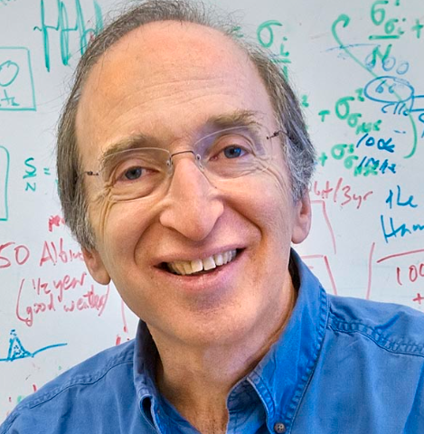 Saul Perlmutter合作论文数Lawrence Berkeley National Laboratory;Department of Physics, University of California, Berkeley31Gregory Scott Aldering合作论文数Lawrence Berkeley National Laboratory, University of California30
 Ariel Marcelo Goobar合作论文数Oskar Klein Centre for Cosmoparticle Physics, Stockholm University29Craig Pellegrino合作论文数Las Cumbres Observatory;Department of Physics, University of California;Department of Physics, University of California28
 Richard Ellis合作论文数Department of Physics & Astronomy, Faculty of Maths & Physical Sciences, University College London27d hardin合作论文数26G. Hosseinzadeh合作论文数26David J. Sand合作论文数26
 Rahman Amanullah合作论文数24
 Gastón Folatelli合作论文数Instituto de Astrofísica de La Plata, Conicet La Plata;Facultad de Ciencias Astronómicas y Geofísicas, Universidad Nacional de la Plata24A. G. Kim合作论文数24
 Chris Lidman合作论文数Research School of Astronomy & Astrophysics, College of Science, Australian National University;Centre for Gravitational Astrophysics, College of Science, Australian National University24
 Mansi M. Kasliwal合作论文数California Institute of Technology23
 Susana Deustua合作论文数National Institute of Standards and Technology23G. Goldhaber合作论文数22Timothy Stahl合作论文数21k schahmaneche合作论文数21E. P. González合作论文数21s nobili合作论文数21P. Ruiz-Lapuente合作论文数20Al Spadafora合作论文数20G. Garavini合作论文数20
 Michael Shane Burns合作论文数Colorado College19j raux合作论文数18Griffin Hosseinzadeh合作论文数18
 Alexei V. Filippenko合作论文数Department of Astronomy, University of California, Berkeley18
 Shri Kulkarni合作论文数Division of Physics, Mathematics and Astronomy, California Institute of Technology17
 Pierre Antilogus合作论文数IN2P3-CNRS, Université Claude Bernard de Lyon17
 Brad Cenko合作论文数Astrophysics Science Division, NASA Goddard Space Flight Center;, Joint Space-Science Institute16
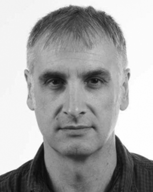 V. Stanishev合作论文数16
 Ray Carlberg合作论文数David A. Dunlap Department of Astronomy & Astrophysics, University of Toronto16
 J. Craig Wheeler合作论文数Department of Astronomy, College of Natural Sciences, The University of Texas at Austin;The Wootton Center for Astrophysical Plasma Properties, College of Natural Sciences, The University of Texas at Austin16
 Andrew Fruchter合作论文数Space Telescope Science Institute16Christophe Balland合作论文数16
 Kate Clark合作论文数GNS Science16Carlton R Pennypacker合作论文数16




