The Cooperative Science and Monitoring Initiative aims to generate data and information to support environmental management in the Laurentian Great Lakes of North America. On a rotating basis, efforts are focused on each lake every five years. In this study, we developed a state-of-the-art hydrodynamic and ecological modeling framework to aggregate data collected during these initiative years and from other sources, and to simulate lake eutrophication processes in Lake Ontario, with an emphasis on nearshore conditions. Model calibration and validation were based primarily on data from three initiative years (2008, 2013, and 2018). This integrated model provides a framework for data organization, understanding complex lake process interactions, and guiding future data collection. It is designed as a management support tool that can simulate lake responses to changes in loading conditions, such as sensitivity of nearshore water quality to Niagara River phosphorus loads. Its designated aim is to support evaluation of management questions in Lake Ontario by providing quantitative evaluation of the relative benefits of potential nutrient loading abatement strategies to mitigate eutrophication in the nearshore. This framework is also well suited for possible future expansion to address management issues on a whole-lake basis.
Invasive dreissenid mussels (Dreissena polymorpha and Dreissena bugensis) have a profound effect on the total phosphorus (TP) budget in Lake Ontario, which in turn influences ecological processes such as the resurgence of the benthic alga Cladophora. A validated three-dimensional integrated hydrodynamic and ecological modeling framework is applied to quantify the impact that dreissenids have on the spatial and species distribution of TP in the lake. Model results for April to September 2013 show that dreissenids decrease TP in the water column by about 1812 metric tonnes, which is about 60% of the tributary TP loading to the lake. This reduction in TP affects other processes controlling its distribution. Physical transport of TP from nearshore to offshore waters is reduced, and the amount of TP involved in chemical reactions is reduced, while TP processed by biological transformations is increased. This study provides the first attempt to quantify the TP budget changes in Lake Ontario by dreissenids using numerical modeling, and findings of this study can be generalized to other lakes with similar conditions.
Excess nutrients from agricultural settings contribute to surface water and groundwater impairment. Constructed wetlands have been widely used for water quality protection in various agricultural systems. We used a synthesis approach to document the performance of constructed wetlands for nutrient removal from a range of landscapes and geographic regions with the following objectives: (1) review the current use of constructed wetlands in agricultural applications, (2) summarize the nutrient removal efficiency of constructed wetlands, and (3) identify the geographic usage and costs associated with constructed wetlands. We reviewed over 130 publications and reports to characterize nutrient removal performance for the following types of agricultural effluents: cropland surface and subsurface drainage, and wastewater from livestock production, greenhouse, aquaculture, and hydroponic systems. Data from the reviewed studies indicate that constructed wetlands are efficient in protecting water quality in agricultural production settings. However, differences in constructed wetland characteristics reported by the studies suggest that standards are needed to ensure nutrient removal goals are met based on wetland design. Researchers should consider including basic performance parameters for constructed wetlands in published reports, including influent and effluent concentrations, hydraulic retention time, hydraulic loading rate, watershed to treatment wetland ratios, and plant species and relative cover. Future studies are needed to explore cost-benefit analyses to assess the feasibility and potential promotion of wetland incentive programs in various geographic regions and watershed nonpoint-source pollution goals for using these systems in agricultural settings.
Constructed and restored wetlands can be effective sinks for particulate and dissolved phosphorus (P) if properly managed, but identifying suitable P retention wetland locations remains challenging. From a landscape perspective, Soil and Water Assessment Tool (SWAT) models identify locations within target watersheds with high nutrient loads that exhibit appropriate site characteristics and hydrodynamics. However, soil properties vary at the field scale, dictating the capacity of wetland systems to remove P and ultimately determining if a given wetland will operate as a sink or source of P over time. Land ownership and site access further complicate identification of P retention wetland locations. As a result, optimization and identification of P retention wetland locations requires analysis at both 1) watershed and 2) field scales, and 3) public engagement. In response, a survey effort linked SWAT model results that identified locations with target watersheds with field soil P storage capacity data and interested landowners. Results suggest that several locations recommended for their high SWAT-predicted P loading and landowner interest were in fact not well suited for project implementation due to soil P saturation and legacy P constraints. These findings highlight the need to couple watershed models with field scale soils analysis to identify locations for P retention wetlands in order to avoid unintended P release. Additionally, increased collaboration with social scientists and others familiar with public engagement strategies is needed to improve outreach activities targeting regional water quality improvements. Practical applications for nutrient retention wetland site selection are also discussed.
To address the management of eutrophication in aquatic systems, the behavioral mechanisms that drive change at the individual level must be considered when designing policy interventions. This analysis identifies the beliefs that are critical to behavioral change, and explores the likelihood that farmers will adopt two management practices believed to be critical to reducing nutrient loading to recommended levels in Lake Erie. We find that there is potential for farmers to adopt key infield practices needed to reduce nutrient inputs. And further, that increased adoption of such practices is possible by increasing the perceived efficacy of the majority of farmers who are motivated to take action. Integrating these findings with physical models of nutrient movement indicates that adoption of these practices in combination with edge of field practices can attain phosphorus reduction targets for the lake. Future research should focus on measuring the effectiveness of education and outreach programs aimed at engaging farmers and promoting adoption of recommended practices. Such programs may only be effective if they are successfully building farmer confidence in their ability to implement the practices (i.e., perceived self efficacy) and increasing farmer's belief in the effectiveness of the practices at reducing nutrient loss and improving local water quality (i.e., perceived response efficacy).
The Missouri River Basin (MRB) functions as the “life zone” for the larger Mississippi River Basin, providing grassland habitat that infiltrates precipitation and recharges groundwater, reduces sediment erosion, filters nutrients, stores carbon, and provides critical habitat for wildlife. The role of this region as a producer of food and fuel, both nationally and internationally, creates unique challenges for conservation. To support conservation efforts and sustainable management of this invaluable resource, a large-scale, screening-level evaluation of the water quantity and quality benefits of land conservation efforts in the MRB was performed. This paper describes the development and application of a Soil and Water Assessment Tool (SWAT) model to the MRB study area to provide estimates of water quantity and quality (sediment, total phosphorus, total nitrogen) benefits from the avoided conversion of intact grassland to cultivated cropland. The results of this study indicate that the avoided conversion of grassland to cropland could potentially prevent more than 1.7 trillion gallons of surface runoff as well as prevent the export of approximately 46 million tons of sediment, 87 million pounds of total phosphorus, and 427 million pounds of total nitrogen from the MRB study area landscape every year.
Since the mid-1990s, Lake Erie has experienced re-eutrophication symptoms including harmful algal blooms in the western basin and summer hypoxia in the Central Basin. The 2012 Protocol for the Great Lakes Water Quality Agreement (GLWQA) required phosphorus objectives and management recommendations to be set for all the Great Lakes, beginning with Lake Erie. To inform setting revised loading targets for the Lake Erie portion of the GLWQA, modeling was performed. The development and application of one of those models, the Western Lake Erie Ecosystem Model (WLEEM), is described here. WLEEM is a three dimensional, fine-scale, process-based model that links hydrodynamic, sediment transport, and in-lake biogeochemical and ecological processes. WLEEM was applied here to assess system sensitivity to a range of variables, and ultimately to develop a robust phosphorus load — cyanobacteria response relationship to determine a maximum load of total phosphorus from the Maumee River during the period of March–July that would produce a mild cyanobacteria bloom (<7830MT cyanobacteria biomass) in Western Lake Erie. The maximum total phosphorus load from the Maumee River for that period to produce a mild bloom was determined to be 890metrictons. Given the natural variability of systems like this, tools like WLEEM used in a dynamic operational modeling mode, consistent tributary and lake monitoring, and ongoing research will be essential components of effective mitigation and science-based adaptive management of eutrophication in Lake Erie and other nutrient-impacted water bodies.
The alteration of natural flow regimes associated with land use change increases storm water runoff volume, increases peak flows, and reduces the time to peak flow. This can cause flooding, erosion, and higher pollutant loading in streams, rivers, lakes, and estuaries. Rain gardens represent a sustainable and economic method to decrease the volume of water that flows into rivers and streams from impervious areas during storm events. For developments that were built without permanent storm water controls, rain gardens may be a viable retrofit instead of centralized and more costly alternatives. However, there is a lack of knowledge about the performance of rain gardens in urban retrofit applications. In this rain garden study, the hydrologic performance of terraced, street-side rain gardens was examined by monitoring inflow and outflow volumes and water tables during simulated runoff events. Areas of uncertainty that were addressed include general relationships between inflow and hydrologic performance, and analyzing the behavior of the internal saturation zone. The performance variables quantified were runoff volume reduction, reduction in peak flow, and peak delay. For eight simulated runoff events of equivalent rainfall depths ranging from 0.1-1.7 cm, the street-side rain gardens reduced storm water volume by an overall total of 37% with mean individual simulation values for volume reduction, peak flow reduction, and peak delay of 52%, 62%, and 16 min, respectively. Regression relationships between equivalent rainfall depth and volume reduction were developed from the simulated runoff events for rain gardens of different surface area to catchment area ratios. From these relationships, it was conservatively predicted that the rain gardens retained the entire runoff volume for 26% of the 38 natural storm events monitored during the study. The results of this study suggest that rain gardens can benefit existing developments by reducing runoff volume and peak flow, and provide a dynamic internal saturation zone with the potential for water quality benefits. The findings also show the importance of understanding interactions with the in situ soil, the existing drainage system, and the entire catchment area when sizing rain gardens in urban retrofits to meet desired reduction objectives. (C) 2014 American Society of Civil Engineers.
Rain gardens are promoted as a best management practice to reduce overland runoff in communities where impervious surfaces are widespread. Benefits of stormwater mitigation include fewer combined-sewer overflow events, reduction of watershed discharge volume and partial reduction of pollutant loads via biofiltration. There is extensive literature detailing hydraulic and chemical behaviors of individual bioretention cells and a growing number of network models, but currently no peerreviewed studies on implemented networks of rain gardens. Starting in February 2009, two adjacent neighborhoods of comparable size and residential density (0.05 sq.mi., ~33 homes) in Westerville, Ohio were monitored for storm water discharge before and after the construction of residential rain gardens (14 downspout, 6 street-side) in one neighbourhood. The other neighbourhood was monitored as a control site to provide a reference for each storm event during the three year experiment. Flow data was collected at the outfalls of storm sewers for each neighbourhood. A weather station and rain gage were installed to calibrate flow data to specific storm events. The rain gardens will be installed during a 28-day period starting June 2010, allowing for four months of baseline discharge data collection. Models show rain gardens decreased total runoff in the experimental neighbourhood by 50% or greater (confirmed by data collected in spring of 2010). Water samples were collected from the outfalls and channels during storm events and analyzed for TN, TP and DOC to understand the impact of overland runoff from residential yards and roads on water quality in the drainage channel.
 Todd Redder合作论文数5
 Chelsie Boles合作论文数LimnoTech4
 Jay F. Martin合作论文数2
 Yuan Hui合作论文数Dept Civil Struct & Environm Engn, Univ Buffalo2Zhenduo Zhu (朱振铎)合作论文数2
 Joseph F. Atkinson合作论文数Department of Civil Engineering, State University of New York at Buffalo2Larry C. Brown合作论文数1
 Andrew Ward合作论文数1
 John T. McMaine合作论文数Dept Agr & Biosyst Engn, South Dakota State Univ1Christine M. VanZomeren合作论文数1
 edward verhamme合作论文数LimnoTech1Moore Trisha L C合作论文数Weaver Labs, North Carolina State University1
 Jacob Berkowitz合作论文数Engineer Research and Development Center, US Army Corps of Engineers1
 Natalie Nelson合作论文数1
 Sarah Olimb合作论文数1
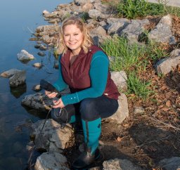 Tiffany L. Messer合作论文数1
 Amanda Flynn合作论文数1Laurent Ahiablame合作论文数Dept Agr & Biosyst Engn, South Dakota State Univ1
 Eban Z. Bean合作论文数1
 Robyn Suzanne Wilson合作论文数School of Environment and Natural Resources, The Ohio State University1
 Joseph Depinto合作论文数1
 John F. Bratton合作论文数Woods Hole Science Center U.S. Geological Survey1




