In today's chemical plants, human field operators perform frequent integrity checks to guarantee high safety standards, and thus are possibly the first to encounter dangerous operating conditions. To alleviate their task, we present a system consisting of an autonomously navigating robot integrated with various sensors and intelligent data processing. It is able to detect methane leaks and estimate its flow rate, detect more general gas anomalies, recognize oil films, localize sound sources and detect failure cases, map the environment in 3D, and navigate autonomously, employing recognition and avoidance of dynamic obstacles. We evaluate our system at a wastewater facility in full working conditions. Our results demonstrate that the system is able to robustly navigate the plant and provide useful information about critical operating conditions.
The availability of a robust map-based localization system is essential for the operation of many autonomously navigating vehicles. Since uncertainty is an inevitable part of perception, it is beneficial for the robustness of the robot to consider it in typical downstream tasks of navigation stacks. In particular localization and mapping methods, which in modern systems often employ convolutional neural networks (CNNs) for perception tasks, require proper uncertainty estimates. In this work, we present uncertainty-aware Panoptic Localization and Mapping (uPLAM), which employs pixel-wise uncertainty estimates for panoptic CNNs as a bridge to fuse modern perception with classical probabilistic localization and mapping approaches. Beyond the perception, we introduce an uncertainty-based map aggregation technique to create accurate panoptic maps, containing surface semantics and landmark instances. Moreover, we provide cell-wise map uncertainties, and present a particle filter-based localization method that employs perception uncertainties. Extensive evaluations show that our proposed incorporation of uncertainties leads to more accurate maps with reliable uncertainty estimates and improved localization accuracy. Additionally, we present the Freiburg Panoptic Driving dataset for evaluating panoptic mapping and localization methods.
Reliable scene understanding is indispensable for modern autonomous systems. Current learning-based methods typically try to maximize their performance based on segmentation metrics that only consider the quality of the segmentation. However, for the safe operation of a system in the real world it is crucial to consider the uncertainty in the prediction as well. In this work, we introduce the novel task of uncertainty-aware panoptic segmentation, which aims to predict per-pixel semantic and instance segmentations, together with per-pixel uncertainty estimates. We define two novel metrics to facilitate its quantitative analysis, the uncertainty-aware Panoptic Quality (uPQ) and the panoptic Expected Calibration Error (pECE). We further propose the novel top-down Evidential Panoptic Segmentation Network (EvPSNet) to solve this task. Our architecture employs a simple yet effective panoptic fusion module that leverages the predicted uncertainties. Furthermore, we provide several strong baselines combining state-of-the-art panoptic segmentation networks with sampling-free uncertainty estimation techniques. Extensive evaluations show that our EvPSNet achieves the new state-of-the-art for the standard Panoptic Quality (PQ), as well as for our uncertainty-aware panoptic metrics.
The transition from today's mostly human-driven traffic to a purely automated one will be a gradual evolution, with the effect that we will likely experience mixed traffic in the near future. Connected and automated vehicles can benefit human-driven ones and the whole traffic system in different ways, for example by improving collision avoidance and reducing traffic waves. Many studies have been carried out to improve intersection management, a significant bottleneck in traffic, with intelligent traffic signals or exclusively automated vehicles. However, the problem of how to improve mixed traffic at unsignalized intersections has received less attention. In this letter, we propose a novel approach to optimizing traffic flow at intersections in mixed traffic situations using deep reinforcement learning. Our reinforcement learning agent learns a policy for a centralized controller to let connected autonomous vehicles at unsignalized intersections give up their right of way and yield to other vehicles to optimize traffic flow. We implemented our approach and tested it in the traffic simulator SUMO based on simulated and real traffic data. The experimental evaluation demonstrates that our method significantly improves traffic flow through unsignalized intersections in mixed traffic settings and also provides better performance in a wide range of traffic situations compared to the state of the art.
Panoptic segmentation of point clouds is a crucial task that enables autonomous vehicles to comprehend their vicinity using their highly accurate and reliable LiDAR sensors. Existing top-down approaches tackle this problem by either combining independent task-specific networks or translating methods from the image domain ignoring the intricacies of LiDAR data and thus often resulting in sub-optimal performance. In this paper, we present the novel top-down Efficient LiDAR Panoptic Segmentation (EfficientLPS) architecture that addresses multiple challenges in segmenting LiDAR point clouds including distance-dependent sparsity, severe occlusions, large scale-variations, and re-projection errors. EfficientLPS comprises of a novel shared backbone that encodes with strengthened geometric transformation modeling capacity and aggregates semantically rich range-aware multi-scale features. It incorporates new scale-invariant semantic and instance segmentation heads along with the panoptic fusion module which is supervised by our proposed panoptic periphery loss function. Additionally, we formulate a regularized pseudo labeling framework to further improve the performance of EfficientLPS by training on unlabelled data. We benchmark our proposed model on two large-scale LiDAR datasets: nuScenes, for which we also provide ground truth annotations, and SemanticKITTI. Notably, EfficientLPS sets the new state-of-the-art on both these datasets.
Robust localization in dense urban scenarios using a low-cost sensor setup and sparse HD maps is highly relevant for the current advances in autonomous driving, but remains a challenging topic in research. We present a novel monocular localization approach based on a sliding-window pose graph that leverages predicted uncertainties for increased precision and robustness against challenging scenarios and per-frame failures. To this end, we propose an efficient multi-task uncertainty-aware perception module, which covers semantic segmentation, as well as bounding box detection, to enable the localization of vehicles in sparse maps, containing only lane borders and traffic lights. Further, we design differentiable cost maps that are directly generated from the estimated uncertainties. This opens up the possibility to minimize the reprojection loss of amorphous map elements in an association-free and uncertainty-aware manner. Extensive evaluation on the Lyft 5 dataset shows that, despite the sparsity of the map, our approach enables robust and accurate 6D localization in challenging urban scenarios using only monocular camera images and vehicle odometry.
Due to their ubiquity and long-term stability, pole-like objects are well suited to serve as landmarks for vehicle localization in urban environments. In this work, we present a complete mapping and long-term localization system based on pole landmarks extracted from 3-D lidar data. Our approach features a novel pole detector, a mapping module, and an online localization module, each of which are described in detail, and for which we provide an open-source implementation [1]. In extensive experiments, we demonstrate that our method improves on the state of the art with respect to long-term reliability and accuracy: First, we prove reliability by tasking the system with localizing a mobile robot over the course of 15 months in an urban area based on an initial map, confronting it with constantly varying routes, differing weather conditions, seasonal changes, and construction sites. Second, we show that the proposed approach clearly outperforms a recently published method in terms of accuracy.
Navigating autonomously underwater, where a priori information on the environment is sparse and changing ambient conditions complicate perception, requires robust sensing capabilities as well as advanced signal processing strategies. Multimodality in sensing as well as data processing is considered as an approach to strengthen the robustness of decision making for autonomous underwater robots. This chapter summarizes the current developments in sensing technology and opens new research questions with respect to sensing and signal processing using machine learning approaches.
Traffic signal controllers play an essential role in today's traffic system. However, the majority of them currently is not sufficiently flexible or adaptive to generate optimal traffic schedules. In this paper we present an approach to learn policies for signal controllers using deep reinforcement learning aiming for optimized traffic flow. Our method uses a novel formulation of the reward function that simultaneously considers efficiency and equity. We furthermore present a general approach to find the bound for the proposed equity factor and we introduce the adaptive discounting approach that greatly stabilizes learning and helps to maintain a high flexibility of green light duration. The experimental evaluations on both simulated and real-world data demonstrate that our proposed algorithm achieves state-of-the-art performance (previously held by traditional non-learning methods) on a wide range of traffic situations.
Whether it is object detection, model reconstruction, laser odometry, or point cloud registration: Plane extraction is a vital component of many robotic systems. In this paper, we propose a strictly probabilistic method to detect finite planes in organized 3-D laser range scans. An agglomerative hierarchical clustering technique, our algorithm builds planes from bottom up, always extending a plane by the point that decreases the measurement likelihood of the scan the least. In contrast to most related methods, which rely on heuristics like orthogonal point-to-plane distance, we leverage the ray path information to compute the measurement likelihood. We evaluate our approach not only on the popular SegComp benchmark, but also provide a challenging synthetic dataset that overcomes SegComp’s deficiencies. Both our implementation and the suggested dataset are available at [1].
The Bayes filter is the basis for many state-of-the-art robot localization algorithms. In the literature, its derivation typically requires the robot controls to be chosen independently of all other variables. However, this assumption is not valid for a robotic system that is to act purposefully. The contribution of this letter is twofold: We prove that the Bayes filter is also exact for an autonomous system that chooses the controls depending on any subset of all observable variables. We further show how to augment the filter if a human agent chooses controls on the basis of parts of the state space that are not directly accessible to the robot. In this case, modeling the agent's purpose improves the pose estimate as the control selection provides additional information about the hidden state space. A careful derivation of the Bayes filter then leads to an additional pseudo measurement update step. Simulation and real-world experiments with a teleoperated mobile robot as well as evaluations on the KITTI dataset show that the localization accuracy significantly improves if we augment a particle filter with the proposed pseudo measurement update. Finally, we present an analytical example for an augmented Kalman filter, which leads to a more accurate estimate than the standard Kalman filter.
The ability to build models of the environment is an essential prerequisite for many robotic applications. In recent years, mapping of dense surface geometry using RGB-D cameras has seen extensive progress. Many approaches build colored models, typically directly using the intensity values provided by the camera. Unfortunately, these intensities are inherently affected by illumination. Therefore, the resulting maps only represent the environment for one specific lighting condition. To overcome this limitation, we propose to build reflectance maps that are invariant against changes in lighting. Our approach estimates the diffuse reflectance of a surface by recovering its radiosity and the corresponding irradiance. As imperfections in this process can significantly degrade the reflectance estimate, we remove outliers in the high dynamic range radiosity estimation and propose a method to refine the reflectance estimate. Our system implements the whole pipeline for offline reconstruction of dense reflectance maps including the segmentation of light emitters in the scene. We demonstrate the applicability of our approach in real-world experiments under varying lighting conditions.
Man-made environments such as households, offices, or factory floors are typically composed of linear structures. Accordingly, polylines are a natural way to accurately represent their geometry. In this paper, we propose a novel probabilistic method to extract polylines from raw 2-D laser range scans. The key idea of our approach is to determine a set of polylines that maximizes the likelihood of a given scan. In extensive experiments carried out on publicly available realworld datasets and on simulated laser scans, we demonstrate that our method substantially outperforms existing state-of-the-art approaches in terms of accuracy, while showing comparable computational requirements. Our implementation is available under https://github.com/acschaefer/ple.
 Wolfram Burgard合作论文数Department of Computer Science & Artificial Intelligence, University of Technology Nuremberg13
 Alexander Schaefer合作论文数4
 Kshitij Sirohi合作论文数4
 Lukas Luft合作论文数3
 Shengchao Yan合作论文数Technische Fakultät, Albert-Ludwigs-Universität Freiburg2
 Johan Vertens合作论文数University of Freiburg2
 Abhinav Valada合作论文数Robot Learning Lab, University of Freiburg;Department of Computer Science, University of Freiburg2
 Kürsat Petek合作论文数1
 Georg K.J. Fischer合作论文数1M. Bergau合作论文数1Niklas Wetzel合作论文数1
 Nikhil Gosala合作论文数Robot Learning Lab, Department of Computer Science, Technische Fakultät, Universität Freiburg1Sajad Marvi合作论文数1Michael Krawez合作论文数Univ Freiburg, Autonomous Intelligent Syst, Freiburg, Germany1
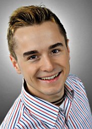 Andreas Wachaja合作论文数Univ Freiburg, Dept Comp Sci, Freiburg, Germany1
 Tim Caselitz合作论文数Department of Computer Science, University of Freiburg1
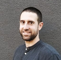 Federico Boniardi合作论文数Department of Computer Science Germany, University of Freiburg1
 Tim Welschehold合作论文数Computer Science, University of Freiburg1
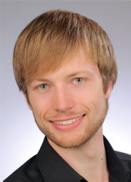 Johannes Grater合作论文数1
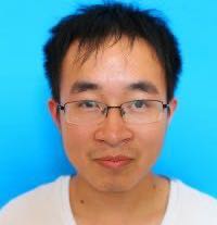 Jingwei Zhang合作论文数The Hong Kong University of Science and Technology1
 Rohit Mohan合作论文数Robot Learning Lab, University of Freiburg1Mark Van Loock合作论文数Advanced Technologies, Toyota Motor Europe/NV/SA1
 Peter Kampmann合作论文数Robotics Innovation Center (RIC),, DFKI GmbH1
 Fabian Höflinger合作论文数Department of Microsystems Engineering, University of Freiburg1
 Ralf Bachmayer合作论文数Chair for Ocean Technology;Faculty of Engineering and Applied Science;Memorial University of Newfoundland;Faculty of Engineering and Applied Science, Memorial University of Newfoundland1




