ISAC is a new system concept combining communication and sensing. The channel models usually applied to evaluate communication systems have to be revised and extended for testing ISAC applications. The current work proposes a scalable hybrid channel model for ISAC that includes deterministic and stochastic contributions by a simplified raytracer tool and stochastic 3GPP TR.38.901 model. The requirements of the ISAC applications are discussed, which smoothly leads to the model’s scalability. Simulation results are provided to show the capabilities of the resulting hybrid channel model.
We present our new scalable multi-channel and multi-node sounder, the ILMSound G3 . It is configurable in terms of the number of switched Tx and parallel Rx nodes. The basic structures of the Tx and Rx nodes are given with consideration of the measurement system requirements.The ILMSound G3 is validated via a proof of concept measurement at 2.53 GHz in an urban environment. The system was configured as a sounder with two Tx nodes and one Rx node, which records two MIMO links simultaneously. Each node uses an antenna array. The transmitters were moved by cars whereas the receiver was elevated 20 m above the ground by a lifting platform acting as a base station. The used system configuration results in a snapshot rate of approx. 0.5 kHz, which covers the expected time variance of the chosen environment.The measurement results were analyzed using HRPE, providing a parametric description of the specular propagation paths of the radio channel per measurement link. Each estimated path is described by its directions of departure and arrival, delay, Doppler shift, and fully polarimetric complex path weights.
In this contribution, we investigate how changes in received power for a vehicle to infrastructure (V2I) communication scenario in an urban environment can be modeled. Significant changes are not only observed for line of sight (LoS) to none line of sight (NLoS) transitions but also when the mobile station travels from a narrow street onto a crossroad and other maneuvers, even with no LoS being present. To model these transitions, in terms of received power, we propose a variant of an arctangent function. We fit the model to different exemplary transitions, which were found in channel sounding data collected in a V2I measurement campaign. We discuss the results in terms of quality of fit and the estimated parameters.
Several frequency bands and system architectures are proposed for 5G and beyond to meet the higher data rates for point-to-point communication and point-to-area coverage. In this paper, we present radio propagation studies and models developed in typical scenarios for massive antenna deployment and body area networks, in frequency bands below 6 GHz, building entry loss and clutter loss and vehicular communication, in the millimeter wave bands, and models in the Terahertz for 5G and beyond.
This contribution investigates the stationarity of the vehicle to vehicle (V2V) channel in terms of distance and time. Due to high inherent mobility, the channel can not be assumed to follow the wide sense stationary (WSS) and uncorrelated scattering (US) assumption. Therefore, new evaluation methods have to be applied. We assess the stationarity for a V2V highway scenario using the generalized local scattering function (GLSF) and its collinearity based on measurements. We compare results for exemplary traffic situations and investigate the influence of the antenna placements on the stationarity of the channel. Our results show a strong relation between the stationarity time and the change and rate-of-change of distance between transmitter and receiver.
The time-variant characteristic of the vehicle to vehicle channel is discussed using measurements at 2.53 GHz from a highway scenario. For typical use cases, spectrograms in the time-delay as well as the Doppler domain are shown based on sequences of the generalized local scattering function. Delay-Doppler-bounds to be expected for single bounce reflections are determined by known movements of the transmitter and receiver using a channel representation in a prolate spheroidal coordinate system. Dominant moving scatterers are identified by visual inspection using proper meta data.
Several frequency bands and system architectures are proposed for 5G and beyond to meet the higher data rates for point-to-point communication and point-to-area coverage. In this paper, we present radio propagation studies and models developed in typical scenarios for massive antenna deployment and body area networks, in frequency bands below 6 GHz, building entry loss and clutter loss and vehicular communication, in the millimeter wave bands, and models in the Terahertz for 5G and beyond.
In this paper, we discuss the possibilities of utilizing the stationarity of the vehicle to everything (V2X) radio channel for applications in the field of communication as well as passive radar. The stationarity can be interpreted as a measure of how severely the radio channel changes. We compute it in the temporal domain using the generalized local scattering function (GLSF) and its collinearity. Knowing about the stationarity can enable us to adapt communication and passive radar systems to make them more efficient and reliable at the same time.
This paper investigates the behaviour of Vehicle-to-Infrastructure (V2I) channels when propagation conditions transition from Line-of-Sight (LoS) to Non-Line-of-Sight (NLoS) and when the vehicle is approaching an open square from a narrow street. The measurement data used is obtained from a channel sounding campaign at 2.53 GHz center frequency in the city of Bonn, Germany. The channel is investigated in terms of average receive power separated into co- and cross-polar components. Furthermore, second order statistics such as delay and angular spreads are analysed. We observe a similar behaviour when links transition between LoS and NLoS and between open square and narrow street. In both cases power decreases and spreads increase. A transition area can be identified that starts/ends well before/after the actual LoS area or open square indicating the necessity of proper modelling of such areas.
 Christian Schneider合作论文数8
 Reiner S. Thomä合作论文数Fachgebiet Elektronische Messtechnik und Signalverarbeitung, Fakultät für Elektrotechnik und Informationstechnik, Technische Universität Ilmenau6
 Giovanni Del Galdo合作论文数Institute for Information Technology Ilmenau, Technische Universität Ilmenau5
 Martin Kaske合作论文数4
 Gerd Sommerkorn合作论文数4
 Belen Montenegro Villacieros合作论文数2Diego Andres Dupleich合作论文数Technische Universitat Ilmenau2
 Turbic, K.合作论文数2
 Jian Luo合作论文数Eur. Res. Center (ERC),, Huawei Technol. Duesseldorf GmbH;c2
 Mate Boban合作论文数Huawei Technol Dusseldorf GmbH2
 Sana Salous合作论文数Department of Engineering, Durham University2
 Thomas Kürner合作论文数Mobile Radio Systems Group, Institute for Communications Technology, Technische Universitat Braunschweig2
 Fredrik Tufvesson合作论文数Department of Electrical and Information Technology, Lund University2Haneda, K.合作论文数1Vimukthi Herath合作论文数1
 Luis M. Correia合作论文数1Daniel Stanko合作论文数1
 Michael Dobereiner合作论文数1
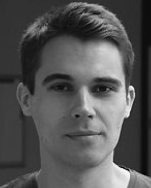 Carsten Andrich合作论文数1
 Steffen Schieler合作论文数Tech Univ Ilmenau1
 Sebastian Semper合作论文数Technische Universität Ilmenau1
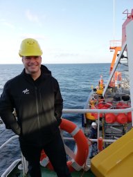 Michael Walter合作论文数1
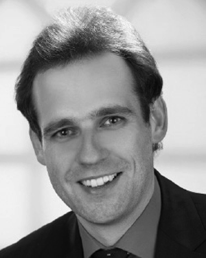 Alexander Ihlow合作论文数1
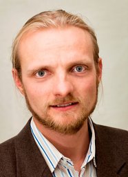 Markus Landmann合作论文数Ilmenau Technical University1
 Luís M Correia合作论文数Instituto Superior Técnico, Technical University of Lisbon1




