Affordable platforms underpin our ability to make sustained in situ observations of the ocean. Autonomous vehicles, such as drifting and profiling floats, already complement research, survey and voluntary ships. Floats are but one, more mature, member of what can be considered a family of autonomous platforms. The more recent additions to the family include moored profilers, autonomous surface craft, gliders and propelled autonomous underwater vehicles. Research communities of scientists and technologists are rapidly gaining experience of these newer vehicles, building on the proven attributes of today's technology. This experience will provide a firm foundation for the introduction of new platforms into the arena of sustained observations.
Studies conducted over the past decade indicate that the Arctic may be both a sensitive indicator of climate change and an active agent in climate variability. Although progress has been made in understanding the Arctic's coupled atmosphere‐ice‐ocean system, documentation of its evolution is hindered by a sparse data archive. This observational gap represents a critical shortcoming of the ‘global’ ocean observing system's ability to quantify the complex interrelated atmospheric, oceanic, and terrestrial changes now under way throughout the Arctic and that have demonstrated repercussions for society [Symon et al., 2005].Motivated by the Argo float program, an international effort to maintain an ensemble of approximately 3000 autonomous profiling instruments throughout the temperate oceans (see http://w3.jcommops.org), a new instrument, the ‘Ice‐Tethered Profiler’ (ITP) was conceived to repeatedly sample the properties of the ice‐covered Arctic Ocean at high vertical resolution over time periods of up to three years.
Abstract : The goal of the NOPP funded project, Low Cost Modular Telemetry for Coastal Time Series Data [1], was to develop an affordable, easy to use technology for the real time collection and dissemination of data from instruments deployed in the coastal ocean. The observing system that was developed consists of four elements: 1) low cost acoustic modems that are deployed with each instrument, 2) small, easy to deploy surface buoys (and moorings) that carry the acoustic hydrophones and acoustic receiver and RF link, 3) a shore-based receive station that automatically forwards data received and logs it on a website, and (4) a back channel to the surface buoys from the laboratory so that acoustic receivers and RF links can be modified without requiring a site visit. An alternative to (2) was to deploy systems on existing Coast Guard buoys; if successful, this strategy might provide a large network of stations, especially in high-traffic areas where locating additional buoys are not feasible. The goal of the continuation project reported on here, Completion and Field Demonstration of a Portable Coastal Observatory, was to complete the development and testing of the low cost acoustic modem, which was not completed under the original project and to demonstrate its performance in the field. The larger goal was to demonstrate a technological approach for building coastal observatories with real time data distribution. Our vision is that acoustically linked coastal observatories will provide easy to use and easy to relocate systems that compliment fixed cabled observatories, which provide high bandwidth and power to offshore sensors, but are expensive, difficult to install and not relocatable.
Abstract : The purpose of this project was to develop and demonstrate a low cost, easy to operate system for collecting and disseminating coastal ocean data. The system that was developed uses acoustic modems to transfer data from instruments on the seafloor to small surface buoys or existing navigation buoys that are equipped with acoustic receivers and RF links. Data received by the buoy's acoustic receiver are forwarded via the RF link to a station on shore. The shore station transfers the received data via landline to WHOl where it is automatically placed on a project website that is accessible to all. Key elements in this system include: 1) low cost acoustic transmitters that are deployed with each instrument, 2) small, easy to deploy surface buoys that carry the acoustic receivers and RF links, 3) a network architecture that allows a single surface buoy to receive data from a number of subsurface instruments, and 4) a back channel to the surface buoys from the laboratory at WHOl so that the acoustic receivers can be modified without requiring a visit to the site.
The prototype ULTRAMOOR design is a subsurface mooring that supports 10 (or more) discrete acoustic current meters. Travel time and acoustic Doppler sensors are being evaluated. Each current sensor is equipped with a small, low power acoustic transmitter that transfers compressed data from the instrument to a receiver located below the euphotic zone (nominally at 500-m depth). The acoustic receiver forwards these data to an array of up to 10 expendable data capsules. In a typical scenario a capsule would release every 6 months over a 5-year deployment interval. Each capsule contains 4 Mbytes of solid-state memory and an Orbcomm transceiver, which transfers the data via satellite as the capsule drifts away from the mooring. The initial deep ocean test of the ULTRAMOOR prototype will be conducted from July to November 2000 offshore Bermuda. This paper describes the overall system design and discusses its scientific applications
The specifications and performance of a moored vertical profiling instrument, designed to acquire near-full-ocean-depth profile time series data at high vertical resolution, are described. The 0.8-m-diameter by 0.4-m-wide device utilizes a traction drive to propel itself along a standard mooring wire at a speed of similar to 0.3 m s(-1). The average power required to profile at this speed is 1-2 W; the present sensor suite and controller draw about 1.5 W. Based on these figures, the instrument's battery capacity will support approximately 1 million meters of profiling. Instrument actions are regulated by an onboard microcontroller, allowing complex dive programs to be carried out. Oceanographic and engineering data are recorded internally on a hard disk interfaced to the controller. The measurement suite thus far deployed includes a CTD for deriving ocean temperature and salinity profiles, and an acoustic current meter that returns ocean velocity profile data. Addition of other oceanographic sensors is anticipated. Results from several trial deployments in the open ocean are reported.
Velocity profile measurements from a recently-developed moored profiling instrument are discussed. The WHOI Moored Profiler uses a traction drive system to propel itself along a standard subsurface mooring cable at a nominal speed of 0.3 m s/sup -1/. The instrument's onboard controller supports complex sampling scenarios, limited chiefly by the configuration of the mooring and the capacity of the battery. The vehicle has thus far been equipped with a CTD and an acoustic travel-time current meter; data from the latter are examined. As part of this assessment, comparisons are made between velocity profile data obtained with moored profilers and those obtained from an expendable current profiler, the High Resolution Profiler, and a lowered acoustic Doppler profiler. The authors conclude with a summary of possible applications for the new instrument.
Abstract : The long-term goal of these programs is the acquisition and continuing support of twenty state-of-the-art acoustic modems that will be made available to researchers in the oceanographic community. This pool of instruments will provide researchers from universities, Navy laboratories, and related groups the tools they need to communicate reliably via the acoustic channel. The Acoustic Modem Pool will be a self-supporting facility once the original inventory has been acquired.
Abstract : The long-term goal of the AOSN MURI is to create and demonstrate a reactive survey system capable of long-term unattended deployments in harsh environments. We refer to such a system as an Autonomous Ocean Sampling Network [1]. The particular elements of the AOSN addressed by this project are the moored docking and telemetry subsystems that allow data to be forwarded from the ocean's interior to investigators on shore. Our goal is to develop these systems so that they are reliable, cost effective, and applicable to a variety of ocean measurement problems. Our objective was to build, test and deploy a pair of moorings in the Labrador Sea capable of supporting the AUV docking system and providing a reliable connection to a surface buoy equipped with 2-way satellite telemetry links. This objective was modified prior to the January 1998 cruise to deploy a single mooring. The second mooring was then designated a spare.
The design and performance of a new style underwater frame for supporting instrumentation and water collection bottles used in hydrographic sampling is presented. Unlike a conventional frame that is fixed to the end of an electromechanical cable, the new frame is free to slide vertically along its tether. Allowing the frame to move relative to the sea cable decouples the underwater instrumentation from ship roll on downcast. Improved data quality from CTD instrumentation and the ability to work in more severe sea states result. Furthermore, the chance of cable damage that occurs when wire speed (lowering rate plus ship roll velocity) exceeds the terminal velocity of conventional underwater packages is greatly reduced. Absence of direct electrical connection to the underwater instrumentation necessitates an alternative scheme for real-time data display and command of water sample collection. These are accomplished with an acoustic telemetry system, implemented using commercially available components.
The Atlantic Long-Term Oceanographic Mooring (ALTOMOOR) has been maintained offshore Bermuda since 1993 as a testbed for the evaluation of new data telemetry technologies and new
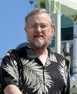 John M. Toole (John Toole)合作论文数Department Physical Oceanography, Woods Hole Oceanographic Institution8
 Kenneth W. Doherty合作论文数8
 John L. Spiesberger合作论文数4John N. Kemp合作论文数Woods Hole Oceanographic Institution4Keith von der Heydt合作论文数3Bradford Butman合作论文数U.S. Geological Survey3Sp Liberatore合作论文数2Bryce Prindle合作论文数2richard arthur合作论文数2W.B. Owens合作论文数2Donald B. Peters合作论文数2
 Richard Krishfield合作论文数Department of Physical Oceanography, Woods Hole Oceanographic Institution2
 Andrey Proshutinsky合作论文数2Alessandro Bocconcelli合作论文数2James O'Brien合作论文数1Mark A. Johnson合作论文数1Mark Johnson合作论文数1H. O. Berteaux合作论文数1Neil McPhee合作论文数1richard burnes合作论文数1phillippe marchand合作论文数1
 Timothy M Shanahan合作论文数Department of Geological Sciences, Jackson School of Geosciences, University of Texas at Austin1
 Mary-Louise Timmermans合作论文数Department of Earth & Planetary, Yale University1
 W. Rockwell Geyer合作论文数Department of Applied Ocean Physics and Engineering, Woods Hole Oceanographic Institution1Harley Hurlburt合作论文数The University of Southern Mississippi;Florida State University;United States Naval Research Laboratory1Harley E. Hurlburt合作论文数1
 Carl Wunsch合作论文数Department of Earth and Planetary Sciences, Harvard University;Department of Earth, Atmospheric and Planetary Sciences, Massachusetts Institute of Technology1
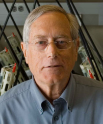 Russ E. Davis合作论文数Scripps Institution of Oceanography, University of California, San Diego1
 Gwyn Griffiths合作论文数Ocean Technology Division;Southampton Oceanography Centre;Ocean Technology Division, Southampton Oceanography Centre1D. Peters合作论文数1
 R. C. Millard合作论文数1Carin J. Ashjian合作论文数Biology Department, Woods Hole Oceanographic Institution1Nelson G. Hogg合作论文数1
 Tommy Dickey合作论文数Ocean Physics Laboratory, Department of Geography, University of California1Terence R. Hammar合作论文数1
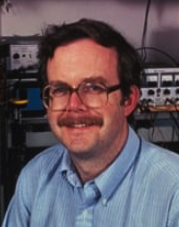 Robert A. Weller合作论文数Woods Hole Oceanographic Institution1
 Charles Eriksen合作论文数School of Oceanography, College of the Environment, University of Washington1




