Mendocino Channel lies at the base of Gorda Escarpment on the southern edge of Gorda deep-sea fan about 40 km off Cape Mendocino, California. The channel marks the seaward extension of the Mattole and Mendocino Submarine Canyons and contains several prominent meanders along its length. Based on water-gun and 3.5-kHz seismic records, the channel-levee geometry and structure are similar to deepsea meandering channels reported elsewhere. Over the approximately 50-km section of the channel studied, channel sinuosity and channel slope are about 1.7 and 4.2 m/km, respectively. The valley slope is likely time-variable because of the tectonically induced movements of the southern Gorda Plate upon which the channel is situated. Changes to the valley slope will lead to changes in the meander development during future episodes of turbidity currents. Five (possibly six) turbidite units that have 14C ages ranging from 960 yBP to 3,595 yBP were recovered in box cores from the channel floor. These ages overlap dates of great earthquakes that are estimated to have occurred along the region north of Cape Mendocino. Paleoseismic events are proposed to be the triggering mechanisms for the turbidity currents that deposited the turbidites in Mendocino Channel.
The sedimentology and stratigraphy of river-fed continental margins reflect a diverse range of tectonic, climatic and hydrodynamic conditions that moderate the supply, transport and accumulation of terrigenous sediment in the coastal ocean. This paper describes a study of the modern and late Holocene northern California shelf and slope. The aim is to elucidate fundamental processes of land-to-ocean sediment dispersal and accumulation relevant to active margins world-wide. Annually, northern California rivers deliver a total of 30 - 40 x 10(6) tons of suspended sediment to the coast, nearly 70% of which bypasses the shelf in association with oceanic storms and major floods. Off-shelf export is highly time dependent, and is maximal when periods of peak river discharge and across-shelf flow coincide. Sediment not exported is sequestered on the shelf through dynamic trapping mechanisms in the bottom-boundary layer, as well as by static conditions related to tectonically produced topography. Significantly, interactions between shelf bathymetry and near-bottom flows influence patterns and rates of strata formation on a wide range of temporal and spatial scales. The shelf displays a rich sedimentary record that archives signatures related to Holocene transgression, climatic variations in continental runoff, and land-use change during historical times.
All s ediment that is delivered to the seabed is subject to post-depositional alteration before it becomes part of the preserved stratigraphic record. Physical and biological processes occurring in the upper few decimetres of the seabed alter newly deposited sediment, thereby creating the fine-scale sedimentary record. The geographical region of focus is the Eel margin of northern California, where a combination of high precipitation, frequent winter storms and intense benthic biological processes exert fundamental controls on the fine-scale stratigraphy. Major findings are that: 1 although the wave conditions on the Eel shelf are highly energetic, only a few millimetres to one or two centimetres of bed material are typically put in suspension during storms; 2 despite a high initial porosity (i.e. low strength), flood beds quickly become resistant to erosion; 3 shelf macrofauna show considerable resilience to deposition of flood sediment; 4 storm deposits have a low preservation potential on open continental margins; 5 episodic sedimentation is key to preservation of strata and signals produced by flood and storm events. Future insight into post-depositional alteration will benefit from focused observations and theoretical modelling that explicitly couple physical and biological processes on multiple time-scales.
Potential environmental impacts of materials discharged from oil and gas development and production platforms off the coast of southern California (Santa Maria Basin) are being monitored during an ongoing, long-term (fiveyear) field program. The study combines hypothesis testing of platform effects with basic research on the structure and dynamics of the regional ecosystem over a time series encompassing both seasonal and repeated annual scales. Oceanographic features and processes that are being measured focus on the benthos and include biological community indices and species abundances for hard-bottom and soft-bottom (macroinfauna and meiofauna) assemblages; levels and distributions of trace metals and hydrocarbons in bottom sediments, suspended particulates, animal tissues, and pore waters; water currents and otherphysical-oceanographicfeatures; various sedimentological properties (sediment grain size, total organic carbon, shear strength, distribution of mineral types, radioisotope profiles, and degrees of sediment mixing as a result of bioturbation); sediment and pollutant-transport processes; and animal-sediment-pollutant interactions. Synoptic measurement of these different environmental variables over the extended sampling period provides an opportunity to examine long-term variability in the benthic environment with respect to both natural and anthropogenic causes. Efforts to distinguish between natural variability and low-level cumulative impacts of drilling are given special attention.
Measurements of currents, waves and light transmission obtained with an instrumented bottom tripod (GEOPROBE) were used in conjunction with a theoretical bottom-boundary-layer model for waves and currents to investigate sediment transport on the continental shelf south of the Ebro River Delta, Spain. The current data show that over a 48-day period during the fall of 1984, the average transport at 1 m above the seabed was alongshelf and slightly offshore toward the south-southwest at about 2 cm/s. A weak storm passed through the region during this period and caused elevated wave and current speeds near the bed. The bottom-boundary-layer model predicted correspondingly higher combined wave and current bottom shear velocities at this time, but the GEOPROBE optical data indicate that little to no resuspension occurred. This result suggests that the fine-grained bottom sediment, which has a clay component of 80%, behaves cohesively and is more difficult to resuspend than noncohesive materials of similar size. Model computations also indicate that noncohesive very fine sand in shallow water (20 m deep) was resuspended and transported mainly as bedload during this storm. Fine-grained materials in shallow water that are resuspended and transported as suspended load into deeper water probably account for the slight increase in sediment concentration at the GEOPROBE sensors during the waning stages of the storm. The bottom-boundary-layer data suggest that the belt of fine-grained bottom sediment that extends along the shelf toward the southwest is deposited during prolonged periods of low energy and southwestward bottom flow. This pattern is augmented by enhanced resuspension and transport toward the southwest during storms.
The Geological Long-Range Inclined Asdic (GLORIA) side-scanning sonar system was used to obtain data that were compiled as an image-enhanced acoustic mosaic, similar to an aerial photograph, of the sea floor from the edge of the continental shelf to 200 nmi offshore within the US Exclusive Economic Zone off California, Oregon, and Washington. The mosaic clearly displays the large-scale geomorphic and sedimentologic features of the sea floor, including spreading centers, seamounts, fracture zones, sediment fans, continental-slope canyons, and abyssal-plain channels. Hundreds of seamounts (some previously uncharted) dot the deep sea floor, and many have large summit craters and attendant volcanic flows. The major Nitinat, Astoria, Delgada, and Monterey sediment fans are traversed by lengthy channel-levee complexes that extend from morphologically diverse canyons on the adjacent continental slope. Areally extensive sediment-wave fields occur adjacent to the complexes. Some channels on the abyssal plain are straight whereas others are highly sinuous, suggesting that various channel-forming processes occur on the sea floor. The contrast between the transform tectonic regime south of Cape Mendocino and the convergent tectonic regime to the north is particularly apparent on the mosaic. The linear basement ridges that were generated at the Gorda and Juan de Fuca spreading centersmore » and were later moved apart by sea-floor spreading are abruptly truncated by the Mendocino and Blanco fracture zones that accommodate horizontal slip between adjacent lithospheric plates.« less
A record discharge of about 54 × 106 metric tons of predominantly fine-grained detrital sediment was introduced during 1969 into the eastern part of Santa Barbara Channel from the Santa Clara and Ventura Rivers. The clay-size fraction from bottom samples collected during a time-series of about 18 months revealed movement across the shelf and into the adjacent basin in a repetitive sequential pattern. Light transmission profiles show resuspension and transport of sediments at depths of up to 225 m. This transport and distribution history is attributed to seasonal variations in the vertical and lateral position of a poleward-flowing current.
Funding was provided by the National Science Foundation under Grant OCE 80-14938 and OCE 80-14941 and by the United States Geological Survey.
Strong currents are present throughout much of the northern B$ring Sea, particularly where westward land projections interject into the prevailing northward flow, such as in the eastern Bering Strait area (see fig 1, Nelson, Holocene transgression article this volume) (Fleming and Heggarty, 1966). In such regions large bedforms develop and migrate to form an unstable sea floor that can be a potential hazard to platform foundations and pipelines. Such potentially hazardous areas must be identified, their history assessed, and magnitude of future problems predicted. This paper outlines regions of mobile bedforms (fig. 1) and presently known aspects of their activity.
The Continental Margin Sediment Dynamics program of the U.S. Geological Survey has been using a variety of optical instruments to monitor water turbidity as part of our studies of sediment transport. Although we suspect that optical devices will eventually be supplanted by more direct measures of suspended sediments, results of several field experiments indicate that for now transmissometers and nephelometers offer the best solution to the problem of long term environmental monitoring in the ocean. The Continental Margin Sediment Dynamics (CMSD) program of the U.S. Geological Survey is structured to investigate those oceanographic and geological processes which influence and control the active transport of sediments and other materials over continental margins. The focus of this program is on active sedimentary processes, the mechanisms which create them, and the effects they produce (see Figure 1 for a diagrammatic depiction). Basically, we design our experiments to investigate (1) transport mechanisms of oceanic sediments and other materials as suspended load and bed load, and (2) relationships of erosion and deposition to the dynamical characteristics of oceanic bottom boundary layers. The purpose of this report is to describe briefly those aspects of equipment and experiments that relate to our study of suspended particulate matter and water turbidity. Much of our understanding of the spatial distribution and temporal variability of suspended sediments depends upon measurements from optical instruments. In this report we describe those instruments and give examples of their use and some results of two field experiments.
 David Cacchione合作论文数10
 herman a karl合作论文数6
 Michael E. Field合作论文数U.S. Geological Survey4Brian D. Edwards合作论文数3
 Neil H. Kenyon合作论文数NOC3David S. Mcculloch合作论文数3
 James E. Gardner合作论文数3
 Robert A. Wheatcroft (Robert Wheatcroft)合作论文数College of Earth, Ocean, and Atmospheric Sciences, Oregon State University3WD GRANT合作论文数2
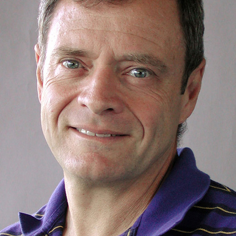 Charles A. Nittrouer (Charles Nittrouer)合作论文数Department of Earth and Space Sciences, College of the Environment, University of Washington;School of Oceanography, College of the Environment, University of Washington2Douglas G. Masson合作论文数2
 Albert J. Williams合作论文数Woods Hole Oceanographic Institution2Monty A. Hampton合作论文数2
 A.s. Ogston合作论文数US Geological Survey, Menlo Park Field Center2Jeffry C Borgeld合作论文数2
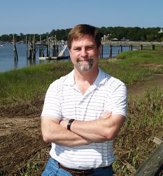 Clark R. Alexander, Jr合作论文数Skidaway Institute of Oceangraphy, Georgia Southern University2
 Elana L. Leithold合作论文数Department of Marine, Earth and Atmospheric Sciences, North Carolina State University2D.A. Cacchione合作论文数2John S. Allen合作论文数1John L. Chin合作论文数1
 Raul Medina合作论文数1Margarete Steinhauer合作论文数1
 William J. Plant合作论文数Applied Physics Laboratory, University of Washington Seattle1R. L. Gordon合作论文数1Clinton Winant合作论文数Scripps Institution of Oceanography, University of California San Diego1Carl A. Friehe合作论文数1Ronald L. Kolpack合作论文数1
 Paul A. Montagna (Paul Montagna)合作论文数Harte Research Institute for Gulf of Mexico Studies, Texas A&M University-Corpus Christi1Gail C Kineke合作论文数1
 Samuel Bentley合作论文数Department of Geology and Geophysics, College of Science, Louisiana State University1E. Crecelius合作论文数1William L. Stubblefield合作论文数1George L. Freeland合作论文数1Donald J.P. Swift合作论文数1
 Christopher K. Sommerfield合作论文数College of Marine Studies, University of Delaware1Jeffrey L. Hyland合作论文数1
 Russ E. Davis合作论文数Scripps Institution of Oceanography, University of California, San Diego1
 Robert C Beardsley合作论文数Department of Physical Oceanography, School of Marine Science and Technology, U. Mass.-Dartmouth;Woods Hole Oceanographic Institution1George H. Keller合作论文数1Kate Kranck合作论文数1B.L. Mullenbach合作论文数1Tor H. Nilsen合作论文数1
 Patricia L. Wiberg合作论文数Department of Environmental Sciences, College and Graduate School of Arts & Sciences, University of Virginia1
 Courtney K. Harris合作论文数School of Marine Science, Virginia Institute of Marine Sciences1
 Miguel A. Losada合作论文数Dept. de Ciencias y Técnicas del Agua y del Medio Ambiente, University of Cantabria1
 Patrick Hatcher合作论文数Department of Chemistry and Biochemistry, College of Sciences, Old Dominion University1George B. Tate合作论文数1
 Dane Hardin合作论文数1James D. Irish合作论文数1




