The urban climate is highly influenced by its building geometry, material characteristics, street orientation and high fraction of impermeable surfaces. All of these influence the microclimate and the resulting outdoor thermal comfort. Mean radiant temperature (Tmrt) is often used as an estimator for heat exposure as it is one of the most important variables governing outdoor human thermal comfort on clear, calm and warm days. The highest values of Tmrt are commonly found in front of sunlit facades where a human is exposed to high levels of direct and reflected shortwave radiation from the sun, as well as high levels of longwave radiation emitted from surrounding sunlit walls. As a consequence, outdoor thermal comfort modelling requires accurate simulation of wall surface temperatures (Ts).The aim of this study is to present a step heating approach for calculating wall Ts in the SOlar and LongWave Environmental Irradiance Geometry model (SOLWEIG) and quantify how it influences Tmrt. This method requires information on material characteristics, i.e. specific heat capacity, density, thermal conductivity, albedo and thickness of the outer layer of the wall, as well as radiation balance at the wall surface, and ambient air temperature. Simulated Ts is compared to observed Ts of two white walls (albedo = 0.5) in Gothenburg, Sweden; one wooden wall and one plaster brick wall. The simulations show high agreement with the 15 394 observations, with R2=0.93 and RMSE = 2.09 degrees C for the wooden wall and R2=0.94 and RMSE = 1.94 degrees C for the plaster brick wall. For the walls presented here, this new parameterization scheme results in differences in Tmrt of up to 2.5 degrees C compared to the previous version of SOLWEIG.With this new approach, SOLWEIG can be used to evaluate the effect of building materials on outdoor thermal comfort. The speed and accuracy of this approach suggests that it also could be applied in other areas where Ts of walls are important, for example building energy models and urban energy balance models.
In an era of changing climate, rapid urbanization, and densification there is a need for spaces that can manage extreme weather events, such as heat waves and heavy precipitation, whilst simultaneously be attractive for the urban citizens, i.e., multifunctional spaces. In this paper a framework for integrated assessment of the potential of multiple urban blue-green infrastructure (BGI) elements to provide climate regulating and social functions, i.e. multifunctionality potential, based on best research available, in relation to cost for construction and maintenance to be used in planning is presented. The assessment of functions and costs is done on a nominal scale from 1 to 5 using a mixed-method approach (systematic literature review, model simulations and workshops). The integrated assessment is presented in a multifunctionality potential and cost matrix and allows for weighting of each function and cost, as their relative importance is context dependent. It is shown that the majority of BGI elements have a relatively low potential to provide multifunctionality in terms of urban stormwater management, heat stress reduction and recreation. Some of them to a low cost (e.g., road verges, ditches, permeable pavements) others to a high cost (e.g., green roofs and walls). The highest multifunctionality potential is found in large parks, but to a high cost. The most favourable element, i.e., high potential in relation to costs is urban forests. The matrix presented here is considered usable for making general well informed integrated decisions in planning and to enhance the awareness of single and multiple functions of BGI elements.
Heat stress can have negative effects on human wellbeing with morbidity and mortality as harmful consequences, especially in vulnerable groups, e.g. children, elderly and chronically ill. Children is for example at higher risk of dehydration and heat stroke compared to healthy adults. Furthermore, children attending preschools are endorsed to spend time outdoors and engaging in physical activities. Therefore, thermally comfortable preschool yards are detrimental to sustain safe environments where the children can continue their physically active play. Here we show that preschoolers in five Swedish cities, Malmö, Gothenburg, Stockholm, Östersund and Luleå, are exposed to heat stress on warm and clear days between May-August in preschool yards with insufficient shading, using three different thermal indices (COMFA, PET and UTCI). Furthermore, future number of heat stress days are evaluated using the SMHI RCA4 regional climate model from the EURO-CORDEX project, forced with six different global climate models. Results show that heat stress will increase under the RCP2.6, 4.5 and 8.5 climate change scenarios. In Malmö, Gothenburg and Stockholm number of days with heat stress all hours 09:00–15:00 while playing in a sunlit sandbox have doubled from approximately 10 to 20 days for 2071–2100 (RCP8.5) compared to 2008–2020. These numbers are even higher if active play, e.g. running, is performed, estimating to around two weeks in July alone by the end of the century. Without adaptation this is likely to have adverse effects on the health and learning of children. If the preschool yard, on the other hand, is shaded by trees, days with heat stress are almost entirely diminished, indicating the importance of trees in preschool yard design as a tool to mitigate heat stress.
Warm weather can have negative effects on the health and wellbeing of humans, especially risk groups e.g. children. Methods for estimating thermal comfort and physiological stress outdoors are not developed or adjusted for children. A consequence of this is few existing studies on children and thermal comfort and heat stress, particularly in a Swedish context. Children are at higher risk of heat stress than adults because of a larger body-surface-area to body-mass-ratio, lower sweat rate and that they are less aware of their thermal status. Swedish children attending preschool spend around three hours per day outdoors and the effects of weather and outdoor environment design on children’s thermal comfort are not clear. By better understanding how weather affects children's thermal comfort, measures can be taken to reduce heat stress and increase children's health and wellbeing. Here we present results from a project on the effect of warm weather on Swedish preschooler’s health and wellbeing. The results are based on detailed observations and simulations for present day climate as well as future climate change scenarios and give indications on exposure to heat stress and potential implications on the health and wellbeing of the children. For example, two thirds of preschool yards in Gothenburg are exposed to strong heat stress on clear and warm days. Strong heat stress have negative consequences for the pedagogic activities and wellbeing. Moreover, days with strong heat stress will increase in the future in exposed yards, whereas yards with sufficient shade are less prone to heat stress.
A robust representation of the radiative properties in complex urban settings is important for accurate estimations of radiant load. Here, we present a new parameterization scheme in the SOlar and LongWave Environmental Irradiance Geometry (SOLWEIG) model that partitions the upper hemisphere into 153 patches. Partitioning of the upper hemisphere enables determination if longwave irradiance originates from the sky, vegetation, sunlit building surfaces, or shaded building surfaces from each patch. Furthermore, a model for anisotropic sky longwave irradiance where emissivity increases with zenith angle is included. Comparisons between observations and simulations show high correlation, with R 2 and RMSE for T mrt of 0.94 and 4.6 °C, respectively, and R 2 and RMSE for longwave radiation of 0.89 and 14.1 Wm −2 , respectively. Simulations show that mean radiant temperature ( T mrt ) can be up to 1.5 °C higher with an anisotropic sky compared to a uniform sky as an effect of higher radiant load on the vertical of a human when sky longwave irradiance increases with zenith angle. In comparisons of simulated T mrt with the new parameterization and old parameterization schemes, previously overestimated T mrt under trees (high sky obstruction, sky view factor (SVF) < 0.3) can be decreased by up to 3 °C from more realistic estimations using the patches. Moreover, T mrt close to sunlit walls (SVF ~ 0.5) is increased by up to 2–3 °C from increased exposure to sunlit surfaces. Concluding, anisotropic sky longwave radiation and directionality of longwave radiation from different sources are important in estimations of T mrt of humans in outdoor settings.
Knowledge of how personal experience with climate and air quality influence personal attitudes, concerns, and actions about environmental issues is increasingly important. A solid foundation for such studies is to combine interview or survey data on respondents’ attitudes and beliefs with indices created from independent meteorological or environmental monitoring data matched to the respondents location. In this project, indicators of climate and air pollution were integrated with data from the European Social Survey for a selection of large European urban regions. A prototype provenance description application was also developed for describing the workflow for creating indicators and integrating data. Our main focus was on creating indicators that represent regional anomalies in local air quality and weather for a range of time windows up-to-and-including the dates of the interviews. The goal is to facilitate investigation of relationships between urban citizen’s attitudes and behaviors as represented in the survey responses and the conditions in their local environment.
Hot weather conditions can have negative impacts on the thermal comfort and physical activity of vulnerable groups such as children. The aim of this study is to analyze the effects of warm weather on 5-year-old children's thermal comfort and physical activity in a preschool yard in Gothenburg, Sweden. In situ measurements were conducted for 1-1.5 h in the early afternoon on 8 days in May, June, and August of 2022. The thermal comfort and physical activity was estimated with GPS-tracks, heart rate monitors, and step counts and compared to observed weather conditions. Results show that physical activity decreases under warmer weather conditions, depicted by a decrease in distance moved, step counts, and highest registered pulse. Moreover, on warm days, the children avoid sunlit areas. For 50% or more of the time spent in sunlit areas, the children are exposed to cautious levels of heat. In shaded areas, on the other hand, the children are less exposed, with five out of 8 days having 50% or more of the time at neutral levels. The study demonstrates the importance of access to shaded areas in preschool yards where children can continue their active play while simultaneously maintaining a safe thermal status.
The recent warming trend, and associated shifts in growing season length, challenge the principle of uniformi-tarianism, i.e., that current relations are persistent over time, and complicates the uncritical inferences of past climate from tree-ring data. Here we conduct a comparison between tree-ring width chronologies of Pinus syl-vestris L. (Scots pine), Picea abies (L.) Karst. (Norway spruce) and Betula pubescens Ehrh. (Downy birch) and phenological observations (budburst and leaf senescence) of Fagus sylvatica L. (European beech), Quercus robur L. (European oak), Betula sp. (Birch), Norway spruce and Scots pine) in Sweden to assess to what extent the tree -ring width-temperature relationship and the timing of phenological phases are affected by increased tempera-ture. Daily meteorological observations confirm a prolongation of the thermal growing season, most consistently observed as an earlier onset of around 1-2 weeks since the beginning of the 20th century. Observations of budburst closely mimic this pattern, with budburst of the deciduous trees occurring 1-2.5 weeks earlier. In contrast to the changes seen in phenology and observational temperature data, the tree-ring width-temperature relationships remain surprisingly stable throughout the 20th century. Norway spruce, Scots pine and Downy birch all show consistently significant correlations with at least one 30 day-long window of temperature starting in late June-early July season. Norway spruce displays the largest degree of stability, with a consistent 60 day-long temperature window with significant correlation starting around Julian calendar day 150. Thus, our results suggest that the principle of uniformitarianism is not violated during the period covered by modern meteoro-logical observations. Further research is needed to determine at what thresholds the temperature sensitivity of these species may alter or deteriorate as a consequence of the ongoing climate change.
Mean radiant temperature (Tmrt) is a frequently used measure of outdoor radiant heat conditions. Excessive Tmrt, linked especially to clear and warm days, has a negative effect on human wellbeing. The highest Tmrt on such days is found in sunlit areas, whereas shaded areas have significantly lower values. One way of alleviating high Tmrt is by planting trees to provide shade in exposed areas. Achieving the most efficient mitigation of excessive Tmrt by tree shade with multiple trees requires optimized positioning of the trees, which is a computationally extensive procedure. By utilizing metaheuristics, the number of calculations can be reduced. Here, we present TreePlanter v1.0, which applies a metaheuristic hill-climbing algorithm on input raster data of Tmrt and shadow patterns to position trees in complex urban areas. The hill-climbing algorithm enables dynamic exploration of the input data to position trees, compared with very computationally demanding brute-force calculations. The hill-climbing algorithm has been evaluated with a static greedy algorithm that positions trees one at a time based on ranking and is expected to always find relevant locations for trees. The results show that the hill-climbing algorithm, in relatively low model runtime, can find positions for several trees simultaneously, which lowers Tmrt substantially. TreePlanter, with its two algorithms, can assist in optimization of tree planting in urban areas to decrease thermal discomfort.
Using a mixed-method approach consisting of interviews with preschool teachers and modelling of the outdoor thermal conditions using the mean radiant temperature as an indicator of heat stress, the occurrence of heat stress in Gothenburg preschools during the summer of 2018 and its effects have been studied. One third of 440 preschool yards modelled have more than 50% of the preschool yard-area exposed to strong heat stress during a warm and sunny summer day, implying children in many preschools have considerably less play area than current guidelines deem sufficient. Shade, where present, was mostly from trees within the preschool yards themselves rather from objects in surrounding areas, provided effective heat mitigation. Interviews confirmed that excessive heat conditions at preschool yards resulted in tired, drowsy and overheated children as well as forcing the preschool to prioritise care over pedagogical activities. The results demonstrated that heat stress occurs at Gothenburg preschools, with difficulties in ensuring the well-being of children at many preschools as a consequence. Many preschools need more shade, preferably from trees to provide healthy and secure environments for preschool children. Finally, the study highlights the need for more research on how weather and outdoor environments affect children's activity and well-being.
Sweden has set the target of a fossil independent vehicle fleet in 2030, focusing on a transport system mainly driven by biofuel and electricity. This study investigates the potential of reducing GHG emissions and improving local air pollution, by altering propellant- and vehicle use. Based on literature studies, five individual- and two combined scenarios were created, with different amount of hybridization, electrification and a shift towards biodiesel, for four different vehicle categories. Emission factors, collected from HBEFA, were used for 2016 and 2030 to generate the total emissions, in Business As Usual (BAU) and the individual scenarios. For cases where emission factors were missing, new factors were created through literature studies and the relation between new and conventional propellant- and engine types. The geographical vehicle distribution and vehicle numbers were used to calculate total annual emissions, showing large improvements, in both CO2 and NOX, from 2016 to 2030 BAU with even further reduction in the scenarios. Dispersion simulations of NO2 were conducted with The Air Pollution Model and the results showed large potential in improving the local air quality and reducing the population exposed to concentrations above the environmental target.
BACKGROUND:The Wet-Bulb Globe Temperature (WBGT) index is a common tool to screen for heat stress for sporting events. However, the index has a number of limitations. Rational indices, such as the physiological equivalent temperature (PET) and Universal Thermal Climate Index (UTCI), are potential alternatives.AIM:To identify the thermal index that best predicts ambulance-required assistances and collapses during a city half marathon.METHODS:Eight years (2010-2017) of meteorological and ambulance transport data, including medical records, from Gothenburg's half-marathon were used to analyse associations between WBGT, PET and UTCI and the rates of ambulance-required assistances and collapses. All associations were evaluated by Monte-Carlo simulations and leave-one-out-cross-validation.RESULTS:The PET index showed the strongest correlation with both the rate of ambulance-required assistances (R2=0.72, p=0.008) and collapses (R2=0.71, p=0.008), followed by the UTCI (R2=0.64, p=0.017; R2=0.64, p=0.017) whereas the WBGT index showed substantially poorer correlations (R2=0.56, p=0.031; R2=0.56, p=0.033). PET stages of stress, match the rates of collapses better that the WBGT flag colour warning. Compared with the PET, the WBGT underestimates heat stress, especially at high radiant heat load. The rate of collapses increases with increasing heat stress; large increase from the day before the race seems to have an impact of the rate of collapses.CONCLUSION:We contend that the PET is a better predictor of collapses during a half marathon than the WBGT. We call for further investigation of PET as a screening tool alongside WBGT.
About a quarter of the global anthropogenic greenhouse gas emissions are attributable to agriculture, forestry and other land use. Few studies of afforested drained peatlands have measured exchanges of all three major greenhouse gases (GHG) at a given site, leading to uncertainty in estimated GHG budgets. Thus, we measured forest floor exchange of carbon dioxide (CO2), methane (CH4) and nitrous oxide (N2O) at a well-drained afforested peatland in southern Sweden. The CO2 emissions (76000 kg ha(-1) a(-1); SE 6000) were large compared with previous measurements at similar sites, which may have been partly due to a measurement technique that did not underestimate the flux. A net CH4 uptake of 4.4 kg ha(-1) a(-1) (SE 0.41) and a net N2O emission of 2.7 kg ha(-1) a(-1) (SE 0.23) were found, which agreed well with published models relating fluxes to stand biomass (CH4 models) or soil C:N ratio (N2O models).
Spatiotemporal variation of mean radiant temperature (Tmrt), a major driver of outdoor human thermal comfort, is driven by exposure to solar and longwave radiation, which in turn respond to local patterns of shading, wind speed, air humidity and air temperature. In this study, the SOlar and LongWave Environmental Irradiance Geometry (SOLWEIG) model was used to simulate how changes in minimum and maximum air temperature and solar radiation under Representative Concentration Pathways (RCP) 4.5 and 8.5 climate projections would change Tmrt in Vancouver over the 2070-2100 period. With micrometeorological variables representative of a changed climate, days with Tmrt above 65 degrees C were predicted to increase three-to five-fold under RCP 4.5 and 8.5, respectively. SOLWEIG was also used to quantify the potential of maximum feasible street tree cover to reduce Tmrt for the hottest day on record for Vancouver (July 29, 2009), and an end-of-century hot day under the two future climate scenarios. SOLWEIG simulations with maximum feasible street tree cover under RCP 4.5 demonstrated an average reduction of 1.3 degrees C in Tmrt, compared to the contemporary extreme heat day with current street trees. However, average Tmrt increased by 1.9 degrees C under the RCP 8.5 scenario even with maximum feasible street tree cover, relative to the contemporary extreme heat day. We conclude that adding street trees has the potential to offset Tmrt increases under the RCP 4.5 scenario, however this measure is insufficient to maintain contemporary Tmrt under the RCP 8.5 scenario.
The dominant large-scale interannual modes in the tropical Pacific and Indian Oceans—El Niño southern oscillation (ENSO) and the Indian Ocean Dipole (IOD)—dominate seasonal rainfall patterns in Ethiopia. However, there is a clear interaction between ENSO and the IOD, and it is unclear whether the IOD has an independent influence on seasonal monsoon patterns in Northern Ethiopia. We use monthly rainfall records from 15 stations from two drought–prone regions in Northern Ethiopia (Afar and Amhara) for the period 1966–2006 to explore relationships between rainfall and circulation patterns and sea surface temperature (SST) anomalies over the tropical Indo-Pacific region. Our analysis confirms that regional summer monsoon (Kiremt) rainfalls in these regions are predominantly modulated by ENSO. Warm and cold ENSO episodes (El Niño/La Nina) are associated with below and above average summer monsoon rainfall, respectively. Lagged relationship between the IOD and Kiremt rainfall shows that positive/negative phases of the IOD are generally conducive to Kiremt rainfall increases/decreases over large parts of Ethiopia. Regression models based on the large-scale circulation indices NINO3.4 and a Dipole Mode Index (DMI)NO-ENSO representing the “ENSO-free IOD” also highlight the role of ENSO. However, the relative-weights for the models with DMINO-ENSO, calculated using Akaike Information Criteria (AIC), were 1.5 and 1.1 times the weights for the ENSO only models for the Afar and Amhara regions, respectively. This suggests that the IOD has an independent regional influence. This is in line with the conception of the IOD as a unique coupled-mode in the tropics, and may have important implications in boosting seasonal forecasting skills in the regions. No statistically significant trends were found in the regional and modeled rainfall time-series.
Objectives Despite endurance races leading to a substantial number of ambulance‐requiring cases (ARC), little is known regarding where they occur, meaning that knowing where to place medical teams, ambulance pick‐up points, etc, is difficult. This article investigates whether the location of ARCs can be identified by race participants. Methods Using the world's largest half marathon (Gothenburg half marathon) as a case, 237 runners were asked, post‐race, to mark on a map which geographical point of the race was most exhausting. Using the level of agreement tests, these geographical points were then compared with the GPS positions of ARCs. Results According to the level of agreement tests, the most exhausting positions (MEP), as identified by participants, seem to be highly correlated to the location of ARCs. This study can also show that ambulance‐requiring cases seem to be more prevalent towards the end of the race and in uphill sections. Conclusions By asking participants where they found the race most exhausting it seems possible to identify high‐risk places for an ARC. From a practical perspective, using this method could considerably increase the safety of competitors as well as improving the cost‐effectiveness of safety interventions at endurance races. Further studies are needed to understand the specific risk factors of the high‐risk areas as well as characteristics of collapsed runners.
During the last decade, an increasing global popularity of endurance events has been seen, with a particular increase in the number of both half and full city marathons. Although events that promote physical activity are important, particularly from a public health perspective, endurance events also lead to a considerable number of medical emergencies. Despite this, very little is known regarding where serious life-threatening medical encounters (SLTMEs) occur during a race. Also, it is not known if the locations coincide with where runners experience the race as the most exhausting. Using the world’s largest half marathon (Gothenburg half marathon) as a case, SLTME data collected from the local ambulance provider (over 7 years), and data from runners’ experiences (n=237) is presented. Level of agreement tests are performed and, using the runners’ experiences as a template, specific high-risk clusters are presented. SLTMEs are shown to be considerably more common towards the end of the race and in uphill sections. By asking runners where they found the race most exhausting, it is possible to identify places where the risk of SLTMEs will be greater and thereby where medical personnel should be stationed. From a practical perspective, using this method could considerably increase the safety of competitors as well as improving the cost-effectiveness of safety interventions at endurance races.
Present-day and projected future changes in mean radiant temperature, T (mrt) in one northern, one mid-, and one southern European city (represented by Gothenburg, Frankfurt, and Porto), are presented, and the concept of hot spots is adopted. Air temperature, T (a) , increased in all cities by 2100, but changes in solar radiation due to changes in cloudiness counterbalanced or exacerbated the effects on T (mrt). The number of days with high T (mrt) in Gothenburg was relatively unchanged at the end of the century (+1 day), whereas it more than doubled in Frankfurt and tripled in Porto. The use of street trees to reduce daytime radiant heat load was analyzed using hot spots to identify where trees could be most beneficial. Hot spots, although varying in intensity and frequency, were generally confined to near sunlit southeast-southwest facing walls, in northeast corner of courtyards, and in open spaces in all three cities. By adding trees in these spaces, the radiant heat load can be reduced, especially in spaces with no or few trees. A set of design principles for reducing the radiant heat load is outlined based on these findings and existing literature.
 Fredrik Lindberg合作论文数Department of Earth Sciences, University of Gothenburg22
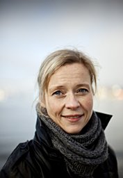 Sofia Thorsson合作论文数Department of Earth Sciences, Göteborg University19
 Nils Wallenberg合作论文数9
 Björn Holmer合作论文数Department of Earth Sciences, University of Gothenburg9
 Deliang Chen (陈德亮)合作论文数Department of Earth System Science, Tsinghua University5
 Bijan Dargahi合作论文数Division of Hydraulic Engineering;Department of Land and Water Resources Engineering;Royal Institute of Technology;Department of Land and Water Resources Engineering, Royal Institute of Technology5
 Shimelis Gebriye Setegn合作论文数Department of Earth and Environment, Florida International University5
 Assefa M. Melesse合作论文数Department of Earth and Environment, Florida International University5
 R Srinivasan合作论文数Spatial Sciences Laboratory, Department of Ecology and Conservation Biology, College of Agriculture & Life Sciences, Texas A&M University;Department of Biological and Agricultural Engineering, College of Agriculture & Life Sciences, Texas A&M University;Texas A&M AgriLife Blackland Research & Extension Center4
 Hans W. Linderholm (Hans Linderholm)合作论文数Department of Earth Sciences, University of Gothenburg4
 Gunnar Palm合作论文数3
 Oskar Backlin合作论文数3
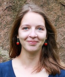 Janina Konarska合作论文数Dept Earth Sci, Univ Gothenburg3
 Mats Borjesson合作论文数Sahlgrens Univ Hosp3
 Nilson Finn合作论文数Department of Environmental and Life Sciences, Karlstad University3
 Kevin Lau合作论文数Department of Civil, Environmental and Natural Resources Engineering, Luleå University of Technology3
 Eric D. Carlström合作论文数Department of Nursing, Health and Culture, University West3
 Amir Khorram-Manesh合作论文数Prehospital and Disaster Medicine Centre, Gothenburg, Sweden3Christine Achberger合作论文数Regional Climate Group, Göteborg University3Linnea Lundgren合作论文数2
 Jonatan Jungmalm合作论文数Center for Health and Performance, University of Gothenburg2
 Anders Raustorp合作论文数School of Sport Sciences, Linnaeus University2
 Andreas Froberg合作论文数Department of Food and Nutrition, and Sport Science, University of Gothenburg2
 Michael Roderick合作论文数Research School of Earth Sciences, College of Science, Australian National University2
 Tim McVicar合作论文数CSIRO2
 Lucrezia Ricciardulli合作论文数Remote Sensing Systems2
 Randall J. Donohue合作论文数CSIRO Land & Water2
 Jesper Bjorklund合作论文数university of gothenburg2
 Marie Haeger-Eugensson合作论文数IVL Swedish Environmental Research Institute Ltd2T. De Bruin合作论文数1Bénédicte Dousset合作论文数1David I. Berry合作论文数1Maja Dolinar合作论文数1Ramona Bergman合作论文数1Jan René Larsen合作论文数1Irena Vipavc Brvar合作论文数1Iris Alfredsson合作论文数1Petter Stridbeck合作论文数1Sabrina Campe合作论文数1hilde orten合作论文数1
 Ana Monteiro合作论文数1Marten Tacoma合作论文数1
 Eva Rocha合作论文数1
 Mauricio Fuentes合作论文数1
 Peng Zhang (张鹏)合作论文数Department of Physical Geography, School of Geography and Ocean;Science, Nanjing University1Anders Wörman合作论文数1
 Daniel Gebregiorgis合作论文数Georgia State Univ, Dept Geosci, Atlanta, GA 30303 USA1Ge Gao (高歌)合作论文数1Yanxiang Liu (柳艳香)合作论文数China Meteorological Administration1




