Mining leads to soil degradation and land subsidence, resulting in decreased soil quality. However, there are limited studies on the detailed effects of mining activities on soil properties, particularly in western aeolian sand. This study, therefore, quantitatively assessed the aeolian sandy soil disturbance induced by mining activities in the contiguous regions of Shanxi, Shaanxi, and Inner Mongolia. The following soil physical quality indices were measured in the pre (May 2015), mid (October 2015), and postmining period (April 2016), such as the soil water content (SWC), particle size (PS), soil penetration (SP), and soil saturated hydraulic conductivity (SSHC). The results showed that mining activities brought irreversible effects on soil structures. In the pre-mining period, land subsidence broke up large soil particles, destroying soil structure, leading to decreased PS (218.33 vs. 194.36 mu m), SP (4615.56 vs. 2631.95 kPa), and subsequently decreased SSHC (1.12 vs. 0.99 cm/min). Rainfall during the midmining period exacerbated this fragmentation. Thereafter, low temperatures and humidity caused the soil to freeze, allowing the small soil particles to merge into larger ones. Meanwhile, the natural re-sedimentation, subsidence, and heavy mechanical crushing in the post-mining period increased PS and SP. The SSHC hence increased to 1.21 cm/min. Furthermore, the evaluation of soil indices from different stress zones showed that the external pulling stress zone always had a higher SSHC than the neutral zone in any mining period, possibly due to the presence of large cracks and high SWC. This study contributes to the understanding of the impact of mining activities on soil physical qualities, providing a theoretical basis and quantitative guidance for the surface damage caused by coal mining in the aeolian sandy area in Western China.
China’s loess deposits exhibit high vulnerability to deformation under precipitation and snowmelt, posing significant risks to infrastructure. This study utilized enzyme-induced carbonate precipitation (EICP) to enhance the mechanical properties of Yili loess. Comparative analyses of untreated and EICP-treated samples were conducted using unconfined compression strength (UCS) tests, unconsolidated–undrained (UU) triaxial shear tests, and scanning electron microscopy (SEM). Results demonstrated that urease activity increased markedly between 25–65 °C, while calcium carbonate production peaked at 55 °C before declining. EICP treatment elevated UCS by 52% relative to untreated soil and altered the failure mechanisms: untreated specimens failed through penetrating shear cracks, whereas treated specimens exhibited compressive failure with vertical fissures. Triaxial tests confirmed enhanced properties in EICP-stabilized loess, showing 8.3–10.7% higher failure strength and 15.7% greater cohesion (increasing from 31.3 kPa to 36.2 kPa), while the internal friction angle remained largely unchanged. Microstructural analysis revealed that EICP generated continuous cementitious layers and crystal bridges of vaterite, transforming particle contacts from point-to-point to surface-to-surface interfaces. Simultaneously, crystal precipitation reduced pore sizes and increased tortuosity. These micro-scale modifications improved interparticle friction constraints and stress transfer efficiency, thereby enhancing the macroscopic mechanical performance. The findings validate EICP’s efficacy for stabilizing collapsible loess deposits and provide insights for geohazard mitigation in similar engineering contexts.
Soil heavy metal contamination is one of the most severe global environmental challenges today. Microbiologically induced calcite precipitation (MICP), as an environmentally friendly bioremediation technique, demonstrates significant potential in addressing such pollution. To optimize the MICP process, the research systematically investigated the influence of urea concentration on the remediation of soils co-contaminated with cadmium (Cd) and nickel (Ni). A highly efficient urease-producing strain, SX4 (Enterobacter sp.), was isolated from mining areas, showing the highest urease activity (conductivity change: 22.14 mS·cm⁻1) among all isolates. Under optimal growth conditions (pH = 7, urea concentration 20 g·L⁻1, OD600 = 1.76), the remediation cycles for Cd– and Ni-contaminated soils were 120 h and 132 h, respectively. Evaluation of different urea concentrations (0, 10, 20, 40 g·L⁻1) confirmed that the 20 g·L⁻1 group was the most effective. It achieved effective removal rates of 45.71
The limited availability of phosphorus (P) in soil poses a critical constraint on agricultural productivity, and sustainable P fertilization practices are of great importance for crop production. In this study, we developed a novel dual-function granular material (RMG) derived from red mud, a waste residue from the aluminum industry. This material is capable of adsorbing P in P-rich soils and releasing P in P-deficient soils, thereby enabling the sustainable use of red mud and P fertilizer. The influences of RMG on the migration and transformation of P in soil were investigated. Application of RMG significantly increased the critical threshold for P leaching, thereby effectively mitigating P loss. In the initial stage of leaching, P in the leachate was present predominantly as particulate phosphorus, whereas molybdate-reactive P became the dominant form in later stages. With increasing RMG dosage, the pH of the leachate rose while the total phosphorus concentration declined, indicating that alkaline components in RMG promoted the adsorption and precipitation of phosphates in soil. The release behavior of P from P-enriched RMG was also examined. The results showed that the total soil P content increased progressively with higher RMG dosage and longer cultivation duration. Elevated temperature and soil moisture content were found to enhance the release and migration of P from RMG into the soil. SEM-EDS analyses revealed that released components (e.g., Ca2+ and Fe3+) from RMG formed relatively stable complexes with free phosphates. Moreover, adsorption of P onto the RMG surface further facilitated its migration and transformation within the soil. The research findings provide valuable insights for the simultaneous pollution remediation and resource utilization of red mud and phosphorus.
Soil sampling and in situ measurements were conducted at 24 locations at three time points from May 2015 to April 2016. The statistical analysis showed that the variabilities of soil water content and soil penetration were moderate, while particle size and soil saturated hydraulic conductivity varied considerably. Rainfall before measurements contributed positively to the mean soil water content and negatively to particle size. This was mainly due to the soil aggregates and large soil particles being broken into smaller particles from rain splash. The detached small-sized soil particles could coalesce into larger-sized ones and even soil aggregates. Stressors in zones differ, resulting in variations between soil physical quality indices. The point-to-point comparisons indicated that the mean measured soil water content and soil saturated hydraulic conductivity were similar, if the measurements for these two indices were conducted under similar weather conditions during the same period between years. The investigation on the relationships among soil physical quality indices showed a negative relationship between the measured soil water content and soil saturated hydraulic conductivity. A positive correlation was also found between soil particle size and soil saturated hydraulic conductivity. Lower soil strength resulted in higher soil saturated hydraulic conductivity.
The rapid development of urbanization has led to population growth, increased resource consumption, and intensified environmental pollution. Consequently, urban ecological security has increasingly become a key factor constraining the sustainable development of socio-economic systems. This study constructed an urban ecological security evaluation system based on the Pressure-State-Response (PSR) model and used Xuzhou, a typical coal resource city, as a case study to apply and validate the model. Specifically, the analytic hierarchy process and entropy weight method were used to determine the index weights, and the ecological security index was used to evaluate the ecological security status of each system in Xuzhou from 2006 to 2022. Finally, the grey prediction GM (1,1) model was used to predict the ecological security status of Xuzhou in the next five years. The results show that the “disposal capacity of waste gas treatment facilities”, “per capita disposable income”, and “agricultural fertilizer application intensity” occupy a large weight in the whole evaluation system. The pressure index generally showed a fluctuating upward trend, and the state index fluctuated around 0.12. There is a simultaneous upward trend in the response index and the composite index. The ecological security level of the composite index has increased from “unsafe” in 2006 to “relatively safe” in 2022 and will continue to improve to “ideal security” in the future. This study provides a scientific basis for the formulation of sustainable development policies in Xuzhou and also provides a reference for the ecological safety management and assessment of other similar cities.
Studying the spatial distribution of soil organic matter (SOM) and exploring its driving factors in semi-arid grassland open-pit coal mining areas is crucial for sustaining ecological development and security. Currently, research on SOM in mining areas lacks large-scale investigation, sampling, spatial distribution, and driving force research for semi-arid grassland open-pit coal mining areas, and it is unable to comprehensively grasp the distribution characteristics and driving force of SOM in open-pit coal mines. In view of this, this study took the Shengli Coal Field in Xilinhot City, the hinterland of Xilingol Grassland, as an example to research the spatial distribution and driving forces of SOM in the semi-arid grassland open-pit coal mining area. The results show that: (1) Areas with high SOM content were mainly distributed in the north of open-pit germanium mine, west No. 2 open-pit mine, and No. 1 open-pit mine. Areas with low SOM content were mainly distributed on the east and southeast sides of the city. From the spatial distribution perspective, mining has a certain impact on SOM in the study area. (2) Natural factors have a higher impact on SOM changes than human factors. The order of influence degree of each factor on the spatial distribution of SOM is NDVI > Water > Agriculture > Mine > Town > Industry. The sources of influence on SOM in the research area are relatively complex. (3) The interaction between two factors presents two relationships: nonlinear enhancement and dual-factor enhancement. A single factor is lower than the interaction between various factors. In the interaction between factors, the explanation rate of interaction between Town, Agriculture, Mine, NDVI, Water, and all other factors is above 0.85. This study has important practical significance for soil management in mining areas, ecological restoration, and planning of national land space, etc.
Laboratory experiments were carried out to analyze 39 soil samples collected from four industrial areas in Xuzhou City using inductively coupled plasma mass spectrometry and atomic fluorescence spectrometry. The descriptive statistics of heavy metals (HMs) in the soil profiles showed that the HM content at three depths was highly variable, and most coefficients of variation (CVs) showed moderate variability. The enrichment of Cd at all depths exceeded the risk screening value, and Cd pollution occurred in four plants. The enrichment of the other HMs at three depths was mainly concentrated in the pharmaceutical plant A and chemical plant C. It was found that the different HMs had different vertical distribution characteristics. For the different industrial plants, the raw materials and products not only made the spatial distribution characteristics of the HMs different, but also caused the HM types and contents to differ. The average single pollution indices of Cd in plant A, iron-steel plant B, and plant C indicated a slight pollution level. The other seven HMs in A, B, and C and all HMs in chemical plant D belonged to the safe category. The mean values of the Nemerow pollution index in the four industrial plants belonged to the warning category. The analysis showed that none of the HMs posed potential noncarcinogenic health risks, and only the carcinogenic health risks of Cr in plants A and C were unacceptable. The carcinogenic effect of Cr through the inhalation intake of resuspended soil particulates and that of Cd, Ni, and As via direct oral ingestion were the main exposure pathways.
Soil heavy metal pollution is a severe and growing problem, and it is crucial to assess the level of soil heavy metal contamination and determine the origins of pollutants. However, there is limited research on soil heavy metal source apportionment and its carcinogenic and non-carcinogenic hazards. Positive Matrix Factorization (PMF) is a powerful technique for source apportionment of pollutants in environmental matrices such as atmospheric particulate matter and soil, as it can handle missing and imprecise data to ensure data reliability, among other benefits. In order to explore the distribution characteristics and main sources of heavy metals in agricultural land, the contents of Cd, Cr, Cu, Pb, and Ni were collected and determined. The positive matrix factorization (PMF) model was used to analyze the source of heavy metals in the soil in the study area, and the human health risk evaluation was carried out. The results showed that (1) the coefficient of variation of Cd in the four areas was much higher than that of the other four heavy metals, which showed strong variability; (2) the content and distribution of heavy metals in different regions were different under the influence of different environments; (3) the PMF model analysis showed that the heavy metal pollution sources in the four areas were divided into two types: the soil parent material, which had industrial pollution, traffic pollution, and agricultural pollution; and the contribution rate of each pollution source; (4) the non-carcinogenic risks of heavy metals in children at all points in the study area were greater than those of adults, and the carcinogenic risks were the opposite of the carcinogenic risk in the study area. And the most serious carcinogenic risk in the study area was the harm caused by oral ingestion of heavy metal Cr into the adults’ bodies.
The stability of drinking water distribution systems and the management of disinfection by-products are critical to ensuring public health safety. In this paper, the interrelationships between corrosion products in the network, microbes, and drinking water quality are elucidated. This review also discusses the mechanisms through which corrosive by-products from the piping network influence the decay of disinfectants and the formation of harmful disinfection by-products. Factors such as copper corrosion by-products, CuO, Cu2O, and Cu2+ play a significant role in accelerating disinfectant decay and catalyzing the production of by-products. Biofilms on pipe walls react with residual chlorine, leading to the formation of disinfection by-products (DBPs) that also amplify health risks. Finally, this paper finally highlights the potential of peroxymonosulfate (PMS), an industrial oxidant, as a disinfectant that can reduce DBP formation, while acknowledging the risks associated with its corrosive nature. Overall, the impact of the corrosive by-products of pipe scale and microbial communities on water quality in pipe networks is discussed, and recommendations for removing DBPs are presented.
Based on soil sampling, lab experiment and support resistance monitoring, the disturbance of soil physical quality indices between different underground mining stages of No 52303 working face was studied in semi-arid region of western China. Soil sampling was conducted in same locations before and after mining in 2014. This study proved that soil water content, soil cohesion and soil porosity were greatly decreased, while bulk density and dry density were increased by coal mining. In comparison, coal mining had slight effect on organic matter, internal fraction angle, and D1 and D2 percent. Underground pressure monitoring showed that P1 during stage 2 was significantly greater than that during stage 1, indicating the large difference of pressure characteristics in tail areas of working face between two stages. Both soil water content and soil cohesion were decreased during two stages in two sites. Soil cohesion was strongly correlated to soil water content, and D1 and D2 percent in 2013 and 2014. Coal mining subsidence increased the cumulative probability to reach the same value of soil water content and soil cohesion. The cover depth produced different elastic and plastic zone widths between sites by theoretical model calculation, consistent with the support resistances in tail areas of working face. Higher pressure might cause a more serious destructive rock-soil body and a larger groundwater level decrease. The dryer and more serious erosive soil column induced by coal mining is a non negligible matter for the semi-arid region.
黄河流域煤炭资源富集与生态环境脆弱并存,亟待破解煤炭资源开发与生态环境保护的矛盾,构建黄河流域高质量发展新格局.按流域水系划分并结合《全国矿产资源规划(2016-2020年)》,有57个国家规划煤矿区应隶属黄河流域.为此,构建了黄河流域资源环境承载力指标体系,揭示了黄河流域资源环境承载力指数的时空规律;重新审视了煤炭资源开发强度测算方法,量化了黄河流域34个煤矿区的煤炭资源开发强度;利用耦合协调度模型测度了矿区尺度煤炭资源开发强度与区域尺度资源环境承载力的匹配程度.结果 发现,下游以高级协调为主,显著高于中上游且较稳定.但2010-2018年中上游变化趋势有差异:中游从初级协调(0.62)降至勉强协调(0.51);上游以初级协调为主,耦合协调度从0.60提升至0.62.随着能源战略重心西移,晋陕蒙宁四省区的煤炭开发强度不断增大,特别是榆横、榆神、吴堡、离柳等矿区煤炭资源开发强度已然与资源环境承载力不匹配;青海木里矿区从勉强协调(0.53)降至中度失调(0.25),降幅超50%;甘肃整体改善幅度较大,各矿区均有不同程度提升.基于此,研判黄河流域煤炭资源保护性开发利用战略:①要从"水资源-煤炭资源-社会经济-生态"的全局性视角探析黄河流域"煤水双保";②与资源环境承载力不相匹配的煤炭开发方式亟需改进或退出;③煤炭资源开发应与更大尺度的国土空间规划相协同;④加强闭矿后矿业废弃地与废弃矿井的资源化利用.鉴于黄河流域地域跨度大、矿区分布广,历史遗留问题较多、潜在生态风险较高,点上问题亟待解决、线上问题不容忽视、面上问题更需重视.建议将黄河流域煤矿区划分为青甘保育区、蒙宁陕风沙区、晋陕黄土区、豫鲁平原区4类区域,未来煤炭资源开发与生态修复应实施分区管控、分类治理、分级修复、分步推进,坚持生态保护与修复并举、自我恢复与人工修复并重,以期为黄河流域生态保护与煤炭高质量发展提供科技支撑.
The upsurge of phosphorus (P) demands in agriculture and the diminishing high-grade reservoirs of P are a serious challenge in the fertilizer industry. Currently, researchers in the fertilizer industry are exploring the potential of medium-low-grade phosphate rock (PR) resources. This study aims to elucidate the possible activation mechanism of P from a mixture of lignite and low-grade rock-phosphate by assessing the release in various pyrolytic products and calcined solid phosphorus using a thermogravimetric analyzer coupled with a Fourier transform infrared spectrometer (TG-FTIR). The results show that a suitable calcination temperature can effectively enhance the release of P from phosphate rock, and TG-FTIR revealed the mechanism that the effect of the calcination temperature has on the release of water-soluble phosphorus from phosphate rock mixed with lignite. Our findings confirm that the thermal treatment of PR + lignite mixture at 150°C (APR150), which is higher than the high pyrolysis temperature of 450–850°C, and the P solubility increased by 50.6% compared to that of non-pyrolytic APR. It is therefore suggested that calcined lignite at 150°C can conceivably be used as an effective substitute for expensive catalysts in the activation of low-grade PR, and thus, the high cost of PR activation can be decreased.
Soil nitrogen is a key indicator of soil quality and plays a significant role for plant growth. Therefore, it is very important to study soil nitrogen distribution, especially in semi-arid area of western China. Fewer scholars paid attention to the effect on soil nitrogen due to coal mining in semi-arid mining areas of western China. In this paper, soil samples of different locations were tested in both the loess region and the aeolian sand region in the Daliuta mining area in Shaanxi Province. The impacts of mining subsidence on soil nitrogen were investigated. The soil nitrogen distributions between the loess region and the aeolian sand region were compared, and used the principal component analysis method to evaluate soil quality in semi-arid mining area. The results showed that the comprehensive score of soil quality in the loess region was as follows: the internal pulling stress zone (NLS) > the external pulling stress zone (WLS) > the compressive stress zone (YS) > the neutral zone (ZX). The content of soil total nitrogen in YS-zone was the lowest in the loess region. The loss of nitrogen increased with time in the mining area, in which the total nitrogen loss at the depth of 0−15 cm was 0.27 g/kg, and the alkaline nitrogen loss at the depth of 0−15 cm was 1.08 mg/kg. In the aeolian sand region, the comprehensive score of soil quality was as follows: WLS > FC (the non-mining zone) > ZX > NLS > YS. The amount of soil nitrogen content in the loess region was larger than that in the aeolian sand region. It was found that for the loess region, the relationship between total nitrogen and nitrate nitrogen showed a significant positive correlation. It was also a significant positive correlation between ammonium nitrogen and alkaline nitrogen. In the aeolian sand region, there was a significant positive correlation between total nitrogen and alkaline nitrogen. There was no significant correlation among other nitrogen forms.
Farmlands of sandy loam soil in the Daliuta mining in Shaanxi Province was chosen as object of the study. Soil compactness and moisture content was measured in situ for statistical analysis and linear fitting, and furthermore, for com-parative analysis in combination with four semi-empirical models in simulation and prediction. Results show that soil at the early harvesting stage was the lowest in compactness, and the highest in soil moisture content;Planting of mung bean re-duced soil compactness fairly;soil moisture content in the range of 8. 30%-16. 14% was linearly and negatively related to soil compactness;The linear model and the four semi-empirical models all fitted well in Area B ( corn) , with correlation coefficients being all higher than 0. 7;Among the models, the Ayers model performed the best in prediction, which means that the model can be used to predict soil conditions of the semi-arid mining areas.
教学与科研是矛盾的统一体,是相辅相成的;但形成这种思想需要教师在思维上进行深刻理解,更需要管理人员在政策导向和相关措施的出台前进行深入调查.工科专业的教育更需要科研作为后盾以来提高教学质量,在很多时候,教学的确能够促进科研思想的出现.
The behavior of a vertical plunging jet was numerically investigated using the coupled Level Set and Volume of Fluid method. The computational results were in good agreement with the experimental results reported in the related literature. Vertical plunging jet characteristics, including the liquid velocity field, air void fraction, and turbulence kinetic energy, were explored by varying the distance between the nozzle exit and the still water level. It was found that the velocity at the nozzle exit plays an unimportant role in the shape and size of ascending bubbles. A modified prediction equation between the centerline velocity ratio and the axial distance ratio was developed using the data of the coupled Level Set and Volume of Fluid method, and it showed a better predicting ability than the Level Set and Mixture methods. The characteristics of turbulence kinetic energy, including its maximum value location and its radial and vertical distribution, were also compared with that of submerged jets.
Simulations for root growth, crop growth, and N uptake in agro-hydrological models are of significant concern to researchers. SWMS_2D is one of the most widely used physical hydrologically related models. This model solves equations that govern soil-water movement by the finite element method, and has a public access source code. Incorporating key agricultural components into the SWMS_2D model is of practical importance, especially for modeling some critical cereal crops such as winter wheat. We added root growth, crop growth, and N uptake modules into SWMS_2D. The root growth model had two sub-models, one for root penetration and the other for root length distribution. The crop growth model used was adapted from EU-ROTATE_N, linked to the N uptake model. Soil-water limitation, nitrogen limitation, and temperature effects were all considered in dry-weight modeling. Field experiments for winter wheat in Bouwing, the Netherlands, in 1983-1984 were selected for validation. Good agreements were achieved between simulations and measurements, including soil water content at different depths, normalized root length distribution, dry weight and nitrogen uptake. This indicated that the proposed new modules used in the SWMS_2D model are robust and reliable. In the future, more rigorous validation should be carried out, ideally under 2D situations, and attention should be paid to improve some modules, including the module simulating soil N mineralization.
 Zhengfu Bian (卞正富)合作论文数School of Environment and Spatial Informatics, China University of Mining and Technology14
 Shaogang Lei (雷少刚)合作论文数School of Environment and Spatial Informatics, China University of Mining and Technology10
 Tuqiao Zhang (张土乔)合作论文数Municipal Engineering Institute, College of Civil Engineering and Architecture, Zhejiang University10
 KeFeng Zhang (张可锋)合作论文数9
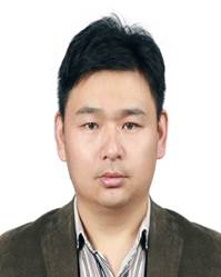 Jibing Xiong (熊集兵)合作论文数School of Environment and Spatial Informatics, China University of Mining and Technology8
 Shouguo Mu (牟守国)合作论文数School of Public Policy & Management, China University of Mining and Technology5Guo-qiang DU (杜国强)合作论文数4
 Lizhang Wang (王立章)合作论文数School of Environment and Spatial Informatics, China University of Mining and Technology4Xiu-qin CHEN (陈秀琴)合作论文数3
 Jiachao Jiang (蒋家超)合作论文数School of Environment and Spatial Informatics, China University of Mining and Technology3
 Shuai Guo (郭帅)合作论文数College of Civil Engineering, Hefei University of Technology3
 Duncan Joseph Greenwood合作论文数HRI/University of Warwick3Yajun Zhang合作论文数2QIE Chen-long (郄晨龙)合作论文数2YIPEI HUA合作论文数2
 Haochen Yu (于昊辰)合作论文数College of Economics and Management, Qingdao University of Science and Technology2Qin CAI (蔡钦)合作论文数2Jian Ma (马健)合作论文数2Yi Ding (丁毅)合作论文数2
 Liping Wang (王丽萍)合作论文数School of Environment and Spatial Informatics, China University of Mining and Technology2Jie-Ze Yu合作论文数2
 Li Fu (傅力)合作论文数School of Material and Environmental Engineering, Hangzhou Dianzi University1Song Wu合作论文数1Zhongxian Guo合作论文数1Zixuan Niu合作论文数1
 Yanxu Wang (王延续)合作论文数1Qianqian Jia合作论文数1WU Zhong-hua合作论文数1
 Chunguang Li (李春光)合作论文数Institute of Rock and Soil Mechanics, Chinese Academy of Sciences;University of Chinese Academy of Sciences1Dengyu Yin合作论文数1Zizhao Zhang合作论文数1Yuan Li合作论文数Tianjin Eco-Environmental Monitoring Center, Tianjin 300191, China.1
 Zhenhua Wu合作论文数1
 Sohail Muhammad合作论文数Faculty of Life Sciences, University of Okara1Qing CHEN (陈清)合作论文数1
 Fayuan Wang (王发园)合作论文数College of Environment and Safety Engineering, Qingdao University Science and Technology1WeiMing Guan (管伟明)合作论文数1XiaoGang Wu (吴小刚)合作论文数1YaDong Huang (黄亚东)合作论文数1
 Yaqin Zhao (赵雅琴)合作论文数School of Environment and Spatial Informatics, China University of Mining and Technology1Hongjian Zhang (张洪建)合作论文数School of Environment and Spatial Informatics, China University of Mining and Technology1
 Ping Luo (罗萍)合作论文数School of Environment and Spatial Informatics, China University of Mining and Technology1Chuanyi Zhang (张传义)合作论文数School of Environment and Spatial Informatics, China University of Mining and Technology1
 Yongjun Yang (杨永均)合作论文数School of Environment and Spatial Informatics, China University of Mining and Technology1
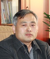 Guoqing Zhu (朱国庆)合作论文数School of Safety Engineering, China University of Mining and Technology1
 Lei Zhang (张雷)合作论文数School of Mechanical Engineering, Hefei University of Technology1
 Wanghua Sui (隋旺华)合作论文数School of Resources and Geoscieces, China University of Mining and Technology1Zhou Qingwei合作论文数Institute for Advanced Materials and Laboratory of Quantum Engineering and Quantum Materials, South China Academy of Advanced Optoelectronics1
 Philip J. White合作论文数The James Hutton Institute;Huazhong Agriculture University;University of Nottingham1




