To address the challenges of limited detection range, unstable tracking, and object flickering caused by ground interference from uneven farmland, inaccurate visual masks, and sparse LiDAR point clouds at mid-to-long distances, this study constructs a multi-sensor fusion perception system based on 3D LiDAR and cameras. Furthermore, it proposes an obstacle detection method incorporating cascaded ground filtering, multimodal feature fusion, and temporal tracking. The method first utilizes a cascaded algorithm combining Random Sample Consensus (RANSAC) and Cloth Simulation Filter (CSF) to address the challenge of ground clutter filtering in uneven terrain. To account for the varying reliability of sensor modalities at different distances, a matching strategy based on hybrid cost is developed. This strategy enables a robust association between LiDAR clusters and visual targets by adaptively weighting the precise boundary information from visual masks and the stable positional features from detection bounding boxes. A Kalman filter is subsequently integrated to impose temporal smoothness on the fusion results and eliminate long-range object flickering. Experimental results demonstrate that the proposed method reduces the ground false positive rate to 0.3% and achieves an overall average precision of 91.4%. Regarding mid-to-long distance detection, in contrast to the baseline method where the recall drops sharply beyond 35 m, the proposed method achieves an average recall of 98.2% within the entire 0-45 m range. Furthermore, accuracy (MOTA) and tracking continuity (IDF1) are improved to 92.93% and 98.03%, respectively. Therefore, the proposed method satisfies the requirements for high precision, high recall, and stable environmental perception in complex farmland scenarios.
To achieve an unmanned rice farm, in this study, a cotransporter system was developed using a tracked rice harvester and transporter for autonomous harvesting, unloading, and transportation. Additionally, two unloading and transportation modes-harvester waiting for unloading (HWU) and transporter following for unloading (TFU)-were proposed, and a harvesting-unloading-transportation (HUT) strategy was defined. By breaking down the main stages of the collaborative operation, designing module-state machines (MSMs), and constructing state-transition chains, a HUT collaborative operation logic framework suitable for the embedded navigation controller was designed using the concept and method of the finite-state machine (FSM). This method addresses the multiple-stage, nonsequential, and complex processes in HUT collaborative operations. Simulations and field-harvesting experiments were performed to evaluate the applicability of this proposed strategy and system. The experimental results showed that the HUT collaborative operation strategy effectively integrated path planning, path-tracking control, inter-vehicle communication, collaborative operation control, and implementation control. The cotransporter system completed the entire process of harvesting, unloading, and transportation. The fieldharvesting experiment revealed that a harvest efficiency of 0.42 hm2 center dot h-1 was achieved. This study can provide insight into collaborative harvesting and solutions for the harvesting process of unmanned farms. (c) 2024 THE AUTHORS. Published by Elsevier LTD on behalf of Chinese Academy of Engineering and Higher Education Press Limited Company. This is an open access article under the CC BY license (http://creativecommons.org/licenses/by/4.0/).
ObjectiveThe objective of this study is to solve the problem of large longitudinal spacing of fruit trees and the inavailability of global navigation satellite system (GNSS) signals in closed-canopy orchard environment. MethodA navigation method based on three-dimensional light detection and ranging (3D LiDAR) was proposed, taking the wheeled spray robot as the research platform and the canopy mango orchard as the experimental environment. For laser point cloud preprocessing, mounting error calibration of the liDAR was initially conducted. Terrain compensation for 3D LiDAR point cloud positions was implemented via an attitude and heading reference system (AHRS). The cloth simulation filter (CSF) was employed to extract ground points. An improved statistical filtering method based on the Euclidean distance of point clouds was used to both remove noise point clouds and retain distant fruit tree point clouds. Based on the scanning characteristics of 3D LiDAR point cloud and the triangular inequality condition, an adaptive distance threshold calculation method with clustering body center constraint was designed, and the obtained body center position was projected to the X-Y plane of the navigation coordinate system to obtain the clustered body center position of the trunk point cloud. Newton’s interpolation method was used to interpolate the body-centered position data, and the random sample consensus (RANSAC) algorithm was used to fit the navigation path, i.e., NIL-RANSAC, after the interpolation was completed. In order to verify the accuracy and reliability of navigation path extraction, two methods, least squares method (LSM) and RANSAC, were used to obtain the navigation path directly and conduct comparative experiments. A linear quadratic regulator (LQR) was used for path following control. ResultUsing CSF in closed-canopy orchard effectively removed weeds and uneven ground point clouds and the treatment time was only 0.03 s. The success rate of Euclidean clustering with the adaptive distance threshold within 15 m was more than 95%. LQR realized path following control, and the maximum lateral deviations of NIL-RANSAC, RANSAC and LSM were 0.26, 0.32 and 0.42 m, respectively, and the standard deviation of NIL-RANSAC was the minimum, being only 0.09 m. The navigation accuracy of the NIL-RANSAC path fitting method was better than those of RANSAC and LSM, and the average time of the complete navigation algorithm was less than 100 ms. ConclusionThe NIL-RANSAC method can meet the requirements of accurate and real-time navigation of closed-canopy orchard environment, and provide a reference for autonomous navigation of orchard ground equipment.
To realize the automatic row-alignment harvesting of cotton without the requirement for preset paths, this study designed the contact sensor and its modeling method, processed and corrected the position and attitude information obtained from the GNSS/IMU (Global Navigation Satellite System/Inertial Measurement Unit), and constructed a data fusion method based on the Kalman Filter to achieve accurate and stable acquisition of the row-alignment deviation. Furthermore, a navigation control system for the cotton picker was developed, the validation and field harvest experiments were performed to test the applicability of the proposed method and system. The validation experiments showed that the SD (Standard Deviation) of the row-alignment deviation after data fusion was reduced by 32.35 % compared to the contact-sensor direct-out data. The data fusion method not only reduced the measurement noise of the contact sensor but also improved the adaptability for missing detection and lack of plants. The field harvest experiments showed that the MAE (Mean Absolute Error), MAD (Maximum Absolute Deviation), and SD of the automatic row-alignment harvest were 0.035, 0.133, and 0.044 m, respectively. This method exhibits better adaptability and practicability in field environments. These results indicate that the proposed multi-sensor fusion method and automatic row-alignment control system proposed and designed in this study can satisfy the requirements of practical field operations.
The growing demand for automation in the apple-harvesting industry remains challenging due to the complex and dynamic nature of orchard environments. This study presents an enhanced deep learning model designed to improve the accuracy and adaptability of recognition algorithms for robotic arm-based harvesting. Specifically, an optimized You Only Look Once (YOLO) v8n model was developed by integrating a dilation-wise residual–dilated re-parameterization block module, a generalized feature pyramid network, and the Scylla Intersection-over-Union loss function. The enhanced model was trained and evaluated on a comprehensive dataset, achieving precision, recall, F1 score, and mAP50 values of 81.43 %, 68.48 %, 74.40 %, and 81.68 %, respectively. These results indicate improvements of 1.06 %, 1.42 %, 1.28 %, and 1.61 % over the original YOLOv8n, while preserving comparable model parameters, computational efficiency, and detection speed. Furthermore, the enhanced model demonstrated superior overall performance compared to YOLOv5, YOLOv6, and RT-DETR. To validate its adaptability and robustness, the enhanced model was rigorously tested against the original YOLOv8n model diverse conditions, including varying growth stage, lighting environments, field of view, and levels of occlusion. In outdoor field experiments conducted under cloudy, low-light, and artificial lighting conditions, the model achieved localization errors of 2.43 mm (X-axis), 3.70 mm (Y-axis), and 1.28 mm (Z-axis), representing reductions of 19.27 %, 12.67 %, and 23.05 %, respectively. Furthermore, counting accuracy improved to 69.39 %, reflecting a 2.42 % increase over the original model. The results demonstrate the enhanced model's reliable performance and heightened precision for robotic arm-based apple harvesting in complex and challenging orchard environments. The study also provides a comprehensive analysis of the model's strengths, limitations, and avenues for future research. Ultimately, this work contributes to advancing agricultural automation, paving the way for smarter, more efficient, and sustainable farming practices.
In autonomous rice harvesting, the use of transporters to assist rice transportation is an effective way to improve efficiency. However, nonlinear systems, such as double Hydraulic Static Transmission (HST)-driven tracked rice harvesters and transporters, make it challenging to control the precise parallel parking alignment during transportation, often leading to rice loss and potential safety hazards. To address this issue, this study established a geometric cotransporter model and used a preset path to decouple a two-dimensional control problem into two sets of one-dimensional controls. Dynamic and kinematic models of the longitudinal drive and steering systems were analyzed. Based on the identified longitudinal drive system transfer function, a predictive model was constructed to predict and compensate for the parking slip caused by system inertia. It was combined with the integrator wind-up protection to improve the pure tracking method and eliminate or reduce system errors in path tracking. A parallel parking alignment control system was designed using these two methods, and comparative experiments were conducted on the road surface. The results demonstrate that the compensated predictor (CP) longitudinal control improves the alignment accuracy compared with the proportional differential (PD) controller, whereas the Improved Pure-Pursuit Control (IPPC) path-tracking slightly enhances the tracking accuracy compared with proportional integral (PI). Moreover, a field-autonomous rice-harvesting cotransporter experiment showed that the longitudinal alignment accuracy of the designed system was less than 0.2 m. The lateral alignment accuracy was less than 0.1 m.
To accurately control the longitudinal relative position of a harvester and transport vehicle, such that grain in the harvester can be accurately unloaded into the transport vehicle's granary, this study established a master–slave collaborative harvesting system. Furthermore, this study proposed a calculation method for the longitudinal deviation of two vehicles, analyzed the structure and mathematical model of the hydraulic stepless transmission, identified the proposed stem transfer function of the hydraulic stepless transmission speed, analyzed incremental proportional–integral–derivative (PID), and developed self-adjusting–single-neuron PID control methods. Simulations and field experiments were performed to test the applicability of the proposed system. The experimental results indicated that the maximum overshoot of the longitudinal deviation between the harvester and the transport vehicle did not exceed 0.25 m, the steady-state mean absolute deviation did not exceed 0.08 m, the steady-state maximum deviation did not exceed 0.26 m, and the steady-state standard deviation did not exceed 0.09 m, when the harvester speed was 0.6, 0.8, and 1 m/s. Field-harvesting application experiments showed that the settling time during the alignment process was 13.2 s, and the steady-state maximum deviation was 0.253 m. The grain can be accurately unloaded into the granary of the transport vehicle. These results indicate that the control method and the master–slave collaborative harvesting system proposed in this study can meet the needs of precise collaborative unloading between the harvester and transport vehicle.
To achieve high-frequency and effective inter-vehicle communication between harvesters and transport vehicles during cooperative harvesting, a protocol for wireless communication was designed by analyzing actual communication requirements. Two different wireless communication modes (radio and 4G) were selected for the hardware design; then, a Kalman Filter was designed based on real-time Dead-reckoning and inter-vehicle Communication data after delay Compensation (KFDCC). Finally, the relative longitudinal deviation between two vehicles was obtained and updated steadily at a 10 Hz frequency. By using the relative longitudinal deviation of two vehicles, calculated after aligning the UTC stamp with the local GNSS data from the harvester and transport vehicle as a comparative metric, accuracy evaluation experiments were conducted regarding radio and 4G. The maximum absolute errors of the KFDCC output value were 0.03783 and 0.07381 m, respectively, and the mean square errors were 0.00392 and 0.01317 m, respectively. Compared with systems without the KFDCC method, the mean square errors were reduced by 88.76% and 90.60%, respectively. The KFDCC method can also effectively solve the problems of data delay, packet loss, blockage, error, and so on, in wireless communication, and has short-time breakpoint endurance capabilities. Field experiments showed that the proposed method can provide accurate data support for the dynamic alignment and unloading processes of harvesters and transport vehicles, and it can also provide algorithmic support for real-time communication data fusion between different wireless communication modes. Overall, the inter-vehicle communication mode and data-processing method designed in this paper have good effects and adaptability, and they can guarantee that the whole process of autonomous harvesting operates properly.
针对水稻收获机与转运车双机协同自主作业环节多、粮食转运过程复杂等问题,该研究设计了一种基于有限状态机(Finite State Machine,FSM)的水稻收获机与转运车协同作业策略,分析了水稻收获机与转运车协同作业模式,建立有限状态机模型.首先,基于作业环节设计触发条件、评估方法和执行流程等基础模块;然后,根据双机协同的各项状态建立状态信息矩阵;最后,依据协同触发事件与状态转移的逻辑设计状态转移链.构建协同作业时分复用控制逻辑框架,并运用Stateflow软件进行仿真分析,为验证所设计策略的田间实际作业效果,搭建了履带式水稻收获转运双机协同试验系统,收获速度为0.8 m/s,收割幅宽1.9 m,共28条收获边,协同路径选择在短边的机耕道上,连续协同工作时间大于等于120 min,采用套圈路径自主收获0.7 hm2水稻,期间共进行6次自动协同转运作业,将所收获的粮食转运到卡车上.试验结果表明,该策略可以实现水稻收获/卸粮转运自主作业,收获效率为0.35 hm2/h,为实现水稻收获双机智能转运协同功能奠定了基础,可为水稻无人农场建设提供技术支持.
[目的]开发基于星基增强精密单点定位的农机自动导航系统.[方法]以国产雷沃TX1204拖拉机为平台,采用国产星基增强定位板卡的输出数据作为农机位置反馈量,设计位速卡尔曼滤波器对定位数据进行滤波处理,开发预瞄跟随PID路径跟踪控制算法进行导航控制,整定不同行驶速度条件下的模型控制参数,采用地基增强RTK高精度定位接收机输出数据作为参考量,搭建农机自动导航测试系统并开展系统性能测试.[结果]在直线跟踪误差方面,所开发的农机自动导航系统平均误差为?0.0009436?m,标准差为0.02452?m,最大误差绝对值为0.08472?m;在邻接行误差方面,平均误差为0.0007128?m,标准差为0.02986?m,最大误差绝对值为0.15444?m.这一精度可满足大部分农机自动导航作业需求.[结论]将国产星基增强精密单点定位技术用于农机自动导航是可行的;本文设计的预瞄跟随PID路径跟踪控制模型和提出的不同速度条件下PID参数与前视距离的整定方法,提高了系统对不同速度的自适应能力.
In the current research on the navigation of rice transplanters, navigation and positioning are achieved by measuring and controlling the body of a rice transplanter. However, the transplanter body and the implement experience relative pose changes, and the trajectories of the body and the implement are inconsistent. Considering this problem, a positioning correction method for rice transplanters based on the attitude of the implement was designed in this study. The transformational relationship between coordinate systems was established and used to estimate the position and attitude of the rice transplanter. A Kalman filter was designed to integrate the estimated positioning and attitude data. Thus, the attitude of the center of the implement was indirectly obtained and used for navigating and positioning the rice transplanter. The experimental results showed that the root-mean-square errors of the positions determined with the body and implemented as control points were 0.031 m and 0.063 m, respectively. When the body of a rice transplanter tilts, the positioning correction method based on the attitude of the implement can satisfactorily improve the positioning accuracy of the rice transplanter and help improve the navigation control accuracy for paddy rice seedling transplantation.
[目的]更好地满足车辆自动驾驶时航向角测量的精度要求.[方法]提出卡尔曼滤波算法,把实时动态-全球导航卫星系统(RTK-GNSS)测量出来的经纬度和高程经过高斯投影转换为高斯平面坐标,和微电子机械系统(MEMS)陀螺仪测得的累积航向角进行融合处理,最终得到车辆更为精准的航向角.[结果]融合后的航向角度曲线既保持了GNSS航向的整体变化趋势,也保持了陀螺仪航向的细部变化趋势,且较GNSS和陀螺仪所得曲线更为平滑,可以跟踪车辆180°调头的转弯动作.[结论]卡尔曼滤波算法可以实时在线且精准地测得车辆航向角数据,精度较GNSS测量结果提高80% 以上.
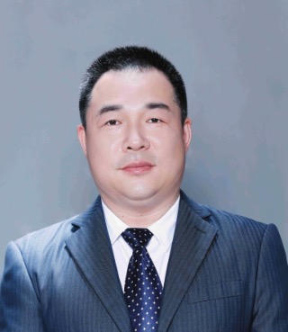 Zhigang Zhang (张智刚)合作论文数College of Engineering, South China Agricultural University10
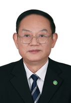 Xiwen Luo (罗锡文)合作论文数College of Engineering, South China Agricultural University7
 Lian Hu (胡炼)合作论文数College of Engineering, South China Agricultural University4
 Mingda Peng合作论文数3Liwen Hu合作论文数3
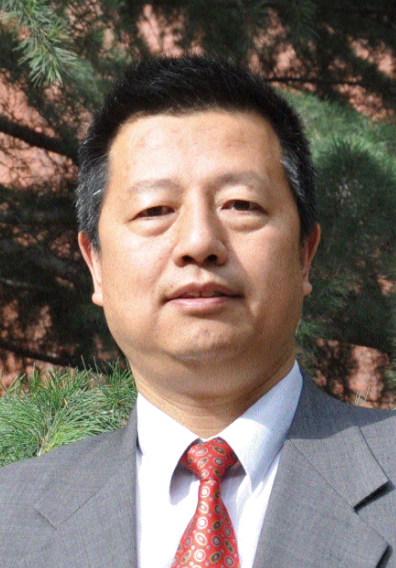 Wenyu Zhang (张文煜)合作论文数School of Geo-Science and Technology, Zhengzhou University;College of Atmospheric Sciences, Lanzhou University3Xinluo Wu合作论文数2BinBin Yue (岳斌斌)合作论文数2Hui Wang (王辉)合作论文数2
 Jie He (何杰)合作论文数College of Engineering, South China Agricultural University2
 Zhao Zhang (张昭)合作论文数College of Information and Electrical Engineering, China Agricultural University1MAO Zhenqiang (毛振强)合作论文数1Jiarui Zhang合作论文数1
 Jie Guo (郭杰)合作论文数School of Mechanical and Electrical Engineering, Hainan University1
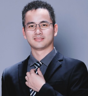 Peikui Huang (黄培奎)合作论文数South China Agricultural University1
 Xiongzhe Han合作论文数Department of Biosystems and Biomaterials Engineering and Research Institute of Agriculture and Life Sciences, Seoul National University1
 Pei Wang (王沛)合作论文数CET-College of Engineering and Technology, Southwest University1
 Jing He合作论文数1




