Abstract. The Arctic Mediterranean is rapidly changing, a statement that is often made, but the follow-up statements: changing from what and towards what are often omitted. Hence its role in the global climate system, particularly regarding the Atlantic Meridional Overturning Circulations remains poorly constrained. This review of the oceanography of the Arctic Mediterranean Sea develops an unified perspective of how interacting components of the system evolve in space and time, and the processes that determine their evolution. To set the stage a succinct overview of the geographic setting and early explorations is given. We then follow the pathways of the principal water masses to describe inflows, inter-basin circulations, water mass transformations, and outflows of heat and salt to the bordering subpolar gyre and the global ocean. The fundamental connection to the global ocean, the Atlantic water, is traced along its route into and through the Arctic Mediterranean. Its transformations, driven by cooling, and by the freezing and melting of sea ice, lead to the creation of both denser and less dense waters that form and maintain the water column structures within the Arctic Mediterranean; the so-called double estuary. A second advective component to the Arctic, the low salinity water carried by the Pacific inflow, is concentrated into the Amerasian Basin and acts there to further isolate the denser waters derived from the Atlantic inflow. Hence, the waters return to the North Atlantic either as dense overflows or buoyant outflows. The water masses within diverse regions of the Arctic Mediterranean have changed over the past few decades, and this influences their exchanges with the world ocean across the Greenland-Scotland Ridge. That the water mass transformations in the Arctic Mediterranean take place beyond a ridge allows for the build-up of significant density differences that, through entrainment, can increase the impact of the Arctic Mediterranean on global overturning circulation.
Nitrogen constrains biomass across the Arctic Ocean, with nitrate (NO3) supply to the surface waters fuelling new primary production and net carbon drawdown. In this Review, we explore the physical mechanisms driving NO3 fluxes to the euphotic zone across the Arctic Ocean and how biological processes respond. The volume and inflow depth of Atlantic and Pacific Ocean waters, together with sea ice and halocline dynamics, govern internal physical mixing of NO3. Respectively, these inflows supply ~34 ± 5 kmol NO3 s−1 and 9 ± 1 kmol NO3 s−1, spreading at mid-depth. NO3 from below the euphotic zone is mixed upwards via several mechanisms. Overall, NO3 fluxes associated with diffusive and turbulent mixing, submesoscale fronts and cyclonic mesoscale eddies are relatively low (on the order of ~0.1–0.7 mmol m−2 per day) but cover a large area, with peaks associated with wind events or individual strong eddies. By comparison, upwelling-driven fluxes are much stronger (on the order of ~1 mmol m−2 per day) but are more localized. Near-inertial and tidal mixing over the Arctic Ocean’s complex bathymetry drives perhaps the strongest NO3 fluxes, for example, reaching 4.5 mmol m−2 per day in the Barents Sea. Comparing these fluxes with observed biological NO3 uptake rates indicates that the internal physical supply of NO3 only limits primary productivity in 9 of the 17 cases considered. Thereafter, light limitation and lagged growth responses can result in excess NO3 remaining in the surface waters. Future research should prioritize linking NO3 supply and uptake at corresponding spatiotemporal scales. Vertical nitrate fluxes to sunlit surface waters have an important role in supporting primary production in the Arctic Ocean. This Review explores the contributions of various physical mixing mechanisms in supplying nitrate to the Arctic euphotic zone and compares them to the biological uptake rates.
The Kitikmeot Sea, in the south-central Canadian Arctic Archipelago, is an estuarine system comprised of Coronation Gulf, Bathurst Inlet, Dease Strait, and Queen Maud Gulf. It is unique in the pan-Arctic system due to three defining features: (1) shallow bounding straits to the west (Dolphin and Union Strait) and northeast (Victoria Strait) that are less than 30 m deep; (2) Arctic Ocean inflow carrying nutrient and salt supplies over the bounding sills that are primarily delivered from the Canada Basin; and (3) massive freshwater input from the mainland watershed that drains an area almost 5 times larger than the Kitikmeot Sea. Here we present physical and geochemical observations obtained from 1999–2020 to show that these conditions maintain an estuarine circulation year-round, wherein the excess low-salinity water, formed from inflowing rivers and seasonal ice melt, exits over both bounding sills and is replenished by inflowing oceanic waters from Amundsen Gulf and Larsen Sound. The shallow sills both restrict the depth of inflow, dictating the salinity and nutrient concentrations of inflowing waters, and increase tidal speeds over the sills, which leads to mixing between the outflowing and inflowing water that further lowers inflowing salinity and nutrient concentrations. Together, all these processes establish a strongly stratified and overall low-productivity ecosystem within the Kitikmeot Sea. We propose a conceptual model of marine ecosystem function that favors an abundance of Arctic char and seals as top predators instead of the larger polar bears and whales as found adjacent to the Kitikmeot Sea in the Canadian Arctic Archipelago.
Land and ocean ecosystems are strongly connected and mutually interactive. As climate changes and other anthropogenic stressors intensify, the complex pathways that link these systems will strengthen or weaken in ways that are currently beyond reliable prediction. In this review we offer a framework of land–ocean couplings and their role in shaping marine ecosystems in coastal temperate rainforest (CTR) ecoregions, where high freshwater and materials flux result in particularly strong land–ocean connections. Using the largest contiguous expanse of CTR on Earth—the Northeast Pacific CTR (NPCTR)—as a case study, we integrate current understanding of the spatial and temporal scales of interacting processes across the land–ocean continuum, and examine how these processes structure and are defining features of marine ecosystems from nearshore to offshore domains. We look ahead to the potential effects of climate and other anthropogenic changes on the coupled land–ocean meta-ecosystem. Finally, we review key data gaps and provide research recommendations for an integrated, transdisciplinary approach with the intent to guide future evaluations of and management recommendations for ongoing impacts to marine ecosystems of the NPCTR and other CTRs globally. In the light of extreme events including heatwaves, fire, and flooding, which are occurring almost annually, this integrative agenda is not only necessary but urgent.
Great Bear Lake (GBL) is the largest lake entirely within Canada and the largest polar-type lake in the world. It holds cultural and sustenance value to the Deline Got'ine. However, its baseline physical limnology and how this may be altered by climate warming and anthropogenic stressors have received little attention. To explore the roles that surface heat exchange, wind, seasonal ice cover, and thermodynamic constraints play in the seasonal progression of ventilation and stratification of GBL, we report data from two 2008-09 moorings, satellite-derived lake surface temperatures, and observations made in 1964. Three spatially constrained processes regulate seasonal patterns of ventilation and stratification. Mid-lake temperatures remain below the temperature of maximum density (TMDsurf = 3.98 degrees C) throughout the year. In this area, solar radiation drives vertical convection while cooling develops stratification. Waters along the perimeter of the lake and within its five major arms do rise above TMDsurf in summer and stratify. It follows that mixing between the inner and outer domains form water at TMDsurf to create a convergent sinking zone or thermal bar. Because TMD decreases with increasing pressure, ventilation in the deepest region of the lake (McTavish Arm, Z(max) = 446 m) requires wind-aided downwelling to force cold surface water to a depth where it lies closer to the local TMD, triggering thermobaric instability, which then drives full-depth ventilation. These patterns of ventilation and stratification constrain the availability of light and nutrients, therefore setting rates of biogeochemical processes, and regulating the lake's overall response to climate change. Plain Language Summary Great Bear Lake (GBL), crossed by the Arctic Circle, is the world's largest polar-type lake. It has three unique areas: the middle, where temperatures stay below 3.98 degrees C, with dense water sinking in summer and stratification occurring in winter; the five protected arms, where temperatures exceed 3.98 degrees C, creating stratification in both summer and winter, and interactions between the cooler main body and warmer arms form vertical barriers; and McTavish Arm, where depths reach 446 m show extra layering due to water compressibility, requiring wind convection for mixing. Our study examines these processes through comprehensive temperature data from 2008, 2009, and 1964, alongside satellite images, to understand the lake's ecology and response to climate change.
François Lake is a long, deep, seasonally ice-covered, dimictic lake set in an east-west orientation in mid-British Columbia. As a baseline we here present data from a full-depth temperature mooring deployed at the lake’s mid-point in 2004–2005 and one full-depth conductivity-temperature-depth cast. We use these temperature records to define lake stability, scales of motion and the annual cycle of thermal stratification, mixing and deep-water ventilation. Owing to its length (110 km) both the Wedderburn and Lake numbers—indices of thermocline tilt and mixing under wind forcing—transition through critical values during fall and spring seasons, suggesting thermocline outcropping and strong turbulent mixing within the thermocline at these times. Owing to its depth (240 m) the decreasing temperature of maximum density (T MD ) with depth (thermobaric effect) adds complexity to overturn events. Owing to its seasonal ice cover (2–3 months per year) the critical period for effective fall ventilation occurs before ice formation and concurrent wind shielding, while that of spring ventilation lies between the dates that the ice cover melts and the lake surface water warms above 4°C. While the lake undergoes full depth ventilation in both fall and spring, we show that both progress in distinct dynamical stages. Fall ventilation is more efficient than that of spring, and the transition temperature and resulting bottom temperature from fall to winter stratification (positive to inverse) and winter to spring stratification (inverse to positive) lies close to the temperature of maximum density calculated for the maximum depth of free and forced convection (in this case, closer to 3.7°C).
Over the last two decades, in an effort to engage youth in polar science, the Students On Ice (SOI; https://studentsonice.com/) project has become a platform for youth to partake in scientific expeditions around the globe. Among the various activities offered, youth are able to join cruises in the North Atlantic or Arctic, and drop sealed glass bottles into the ocean. Of the thousands that have been deployed, 5% of bottles have been recovered and reported back to SOI with details on when and where they were found. Here, we compare the observational bottle data with virtual particle trajectories from a high resolution regional ocean model. Although modelling results indicate a higher likelihood of bottles reaching the shores of the western Atlantic, the majority of recovered bottles were found on the eastern side of the Atlantic. We attribute this disparity to differences in population density in Canada and Europe, biasing the recovery rates. Despite this bias, we find that changes in recovery locations over time are consistent with changes in the main ocean currents associated with the contraction and expansion of the North Atlantic Subpolar Gyre, as simulated in our ocean model. In 2007, a large number of bottles were found in Norway, coinciding with a contracted North Atlantic Subpolar Gyre during 2004-2008. While between 2012-2016, the majority of bottles were recovered on the British Isles, during a time of gyre expansion. These results underline the importance of large scale oceanic cycles for tracking marine debris and pollution, and show how even simple data collection methods, such as drift bottles, can provide clues to the changes in the large scale ocean circulation.
Kelps play important roles in ecosystems as they provide structural habitat and protection, and supply food. Given these beneficial roles and observed increases in seaweed biomass and distribution ranges across the Arctic, mapping kelp occurrence around Arctic coasts is both timely and necessary for future conservation. Here, we fill spatial gaps in the knowledge of kelp distribution in the southern Northwest Passage, Canadian Arctic Archipelago; specifically, we report the occurrence of Laminaria solidungula, Saccharina latissima and Alaria esculenta from Victoria and Dease straits and Bathurst Inlet in the Kitikmeot Region at depths mostly from 10 to 30 m (max. 40 m; upper extent vessel-limited). Kelp specimens were found at bottom water temperatures from sub-zero to 1 °C (surface-T to ~ 6 °C) and bottom water salinities of ~ 28 (surface-S < 20) in August–September. Kelp sites were characterized by both strong tidal currents (max. estimates from a tidal model 20–70 cm s−1 in center of passages) and hard substrates, interspersed with finer sediments. Co-occurring identifiable epibenthos was dominated by suspension-feeders preferring currents (sea cucumbers, soft corals, Hiatella clams), potential kelp consumers (sea urchins Strongylocentrotus sp., Margarites snails, limpets) and predatory invertebrates (sea stars, lyre crabs). At the same and some deeper nearby sites, loose kelp fragments were also found at the seabed, suggesting that kelps contribute to the regional detrital food web by supplying carbon to less productive sites. Kelps in the region may expand their ranges and/or growing season with reduced ice cover and warming, although constraints through local turbidity sources, extreme temperatures, low salinity and low nutrient concentrations are also recognized.
The Arctic Ocean is the smallest of the world oceans, yet one whose currents and water masses extend globally. It is an advection-dominated ocean in that currents import distinct waters from both the North Atlantic and the North Pacific that interact and layer vertically by density. Further modified by river inputs and the freezing and melting of sea ice, the Arctic Ocean exports modified waters back into the North Atlantic, thus impacting the global thermohaline circulation. This physical system forms the backdrop for almost all chemical, biological, and geological processes within the Arctic Ocean, all of which are expected to change in a warming Earth. To anticipate the effects of such changes in external and advective forcing, it is necessary to understand how they interact and are manifested in the observed hydrographic structures. The aim of this review is thus to present and discuss the processes responsible for these structures.
The foremost flooding event of the past century happened in 2013 on the Amur River, which flows into the Sea of Okhotsk. Concurrently, the winter of 2012–2013 was a year of heavy sea ice and delayed onset of melting in this region. To examine the joint effects of these major, regional-scale hydrological freshening events on oceanographic processes, we compared physical (CTD, tides and currents) and biological (zooplankton) data measured in 2004 and 2013 in Academy Bay, Sea of Okhotsk. Our results indicate that the difference in sea water temperature between the two years played a primary role in shaping zooplankton variability. Data collected in 2013 showed that water temperature was colder and that the upper layer was substantially fresher (∼4–5 psμ) than in 2004. This decrease in water temperature and salinity reduction was accompanied by a significant decrease in the abundance of some key zooplankton species including Calanus glacialis, Pseudocalanus spp. and Sagitta elegans and a corresponding increase in the abundance of Limacina helicina. Delayed melting of sea ice in 2013 potentially triggered a mismatch in pelagic production that may have impacted the recruitment of calanoid copepods. Variation in tidal and subtidal advection of cold and highly saline Okhotsk Sea shelf water appears to be an important process influencing regional variation in zooplankton abundance. The occurrence of such hydrological events has the potential to trigger cascading effects through the food web.
The contrasting roles of seasonal stratification and seasonal ventilation are among the most important attributes of lake systems in defining their geochemistry, biology and response to climate forcing. The physical processes that regulate these processes are especially significant in very deep lakes, where the joint effect of temperature and pressure on water density becomes important. Here we report on a year‐long time series (2019–2020) of temperature from a mooring deployed in seasonally ice covered and dimictic Great Slave Lake (614 m depth). Because the temperature of maximum density (T MD ) decreases with increasing pressure, once ∼4°C water begins to sink, it is no longer at its depth‐specific maximum density and additional processes are required to drive convection and convective mixing. The key physical mechanism governing deep‐water renewal is the conditional thermobaric instability. We show here that (a) different temperature dynamics control the quantity and timing of convective renewal in the upper ∼200 m versus deep‐water renewal below; (b) fall and spring deep‐water renewal events are asymmetric and linked to weather during the brief time of ice forming (melting) and surface temperatures cooling (warming) through 4°C; (c) short term variability (days to weeks) related to the length of time between surface waters passing through T MD and ice formation (fall) and melt (spring) shapes the subsequent thermal structure; and (d) the penetration of solar radiation through ice in early spring drives penetrative convection in the upper layer, deepening the mixed‐layer, and this likely affects the timing of spring phytoplankton production.
Many complex fjord systems cross British Columbia's coastline. A 70 year (1951–2020) time series analysis of temperature, salinity, and oxygen in four such fjords between ∼54 and 50oN (Douglas Channel, Rivers Inlet, Knight Inlet and Bute Inlet) shows that changes were greatest in deep waters between the sill and the bottom. In Rivers, Knight and Bute Inlet, the deep water temperature increased by 1.2–1.3°C over 70 years, up to two times the global average for open ocean waters at corresponding depths, while salinity increased by 0.1–0.2, and oxygen decreased by 0.4–0.7 mLL−1. The most northern inlet, Douglas Channel, showed a temperature increase of 0.8°C from 1951 to 2016, while trends in oxygen and salinity were not statistically significant. An analysis of Apparent Oxygen Utilization suggests that the deep waters in Douglas Channel are more readily exchanged with the outer coast than the three other fjords.
Mooring observations in the eastern Eurasian Basin of the Arctic Ocean showed that mean 2013–2018 along-slope volume and heat (calculated relative to the freezing temperature) transports in the upper 800 m were 4.8 ± 0.1 Sv (1 Sv = 106 m3/s) and 34.8 ± 0.6 TW, respectively. Volume and heat transports within the Atlantic Water (AW) layer (∼150–800 m) in 2013–2018 lacked significant temporal shifts at annual and longer time scales: averaged over the two periods of mooring deployment in 2013–2015 and 2015–2018, volume transports were 3.1 ± 0.1 Sv, while AW heat transports were 31.3 ± 1.0 TW and 34.8 ± 0.8 TW. Moreover, the reconstructed AW volume transports over longer, 2003–2018, period of time showed strong interannual variations but lacked a statistically significant trend. However, we found a weak positive trend of 0.08 ± 0.07 Sv/year in the barotropic AW volume transport estimated using dynamic ocean topography (DOT) measurements in 2003–2014 – the longest period spanned by the DOT dataset. Vertical coherence of 2013–2018 transports in the halocline (70–140 m) and AW (∼150–800 m) layers was high, suggesting the essential role of the barotropic forcing in constraining along-slope transports. Quantitative estimates of transports and their variability discussed in this study help identify the role of atlantification in critical changes of the eastern Arctic Ocean.
The Canada Basin has exhibited a significant trend toward a fresher surface layer and thus a more stratified upper‐ocean over the past three decades. State‐of‐the‐art ice‐ocean models, by contrast, tend to simulate a surface layer that is saltier and less stratified than observed. Here, we examine decadal changes to seasonal processes that may contribute to this wide‐reaching model bias using climate model simulations from the Community Earth System Model and below‐ice observations from the Arctic Ice Dynamics Joint Experiment in 1975 and Ice Tethered Profilers in 2006–2012. In contrast to the observations, the models simulate salinity profiles that show relatively little variation between 1975 and 2012. We demonstrate that this bias can be mainly attributed to unrealistically deep vertical mixing in the model, creating a surface layer that is saltier than observed. The results provide insight for climate model improvement with broad implications for Arctic sea ice and ecosystem dynamics.
An important yet still not well documented aspect of recent changes in the Arctic Ocean is associated with the advection of anomalous sub-Arctic Atlantic- and Pacific-origin waters and biota into the polar basins, a process which we refer to as borealization. Using a 37-year archive of observations (1981–2017) we demonstrate dramatically contrasting regional responses to atlantification (that part of borealization related to progression of anomalies from the Atlantic sector of sub-Arctic seas into the Arctic Ocean) and pacification (the counterpart of atlantification associated with influx of anomalous Pacific waters). Particularly, we show strong salinification of the upper Eurasian Basin since 2000, with attendant reductions in stratification, and potentially altered nutrient fluxes and primary production. These changes are closely related to upstream conditions. In contrast, pacification is strongly manifested in the Amerasian Basin by the anomalous influx of Pacific waters, creating conditions favorable for increased heat and freshwater content in the Beaufort Gyre halocline and expansion of Pacific species into the Arctic interior. Here, changes in the upper (overlying) layers are driven by local Arctic atmospheric processes resulting in stronger wind/ice/ocean coupling, increased convergence within the Beaufort Gyre, a thickening of the fresh surface layer, and a deepening of the nutricline and deep chlorophyll maximum. Thus, a divergent (Eurasian Basin) gyre responds altogether differently than does a convergent (Amerasian Basin) gyre to climate forcing. Available geochemical data indicate a general decrease in nutrient concentrations Arctic-wide, except in the northern portions of the Makarov and Amundsen Basins and northern Chukchi Sea and Canada Basin. Thus, changes in the circulation pathways of specific water masses, as well as the utilization of nutrients in upstream regions, may control the availability of nutrients in the Arctic Ocean. Model-based evaluation of the trajectory of the Arctic climate system into the future suggests that Arctic borealization will continue under scenarios of global warming. Results from this synthesis further our understanding of the Arctic Ocean’s complex and sometimes non-intuitive Arctic response to climate forcing by identifying new feedbacks in the atmosphere-ice-ocean system in which borealization plays a key role.
The Arctic marine system is large and heterogeneous, harsh and remote, and now changing very rapidly, all of which contribute to our current inadequate understanding of its basic structures and functions. In particular, many key processes within and external to the Arctic Ocean are intrinsically linked to its freshwater system, which itself is undergoing rapid and uncertain change. The role of the freshwater system (delivery, disposition, storage, and export) in the Arctic Ocean has recently received significant attention; however, due to the fact that few studies are able to cover all regions and seasons equally, we still lack an accessible, unified pan-Arctic representation generalizing the impacts of freshwater on the upper Arctic Ocean where many biological and geochemical interactions occur. This work seeks to distill our current understanding of the Arctic freshwater system, and its impacts, into conceptual diagrams which we use as a basis to speculate on the impact of future changes. We conclude that an understanding of regional and seasonal variability is required in order to gain a pan -Arctic perspective on the physical-geochemical-biological state of the upper Arctic Ocean. As an example of regionality, enhanced stratification due to freshening will be more important in the Pacific influenced Amerasian Basin, which stores the bulk of the freshwater burden, while the Atlantic influenced Eurasian Basin will experience more consequences related to increased heating from advective sources. River influenced coastal regions will experience a mosaic of these and other biogeochemical effects, whereas glacial fjords may follow their own unique trajectories due to the loss of upwelling mechanisms at glacial fronts. As an example of seasonality, the continued modulation of the sea ice freeze-melt cycle has increased the seasonal freshwater burden in the deep basins dramatically as the system progresses toward ice-free summer conditions, but will eventually reverse, reducing the seasonal flux of freshwater by more than half in a future, perennially ice-free ocean. It is our goal that these conceptualizations, based on the current state-of-the-art, will drive hypothesis-based research to investigate the physical-biogeochemical response to a changing freshwater cycle in a future Arctic Ocean with greatly reduced ice cover.
Data from coastal tide gauges, oceanographic moorings, and a numerical model show that Arctic storm surges force continental shelf waves (CSWs) that dynamically link the circumpolar Arctic continental shelf system. These trains of barotropic disturbances result from coastal convergences driven by cross-shelf Ekman transport. Observed propagation speeds of 600−3000 km day–1, periods of 2−6 days, wavelengths of 2000−7000 km, and elevation maxima near the coast but velocity maxima near the upper slope are all consistent with theoretical CSW characteristics. Other, more isolated events are tied to local responses to propagating storm systems. Energy and phase propagation is from west to east: ocean elevation anomalies in the Laptev Sea follow Kara Sea anomalies by one day and precede Chukchi and Beaufort Sea anomalies by 4−6 days. Some leakage and dissipation occurs. About half of the eastward-propagating energy in the Kara Sea passes Severnaya Zemlya into the Laptev Sea. About half of the eastward-propagating energy from the East Siberian Sea passes southward through Bering Strait, while one quarter is dissipated locally in the Chukchi Sea and another quarter passes eastward into the Beaufort Sea. Likewise, CSW generation in the Bering Sea can trigger elevation and current speed anomalies downstream in the Northeast Chukchi Sea of 25 cm and 20 cm s–1, respectively. Although each event is ephemeral, the large number of CSWs generated annually suggest that they represent a non-negligible source of time-averaged energy transport and bottom stress-induced dissipative mixing, particularly near the outer shelf and upper slope. Coastal water level and landfast ice breakout event forecasts should include CSW effects and associated lag times from distant upstream winds.
The Arctic Ocean is overwhelmingly forced by its lateral boundaries, and interacts with, the global system. For the development of nested conceptual models of the Arctic Ocean ecosystem we here choose the full pan-Arctic as our focal scale. Understanding the pan-Arctic scale, however, requires that we look at the underlying scales of its major components, by considering regionality, connectivity and seasonality. Six regions are identified on the basis of hydro-morphological characteristics, which subsequently reflect ecological function and traits. Regions are static, tied to geography, but are linked by contiguous domains of shared function that facilitate material transports and share key ecological features. The pan-Arctic scale also requires attention to forcing by the seasonal light intensity, wherein the maximum length of a single day varies from near 24 h at the Arctic Circle to about 4400 h (183 days) at the North Pole. The light climate forces a strong phenology in the Arctic, as reflected in the periodic life cycle events of organisms. In addition to light climate, Arctic Ocean ecosystems are dominated by three fundamental variables: ice cover, nutrient/food availability and advection. The conditions under which each of these variables play out in the course of a year are set by the regions and contiguous domains within which they operate and interact. Together, the defined regions and their seasonality, the contiguous domains and their connectivity, and the three fundamental variables allow unambiguous application of scale-nested, parsimonious and adaptive, conceptual models, from which to 1) create testable hypotheses, 2) plan and then modify field campaigns, and 3) communicate essential results to managers and the general public. The development of these nested conceptual pan-Arctic scale models creates a vital step into the future of unifying, integrative oceanographic and ecological work.
 Fiona Mclaughlin合作论文数41
 Koji Shimada合作论文数Japan Agcy Marine Earth Sci & Technol, Inst Observat Res Global Change23
 Andrey Proshutinsky合作论文数22
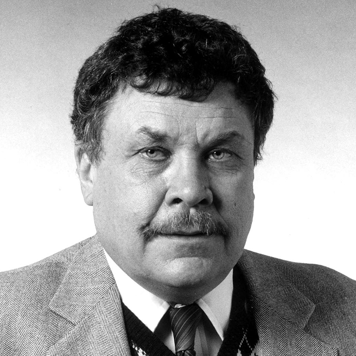 William J. Williams合作论文数Department of Electrical Engineering and Computer Science, Michigan University20F. A. McLaughlin合作论文数20
 Igor V. Polyakov合作论文数International Arctic Research Center, University of Alaska Fairbanks19
 Richard Krishfield合作论文数Department of Physical Oceanography, Woods Hole Oceanographic Institution18Motoyo Itoh合作论文数17Michiyo Yamamoto-Kawai合作论文数International Arctic Research Center, University of Alaska17Svein Vagle合作论文数15
 Robie Macdonald合作论文数Institute of Ocean Sciences,Department of Fisheries and Oceans15
 Mary-Louise Timmermans合作论文数Department of Earth & Planetary, Yale University13
 Knut Aagaard合作论文数Applied Physics Laboratory, Polar Science Center, University of Washington;School of Oceanography, College of the Environment, University of Washington13Sergey A. Kondratyev合作论文数12Vladislav A. Rumyantsev合作论文数12Victor P. Saltankin合作论文数12Tatyana Gronskaya合作论文数12Anna V. Izmaylova合作论文数12Николай Николаевич Филатов合作论文数12
 Hubert Chanson合作论文数School of Civil Engineering, Faculty of Engineering, Architecture and Information Technology, The University of Queensland12
 Bijan Dargahi合作论文数Division of Hydraulic Engineering;Department of Land and Water Resources Engineering;Royal Institute of Technology;Department of Land and Water Resources Engineering, Royal Institute of Technology12Sarah Zimmermann合作论文数12V. V. S. Gurunadha Rao合作论文数12
 Jean Albergel合作论文数Mission IRD, IRD12
 Stanley Trimble合作论文数College of Social Sciences, University of California, Los Angeles12
 Andrey Pnyushkov合作论文数Arctic and Antarctic Research Institute St. Petersburg11
 Humfrey Melling合作论文数Institute of Ocean Sciences11
 Shigeto Nishino合作论文数Japan Agency for Marine-Earth Science and Technology, Research Institute for Global Change11Reginald W. Herschy合作论文数10Keishi Shimada合作论文数9
 Bodil Bluhm合作论文数University of Alaska Fairbanks School of Fisheries and Ocean Sciences, Institute of Marine Science9Kristina Brown合作论文数8
 Seth L. Danielson合作论文数Institute of Marine Science, University of Alaska8
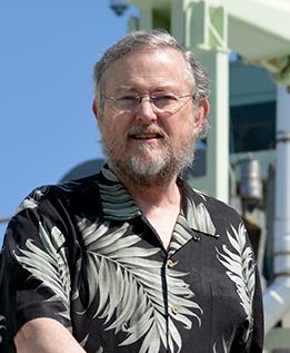 John M. Toole (John Toole)合作论文数Department Physical Oceanography, Woods Hole Oceanographic Institution8
 Vladimir Ivanov合作论文数8F. Mclaughlin合作论文数7James Swift合作论文数7S Nishino合作论文数7Robert Rember合作论文数International Arctic Research Center, University of Alaska Fairbanks7
 Konstantin Rogachev合作论文数7
 Laurie Padman合作论文数7Fa Mclaughlin合作论文数6
 Don Perovich合作论文数Thayer School of Engineering, Dartmouth College6
 John E. Walsh合作论文数Department of Climate, Meteorology & Atmospheric Sciences, School of Earth, Society & Environment, University of Illinois Urbana-Champaign;International Arctic Research Center, University of Alaska Fairbanks6
 Jennifer M. Jackson合作论文数Seismological Laboratory, Division of Geological and Planetary Sciences, California Institute of Technology6Ronald C. Wiegand合作论文数6
 Vladimir E. Romanovsky合作论文数Permafrost Laboratory, Geophysical Institute, University of Alaska Fairbanks6
 James E. Overland合作论文数Pacific Marine Environmental Laboratory|NATIONAL OCEANIC AND ATMOSPHERIC ADMINISTRATION6Christopher H. Pharo合作论文数6




