The introduction of multibeam echosounders has marked a turning point in bathymetric data acquisition, providing precise and detailed digital bathymetric models. These instruments not only enhance our understanding of underwater terrain dynamics but also reveal the presence of complex sedimentary structures, such as submarine dunes. Dunes play an important role in the preservation of the environment but can also be obstacles to safe navigation, requiring dragging operations. Hence, it is important to detect them from bathymetric models. Although information about these dunes has numerous applications, their identification methods remain poorly automated. This paper aims to leverage deep learning to develop a segmentation method for submarine dunes. Several challenges must be overcome. Dunes are complex objects with irregular, highly variable shapes, while bathymetric data are noisy and lack detailed information. Furthermore, in the fluvio-marine context, no labeled datasets exist for training purposes. Starting from a small pre-labeled dataset, this paper proposes a systematic approach to train a Mask R-CNN network. First, data augmentation techniques are applied to expand the dataset significantly and introduce meaningful variations. By relying on transfer learning with a carefully selected pre-trained backbone, feature extraction is optimized, reducing training time while enhancing model performance. The adaptation of the Mask R-CNN model to our submarine dune segmentation task has led to a significant improvement in detection performance, with a pixel-level F1-score reaching 89%. Additionally, the mean Average Precision has exceeded 50%, demonstrating the model’s effectiveness in identifying and delineating dunes despite their varied shapes and blurred contours. These results confirm the relevance of our approach for achieving more reliable dune segmentation in a complex fluvio-marine environment.
The preservation of hydrological ecosystems is crucial for sustainable forest management. Thanks to airborne lidar data acquisition programs, it is possible to collect high-resolution geospatial data and produce hydrographic networks from digital terrain models (DTM). However, underground structures such as culverts remain invisible in the DTM, causing deviations in the simulated flows along the paths. Drainage enforcement strategies are needed to solve this problem, but they modify the data. This project aims to integrate the culverts into the linear network, enabling an accurate mapping of the drainage network, including the subsurface component, without drainage enforcement that alters the DTM, or requiring manual intervention. The process relies on mapping the watercourses and drainage divides from the DTM and integrating culverts provided in a database. It involves careful modeling of the culverts, thoughtful design of the hydrographic network data structure, and the redefinition of the algorithm to calculate the drainage network. In addition to addressing underground and surface watercourses as two types of watercourse in the drainage network, it also provides a more accurate delimitation of drainage basins.
Boreal forest ecosystems are under immense pressure, and while airborne LiDAR has emerged as a powerful monitoring tool, leveraging its large data volumes requires automated analysis. Deep learning methods offer a solution but are hindered by the scarcity of large-scale, labeled datasets in forestry, contrasting to the data-rich urban environments. To address this gap, we introduce the Quebec Simulated Forest (QC-SF), a large-scale, synthetic airborne LiDAR dataset fully labeled for semantic segmentation. QC-SF contains 60,000 forest plots, each composed of a controlled mixture of the two dominant species in Quebec’s boreal forest: Black Spruce and Balsam Fir. Using this benchmark, we evaluate the performance of five renowned and state-of-the-art point cloud networks: KP-Conv, MinkUNet, DGCNN, Point Mamba and Point Transformer V3. Our results identify Point Transformer V3 as the most effective architecture, achieving 91.66% mIoU. Furthermore, we validate the sim-to-real transferability of our dataset, demonstrating that augmenting a small number of real-world scans with our synthetic data improves segmentation performance by 6 points in mIoU score. QC-SF is available at : qc-sf.org.
A landform is a physical feature of the Earth’s surface with its own recognizable shape. Most current automated landform identification methods use Object-Based Image Analysis (OBIA) techniques. Such methods segment the terrain into landform elements and assemble them into topographic objects and landforms. Usually, these methods are specific to the landform to be identified. However, geomorphologist experts can contextually recognize any landform on the Earth’s surface in relation to its environment. They have a holistic view of the landscape, adopting a physiographic approach for the interpretation of the observed regions, the objects that they contain and their relationships. Moreover, geomorphological processes leave marks on the Earth’s surface that enable geomorphologists to identify homogeneous regions by recognizing features known as structural elements. In this paper, we show that the physiographic approach can be formalized and that the context of appearance of a landform and its association with other types of landforms can be represented as a landsystem. We propose a conceptual model that organizes the main concepts and relationships characterizing the physiographic approach: they are used to formalize landsystems, landforms and structural elements. The approach is illustrated using a case study of the identification of landsystems characteristic of mountainous glacial valleys. We developed a software to automatically identify landsystems, in a way that is compatible with the geomorphologists’ physiographic approach. The core of this system is a knowledge base implemented as a Neo4j graph database. We also provide details about the logical transformation of the conceptual model and the corresponding ontologies in Noe4j structures. The tool automates the identification of landsystems in accordance with geomorphological practices, facilitating the integration of expert knowledge in the computational workflows.
This entry gives an overview of the main data structures and approaches used for a two-dimensional representation of the terrain surface using a digital elevation model (DEM). A DEM represents the elevation of the earth surface from a set of points. It is used for terrain analysis, visualisation and interpretation. DEMs are most commonly defined as a grid where an elevation is assigned to each grid cell. Due to its simplicity, the square grid structure is the most common DEM structure. However, it is less adaptive and shows limitations for more complex processing and reasoning. Hence, the triangulated irregular network is a more adaptive structure and explicitly stores the relationships between the points. Other topological structures (contour graphs, contour trees) have been developed to study terrain morphology. Topological relationships are captured in another structure, the surface network (SN), composed of critical points (peaks, pits, saddles) and critical lines (thalweg, ridge lines). The SN can be computed using either a TIN or a grid. The Morse Theory provides a mathematical approach to studying the topology of surfaces, which is applied to the SN. It has been used for terrain simplification, multi-resolution modelling, terrain segmentation and landform identification. The extended surface network (ESN) extends the classical SN by integrating both the surface and the drainage networks. The ESN can itself be extended for the cognitive representation of the terrain based on saliences (typical points, lines and regions) and skeleton lines (linking critical points), while capturing the context of the appearance of landforms using topo-contexts.
In bathymetry, the detection and mapping of underwater dune areas are crucial for coastal development planning, maritime navigation, coastal resource management, and the preservation of coastal biodiversity. Digital Bathymetric Models (DBMs) are frequently used to address this issue. However, segmenting dunes from such data presents a significant challenge due to data insufficiency and their specific characteristics. Moreover, current solutions in the literature often lack generalization and require substantial adaptation for each study area. We refined a Mask R-CNN model with pretrained weights using our dune data from the Saint Lawrence River estuarine zone. Our focus was primarily on data preparation and adapting the network to maximize extracting underwater characteristics. Our approach shows promising results in terms of generalizing a large amount of data and improving the quality of feature maps extracted from the backbone. At this stage, we conclude that having a substantial amount of available data and utilizing transfer learning are advantageous for ensuring meticulous segmentation of underwater dunes.
Twenty years after Mark and Smith's seminal paper, a Science of Topography, we revisit some of their fundamental questions about how landforms are recognised by people and how they can be automatically extracted or delimited from representations of topographic surfaces. Many approaches and tools, essentially based on GeoOBIA, can extract objects associated with landforms from image data. But, they cannot relate these objects to the topology and topography of the terrain. Yet, geo-scientists can easily recognise landforms, considering terrain characteristics and other factors composing the context of appearance of those landforms. Revisiting Gestalt Theory, we propose a salience-based approach fostering a holistic view of the terrain which fits with the geoscientists' ability to recognise landforms using the topographic and hydrologic contexts. The terrain is represented as an extended surface network (ESN), a graph composed of elementary saliences (peaks, pits, saddles, thalweg and ridge networks) and obtained from raster data. The ESN combines both the surface and the drainage networks in a sound topological representation of the terrain. A skeletonisation technique of the ESN's thalweg and ridge networks is proposed to geometrically and topologically characterise landforms, as well as ensembles of landforms. On this basis and to represent the context of appearance of landforms, geo/topo-contexts are introduced as structures grounded in the properties of the ESN and using the skeletonisation technique. We give an illustration of how a geomorphologist can apply our approach and tools, using the depressions and drainage basins as examples of useful geo/topo-contexts.
Virtual LiDAR Scan (VLS) serves as a powerful tool for the replication of real world conditions and can assist with the calibration of LiDAR systems. In this study, we utilize HELIOS++, a VLS software, to investigate the impact of point cloud density on the semantic segmentation performance of a well-established Deep Learning (DL) method for point clouds, KPConv. Our experiment is focused on a typical Quebec boreal forest composed of Abies balsamea and Picea mariana. We generated 10250 structurally diverse forest plots to train 10 DL models on a wide range point cloud densities to assess their effect on the semantic segmentation. Densities varied from 23 points/m 2 to 225 points/m 2 , replicating point clouds output from classic airborne LiDAR scanning and high-density unmanned LiDAR scanning. Our results demonstrate that point cloud densification improves IoU score for both boreal tree species by an average of 0.3 percentage points per 10 points/m 2 .
The surface network is an application of the Morse-Smale complex to digital terrain models connecting ridges and thalwegs of the terrain in a planar, undirected graph. Although it provides a topological structure embedding critical elements of the terrain, its application to morphological analysis and hydrology remains limited mainly because the drainage network is the most relevant structure for analysis and it cannot be derived from the surface network. The drainage network is a directed, hierarchical graph formed by streams. Ridges of the surface network are not equivalent to drainage divides, which are not contained in the drainage network, and there is no direct association between thalwegs and streams. Therefore, this paper proposes to extend the surface network into a new structure that also embeds the drainage network. This is done by (1) revising the definition of ridges so that they include drainage divides and (2) assigning a flow direction to each thalweg, taking into account spurious depressions to avoid flow interruption. We show that this extended surface network can be used to compute the flow accumulation and different hydrographic features such as drainage basins and the Strahler order. The drainage network extracted from the extended surface network is compared to drainage networks computed with the traditional D8 approach in three case studies. Differences remain minor and are mainly due to the elevation inaccuracy in flat or slightly convex areas. Hence, the extended surface network provides a richer data structure allowing the use of a common topological data structure in both terrain analysis and hydrology.
Airborne LiDAR scanning is a promising approach to providing high-resolution products that are appropriate for different applications, such as flood management. However, the vertical accuracy of airborne LiDAR point clouds is not constant and varies in space. Having a better knowledge of their accuracy will assist decision makers in more accurately estimating the damage caused by flood. Data producers often report the total estimation of errors by means of comparison with a ground truth. However, the reliability of such an approach depends on various factors including the sample size, accessibility to ground truth, distribution, and a large enough diversity of ground truth, which comes at a cost and is somewhat unfeasible in the larger scale. Therefore, the main objective of this article is to propose a method that could provide a local estimation of error without any third-party datasets. In this regard, we take advantage of geostatistical ordinary kriging as an alternative accuracy estimator. The challenge of considering constant variation across the space leads us to propose a non-stationary ordinary kriging model that results in the local estimation of elevation accuracy. The proposed method is compared with global ordinary kriging and a ground truth, and the results indicate that our method provides more reliable error values. These errors are lower in urban and semi-urban areas, especially in farmland and residential areas, but larger in forests, due to the lower density of points and the larger terrain variations.
Greater availability of digital elevation models (DEMs) derived from airborne light detection and ranging (LiDAR) has made it possible to map precisely hydrographic features such as streams over large watersheds. Road embankments are precisely detected, given that DEMs are especially accurate over open areas, while culverts are not. Consequently, mapped stream positions are often erroneous along and through these anthropogenic structures. The position of actual culverts is often imprecise, incomplete or unavailable for large territories; thus, there is a need to develop and evaluate automated methods to locate culvert positions by remote sensing. Six geoprocessing methods were tested and compared to field-based culvert positioning data gathered in forested areas. These methods rely on preprocessing of depressions, manipulation of road embankment elevation, or both. When exact locations of culverts were unknown, the ‘Breach Depressions’ algorithm (WhiteBox GAT) was most accurate in reducing omission and commission errors. Depending upon the expected stream flow regime, it was possible to reduce cumulative error from 10% to 30% by using this method compared to less effective methods. When exact locations of culverts were known, it was possible to reduce cumulative error from 20% to 45% by burning them into the DEM. Comparisons of two different methods revealed that no automated geoprocessing allowed accurate detection of poorly located culverts, i.e. where small streams deviated into road-side ditches. Despite automated geoprocessing methods that are available, a database geolocating all culverts within a territory is the best way to create exact hydrographic networks without road embankment influence.
The identification of underwater landforms represents an important role in the study of the seafloor morphology. In this context, the segmentation and characterization of underwater dunes allow a better understanding of the dynamism of the seafloor, since the formation of these structures is directly related to environmental conditions, such as current, tide, grain size, etc. In addition, it helps to ensure safe navigation, especially in the context of navigation channels requiring periodic maintenance. This paper proposes a novel method to automatically characterize the underwater dunes. Its originality relies on the extraction of morphological descriptors not only related to the dune itself, but also to the fields where the dunes are located. Furthermore, the proposed approach involves the entire surface of the dunes, rather than profiles or group of pixels as generally found in previous works. Considering the surface modelled by a digital bathymetric model (DBM), the salient features of the dunes (i.e., crest line, stoss trough, and lee trough) are first identified using a geomorphometric analysis of the DBM. The individual dunes are built by matching the crest lines with their respective troughs according to an object-oriented approach. Then, a series of morphological descriptors, selected through a literature review, are computed by taking advantage of the dune salient features, surface representation, and spatial distribution in the fields where they are located. The validation of the proposed method has been conducted using more than 1200 dunes in the fluvio-marine context of the Northern Traverse of the Saint Lawrence River.
The estimation of the uncertainty related to bathymetric data is essential in determining the quality of the data acquisition. This estimation is based on the covariance propagation considering the classical sounding georeferencing model. The estimation of the uncertainty using the Total Propagated Uncertainty (TPU) model is well described in the literature. Developing on this model, this study introduces an analysis of the morphological influence of the seafloor on the uncertainty value of the sounded points. Advancing the comprehension of the influence of the seafloor on the uncertainty value of the bathymetric data would improve the processing and interpretation of the seafloor surface as well as the structures present on the seafloor.
A landform is any physical feature of the earth's surface having a characteristic, recognizable shape. Most landform identification methods rely on OBIA (Object-Based Image Analysis) techniques to segment the terrain data and classify segments into objects that are assumed to compose the landform. However, geomorphologists can visually recognize any landform, considering the characteristics of the surrounding environment that plays the role of context. This notion of context was not considered in previous landform identification methods. We propose to model it using the notion of landsystem. Landsystems are geomorphologic elements that result from a set of natural geomorphological processes. They are also easily recognized by geomorphologists. In this paper, we present a new knowledge- based method to automatically identify landsystems as the context for landform identification. We first present a conceptual model as a core ontology of geomorphologic elements including landsystems and landforms, capturing relevant geomorphologists' knowledge. Then, we present how this model is extended to create a domain ontology for a chosen domain in geomorphology. We illustrate such an extension for the case of mountainous glacial valleys. We used the graph database engine Neo4J to implement the domain ontology and to develop a knowledge-based system (a framework) to automatically identify landsystems from spatial datasets. We present the architecture of our framework and discuss how it is used to support: 1) the knowledge acquisition tasks; 2) the spatial data preparation task; 3) the processing of the user's request seeking landsystems in a chosen study area.
E-learning has been touted as a new phenomenon and formidable frontier of education, offering tremendous benefits to teachers, learners and educational administrators. However, despite the adoption of e-learning in many educational institutions worldwide, to enhancing teaching and learning experience, delivery of construction measurement courses has been limited to traditional lecture approach and the use of little technology such as PowerPoint. Therefore, this study investigates learners' satisfaction, benefits, and the usefulness of e-learning approach, relative to instructional videos. A total of 76 undergraduate construction students were surveyed using a closed and open-ended questionnaire in one of the universities in Hong Kong. The results showed that students were satisfied with design and content of the instruction videos. Students also considered e-learning approach useful because it allows them to control their pace, time and location for learning. Learners prefer blended learning, i.e. a combination of e-learning (at 41%) and traditional face-to-face method (at 59%). The participants opined that blended learning has more significant benefits in delivering measurement course. The results of this study should assist educators in structuring blended learning approach.
The recognition of underwater dunes has a central role to ensure safe navigation. Indeed, the presence of these dynamic landforms on the seafloor represents a hazard for navigation, especially in navigation channels, and should be at least highlighted to avoid collision with vessels. This paper proposes a novel method dedicated to the segmentation of these landforms in the fluvio-marine context. Its originality relies on the use of a conceptual model in which dunes are characterized by three salient features, namely the crest line, the stoss trough, and the lee trough. The proposed segmentation implements the conceptual model by considering the DBM (digital bathymetric model) as the seafloor surface from which the dunes shall be segmented. A geomorphometric analysis of the seabed is conducted to identify the salient features of the dunes. It is followed by an OBIA (object-based image analysis) approach aiming to eliminate the pixel-based analysis of the seabed surface, forming objects to better describe the dunes present in the seafloor. To validate the segmentation method, more than 850 dunes were segmented in the fluvio-marine context of the Northern Traverse of the Saint-Lawrence river. A performance rate of nearly 92% of well segmented dunes (i.e., true positive) was achieved.
A surface network is a topological data structure formed by a set of thalwegs and ridges on a digital terrain model. Its computation relies on the detection of saddles on the terrain. Hence, computation methods must guarantee enough saddles are detected but also that no improper conflicts between ridges and thalwegs are created, leading to an inconsistent network. This paper presents a new approach that maximizes the number of saddles and ensures this topological consistency for high-resolution terrain models represented by a raster grid. The grid is triangulated in order to preserve saddles and to facilitate thalweg and ridge computation. It does not require any user parameter and lines remain aligned with triangulation edges, avoiding numerical errors. The method also includes a coherent partitioning of the terrain into hills and dales. A case study shows that the surface network computation can be achieved in reasonable time and hence can be applied to the analysis of large terrain models.
The present paper provides a review of two research topics that are central to geospatial semantics: information modeling and elicitation. The first topic deals with the development of ontologies at different levels of generality and formality, tailored to various needs and uses. The second topic involves a set of processes that aim to draw out latent knowledge from unstructured or semi-structured content: semantic-based extraction, enrichment, search, and analysis. These processes focus on eliciting a structured representation of information in various forms such as: semantic metadata, links to ontology concepts, a collection of topics, etc. The paper reviews the progress made over the last five years in these two very active areas of research. It discusses the problems and the challenges faced, highlights the types of semantic information formalized and extracted, as well as the methodologies and tools used, and identifies directions for future research.
Modeling thematic and spatial dynamic behaviors of urban heat islands (UHIs) over time is important for understanding the evolution of this phenomenon to mitigate the warming effect in urban areas. Although previous studies conceptualized that a UHI only has a single life cycle with spatial behaviors, a UHI can be detected to appear and disappear several times periodically in terms of thematic and spatial integrated behaviors. Such multiple behaviors have not yet been illustrated with proof or evidence. This study conceptualizes a UHI as an object which has thematic and spatial behaviors simultaneously and proposes several graphs to depict periodic life‐cycle transitions triggered by behaviors. The conceptualized behaviors have been modeled and implemented in an object‐relational database management system and temperature readings collected from numerous weather stations were interpolated as temperature images per hour. The results of this study indicate that the model could track the spatial and thematic evolution of UHIs continuously and reveal their periodical patterns and abnormal cases.
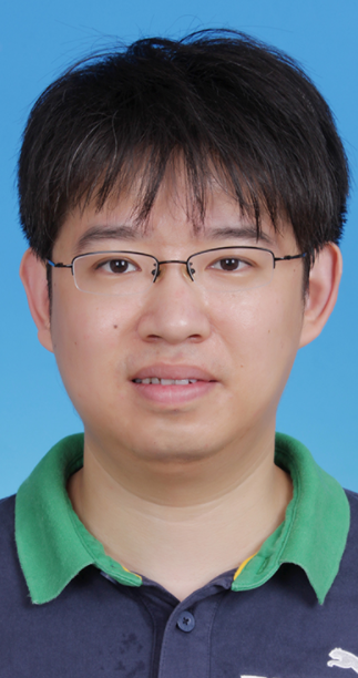 Ling Zhang (张翎)合作论文数School of Geography, Nanjing Normal University6
 Hui Lin (林珲)合作论文数School of Geography and Environment, Jiangxi Normal University6
 Sylvie Daniel合作论文数Universite Laval -- Quebec City6
 Jingya Yan (严静雅)合作论文数Cambridge Centre for Advanced Research and Education, University of Cambridge5
 Man Sing Wong (黄文聲)合作论文数Department of Land Surveying and Geo-Information,The Hong Kong Polytechnic University5
 Eric Saux合作论文数5E. Saux合作论文数4
 Rui Zhu合作论文数4
 Willian Ney Cassol合作论文数4
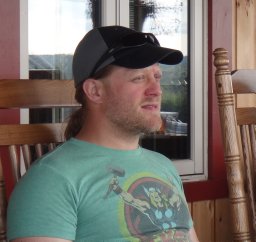 Sylvain Jutras合作论文数Centre Eau, Terre et Environnement, Institut National de la Recherche Scientifique4
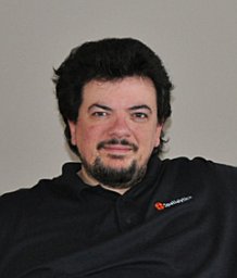 Thierry Badard合作论文数Centre for Research in Geomatics, Laval University3Bernard Moulin合作论文数Universite Laval, Departement Informatique3
 Francis Lessard合作论文数2Naïm Perreault合作论文数2
 Margarita Kokla合作论文数National Technical University of Athens2
 Mir Abolfazl Mostafavi合作论文数Département des Sciences Géomatiques, Faculté de Foresterie, de Géographie et de Géomatique, Université Laval2xunruo zhang合作论文数2Yi Long合作论文数1
 Antonio Ferraz合作论文数1Reza Mahmoudi Kouhi合作论文数1
 Olugbenga Timo Oladinrin合作论文数Dept Built Environm, Univ Wolverhampton1
 P. W. Chan合作论文数Hong Kong Observ, Kowloon, Hong Kong, Peoples R China1
 Christabel Man Fong Ho合作论文数Department of Building & Real Estate,The Hong Kong Polytechnic University1
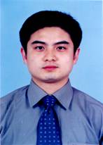 Yubin Yang (杨育彬)合作论文数Department of Computer Science and Technology, Nanjing University1
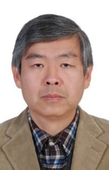 Ge Chen (陈戈)合作论文数Sanya Oceanographic Institution, Ocean University of China1
 Marc Daniel合作论文数1
 Christopher Pettit合作论文数City Futures Research Centre, University of New South Wales1Francois Anton合作论文数Department of Informatics and Mathematical Modeling;Technical University of Denmark1Julien Gaffuri合作论文数IGN COGIT Laboratory1
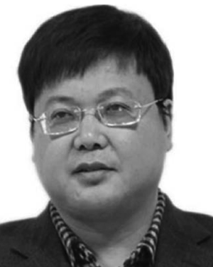 Chaoyang Fang合作论文数1Bernhard Jenny合作论文数Department of Human Centred Computing, Faculty of Information Technology, Monash University1
 Roy Kam合作论文数1Nathalie Debese合作论文数1
 Arzu Coltekin合作论文数Dept Geog, Univ Zurich1
 Umit Isikdag合作论文数Beykent University1
 Janet Nichol合作论文数School of the Environment and Life Sciences, University of Portsmouth1
 Pawel Boguslawski合作论文数Department of Computing and Mathematics Wales, University of Glamorgan1
 Patrick Lajeunesse合作论文数Centre d'études nordiques and Département de Géographie, Université Laval1




