Abstract Offshore fresh groundwater (OFG) is regarded as a significant, albeit typically non‐renewable, unconventional water resource stored within continental shelves. Many models of offshore freshwater emplacement use present‐day stratigraphy while applying Pleistocene sea‐level fluctuations. However, these static‐grid models do not account for sediment deposition or erosion, processes that could affect the volume and distribution of OFG. Here, we couple a sediment transport model (Sequence) with a variable‐density groundwater flow and solute transport model to reconstruct OFG sequestration over the last 500 kyr BP in response to late Pleistocene sea‐level changes. Our simulations incorporate the dynamic evolution of continental margin stratigraphy and associated hydrogeological processes. We examine six scenarios, including varying sea‐level fluctuations, deposition/erosion dynamics, subsidence rate, sediment flux, and offshore sediment diffusivity. Our findings demonstrate that overpressure generation due to relatively rapid sedimentation inhibits offshore freshwater emplacement. We also found that static‐grid models can significantly overestimate the volume of OFG. A second key observation is that the largest volumes of fresh groundwater are emplaced within the shallowest confined aquifer. Progressive burial of this unit by overlying confining units promotes salinization of the fresh groundwater through isolation from direct recharge and variable‐density flow effects. Our simulated OFG volumes range from 0.07 to 6.18 km3 per km length of coastline, consistent with field‐based estimates from continental shelf margins around the world. These findings showcase the importance of incorporating sediment dynamics into coastal hydrogeologic modeling to accurately predict the OFG distribution and support sustainable water management practices.
Lowering the barrier to scientific contribution requires more than adopting good software practices; it requires software structures and standards that make contribution and reuse safe, scoped, and sustainable. We describe how the Community Surface Dynamics Modeling System (CSDMS) addresses these challenges through two complementary efforts: the Landlab modeling framework and the Basic Model Interface (BMI).Landlab is a Python package designed as a platform for building Earth-surface process models. Over time, we discovered its architecture also promoted the user-turned-developer pathway, which has been critical to its success. While good software practices such as automated testing, continuous integration, documentation, and linting provide a foundation of reliability, Landlab’s component-based architecture has been central to enabling contribution. This design offers contributors clearly scoped and isolated entry points for adding new process models without needing to understand or modify the entire codebase. By enabling contributions from a growing set of domain experts and supporting them through shared maintenance infrastructure, this model expands the pool of invested contributors and reduces reliance on a small number of core developers, strengthening the prospects for long-term project sustainability.The Basic Model Interface (BMI) complements this approach by providing a lightweight, language-agnostic interface standard that defines how models expose their variables, parameters, and time-stepping controls to the outside world. By separating scientific algorithms from model orchestration, BMI enables models to be reused, coupled, and tested across different frameworks without requiring changes to their internal implementations. Ongoing, community-guided work toward BMI 3.0 aims to extend these capabilities by improving support for parallel execution, clearer state management, and optional interface extensions.Together, Landlab and BMI illustrate how framework design and community-driven standards can reduce technical debt and enable researchers to contribute reusable and interoperable software without requiring them to become full-time software engineers.
Earth's rivers, especially in mountainous settings, carry sediment with a wide variety of properties, among which are size and lithology. Despite their critical influence on bedrock incision, transport/deposition patterns, and topographic forms, sediment properties are often overlooked in landscape evolution models. Here we present a new set of Landlab components centered on the Enhanced Gravel Bedrock Eroder (EGBE), which simultaneously describes the evolution of a gravel-sized alluvium layer and the underlying bedrock in a network of rivers. The component implements numerical solutions to fluvial sediment transport, deposition, attrition, and bedrock incision, taking into account sediment load heterogeneity in size or toughness. Additionally, EGBE allows the user to select between two assumptions regarding channel geometry: a fixed-width model (in which channel width scales with water discharge) and a dynamic-width model (in which channel width adjusts such that the bed shear stress is slightly above the transport threshold for the median-size sediment grain). EGBE relies on other Landlab components that handle flow routing and mass exchange among different sediment classes, and it can be coupled with hillslope sediment transport components. These components are integrated in a code called EGBE-LEM.A set of 1D EGBE numerical experiments highlights the importance of sediment size for channel steepness. These experiments illustrate how an upstream source of coarse, resistant gravel leads to a steeper overall profile. Conversely, a downstream source steepens only the lower portion of the profile, leading to a break-in-slope that coincides with the lithologic transition. Several additional EGM-LEM experiments explored the impact of sediment toughness heterogeneity on landscape evolution. These demonstrate how upstream variations in toughness can influence the form and dynamics of channel networks downstream. For example, upstream variations in the toughness of source material can lead to asymmetric drainage divides and contrasts in the steepness index across adjacent drainage basins. In addition, we demonstrate how lithologic heterogeneity can influence river network concavity, planform geometry and steepness.EGBE improves on previous modeling efforts by explicitly representing sediment attrition and size-dependent transport of heterogeneous sediment load: a useful addition given that size and lithology are two of the most commonly used and accessible measures of river systems. In addition, the EGBE-LEM code provides an advanced integrated modeling platform for understanding mechanisms and dynamics across a range of river types and geological settings.
Geomorphologists have more data and computational resources available than ever before. Collaboration between researchers specializing in different modes of inquiry (e.g. numerical, experimental, and field-based) often accelerates impactful scientific insights, but tools to facilitate these collaborations are lacking. In this article, we present four challenges to collaboration in the geomorphology community, and provide a framework that addresses these challenges to enable research utilizing the full extent of data and computational resources available today. We report a component of this framework, a newly developed specification for a shareable data schema called sandsuet. The schema is designed to accommodate most kinds of rasterized geomorphology data, and makes it easy to package, publish, and share those data. Finally, we present possibilities for community development of resources to address other challenges to collaboration in geomorphology.
Flocculation dynamics of inorganic mineral grains are quantified for ten mid-to-high latitude, deep coastal basins along the Atlantic, Pacific and Southern Oceans. Suspended floc populations are imaged in situ, capturing an undisturbed water column. The basins receive and accumulate low carbon sediment via delivery of inorganic mineral flocs that carry a reactive organic carbon component during transport. Suspended particles are distributed among four particle reservoirs each characterized by a settling velocity (w) and floc size (D): 1) microflocs and constituent grains (D < 50 mu m, w < 4 m/day); 2) medium size flocs (D = 50 to 650 mu m, w = 4 to 32 m/day; 3) large flocs (D = 650-5000 mu m, w = 32 to 172 m/day); and 4) strings of flocs (5-100 mm in length, w = 200 to 400 m/day) sometimes forming "fabrics". Stratified currents control flocculation by providing the necessary conditions to support bio-mediated inorganic flocculation. A multi-layer classification scheme based on vertical trends in floc concentration and diameter is used to identify hotspots of flocculation growth and decay within a suite of particle layers: 1) surface layers, 2) flocculation fronts, 3) dilution layers, 4) steady-state layers, 5) deep basin waters, 6) bottom boundary layers, and 7) shelf nepheloid layers. Flocculation fronts form along oceanographic sill depths carrying shear turbulence, and similarly along brackish to seawater mixing depths. Once flocs enter deep basin waters, their properties change little during sedimentation. Transit time for flocs to reach a basin's seafloor ranged from 1 to 14 days for basin depths 73 to 873 m. Evidence suggests multiple aggregation processes (e.g. doubling, onion skin, chaos) can act simultaneously within basin waters. Insights from this study can inform environmental management, such as mitigating the effects of sedimentation from human activities and understanding the implications of climate change on fjord ecosystems.
Landlab is an open-source Python package that streamlines the creation, combination, and reuse of 2D numerical models and is a key element of the Community Surface Dynamics Modeling System (CSDMS) Workbench. The Landlab Toolkit provides building blocks for model development such as grid data structures, input/output functions, and a library of several dozen components that each model a separate physical process. Additionally, it provides a framework for assembling integrated models from component parts. We've found that Landlab significantly accelerates model development, encourages user-developers to adopt standard practices and contribute new components to the library. It serves as a platform that nurtures a community of model developers, assisting them in creating coupled models to investigate non-linear interactions between geologic processes. Using the Landlab toolkit, we developed a new model, Sequence, which is a modular 2D (i.e., profile) sequence stratigraphic model that incorporates key geophysical processes influencing accommodation space in both terrestrial and marine environments. These factors include tectonics and faulting, eustatic sea level changes, flexural isostatic compensation of sediment and water, sediment compaction, and hypopycnal sediment plumes. Each process is encapsulated as an individual, standalone Landlab component, providing flexibility in the construction of new models. Sequence serves not only as a distinct model, but also as a scaffold for the development of new models. Sequence simulates the evolution of stratigraphy on a continental margin over time scales ranging from thousands to millions of years. Sediment transport and deposition primarily occur during infrequent, high-energy events like storms and floods. For these extended time frames, Sequence employs a scale-integral approach. This method utilizes differential equations to summarize the cumulative effect of sediment transport and deposition across different depositional environments over longer periods (e.g., on the order of a hundred years). The model features a moving-boundary formulation to track shoreline changes and partitions the domain into distinct areas: coastal plain, continental shelf, and upper and lower slope/rise. Submarine sediment transport and deposition are modeled through nonlinear diffusion, with a diffusion coefficient that varies inversely with water depth. The model tracks evolving stratigraphic layers and sediment lithology that is a mixtuer of two grain sizes (sand and mud) each with separate transport functions.
Progress in better understanding and modeling Earth surface systems requires an ongoing integration of data and numerical models. Advances are currently hampered by technical barriers that inhibit finding, accessing, and executing modeling software with related datasets. We propose a design framework for Data Components, which are software packages that provide access to particular research datasets or types of data. Because they use a standard interface based on the Basic Model Interface (BMI), Data Components can function as plug-and-play components within modeling frameworks to facilitate seamless data–model integration. To illustrate the design and potential applications of Data Components and their advantages, we present several case studies in Earth surface processes analysis and modeling. The results demonstrate that the Data Component design provides a consistent and efficient way to access heterogeneous datasets from multiple sources and to seamlessly integrate them with various models. This design supports the creation of open data–model integration workflows that can be discovered, accessed, and reproduced through online data sharing platforms, which promotes data reuse and improves research transparency and reproducibility.
<p class="p1">Landlab is an open-source Python package designed to facilitate creating, combining, and reusing 2D numerical models. As a core component of the Community Surface Dynamics Modeling System (CSDMS) Workbench, Landlab can be used to build and couple models from a wide range of domains. We present how Landlab provides a platform that fosters a community of model developers and aids them in creating sustainable and FAIR (Findable, Accessible, Interoperable, Reusable) research software.</p> <p class="p1">Landlab&#8217;s core functionality can be split into two main categories: infrastructural tools and community-contributed components. Infrastructural tools address the common needs of building new models (e.g. a gridding engine, and numerical utilities for common tasks). Landlab&#8217;s library of community-contributed components consists of several dozen components that each model a separate physical process (e.g. routing of shallow water flow across a landscape, calculating groundwater flow, or biologic evolution over a landscape). As these user-contributed components are incorporated into Landlab, they are able to attach to the Landlab infrastructure so that they also become both findable and accessible (through, for example, standardized metadata and versioning) and are maintained by the core Landlab developers.</p> <p class="p1">One key aspect of Landlab&#8217;s design is its use of a standard programming interface for all components. This ensures that all Landlab components are interoperable with one another and with other software tools, allowing researchers to incorporate Landlab's components into their own workflows and analyses. By separating processes into individual components, they become reusable and allow researchers to combine components in new ways without having to write new components from scratch.</p> <p class="p1">Overall, Landlab's design and development practices support the principles of FAIR research software, promoting the ability for scientific research to be easily shared and built upon. This design also provides a platform onto which model developers are able to attach their model components and take advantage of Landlab&#8217;s development practices and infrastructure and ensure their components also follow FAIR principles.</p>
Projecting how arid and semi‐arid ecosystems respond to global change requires the integration of a wide array of analytical and numerical models to address different aspects of complex ecosystems. We used the Landlab earth surface modeling toolkit (Hobley et al., 2017, https://doi.org/10.5194/esurf-5-21-2017 ) to couple several ecohydrologic and vegetation dynamics processes to investigate the controls of exogenous drivers (climate, topography, fires, and grazing) and endogenous grass‐fire feedback mechanisms. Aspect‐controlled ecosystems and historical woody plant encroachment (WPE) narratives in central New Mexico, USA are used to construct simulations. Modeled ecosystem response to climatic wetness (i.e., higher precipitation, lower potential evapotranspiration) on topography follows the Boyko's “geo‐ecological law of distribution.” Shrubs occupy cooler pole‐facing slopes in the dry end of their ecoclimatic range (Mean Annual Precipitation, MAP ≤ 200 mm), and shift toward warmer equator‐facing slopes as regional moisture increases (MAP > 250 mm). Trees begin to occupy pole‐facing slopes when MAP > 200 mm, and gradually move to valleys. Pole‐facing slopes increase species diversity at the landscape scale by hosting relict populations during dry periods. WPE observed in the region since the middle 1800s is predicted as a three‐phase phenomenon. Phase II, rapid expansion, requires the removal of the positive grass‐fire feedback by livestock grazing or fire suppression. Regime shifts from grassland to shrubland are marked by critical thresholds that involve grass cover remaining below 40%, shrub cover increasing to 10%–20% range, and the grass connectivity, Cg, remaining below 0.15. A critical transition to shrubland is predicted when grazing pressure is not removed before shrub cover attains 60%.
<p>The Community Surface Dynamics Modeling System (CSDMS) is a US-based science facility that supports computational modeling of diverse Earth and planetary surface processes, ranging from natural hazards and contemporary environmental change to geologic applications. The facility promotes open, interoperable, and shared software. Here we review approaches and lessons learned in advancing FAIR principles for geoscience modeling. To promote sharing and accessibility, CSDMS maintains an online Model Repository that catalogs over 400 shared codes, ranging from individual subroutines to large and sophisticated integrated models. Thanks to semi-automated search tools, the Repository now includes ~20,000 references to literature describing these models and their applications, giving prospective model users efficient access to information about how various codes have been developed and used. To promote interoperability, CSDMS develops and promotes the Basic Model Interface (BMI): a lightweight, language-agnostic API standard that provides control, query, and data-modification functions. BMI has been adopted by a number of academic, government, and quasi-private institutions for coupled-modeling applications. BMI specifications are provided for common scientific languages, including as Python, C, C++, Fortran, and Java. One challenge lies in broader awareness and adoption; for example, self-taught code developers may be unaware of the concept of an API standard, or may not perceive value in designing around such a standard. One way to address this challenge is to provide open-source programming libraries. One such library that CSDMS curates is Landlab Toolkit: a Python package that includes building blocks for model development (such as grid data structures and I/O functions) while also providing a framework for assembling integrated models from component parts. We find that Landlab can greatly speed model development, while giving user-developers an incentive to follow common patters and contribute new components to the library. However, libraries by themselves do not solve the reproducibility challenge. Rather than reinventing the wheel, the CSDMS facility has approached reproducibility by partnering with the Whole Tale initiative, which provides tools and protocols to create reproducible archives of computational research. Finally, we have found that a central challenge to FAIR modeling lies in the level of community knowledge. FAIR is a two-way street that depends in part on the technical skills of the user. Are they fluent in a particular programming language? How familiar are they with the numerical methods used by a given model? How familiar are they with underlying scientific concepts and simplifying assumptions? Are they conversant with modern version control and collaborative-development technology and practices? Although scientists should not need to become software engineers, in our experience there is a basic level of knowledge that can substantially raise the quality and sustainability of research software. To address this, CSDMS offers training programs, self-paced learning materials, and online help resources for community members. The vision is to foster a thriving community of practice in computational geoscience research, equipped with ever-improving modeling tools written by and for the community as a whole.</p>
The babelizer is a Python utility that generates code to import libraries from other languages into Python.Target libraries must expose a Basic Model Interface (BMI) (Hutton et al., 2020;Peckham et al., 2013) and be written in C, C++, or Fortran, although the babelizer is extendable, so other languages can be added in the future.The babelizer provides a streamlined mechanism for bringing scientific models into a common language where they can communicate with one another as components of an integrated model.
Abstract. Hutton (2016) argued that computational hydrology can only be a proper science if the hydrological community makes sure that hydrological model studies are executed and presented in a reproducible manner. We replied that to achieve this, hydrologists shouldn't ‘re-invent the water wheel’ but rather use existing technology from other fields (such as containers and ESMValTool) and open interfaces (such as BMI) to do their computational science (Hut, 2017). With this paper and the associated release of the eWaterCycle platform and software package1 we are putting our money where our mouth is and provide the hydrological community with a ‘FAIR by design’ platform to do our science. eWaterCycle is a platform that separates the experiment done on the model from the model code. In eWaterCycle hydrological models are accessed through a common interface (BMI) in Python and run inside of software containers. In this way all models are accessed in a similar manner facilitating easy switching of models, model comparison and model coupling. Currently the following models are available through eWaterCycle: PCR-GLOBWB 2.0, wflow, Hype, LISFLOOD, TopoFlex HBV, MARRMoT and WALRUS. While these models are written in different programming languages they can all be run and interacted with from the Jupyter notebook environment within eWaterCycle. Furthermore, the pre-processing of input data for these models has been streamlined by making use of ESMValTool. Forcing for the models available in eWaterCycle from well known datasets such as ERA5 can be generated with a single line of code. To illustrate the type of research that eWaterCycle facilitates this manuscript includes five case studies: from a simple ‘Hello World’ where only a hydrograph is generated to a complex coupling of models in different languages. In this manuscript we stipulate the design choices made in building eWaterCycle and provide all the technical details to understand and work with the platform. For system administrators who want to install eWaterCycle on their infrastructure we offer a separate installation guide. For computational hydologist who want to work with eWaterCycle we also provide a video explaining the platform from a users point of view. With the eWaterCycle platform we are providing the hydrological community with a platform to conduct their research fully compatible with the principles of Open Science as well as FAIR science.1available on Zenodo: doi.org/10.5281/zenodo.5119389
Abstract. Computational modelling occupies a unique niche in Earth and environmental sciences. Models serve not just as scientific technology and infrastructure, but also as digital containers of the scientific community's understanding of the natural world. As this understanding improves, so too must the associated software. This dual nature–models as both infrastructure and hypotheses–means that modelling software must be designed to evolve continually as geoscientific knowledge itself evolves. Here we describe design principles, protocols, and tools developed by the Community Surface Dynamics Modeling System (CSDMS) to promote a flexible, interoperable, and ever-improving research software ecosystem. These include a community repository for model sharing and metadata, interface and ontology standards for model interoperability, language bridging tools, a modular programming library for model construction, modular software components for data access, and a Python-based execution and model-coupling framework. Methods of community support and engagement that help create a community-centered software ecosystem are also discussed.
On wave‐influenced river deltas, wave‐driven sediment redistribution affects river progradation, and therefore avulsions, while avulsions change where sediment is delivered to the coastline, affecting coastline shape. Coastline shape, in turn, affects sediment redistribution rates and patterns. Here we use a numerical model to investigate how the asymmetry of wave climates affects delta avulsion behaviors, which are coupled with delta shape evolution. Increasing wave‐climate asymmetry tends to reduce (increase) the curvature of updrift (downdrift) delta flanks, by increasing (decreasing) local shoreline diffusivity. In our model experiments, reduced shoreline curvature restricts the possible updrift post‐avulsion river mouth locations, while increased curvature expands the possible downdrift locations, favoring “downdrift avulsions.” However, under some wave climates, local diffusivity on the downdrift flank can become negative, leading to convexity and shoreline accretion, inhibiting downdrift avulsions. Increasing wave heights and decreasing superelevation threshold for avulsions both tend to reduce delta morphologic asymmetry, and therefore avulsion tendency.
The eWaterCycle platform (https://www.ewatercycle.org/) is a fully Open Source system designed explicitly to advance the state of Open and FAIR Hydrological modelling. While working with Hydrologists to create a fully Open and FAIR comparison study, we noticed that many ad-hoc tools and scripts are used to create input (forcing, parameters) for a hydrological model from the source datasets such as climate reanalysis and land-use data. To make this part of the modelling process better reproducible and more transparent we have created a common forcing input processing pipeline based on an existing climate model analysis tool: ESMValTool (https://www.esmvaltool.org/). Using ESMValTool, the eWaterCycle platform can perform commonly required preprocessing steps such as cropping, re-gridding, and variable derivation in a standardized manner. If needed, it also allows for custom steps for a hydrological model. Our pre-processing pipeline directly supports commonly used datasets such as ERA-5, ERA-Interim, and CMIP climate model data, and creates ready-to-run forcing data for a number of Hydrological models. Besides creating forcing data, the eWaterCycle platform allows scientists to run Hydrological models in a standardized way using Jupyter notebooks, wrapping the models inside a container environment, and interfacing to these using BMI, the Basic Model Interface (https://bmi.readthedocs.io/). The container environment (based on Docker) stores the entire software stack, including the operating system and libraries, in such a way that a model run can be reproduced using an identical software environment on any other computer. The reproducible processing of forcing and a reproducible software environment are important steps towards our goal of fully reproducible, Open, and FAIR Hydrological modelling. Ultimately, we hope to make it possible to fully reproduce a hydrological model experiment from data pre-processing to analysis, using only a few clicks.
The eWaterCycle platform(https://www.ewatercycle.org/) is a fully Open Source system designed explicitly to advance the state of Open and FAIR Hydrological modelling.Reproducibility is a key ingredient of FAIR, and one of the driving principles of eWaterCycle.While working with Hydrologists to create a fully Open and FAIR comparison study, we noticed that many ad-hoc tools and scripts are used to create input (forcing, parameters) for a hydrological model from the source datasets such as climate reanalysis and land-use data.To make this part of the modelling process better reproducible and more transparent we have created a common forcing input processing pipeline based on an existing climate model analysis tool: ESMValTool (https://www.esmvaltool.org/).Using ESMValTool the eWaterCycle platform can perform commonly required pre-processing steps such as cropping, re-gridding, and variable derivation in a standardized manner.If needed, it also allows for custom steps for a Hydrological model.Our pre-processing pipeline directly supports commonly used datasets such as ERA-5, ERA-Interim, and CMIP climate model data, and creates ready-to-run forcing data for a number of Hydrological models.Besides creating forcing data, the eWaterCycle platform allows scientists to run Hydrological models in a standardized way using Jupyter notebooks, wrapping the models inside a container environment, and interfacing to these using BMI, the Basic Model Interface (https://bmi.readthedocs.io/).The container environment (based on Docker) stores the entire software stack, including the operating system and libraries, in such a way that a model run can be reproduced using an identical software environment on any other computer.The reproducible processing of forcing and a reproducible software environment are important steps towards our goal of fully reproducible, Open, and FAIR Hydrological modelling.Ultimately, we hope to make it possible to fully reproduce a Hydrological model experiment from data pre-processing to analysis, using only a few clicks.
River deltas grow through repeated stacking of sedimentary lobes, the location and size of which are determined by channel avulsions (relatively sudden changes in river course). We use a model coupling fluvial and coastal processes to explore avulsion dynamics under a range of wave energies and sea-level-rise rates and find that the primary control on avulsion location and delta lobe size in our model is the critical superelevation ratio (SER), the amount of channel aggradation relative to the surrounding floodplain that is required to trigger an avulsion. The preferred avulsion location arises because of geometric constraints - a preferential avulsion node occurs at the break in floodplain slope that develops as the river progrades and/or sea level rises. This concavity develops in our model because the river profile aggrades and erodes via linear diffusion, whereas the diffusion of the floodplain topography is limited to episodic crevasse splays. These results are in contrast to recent modeling work, which was motivated by laboratory experiments and assumes a union between river channel and floodplain aggradation rates, and where avulsion nodes are driven by backwater hydrodynamics. The preferred avulsion length in our model scales well with laboratory, field, and model results without including hydrodynamic backwater effects. This work suggests an alternative mechanism to explain avulsion locations on deltas where floodplain topography aggrades and/or diffuses more slowly than the river channel profile, and it points to the need to elucidate river channel and floodplain connectivity over large space and time scales, and how the connectivity varies from one type of delta to another. Published by Elsevier B.V.
Computational modelling occupies a unique niche in Earth environmental sciences. Models serve not just as scientific technology and infrastructure, but also as digital containers of the scientific community's understanding of the natural world. As this understanding improves, so too must the associated software. This dual nature---models as both infrastructure and hypotheses---means that modelling software must be designed to evolve continually as geoscientific knowledge itself evolves. Here we describe design principles, protocols, and tools developed by the Community Surface Dynamics Modeling System (CSDMS) to promote a flexible, interoperable, and ever-improving research software ecosystem. These include a community repository for model sharing and metadata, interface and ontology standards for model interoperability, language bridging tools, a modular programming library for model construction, modular software components for data access, and a Python-based execution and model-coupling framework. Methods of community support and engagement that help create a community-centered software ecosystem are also discussed.
Earth and Space Science Open Archive PosterOpen AccessYou are viewing the latest version by default [v1]The CSDMS Model RepositoryAuthorsMarkPiperiDGregoryTuckeriDIrinaOvereemAlbertKettneriDEricHuttoniDLynnMcCreadySee all authors Mark PiperiDCorresponding Author• Submitting AuthorUniversity of Colorado at BoulderiDhttps://orcid.org/0000-0001-6418-277Xview email addressThe email was not providedcopy email addressGregory TuckeriDUniv ColoradoiDhttps://orcid.org/0000-0003-0364-5800view email addressThe email was not providedcopy email addressIrina OvereemUniversity of Coloradoview email addressThe email was not providedcopy email addressAlbert KettneriDUniversity of ColoradoiDhttps://orcid.org/0000-0002-7191-6521view email addressThe email was not providedcopy email addressEric HuttoniDCommunity Surface Dynamics Modeling SystemiDhttps://orcid.org/0000-0002-5864-6459view email addressThe email was not providedcopy email addressLynn McCreadyUniversity of Coloradoview email addressThe email was not providedcopy email address
Model comparisons are an important exercise to gain new hydrological insight from the diversity in our communities hydrological models. Current practice in model comparison studies is to have each model be run by the creator/representative of that model and combine the results of all these model runs in a single analysis. In this work we present the first major model comparison done within the eWaterCycle Open Hydrological Platform. eWaterCycle is a platform for doing hydrological experiments where hydrological models are accessed as objects from an (online) Jupyter notebook experiment environment. Through the use of GRPC4BMI and containers, (pre-existing and newly made) models in any programming language can be used, without diving into the code of those models. This makes eWaterCycle ideally suited to compare (and couple) models with widely different model setups: conceptual versus distributed for example. eWaterCycle is FAIR by design: any eWaterCycle experiment should be reproducible by anyone without the support of the original model developer. This will make it easier for hydrologists to work with each other's models and speed up the cycle of hydrological knowledge generation. In this comparison we’re looking at the impact of the new ERA5 dataset over the older ERA-Interim dataset as a forcing for hydrological models. A key component in making hydrological experiments reproducible and transparent in eWaterCycle is the use of EMSValTool as a pre-processor for hydrological experiments. Using EMSValTool’s recipes structure ensures that model specific input files based on ERA5 or ERA-Interim are all handled identically where possible and that model specific operations are clearly and transparently defined. We have run 7 models or model-suites (LISFlood, MARRMoT, WFLOW, HYPE, PCRGlobWB 2.0, SUMMA, HBV) for 6 basins forced with both ERA5 and ERA-Interim and compared model outputs against GRDC discharge observations. From this broad comparison we will conclude what the impact of ERA5 over ERA-Interim will be for hydrological modelling in the foreseeable future.
 Greg Tucker合作论文数Department of Geological Sciences, College of Arts and Sciences, University of Colorado Boulder52
 Erkan Istanbulluoglu合作论文数Department of Civil and Environmental Engineering, College of Engineering , University of Washington37
 Daniel Edward James Hobley合作论文数School of GeoSciences, University of Edinburgh35
 Nicole M Gasparini合作论文数Department of Earth and Environmental Sciences, Tulane University35
 James Syvitski合作论文数Department of Atmospheric and Oceanic Sciences, College of Arts and Sciences, University of Colorado Boulder;Department of Geological Sciences, College of Arts and Sciences, University of Colorado Boulder31
 Nudurupati Sai Siddhartha合作论文数26
 Albert J. Kettner合作论文数INSTAAR, University of Colorado-Boulder21
 Mark Daniel Piper合作论文数Inst Arctic & Alpine Res INSTAAR, Univ Colorado16
 Barnhart Katherine R合作论文数Dept Geol Sci, Univ Colorado15
 Irina Overeem合作论文数Community Surface Dynamics Modeling System (CSDMS),, University of Colorado15
 Jordan Marie Adams合作论文数Sci & Math Div, Delgado Community Coll14
 JM Adams合作论文数14
 Christina Bandaragoda合作论文数Department of Civil & Environmental Engineering, University of Washington12
 Scott David Peckham合作论文数University of Colorado8
 Katherine Ratliff合作论文数Center for Environmental Solutions and Emergency Response, U.S. Environmental Protection Agency7
 Lincoln Pratson合作论文数Earth & Ocean Sciences, Nicholas School of the Environment, Duke University7
 Margaux Mouchene合作论文数6
 Nathan J. Lyons合作论文数Dept Earth & Environm Sci, Tulane Univ6
 David Tarboton合作论文数Utah Water Research Laboratory, Utah State University;Department of Civil and Environmental Engineering, Utah State University6
 Chris Jenkins合作论文数5Lynn McCready合作论文数5
 Jerom Aerts合作论文数Fac Civil Engn & Geosci, Delft Univ Technol5
 Benjamin Campforts合作论文数5
 Niels Drost合作论文数Department of Computer Science, VU University5
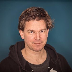 Rolf Hut合作论文数Department of Water Management, Faculty of Civil Engineering and Geosciences, Delft University of Technology5
 Courtney K. Harris合作论文数School of Marine Science, Virginia Institute of Marine Sciences5
 Sai Nudurupati合作论文数4Jimmy Phuong合作论文数Univ Washington, Dept Biomed & Hlth Informat, Seattle, WA 98195 USA4Ronda Strauch合作论文数4
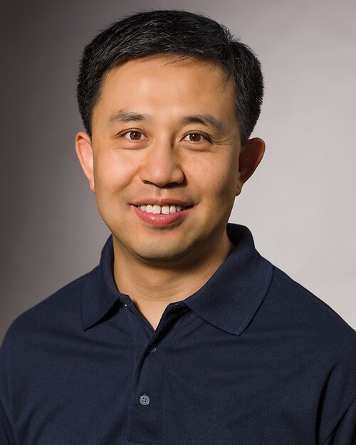 Shaowen Wang合作论文数Department of Geography & Geographic Information Science, School of Earth, Society & Environment, College of Liberal Arts & Sciences, University of Illinois Urbana-Champaign;Siebel School of Computing and Data Science, The Grainger College of Engineering, University of Illinois Urbana-Champaign;Institute for Geospatial Understanding through an Integrative Discovery Environment4
 Nick Van De Giesen合作论文数Faculty of Civil Engineering and Geosciences, Delft University of Technology4Guillermo Auad合作论文数4
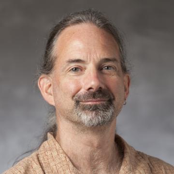 A. Brad Murray合作论文数Division of Earth and Ocean Science, Nicholas School of the Environment and Earth Sciences, Duke University4Berend Weel合作论文数3gan tian合作论文数3Jaro Camphuijsen合作论文数3Gijs van den Oord合作论文数Royal Netherlands Meteorol Inst KNMI3
 Yifat Dzigan合作论文数3Bouwe Andela合作论文数3
 Peter Kalverla合作论文数Netherlands eSci Ctr, Amsterdam, Netherlands3Fakhereh Alidoost合作论文数3Pelupessy Inti合作论文数Leiden Observatory, Leiden University3
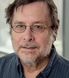 Gary Parker合作论文数Department of Civil and Environmental Engineering, The Grainger College of Engineering, University of Illinois Urbana-Champaign;Department of Geology, University of Illinois Urbana-Champaign3Brian M. Hynek合作论文数University of Colorado at Boulder, University of Colorado at Boulder3
 Liviu Giosan合作论文数Department of Geology & Geophysics, Woods Hole Oceanographic Institution3
 Eckart Meiburg合作论文数Department of Mechanical Engineering, College of Engineering, University of California, Santa Barbara3
 Basil Gomez合作论文数Department of Geography and Environment, College of Social Sciences, University of Hawaiʻi3
 Jasim Imran合作论文数Department of Civil and Environmental Engineering, University of South Carolina3




