Lagrangian coherent eddies efficiently transport water properties, such as heat and salt, as well as tracers, including oil, larvae, and Sargassum, throughout the ocean. For instance, during the 2010 Deepwater Horizon oil spill, part of the oil was captured within a Loop Current Frontal Eddy (LCFE), preventing it from reaching the Florida Keys. Similarly, Loop Current Eddies (LCEs) carry warmer, saltier waters typical of the Caribbean Sea to the western Gulf of Mexico (GoM). In this study, we employ machine learning alongside various satellite observations—absolute dynamic topography (ADT), sea surface temperature (SST), and chlorophyll‐a (Chl‐a)—to identify Lagrangian coherent eddies in the GoM and predict their lifetime. Three durations of Lagrangian coherence are investigated: 5, 10, and 20 days. This study also investigates the contributions of Chl‐a to identifying and forecasting LCEs' and LCFEs' Lagrangian coherence, aiming to assess the advantages of integrating this data set into data‐assimilative Gulf ocean models, in addition to ADT and SST. The machine learning model trained with ADT successfully identifies and predicts the lifetimes of eddies, achieving accuracy rates of 90% for LCE identification and 93% for lifetime prediction, along with 71% and 61% for LCFEs, respectively. Incorporating SST and Chl‐a enhanced eddy predictions over ADT‐only or ADT and SST combined, in particular LCEs and LCFEs, highlighting the benefits of assimilating Chl‐a into ocean models to improve the representation and the forecast of these eddies. This machine learning framework has the potential to advance predictions of eddy lifetimes and the advection of various tracers.
Internal tide generation and breaking play a primary role in the vertical transport and mixing of heat and other properties in the ocean interior, thereby influencing climate regulation. Additionally, internal tides increase sound speed variability in the ocean, consequently impacting underwater acoustic propagation. With advancements in large-scale ocean modeling capabilities, it is essential to assess the impact of higher model resolutions (horizontal and vertical) in representing internal tides. This study investigates the influence of vertical resolution on internal tide energetics and its subsequent effects on underwater acoustic propagation in the HYbrid Coordinate Ocean Model (HYCOM). An idealized configuration with a ridge, forced only by semidiurnal tides and having 1-km horizontal grid-spacing, is used to test two different vertical-grid discretizations, defined based on the zero-crossings of horizontal velocity eigenfunctions and the merging of consecutive layers, with seven distinct numbers of isopycnal layers, ranging from 8 to 128. Analyses reveal that increasing the number of layers up to 48 increases barotropic-to-baroclinic tidal conversion, available potential energy, and vertical kinetic energy, converging with higher layer counts. Vertical shear exhibits a similar pattern but converges at 96 layers. Increasing the number of isopycnal layers, up to 48, increases the available potential energy contained in high (third-to-eighth) tidal baroclinic modes. Finally, sound speed variability and acoustic parameters differ for simulations with less than 48 layers. Therefore, the study concludes that a minimum vertical resolution (48 layers in this case) is required in isopycnal models to accurately represent internal tide properties and associated underwater acoustic propagation.
Abstract. The capacity in monitoring and forecasting the global ocean is increased nowadays, thanks to the advancements in observing and in modelling the main physical ocean processes and dynamics. This has led to the growth of core services, devoted to providing free and open data, science-driven, and based on users' needs. Here we illustrate the fundamental steps that have been developed, over the last decades, for improving the ocean value chain – from access to upstream data like observations to the delivery of products to users for downstream services and applications, with description of worldwide state-of-the-art operational ocean forecasting systems at a global scale. We also provide some examples on core service organisation, like the Copernicus Marine Service and many others, which are available today and operating for the provision of near-real-time predictions.
Accurate prediction of underwater sound speed and acoustic propagation is dependent on realistic representation of the ocean state and its underlying dynamics within ocean models. Stratified, high-resolution global ocean models that include tidal forcing better capture the ocean state by introducing internal tides that generate higher frequency (supertidal) internal waves. Through the disciplines of internal wave modeling, acoustics, and machine learning, we examined how internal wave energy moves through numerical simulations, how this energy alters the ocean state and sound speed, and how machine learning could aid the modeling of these impacts. The project used global, basin-scale, and idealized HYbrid Coordinate Ocean Model (HYCOM) simulations as well as regional Massachusetts Institute of Technology general circulation model (MITgcm) simulations to examine how tidal inclusion affects sea surface height variability, the propagation and dissipation of internal wave energy, and the sensitivity of internal wave modeling to vertical and horizontal grid spacing. Sound speed, acoustic parameters, and modeled acoustic propagation were compared between simulations with and without tidal forcing, and deep learning algorithms were used to examine how a tidally forced ocean state could be generated while reducing computational costs.
In this study, we diagnose the spatial variability in the energetics of tidally generated diurnal, semidiurnal, and supertidal ( cycles per day) internal wave vertical modes (up to mode 6) in a 30‐day forward global ocean model simulation with a 4‐km grid spacing and 41 layers. The simulation is forced with realistic tides and atmospheric fields. Diurnal modes are resolved beyond mode 6, semidiurnal modes are resolved up to mode 4, and supertidal modes are resolved up to mode 2, in agreement with a canonical horizontal resolution criterion. The meridional trends in the kinetic to available potential energy ratios of these resolved modes agree with an internal wave consistency relation. The supertidal band is dominated by the higher harmonics of the diurnal and semidiurnal tides. Its higher harmonic energy projects on the internal wave dispersion curves in frequency‐wavenumber spectra and is captured mostly by the terdiurnal and quarterdiurnal mode‐1 waves. Terdiurnal modes are mostly generated in the west Pacific, where diurnal internal tides are strong. In contrast, quarterdiurnal modes occur at all longitudes near strong semidiurnal generation sites. The globally integrated energy in the supertidal band is about one order of magnitude smaller than the energy in the tidal band. The supertidal energy as a fraction of the tidal energy is elevated along semidiurnal internal wave beams in the tropics. We attribute this to near‐resonant interactions between tidal modes of the same mode number.
The surface mixed layer of the ocean plays a key role in ocean‐atmosphere interactions. Despite the ocean surface warming in the past four decades, which increased the stratification, the mixed layer depth (MLD) has been found to increase, most notably in the Southern Ocean in summer. We use 12 models from the Ocean Model Intercomparison Project (OMIP) at different resolutions, forced by the atmospheric reanalysis JRA55‐do, to assess their capability to represent the MLD trends over the period 1970–2018 and to investigate their origin. The MLD evolution in the OMIP models is extremely well correlated across models at interannual time scales, especially in summer. Correlations are lower in high resolution models because of the chaotic nature of the mesoscale variability. OMIP models reproduce consistently the deepening trend of the mixed layer in summer in the Southern Ocean and confirm its relation to the wind speed. The MLD deepening is weaker in the models than in observations, probably due to the fact that the wind speed trend is underestimated in the atmospheric reanalysis. We find however that the MLD deepening is not a simple one‐dimensional response to the increase of the wind speed at a given location, but that the three‐dimensional processes that control the stratification also play a part. This study gives confidence in the capacity of ocean models to project the response of the mixed layer to future changes in wind speed.
Deep learning models have demonstrated remarkable success in fields such as language processing and computer vision, routinely employed for tasks like language translation, image classification, and anomaly detection. Recent advancements in ocean sciences, particularly in data assimilation (DA), suggest that machine learning can emulate dynamical models, replace traditional DA steps to expedite processes, or serve as hybrid surrogate models to enhance forecasts. However, these studies often rely on ocean models of intermediate complexity, which involve significant simplifications that present challenges when transitioning to full-scale operational ocean models. This work explores the application of convolutional neural networks (CNNs) in data assimilation within the context of the HYbrid Coordinate Ocean Model (HYCOM) in the Gulf of Mexico. The CNNs are trained to correct model errors from a 2-year, high-resolution (1/25°) HYCOM dataset, assimilated using the Tendral Statistical Interpolation System (T-SIS). The CNNs are trained to replicate the increments generated by the T-SIS data assimilation package, aiming to correct model forecasts of sea surface temperature (SST) and sea surface height (SSH). The inputs to the CNNs include real satellite observations of SST from the Group for High Resolution Sea Surface Temperature (GHRSST), along-track altimeter SSH observations (ADT), the model background state (previous forecast), and the innovations (differences between observations and background). We assess the performance of the CNNs across five controlled experiments, designed to provide insights into their application in environments governed by full primitive equations, real observations, and complex topographies. The experiments focus on evaluating (1) the architecture and complexity of the CNNs, (2) the type and quantity of observations, (3) the type and number of assimilated fields, (4) the impact of training window size, and (5) the influence of coastal boundaries. Our findings reveal significant correlations between the chosen training window size – a factor not commonly examined – and the CNNs' ability to assimilate observations effectively. We also establish a clear link between the CNNs' architecture and complexity and their overall performance. This research uses artificial intelligence to enhance ocean forecasting in the Gulf of Mexico. By using convolutional neural networks, the study improves predictions of sea temperatures and heights by integrating real satellite data with existing models. Through five comprehensive experiments, the team found that the amount of training data and the design of the neural networks significantly affect accuracy. These insights pave the way for faster, more reliable ocean models, benefiting environmental monitoring and maritime operations.
Accurate circulation modeling in the Gulf of Mexico (GoM) is hampered by the limited availability of in-situ subsurface data, leading to inaccuracies in subsurface representations. These inaccuracies diminish the reliability of ocean models and constrain the duration of dependable forecasts. This study introduces NeSPReSO (Neural Synthetic Profiles from Remote Sensing and Observations), a data-driven method to efficiently and accurately estimate subsurface temperature and salinity profiles using satellite-derived surface data. This provides an alternative to conventional synthetic data generation techniques.Principal Component Analysis (PCA) is applied to extract the main features of temperature and salinity profiles of an Argo dataset. Then, a neural network is trained to predict these principal features using inputs such as time, location, and satellite-derived absolute dynamic topography alongside sea surface temperature and salinity. The model, evaluated using additional Argo profiles and glider data collected in the Gulf of Mexico, over-performs other traditional synthetic data generation methods, such as the Gravest Empirical Modes (GEM), Multiple Linear Regression (MLR) and Improved Synthetic Ocean Profile (ISOP), in terms of root mean square error and bias. Our findings indicate that our method effectively captures the main variations of subsurface fields, and that synthetic profiles generated by the model align well with actual observations, accurately capturing key features such as thermoclines, haloclines, and temperature-salinity structure of the region. This new method will be implemented in GoM data assimilative models and is expected to improve the accuracy of modeled subsurface currents.
Abstract In recent years, efforts have been made to include tides in both operational ocean models as well as climate and earth system models. The accuracy of the barotropic tides is often limited by the model topography, which is in turn limited by model horizontal resolution. In this work, we explore the reduction of barotropic tidal errors in an ocean general circulation model (Modular Ocean Model version 6; MOM6) using sub‐grid scale topography representation. We follow the methodology from Adcroft (2013, https://doi.org/10.1016/j.ocemod.2013.03.002), which utilizes statistics from finer resolution topographic data sets to represent sub‐grid scale features with a light computational cost in a structured finite volume formulation. The geometric effect from sub‐grid scale topography can be introduced to the model with only a few parameters at each grid cell. The porous barriers, which are implemented at the walls of the grid cells, are used to modify transport between grid cells. Our results show that the globally averaged tidal error in lower‐resolution simulations is significantly reduced with the use of porous barriers. We argue this method is a potentially useful tool to improve simulations of tides (and other flows) in low‐resolution simulations.
Abstract This study utilizes Deep Neural Networks (DNN) to improve the K‐Profile Parameterization (KPP) for the vertical mixing effects in the ocean's surface boundary layer turbulence. The deep neural networks were trained using 11‐year turbulence‐resolving solutions, obtained by running a large eddy simulation model for Ocean Station Papa, to predict the turbulence velocity scale coefficient and unresolved shear coefficient in the KPP. The DNN‐augmented KPP schemes (KPP_DNN) have been implemented in the General Ocean Turbulence Model (GOTM). The KPP_DNN is stable for long‐term integration and more efficient than existing variants of KPP schemes with wave effects. Three different KPP_DNN schemes, each differing in their input and output variables, have been developed and trained. The performance of models utilizing the KPP_DNN schemes is compared to those employing traditional deterministic first‐order and second‐moment closure turbulent mixing parameterizations. Solution comparisons indicate that the simulated mixed layer becomes cooler and deeper when wave effects are included in parameterizations, aligning closer with observations. In the KPP framework, the velocity scale of unresolved shear, which is used to calculate ocean surface boundary layer depth, has a greater impact on the simulated mixed layer than the magnitude of diffusivity does. In the KPP_DNN, unresolved shear depends not only on wave forcing, but also on the mixed layer depth and buoyancy forcing.
The roles of the Loop Current (LC) and associated eddies in driving the circulation of the Gulf of Mexico (GoM) have been investigated for several decades from different perspectives. Nevertheless, a clear understanding of the relative contributions of the wind forcing and the Loop Current eddies (LCEs) to the GoM circulation and variability remain lacking. In this study, the roles of these two factors in sustaining the less well-known western GoM upper-layer (~1000 m) circulation are investigated with two numerical experiments using the HYbrid Coordinate Ocean Model (HYCOM). First, we examine the relative contributions of the wind and LCEs in setting the mean circulation in the western GOM. We then perform a vorticity balance to analyze the relative importance of the physical processes, including the wind stress, involved in sustaining the western GoM circulation. The results show that the wind stress contributes to a mean anticyclonic circulation in the central and northwestern Gulf, while in the southwestern subregion both wind and LCEs combine to induce a cyclonic circulation, highlighting the role of wind stress curl and topographic confinement. The vorticity balance analysis conducted in the upper layer of the western basin shows that planetary vorticity and stretching are primarily responsible for the balance in time scales longer than weeks, and their co-variability are good indicators of LCEs entering the central and northwestern subregions. However, the southwestern subregion is primarily driven by vortex stretching. Mean advection of vorticity and planetary vorticity are also contributors to the time-averaged vorticity field. Since the wind stress is distributed over the upper layer of the GoM, direct input of vorticity in the regional vorticity balance is negligible, but it does play a role through the vortex stretching term. The results also suggest that wind forcing acts to produce larger, faster moving, and longer-lived anticyclonic eddies that impact the western Gulf and modulate the circulation over monthly timescales.
The formation of cold, dense waters south of the Antarctic Circumpolar Current (ACC) is one of the main drivers of the global overturning circulation, with major effects on the earth’s climate. A key region where dense waters are formed is the Ross Sea, which is separated from the ACC by the Ross Gyre. The strength and variability of the Ross Gyre circulation impacts the formation and export of dense water, but observations of the Ross Gyre circulation are limited because of its remote location, severe weather conditions, and ice cover that has limited the application of remote sensing techniques. Quantitative estimates of the gyre’s total strength are difficult to obtain from hydrographic observations alone due to the limited sampling and the relatively weak stratification. In this paper, we use a combination of observations and modeling studies to estimate the strength and variability of the Ross Gyre transport and investigate the relative contributions of the wind, buoyancy forcing, eddy fluxes, and the influence of ACC to the Ross Gyre circulation. We find that the mean transport of the Ross Gyre can be as high as about 45 Sv, more than twice the typical estimate of about 20 Sv. Sensitivity experiments to wind and buoyancy forcing, nonlinear terms, and the ACC were performed with a regional configuration of the Hybrid Coordinate Ocean Model (HYCOM). The numerical experiments show that the total Ross Gyre circulation, and its variability, are primarily wind-driven. The ACC is responsible for a small recirculation. Buoyancy and nonlinearity or eddy fluxes play a smaller role in the gyre dynamics, though they are regionally important.
Predicting the ocean state in a reliable and interoperable way, while ensuring high-quality products, requires forecasting systems that synergistically combine science-based methodologies with advanced technologies for timely, user-oriented solutions. Achieving this objective necessitates the adoption of best practices when implementing ocean forecasting services, resulting in the proper design of system components and the capacity to evolve through different levels of complexity. The vision of OceanPrediction Decade Collaborative Center, endorsed by the UN Decade of Ocean Science for Sustainable Development 2021-2030, is to support this challenge by developing a “predicted ocean based on a shared and coordinated global effort” and by working within a collaborative framework that encompasses worldwide expertise in ocean science and technology. To measure the capacity of ocean forecasting systems, the OceanPrediction Decade Collaborative Center proposes a novel approach based on the definition of an Operational Readiness Level (ORL). This approach is designed to guide and promote the adoption of best practices by qualifying and quantifying the overall operational status. Considering three identified operational categories - production, validation, and data dissemination - the proposed ORL is computed through a cumulative scoring system. This method is determined by fulfilling specific criteria, starting from a given base level and progressively advancing to higher levels. The goal of ORL and the computed scores per operational category is to support ocean forecasters in using and producing ocean data, information, and knowledge. This is achieved through systems that attain progressively higher levels of readiness, accessibility, and interoperability by adopting best practices that will be linked to the future design of standards and tools. This paper discusses examples of the application of this methodology, concluding on the advantages of its adoption as a reference tool to encourage and endorse services in joining common frameworks.
The decomposition of oceanic flow into its balanced and unbalanced motions carries theoretical and practical significance for the oceanographic community. These two motions have distinct dynamical characteristics and affect the transport of tracers differently from one another. The launch of Surface Water and Ocean Topography (SWOT) satellite provides a prime opportunity to diagnose the surface balanced and unbalanced motions on a global scale at an unprecedented spatial resolution. Here, we apply dynamic-mode decomposition (DMD), a linear-algebraic data-driven method, to a tidally-forced numerical simulation and one-day-repeat SWOT observations of sea-surface height (SSH) in the Gulf Stream extension. DMD is able to separate out the spatial modes associated with sub-inertial periods from super-inertial periods. The sub-inertial modes of DMD can be used to extract geostrophically balanced motions from SSH fields, which have an imprint of internal tides and gravity waves. We utilize the statistical relation between relative vorticity and strain rate as the metric to gauge the extraction of geostrophy.
This study evaluates the impact of increasing resolution on Arctic Ocean simulations using five pairs of matched low- and high-resolution models within the OMIP-2 (Ocean Model Intercomparison Project phase 2) framework. The primary objective is to assess whether a higher resolution can mitigate typical biases in low-resolution models and improve the representation of key climate-relevant variables. We reveal that increasing the horizontal resolution contributes to a reduction in biases in mean temperature and salinity and improves the simulation of the Atlantic water layer and its decadal warming events. A higher resolution also leads to better agreement with observed surface mixed-layer depth, cold halocline base depth and Arctic gateway transports in the Fram and Davis straits. However, the simulation of the mean state and temporal changes in Arctic freshwater content does not show improvement with increased resolution. Not all models achieve improvements for all analyzed ocean variables when spatial resolution is increased so it is crucial to recognize that model numerics and parameterizations also play an important role in faithful simulations. Overall, a higher resolution shows promise in improving the simulation of key Arctic Ocean features and processes, but efforts in model development are required to achieve more accurate representations across all climate-relevant variables.
This study assesses the capability of a coarse-resolution ocean model to replicate the response of the Southern Ocean Meridional Overturning Circulation(MOC) to intensified westerlies,focusing on the role of the eddy transfer coefficient(κ).κ is a parameter commonly used to represent the velocities induced by unresolved eddies.Our findings reveal that a stratification-dependent κ,incorporating spatiotemporal variability,leads to the most robust eddy-induced MOC response,capturing 82% of the reference eddy-resolving simulation.Decomposing the eddy-induced velocity into its vertical variation(VV) and spatial structure(SS) components unveils that the enhanced eddy compensation response primarily stems from an augmented SS term,while the introduced VV term weakens the response.Furthermore,the temporal variability of the stratification-dependent κ emerges as a key factor in enhancing the eddy compensation response to intensified westerlies.The experiment with stratification-dependent κ exhibits a more potent eddy compensation response compared to the constant κ,attributed to the structure of κ and the vertical variation of the density slope.These results underscore the critical role of accurately representing κ in capturing the response of the Southern Ocean MOC and emphasize the significance of the isopycnal slope in modulating the eddy compensation mechanism.
Abstract The Tendral Statistical Interpolation (T-SIS) package is used with HYCOM to produce the reanalysis hindcast. To assess 1/25° and 1/100° resolution model hindcasts’ performance, model results were compared to independent ADCP current measurements from several sites in the Northern GOM impacted by passing Loop Current Eddies, Deep Cyclonic Eddies (without a clear surface expression) and Tropical Storms. The comparative analysis of HYCOM-TSIS reanalysis data and ADCP measurements showed a good qualitative and satisfactory quantitative agreement between model and observations. Of most importance, the model with the T-SIS package resolves the general kinematic structure of subsurface flows associated with the Deep Cyclonic Eddies, reflecting a substantial improvement of the model skill compared to the previous version of the hindcast.
Abstract. Operational ocean forecasting systems provide important information on physical and biogeochemical variables across global, regional, and coastal scales. Regional systems, with higher resolution than global models, capture small-scale processes like eddies and tides, but lack detailed land-sea interactions essential for coastal areas. These models, often nested within global systems, vary in spatial resolution (1–20 km) and may include biogeochemical components. While regional systems focus on physical parameters such as sea surface height, temperature, and currents, only a few incorporate biogeochemical processes. The growing demand for biogeochemical data has prompted advancements and more systems will include this component in the coming years. This paper provides an overview on status of regional forecasting systems at today, discussing examples as the Copernicus Marine Service from the OceanPredict, analysing the offer in terms of covered regions, resolution and ocean variables product catalogue.
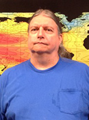 Alan Wallcraft合作论文数Center for Ocean-Atmospheric Prediction Studies, Florida State University43
 Xiaobiao Xu合作论文数43
 Alexandra Bozec合作论文数LOCEAN / IPSL32Harley Hurlburt合作论文数The University of Southern Mississippi;Florida State University;United States Naval Research Laboratory28
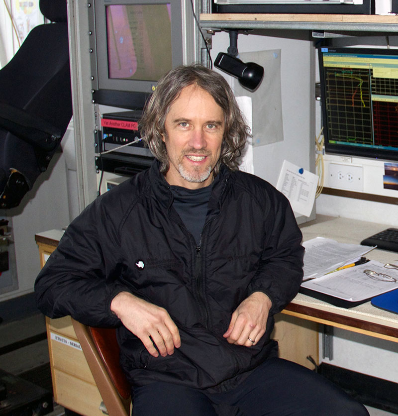 Stephen Matthew Griffies (Stephen M. Griffies)合作论文数Princeton University;Geophysical Fluid Dynamics Laboratory, National Oceanic and Atmospheric Administration25
 Robert Hallberg合作论文数Geophysical Fluid Dynamics Laboratory, National Oceanic and Atmospheric Administration;Princeton University24Steven L. Morey合作论文数Center for Ocean-Atmospheric Prediction Studies, Florida State University22
 Gokhan Danabasoglu合作论文数Oceanography Section, Climate and Global Dynamics Laboratory, National Science Foundation National Center for Atmospheric Research21
 Brian Arbic合作论文数Department of Climate and Space Sciences and Engineering, College of Engineering, University of Michigan-Ann Arbor19Jay F. Shriver合作论文数19
 Anne-Marie Treguier合作论文数Laboratoire de physique19E. Joseph Metzger合作论文数Naval Research Laboratory;Stennis Space Center;Naval Research Laboratory, Stennis Space Center18
 Dmitry S Dukhovskoy合作论文数Center for Ocean Atmospheric Prediction Studies, Florida State University18
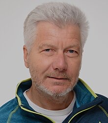 Claus Böning合作论文数Division of Ocean Circulation and Climate Dynamics, GEOMAR Helmholtz Centre for Ocean Research Kiel;Christian-Albrechts-Universität zu Kiel17
 Stephen Gerald Yeager合作论文数Climate and Global Dynamics Laboratory, National Center for Atmospheric Research17
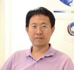 Qiang Wang合作论文数Alfred Wegener Institute for Polar and Marine Research15
 William G. Large合作论文数Climate and Global Dynamics Division, National Center for Atmospheric Research15
 Julien Le Sommer合作论文数CNRS, UJF15James Cummings合作论文数15
 Patrick Heimbach合作论文数Department of Geological Sciences, Jackson School of Geosciences, University of Texas at Austin14Hiroyuki Tsujino (辻野博之)合作论文数First Laboratory, Department of Atmosphere, Ocean, and Earth System Modeling Research, Meteorological Research Institute, Japan Meteorological Agency14
 Tamay M. Özgökmen合作论文数Ocean Sciences Department, Rosenstiel School of Marine and Atmospheric Science, University of Miami14
 Rainer Bleck合作论文数Cooperative Institute for Research in Environmental Sciences, University of Colorado Boulder14O. M. Smedstad合作论文数13
 Dmitry Sidorenko合作论文数Alfred Wegener Institute for Polar and Marine Research13
 Simon J. Marsland合作论文数Ctr Australian Weather & Climate Res13
 Simona Masina合作论文数Institute for Earth System Predictions, Centro Euro-Mediterraneo sui Cambiamenti Climatici12
 Sergey Danilov合作论文数Klimadynamik, Alfred-Wegener-Institut Helmholtz-Zentrum für Polar- und Meeresforschung12
 Mehmet Ilicak合作论文数Eurasia Inst Earth Sci, Istanbul Tech Univ11
 Steve Murawski合作论文数Department of Biological Oceanography, College of Marine Science, University of South Florida11
 George R. Halliwell合作论文数11
 Maarten C. Buijsman合作论文数University of California Los Angeles11Ashwanth Srinivasan合作论文数Rosenstiel School for Marine and Atmospheric Science, University of Miami11
 Fox-Kemper合作论文数Department of Earth, Environmental, and Planetary Sciences, Brown University;Brown Theoretical Physics Center, Brown University11
 Mats Bentsen合作论文数Nansen Environmental and Remote Sensing Center11Arne Biastoch合作论文数11Patrick J. Hogan合作论文数Open Ocean Processes and Prediction Systems Section, Naval Research Laboratory, Stennis Space Center11
 Pierre Lermusiaux合作论文数Department of Mechanical Engineering, Massachusetts Institute of Technology11
 Shuyi S. Chen合作论文数Department of Atmospheric Sciences, College of the Environment, University of Washington11
 Helge Drange合作论文数Geophysical Institute, University of Bergen;Bjerknes Centre for Climate Research, University of Bergen;Department of Geophysics, University of Bergen10Daryl T. Kleist合作论文数Science Applications International Corporation, National Centers for Environmental Prediction10
 Z. Garraffo合作论文数10
 George Nurser合作论文数National Oceanography Centre10Bonita L. Samuels合作论文数10
 Cecilia Bitz合作论文数Department of Atmospheric Sciences, University of Washington10
 Edward Dunlea合作论文数Department of Earth;Atmospheric and Planetary Sciences;Massachusetts Institute of Technology;Department of Earth|Atmospheric and Planetary Sciences, Massachusetts Institute of Technology10St Rao合作论文数9Anke Kamrath合作论文数9Amanda Purcell合作论文数9




