The demand for hydrocarbons and other mineral resources worldwide is increasingly met by tapping the vast seabed resources in ever more difficult and risky environments, like the abyssal oceanic depths or the arctic regions. The development of suitable means for safe underwater operations is a fundamental requisite for their sustainable exploitation, in particular on the delicate polar environments or the environmentally and socially stressed east Mediterranean region.
Recent structural collapses were studied in order to identify gaps in technology and to propose priorities in enhancing urban search and rescue (USAR) tools. The time-lines of the events were examined with the scope of extracting critical factors that affect rescue time and can be used to define priorities in tools and technologies development, so that efficient and fast location, recovery and treatment of victims can be achieved. In this context, seven factors were identified: (1) best practices and lessons learned, (2) rescue technology, (3) community involvement, (4) information systems, (5) technology integration, (6) crisis management and (7) available budget. Each of these factors is reviewed, analyzed and discussed with the scope of providing future developments in tools and technology for USAR operations.
Ports constitute crucial intermodal nodes in the freight and passenger transport network as well as important border control points. Their security is therefore of paramount importance not only because of their critical transport functions but also because of their specific role, as control points, in the regional, national and European security. Port security is a cornerstone for the implementation of the new international maritime transport security regime. The aim of the present paper is to analyse the problem, highlight the issues faced in a systematic way towards a better port security without penalising excessively the trade or the port related activities, with a particular emphasis on access control and identity management. Finally, two practical measures for increasing the EU port security are highlighted.
The DIFIS project has proposed a new solution for the immediate intervention directly on tanker wrecks so as to contain any leakages and prevent eventual pollution. The method could be extended also to oil well-blow-out cases such as the recent accident in the Gulf of Mexico. The DIFIS deployment typically requires the use of ROVs and dedicated dynamic-positioning ships that increase the cost significantly and make the operations weather-dependent. Eventual AUV use would result in much more efficient and flexible deployment procedures. The scenario studied here consists of a hook-grasping task that is part of the DIFIS mooring procedure. The overall objective is to automate certain processes enabling the use of AUVs or, at least, enhancing the currently foreseen ROV operations. A two-step method is presented consisting of a genetic algorithm for the determination of the optimum docking pose for the vehicle, and a particle filter algorithm that runs on a later stage for the tactile localisation of the hook. The method proposed is rather generic and can be extended to several steps of the DIFIS Deployment procedure, or even to other AUV intervention missions in a semi-structured environment. Results from the two algorithms are also presented and discussed.
Purpose - The purpose of this paper is to describe a method for the prompt intervention and remediation of tanker wrecks, for recovering the fuel trapped in their tanks.Design/methodology/approach - The environmental conditions, the functional specifications, the conceptual and preliminary design, the computational methods (fluid/structure interaction, computational fluid dynamics analysis and finite element analysis), the hydrodynamic scale model tests and the dynamic response analysis are included in this research paper.Findings - The paper provides analytical and numerical tools for the response of subsea structures. These tools were calibrated by hydrodynamic scale model tests and extrapolated for different depths (shallow, deep water and ultra deep water).Research limitations/implications - The method is applicable as long as the trapped pollutant does not dissolve and is of lower density than the sea water.Originality/value - This paper presents a new structure for the oil recovery from shipwrecks, which is simple and quickly deployed.
Public transportation vehicles have become occasional targets for terrorist attacks. Conventional closed circuit television surveillance has several limitations that make it of little use in managing these emergencies. This article describes a new smart surveillance system that has been designed to provide prompt, pertinent information for the management of emergency situations without infringing on the privacy of passengers during normal operations. The proposed system records and transmits information on the occurrence of an emergency event. The monitoring system watches its assigned space without retaining or transmitting any information under normal circumstances. However, when the device is triggered through sensors or manually, it can capture information in the form of a sequence of photo frames. Each triggered device sends an alarm to a central station and uploads its buffer of captured images to a central station. Once the buffer has been uploaded, it enters a real-time surveillance/communication mode that can supply pictures immediately to the control center. The system has been developed for three operational scenarios: surveillance, explosions and gunshots onboard underground metro/suburban rail trains; monitoring cabin occupancy under ferry/cruise vessel evacuation conditions; and monitoring doors and access to sensitive rooms on ferries or cruise vessels. A test of the prototype system on a metro network demonstrated the validity of the system.
This paper describes a system for the recovery of oil from ship wrecks, even in very large water depths. The system is light-weight, completely passive, more cost-effective than existing solutions and relatively easy to install. The design for the DIFIS (“Double Inverted Funnel for the Intervention on Ship wrecks”) concept was made in an EU-funded research project. The background of the DIFIS concept is explained and the system components are introduced. During the design, the behavior of the system was investigated through extensive series of computer simulations and scale model tests. The system performance in operational conditions, in survival conditions and during deployment is discussed. Finally, possible future developments of the DIFIS system are presented.
In the aftermath of the PRESTIGE disaster, an innovative system for the prompt intervention on oil pollution sources (primarily ship wrecks) at great depths was conceived at the Joint Research Center of the European Commission. This system, with some re-engineering, could also serve for collecting oil and gas leaking after an offshore well blow-out and could constitute a reference method for prompt intervention on deep water oil pollution sources like ship wrecks and blown-out offshore wells. A large fabric dome, solidly anchored at the sea bed, covers entirely the pollution source and channels the leaking oil to a large open bell-shaped reservoir just under the sea surface so as not to be affected by the waves. Oil occupies the upper part of the bell and is periodically recuperated by a shuttle tanker while water escapes from the open bottom. The buoyancy of the reservoir keeps the whole system in tension. The concept was validated and optimized through detailed engineering, laboratory experiments and numerical simulations performed by a consortium of European institutes and industries in a dedicated collaborative research project called DIFIS (Double Inverted Funnel for the Intervention on Shipwrecks). The project resulted in a light, modular and easy to deploy system design. Such a system, suitably dimensioned and re-engineered to take account the gas flow, could also be used to cover the wellhead area so as to collect all leaking oil and gas until the implementation of the relief drilling. The present paper outlines the DIFIS system and elaborates on its advantages and risks in containing oil well blow-outs.
Images or video streams, extracted from data acquired through surveillance systems and intended to be used as evidence in court, should have all attributes of conventional digital evidence, meaning that they should be admissible, authentic, reliable, complete and believable. This paper discusses the first three attributes that surveillance systems should comply with to be submitted as evidence in legal proceedings and it identifies some of the obstacles in the way through harmonization. The focus is on data gathered from a range of ad hoc sources present at the scene of an incident, including smartphones and wireless sensor networks (used for safety, security or traffic management/environmental monitoring). New scenarios for crowd-sourced surveillance mediated by law enforcement supervision are further considered. Specific attention is brought to the compliance with privacy requirements that often condition the admissibility of the evidence. (6 pages)
Unattended surveillance of public transportation infrastructures that may generate alarms in the case of a destructive event, and provide information on the current status of the infrastructure as well as on the short interval before the event, can empower the Search and Rescue teams with useful information that may save lives increasing their overall effectiveness. This paper presents a novel system that aims at providing a scalable, unattended surveillance system with networked embedded systems, cameras and sensors for public transportations sector.
An approach for the determination of the optimum docking or hovering position of an Underwater Unmanned Vehicle is proposed towards the optimum performance for a desired intervention task. An underwater scenario with a UUV equipped with a 6 DOF manipulator is examined in order to verify the applicability of the algorithm. The optimization problem is formulated taken into account primarily the manipulator dexterity as well as the distance between the current position and the optimal one and the geometric constraints imposed by the environment. The ability of the vehicle to dock in the determined optimal location is assumed. A Genetic Algorithm is designed and implemented to search for the best docking position.
Most of current Port Security analyses provide a clear view of the land-side security measures (fencing, access control, area monitoring...) but the seaside security issues are not always that clearly defined (exact extent, Authority in charge, assessment of realistic threats etc.). In one hand, there is no doubt that proper seaside security measures are even more site-specific than terrestrial ones. In the other hand, providing some sort of systemic analysis can help for “setting the scene” and easing the alignment of all stakeholders for specifying the strictly compliant but most cost-effective solution lay-out. Water-side port security includes a range of activities, of preventive character, ultimately aiming at controlling who and what enters the port area from the water side. It includes crews, passengers and cargo entering on-board of large announced vessels, on-board of small un-announced surface crafts, swimmers, divers or even small submersibles. It also includes vessel under-keel appendices commonly used for smuggling and, potentially, for terrorism... Response measures are very diverse. They can range from intelligence and information management, satellite imagery, radar and VTS down to sophisticated underwater and/or above-water sensors, manned or unmanned patrolling and inspection assets etc. A number of these measures are local, but others require wide area surveillance activities and some might require controls as far as the port of departure or the last ports of call. This paper aims in providing a taxonomy of the waterside port threats and the respective means of protection/response, identifying possible gaps and technology requirements.
In response to the tragic events of September 11 2001 and the growing concern for the security of ships and ports, the International Maritime Organization set up new security regulations implemented in the International Ship and Port facility Security code as an amendment to the Safety of Life at Sea convention on minimum security arrangements for ships and port facilities. It has been transposed to the Community legal framework by the Regulation 725/2004, successively, extended into the whole port area by the Directive 2005/65/CE. Ports constitute crucial intermodal nodes in the freight and passenger transport network as well as important border control points. Their security is therefore of paramount importance not only because of their critical transport functions but also because of their specific role, as control points, in the regional, national and European security. Indeed, port security is a cornerstone for the implementation of the new international maritime transport security regime in what regards the protection of port users and public as well as the protection of the maritime vessels. The aim of the present paper is to analyse the problem, highlight the issues faced in a systematic way and provide a systemic framework towards a better port security without penalising excessively the trade or the port related activities. To this end: (1) A basic taxonomy concerning ports, port facilities and security is established (2) The main requirements from the EU and international regulations are highlighted. (3) The port facility security, basic functional block for the port security, is analysed and its main parameters are derived. (4) The current situation of EU port facilities is highlighted and some conclusions on the short term priorities and the way ahead are drawn.
ABSTRACT A method for the prompt and cost-effective intervention and remediation of tanker wrecks dealing with eventual leaks and recovering the fuel trapped in their tanks, even at considerable depths, is described. The method is of general applicability as long as the trapped pollutant does not dissolve and is of lower density than sea water. It relies on gravity to channel the flow of spilt fuel towards the surface. Instead of channeling the flow directly to the surface, the fuel-water mix is directed to a buffer reservoir/separator some 30–50 m below the sea surface so as not to be affected by rough weather. This is achieved by means of a light, quickly deployable flexible structure that should stay in place until all the tanks of the wreck are emptied and the pollution threat eliminated. The buffer reservoir, into which the spilt fuel is channelled, is provided with standard equipment through which shuttle vessels, weather permitting, can recover the fuel rapidly, using standard off-shore equipment and procedures.
Collapse of buildings happens too rarely to justify continuous data collection, even in buildings of special occupancy. Then again, in the event of a collapse, prompt availability of information is crucial for the rescue of trapped people.The use of autonomous sensors to trigger data capturing only when required is the base of a system that was developed to collect and manage information useful for Urban Search and Rescue (USAR). The system comprises monitoring devices installed in each closed space of the building and portable units to be used by the intervention teams. Triggered by a collapse, each monitoring device stores a sequence of images concerning to the situation in the room 5 min before the collapse and 10 s after. It then stays in the rubble, ready to transmit the data to the USAR team on demand.Laboratory tests of the preindustrial prototype system and hands-on evaluation by rescuers in field conditions provided valid proof of concept.
In this work the architecture of a mine identification core module (MICM) system is presented. This system focuses on the objects to be identified rather than the sensor technology, where most R&D efforts are concentrated. Fusing sensorial with accumulated data, it could be the base of a sensor independent decision support system forming the common core of the future multi-sensorial landmine detection/identification systems.The system is based on a landmine CAD database, a database of the different sensor types and a constantly updated false alarm database that exchange information through layers constructed using Object Oriented programming techniques. The overall structure of the tool is based on the agent/object unit concept, which represents the participating entities and their interactions. The action sequences of the de-mining operations are formed with the same technique, giving to the system the characteristics of openness, versatility and reusability.
 Massimo Zucchetti合作论文数Dipartimento di Energetica,Politecnico di Torino5
 Panagiotis Sotiropoulos合作论文数4
 A. Angelini合作论文数3H.-W. Bartels合作论文数3
 Miranda Dandoulaki合作论文数Dept Geog, Harokopio Univ2
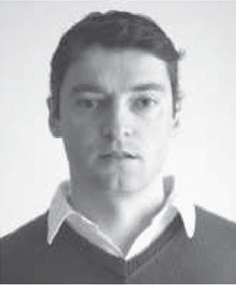 Franck Geffard合作论文数2Vassilis Kostopoulos合作论文数Univ. of Patras2Daniel Grosset合作论文数2w daenner合作论文数2
 Dimitrios Mazarakos合作论文数2j vamvakari合作论文数1
 Hans Cozijn合作论文数1
 Fanny Coudert合作论文数1p konstantinopoulos合作论文数1k charatsis合作论文数1γεώργιος καραστέργιος合作论文数1
 Niccolò Tosi合作论文数LIST, CEA, Gif-sur-Yvette, France|c|1Cozijn, H.合作论文数1
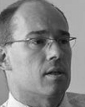 Laurent Beslay合作论文数1Uberto Delprato合作论文数1C Konrad合作论文数1J. F. Drogou合作论文数1
 Milt Statheropoulos合作论文数1Christos Alexakos合作论文数Pattern Recognition Laboratory, University of Patras1
 Manos J. Georgoudakis合作论文数1A. Arnedo Pena合作论文数1
 Charles L Paul Thomas合作论文数1
 Sofia Karma合作论文数1C. Derdas合作论文数1
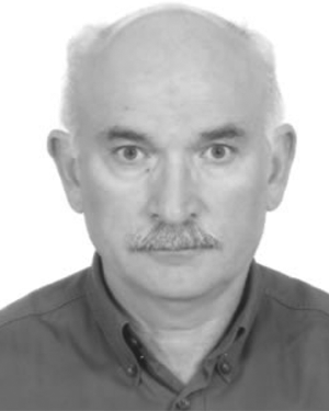 Nikos A. Aspragathos合作论文数Dept Mech & Aeronaut Engn, Univ Patras1
 Laurent Eck合作论文数1Andrew D Dimarogonas合作论文数1
 Nikos Katevas合作论文数1F. Farfaletti-Casali合作论文数1
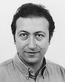 Grigorios Kalivas合作论文数Dept Elect & Comp Engn, Univ Patras1Georgios S Papadopoulos合作论文数1K. Mikedi合作论文数1
 Athanasios P. Kalogeras合作论文数Industrial Systems Institute Patras Science Park1




