From archaeology to the inspection of subsea structures, underwater mapping has become critical to many applications. Because of the balanced trade-off between range and resolution, multibeam sonars are often used as the primary sensor in underwater mapping platforms. These sonars output an image representing the intensity of the received acoustic echos over space, which must be classified into free and occupied regions before range measurements are determined and spatially registered. Most classifiers found in the underwater mapping literature use local thresholding techniques, which are highly sensitive to noise, outliers, and sonar artifacts typically found in these images. In this paper we present an overview of some of the techniques developed in the scope of our work on sonar-based underwater mapping, with the aim of improving map accuracy through better segmentation performance. We also provide experimental results using data collected with a DIDSON imaging sonar that show that these techniques improve both segmentation accuracy and robustness to outliers.
The aim of this work is fast, automated planning of robotic inspections involving complex 3D structures. A model comprised of discrete geometric primitives is provided as input, and a feasible robot inspection path is produced as output. Our algorithm is intended for tasks in which 2.5D algorithms, which divide an inspection into multiple 2D slices, and segmentation-based approaches, which divide a structure into simpler components, are unsuitable. This degree of 3D complexity has been introduced by the application of autonomous in-water ship hull inspection; protruding structures at the stern (propellers, shafts, and rudders) are positioned in close proximity to one another and to the hull, and clearance is an issue for a mobile robot. A global, sampling-based approach is adopted, in which all the structures are simultaneously considered in planning a path. First, the state space of the robot is discretized by constructing a roadmap of feasible states; construction ceases when each primitive is observed by a specified number of states. Once a roadmap is produced, the set cover problem and traveling salesman problem are approximated in sequence to build a feasible inspection tour. We analyze the performance of this procedure in solving one of the most complex inspection planning tasks to date, covering the stern of a large naval ship, using an a priori triangle mesh model obtained from real sonar data and comprised of 100,000 primitives. Our algorithm generates paths on a par with dual sampling, with reduced computational effort.
In recent years, the use of autonomous undersea vehicles (AUVs) for highly time-critical at-sea operations involving surface ships has received increased attention, magnifying the importance of optimal interception. Finding the optimal route to a moving target is a challenging procedure. In this work, we describe and apply our exact time-optimal path planning methodology and the corresponding software to such ship interception problems. A series of numerical ship interception experiments is completed in the southern littoral of Massachusetts, namely in Buzzards Bay and Vineyard Sound around the Elizabeth Islands and Martha's Vineyard. Ocean currents are estimated from a regional ocean modeling system. We show that complex coastal geometry, ship proximity, and tidal current phases all play key roles influencing the time-optimal vehicle behavior. Favorable or adverse currents can shift the optimal route from one island passage to another, and can even cause the AUV to remain nearly stationary until a favorable current develops. We also integrate the Kelvin wedge wake model into our path planning software, and show that considering wake effects significantly complicates the shape of the time-optimal paths, requiring AUVs to execute sequences of abrupt turns and tacking maneuvers, even in highly idealized scenarios. Such behavior is reminiscent of ocean animals swimming in wakes. In all cases, it is shown that our level set partial differential equations successfully guide the time-optimal vehicles through regions with the most favorable currents, avoiding regions with adverse effects, and accounting for the ship wakes when present.
We present a unified formalism for multiagent networked control and estimation with scheduling, delays, and packet loss in the communication channels between the controller and distributed sensors and actuators. The modular framework is a combined construction of a stochastic jump linear system (JLS) description of the plant and network effects, a Kalman filter-based estimator, and packetized predictive control, a receding horizon optimization technique with buffering at the actuator. Integration of these elements enables the synthesis of a novel estimation technique that generalizes prior approaches for control and measurement packet loss to the case with schedules, delays, control buffering, and most importantly, delayed and lossy control packet acknowledgments (ACKs). The JLS framework allows a clean separation of jump variable estimation and a posteriori state estimation using a backup-and-rerun strategy, and can handle variable-length ACK histories for multiple independent control communication channels. Finally, we derive modified covariance priors for the filter that account for uncertainty in the control action applied at the vehicle when ACKs are not available and control buffers are used. Simulations with single vehicle and multivehicle systems demonstrate the methods and show the benefits of utilizing delayed and lossy ACKs.
We present a cooperative bathymetry-based localization approach for a team of low-cost autonomous underwater vehicles (AUVs), each equipped only with a single-beam altimeter, a depth sensor and an acoustic modem. The localization of the individual AUV is achieved via fully decentralized particle filtering, with the local filter's measurement model driven by the AUV's altimeter measurements and ranging information obtained through inter-vehicle communication. We perform empirical analysis on the factors that affect the filter performance. Simulation studies using randomly generated trajectories as well as trajectories executed by the AUVs during field experiments successfully demonstrate the feasibility of the technique. The proposed cooperative localization technique has the potential to prolong AUV mission time, and thus open the door for long-term autonomy underwater.
We propose a submap-based technique for mapping of underwater structures with complex geometries. Our approach relies on the use of probabilistic volumetric techniques to create submaps from multibeam sonar scans, as these offer increased outlier robustness. Special attention is paid to the problem of denoising/enhancing sonar data. Pairwise submap alignment constraints are used in a factor graph framework to correct for navigation drift and improve map accuracy. We provide experimental results obtained from the inspection of the running gear and bulbous bow of a 600-foot, Wright-class supply ship.
Marine robots communicating wirelessly is an increasingly attractive means for observing and monitoring the ocean, but acoustic communication remains a major impediment to real-time control. In this paper we address through experiments the capability of acoustics to sustain highly dynamic, multi-agent missions, in particular range-only pursuit in a challenging shallow-water environment. We present in detail results comparing the tracking performance of three different communication configurations, at operating speeds near 1.5m/s. A "lower bound" case with RF wireless communication, a 4-second cycle and no quantization has a tracking bandwidth of approximate to 0.5 rad/s. When using full-sized modem packets with negligible quantization and a 23-second cycle time, the tracking bandwidth is approximate to 0.065 rad/s. With 13-bit mini-packets, we employ logarithmic quantization to achieve a cycle time of 12 s and a tracking bandwidth of approximate to 0.13 rad/s. These outcomes show definitively that aggressive dynamic control of multi-agent systems underwater is tractable today.
Many of today's robot applications depend on wireless communications, whose performance can impact the whole system. To support analysis of feedback control through limited channels, we develop describing functions (DFs) for three variations on the series interconnection of a quantizer, a binary erasure channel, and decoder for a single input single output (SISO) system. The key steps in our derivation hold when the decoder is a linear-quadratic-Gaussian (LQG)-type control, a zero-output decoder, or a hold-output decoder. We confirm the accuracy of the new formulas and provide an example showing limit cycle behavior.
Actuated sensor networks enabled by underwater acoustic communications can be efficiently used to sense over large marine expanses that are typically challenged by a paucity of resources (energy, communication bandwidth, number of sensor nodes). Many marine phenomena of interest admit sparse representations, which, coupled with actuation and cooperation, can compensate for being data starved. Herein, new methods of field reconstruction, target tracking, and exploration-exploitation are provided, which adopt sparse approximation, compressed sensing, and matrix completion algorithms. The needed underlying structure (sparsity/low-rank) is quite general. The unique constraints posed by underwater acoustic communications and vehicle kinematics are explicitly considered. Results show that solutions can be practically implemented, even over large ocean spaces.
This paper presents a technique for improved mapping of complex underwater environments. Autonomous underwater vehicles (AUVs) are becoming valuable tools for inspection of underwater infrastructure, and can create 3D maps of their environment using high-frequency profiling sonar. However, the quality of these maps is limited by the drift in the vehicle’s navigation system.We have developed a technique for simultaneous localization and mapping (SLAM) by aligning point clouds gathered over a short time scale using the iterative closest point (ICP) algorithm. To improve alignment, we have developed a system for smoothing these “submaps” and removing outliers. We integrate the constraints from submap alignment into a 6-DOF pose graph, which is optimized to estimate the full vehicle trajectory over the duration of the inspection task. We present real-world results using the Bluefin Hovering AUV, as well as analysis of a synthetic data set.
Multi-vehicle operations in the ocean are increasingly attractive as more vehicles become commercially available, however acoustics still defines the main practical channel for long-range wireless communication underwater. Long transmission times, scheduling delays and packet losses remain obstacles to implementing real-time multi-vehicle cooperative control for marine vehicles. We present a control system for dynamic pursuit with multiple vehicles exchanging time-difference-of-arrival (TDOA) measurements via underwater acoustic communications. Using data from field experiments conducted with autonomous surface vehicles, we show that a decentralized controller can track fast-moving targets and formation changes, leveraging partial information updates and decreased effective cycle times. As a comparison, we show results for trials conducted with one similar but centralized control scheme.
We consider the problem of maximizing underwater acoustic data transmission, by adaptively positioning a mobile relay. This is a classic exploration vs. exploitation scenario well-described by a multi-armed bandit formulation, which in its canonical form is optimally solved by the Gittins index rule. For an ocean vehicle traveling between distant waypoints, however, switching costs are significant, and the MAB with switching costs has no optimal index policy. To address this we have developed a strong adaptation of the Gittins index rule that employs limited-horizon enumeration. We describe autonomous shallow-water field experiments conducted in the Charles River (Boston, MA) with unmanned vehicles and acoustic modems, and compare the performance of different algorithms. Our switching-costs-aware MAB heuristic offers both superior real-time performance in decision-making and efficient learning of the unknown field.
We present an integrated framework for joint estimation and pursuit of dynamic features in the ocean, over large spatial scales and with multiple collaborating vehicles relying on limited communications. Our approach uses ocean model predictions to design closed-loop networked control at short time scales, and the primary innovation is to represent model uncertainty via a projection of ensemble forecasts into local linearized vehicle coordinates. Based on this projection, we identify a stochastic linear time-invariant model for estimation and control design. The methodology accurately decomposes spatial and temporal variations, exploits coupling between sites along the feature, and allows for advanced methods in communication-constrained control. Simulations with three example datasets successfully demonstrate the proof-of-concept.
Without access to GPS and high-quality visual landmarks, many autonomous underwater vehicles (AUV) face a fundamental navigation vs. cost tradeoff: advanced navigation systems that might include an INS, Doppler velocity, or long-baseline acoustics are expensive. Supporting low-cost operations, this work focuses on collaborative positioning for a team of AUV's, given a bathymetric terrain map, and only an altimeter and acoustic modem on each vehicle. The joint localization is performed via decentralized particle filtering, where we extend the usual measurement model to allow received information to modulate the importance function. We investigate the impact on performance of sensor noise, communication interval and number of vehicles. Results are shown for bathymetry maps near St. John's Island, Singapore, and for the Charles River Basin, Boston. In the second case, we ran our algorithm with physical measurements from actual vehicles executing trajectories.
We formulate mixed-integer conic approximations to AC transmission system planning. The first applies lift-and-project relaxations to a nonconvex model built around a semidefinite power flow relaxation. We then employ a quadratically constrained approximation to the DistFlow equations in constructing a second-order cone model that is convex without relaxation. We solve mixed integer linear and second-order cone programs using commercial software and assess their performance on two benchmark problems. As with DC power flow models and linear AC relaxations, the new models usually produce solutions which are infeasible under the original constraints. However, they are nearer to feasibility, and therefore represent stronger alternatives.
Marine robots are an increasingly attractive means for observing and monitoring in the ocean, but underwater acoustic communication (“acomms”) remains a major challenge, especially for real-time control. Packet loss occurs widely, bit rates are low, and there are significant delays. We consider here strategies for feedback control with acomms links in either the sensor-controller channel, or the controller-actuator channel. On the controller-actuator side we implement sparse packetized predictive control (S-PPC), which simultaneously addresses packet-loss and the data rate limit. For the sensor-controller channel we study a modified information filter (MIF) in a Linear Quadratic Gaussian (LQG) control scheme. Field experiments were carried out with both approaches, regulating crosstrack error in a robotic kayak using acomms. Outcomes with both the S-PPC and MIF LQG confirm that good performance is achievable.
 Michael Triantafyllou合作论文数Department of Mechanical Engineering, Massachusetts Institute of Technology71
 Brendan Englot合作论文数Department of Mechanical Engineering, Charles V. Schaefer, Jr. School of Engineering and Science, Stevens Institute of Technology16
 Josh Taylor合作论文数The Edward S. Rogers Sr. Department of Electrical & Computer Engineering, Faculty of Applied Science and Engineering, University of Toronto12
 Alexandra H. Techet合作论文数Department of Mechanical Engineering, Massachusetts Institute of Technology;Center for Ocean Engineering, Massachusetts Institute of Technology10
 Eric Gilbertson合作论文数Department of Mechanical Engineering, Massachusetts Institute of Technology10
 Yahya Modarres-Sadeghi合作论文数Department of Mechanical and Industrial Engineering, University of Massachusetts10
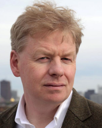 John Leonard合作论文数Department of Mechanical Engineering, Massachusetts Institute of Technology;Schwarzman College of Computing Building, Massachusetts Institute of Technology9
 Brooks L. Reed合作论文数9
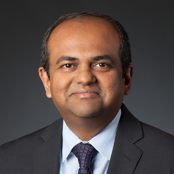 Gaurav Sukhatme合作论文数Thomas Lord Department of Computer Science, Viterbi School of Engineering, University of Southern California;Robotic Embedded Systems Laboratory, University of Southern California;Amazon8
 Michael Kaess合作论文数Robot Perception Lab, Robotics Institute, School of Computer Science, Carnegie Mellon University;Field Robotics Center, Robotics Institute, School of Computer Science, Carnegie Mellon University;Aquatonomy8
 Urbashi Mitra合作论文数Ming Hsieh Department of Electrical and Computer Engineering, Viterbi School of Engineering, University of Southern California;Thomas Lord Department of Computer Science, Viterbi School of Engineering, University of Southern California8
 J. M. Dahl合作论文数Center for Ocean Engineering, Massachusetts Institute of Technology8
 Stephen Licht合作论文数7Matthew Greytak合作论文数6Joshua Leighton合作论文数6Damus, R.合作论文数AUV Lab., MIT;c5
 Hanumant Singh合作论文数Electrical and Computer Engineering, College of Engineering, Northeastern University5Mei Yi Cheung合作论文数5Robert Hummel合作论文数5
 Hordur Johannsson合作论文数Teledyne Gavia5
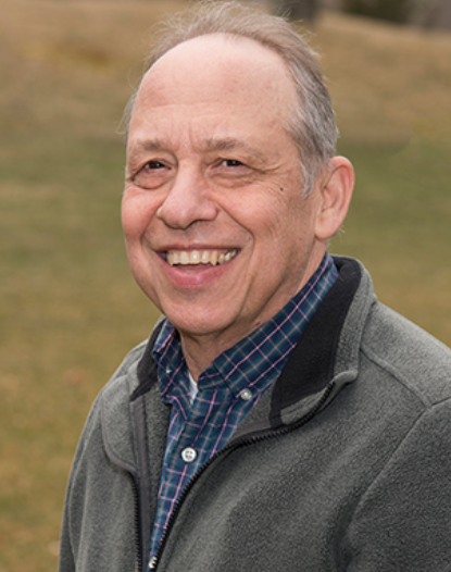 Dana Yoerger合作论文数Deep Submergence Laboratory, Department of Applied Ocean Physics & Engineering, Woods Hole Oceanographic Institution5Chryssostomos Chryssostomidis合作论文数5Victor Polidoro合作论文数5
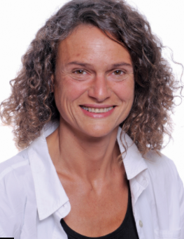 Milica Stojanovic合作论文数Department of Electrical and Computer Engineering, College of Engineering, Northeastern University;Department of Bioengineering, College of Engineering, Northeastern University;Woods Hole Oceanographic Institution;AUV Laboratory, Massachusetts Institute of Technology5H. Mukundan合作论文数4jose arellano合作论文数4
 Dick K. P. Yue (俞久平)合作论文数Department of Mechanical Engineering, School of Engineering, Massachusetts Institute of Technology4Desset, S.合作论文数4
 Pradya Prempraneerach合作论文数4
 Nicholas M. Patrikalakis合作论文数Department of Mechanical and Ocean Engineering, Massachusetts Institute of Technology4Alfred C. H. Tan合作论文数4
 Geoff Hollinger合作论文数Robotic Decision Making Laboratory4J. J. Leonard Vaganay合作论文数3bryan freeman合作论文数3
 Hanna Kurniawati合作论文数School of Computing, Australian National Univeristy3
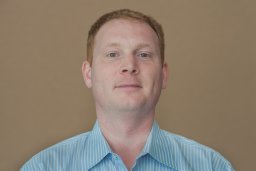 Scott Willcox合作论文数Bluefin Robotics Corporation3
 Sunav Choudhary合作论文数3
 Stephen M. Hou合作论文数3F. Chasparis合作论文数3
 Tirthankar Bandyopadhyay合作论文数CENSAM IRG, SMART, Singapore3
 Jeffrey Lang合作论文数Department of Electrical Engineering and Computer Science, Massachusetts Institute of Technology3Vicente Fernández合作论文数3Pedro V. Teixeira合作论文数2pga madden合作论文数2
 Rubaina Khan合作论文数Ontario Institute for Studies in Education, University of Toronto2
 Haining Zheng (郑海宁)合作论文数ExxonMobil2matthew watts合作论文数2
 Mandar Chitre合作论文数Department of Electrical & Computer Engineering, College of Design and Engineering, National University of Singapore;Acoustic Research Laboratory, Tropical Marine Science Institute, National University of Singapore;Subnero Pte. Ltd.2
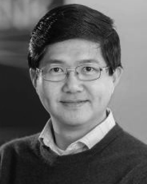 Tan Yew Teck合作论文数Dept. of Electr. & Comput. Eng., Nat. Univ. of Singapore;c;Dept. of Electr. & Comput. Eng., Nat. Univ. of Singapore2




