River-dominated ocean margins (RiOMars), located at the land-ocean boundary, are susceptible to both land- and ocean-based stressors. Due to climate change, hydrological regimes are expected to change, with, for example, an increase in the intensity and frequency of river floods in the near future. To better understand the impact of these changes on the benthic ecosystem in RiOMars, we conducted eleven sampling campaigns in the Rhône River prodelta (Mediterranean Sea, France) between October 2023 and September 2024. We measured variations in total oxygen uptake (TOU), and benthic fluxes of dissolved inorganic carbon (DIC) and total alkalinity (AT), using ex-situ core incubations. Our results show integrated values of 26 ± 4, 54 ± 6, and 41 ± 5 mmol m-2 d-1 for TOU, and fluxes of DIC and AT, respectively, with strong variability throughout the year. Flood material derived from the western flank of the Rhône River likely contained relatively more labile organic matter (OM) compared to that of the rest of the catchment area. The lowest fluxes were observed after large flood depositions, likely containing large amounts of non-reactive OM, while high fluxes occurred after smaller flood depositions with, possibly, high labile OM content. The highest rates (DIC: 104 ± 8, AT: 81 ± 6, TOU: 35 ± 9 mmol m-2 d-1) occurred in spring and early summer due to the conceivable input of fresh, labile OM from riverine primary production. Our results thus highlight the relationships among river catchment area, the origin of flood material, seasonality, OM quality, and their effects on benthic flux rates.
Changes in marine animal communities shape ecological processes and ecosystem functioning. Monitoring temporal community dynamics is increasingly important under global change, yet remains challenging because community fluctuations can arise from multiple natural processes and are difficult to assess. Passive acoustic monitoring of signals produced by marine fauna offers a non-invasive means of tracking community dynamics, providing continuous, high-resolution data that capture temporal patterns often missed by traditional methods. Despite their potential as proxies for macrofaunal assemblages and associated dynamics, the responses of acoustic communities to environmental variability in marine ecosystems remain largely unexplored. This study aimed to characterize fish acoustic communities in a tidal European kelp forest and identify the environmental drivers shaping their temporal variability. Continuous acoustic recordings were combined with environmental measurements and underwater visual surveys to address these objectives. Generalized linear models revealed that diel and tidal cycles were the dominant drivers of acoustic activity, diversity, and community composition during the summer study period. Other environmental variables had weaker effects, reflecting the fauna’s adaptation to marked short-term fluctuations in this dynamic ecosystem. Acoustic activity and richness increased at low water height, contrasting with higher visually observed fish abundance at high water height. This discrepancy suggests that sound production reflects behavioural interactions rather than fish abundance alone. The greater number of sound types (26) relative to observed species (19) indicates either behavioural sound diversity within species or the presence of undocumented soniferous taxa. Calmer sea conditions also promoted higher vocal activity and acoustic richness. This study provides an unprecedented description of kelp forest acoustic communities in Europe, demonstrating the value of ecoacoustics to complement visual surveys for capturing natural variability and establishing essential baseline information for detecting long-term ecological shifts in these climate-sensitive habitats.
In many fish species, migration is an important, yet complex step of their life cycle driven by numerous environmental and behavioral factors. This is particularly true for the endangered European eel (Anguilla anguilla) when it enters inland waters as glass eels. These inland waters, and especially transitional waters such as Mediterranean lagoons, are subjected to sharp changes in their environmental conditions, as reported from 2022 to 2025 when an historic drought affected the western French Mediterranean. Moreover, glass eels experience behavioral change during ontogeny that may affect their migration abilities. In this study, a time series of glass eel monitoring (2018-2026) conducted in a Mediterranean lagoon was analyzed to test two hypotheses: 1- different climatic conditions between dry and wet seasons will influence the role of environmental drivers on glass eel migration and 2- this role will also differ with glass eel ontogeny in relation to their locomotor behavior. Our first hypothesis was confirmed, revealing common environmental drivers under both climatic conditions, alongside specific drivers associated to dry and wet seasons. Oppositely, no consistent evidence was found for an effect of ontogeny on glass eel migration. Finally, our results confirmed that environmental drivers facilitating orientation play a more prominent role than those facilitating passive transport in transitional waters. Further experimental studies are needed to better understand how subtle behavior changes during ontogeny influence responses to environmental drivers in early life stages such as glass eels.
Underwater gliders equipped with current profilers and optical turbidity sensors offer a low-energy solution for high-resolution measurements of currents, suspended particle properties, and sediment transport in coastal waters. Because the spatial structure of hydrosedimentary processes often changes on short time scales (hours to weeks), especially in coastal areas, validating the distribution of glider observations is required to assess our capacity to represent hydrosedimentary processes. Here we propose to validate in a shelf tide-dominated environment, both (i) glider-based currents, and (ii) glider-based acoustic backscatters and optical turbidities in full resolution delayed mode, using in situ collocated and synchronous ancillary observations. The deployed glider system correctly measures the periodic pattern of the tidal current, with a RMSD of O(3 cms-1), demonstrating the system's ability to accurately capture tidal variability. Glider optical turbidities highly correlate with the ancillary observations (R2 up to 0.83). They also correlate well with their glider acoustic counterpart for most of the campaign period (R2=0.76), allowing an estimation of suspended particulate matter concentrations from acoustic measurements. Hence, the glider could observe not only the presence of bottom nepheloid layers of several mgL-1 but also residual fluxes of the order of 1 gm-1s-1 on the shelf. These results highlight the potential of gliders for quantifying sediment fluxes and advancing our understanding of coastal hydrosedimentary processes.
Dense shelf water cascading (DSWC) is a key oceanographic process in transferring energy and matter from continental shelves to deep ocean areas. Although intense DSWC (IDSWC) events have received most attention due to their large impacts, mild DSWC (MDSWC) events are the most frequent in the northwestern Mediterranean and are expected to become more common under climate change. However, their dynamics, particularly in the Cap de Creus Canyon, have been less comprehensively described and compared to strong-winter events. This study investigates MDSWC in the Cap de Creus Canyon during the mild winter of 2021–2022, examining shelf-canyon transports of both dense shelf waters and suspended particulate matter (SPM). Observations from the FARDWO-CCC1 multiplatform cruise in March 2022 revealed the presence of cold, dense, and turbid shelf waters, enriched in dissolved oxygen and chlorophyll a, on the continental shelf adjacent to the canyon. These waters cascaded into the canyon head and progressed further into the canyon along its southern flank to ∼ 390 m depth. Estimated water and SPM transports during this event were 0.7 Sv and 105 metric tons (t), respectively, at the continental shelf. Within the canyon, transports were 0.3 Sv and 105 metric tons in the upper section, while mid-canyon transports were lower (0.05 Sv and 104, respectively), indicating that most dense shelf waters likely remained confined to the shelf area and upper canyon. During this event, dense shelf waters were transported ∼ 30 km from the shelf into the canyon. Our results show that significant transport of dense shelf waters (260 km3) and suspended sediment can occur in the Cap de Creus Canyon during MDSWC events under mild winters, also contributing significantly to the formation of Western Intermediate Water (WIW) in the canyon. The Mediterranean Sea Physics reanalysis data indicate that the cascading season lasted from late-January to mid-March 2022, with several shallow cascading pulses throughout this period. Peak transport occurred in mid-March associated with an eastern storm, which likely intensified MDSWC in the canyon. Our study reinforces the idea that dense shelf water transports exhibit marked interannual variability, even under mild winters.
The dynamics of sediments entering lakes in river plumes is virtually unknown. This field study provides unprecedented evidence of the initiation and evolution of suspended sediment flocculation in the nearfield of the negatively-buoyant Rh & ocirc;ne River plume, flowing as interflow in the thermocline of stratified Lake Geneva. Sediment floc property changes (formation, size, composition, shape) with depth and distance from the mouth, were determined by combining digital holographic camera LISST-HOLO data with full-depth in situ profiles of particle size (LISST-100X), density, turbidity, currents and water samples taken along the plume path. The total suspended matter volume of inflowing Rh & ocirc;ne River waters (similar to 155 mg l(-1)) mostly consisted of clays (<4 mu m), very fine silts (4-8 mu m) and small contributions of microflocs (20-100 mu m). This composition was also found in the interflow plume core. Above the plume, in the epilimnion, fine silts, microflocs and numerous phytoplanktonic organisms (similar to 200 mu m) were observed, representative of the lake background. High levels of shear (15-27 s(-1)) and turbulence occurred in the shear layer that formed between the interflow bottom and the hypolimnion below. It was found that macroflocs only formed in this shear layer. In the hypolimnion, sediment load was the lowest and macroflocs (up to similar to 300 mu m) composed of inorganic particles were dominant. The size of the largest flocs was limited by the size of the smallest turbulent eddies determined by the Kolmogorov microscale. Floc 3D fractal dimensions of similar to 2.1-2.5 suggest an intermediate shape complexity between marine snow and sludge flocs.
The Beagle Channel is a 300-km long passage connecting the Pacific and Atlantic Oceans at similar to 55 degrees S, where glaciers and river streams meet subantarctic waters. Here we present the first evaluation of downward fluxes and composition of particulate matter in the channel. Settling particle fluxes were collected by sequential sediment traps deployed in two contrasting areas: one in the western part of the channel, corresponding to an early post-glacial environment (site A) and a second, fully deglaciated, river-dominated environment (site B) in the eastern part. In early summer, fluxes at both sites are driven by organic matter produced in spring, with peak organic carbon fluxes of 289 and 413 mg C m(-2) d(-1) at sites A and B, respectively (C:N ratios of 7.3 and 6.3, respectively). During winter, the fluxes of fecal pellets, particulate organic carbon (POC) and particulate nitrogen (PON) were at their minimum. At site A (integrated annual POC flux of 74 g C m(-2) yr(-1)), seasonality was weak and the flux was driven by ballast material (>95% of total particle flux) of glacial origin year-around, which also promotes the POC export. According to isotopic and taxonomic analyses performed at site A, the low seasonality in the organic component of the flux appears to be mainly related to autochthonous production of nano- and pico-phytoplankton during autumn and winter, later replaced by microphytoplankton fluxes during spring and summer. At site B, ballast material accounted for <60% of total mass flux and the POC flux showed a marked seasonality with a well-defined maximum after the spring phytoplankton bloom. Regarding the contribution of zooplankton, fecal pellets of appendicularians dominated at the western sector of the channel (site A) while Munida gregaria pellets dominated the flux at the eastern site (site B). This work is a contribution to ongoing efforts to unveil the physical and biogeochemical variables driving the biological carbon pump and the land-sea connections in this high-latitude ecosystem threatened by climate change.
Thick sand deposits at the edge of continental shelves, sometimes covered with large bedforms, are generally considered as relict features inherited from periods of low sea level, but alternative interpretations are possible, even in zones where modern oceanic processes are moderate. Detailed investigations in the western Gulf of Lions (western Mediterranean Sea) reveal the presence of remains of Marine Isotope Stage 4 (MIS 4) and MIS 2 shelf-edge deltas at the head of canyons. The sands were then "cannibalized" by strong rising sea-level currents, forming a 20-km-long, strike-oriented sand body covered by dunes. Presently, the migration of dunes is maintained by strong storm-driven currents. The seasonal reversal of circulation is at the origin of inversion of dune morphology, thus the sand body mimics a tidal sand bank with clockwise circulation of bedforms. In the long term, dunes migrate southward with a negative angle of climb, eroding into the underlying shelf-edge deltas. Acoustic Doppler current profiles and numerical simulations indicate that the sediment is sorted, once in suspension, and is flushed to the deep sea while sand bedload contributes to bedform migration. This relative enrichment of sand without external supply is referred to as a "natural sand plant," by analogy with industrial sand plants where sand is washed and sieved. It forms a discontinuous sand belt, 5-20 m thick, more than 110 km along-strike, connecting multiple shelf-edge deltas. The geological importance of recognizing this recycling mechanism is indicated by the preservation of similarly large buried dunes formed during the deglaciation leading to interglacial MIS 7 at ca. 240 ka (Termination III).
<p>Small mountainous rivers provide an important part of the sedimentary inputs to the oceans. The particularity of theses rivers comes from the fact that their inputs take place mostly during brief and intense flood events. While the quantification of fine sediment flux is fairly well known, sandy inputs are very poorly known and field measurements are scarce. River mouth sand discharge is a key variable in the coastal sediment budget as it participates to the coastline evolution and its protection against marine events. Coarse sediments are mainly transported as bedload, making it difficult to estimate with traditional methods such as traps. In this study, a fixed Acoustic Doppler Current Profiler (ADCP Nortek Aquapro 1 MHz) was deployed on a bottom frame, near the mouth of the T&#234;t river (SE France) to estimate near-bottom sediment transport during flood events. In addition, cross sections have been undertaken with a Sontek Hydroboard equipped with a Sontek M9 ADP at different water discharge during several flood events. A calibration of the backscatter index was carried out using gravimetric measurements and granulometric analysis of water samples to estimate the sediment flux and the sand proportion. Sediment fluxes were then compared with the altimetric variations observed from bathymetric surveys. Results allowed to characterize the variability of the boundary layer thickness and the sediment concentrations during flood events. Those results give useful information to estimate sand fluxes from mountainous rivers to the coastal area in a context where these are considered to be low or non-existent compared to large coastal rivers.</p>
Migration is an important yet dangerous phase in the life of numerous animals, including the European eel (Anguilla anguilla), which migrates thousands of kilometers between its growing habitats and spawning area. The behaviors and mechanisms involved in the migration of silver eels to their spawning area have been extensively documented in rivers, estuaries and marine environments but rarely in Mediterranean lagoons, despite the high abundance of eels in lagoons. To fill this gap, we used an ARIS 1800 acoustic camera to monitor silver eel migration (escapement) in a channel that connects the Bages-Sigean lagoon (South of France) to the Mediterranean Sea. The camera was deployed over 905 days from October 2018 to April 2022 and coupled with the monitoring of 10 environmental parameters. Silver eel escapement mainly occurred in the first hours of the night, between October and December, and to a lesser extent in March and April during a few mass migration episodes. Interestingly, silver eels that escaped from October to December were mostly males, shorter than 45 cm, whereas silver eels that escaped in March and April were mostly females (>45 cm). The night migration of silver eels and their tendency to migrate in large groups is likely a strategy to limit their risk of predation. They escaped principally when the water flowed seaward, which limits their energy demand for migration. Finally, we emphasized that knowledge gaps on the behavior of males silver eels at sea need to be addressed as a priority to improve the understanding of eel ecology.
Accurately predicting the flow speed is crucial for applications of coastal ocean circulation simulations such as sediment, larval or contaminant dispersal. This study aims to assess the accuracy of simulated flow speed in a coastal circulation model in comparison with field observations. Deviation between simulated and observed flow speed was assessed in four shallow, coastal locations and four deep, offshore locations in the Gulf of Lion (NW Mediterranean Sea) using six indicators (bias, relative bias, root mean square error, Hanna & Heinold index, correlation and scatter index). Statistical distributions of indicators were calculated during reference periods with low wind, no waves and no stratification. During these periods, relative bias indicated the model displayed a higher performance in predicting transport at shallow stations than at deep stations probably due to grid refinement at these stations. However, there was a low correlation between simulated and observed flow speed, indicating short term time/space mismatches, at all stations during reference periods. Indicators were then calculated during three types of events (wind, waves and stratification) when model assumptions were expected to be violated and their corresponding probability during reference periods indicated that neither wind, wave nor stratification events worsens model's performance.
Estimating the diffuse attenuation coefficient of the Photosynthetically Available Radiation $(K_{\mathrm{PAR}})$ allows to monitor primary production, dissolved organic matters, coastal suspended sediments and water transparency. The latter aim, especially for military purposes, may be efficiently achieved with the use of underwater gliders. The present study aims at estimating the $K_{\mathrm{PAR}}$ in the the Bay of Biscay (North-East Atlantic), during a sea campaign which took place in February 2021, in fairly transparent waters mainly containing non-living suspended material. The sea survey involved a SEAEXPLORER glider equiped with an ocean color radiometer. The glider measurements were in agreement with those from shipboard CTD-PAR casts (with a mean relative difference of about 11%). VIIRS L2 and MODIS L4 satellite products were validated with the glider data. Accordingly, a bias correction has been proposed for the ocean color satellite $K_{\mathrm{PAR}}$ algorithm.
Many river mouths presenting a seasonal variation of flow suffer of periodically (semi-) closure of their channels by the development of sand spits.Due to their low elevations, they are subject to different levels of coastal flooding during storm events.This is the case of the microtidal mouth of the Têt (Canet en Roussillon, Occitanie) which has a persistent sandy spit in its northern part.In order to study the impact of marine energy events on the morphology of this spit, high-frequency hydrodynamic measurements, video and topographic surveys by UAV were set up on a monthly basis and before and after each potentially morphogenic event.The analysis of twelve marine storms showed a linear relationship between the significant wave height and the mode of overtopping over the spit, ranging from a few localised overtopping to complete coastal flooding for several hours.Four morphogenic response thresholds were identified, allowing us to predict the behaviour of this sandy spit as a function of coastal flooding hazards.On the other hand, it seems that the pre-existing morphology of the spit, in particular the altitude of its crest, modulates the extent of the overtopping, although there does not seem to be any systematic control.
The European eel, Anguilla anguilla, is an emblematic facultative catadromous species that spawns in the Sargasso Sea and grow in continental waters of Europe and North Africa. In most of its growing habitats its population has dropped since 1980. Although Mediterranean lagoons represent particularly important habitats for eel, knowledge of eel ecology in lagoons is not as developed as it is in rivers. Particularly, data on the phenology, drivers and biometrics characteristics of glass eel entering lagoons are scarce. To address this lack of data, the abundance, pigmentation stage, size, and weight of glass eel entering the Bages-Sigean lagoon (western French Mediterranean) were monitored during 647 d from December 2018 to April 2021 using passive floating traps. Simultaneously, different environmental drivers were measured (flow velocity, temperature, rainfalls horizontal ellipsis ). The highest abundances of glass eels were observed between mid-November and mid-March especially when the discharge of the main tributary of the lagoon was higher than its base flow. The glass eels captured during the peak of entrance were less pigmented, longer, and bigger than during other months. This work enabled us to identify periods when anthropogenic activities should be limited to decrease human-based impact on glass eel in similar habitats.
Describing and quantifying storm-induced sediment dynamics enables improved mapping of the fate of sediments over continental shelves, which is necessary to understand their role in the structure and dynamics of marine ecosystems, nutrient cycling, and dispersion of pollutants. Storms are episodic processes that can lead to massive sediment resuspension and transport on continental shelves. However, understanding sediment dynamics during storms remains a challenge, because these events are spatially under-sampled due to their intermittency and intensity. This paper quantifies processes that drive sediment dynamics and their spatiotemporal variability over the outer shelf of the Gulf of Lions (NW Mediterranean), during a 5-year return period storm, using an active acoustic glider combined with a hydrodynamic model (SYMPHONIE) and wave model (WAVEWATCH-III). The glider-ADCP (Acoustic Doppler Current Profiler) measurements proved invaluable validation of current vertical profiles of the hydrodynamic model during this episodic event. The combination of observations with numerical simulations suggest that sediment resuspension is an important process at depths greater than 90 m on the shelf. This appears to be primarily due to the wave forcing, which most likely accounts for some of the observed increase in suspended particulate matter in the water column. At the regional scale, an along shelf sediment transfer by successive jumps associated with onshore storms is suggested, from the main input (the Rhone River) to the output (the Cap de Creus) area of the Gulf of Lions' shelf. This study highlights the complementarity between numerical modeling and new observation instrument designed to spatially extend the measurement of current and turbidity to study sediment resuspension and transport during extreme events on continental shelves.
The Rhone River is one of the largest rivers in the North-West Mediterranean Sea. Freshwater and particle (sediments, nutrients and contaminants) inputs make the adjacent coastal area as a remarkable ROFI known as a hotspot of biodiversity in the Gulf of Lions. The dynamics and behavior of riverine particles is often observed from classical moorings, buoys as well as remote sensing. These observing systems only permit limited measurements in 1D for single-point observations in the water column and at the water surface during cloud-free days from remote sensing data. But there is a lack of spatio-temporal observations especially during extreme events when sea campaign investigations are difficult. An autonomous underwater vehicle, also named glider, equipped with a Laser In-Situ Scattering and Transmissometry (LISST) sensor was deployed in front of the Rhone River in February 2019 in order to investigate the small-scale characteristics of particles in the coastal area. In-situ particle size measurements and volume concentrations of suspended particles were related to mass concentrations in order to estimate the density and settling velocity. Results revealed the presence of highly dynamic surface, intermediate and bottom nepheloid layers composed of particles with distinct characteristics. Those results give useful informations to undestand the behavior of particles in the coastal area and for amelioration of regional hydro-sedimentary models.
This study investigates the capability of high and medium spatial resolution ocean color satellite data to monitor the transport of suspended particulate matter (SPM) along a continuum from river to river mouth to river plume. An existing switching algorithm combining the use of green, red and near-infrared satellite wavebands was improved to retrieve SPM concentrations over the very wide range (from 1 to more than 1000 g.m−3) encountered over such a continuum. The method was applied to time series of OLI, MSI, and MODIS satellite data. Satisfactory validation results were obtained even at the river gauging station. The river liquid discharge is not only related to the SPM concentration at the gauging station and at the river mouth, but also to the turbid plume area and SPM mass estimated within the surface of the plume. The overall results highlight the potential of combined field and ocean color satellite observations to monitor the transport and fluxes of SPM discharged by rivers into the coastal ocean.
In estuaries and marine environments, primary particles are frequently transported as large flocs. This study provides, for the first time, evidence of in situ flocculation in Lake Geneva, a glacier-fed freshwater lake on the Swiss/French border. Measurements were focused in the nearfield of the Rhône River plume as it flows as an interflow into the stratified lake (i.e., during summer). Direct observations of flocculated particles in the whole water column with a digital holographic camera (LISST-HOLO 30-2000 μm), permitted estimation of the variability of sediment floc properties (size, nature and shape) with depth. Combined with full-depth in situ laser particle sizing (LISST-100X), the measurements revealed that very fine silts (4-8 μm) are dominant in the Rhône River interflow (flowing at thermocline depth), which exhibited the highest suspended sediment loads in the water column. In the hypolimnion below the interflow, where sediment loads were the lowest, microflocs (20-125 μm) and macroflocs (> 125 μm) were most frequent. The size of the largest macroflocs decreased along the interflow pathway, from 272 μm at 350 m from the mouth to 195 μm at 1700 m. In the epilimnion above the interflow, very fine silts and numerous phytoplanktonic organisms (~100-200 μm) were observed. In the hypolimnion, the average estimated fractal dimension (DF3D) of the flocs ranged between 2.35 and 2.40, highlighting the complexity in floc shape, whereas phytoplanktonic organisms in the epilimnion had DF3D values ranging between 2.45 and 2.50, suggesting less complex shapes. The transition zone between the bottom layer of the interflow and the hypolimnion (~25-30 m depth) was marked by a sudden increase in the median particle diameter, corresponding to decreasing proportions of clays and very fine silts and to increasing proportions of micro and macroflocs. High-resolution profiles of turbulence collected with a Signature1000 revealed strong turbulence fluctuations and intense shear in this transition zone, compared to the interflow core. These levels of turbulence result in fine particle collisions, and favor the formation of larger flocs (i.e., flocculation) in the transition zone. Furthermore, the influence of instantaneous turbulent kinetic energy as a factor limiting the maximum floc size below the Rhône River interflow was investigated. The observed turbulence level below the interflow corresponded to an estimated Kolmogorov microscale of less than ~320 μm at 350 m from the mouth to ~200 μm at 1700 m, values that are consistent with measurements. This results in the potential breakup of flocs larger than these estimates into smaller finer particles and microflocs, and so can explain the decrease in the macrofloc size along the interflow pathway.
River mouths are highly dynamic environments responding very rapidly to changes in wave energy or river floods. While the morphological response during floods or during marine storm events has been widely documented in the literature, little is known about the mechanisms acting during the co-occurrence of fluvial and marine hazards. This concomitance of river flood and marine storm is quite common in the western Mediterranean Sea, and was the case for the Gloria event, considered to be the most extreme event in recent decades. During this event, monitoring of hydrodynamics and morphological evolution was implemented, making it possible to better understand the impact of concomitant marine storm and fluvial flood during an extreme meteorological event on spit breaching of a small Mediterranean river mouth. Monitoring using a combination of high-resolution hydrodynamic measurements, topographic and bathymetric surveys, and sediment cores was used before, during, and after the storm "Gloria". The results suggest an amplification of the morphological impact of the events and a different morphogenic response than if each of the events had acted independently on the system. The marine storm, occurring first, weakened the spit and initiated its breaching, which was continued by the extreme fluvial flood, thus leading to the complete destruction of the mouth. The destruction of the spit acted as a sediment source for subaqueous large delta deposition amounting to 50% of the total volume. The contribution of the river, estimated at 30%, was quite low for an exceptional event, showing the importance of locating rainfall in a catchment area controlled by a dam. For this event, extreme morphological evolution was observed, as well as the importance of water levels in the river mouth, which probably increased flood hazards, demonstrating the importance of including the compounding effect of extreme coastal water levels in river flood risk management.
 Xavier Durrieu de Madron合作论文数UMR 5110 CNRS, University of Perpignan34
 C. Estournel合作论文数Laboratoire d'Aérologie, Université Paul Sabatier13
 Gael Many合作论文数12
 Pierre Testor合作论文数LOCEAN, Université Pierre and Marie Curie11
 Loïc Houpert合作论文数OSE Engn10
 Pere Puig合作论文数Institut de Ciències del Mar (CSIC), Passeig Marítim de la Barceloneta, 37-49. E-08003 Barcelona, Spain10
 Jacobo Martin合作论文数Institut de Ciències del Mar, Consejo Superior de Investigaciones Científicas (ICM-CSIC),9
 Albert Palanques合作论文数Department of Marine Geosciences, Instituto de Ciencias del Mar, Consejo Superior De Investigaciones Cientificas9
 David Doxaran合作论文数9
 Laurent Coppola合作论文数Laboratoire d’Etudes en Geophysique et Oceanographie Spatiales, Université de Toulouse9
 Anna Sanchez-Vidal合作论文数Dept. d'Estratigrafia, Paleontologia i Geociències Marines, Universitat de Barcelona8
 Miquel Canals Artigas合作论文数Departament de Dinàmica de la Terra i de l'Oceà, Universitat de Barcelona8
 Patrick Marsaleix合作论文数7
 Romaric Verney合作论文数Ifremer, Laboratoire Dyneco/Physed, BP 70, 29280 Plouzane, France7
 Serge Heussner合作论文数CNRS, University of Perpignan7Yann Balouin合作论文数Département de Géologie et Océanographie;Université Bordeaux;Département de Géologie et Océanographie, Université Bordeaux7Florian Meslard合作论文数6Laurent Beguery合作论文数ALSEAMAR, Meyreuil, France6
 Anthony Bosse合作论文数Aix Marseille Univ, Univ Toulon6Laurent Mortier合作论文数6
 Ivane Pairaud合作论文数6Mathieu Gentil合作论文数CNRS, Univ Perpignan Via Domitia5Wolfgang Ludwig合作论文数Laboratory of Materials, Institut National Des Sciences Appliquees De Lyon5Nicolas Robin合作论文数Scaliger Institute and Institute for Cultural Disciplines, Leiden University5Lies Loncke合作论文数5
 Fabrizio D'Ortenzio合作论文数Laboratoire d'Océanographie de Villefranche, Université Pierre et Marie Curie5Ximena Flores-Melo合作论文数4
 Orens Pasqueron de Fommervault合作论文数ALSEAMAR ALCEN4Anouck Ody合作论文数Université de Lyon 1 (CNRS, Université de Lyon),4
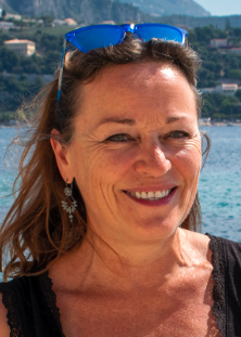 Cécile Guieu合作论文数Laboratoire d'Océanographie de Villefranche4
 Yann Leredde合作论文数4Louis Prieur合作论文数INSU/CNRS/UPMC, Laboratoire d'Océanographie de Villefranche4
 Maria-Angela Bassetti合作论文数Université de Perpignan4
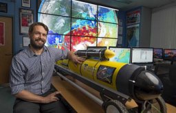 Travis N. Miles合作论文数Department of Marine, Earth & Atmospheric Sciences, North Carolina State University4Matthieu Bressac合作论文数Groupe de Recherche Inter-universitaire en limnologie (GRIL),, Université de Montréal4Roselyne Buscail合作论文数4
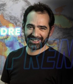 Samuel Somot合作论文数Centre National De Recherches Météorologiques4
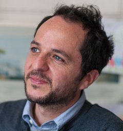 Vincent Taillandier合作论文数CNRS, Laboratoire Océanologique of Villefranche4
 Joaquín Tintoré Subirana合作论文数Sistema de Observación Y Prediccion Costero De Las Illes Balears3m higueras合作论文数3Jason Peyre合作论文数3Christophe Menniti合作论文数3Eric Palvadeau合作论文数3
 Mahrez Sadaoui合作论文数Centre de Formation et de Recherche sur les Environnements Méditerranéens, Université de Perpignan3aurelien gangloff合作论文数Serv Hydrog & Oceanog Marine SHOM3Raphaël Lagarde合作论文数3
 Gaël Simon合作论文数3
 Pierre Cauchy合作论文数College of Medical and Dental Sciences, University of Birmingham;College of Medical and Dental Sciences, University of Birmingham3




