Future ‘space-tie’ satellite missions such as Genesis aim at co-locating multiple space-geodetic techniques on a single satellite platform to improve the consistency and long-term stability of the Terrestrial Reference Frame (TRF). However, quantifying the benefits of such satellite-based co-location requires not only advanced simulation capabilities, but also a robust validation of real observation data using consistent multi-technique processing strategies. Already today, missions such as the Sentinel satellites provide an opportunity to realise satellite-based co-location by carrying multiple space-geodetic observation techniques onboard.To date, most multi-technique Precise Orbit Determination (POD) approaches rely on orbit determination approaches in which the TRF is fixed and, in the case of Global Navigation Satellite Systems (GNSS) Low Earth Orbit (LEO) POD, GNSS constellation orbits and clocks are typically held fixed as well. Consequently, cross-technique interactions and their impact on GNSS constellation orbits and clocks, LEO orbits, Earth Rotation Parameters (ERPs), and the TRF have so far not been comprehensively assessed for all space-geodetic techniques. Investigating these effects using real observations is therefore a crucial step that can already be performed prior to Genesis.In this study, we investigate an integrated multi-technique POD approach using real GNSS, Doppler Orbitography and Radiopositioning Integrated by Satellite (DORIS), and Satellite Laser Ranging (SLR) tracking data. The analysis covers the multi-technique LEO satellites Sentinel-3A, Sentinel-3B, and Sentinel-6A (MF), together with the GPS and Galileo constellations over a two-year period. Using GFZ’s in-house software EPOS-OC, LEO and GNSS constellation orbits and clocks, the TRF, and ERPs are estimated simultaneously within a single adjustment, fully consistent with respect to dynamic and geometric modelling.A stepwise integration is performed, starting from single-technique LEO POD solutions and proceeding to the integration into a combined GNSS constellation solution using GNSS observations only. DORIS and SLR observations are incrementally added to assess their impact on LEO orbits, GNSS constellation orbits and clocks, ERPs, and ground station coordinates.The results provide a real-data-driven assessment of integrated multi-technique POD for satellite-based co-location and form a basis for subsequent Genesis end-to-end simulation studies and future Genesis real-data processing.
Satellite gravimetry from the GRACE and GRACE Follow-On missions has fundamentally advanced our understanding of the global hydrological cycle. Over the past two decades, these missions have enabled robust scientific assessments of terrestrial water storage and, derived from this, groundwater storage, supporting numerous studies on droughts, floods, and long-term water availability. While the scientific maturity of GRACE-based hydrological products is well established, their systematic translation into operational climate services had yet to happen. Bridging this gap is essential to support climate adaptation and water-related decision-making across societal sectors.In this contribution, we present the operationalisation of GRACE-based hydrological science into a climate service through the introduction of a new Essential Climate Variable (ECV) Service, “Terrestrial Water Storage and Groundwater”, within the Copernicus Climate Change Service (C3S). The service delivers Climate Data Records (CDRs) for the ECV products Terrestrial Water Storage Anomalies (TWSA) and Groundwater Storage Change (GWSC), designed to meet the requirements of long-term climate monitoring and downstream applications. The datasets, together with a comprehensive Data Documentation Package following C3S standards, are already published or will be made publicly available in the coming weeks.A central challenge in transforming GRACE-based products into an operational climate service is the assessment and communication of product quality. For global, satellite-derived estimates of TWSA and GWSC, suitable in-situ reference datasets are largely unavailable, particularly at the spatial and temporal scales resolved by GRACE. We therefore developed a dedicated quality assessment framework that combines internal consistency checks, uncertainty characterisation, inter-comparison with independent models and reanalyses, and transparent documentation of limitations and fitness-for-purpose.The presentation will introduce the new C3S ECV service, describe the delivered datasets and documentation, and focus on the adopted approach to product quality assessment. By doing so, we aim to demonstrate how mature Earth observation science can be translated into an operational climate service that supports adaptation to climate variability and change, while clearly communicating uncertainties to users.
Abstract. Groundwater is one of the most important freshwater resources for ecosystems and mankind. Because of its fundamental role in the Earth's water and energy cycles, groundwater has been declared an essential climate variable by GCOS, the Global Climate Observing System. Similar to other subsurface states and fluxes, groundwater is difficult to monitor at the global scale, with sufficient spatial coverage and over climate-relevant time scales. The Global Gravity-based Groundwater Product (G3P) is a global observation-based data set of large-scale groundwater storage variations. G3P capitalizes on the unique capability of GRACE and GRACE-FO satellite gravimetry as the only remote sensing technology to monitor subsurface mass variations. In a mass balance approach, satellite-based, in situ observation-based and model-based water storage variations of snow water equivalent, root-zone soil moisture, glacier mass, and surface water storage are subtracted from GRACE/-FO terrestrial water storage anomalies to result in monthly variations of groundwater storage. For this combination, the individual compartmental storage data are spatially filtered to be consistent with the spatial resolution of terrestrial water storage from satellite gravimetry. The G3P data set presented here covers the period 2002 to 2023 with monthly resolution on a 0.5° global grid and includes propagated uncertainty information. We describe the details of the G3P data processing chain and of each contributing data stream, provide examples of spatial and temporal groundwater storage variations represented by the G3P data set, and present exemplary evaluation results against in situ groundwater observations for three large aquifer systems. G3P is a prototype for an operational global groundwater service, under development as a cross-cutting extension of the existing portfolio of the Copernicus Climate Change Service C3S. The G3P data set is available via GFZ Data Services at https://doi.org/10.5880/G3P.2024.001 (Güntner et al., 2024).
Accurately quantifying global mass changes at the Earth's surface is essential for understanding climate system dynamics and their evolution. Satellite gravimetry, as realized with the Gravity Recovery and Climate Experiment (GRACE) and GRACE Follow-On (GRACE-FO) missions, is the only currently operative remote sensing technique that can track large-scale mass variations, making it a unique monitoring opportunity for various geoscientific disciplines. To facilitate easy accessibility of GRACE and GRACE-FO (GRACE/-FO in the following) results (also beyond the geodetic community), the Helmholtz Centre for Geosciences (GFZ) developed the Gravity Information Service (GravIS) portal (https://gravis.gfz.de, last access: 21 January 2025). This work aims to introduce the user-friendly mass anomaly products provided at GravIS that are specifically processed for hydrology, glaciology, and oceanography applications. These mass change data, available in both a gridded representation and as time series for predefined regions, are routinely updated when new monthly GRACE/-FO gravity field models become available. The associated GravIS web portal visualizes and describes the products, demonstrating their usefulness for various studies and applications in the geosciences. Together with GFZ's complementary information portal https://www.globalwaterstorage.info/ (last access: 21 January 2025), GravIS supports widening the dissemination of knowledge about satellite gravimetry in science and society and highlights the significance and contributions of the GRACE/-FO missions for understanding changes in the climate system. The GravIS products, divided into several data sets corresponding to their specific application, are available at https://doi.org/10.5880/GFZ.GRAVIS_06_L2B (Dahle and Murböck, 2019), https://doi.org/10.5880/COST-G.GRAVIS_01_L2B (Dahle and Murböck, 2020), https://doi.org/10.5880/GFZ.GRAVIS_06_L3_ICE (Sasgen et al., 2019), https://doi.org/10.5880/COST-G.GRAVIS.5880/GFZ.GRAVIS_01_L3_ICE (Sasgen et al., 2020), https://doi.org/10.5880/GFZ.GRAVIS_06_L3_TWS (Boergens et al., 2019), https://doi.org/10.5880/COST-G.GRAVIS_01_L3_TWS (Boergens et al., 2020a), https://doi.org/10.5880/GFZ.GRAVIS_06_L3_OBP (Dobslaw et al., 2019), and https://doi.org/10.5880/COST-G.GRAVIS_01_L3_OBP (Dobslaw et al., 2020a).
The central hypothesis of the Research Unit (RU) New Refined Observations of Climate Change from Spaceborne Gravity Missions (NEROGRAV), funded for the second three-year phase by the German Research Foundation DFG, reads: only by concurrently improving and better understanding of sensor data, background models, and processing strategies of satellite gravimetry, the resolution, accuracy, and long-term consistency of mass transport series from satellite gravimetry can be significantly increased; and only in that case, the potential of future technological sensor developments can be fully exploited.In continuation of the first RU phase, the individual project Improved Stochastic Modeling in GRACE/GRACE-FO Real Data Processing (ISTORE-2) aims to complete the optimized stochastic modeling for GRACE and GRACE-FO gravity field determination. This includes stochastic modeling of the non-tidal atmospheric and oceanic dealiasing (AOD) models which were recently implemented into the GRACE/GRACE-FO Level-2 processing at the GFZ Helmholtz Centre for Geosciences. In this context, we co-estimate AOD model coefficients using AOD error variance-covariance matrices in terms of constraint matrices.This presentation provides an overview of the main processing steps together with AOD error analyses. In particular, we investigate the impact of taking into account not only static but also temporal correlations of the AOD models with different maximum temporal correlation lengths. Results are presented in terms of gravity field solutions in the spectral and spatial domain.
The GRACE Follow-On satellite mission, a partnership between NASA (US) and GFZ (Germany), successfully completed its nominal five-year prime mission phase in May 2023, and has already entered its extended mission phase. GRACE-FO continues the unique essential climate data record of mass change in the Earth system initiated in 2002 by the GRACE mission (2002-2017). The combined GRACE & GRACE-FO data records now span over 22 years and provide foundational observations of monthly to decadal global mass changes and transports in the Earth system derived from temporal variations in the Earth’s gravity field. These observations have become indispensable for climate-related studies that enable process understanding of the evolving global water cycle, including ocean dynamics, polar ice mass changes, and near-surface and global ground water changes.In this presentation, we will present recent GRACE/GRACE-FO science and applications highlights, review key data processing and calibration approaches for GRACE-FO and lessons learned during the recent years, and discuss the GRACE-FO mission plan to operate and collect high-quality science data through the intensifying solar cycle 25, aiming for continuity with the upcoming NASA/DLR Continuation mission GRACE-C, targeted to launch in 2028.
Errors in ocean tide and non-tidal atmospheric and oceanic models are among the largest error sources in gravity field recovery from space. We co-estimate corrections to these background models subject to uncertainty constraints during the adjustment procedure of gravity field spherical harmonic coefficients. Simulations are performed for the Mass-Change and Geoscience International Constellation to evaluate the effect of such a constrained procedure on monthly gravity field retrievals for the planned ESA-NASA double-pair mission. The influence of co-estimating background model corrections subject to known uncertainty information is evaluated separately for both types of background models and is then combined and used to retrieve monthly gravity fields over one year. Retrieval errors are compared to those obtained with the standard recovery procedure, which neglects these corrections. It is shown that gravity field retrieval errors are reduced by up to 36%. In addition, the one-year simulation is used to estimate residual corrections for eight major tidal constituents in order to improve ocean tide background modelling. Adding these residual corrections to the applied a priori ocean tide model shows that ocean tide errors are decreased by up to 27%.
Dedicated satellite gravity missions orbiting the Earth at very low altitudes have greatly improved our knowledge about mass transport processes. That includes the terrestrial water cycle, ice sheet and glacier dynamics, ocean mass variability, and changes deep within the solid Earth, like the adjustment in the upper mantle in response to massive deglaciations since the last ice age. Initiated with the original GRACE (Gravity Recovery and Climate Experiment) mission launched in 2002, the record of monthly gravity fields now spans 22 years and is still being extended by GRACE-FO which has been in orbit since 2018. To enhance the visibility of the missions within society and to inform about the various contributions of GRACE/GRACE-FO to various scientific fields, GFZ is maintaining a new knowledge portal accessible via www.globalwaterstorage.info.On the one hand, this new portal provides overview information on satellite technology, various geophysical applications, and the numerous industrial and scientific partners who were vital for the success of the GRACE/GRACE-FO missions with the specific aim of informing European stakeholders. On the other hand, we also work towards developing the portal into a publicity channel for the gravimetry community to highlight recent developments towards future satellite missions or new research insights based on mission data. International colleagues interested in advertising their latest achievements through a blog post (ca. 5000 characters) in the knowledge portal are kindly invited to contact globalwaterstorage@gfz-potsdam.de.
In 2019 the Combination Service for Time-variable Gravity fields (COST-G) started its operation with the first release of combined monthly GRACE gravity field models. Meanwhile almost five years have passed, while new experience was gained with the operational combination of the monthly gravity field models of the successor mission GRACE-FO, which has triggered a review of the weighting scheme and consequently a second release of GRACE-FO models in 2023. Moreover, the COST-G consortium has been in close cooperation with new GRACE/GRACE-FO analysis centers from China since spring 2020, which recently provided time-series of unconstrained models, covering the whole GRACE period, as it is requested by the COST-G processing standards. After careful evaluation of all individual time-series the whole GRACE time-series has now been recombined based on the new weighting scheme and also taking into account the contributions of the new COST-G analysis centers APM-SYSU, HUST, SUSTech and Tongji. We present the COST-G GRACE RL02 and also show latest results of the operational GRACE-FO combination.
NASA and DLR will launch in 2028 GRACE-C (Gravity Recovery and Climate Experiment – Continuation). This mission will again be launched into a polar orbit at 500 km initial altitude and extend the observation of the time-variable Earth’s gravity field from GRACE (2002-2017) and GRACE-FO (GRACE Follow-On, 2018-today). ESA plans to launch a Next Generation Gravity Mission (NGGM) in 2032, which shall fly in a lower and inclined orbit and be based on improved instrumentation. GRACE-C and NGGM will then form the double-pair Mass-Change and Geosciences International Constellation (MAGIC) to significantly increase the spatial and temporal resolution of mass transport products and deduce water mass redistribution over the oceans, ice sheets and continents. Thanks to the 20+ years period of GRACE and GRACE-FO observations, scientists are able to analyse extreme hydrological events, such as flooding and droughts. However, due to the rather coarse spatial resolution of the GRACE and GRACE-FO data sets of approximately 350 km, finer spatial details of such extreme events are kept hidden. Further, spatial leakage limits the value of these data for smaller-scale regional investigations. In this contribution, we will employ five years of simulated data for both a single polar pair (GRACE-FO-like) and a MAGIC baseline scenario. Thanks to the simulation, we can also assess the true values of the hydrological input models. Both simulated data sets are filtered with the same DDK filters for comparison. The filter strength can be reduced for the MAGIC baseline scenario without introducing more striping errors. With these simulated data sets, we investigate extreme hydrological events. For example, the localisation of extreme wet events along the northern coast of Australia is much improved, with less signal leakage into the surrounding ocean.
As part of the Science Data System, the GFZ Helmholtz Centre for Geosciences is one of the official GRACE/GRACE-FO Level-2 processing centers which routinely provide monthly gravity field models. These models are used by a wide range of geoscientists to infer mass changes at the Earth’s surface to study climate-related phenomena. Currently, GFZ´s operationally processed monthly gravity fields are still based on release 6 (RL06) standards. The distribution of a reprocessed and improved RL07 time series is planned for fall 2025. Most of the improvements have been developed within the Research Unit “New Refined Observations of Climate Change from Spaceborne Gravity Missions” (NEROGRAV) funded by the German Research Foundation DFG.The main focus of the new release is on optimized stochastic modeling during the Level-2 processing. This includes the extension of the stochastic instrument error models, the optimization of the combination of the different observations, and the inclusion of tidal and temporally changing non-tidal background model error variance-covariance matrices in the adjustment process.We present an overview of the expected performance of our upcoming RL07 gravity field time series compared to the current RL06 time series. Improvements stemming from the applied advanced processing strategy become visible in terms of a reduced noise level, as well as more realistic formal errors.
ICGEM is one of the five services coordinated by the International Gravity Field Service (IGFS) of the International Association of Geodesy (IAG). The service has been actively responding to the needs of the scientific community for the last two decades with an archive of static, temporal, and topographic global gravity field models of the Earth in a standardized format with the possibility to assign DOIs. Furthermore, ICGEM provides interactive calculation and visualisation services of gravity field functionals. Maintenance of such a service and development of new “demand-based” tools are of utmost importance to provide state-of-the-art products.In 2016, the ICGEM portal has been renewed to guarantee a smooth transition to future needs. Since then, the last remaining component of the previous ICGEM portal, the G3 Browser, has been upgraded and integrated into the present ICGEM portal. The G3 Browser (http://icgem.gfz-potsdam.de/g3) aims to compute time series of equivalent water height interactively and gives users the opportunity to compare different gravity model time series as well as impacts of corrections (e.g., GIA, C20) or filters. The G3 Browser is complementary to existing services such as GFZ’s GravIS portal which provides ready-to-use products based on GFZ and COST-G solutions with already applied corrections and filters. On the other hand, the ICGEM G3 Browser includes time series from further processing centres and institutions and different filtering options.Recently, ICGEM has included simulated models (http://icgem.gfz-potsdam.de/sl/simulated) in its archive that are relevant to future gravity mission studies. Currently available simulated Level 2a models are from the ESA’s MAGIC simulation studies and they are the first of their kind on the ICGEM Service. Monthly and weekly series of different scenarios have been made available on the relevant pages together with the links to the publications provided by the authors.As demanded by the users, ICGEM plans to include some practical tools in the service, such as comparison of the functionals computed based on two different models and interactive evaluation tools n spatial and spectral domains. Finally, a new project called SAMDAT (Service and Archive for Mass Distribution And mass Transport data) that is funded by the German Research Foundation will be realized during the next three years which aims to expand the ICGEM service based on FAIR (Findable, Accessible, Interoperable, Reusable) data and a sustainable data archive principles.
The Combination Service for Time-variable Gravity fields (COST-G) of the IAG looks back at an eventful and very successful year. The operational combination of the monthly GRACE-FO gravity fields now comprises eight analysis centers, providing high-quality solutions with short latency on a regular basis. When the new release 06.3 of the GRACE-FO Science Data System (SDS) time-series became available in September 2024, COST-G generated test combinations and could confirm the quality gain compared to the former release 06.2. Meanwhile, release 06.3 is routinely incorporated in the operational combination.The number of analysis centers providing complete time-series of monthly gravity fields of the GRACE mission to COST-G has more than doubled compared to the original COST-G GRACE RL01, published in 2019. The current COST-G GRACE RL02 is aweighted combination of 11 time-series, where the weighting scheme was adapted to be consistent with the operational GRACE-FO combination. The quality gain of the new combination is most pronounced during the early and late GRACE mission period, when data quality issues and environmental conditions were challenging.
GFZ has performed various full-scale simulations within the ESA NGGM/MAGIC Science Support Study, including instrument noise and background model error assumptions. The focus was set on developing and applying extended parameterization techniques for improved de-aliasing of short-term mass variations. The impact of using model uncertainties was investigated for ocean tide and non-tidal atmospheric and oceanic background models. As part of the DFG Research Unit NEROGRAV covariances of model uncertainties were computed and during gravity field retrieval model corrections were co-estimated using this prior covariance information. In principle, model errors are absorbed by the additional co-estimated parameters, and gravity field estimation is thereby improved. First, simulations with only ocean tide errors and only non-tidal background model errors were performed separately for one month to assess the error reduction obtained for each. Finally, ocean tide and non-tidal errors were included together in a full noise simulation and compared to the processing strategy that did not include co-estimation of background model errors. The novel optimized method was then also applied for monthly gravity field retrieval over one year, showing improvements for each month. The estimated residual ocean tides from this 1-year simulation were then used to calculate an improved ocean tide model optimized for gravity field recovery. In addition, monthly solutions, obtained with co-estimation of background model errors, have been calculated for the inclined pair alone using regularization for the not-covered polar regions and compared to double pair solutions for latitudes lower than +/- 70 degrees.
The German Research Centre for Geosciences (GFZ), together with the Alfred-Wegener-Institute (AWI) and the Technische Universität Dresden, maintains the ‘Gravity Information Service’ portal (GravIS, gravis.gfz-potsdam.de). GravIS facilitates the dissemination of user-friendly data of mass variations in the Earth system, based on observations of the US-German satellite missions GRACE (Gravity Recovery and Climate Experiment, 2002-2017) and its successor GRACE-FO (GRACE Follow-On, since 2018). The portal provides ocean bottom pressure (OBP) data on a global 1° grid. Two versions of the product are provided, based on spherical harmonic coefficients taken from either the most recent GRACE/GRACE-FO release from GFZ or from the International Combination Service for Time-variable Gravity Fields (COST-G). Corrections applied to the data include the insertion of estimates of the geocentre motion, replacement of the C20 and C30 coefficients, corrections of the co- and postseismic deformations after the three megathrust earthquakes (Sumatra-Andaman 2004, Chile 2010, Japan-Tohoku 2011), and the correction for glacial isostatic adjustment with the ICE-6G model. The data product consists of barystatic sea-level pressures calculated from the gravity data using the sea-level equation. Residual ocean circulation is provided as well. Besides the gridded products, regional average time series are also available for predefined ocean regions. In addition to the OBP data, GravIS provides terrestrial water storage (TWS) variations over the continents and ice mass variations over Greenland and Antarctica. These data sets are also provided either as grids or regional averages. The data sets of all Earth system domains can be interactively displayed within the portal and are freely available for download. This contribution aims to show the features of the GravIS portal and its potential benefit to sea-level and ocean science applications.
Being part of the GRACE/GRACE-FO Science Data System, the GFZ German Research Centre for Geosciences is one of the official Level-2 processing centers routinely providing monthly gravity field models. These models are used by a wide variety of geoscientists to infer mass changes mainly at the Earth’s surface. Currently, the operationally processed monthly gravity fields are still based on release 6 (RL06) standards, but developments in view of a reprocessed and improved GFZ RL07 time series are already ongoing. Most of these improvements have been developed within the Research Unit “New Refined Observations of Climate Change from Spaceborne Gravity Missions” (NEROGRAV) funded by the German Research Foundation DFG. After a successful first phase, the second three years phase of NEROGRAV has started last year. At present, we primarily work towards the completion of an optimized stochastic modeling for GRACE and GRACE-FO gravity field determination. This includes the extension of the stochastic instrument error models, the optimization of the combination of the different observations, and the inclusion of tidal and temporally changing non-tidal background model error variance-covariance matrices in the adjustment process. This presentation provides an overview of the main outcomes of these advanced processing strategies. We discuss details on stochastic modeling of non-tidal atmospheric-oceanic background models including the assessment of temporal correlations and will present preliminary RL07 Level-2 results in the spectral and spatial domain in comparison with the standard GFZ GRACE/GRACE-FO RL06 time series.
The Global Gravity-based Groundwater Product (G3P) has evolved with a new version (V1.12), bringing substantial enhancements to our satellite-based groundwater storage anomaly dataset—a prototype for a future product within the EU Copernicus Climate Change Service. Groundwater as the world's largest distributed freshwater storage, is a vital resource for human, industrial, and agricultural needs. Despite its significance, Copernicus lacks a service delivering operational, observation-based, and globally comprehensive data on changing groundwater resources. G3P could serve as a pivotal extension to the Copernicus portfolio. Leveraging the unique capabilities of GRACE and GRACE-FO satellite gravimetry, G3P monitors subsurface mass variations employing a mass balance approach. This involves subtracting the satellite-based and partly model-based water storage compartments (WSCs) snow water equivalent, root-zone soil moisture, glacier mass and surface water storage from GRACE/GRACE-FO monthly terrestrial water storage anomalies (TWSA). Ensuring a consistent subtraction of individual WSCs from GRACE-TWSA involves filtering them similarly to GRACE-TWSA, using filters whose type and parametrization had to be derived by spatial correlation analyses. The G3P dataset spans more than two decades (from 2002 to 2023) with a monthly resolution and global coverage at 0.5-degree spatial resolution. Notable updates in V1.12 compared to previous versions include an extended data time period until September 2023, modifications of the methodology of several WSCs, and the incorporation of new evaluation results. This study has received funding from the European Union’s Horizon 2020 research and innovation programme for G3P (Global Gravity-based Groundwater Product) under grant agreement nº 870353.
Non‐tidal ocean loading (NTOL) signals are known to be a significant source of geophysically induced noise in gravimetric and geodetic observations also far‐away from the coast and especially during extreme events such as storm surges. Operationally available corrections suffer from a low temporal and spatial resolution and reveal too small amplitudes on continental stations. Dedicated high‐resolution sea‐level modeling of the North and Baltic Sea provides an improved prediction of NTOL signals. Superconducting gravimeter and Global Navigation Satellite Systems observations on the small offshore island of Heligoland in the North Sea are used for an evaluation of the model values revealing largely increased correlations of up to 0.9 and signal reductions of up to 50% during a storm surge period of one month in January and February 2022. Evaluations on additional continental superconducting gravimeter stations also show significant improvements through the recommended high‐resolution modeling for improved signal separation further away from the coast.
The main observations to recover monthly gravity fields from the GRACE-FO mission are provided by two different and independent instruments, which are the K-band ranging (KBR) instrument and the Laser Ranging Interferometer (LRI). From general perspective, both instruments should measure the same gravitational signals and lead to a similar recovery of monthly gravity fields.Official Level-1B products for KBR and LRI are provided by the GRACE-FO Science Data System (SDS) and are processed at NASA’s Jet Propulsion Laboratory (JPL). For LRI, alternative Level-1B products are also provided by the Albert-Einstein-Institute (AEI). The German Research Centre for Geosciences (GFZ) processed monthly gravity field solutions using the different Level-1B data sets mentioned before to assess the quality of these solutions and identify possible differences caused by the different Level-1B products. In view of the upcoming reprocessing of an improved GFZ release 7 (RL07) time series, the processing method was already adapted compared to the current GFZ RL06 standards, e.g., by an optimized stochastic modelling of instrument errors for KBR/LRI, GPS and accelerometer observations.In this presentation, comparisons between GFZ RL06 KBR solutions and improved GFZ preliminary RL07 KBR and LRI (using different LRI data sets) solutions are made in the spatial and frequency domain, and conclusions are driven in terms of quality and quantity.
The Research Unit (RU) New Refined Observations of Climate Change from Spaceborne Gravity Missions (NEROGRAV) aims at improving the understanding and providing new information about sensor data, background models and the processing strategies for the GRACE and GRACE-FO data. The achieved improvements in the standard GRACE data processing create a possibility for improvements in the computation of gravity fields with a high temporal resolution. In the current contribution we focus on the studying the potential of daily gravity filed solutions obtained by Kalman filtering. We use in particular the NEROGRAV results on stochastic modeling of the observations and background models used in the GRACE data processing, as well as the provided stochastic information on the geophysical processes governing the variations of the gravity field on sub-monthly time scales. While the standard GRACE gravity field solutions are obtained using one month of observational data, there are on-going attempts to obtain high-quality gravity fields with a higher temporal resolution. Unlike the monthly solutions, which are computed fully independent of each other, the computation of the daily gravity fields requires taking into account the temporal correlations between the subsequent solutions. The assessment of this timely correlation is based on the knowledge of the stochastic properties of the underlying geophysical processes. In this contribution we study how the daily Kalman solutions are influenced by the stochastic information on the two main geophysical processes causing high-frequency variations in the gravity field: non-tidal atmospheric and oceanic variations and hydrology. We present results for daily gravity field solutions for several test months in the spectral and spatial domain.
 Christoph Dahle合作论文数92
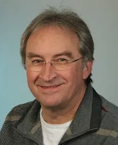 Rolf König合作论文数GFZ German Research Centre for Geosciences, Helmholtz Centre Potsdam48Henryk Dobslaw合作论文数42
 Jürgen Kusche合作论文数Institute of Geodesy and Geoinformation, University of Bonn41
 Christoph Foerste合作论文数GFZ German Research Centre for Geosciences, Helmholtz Centre Potsdam39Hans Neumayer合作论文数38
 Ulrich Meyer合作论文数36Torsten Mayer-Gürr合作论文数36Franz Barthelmes合作论文数32
 Eva Boergens合作论文数Department 1:, Helmholtz Center Potsdam ‐ GFZ German Research Centre for Geosciences27
 Roelof Rietbroek合作论文数Institute for Geodesy and Geo-information, University of Bonn26Adrian Jäggi合作论文数Astronomisches Institut, Philosophisch-Natur-Wissenschaftliche Fakultät, Universität Bern26R. Schmidt合作论文数25Andreas Güntner合作论文数24
 Michael Murbock合作论文数23Andreas Kvas合作论文数Graz University of Technology Institute of Geodesy Graz23
 Elisa Fagiolini合作论文数23
 Jens Schroter合作论文数23Sandraesther Brunnabend合作论文数23
 Srinivas V. Bettadpur合作论文数Department of Aerospace Engineering and Engineering Mechanics, Cockrell School of Engineering, University of Texas at Austin22
 Jean-Michel Lemoine合作论文数21Sean Bruinsma合作论文数Centre National d’Etudes Spatiales20
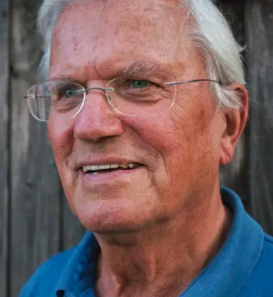 Christoph Reigber合作论文数Institut für Geowissenschaften, Universität Potsdam19
 Jakob Flury合作论文数Institut für Astronomische und Physikalische Geodäsie, TU München17C. Dahle合作论文数16Markus Hauk合作论文数16Stéphane Bourgogne合作论文数15Lieselotte Zenner合作论文数14
 Jens Wickert合作论文数Berlin Institute of Technology;GFZ German Research Centre for Geosciences14
 Josefine Wilms合作论文数Department of Applied Mathematics, University of Stellenbosch14ch dahle合作论文数13Panafidina Natalia合作论文数13
 Markus Rothacher合作论文数Eidgenössische Technische Hochschule Zürich13Andreas Groh合作论文数13Martin Lasser合作论文数12E. Sinem Ince合作论文数Department 1: Geodesy, German Research Centre for Geosciences12H. Neumayer合作论文数12
 Himanshu Save合作论文数Center for Space Research, The University of Texas at Austin12
 Annette Eicker合作论文数HafenCity University Hamburg12Richard Biancale合作论文数12h k neumayer合作论文数11thomas trautmann合作论文数11Susanne Glaser合作论文数11
 C. Gruber合作论文数11
 Matthias Weigelt合作论文数Neurocognition and Action Research Group and Center of Excellence “Cognitive Interaction Technology” (CITEC),, Bielefeld University11
 Felix Landerer合作论文数Jet Propulsion Laboratory, California Institute of Technology11
 Harald Schuh合作论文数Deutsches GeoForschungsZentrum (GFZ)(GeoForschungsZentrum Potsdam),Potsdam,Germany11
 Gottfried Schwarz合作论文数11J. C. Raimondo合作论文数11




