The goal of the presented pilot project is the creation of a modular interactive online and offline interface on CD which can be used between schools, various information sources and the science community, i.e. actual, new research results should be made available for students from elementary schools to high schools in an uncomplicated – school and age specific – form. At the beginning this interface will be realised using as an example the existing knowledge about the Earth atmosphere followed by other topics like (drinking) water, energy, soil, and raw material etc. The interactive, interface concept “ADLATUS for schools", which is a further development of the scientific DUST-2 CD, however, complements and interrelates for the first time this information with a so called “local, school specific" part – about 20% of the CD storage space will be reserved for that – to be generated according to the “individual" school and environmental conditions in special co-operative teaching and learning teams. For the selected topic the ADLATUS CD will contain global and regional background information, examples for time series data, links, and software (freeware and shareware), especially for an interactive graphic representation of the information. The CD should be updated at least every second year. It will document the results of a direct dynamic interrelationship between the geo-science community, elementary schools and other school types. It will be beneficial for the future of both and other science domains that will follow.Ziel des hier vorgeschlagenen Pilotprojekts ist die Erstellung einer modular aufgebauten interaktiven online und offline Schnittstelle (Interface) auf CD, die Schulen mit verschiedenen Informationsquellen und der Wissenschaftsgemeinschaft verbinden kann und so aktuelle wissenschaftliche Forschungsergebnisse den Schülern von der Grundschule bis hin zum Gymnasium in möglichst einfacher, verständlicher und altersgemäßer Form vermittelt. Dieses Interface soll in einer ersten Stufe am Beispiel unseres Wissens über die Erdatmosphäre realisiert werden, gefolgt von den Themen (Trink)Wasser, Energie, Boden und Rohstoffe. Das interaktive Interface-Konzept “ADLATUS f¨ur Schulen", eine Weiterentwicklung der DUST-2 CD - vorwiegend für die Wissenschaftsgemeinde gedacht – ergänzt und verknüpft zum ersten Mal diese Informationen mit einem “schulspezifischen Lokalteil", für den etwa 20% des CD Speicherplatzes vorgesehen werden, und der von den einzelnen Schulen lehrplanspezifisch, lehrerspezifisch und ortspezifisch in Lehr- und Lernteams selbst “erzeugt" werden soll. Die ADLATUS CD wird zu dem ausgewählten Thema globale und regionale Hintergrundinformationen, Zeitreihendaten, Links, und Software (Shareware oder Freeware) enthalten, insbesondere zur interaktiven graphischen Darstellung der Informationen. Sie soll spätestens alle zwei Jahre auf den neuesten Stand gebracht werden. Sie wird die Ergebnisse einer direkten, dynamischen Wechselwirkung zwischen der Geo-Wissenschaftsgemeinschaft, den Grundschulen und anderen Schultypen dokumentieren und für die Zukunft beider nützlich sein – ebenso für die anderen nachfolgenden Wissenschafts- und Technikbereiche.
Abstract. Since November 1993 up to present from Benegas Station, Mendoza, Argentina (site of IEMA Institute) and from high locations in the Andes region, ground based radiometric measurements of stratospheric ozone and tropospheric water vapor have been achieved. Ozone measurements are performed by using a radiometer-spectrometer tuned at 142 GHz and tropospheric water vapor by means of a 92 GHz radiometer. In this paper two case studies of large stratospheric ozone variations due to dynamical processes will be presented. These processes are very likely associated to gravity waves, generated by airflow over the Andes Mountains, or due to Zonda wind effect.
The results of a realistic simulation study in investigating the joint retrieval using measured temperature and water vapour data from the Space Shuttle based Millimeter wave Atmospheric Sounder (MAS) and from a GRAS (GPS/ GLONASS receiver) sensor are presented. It seems highly worthwhile — because of the very impressive results — to place a MAS Follow-on sensor together with a GRAS sensor on the EXPRESS Pallet of the International Space Station (ISS). It is a role model of synergetic use of sensors in the best sense. An international feasibility study shows that this is technically feasible.
Water is the only substance that occurs not only in all three phases, gaseous, fluid, and solid in the Earth's atmosphere but also in transitions between them like in its “polymer forms” - clusters, clathrates, aerosols. Although the importance of the solid and fluid forms is popularly understood, there is less general understanding of the role of water vapor and especially for its polymer forms than for example, of carbon dioxide (C02) or ozone (03). The spatial and temporal distributions of the various phases of water in the atmosphere are in fact very important factors to climate, weather, the biosphere, the homogeneous and inhomogeneous chemistry of the atmosphere, as well as to the propagation of electromagnetic waves used in transatmospheric (global) navigation and communication systems and for relevant remote sensing measurements. In this context the atmosphere acts like a temporal and spatial variable, frequency dependent filter. Despite the fact that above the tropopause, i.e. in the stratosphere and mesosphere, there is less than 0.1 % of the total water vapor content of the Earth's atmosphere its influence is very significant for the physics and chemistry of the upper atmosphere and hence for the climate. The question is discussed: How variable is the total hydrogen budget of the Earth's atmosphere with time?
Space Weather effects influence the atmosphere of the Earth, among others stratospheric ozone. One other region of the upper atmosphere which shows very strong Space Weather dependence is the ionosphere. It is a very important region because it affects satellite communication and navigation. On the other hand the ionization is a good tracer and indicator for various Space Weather influences. In this respect the ionosphere has no predictive capabilities and cannot support early warning but it provides one link between the sun, the solar wind, the magnetosphere and the neutral atmosphere. Solar EUV induced inospheric effects are coupled to solar radiation related events in the neutral atmosphere and therefore ionospheric effects give some qualitative hints at possible effects on stratospheric ozone. Ionospheric Space Weather effects can be observed continously from the ground by means of propagation effects on radio waves. Electron content (TEC) is a very important descriptive quantity for the ionosphere of the Earth. TEC is gained by means of “propagation effects” which are observed on received radio signals which are transmitted from artificial satellites. TEC data have been collected in Europe systematically and on a longterm basis since 1965. The data are used to investigate “geophysical events”, e.g., the Space Weather related (magnetic) storm effects. They are also used to formulate empirical models which describe the large scale and longterm behaviour of average TEC data, usually of monthly medians. We show examples for “instantaneous” TEC data, for a monthly median TEC model and for TEC maps produced on a regular basis for application purposes.
This paper discusses the validation of measurements of O3 distribution in the Earth's atmosphere made by the Millimeter‐wave Atmospheric Sounder (MAS), a component of NASA's ATLAS spacelab shuttle package. Measurements of 184 GHz O3 emission from the Earth's limb at tangent altitudes between 20 and 80 km were made with a 50 channel radiometer having a spectral resolution of 200 KHz. In three missions the emissions of O3, H2O, ClO, and O2 were measured between 70°S and 70°N latitudes. O3 mixing ratio calculations and error analysis were performed with the Rodgers optimal estimation method. Data binned in 128 s batches yield mixing ratio profiles with an altitude resolution of 7 km at the O3 peak and an estimated accuracy of 5%. Additional retrievals made with all data from each mission binned in 5° latitude zones yield mixing ratios with about 5 km altitude resolution and somewhat improved accuracy. Comparisons with coincident measurements from other space platforms indicate a general agreement within approximately 5%. The data are publicly available through the German Remote Sensing Data Center.
Opportunities to use the Global Positioning System (GPS) for ionospheric total electron content (TEC) research are reviewed. The era of TEC measurements using very high frequency geosynchronous beacons is essentially over, and the new GPS TECs need to be treated in special ways if they are to augment the existing database of total electron content. Data taken at Boulder, Colorado, show that with appropriate smoothing, GPS TECs can be used to extend the existing database. The time delay data from the International GPS Geodynamics Service over central Europe are used to map the total electron content and reveal regional structures. Global electron‐density profiles can now be measured using the GPS/MET (meteorology) system. The measurement of precipitable water vapor in the troposphere to an accuracy of 10% requires that 99.9% of the ionospheric delay be removed.
Ozone profile measurements were made by three instruments, ATMOS, MAS, and SSBUV, using distinctly different observing techniques, as part of the ATLAS Space Shuttle missions in March 1992, April 1993, and November 1994. ATMOS makes solar-occultation observations of infrared spectra using a Fourier transform interferometer. MAS uses a limb-scanning antenna to measure emission spectra at millimeter wavelengths. SSBUV is a nadir-viewing instrument measuring the transmission of scattered solar ultraviolet radiation modified by ozone absorption. A sample of zonal-mean mixing ratio profiles indicates that these three ATLAS instruments generally agree to within 10%, although a few potential biases have been noted. There are significant differences in the character of the agreement between ATLAS 1 and ATLAS 2 which will require further study.
We present measurements of the latitudinal variation of nighttime O3 and H2O in the mesosphere and (for O3) lower thermosphere obtained with the Millimeter‐wave Atmospheric Sounder (MAS) instrument during the ATLAS 2 mission (8–15 April 1993). These are the first such measurements that have ever been reported. They indicate an O3 mixing ratio minimum at mid‐latitudes in the upper mesosphere, with maxima in the tropics and at high latitudes. The H2O retrievals indicate H2O mixing ratios decreasing toward the poles in both hemispheres in the upper mesosphere. We also present measurements of the diurnal variation of O3 at southern mid‐latitudes, at higher vertical resolution than has ever been reported previously. The results are generally consistent with previous measurements and modeling studies.
The Millimeter-Wave Atmospheric Sounder (MAS) is a shuttle-based limb-sounding instrument designed for global spectroscopic studies of O-3, and constituents important in O-3 photochemistry, in the middle atmosphere. It is part of the NASA's Atmospheric Laboratory for Applications and Science (ATLAS) spacelab shuttle mission. This paper presents an overview of the instrument, operation, and data analysis. In addition, as an example of the results, we present zonal average retrievals for O-3, H2O, and ClO obtained in ATLAS 1. The MAS O-3 and H2O measurements are shown to agree well with simultaneous observations made with the UARS MLS instrument.
 R. Leitinger合作论文数48w degenhardt合作论文数26E. Putz合作论文数16
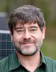 Paul Hartogh合作论文数Abteilung für Planetenwissenschaften, Max-Planck-Institut für Sonnensystemforschung13M. L. Richards合作论文数9
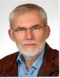 Norbert Jakowski合作论文数DLR, Institute of Communications and Navigation, Kalkhorstweg 53, 17235 Neustrelitz, Germany7A. Hedberg合作论文数7Walter Dieminger合作论文数6C. Jarchow合作论文数6E. Feichter合作论文数6
 R. M. Bevilacqua合作论文数6C. P. Aellig合作论文数6J. J. Olivero合作论文数5
 W. Boogaerts合作论文数5Niklaus Kämpfer合作论文数5j r manzano合作论文数4h g kugland合作论文数4k kunzi合作论文数4Kirk W Davies合作论文数4
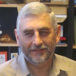 S. Enrique Puliafito合作论文数Universidad Tecnológica Nacional;Grupo de EstudioS Atmosféricos Ambientales, GEAA;GEAA, Universidad Tecnológica Nacional4J. Oksman合作论文数4G. Umlauft合作论文数4M. Daehler合作论文数4V. H. Ríos合作论文数4E Lobsiger合作论文数4r maderbacher合作论文数3antti tauriainen合作论文数3R. Zwick合作论文数3F.-J. Lohmar合作论文数3Julia Ramsauer合作论文数3Charles L. Croskey合作论文数3
 Gottfried Kirchengast合作论文数Institute for Geophysics;University of Graz;Institute for Geophysics, University of Graz3K. F. Künzi合作论文数2k f kuenzi合作论文数2C Puliafito合作论文数2A. Berg合作论文数2K Davies合作论文数2Li Song合作论文数2Hans J Liebe合作论文数2H. Heinrichs合作论文数2
 Sandro Radicella合作论文数The Abdus Salam International Centre for Theoretical Physics2D. L. Kriebel合作论文数2J. Langen合作论文数2K. E. Wolff合作论文数2Ch. Jarchow合作论文数2George a Hufford合作论文数2W. B. Waltman合作论文数2M. G. Cotton合作论文数2Pal Bencze合作论文数2




