Understanding how Quaternary climate shifts shaped fluvial systems through cycles of aggradation and incision is a central theme in fluvial geomorphology. A widely observed pattern is that wetter climatic phases enhance flood discharge and transport capacity, driving valley incision. Whether this relationship is reversed in sedimentrich, semi-arid environments, however, has remained poorly constrained by direct quantitative evidence. Here we present the first quantitative reconstructions of peak flood paleodischarges from the Late Pleistocene Inaoue`ne valley, northern Morocco. Our results show that minimum peak flood discharges during Last Glacial Maximum aggradation were at least 8487 +/- 1128 m3/s, exceeding those of the subsequent incisional phase (>= 1950 +/- 181 m3/s) by more than four times and the maximum modern recorded flood by over 6.5 times. These findings demonstrate a sediment-supply-dominated regime, where abundant clast production from hillslopes overwhelmed even extreme floods and drove valley-wide aggradation. Incision, in turn, occurred under conditions of much lower discharge and reduced sediment input. This study provides direct, quantitative evidence linking abrupt Lateglacial climate transitions to flood-driven landscape evolution in a semi-arid Mediterranean environment.
Terrestrial ecosystems are one of the Earth's largest active carbon reservoirs and hold three times more carbon than the atmosphere. However, their sensitivity and response to global climate change remain debated and may be dependent on multiple processes acting on different spatial and temporal scales. Speleothems, secondary cave carbonate deposits, offer a unique, but under-exploited opportunity to reconstruct the export of dissolved carbon species at the local to regional scale. In this context, radiocarbon is the proxy of choice to unveil the dynamics of the carbon cycle, as it can give information on reservoir turnover times and mixing ratios between different carbon sources. We use an approach consisting in the extraction and isotopic analysis (14C and δ13C) of non-purgeable organic carbon extracts from speleothems, which gives us insight into dissolved organic carbon (DOC) export from the surface. Such observations, especially over periods of rapid climate change exceeding present-day variability, could be invaluable to better constrain the sensitivity of carbon export fluxes to environmental and climatic changes. In this contribution, we will review the progress our group has made over the past years in methodological advances that allow us to develop reproducible and precise DOC reconstructions based on trace amounts of organic matter incorporated in speleothems. We show that, while strongly driven by local conditions, speleothems do retain information on the dynamics and export of DOC from the terrestrial biosphere, and discuss best steps and practices to achieve reliable results.
The world's longest tree-ring chronology comprises thousands of oak and pine series from Germany and continuously covers the Holocene back to 12,325 cal BP. A lack of relict wood from the Younger Dryas cold reversal ca. 12,900-11,700 cal BP, however, challenges the extension of this absolutely dated ring width record further back in time. Here, we combine 646 high-resolution stable oxygen isotope and 795 radiocarbon measurements from subfossil pines that grew during the Younger Dryas at three different sites near Zurich, Switzerland, to extend the record. Coherency of the oxygen isotope variations secures internal crossdating, and radiocarbon wiggle-matching places the final 425-year-long ring-width chronology between 12,716 and 12,292 cal BP with an uncertainty of 68 years. Our study describes an important step towards annual dating precision further into the Late Glacial period.
ABSTRACT Accurate radiocarbon ( 14 C) analysis depends on a successful carbon separation relevant to the studied object. The process of 14 C dating involves the following steps: characterization and sample choice, sample treatment, measurements, and evaluation of the results. Here, we provide an overview of conventional approaches to macromolecular samples and address specific issues such as detecting and removing contamination with roots, dolomite, and conservation products. We discuss the application of elemental analysis (%N, %C) in the preparation of bones and the infrared analysis in monitoring the contamination of samples. Our observations provide the basis for the discussions of the existing results and for planning the future sampling.
This study investigates the paleoenvironmental changes and fluvial dynamics in the Inaouene River Valley of central northern Morocco over the last 22,000 years. Through comprehensive field study and radiocarbon dating of Upper Pleistocene and Holocene alluvial deposits, the research identifies six main alluvial units reflecting distinct phases of fluvial activity and environmental conditions. These phases include coarse gravel aggradation between similar to 22 and 15 cal kaBP, indicating a braided channel system, followed by multiple fine-dominated alluviation phases occurring at similar to 13, similar to 10, similar to 6-5, similar to 3, similar to 0.7-0.3, and similar to 0.1-0 cal kaBP. The trunk channel evolved from a low-sinuosity wandering style in the Early-Middle Holocene to a high-sinuosity pattern in the Late Holocene. Periods of landscape stability, evidenced by soil formation, were dated around 0.3 and 0.8 cal kaBP, with additional episodes estimated just after similar to 12 cal kaBP and around 3.8 cal kaBP. Notably, the study also uncovered evidence of significant human intervention during the Middle Holocene. A comparison with other archives enabled us to reconstruct late Pleistocene and Holocene palaeoenvironmental conditions on both regional and supraregional scales, linking specific stages of floodplain development to prevalent influencing factors. Emphasizing the fluvial system response, we present a cause-effect model that focuses on long-lasting climatic phases (e.g., Last Glacial Maximum, MIS2-MIS1 transition, African Humid Period) as well as sub-millennial to centennial Rapid Climate Changes, North Atlantic cooling events, and solar activity minima. Human intervention played a key role in the Inaouene's evolution during the Middle Holocene, as evidenced by clear anthropogenic markers found in the associated deposits. These findings not only contribute to our understanding of the area's geomorphological history but also highlight its significant archaeological potential, opening new avenues for interdisciplinary research in this understudied region. The study offers new insights into central northern Morocco's late Quaternary alluvial geochronology and paleoenvironmental evolution, aligning with regional findings and contributing to a broader understanding of climate-driven landscape changes and human-environment interactions across North Africa and the Mediterranean.
The Inaouène wadi is a river located in the northern region of Morocco. Its catchment area covers about 5124 km² with an average altitude of 800 m. The tributaries drain the marly reliefs of the Prerif in the northern side, as well as its southern ones are crossing the liasic carbonate and the Paleozoic crystalline rocks of the last Middle Atlas foothills. This region is characterised by a semi-arid Mediterranean climate influenced by the ocean oscillations, the average annual rainfall records 600 mm with a very significant spatial and interannual irregularity. Along the major part of its flow, the Inaouène river has cut its bed between the Prerif and the Middle Atlas belts, by following the foreland corridor that separates them. From a pass (Touaher) that marks the corridor closing, the river valley widens from East to West, forming an alluvial plain with a maximum width of 5 km incised by a meandering and highly sinuous stream. Alluvial deposits in this valley are more developed on the Atlas side than at the Prerif foot; At least five levels representing the vestiges of the Lower and Middle Pleistocene terraces are present in the landscape. More recent deposits occupy the valley floor, they constitute a more homogeneous surface showing low terraces abrupts and lateral limits between different sedimentary units. These alluvial deposits correspond to the terminal Pleistocene, middle and upper Holocene epoch. About 30 samples of charcoal and TOC have been selected and analysed using the AMS 14C dating. Due to the scarcity of organic matter, some of the samples contained less than 0.1 mg of carbon and had to be analysed using the gas ion source (GIS) interface of the MICADAS (Haghipour et al., 2019; Wacker et al.,2013). 12 sections were described in the field and of which 8 sections were analysed regarding grain size, mineralogical composition, carbonate content as well as organic matter in soils and sediments. The analysis results indicate that the late Pleistocene is characterised by a high fluvial activity reflected by the development of braided system river and so coarse material, while fine deposits of floodplains are more abundant during the Holocene. ……........... Haghipour, N., Ausin, B., Usman, M. O., Ishikawa, N., Wacker, L., Welte, C., Ueda, K., and Eglinton, T. I., 2019, Compound-Specific Radiocarbon Analysis by Elemental Analyzer-Accelerator Mass Spectrometry: Precision and Limitations: Analytical Chemistry, v. 91, no. 3, p. 2042-2049. Wacker, L., Fahrni, S., Hajdas, I., Molnar, M., Synal, H., Szidat, S., and Zhang, Y., 2013, A versatile gas interface for routine radiocarbon analysis with a gas ion source: Nuclear Instruments & Methods in Physics Research Section B-Beam Interactions With Materials and Atoms, v. 294, p. 315-319.
The Laacher See eruption (LSE) in Germany ranks among Europe’s largest volcanic events of the Upper Pleistocene 1 , 2 . Although tephra deposits of the LSE represent an important isochron for the synchronization of proxy archives at the Late Glacial to Early Holocene transition 3 , uncertainty in the age of the eruption has prevailed 4 . Here we present dendrochronological and radiocarbon measurements of subfossil trees that were buried by pyroclastic deposits that firmly date the LSE to 13,006 ± 9 calibrated years before present ( bp ; taken as ad 1950), which is more than a century earlier than previously accepted. The revised age of the LSE necessarily shifts the chronology of European varved lakes 5 , 6 relative to the Greenland ice core record, thereby dating the onset of the Younger Dryas to 12,807 ± 12 calibrated years bp , which is around 130 years earlier than thought. Our results synchronize the onset of the Younger Dryas across the North Atlantic–European sector, preclude a direct link between the LSE and Greenland Stadial-1 cooling 7 , and suggest a large-scale common mechanism of a weakened Atlantic Meridional Overturning Circulation under warming conditions 8 – 10 .
The Younger Dryas stadial (YD) was a return to glacial-like conditions in the North Atlantic region that interrupted deglacial warming around 12900 cal BP (before 1950 AD). Terrestrial and marine records suggest this event was initiated by the interruption of deep-water formation arising from North American freshwater runoff, but the causes of the millennia-long duration remain unclear. To investigate the solar activity, a possible YD driver, we exploit the cosmic production signals of tree-ring radiocarbon (14C) and ice-core beryllium-10 (10Be). Here we present the highest temporally resolved dataset of 14C measurements (n = 1558) derived from European tree rings that have been accurately extended back to 14226 cal BP (±8, 2-σ), allowing precise alignment of ice-core records across this period. We identify a substantial increase in 14C and 10Be production starting at 12780 cal BP is comparable in magnitude to the historic Little Ice Age, being a clear sign of grand solar minima. We hypothesize the timing of the grand solar minima provides a significant amplifying factor leading to the harsh sustained glacial-like conditions seen in the YD.
Trees that were killed and buried by volcanic eruptions can be used to date an eruption with annual or even sub-annual resolution. The detection and measurement of subfossil tree-ring widths (TRW), however, often remains challenging if the material was carbonized during the eruption. Here, we show that the application of X-ray densitometry can improve the assessment of charcoal. Measuring the wood density of carbonized trees killed by the Laacher See Eruption ~13,000 years ago, facilitates the identification of the outermost rings that were formed just before the eruption. Our results suggest that anatomical techniques should be routinely applied in the assessment of historical, archaeological and subfossil wood.
ABSTRACTAs the worldwide standard for radiocarbon (14C) dating over the past ca. 50,000 years, the International Calibration Curve (IntCal) is continuously improving towards higher resolution and replication. Tree-ring-based 14C measurements provide absolute dating throughout most of the Holocene, although high-precision data are limited for the Younger Dryas interval and farther back in time. Here, we describe the dendrochronological characteristics of 1448 new 14C dates, between ~11,950 and 13,160 cal BP, from 13 pines that were growing in Switzerland. Significantly enhancing the ongoing IntCal update (IntCal20), this Late Glacial (LG) compilation contains more annually precise 14C dates than any other contribution during any other period of time. Thus, our results now provide unique geochronological dating into the Younger Dryas, a pivotal period of climate and environmental change at the transition from LG into Early Holocene conditions.
The precise date of the Laacher See eruption (LSE), central Europe’s largest Late Pleistocene volcanic event that occurred around 13,000 years ago, is still unknown. Here, we outline the potential of combined high-resolution dendrochronological, wood anatomical and radiocarbon (14C) measurements, to refine the age of this major Plinian eruption. Based on excavated, subfossil trees that were killed during the explosive LSE and buried under its pyroclastic deposits, we describe how a firm date of the eruption might be achieved, and how the resulting temporal precision would further advance our understanding of the environmental and societal impacts of this event. Moreover, we discuss the relevance of an accurate LSE date for improving the synchronization of European terrestrial and lacustrine Late Glacial to Holocene archives.
An abstract is not available for this content so a preview has been provided. As you have access to this content, a full PDF is available via the ‘Save PDF’ action button.
The precise date of the Laacher See eruption (LSE), central Europe’s largest Late Pleistocene volcanic event that occurred around 12,900 years ago, is still unknown. Here, we outline the potential of combined high-resolution dendrochronological, wood anatomical and radiocarbon (14C) measurements, to refine the age of this major Plinian eruption. Based on excavated trees that were killed during the explosive LSE and buried under its pyroclastic deposits, we describe how a firm date of the eruption might be achieved, and how the resulting temporal precision would further advance our understanding of the environmental and societal impacts of this event. Moreover, we discuss the relevance of an accurate LSE date for improving the synchronization of European terrestrial and lacustrine Late Glacial to Holocene archives, and outline how the proposed, interdisciplinary dating approach can be applied to other large, yet undated, volcanic eruptions.
During the Local Last Glacial Maximum (LLGM), the Northern Apennines hosted more than 100 valley and mountain glaciers covering collectively more than 260 km(2). Cosmogenic Be-10 exposure ages obtained for the first time along the Apenninic range constrain the age of the LLGM to pre-date ca 21 ka. The estimated volumes of these Late Pleistocene glaciers exceeded 9.1 km(3) w.e. Their reconstructed Equilibrium Line Altitudes (ELAs) range from ca. 1200 m a.s.l. for northerly facing compound basin valley glaciers to ca. 1620 m a.s.l. for southerly facing mountain glaciers. Reconstructed ELAs in the western sector of the Northern Apennines were among the lowest recorded for the whole of the Italian peninsula, including the Alps, and also when compared with other mountain chains in the surrounding Mediterranean basin. These probably reflect exceptionally high accumulation rates fed by storm tracks in the western Mediterranean, which in turn has implications for the atmospheric circulation pattern that prevailed in the region at the time. (C) 2018 Elsevier Ltd. All rights reserved.
Renowned since the Roman Period for the extraction of precious marble, the Apuan Alps (northern Tuscany) are an extraordinary region of natural and cultural heritage in the Mediterranean basin and contain a large number of geosites of international and national interest. The great variety of morphologic and topographic contexts, ranging from the coastal plain of Versilia to the rugged, harsh landscape in the interior, makes this region remarkable for its peculiar geologic and geomorphologic setting.Two map sheets are appended to this paper: (1) a geomorphological map of Apuan Alps Regional Park and its immediate surroundings at a scale of 1:50,000 and (2) two thematic maps at a scale of 1:100,000 ('Neotectonic Map' and the 'Map of Selected Sites of Geomorphological Significance') and other four thematic maps at a scale of 1:200,000 that present the relief, slope aspects, drainage networks, and climatic elements of the region.The preparation of the Geomorphological Map followed the principles adopted by the National Group of Physical Geography and Geomorphology and by the National Geological Survey, Working Group for Geomorphological Cartography and was updated using the guidelines for the fieldwork and preparation of the Geomorphological Map of Italy at a scale of 1:50,000.The geomorphologic data were stored in a spatial database and managed using a GIS application (ArcGis (TM)).The high relief, complex geologic structure, and Pleistocene climate condition have deeply shaped the evolution of the Apuan landscape, which is characterized by great structural control of the landforms, an extensive and complex epigean and hypogean karst landscape, and impressive shaping by glaciers during the Late Pleistocene. In addition, gravity, frost shattering, marine action, and running water have played significant roles as active morphogenetic agents. The coastal belt has been the source of abundant valuable data regarding the Holocene coastal evolution, Finally, the present-day landscape has also been extensively shaped by a long history of anthropic activities, including agriculture, timber production, intense marble quarrying in the interior and widespread urban and productive settlements in the coastal plain.
 Frederick Reinig合作论文数Johannes Gutenberg University10
 Ulf Büntgen合作论文数Department of Geography, University of Cambridge;Department of Geography, Masaryk University;CzechGlobe Global Change Research Institute CAS;Swiss Federal Research Institute WSL10
 Daniel Nievergelt合作论文数Swiss Fed Res Inst WSL9
 Lukas Wacker合作论文数Institute for Particle Physics and Astrophysics, Department of Physics, Eidgenössische Technische Hochschule Zürich;Department of Earth and Planetary Sciences, Eidgenössische Technische Hochschule Zürich9
 Jan Esper合作论文数Department of Geography, Johannes Gutenberg-Universitat Mainz;Geographisches Institut, Johannes Gutenberg-Universitat Mainz8
 Adam Sookdeo合作论文数Lab Ion Beam Phys, Swiss Fed Inst Technol6
 Irka Hajdas合作论文数Lab Ion Beam Phys, ETH6
 Negar Haghipour合作论文数Swiss Fed Inst Technol, Geol Inst, Zurich, Switzerland5
 Paolo Cherubini合作论文数Eidgenossische Forschungsanstalt fur Wald, Schnee Und Landschaft Eth-Bereichs5
 Stefan Engels合作论文数Department of Biology, University of New Brunswick5
 Clive Oppenheimer合作论文数Department of Geography, University of Cambridge;Etna Observatory, National Institute of Geophysics and Volcanology5
 Olaf Joris合作论文数Forschungsbereich Altsteinzeit des, Römisch-Germanischen Zentralmuseums5
 Maren Pauly合作论文数Everland LLC4Florian Adolphi合作论文数Lund Univ, Dept Geol Quaternary Sci, S-22362 Lund, Sweden4
 Christine Lane合作论文数Department of Geography, University of Cambridge;The Cambridge Tephra Laboratory, University of Cambridge;Corpus Christi College, University of Cambridge4Bernd Kromer合作论文数Klaus Tschira Laboratory of Scientific Dating4
 Vincenzo Picotti合作论文数Dipartimento di Scienze Geologiche, Via Zamboni 67, 40127 Bologna, Italy4Hardy Pfanz合作论文数4Park Cornelia合作论文数3Michael Friedrich合作论文数3
 Willy Tegel合作论文数Inst Forest Growth IWW, Univ Freiburg3
 Kerstin Treydte合作论文数Swiss Federal Research Institute WSL3
 Gerhard Helle合作论文数GFZ Helmholtz Centre for Geosciences3
 Felix Riede合作论文数McDonald Institute for Archaeological Research;Department of Archaeology;University of Cambridge;McDonald Institute for Archaeological Research, University of Cambridge3Lahcen Gourari合作论文数2Raimund Albert Muscheler合作论文数2Alexander Land合作论文数2
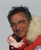 Carlo Baroni合作论文数Dipartimento di Scienze della Terra, Universita di Pisa;School of Biological Sciences, University of Auckland;Institute of Molecular BioSciences, Massey University2Mirko Severi合作论文数2
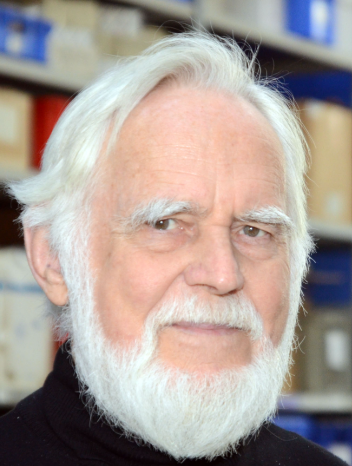 Hans-Ulrich Schmincke合作论文数Department of Volcanology and Petrolog, GEOMAR Helmholtz Centre for Ocean Research Kiel, University of Kiel2
 Martin Street合作论文数2
 Maria Cristina Salvatore合作论文数Dipartimento di Scienze della Terra, Università di Roma “La Sapienza”2Anne Verstege合作论文数2
 Marcus Christl合作论文数Laboratory of Ion Beam Physics, Department of Physics, ETH Zürich2Sabine Remmele合作论文数2
 Christian S. M. Turney(Chris Turney)合作论文数Earth and Sustainability Science Research Centre, School of Biological, Earth and Environmental Sciences, Faculty of Science, The University of New South Wales2Kimberley Elliott合作论文数1Sarah Rowan合作论文数1c s lane合作论文数1Silvia Bollhalder合作论文数1Daniele Nannini合作论文数1s. G. K. Kudsk合作论文数1Nicolas Brehm合作论文数1
 Gang Xue (薛刚)合作论文数Northwest University1
 Franziska A. Lechleitner合作论文数Dept Chem Biochem & Pharmaceut Sci, Univ Bern1Alexandra Fogtmann-Schulz合作论文数1
 Peter A Koehler合作论文数Alfred Wegener Inst Polar & Marine Res, D-27515 Bremerhaven, Germany1
 Michael W. Dee合作论文数Research Laboratory for Archaeology and the History of Art, University of Oxford;Research Laboratory for Archaeology and the History of Art, University of Oxford1
 Sturt Manning合作论文数Department of Classics, The College of Arts Sciences, Cornell University;Cornell Tree Ring Laboratory, Cornell University1




