Understanding how uncertainty propagates in hydrological modelling, from precipitation inputs to streamflow simulations, is essential for improving model sensitivity and strengthening the interpretation of model outputs. While gridded precipitation products are increasingly developed and widely used in different applications worldwide, their impacts on the uncertainty of simulated streamflows remain largely unexplored. In this work, we tested a variety of state-of-the-art precipitation datasets to explore how their uncertainty cascades through a process-based hydrological model and influences streamflow predictions using the Reno River basin in Italy as a case study. Our results indicate that, although precipitation patterns are broadly consistent across datasets, substantial differences emerge at seasonal and annual scales especially in complex terrains. Moreover, precipitation uncertainties are propagated and also amplified to the streamflow, on average 3.5 times for the dry season. The opposite occurs for the wet season, where uncertainty slightly decreases. The subsequent analysis reveals that the influence of precipitation uncertainty differs among subbasins. As such, our work emphasises the substantial impact of precipitation forcing in hydrological modelling and the significance of evaluating and quantifying uncertainty propagation
Climate services are increasingly recognized as important tools for supporting climate change adaptation by providing timely, relevant, and actionable climate information for decision-making. However, limited attention has been given to how climate services are conceptualized and recognized within the communities involved in researching, developing, and using them. In this paper, we investigate whether what is recognized as a climate service is shaped more by its purpose (the needs it addresses) and function (the processes through which it supports decision-making), or by its form (the way it is delivered, such as digital platforms or non-digital tools). Drawing on Rasmussen's Abstraction Hierarchy, we first analyze widely used definitions of climate services to examine how purpose, function, and form are embedded in formal conceptualizations. We then use this analysis to design a survey of researchers, developers/providers, and practitioners involved in European climate-service initiatives. The results show that widely used definitions emphasize purpose and function more than form. However, survey respondents were substantially more likely to recognize digital and data-driven tools as climate services than unconventional formats, even when the latter fulfilled similar functions. While recognition patterns were broadly consistent across disciplinary and professional backgrounds, the findings suggest that shared institutional expectations may shape what is considered a legitimate climate service. These findings point to the need to question implicit biases during the development and implementation of climate services and hint at the limits of interdisciplinarity alone in addressing the "usability gap". Instead, we argue for the potential value of broader transdisciplinary and co-creative approaches that incorporate diverse actors, forms of expertise, and ways of delivering climate-related knowledge. Overall, the study provides an empirical basis for reflecting on how expectations about service form may influence the boundaries and future development of the climate services field. Form over Function: How design expectations shape what counts as a climate service
Earth observation and artificial intelligence provide unprecedented opportunities to monitor water systems. However, unequal access to data and underrepresentation of diverse perspectives risk reinforcing existing disparities.
Effective climate adaptation requires the integration of equitable and evidence-based decision-making tools and data, such as climate services (CS) products. However, the development and use of CS products are often shaped by stakeholder power asymmetries, which can influence who benefits the most and who remains vulnerable. This study uses a system dynamic modelling approach to evaluate how these power imbalances affect sectoral outcomes and the overall sustainability of the human-environmental system. Using the island of Crete, Greece, as a case, we simulated three scenarios reflecting different configurations of CS prioritization across five key sectors: tourism, water, energy, transport, and agriculture. Results show that prioritizing a single dominant sector amplifies adaptation benefits for that sector but increases systemic vulnerabilities elsewhere. Equitable prioritization across sectors fosters more balanced power distributions and improved sustainability outcomes. The findings highlight the need to rethink stakeholder engagement frameworks, such as the Co-create, Co-design, and Co-produce approach, by embedding systems thinking and stakeholder inclusivity from the outset of CS development. This study underscores the critical role of transdisciplinary modelling in informing just and sustainable climate adaptation strategies. Practical Implications: This study demonstrates that the effectiveness and fairness of climate services (CS) depend not only on technical quality but on who participates in their design and how power is distributed among sectors. The Crete case study shows that when CS co-creation is dominated by a single powerful sector, such as tourism, adaptation benefits become concentrated to that sector, while vulnerabilities increase in less influential sectors, particularly water management and agriculture. For practitioners, this highlights that power asymmetries are a practical design risk that must be addressed explicitly. The key lesson from Crete, therefore, is that climate services that prioritize dominant sectors can improve short-term efficiency but undermine system-wide resilience. Practitioners should therefore treat equitable participation as a core operational requirement, not an aspirational goal. Key recommendations for practitioners: i. Map sectoral power at the outset of CS development: Model results show that unexamined power hierarchies shape adaptation outcomes. Practitioners should systematically identify which sectors control resources, data, and decision-making authority, and use this mapping to adjust participation rules during co-creation. ii. Ensure balanced, cross-sectoral participation: In Crete, only the equi-sector scenario, where all sectors had equal participatory weight, produced system-wide resilience gains. CS processes should therefore assign structured roles to less powerful but system-critical actors (e.g., smallholder farmers), rather than relying on voluntary or informal inclusion. iii. Use systems-based tools to reveal trade-offs before implementation: The Crete case shows how sectoral prioritization (e.g., tourism water use) can cascade into higher energy demand and food stress. System dynamics models and scenario simulations should be integrated into CS workflows to test alternative allocation strategies and identify unintended consequences early. iv. Design CS outputs for collective, not sector-specific, use: Practitioners should move beyond tailored products for individual sectors and instead develop shared indicators and dashboards that make cross-sector impacts visible (e.g., water–energy–food–tourism linkages). This supports informed negotiation rather than competition among sectors. v. Institutionalize iterative feedback and learning: The Crete living lab showed that stakeholder engagement improves relevance but requires sustained facilitation. CS should be embedded in adaptive governance cycles where user feedback, changing climate risks, and shifting sectoral roles are regularly reassessed.Broader relevance: For other tourism-dependent islands and Mediterranean regions, the Crete case underscores that resilience emerges from balancing sectoral interests within environmental limits. Practitioners who embed equity, systems thinking, and transparency into CS design can reduce maladaptation risks and ensure that climate services function as shared public goods rather than selective advantages.
Groundwater is the largest freshwater resource, supporting drinking water, irrigation and ecosystems. As natural hazards intensify and intertwine with social, political and economic challenges, short-term groundwater use is emerging as a low-cost, rapid and distributed response strategy. Here we discuss how groundwater can be used strategically during and after hazard events while safeguarding long-term sustainability. Examples of earthquake, wildfire, flood and drought events in different regions highlight the potential value of temporarily using existing wells, pumps and aquifers. However, shifts in mindsets, policies and planning are urgently needed, along with interdisciplinary and equity-focused approaches that draw on disaster sociology, environmental justice, sustainability science and sociohydrology. Examples of policy direction and thought leadership from around the world show how groundwater use is emerging across diverse hazard contexts, which could be amplified by future interdisciplinary, equity-focused research. The use of groundwater can help mitigate the impacts of natural disasters, thereby increasing the resilience of communities during and after events, according to a synthesis of hydrology and disaster response research.
Agricultural insurance is promoted as a drought-risk tool, yet its net long-term socio-hydrological impacts and interactions with other adaptations remain disputed. We expand the Geographical, Environmental and Behavioural model (GEB), a fully distributed hydrological model coupled with an agent-based model (ABM), a process-based crop model and a dynamic farmer adaptation behavior model. We add two adaptation options (wells, crop switching) and two insurance designs (traditional, index), calibrated to an Indian basin. Traditional insurance increases well adoption and profits but creates a lock-in to wells and higher-water-use crops, leading to 20-50% higher annual water use and 30-60% lower groundwater levels. Index insurance avoids this lock-in, shifts production toward lower-water options and delivers higher profits with lower basin-wide water use. Despite this, traditional insurance sustains greater crop diversity and a more diffuse irrigation mix via groundwater, reducing drought risk: profit variability and losses during consecutive droughts are smaller than under index insurance (similar to 0.039 vs similar to 0.085 USD m(-2); similar to 20% vs similar to 28%). Spatial patterns further show that insurance interacts with reservoir effects: uptake is lower in surface-water command areas, whereas index insurance has relatively high uptake in these zones, suggesting potential to counteract reservoir effects. Finally, we find that the level of available irrigation, rather than simple access, determines whether reservoir effects emerge. Our findings highlight design trade-offs: while hydrological and economic metrics favor index insurance, a risk-oriented perspective may prefer traditional insurance, underscoring the utility of ABMs to make these trade-offs explicit.
Groundwater conflicts are increasing worldwide, particularly during droughts. While conflict dynamics have been widely studied in historically water-scarce regions, emerging hotspots in Europe remain understudied. We introduce a text-mining approach to monitor conflicts over time and apply it to Germany, where droughts have exacerbated tensions among water users. Using a corpus of over 12,000 news articles published between 2000 and 2022, we map the spatiotemporal distribution of reported conflicts and identify their drivers using a metric of reported conflict intensity combining frequency and prominence of conflict reporting. Groundwater conflicts are geographically widespread, with recurring hotspots and new conflict areas emerging during the 2018-2022 multi-year drought. While water pollution and environmental protection have diminished in importance, scarcity, agriculture, and drought have become key drivers. Reported conflicts show only moderate spatial correlations with groundwater withdrawal, recharge, and pollution, suggesting media dynamics and social context shape which conflicts become publicly visible.
Natural hazards claim thousands of lives annually, yet warnings often fail to compel action. This is not just a technological issue but also a communication failure. The next leap in disaster risk reduction must be psychological and social: transforming warnings into personalized, actionable messages that are tailored to individuals’ needs.
Wildfires are intensifying worldwide and increasingly threaten cities and communities in the wildland–urban interface. While attention has focused on forests, fuels, and firefighting capacity, water systems are also under growing pressure during major fire events. Groundwater, accessed through decentralized wells across urban, peri-urban, and rural landscapes, remains largely overlooked in wildfire planning despite its potential to support firefighting, provide emergency drinking water, and buffer disruptions to surface water systems. We argue that groundwater should be treated not simply as emergency backup, but as a shared social–ecological resource requiring anticipatory governance. Using a social–ecological systems perspective, we identify key decision contexts where groundwater may be mobilized before, during, and after wildfire events. Integrating groundwater governance into wildfire resilience planning could strengthen water security, reduce inequities, and support communities learning to live with fire in a warming world.
Climate services play a central role in adaptation strategies to water-related risks, yet the long-term implications of relying on different types of climate information remain poorly understood. This paper presents a system dynamics model that explores how short-term and long-term climate services influence adaptation trajectories balancing agricultural production and wealth generation with water management and ecosystem protection. We apply the model to a synthetic case study where water scarcity poses the main risk for agriculture, considering precipitation forecasts as the main climate service. Short-term climate services (e.g., sub-seasonal forecasts) prioritize immediate risks and can facilitate reactive adaptation, such as rapid reservoir expansion and agricultural intensification. Long-term climate services (e.g., climate projections), by contrast, can support strategic planning and promote transformative measures, such as ecological restoration. Our model shows trade-offs between rapid wealth generation and long-term sustainability. Scenarios dominated by short-term climate services lead to faster economic growth, but also frequent and prolonged water crises. In contrast, reliance on long-term climate services can help build resilience and prevent crisis, but lead to lower economic returns. Mixed scenarios can avoid the worst outcomes, though they remain unstable and highly sensitive to climatic variability and shocks. Under climate change, increased variability in water recharge amplifies the demand for reactive measures, reinforcing short-term feedbacks and amplifying the risk of maladaptation. These findings highlight the importance of providing adaptation planners with long-term climate services that support the development of sustainable options while reducing the pressure of immediate threats. The model offers a conceptual framework for anticipating maladaptive patterns and emphasizes the need to balance short- and long-term objectives in coping with climate change.
Floods and droughts often worsen socioeconomic inequalities, as marginalized groups face disproportionate impacts and have fewer resources to recover. Inequalities, in turn, limit their ability to recover, and amplify the impacts of future hydrological extremes, creating vicious cycles of worsening disasters. Yet such floods and drought events can also serve as opportunities for transformative change, addressing underlying vulnerabilities and reducing inequalities. Progress in sociohydrology is essential for better understanding these two-way interactions, requiring case studies and models of human-water systems that account for uneven risk distribution, along with global comparative analyses using emerging datasets. We propose an interdisciplinary research agenda that combines sociohydrological modelling, critical social science perspectives on power and inequality, and the innovative, but carefully scrutinized, use of artificial intelligence (AI) tools, such as text mining. This integrated approach can reveal context-specific dynamics, and help break vicious cycles of disasters and inequalities.
The development of gridded precipitation datasets has accelerated in recent decades, establishing them as crucial tools in hydrological analysis. This study aims to unravel the propagation of uncertainty in hydrological modelling from precipitation data to streamflow simulations. To this end, we examined the impact of using state-of-the-art datasets as model input for the Reno River basin in Italy. Our results show that (1) while seasonal precipitation patterns are similar, wet season and annual averages differ, particularly in the mountainous sub-basin; (2) the mountainous sub-basin exhibits large variability, with winter peak flows frequently underestimated; (3) uncertainties in precipitation propagate into the dry season, where variability is relatively greater than for the entire basin. We also examined the significance of addressing uncertainty in hydrological modelling at various scales. These findings underscore the influence of precipitation data uncertainty on hydrological calculations, particularly in regions with complex topography.
Droughts in Europe are becoming increasingly frequent and severe, with the 2022 drought surpassing previous records and causing widespread socio-economic impacts. Using a Europe-wide survey (n = 481 across 30 countries) combined with hydroclimatic data (i.e., Standardized Precipitation Evapotranspiration Index; SPEI), we quantify how forecasting systems and Drought Management Plans (DMPs) affected response timing and perceived effectiveness. It specifically assesses the role of forecasting systems and Drought Management Plans (DMPs) in improving preparedness and in facilitating more effective and timely responses. Our findings show that organisations with forecasting systems or DMPs in place implemented drought response measures on average two and one months earlier respectively than those without, and rated their effectiveness higher. Additionally, the study investigates how drought management practices and awareness have evolved as a consequence of the 2018 European drought and how recent experiences shape water managers' perceptions, with 35 % of the respondents indicating introducing or updating their DMPs after the 2018 drought. The findings emphasize the necessity of a standardized, continent-wide drought risk management coordination to address the multifaceted nature of drought risk by integrating climatic and societal factors, and advocates for a Drought Directive as a means to achieve this. This research aims to inform policy development towards sustainable and holistic drought risk management, highlighting the crucial roles of preparedness, awareness, and adaptive strategies in mitigating future drought impacts. This study and its companion paper The 2022 drought needs to be a turning point for European drought risk management are the result of a study carried out by the Drought in the Anthropocene (DitA) network, an IAHS initiative.
Human migration has been an essential and transformative process, driven by the need to adapt to changing environmental, social, and economic conditions. Here we explore associations between drought events and migration patterns worldwide, compounded by climatic and socio-economic factors such as armed conflict, water withdrawal, crop yield, income and health metrics, in agriculturally dependent regions during the period 2000-2019. We show that, while socio-economic factors remain the primary drivers of migration, drought also exerts a strong influence. Our findings reveal that drought were major predictors of migration in approximately 11% of the regions analyzed, with robust drought-migration associations in middle-income regions. High-income urban areas do not exhibit strong migration dynamics linked to drought, while changes in income conditions and water withdrawal were associated with emigration. This study underscores the need for a comprehensive understanding of the global impacts of drought on migration patterns in agriculture-dependent regions to inform effective and sustainable strategies of disaster risk reduction and climate change adaptation.
Large dams have become a dominant water management strategy over the last century, but they are typically managed with limited understanding of how human responses to their construction and operation influence the achievement of water management objectives. In recent years, several behavioural response patterns to large dams in human-water systems have been identified, and quantitative models developed to capture these emergent phenomena. However, there is a gap between the understanding of these phenomena in a generalised sense and communicating their relevance to water managers in local contexts. In this study we applied a generalised human-water systems model of reservoir operations during droughts and floods to two case studies in Australia; one in the water-scarce, largely agricultural Lachlan River catchment, and the other in the coastal, highly-urbanised Hawkesbury–Nepean catchment. Modelling results coupled with a qualitative review of historical socioeconomic, hydroclimatic, and water management characteristics of each case study were compared to identify potential emergent phenomena and the characteristics contributing to their development. We found reservoir effects (where increases in water storage capacity increase vulnerability to water scarcity) and lock-in behaviours are inherent risks for large reservoirs. The levee effect, whereby infrastructure reducing the probability of flooding paradoxically increases vulnerability to floods, is a risk, particularly where urbanisation is high. Sequence effects, where measures to deal with one hydrological extreme exacerbate the effects of the other extreme, are likely when operational rules constrain the adaptation of operations to hydroclimatic conditions, or when water management interactions during drought and flood are poorly understood. Where there is economic incentive to increase water usage, supply–demand cycles and rebound effects are a risk. Sensitive downstream ecosystems and high competition for limited resources make shifts in values that redirect water management priorities (pendulum swings) more likely. Identifying these emergent phenomena and their driving characteristics can help water managers identify and focus on context-specific risks to enable a proactive management approach to current and future challenges.
Human displacements due to climate and weather extremes are dramatically increasing worldwide, mainly across areas where extreme events interact with high vulnerability and low adaptive capacity, such that they are now recognized as a primary humanitarian challenge of the 21st century. Human mobility from droughts is multifaceted and depends on environmental, political, social, demographic and economic factors. Although droughts cannot be considered as the single trigger, they significantly influence people's decision to move. Yet, the ways in which droughts influence patterns of human settlements have remained poorly understood. Here we explore the relationships between drought occurrences and changes in the spatial distribution of human settlements across 50 African countries for the period 1992–2013. Since long-term yearly data on human displacements are not consistently available for the entire African continent, we employ both country-based and spatially explicit data sets as reliable proxies. We base our continental study on urban population data and nighttime lights, as a proxy for the spatial and temporal distribution of human settlements. For each country, we evaluate annual relative urban population and human distance to rivers. To identify drought years, we extract annual drought occurrences from two indicators, the international disaster database EM-DAT and the standardized precipitation evapotranspiration index (SPEI-12) records. We then compute human displacements as variations in human distribution between adjacent years, which are then associated with drought (or non-drought) years. We finally examine the consistency between drought occurrences and changes in human settlement patterns to identify macroscopic trends at the continental scale. Our results show that drought occurrences across Africa are often associated with (other things being equal) human mobility toward rivers or cities. In particular, we found that human settlements tend to get closer to water bodies or urban areas during drought conditions, as compared to non-drought periods, in 70%–81% of African countries. This large-scale trend clearly highlights that the occurrence of drought events, although not being the single driving factor, significantly influences human mobility. By interpreting this outcome from a broader perspective, which includes consecutive drought-to-flood events, adverse consequences might occur. An increased human presence in urban areas and close to rivers may result into an increased human exposure to floods, and thus leading to a potentially increased flood risk. Therefore, further investigations are foreseen and encouraged to better understand the interplay between human mobility and climate change in order to increase the resilience of vulnerable areas and population to hydrological extreme events and support the development of sustainable and effective planning strategies for the near future.
Scientists and decision-makers globally confront systemic challenges posed by the intertwining issues of water scarcity and climate change. These challenges give rise to cascading impacts across ecological and socioeconomic systems, often exacerbated by feedback loops and unforeseeable consequences (UNDRR, 2021). As non-linear changes loom, the reliance on consolidative modeling becomes dangerous, risking the activation of disastrous tipping points with severe implications for both nature and humans (Kreibich et al., 2022). The costs associated with neglecting uncertainties in modeling and policy spans diverse domains, including ecosystems, income, employment, capital value, insurance, etc. (UNDRR, 2022; Parrado et al., 2019; Adamson and Loch, 2021). This aligns with the concept of Knightian or deep uncertainty, where the external context, system dynamics, and conflicting outcomes are not fully known or agreed upon (Knight, 1921; Marchau et al., 2019; Lempert et al., 2006). A growing scientific and policy consensus emphasizes the need to move beyond traditional notions of optimality and deterministic prediction in conditions of deep uncertainty. Resilience and robustness emerge as crucial concepts, requiring the development of socio-ecological system (SES) models that explicitly quantify uncertainties (Adamson and Loch, 2021; Di Baldassarre et al., 2016; IPCC, 2021; UNDRR, 2021). Recent research in SES, including coupled human and natural systems and socio-hydrology science, offers innovative modeling techniques integrating human and natural components. These techniques account for feedbacks and heterogeneity between systems, improving insight and the ability to predict tipping points (Gain et al., 2021). Recent studies demonstrate the potential of linking coupled models of human-water systems with sensitivity analysis and multi-system ensembles for robust water management policies (Basheer et al., 2023; Smith et al., 2021). This review initially identified 2160 papers, filtering them to 198 studies that account quantitatively modelling in, both human and water systems. The geographical focus spans the USA, Europe, Australia, the Middle East, South America, China, and East Africa. The models range from piecewise equations to full-fledged representations. However, structural uncertainties are seldom explored, with only 3.5% of studies conducting multi-model ensemble experiments. This highlights a significant oversight in recognizing biases from simplifications. Conversely, parameter uncertainties are more frequently addressed (20.2%), focusing on hydrology, groundwater, behavioral, infrastructure, climatic, economic, and agronomic variables. Input uncertainties, notably contemporary (discharge data) and future (climate change) inputs, are extensively studied (148 out of 198), employing methods like expert judgment and Monte Carlo simulations. Despite this, the review highlights a limited exploration of structural uncertainties and the potential inadequacy of linear piecewise equations, emphasizing the need for more nuanced and robust approaches to enhance the accuracy and reliability of socio-environmental systems modeling. Based on this study, we make the following recommendations to mainstream uncertainty quantification into SES modeling: (i) Quantify parameter and structural uncertainties within systems, (ii) Quantify structural uncertainties between models, (iii) Input uncertainties must be more thoroughly assessed and model assumptions systematically revised, (iv) Deliver actionable science that mainstreams uncertainty quantification into decision making, (v) Establish balanced stakeholder engagement and clear and transparent science-policy engagement rules, (vi) Balance complexity and usefulness to keep the model relevant.
There are numerous studies of the impacts of climate-related natural hazards, such as droughts, heatwaves and wildfires, to water supply. These range from the global mapping of water scarcity to local-level evaluations of damages to production and distribution infrastructure. However, comprehensive and dynamic assessments of climate impacts to water supply that consider both fast (e.g., floods, landslides) and slow onset risks (e.g., drought) as well as changes in water consumption are still lacking, especially in regions perceived as “water-rich”. This study reviewed climate change impacts to water supply in northern temperate climates which, in recent years, have been exposed not only to multiple floods but also to seasonal droughts despite predicted increases in average precipitation. By adopting an extended risk framework, we developed a conceptual overview and visualization of the linkages between climate, water, and society in the context of Southern Sweden. The results highlight the multiple knowledge gaps in the Swedish water sector related to climate change uncertainties at local scales, compound and cascading risks, and the challenge of implementing adaptation measures in practice. When acknowledging intersectoral connections, the conceptualization becomes increasingly complex, emphasizing broader implications for a functional society as a whole. This research contributes to a sparse literature on the impacts of climate change to water supply in northern regions. We argue that conceptual and systemic approaches can benefit water utilities and municipalities where drought risk tends to be overlooked and discuss possible venues for moving adaptation forward.
To better understand the increasing human impact on the water cycle and the feedbacks between hydrology and society, the International Association of Hydrological Sciences (IAHS) organized the scientific decade "Panta Rhei - Everything Flows: Change in hydrology and society" (2013-2022). A key finding is the need to use integrated approaches to assess the co-evolution of human-water systems in order to avoid unintended consequences of human interventions over long periods of time. Additionally, substantial progress has been made in leveraging new data sources on human behaviour, e.g. through text mining of social media posts. Much has been learned about detecting hydrological changes and attributing them to their drivers, e.g. quantifying climate effects on floods. To achieve further progress, we recommend broadening the understanding, the discipline and training activities, while at the same time pursuing synthesis by focusing on key themes, developing innovative approaches and finding sustainable solutions to the world's water problems.
Historically, groundwater resources have been perceived as inexhaustible in Central Europe by policy-makers and the general public. However, recently increasing drought periods and user groups with competing interests caused conflicts about the usage of and access to groundwater resources. Groundwater-related conflicts, defined here as social issues resulting from divergent viewpoints among diverse stakeholders, have been extensively examined in regions with an extended history of water scarcity. Yet, there is limited research on the emergence of groundwater-related conflicts in Central Europe and the role of recent drought events in shaping these. Here, we study the emergence of groundwater-related conflicts in Germany since 2000 using a text-mining approach. Specifically, we investigate four research questions: (i) how are groundwater-related conflicts characterized, (ii) which influential stakeholders are shaping these conflicts, (iii) what are the spatio-temporal patterns of these conflicts and (iv) how do drought events and different socio-economic factors influence their occurrence? To address these questions, we use machine learning and text-mining techniques on more than one million newspaper articles to develop a spatio-temporal database of conflicts. We also extract and categorize involved stakeholders using a named entity recognition algorithm. Then, we use statistical modeling to link the occurrences of groundwater conflicts with drought indices and other additional explanatory variables. Our results reveal the growing diversity and geographical spread of groundwater-related conflicts in Germany. Also, our results shed light on the role of the recent drought events’ influence on conflicts. Our findings contribute to mapping the evolving landscape of groundwater-related conflicts in Germany and the effects of drought events. The proposed methods have the potential to enable large-scale studies of environmental conflicts using vastly available text data.
 Luigia Brandimarte合作论文数Division of Resources, Energy and Infrastructure, Department of Sustainable Development, Environmental Science and Engineering, School of Architecture and the Built Environment, KTH Royal Institute of Technology47
 Maurizio Mazzoleni合作论文数Uppsala Univ, Dept Earth Sci, Uppsala, Sweden46
 Johanna Mård Karlsson合作论文数Department of Physical Geography and Quaternary Geology, Stockholm University44
 Maria Rusca合作论文数Dept Earth Sci, Uppsala Univ35
 Elena Mondino合作论文数Coll Indigenous Futures Educ & Arts, Charles Darwin Univ34
 Elena Ridolfi合作论文数29
 Paul Bates合作论文数Fathom Global;School of Geographical Sciences, University of Bristol28
 Alberto Viglione合作论文数Vienna University of Technology, Technische Universität Wien25
 Anne Van Loon合作论文数Hydrol & Quantitat Water Management Grp, Wageningen Univ25
 Alberto Montanari合作论文数Department of Civil, Chemical, Environmental and Materials Engineering, Alma Mater Studiorum Universita di Bologna24
 Guy Schumann合作论文数School of Geographical Sciences, University of Bristol24
 A. Castellarin合作论文数Department of Civil, Chemical, Environmental, and Materials Engineering, Alma Mater Studiorum - Universita di Bologna22
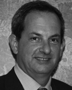 Armando Brath合作论文数20
 Murugesu Sivapalan合作论文数Department of Geography & Geographic Information Science, School of Earth, Society & Environment, College of Liberal Arts & Sciences, University of Illinois Urbana-Champaign;Department of Civil & Environmental Engineering, The Grainger College of Engineering, University of Illinois Urbana-Champaign;Department of Hydraulic Engineering, Tsinghua University18
 kun yan合作论文数Deltares17
 Heidi Kreibich合作论文数Geography Department, Humboldt-Universität zu Berlin;German Research Centre for Geosciences17
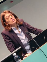 Raffetti Elena合作论文数Unit of Hygiene, Epidemiology and Public Health, University of Brescia17
 Dimitri Solomatine合作论文数IHE Delft Institute for Water Education17
 Elisa Savelli合作论文数Centre of Natural Hazards and Disaster Science, CNDS15
 Günter Blöschl合作论文数Institute of Hydraulic Engineering and Water Resources Management, Vienna University of Technology;Centre for Water Resource Systems, Vienna University of Technology15
 Hannah Cloke合作论文数Department of Geography and Environmental Science, University of Reading15
 Gabriele Messori合作论文数Stockholm Univ, Dept Meteorol, Stockholm, Sweden14
 Korbinian Breinl合作论文数Centre of Natural Hazards and Disaster Science, CNDS14
 Anna Scolobig合作论文数Institute of International Sociology of Gorizia (ISIG), Via Mazzini 13, 34170 Gorizia, Italy14
 Micah Mukolwe合作论文数Department of Civil and Structural Engineering, sinde Muliro University of Science and Technology13
 I.G. Pechlivanidis合作论文数13
 Nienke Wanders合作论文数Department of Pharmacology;Rudolf Magnus;Institute of Neuroscience;University Medical Center Utrecht;Institute of Neuroscience, University Medical Center Utrecht13
 Rangecroft Sally合作论文数School of Geography, University of Exeter12
 Fuqiang Tian (田富强)合作论文数Department of Hydraulic Engineering, School of Civil Engineering, Tsinghua University12
 Sara Lindersson合作论文数Uppsala University11
 Vincent Odongo合作论文数Dept Earth Sci, Uppsala Univ11
 Maria Carmen Llasat合作论文数Dept Appl Phys, Univ Barcelona11Fabio Russo合作论文数11
 Tom Gleeson合作论文数Department of Civil Engineering, Faculty of Engineering and Computer Science, University of Victoria11
 Serena Ceola合作论文数11
 Linda Kuil合作论文数10
 Florian Pappenberger合作论文数Forecast Department, European Centre for Medium Range Weather Forecasts10
 Mariana Madruga de Brito合作论文数Univ Bonn, Dept Geog, Bonn, Germany10
 Amir Aghakouchak合作论文数Department of Civil and Environmental Engineering, Samueli School of Engineering, University of California, Irvine;Center for Hydrometeorology and Remote Sensing, University of California, Irvine10
 Anastasiya Shyrokaya合作论文数9
 Teutschbein Claudia合作论文数Department of Earth Sciences, Uppsala University9
 Saket Pande合作论文数Department of Water Management, Faculty of Civil Engineering and Geosciences, Delft University of Technology9
 Thorsten Wagener合作论文数Institute of Environmental Science and Geography, University of Potsdam9
 Keith Beven合作论文数Lancaster Environment Centre, Lancaster University9
 Marco Borga合作论文数Department of Land, Environment, Agriculture and Forestry, Universita degli Studi di Padova9
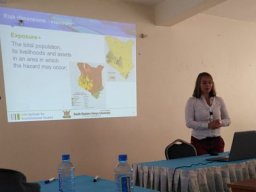 Marthe Wens合作论文数Inst Environm Studies IVM, Vrije Univ Amsterdam8
 Margaret Garcia合作论文数School of Sustainable Engineering and the Built Environment, Arizona State University8
 Viorica Nagavciuc合作论文数Faculty of Forestry, Stefan cel Mare University8
 Gemma Carr合作论文数Centre for Water Resource Systems, Vienna University of Technology8




