Sigmoid growth models are often used to study population dynamics. The size of a population at equilibrium commonly depends explicitly on the availability of resources, such as an energy or nutrient source, which is not explicit in standard sigmoid growth models. A simple generalised extension of sigmoid growth models is introduced that can explicitly account for this resource-dependence, demonstrated by three examples of this family of models of increasing mathematical complexity. Each model is calibrated and compared to observed data for algae under sea-ice in Antarctic coastal waters. It was found that through careful construction, models satisfying the proposed framework can estimate key properties of a sea-ice break-out controlled tipping point for the algae, which cannot be estimated using standard sigmoid growth models. The proposed broader family of energy-dependent sigmoid growth models likely has usage in many population growth contexts where resources limit population size.
Context. Historical records and citizen scientist data are a useful resource for long-term ecological studies, yet their quality and validity have been challenged. Aims. We aimed to investigate how traditional structured surveys and unstructured, opportunistic data sources can be used to understand historical ecological change over half a century. Methods. We studied similar to 6000 records between 1965 and 2020 from the Shiprock site in the Sydney region, to understand ecological changes and insights that could be derived from these diverse data sources. Key results. We report the local disappearance of some fish and invertebrate species, declines in the abundance of many taxa including kelp, potential impacts of the implementation of a marine reserve and range extensions consistent with climate change. Structured surveys provided broadly scientifically useful ecological information, whereas unstructured opportunistic data provided long-term retrospective community information and species presence information. Conclusions. We have described scientifically and managerially relevant insights encompassing foundation, threatened, protected and invasive species, community shifts and the impacts of local and global processes over historical timescales. Implications. Unstructured, opportunistic data sources can document long-term ecological changes arising from local and global processes, but are limited in the ability to provide population and community structure information.
Successional dynamics can vary because of a range of ecological and environmental factors, but our understanding of biogeographic variation in succession, and the processes contributing to community development across ecosystems, is limited. The pattern and rate of recruitment of dispersive propagules likely differs over large spatial scales and can be an important predictor of successional trajectory. Over a 20 degrees tropical-temperate latitudinal gradient, we measured sessile invertebrates over 12 months of community development and successive 3-month recruitment windows to understand succession and how it is influenced by recruitment. Succession and recruitment patterns varied over latitude. In the tropics, fast temporal turnover, fluctuating abundances, and lack of successional progression suggest that the contribution of stochastic processes was high. As latitude increased, successional progression became more apparent, characterized by increasing species richness and community cover and a shift to more competitive taxa over time. At temperate locations, species identities were similar between older communities and recruiting assemblages; however, community composition became more variable across space over time. Such divergence suggests an important role of early colonizers and species interactions on community structure. These findings demonstrate differences in the processes contributing to community development and biodiversity patterns over latitude. Understanding such biogeographic variation in community dynamics and identifying the prevalence of different processes can provide insights into how communities assemble and persist in response to environmental variability.
Light availability and habitat complexity are two key drivers of community assembly. Urbanisation has been shown to affect both, with important consequences to ecological communities. On the intertidal, for instance, studies have shown that light intensity is greater on natural rocky shores than on less complex artificial habitats (seawalls), though different habitats can also experience similar light intensities, for example when shaded by urban structures. Understanding therefore how these factors individually, and combined, affect communities is important to understand the mechanisms driving changes in community structure, and consequently provide solutions to tackle the increasing homogenisation of habitats and lightscapes in urbanised spaces through smart infrastructure designs. Here, we assessed how different light levels affect the recruitment of communities in rock pools and on emergent rock on an intertidal rocky shore. We cleared 30 patches of emergent rock and 30 rock pools and manipulated light using shades with different light transmissions (full light, procedural control, 75%, 35%, and 15% light transmission, full shade) and assessed mobile and sessile communities monthly for 6 months. Effects of reducing light levels were generally stronger on rock than in pools. Fully shaded plots supported double the amount of mobile organisms than plots in full sunlight, in both habitats. Algal cover was higher in pools compared to rock, and at intermediate light levels, but effects varied with site. This study highlights the importance of variable light conditions and different habitats for rocky shore communities, which should be considered in future coastal developments to retain natural biodiversity.
Estuaries are under increasing pressure from urbanization, including through the release of domestic wastes such as anthropogenic debris. Growing concern over environmental contamination has led to management interventions, aimed at reducing the further release of debris. Effective strategies, however, require an understanding of the factors influencing the abundance and distribution of debris. Estuaries pose a challenge to assess debris trends due to the myriad of factors that influence debris patterns. Here we present a Bayesian approach to assess spatial patterns in debris across four estuaries of New South Wales, Australia. We provide an overview of debris composition and employ Integrated Nested Laplace Approximation (INLA) alongside Stochastic Partial Differential Equation (SPDE) to produce three models testing predictors of debris abundance: (i) non spatial, (ii) a model accounting for spatial autocorrelation and (iii) accounting for spatial autocorrelation and introducing the estuarine foreshore as a barrier. Data was sourced from cleanups reported within the Australian Marine Debris Initiative (AMDI), a national citizen science program coordinated by the Tangaroa Blue Foundation. The data, from 169 sampling events between 2012 and 2017 was used. All models tested predictors against the abundance of hard plastic, expanded plastic, plastic bags, and plastic drink bottles. Plastic was the dominant component, ranging from 69% to 82% of total debris within the study estuaries. Important predictors differed across debris types and included ‘distance to estuary mouth’, access to foreshore, population, and site substrate. Specific factors differed in importance when accounting for spatial autocorrelation, demonstrating the need for spatial approaches when assessing debris trends within estuaries. The present Bayesian approach could be used to better understand drivers of estuarine debris and inform interventions for effective management.
Physical disturbances typically cause ecological impacts within areas of direct contact (primary disturbances) but can also impact surrounding areas through other mechanisms (secondary disturbances). Secondary disturbances are often overlooked, especially in marine ecosystems where sufficiently detailed observation can be difficult to obtain. For example, boat moorings create circular clearings in seagrass meadows by physically scouring the seabed, but visible impacts extend beyond this into surrounding areas due to disturbances such as increased sediment transport, edge effects, and shading from boats. Previous studies on impacts of moorings have not distinguished between primary and secondary disturbances, and secondary disturbances are rarely accounted for in environmental management. We used spatial modelling to examine the primary and secondary disturbances associated with moorings in a meadow of the threatened seagrass Posidonia australis. We compared the disturbance from traditional ‘swing’ moorings with ‘environmentally friendly’ moorings (EFM) designed to reduce scour. Within the scour zone (0-5 m from moorings), we compared seagrass cover around swing moorings with cover around EFM. Further from moorings (5-25 m), we tested the degree of association between seagrass cover and secondary disturbances that may accumulate with mooring density and be influenced by mooring design. We found that mooring design affected the degree of direct disturbance, with cover of P. australis in the scour zone of standard moorings ~49% lower than that of EFMs (p < 0.01). Mooring density had cumulative negative effects on P. australis cover in the surrounding meadow, but the influence of mooring density was reduced when most moorings were EFMs. This suggests that secondary effects contingent on direct physical disturbance (e.g. sediment transport, fragmentation, edge effects) may be stronger than the general influence of moored boats (shading). We use the findings to simulate two broad policy scenarios for mooring designs in P. australis meadows: installing only EFM, or only traditional moorings. The simulations suggest that using only EFM would lead to a 14.2% increase (~164 m2), whereas installing only traditional moorings would lead to a 16% (~187 m2) loss of P. australis cover in this already highly disturbed meadow. Synthesis and applications: We demonstrate a nondestructive approach to assessing primary and secondary disturbances driving the distribution of a threatened seagrass and simulate a range of potential management scenarios that could assist in conserving the species.
AimRetrospective (pre- vs. post-invasion) and cross-sectional comparisons of ecosystems exposed to high and low bioinvasion pressure, provide an alternative approach to evaluate shifts in biological communities associated with non-indigenous species (NIS) introductions. In this study, we aimed to examine general patterns of change in community composition, structure and function in six well-studied and globally distributed marine ecosystems that had documented histories of biological invasions.LocationGlobal.MethodsBy considering a range of regional datasets and different sampling approaches, we evaluated trends within and among ecosystems by comparing paired measures of community and functional structure in either space or time.ResultsOur analyses revealed different patterns of structural and functional change at ecosystem scales, but direct comparisons across regions were hindered by confounding effects of study designs and other drivers of change. The most prominent shifts in community composition were observed in the retrospective studies, characterised by the greatest relative contribution of NIS. No uniform pattern of change in functional metrics was observed across study regions. However, functional evenness and dispersion showed a tendency to increase in systems under higher invasion pressure, refuting the hypothesis of selective accumulation of specific traits and functional homogenisation within ecosystems exposed to high invasion pressure.Main ConclusionsAccumulation of NIS within broader communities can be a subtle process, with inherent spatial and temporal variability. Nonetheless, not only do species' proportional contributions to communities change over time in areas subjected to high bioinvasion pressure, but trait profiles can incrementally shift, which alters the original ecology of an area. Planned, long-term studies that incorporate a range of measures of environmental drivers and ecosystem response are crucial for better understanding of cumulative, community-level and ecosystem-scale change associated with biological invasions.
Australia’s distinctive biogeography means that it is sometimes considered an ecologically unique continent with biological and abiotic features that are not comparable to those observed in the rest of the world. This leaves some researchers unclear as to whether findings from Australia apply to systems elsewhere (or vice-versa), which has consequences for the development of ecological theory and the application of ecological management principles. We analyzed 594,612 observations spanning 85 variables describing global climate, soil, geochemistry, plants, animals, and ecosystem function to test if Australia is broadly different to the other continents and compare how different each continent is from the global mean. We found significant differences between Australian and global means for none of 15 climate variables, only seven of 25 geochemistry variables, three of 16 soil variables, five of 12 plant trait variables, four of 11 animal variables, and one of five ecosystem function variables. Seven of these differences remained significant when we adjusted for multiple hypothesis testing: high soil pH, high soil concentrations of sodium and strontium, a high proportion of nitrogen-fixing plants, low plant leaf nitrogen concentration, low annual production rate to birth in mammals, and low marine productivity. Our analyses reveal numerous similarities between Australia and Africa and highlight dissimilarities between continents in the northern vs. southern hemispheres. Australia ranked the most distinctive continent for 26 variables, more often than Europe (15 variables), Africa (13 variables), Asia (12 variables each), South America (11 variables) or North America (8 variables). Australia was distinctive in a range of soil conditions and plant traits, and a few bird and mammal traits, tending to sit at a more extreme end of variation for some variables related to resource availability. However, combined analyses revealed that, overall, Australia is not significantly more different to the global mean than Africa, South America, or Europe. In conclusion, while Australia does have some unique and distinctive features, this is also true for each of the other continents, and the data do not support the idea that Australia is an overall outlier in its biotic or abiotic characteristics.
Stormwater drains act as a pathway for anthropogenic debris from land to sea, particularly in urbanised estuaries where impervious surfaces expedite the process. Debris type and abundance in stormwater drains may vary due to land use and human activity, and knowledge of this variation is necessary to manage the growing threat of debris. Surveys of stormwater debris can inform targeted reduction and remediation efforts by intercepting and identifying pollutants near their source. We surveyed replicate stormwater gross pollutant traps across four land use zones (city centre, shopping cen-tre, transportation hub, industrial precinct) before and during COVID-19 measures to assess the effects of changing human activities. Gross pollutant traps were installed in 120 drains in Greater Melbourne, Australia, and citizen scientists trained by Tangaroa Blue Foundation weighed and classified debris at 6-week intervals between October 2019 and October 2020. Four survey cycles were conducted before lockdowns were implemented, then another four during lockdowns. COVID-19 lockdowns and patterns of debris type and abundance across land use revealed how changes in human activity might im-pact the flow of debris. Cigarette butts were the most abundant macro debris (>5 mm) item in every survey cycle, regard-less of lockdowns. Industrial land use zones had the lowest macro debris counts but contained over 90 % of the micro debris (1-5 mm). The amount of total macro debris decreased during lockdowns, however the most abundant and prob-lematic debris items such as cigarettes and single-use plastics did not decrease as much as might be expected from the con-comitant reductions in human activity. Occupational health and safety items, such as masks and gloves, increased (144 %) during COVID-19 lockdowns. Micro debris counts did not change in industrial zones during lockdowns, suggesting that workplace interventions may be necessary to reduce this debris leakage. Tracing the pathway of debris from source to sea can inform reduction and long-term management strategies.
Aim & methods: To investigate peripheral blood methylation episignatures in KMT2B-related dystonia (DYT-KMT2B), the authors undertook genome-wide methylation profiling of ∼2 M CpGs using a next-generation sequencing-based assay and compared the findings with those in controls and patients with KMT2D-related Kabuki syndrome type 1 (KS1). Results: A total of 1812 significantly differentially methylated CpG positions (false discovery rate < 0.05) were detected in DYT-KMT2B samples compared with controls. Multi-dimensional scaling analysis showed that the 10 DYT-KMT2B samples clustered together and separately from 29 controls and 10 with pathogenic variants in KMT2D. The authors found that most differentially methylated CpG positions were specific to one disorder and that all (DYT-KMT2B) and most (Kabuki syndrome type 1) methylation alterations in CpG islands were gain of methylation events. Conclusion: Using sensitive methylation profiling methodology, the authors replicated recent reports of a methylation episignature for DYT-KMT2B. These findings will facilitate the development of episignature-based assays to improve diagnostic accuracy.
Background & Aims: In patients with primary biliary cholangitis (PBC), the serum liver biochemistry measured during treatment with ursodeoxycholic acid-the UDCA response-accurately predicts long-term outcome. Molecular characterization of patients stratified by UDCA response can improve biological understanding of the high-risk disease, thereby helping to identify alternative approaches to disease-modifying therapy. In this study, we sought to characterize the immunobiology of the UDCA response using transcriptional profiling of peripheral blood mononuclear cell subsets. Methods: We performed bulk RNA-sequencing of monocytes and T(H)1, T(H)17, T-REG, and B cells isolated from the peripheral blood of 15 PBC patients with adequate UDCA response ("responders"), 16 PBC patients with inadequate UDCA response ("nonresponders"), and 15 matched controls. We used the Weighted Gene Co-expression Network Analysis to identify networks of co-expressed genes ("modules") associated with response status and the most highly connected genes ("hub genes") within them. Finally, we performed a Multi-Omics Factor Analysis of the Weighted Gene Co-expression Network Analysis modules to identify the principal axes of biological variation ("latent factors") across all peripheral blood mononuclear cell subsets. Results: Using the Weighted Gene Co-expression Network Analysis, we identified modules associated with response and/or disease status (q<0.05) in each peripheral blood mononuclear cell subset. Hub genes and functional annotations suggested that monocytes are proinflammatory in nonresponders, but antiinflammatory in responders; T(H)1 and T(H)17 cells are activated in all PBC cases but better regulated in responders; and T-REG cells are activated-but also kept in check-in responders. Using the Multi-Omics Factor Analysis, we found that antiinflammatory activity in monocytes, regulation of T(H)1 cells, and activation of T-REG cells are interrelated and more prominent in responders. Conclusions: We provide evidence that adaptive immune responses are better regulated in patients with PBC with adequate UDCA response.
Plastic pollution poses environmental and socio-economic risks, requiring policy and management interventions. The evidence-base for informing management and evaluation of their effectiveness is limited. Partnerships with citizen scientists provide opportunities to increase the spatio-temporal scale of monitoring programs, where training and standardised protocols provides opportunities for the use of data in addressing multiple hypotheses. Here, we provide a baseline of debris trends and infer debris drivers of abundance across 18° of latitude, using 168 surveys from 17 beaches across Queensland, Australia through the ReefClean project. Plastics were the dominant material (87% of total debris, with hard, soft and foam plastics aggregated), although linking recovered debris to sources was limited, as 67% of items were fragmented. We tested potential drivers of specific debris types (i.e., plastics, commercial fishing items, items dumped at-sea, and single-use items) and identified significant relationships between debris accumulation with distance from the nearest population centre and site characteristics (modal beach state, beach orientation and across-beach section). Management efforts should consider beach type and orientation within site selection, as an opportunity to maximise the amount recovered, alongside other criteria such as the risks posed by debris on environmental, economic, and social values. This study demonstrates the utility of citizen science to provide baselines and infer drivers of debris, through data gathered at scales that are infeasible to most formal monitoring programs. The identified drivers of debris may also differ from regional and global studies, where monitoring at relevant scales is needed for effective management.
The perceived and real threat of shark bites have significant direct health and indirect economic impacts. Here we assess the changing odds of surviving an unprovoked shark bite using 200 years of Australian records. Bite survivability rates for bull (Carcharhinus leucas), tiger (Galeocerdo cuvier) and white (Carcharodon carcharias) sharks were assessed relative to environmental and anthropogenic factors. Survivability of unprovoked bull, tiger and white shark bites were 62, 75 and 53% respectively. Bull shark survivability increased over time between 1807 and 2018. Survivability decreased for both tiger and white sharks when the person was doing an in water activity, such as swimming or diving. Not unsurprisingly, a watercraft for protection/floatation increased survivability to 92% from 30%, and 88% from 45%, for tiger and white sharks respectively. We speculate that survival may be related to time between injury and treatment, indicating the importance of rapid and appropriate medical care. Understanding the predictors of unprovoked bites, as well as survivability (year and water activity), may be useful for developing strategies that reduce the number of serious or fatal human-shark interactions without impacting sharks and other marine wildlife.
Records of anthropogenic marine debris and the threats it poses are increasing worldwide, yet we know relatively little about the distribution of benthic debris. The seafloor is the final destination for a large proportion of debris due to the degradation and sinking of items. A more detailed understanding of debris distributions in hotspots such as urbanised estuaries can help decision makers target management and remediation activities. We selected sites frequented by fishers and boaters in Sydney Harbour, an urbanised estuary, to investigate the impacts of recreational activities on debris abundance. The aim of this study was to examine variation in macro debris (>5mm in diameter) type and abundance at two habitat types (piers and non-piers). We chose five locations at various distances from the estuary mouth. In each location SCUBA teams performed fixed transects at two sites, one under a pier and one over nearby soft-sediment habitat. Debris was recovered by the divers and brought to the surface for classification and disposal. Surveys were repeated multiple times at each location between November 2019 and February 2020, recording a total of 2803 debris items over 36 survey events. Overall, piers had more than ten times the debris abundance of soft-sediment sites, and much higher proportion of debris types related to recreational fishing. Over half of the debris items in this study were plastic (65%), and approximately 70% of the total debris was classified as related to recreational fishing. This trait was most prominent in debris at sites closest to the estuary mouth, likely reflecting increased fishing activity in this area. This study indicates that policy makers and community groups in urbanised estuaries should focus monitoring, reduction, and remediation efforts near artificial structures such as piers, and that public awareness campaigns should target the behaviour of recreational users of these structures.
Four drivers of global change are acting in concert to speed up the ecology of our coastal and open ocean ecosystems. Ocean warming, nutrient pollution, disturbance, and species additions increase biological and ecological rates, favoring weedy communities and causing pervasive human impacts. Ocean warming via greenhouse gas emissions is accelerating metabolic processes, with effects scaling up to populations and ecosystems. Likewise, supercharging primary production via increased resources (e.g., nutrients and light) is leading to faster, weedier communities in estuarine and coastal ecosystems. Disturbances like ocean heat waves are becoming more frequent, resetting succession, and creating permanently young assemblages, while species additions are transporting the quick-growing and the fecund. The speeding up of marine ecosystems will necessitate changes in the ways we do science, attempt conservation, and use ecosystem services.
Anthropogenic marine debris is a persistent threat to oceans, imposing risks to ecosystems and the communities they support. Whilst an understanding of marine debris risks is steadily advancing, monitoring at spatial and temporal scales relevant to management remains limited. Citizen science projects address this shortcoming but are often critiqued on data accuracy and potential bias in sampling efforts. Here we present 10-years of Australia's largest marine debris database - the Australian Marine Debris Initiative (AMDI), in which we perform systematic data filtering, test for differences between collecting groups, and report patterns in marine debris. We defined five stages of data filtering to address issues in data quality and to limit inference to ocean-facing sandy beaches. Significant differences were observed in the average accumulation of items between filtered and remaining data. Further, differences in sampling were compared between collecting groups at the same site (e.g., government, NGOs, and schools), where no significant differences were observed. The filtering process removed 21% of events due to data quality issues and a further 42% of events to restrict analyses to ocean-facing sandy beaches. The remaining 7275 events across 852 sites allowed for an assessment of debris patterns at an unprecedented spatial and temporal resolution. Hard plastics were the most common material found on beaches both nationally and regionally, consisting of up to 75% of total debris. Nationally, land and sea-sourced items accounted for 48% and 7% of debris, respectively, with most debris found on the east coast of Australia. This study demonstrates the value of citizen science datasets with broad spatial and temporal coverage, and the importance of data filtering to improve data quality. The citizen science presented provides an understanding of debris patterns on Australia's ocean beaches and can serve as a foundation for future source reduction plans.
Anthropogenic debris is a widespread and prevalent component of aquatic systems. Organisms are increasing exposed to debris, leading to detrimental impacts through pathways such as entanglement, ingestion, and bio-accumulation. Multiple taxa interact with debris, and while the consequences to individual organisms are known in principle, their impacts at scales relevant to management are poorly understood. Despite uncertainties, decision-makers are tasked with addressing issues associated with debris and require an estimate of risks. Here, we provide a methodology to estimate the risk posed by specific debris items to a range of organisms within a management area. Risk was determined as a function of both (1) the consequence of an interaction, and (2) the likelihood of exposure, estimated through expert elicitation and empirical debris data, respectively. Using the New South Wales (NSW) Marine Estate as a case study, the methodology identified specific debris items posing risks to seven biological 'assets' (benthic assemblages, cetaceans, fish and sharks, planktonic assemblages, shorebirds, seabirds, turtles) through several pathways. Items posing 'high risk' to these biological groups included fishing-related items (fishing line, nets, traps and pots) through pathways of ingestion and entangle-ment. Microplastics and hard-plastic fragments also posed high risk via ingestion and bioaccumulation. The values were then assessed spatially, using marine debris databases, identifying variability in risk across the Marine Estate and thus, priority areas for management. By identifying the prominent debris items causing risks to specific and multiple assets, resources may be better allocated to maximise the efficacy of interventions.
Antarctic sea-ice forms a complex and dynamic system that drives many ecological processes in the Southern Ocean. Sea-ice microalgae and their associated microbial communities are understood to influence nutrient flow and allocation in marine polar environments. Sea-ice microalgae and their microbiota can have high seasonal and regional (>1000 km2) compositional and abundance variation, driven by factors modulating their growth, symbiotic interactions and function. In contrast, our knowledge of small-scale variation in these communities is limited. Understanding variation across multiple scales and its potential drivers is critical for informing on how multiple stressors impact sea-ice communities and the functions they provide. Here, we characterized bacterial communities associated with sea-ice microalgae and the potential drivers that influence their variation across a range of spatial scales (metres to >10 kms) in a previously understudied area in Commonwealth Bay, East Antarctica where anomalous events have substantially and rapidly expanded local sea-ice coverage. We found a higher abundance and different composition of bacterial communities living in sea-ice microalgae closer to the shore compared to those further from the coast. Variation in community structure increased linearly with distance between samples. Ice thickness and depth to the seabed were found to be poor predictors of these communities. Further research on the small-scale environmental drivers influencing these communities is needed to fully understand how large-scale regional events can affect local function and ecosystem processes.
Searchable abstracts of presentations at key conferences in endocrinology ISSN 1470-3947 (print) | ISSN 1479-6848 (online)
 Emma Johnston合作论文数School of Life and Environmental Sciences, Faculty of Science, University of Sydney51
 C. J. Fogwill合作论文数university of new south wales13
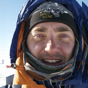 Christian S. M. Turney(Chris Turney)合作论文数Earth and Sustainability Science Research Centre, School of Biological, Earth and Environmental Sciences, Faculty of Science, The University of New South Wales13
 Ziggy Marzinelli合作论文数School of Life and Environmental Sciences, Faculty of Science, The University of Sydney11
 Katherine A Dafforn合作论文数Evolut & Ecol Res Ctr, Univ New S Wales8
 Eleanor Rainsley合作论文数Sch Geog Geol & Environm, Univ Keele7
 John Turnbull合作论文数School of Biological, Earth and Environmental Sciences, University of New South Wales7
 Erik Van Sebille合作论文数Institute for Marine and Atmospheric Research, Utrecht University;Freudenthal Institute, Utrecht University7
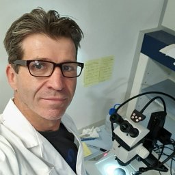 Brendan P. Kelaher合作论文数Department of Ecology;State University of New York;Department of Ecology, State University of New York7
 Jordan Gacutan合作论文数Centre of Marine Science and Innovation, UNSW-Sydney;Global Ocean Accounts Partnership, UNSW-Sydney;Centre of Marine Science and Innovation, UNSW-Sydney6
 Zoë A. Thomas合作论文数Earth and Sustainability Science Research Centre, School of Biological, Earth and Environmental Sciences, Faculty of Science, The University of New South Wales6Richard Jones合作论文数Hadley Centre, Met Office6
 Lionel Carter合作论文数6
 Melinda A Coleman合作论文数University of New South Wales Center for Marine Bioinnovation6
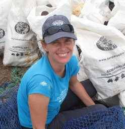 Heidi Tait合作论文数Tangaroa Blue Foundation5
 Matt McGlone合作论文数Long-Term Ecology Laboratory, Landcare Research5
 Janet Wilmshurst合作论文数School of Environment, Faculty of Science, The University of Auckland5Pavla Fenwick合作论文数5
 Jonathan Palmer合作论文数School of Environmental and Life Sciences, College of Engineering, Science and Environment, The University of Newcastle, Australia;Gondwana Tree Ring Laboratory5
 Nathan A. Knott合作论文数School of Biological, Earth and Environmental Sciences, University of New South Wales5
 Jonathan S. Stark合作论文数Human Impacts Research, Australian Antarctic Division5Ezequiel Martin合作论文数4
 Violette Zunz合作论文数4
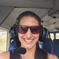 Jasmin C. Lawes合作论文数Ctr Ecosyst Sci, Univ New South Wales4
 Stephanie Waterman合作论文数Department of Earth, Ocean and Atmospheric Sciences, Faculty of Science, The University of British Columbia4
 Sally A Bracewell合作论文数Evolution & Ecology Research Centre, The University of New South Wales4
 Melanie A. Harsch合作论文数4Laura M. Ciasto合作论文数Climate Change Research Centre, University of New South Wales4
 Tracey Rogers合作论文数Centre for Marine Science and Innovation, School of Biological, Earth and Environmental Sciences, Faculty of Science, The University of New South Wales4
 Eamonn Maher合作论文数Aston Medical School, College of Health and Life Sciences, Aston University;National Institute for Health and Care Research4
 Hugues Goosse合作论文数Centre De Recherches Sur La Terre Et Le Climat Georges Lemaître, Earth and Life Institute, Université Catholique De Louvain4Rachel G Knox合作论文数3D Bolton合作论文数School of Biological, Earth and Environmental Science, University of New South Wales3
 Mathew Lipson合作论文数Australian Research Council Centre of Excellence for Climate System Science, UNSW Sydney3
 Eva A. Cougnon合作论文数Inst Marine & Antarctic Studies, Univ Tasmania3
 Jose-Ezequiel Martin合作论文数3
 Ruth Casey合作论文数3Martin J. Riddle合作论文数3
 Alistair G. B. Poore合作论文数Centre for Marine Science and Innovation, School of Biological, Earth and Environmental Sciences, Faculty of Science, The University of New South Wales3
 Victoria Parker合作论文数Department of Oncology and Metabolism, The Medical School, Faculty of Medicine, Dentistry & Health, The University of Sheffield3
 Sarah J Richardson合作论文数Landcare Research3
 Robert Semple合作论文数Centre for Cardiovascular Science, Queen's Medical Research Institute, The University of Edinburgh;College of Medicine and Veterinary Medicine, The University of Edinburgh3
 Kerry-Jayne Wilson合作论文数Entomology Group;Isaac Centre for Nature Conservation Soil;Lincoln University Canterbury;Isaac Centre for Nature Conservation Soil, Lincoln University Canterbury3Rachel S. Smith合作论文数2
 Darren Hargrave合作论文数2Scott Wilson合作论文数2Dan Evans合作论文数2Amit Patel合作论文数2Fay Rodger合作论文数2




