This article addresses the robust formation tracking control problem for multiple underactuated autonomous surface vehicles (ASVs) subject to bounded unknown disturbances. A high-order control barrier function (HOCBF) based collision avoidance formation tracking framework is proposed which combines a nominal controller and the HOCBF induced collision avoidance conditions. First, a predefined-time observer based nominal controller is proposed for the multi-ASV system which achieves formation tracking under general directed communication graphs. Then, a novel HOCBF based collision avoidance method is proposed for ASVs modeled by elliptical shapes to reduce conservatism introduced by conventional circular occupancy area assumptions. Finally, local quadratic optimization problems are established for the ASVs such that the robust collision avoidance formation tracking is achieved with minimal deviation from the nominal trajectories. Extensive simulation and physical experiments are conducted to verify the effectiveness of the proposed control strategy.
The search and containment problem requires a multi-agent system to alternate between dispersion for information acquisition and gathering for target capture under spatiotemporal constraints. Existing studies typically treat search and containment as distinct tasks, whereas this paper shows that they can be addressed within a unified endpoint decision formulation under stage-dependent parameter settings. Specifically, this paper presents a unified framework that predicts the target's position via a hierarchical information map, and generates endpoints in discrete space using a convolution-based greedy algorithm. Then, Gaussian belief propagation is used to refine endpoints and trajectories in continuous space while enforcing safety constraints and stage-dependent termination conditions. Simulations across diverse maps demonstrate order-of-magnitude runtime reductions relative to an integer programming solver, while achieving competitive terminal time and a lower collision rate compared to a baseline that designs separate algorithms for search and containment.
Accurate, robust, and adaptive localization is essential for various robotic operations. This paper proposes a new message passing (MP) algorithm for realizing collaborative localization in a distributed manner. The algorithm unifies Gaussian belief propagation (GBP) and mean-field (MF) approximation, where GBP preserves dependencies among robot states, and MF enables estimation of noise statistics. To effectively handle non-conjugate terms from nonlinear measurement models, the algorithm adopts a parametric formulation in which these terms are treated by gradient estimators. Beyond linearization and sampling, we further design a normalizing flow (NF)-based gradient estimator, enabling learnable sampling. End-to-end training tunes NF parameters according to the behavior of MP, improving the overall estimation performance. To support estimation of practical robotic states that involve rotations, the method is then extended to Lie group state spaces. Finally, the method is applied to multirobot localization task fusing odometry, global navigation satellite system (GNSS) measurements, and inter-robot ultra wideband (UWB) ranging. Simulations and experiments on autonomous surface vehicles (ASVs) demonstrate its improved accuracy, robustness, and adaptability.
This paper presents a marker-free method for reconstructing underwater structures by stitching multi-view dense point clouds from stereo vision with sparse point clouds from Structure from Motion (SFM), using the Iterative Closest Point (ICP) algorithm. The method addresses point cloud registration and stitching challenges in underwater environments without feature markers. Stereo image data are acquired in a single session, defined as a continuous capture along a fixed path under stable conditions. The main contributions of this work are: (1) a complete underwater 3D reconstruction pipeline combining stereo vision and SFM without artificial markers; (2) a two-stage alignment approach robust to underwater imaging challenges such as refraction and texture degradation; and (3) a comprehensive accuracy evaluation using ground-truth laser scans. Experiments under static and clear water conditions validate the method's effectiveness in mitigating refraction and scattering while maintaining stable imaging. Quantitative results show that reducing the stereo baseline angle to 10 degrees improves registration, achieving a Chamfer Distance of 22.58 mm, F-Score values of 0.5086 (tau = 1.0 mm) and 0.4625 (tau = 1.5 mm), and a normal consistency of 0.05967. These results indicate competitive accuracy under real-world underwater conditions. Considering challenges such as light refraction, distortion, and texture degradation, this level of geometric accuracy reflects strong robustness. Compared to existing methods that rely on artificial targets or are sensitive to underwater distortion, the proposed approach enhances robustness and generalizability, providing an efficient and accurate solution for underwater inspection and surface defect analysis in clear, static water using only stereo imaging equipment.
Advanced unmanned and intelligent underwater surveying technologies are increasingly replacing traditional methods for the inspection of underwater structures. However, existing calibration methods often struggle to meet these requirements simultaneously under challenging underwater conditions. A major challenge in underwater multi-camera 3D reconstruction is achieving accurate calibration without the use of artificial markers, which are difficult to deploy. This paper presents a novel marker-free calibration technique based on 2D-3D feature mapping in overlapping areas to stitch 3D point clouds of bridge piers. This method effectively eliminates the dependency on physical markers, enabling efficient and accurate inspection. By utilizing texture features in these overlapping zones, the proposed approach substantially decreases the calibration time required for optical systems and improves the overall efficiency of underwater three-dimensional morphological measurements. The accuracy and practicality of the proposed method were rigorously evaluated through both controlled laboratory tests and field experiments. Laboratory results demonstrated an average stitching error of 0.15 mm for corresponding 3D feature points on concrete cuboid surfaces. During actual pier inspections, the method achieved an average error of 0.3 mm, outperforming conventional close-range photogrammetry, which yielded an average error of 0.71 mm. Moreover, the proposed approach offers greater simplicity, higher efficiency, and enhanced adaptability across diverse inspection scenarios. These findings confirm that the method is well-suited for a broad range of applications in underwater structural inspection.
Autonomous navigation demands the ability to operate in unknown and unstructured environments using only onboard, limited-range sensor data, without reliance on prior maps or global information. To address this challenge, this article introduces a novel end-to-end navigation framework composed of perception and planning modules. By adopting a modular end-to-end paradigm, the framework avoids the compounding errors inherent in traditional, decoupled pipelines. The perception component, Perception Net, is an interpretable deep unfolding network that efficiently processes raw point clouds into a compact feature representation of arbitrary obstacles, exhibiting significant advantages in both efficiency and accuracy. The planning component is a reinforcement learning planner featuring a velocity-adaptive B & eacute;zier action space, which learns a smooth and kinematically feasible navigation policy endowed with a forward-looking capability to handle nonconvex environments. The agent's decisions are based solely on its own state, goal coordinates, and real-time perception features. Extensive simulations demonstrate the framework's high success rate and robust generalization to complex scenarios. The effectiveness of this end-to-end framework is further validated through real-world field tests on an autonomous surface vehicle platform, demonstrating its capability to operate as a map-less and forward-looking system for autonomous navigation in complex environments.
Conventional localization of unmanned surface vehicle (USV) predominantly relies on a single integrated navigation system, typically comprising a global navigation satellite system (GNSS) and an inertial navigation system. However, the GNSS signals are vulnerable to external perturbations, which can substantially compromise the positioning accuracy. To achieve high-precision positioning of USV, this article investigates the cooperative localization problem for a class of USV in peer-to-peer heterogeneous sensor networks. A cooperative consensus localization (CCL) algorithm is proposed for the USV operating within heterogeneous sensor networks composed of ultra wideband modules and an integrated navigation system. The algorithm adopts a consensus-based state estimation approach founded on the principle of consensus on information. By integrating these methodologies, the proposed CCL algorithm enables high-precision localization of USVs, even in the presence of unknown inputs originating from the integrated navigation system. Furthermore, the stability of the proposed CCL algorithm is guaranteed under mild assumptions, including bounded system parameters, the doubly-stochastic property of the weight matrix, and connectivity in the heterogeneous sensor network. Specifically, the estimation error of each estimator remains uniformly bounded in the mean-square sense. Finally, the effectiveness and superiority of the proposed technique are validated through both numerical simulations and practical experiments.
Accurate system identification is crucial for model-based control, planning, and algorithm training. Although numerous robotic model structures have been established, the specific parameter values within these models still require further estimation in practical applications. Meanwhile, with the rapid development of multirobot systems, leveraging collaboration among robots to enhance parameter estimation accuracy and accelerate convergence becomes a viable approach. To this end, a new collaborative parameter estimation strategy is proposed in this article, allowing decentralized fusion estimation and distributed computations. Meanwhile, this decentralized and distributed framework is able to achieve comparable results to centralized estimation that collects measurements from all robots and directly estimate the posterior in a single computing unit. To enhance the robustness against environmental disturbance containing outliers, the robust local estimator is designed based on mean-field variational inference. Finally, we employ autonomous surface vehicles as research subject and conduct a series of experiments to demonstrate the effectiveness of proposed approach.
PurposeThis paper aims to address the limitations of LiDAR-based place recognition in complex and large-scale environments. In practice, performance often degrades due to sparse data, sensor noise, dynamic objects and slow retrieval in large maps. These issues highlight the need for more robust and efficient place recognition approaches.Design/methodology/approachThis study presents the baseline intensity-assisted triangle descriptor, which combines geometric features with calibrated LiDAR intensity for robust place recognition. The process involves intensity calibration, plane detection, image generation and keypoint extraction. Based on these, triangle and intensity descriptors are constructed to represent structure and reflectivity. They are then used in a two-stage loop closure framework for fast retrieval and reliable verification, ensuring both accuracy and efficiency. Finally, the proposed method is thoroughly evaluated on the benchmark data set.FindingsExperimental results indicate that the proposed method achieves higher precision and recall compared to state-of-the-art approaches. On average, the F1-score increases by approximately 26% over STD and 24% over Scan Context. The two-stage framework effectively reduces false matches while maintaining high recall, and the introduction of the baseline intensity descriptor significantly improves retrieval efficiency.Originality/valueThis work proposes a lightweight and interpretable global descriptor that integrates geometric structure with calibrated LiDAR intensity. By combining these complementary features in a two-stage detection framework, the method achieves a balance of accuracy, robustness and efficiency.
Cooperative path planning for multiple autonomous surface vehicles (ASVs) in dynamic environments is essential for the successful execution of various missions. This paper proposes a cooperative motion planning method based on probabilistic inference. The method employs Gaussian process-based dynamic modeling to capture the characteristics of ASV motion, and incorporates individual obstacle avoidance and multi-ASV communication topology constraints. Then the multi-ASV planning problem is addressed using probabilistic inference. To enable real-time planning, an incremental optimization framework based on a sliding window is introduced to segment the trajectory planning process. The overlapping window trajectories are linearly weighted and fused to improve computational efficiency while maintaining continuity. Finally, simulations within the ROS framework validate the method's superiority in balancing planning efficiency and safety in complex environments.
This paper discusses an innovative vehicle-mounted device designed for efficient inspection of bridge undersides, aiming to address the challenges of manual inspections, such as being labor-intensive and inefficient. The device uses high-precision cameras to capture detailed images of bridge bottoms, facilitating a thorough condition assessment. It evaluates three feature point extraction algorithms for image stitching—Scale-Invariant Feature Transform (SIFT), Harris corner detection, and Speeded Up Robust Features (SURF)—to create complete visual representations of bridge undersides. Field tests on a prefabricated I girder bridge demonstrated the device's effectiveness in gathering and stitching images, with the SIFT algorithm performing best for girder bottoms, Harris corner algorithm for web and flange surfaces, and SURF for rapid image processing. This research provides a foundation for the rapid identification of visible defects on bridge superstructures, significantly benefiting bridge maintenance and safety evaluations.
This article investigates the cooperative curved path-following problem of underactuated autonomous surface vessels (ASVs) in time-varying formations. The proposed cooperative guidance strategy consists of the individual guidance law of heading angle and total velocity and the tracking differentiator-based virtual control inputs. Specifically, the former is developed through a novel line-of-sight (LOS) guidance method to guide ASVs to their desired positions, enabling the achievement of time-varying formations; The latter are designed for each ASV to ensure accurate tracking of the guidance signals. The along- and cross-tracking error system is asymptotically stable under the proposed individual guidance law, and the input-to-state stability of the tracking error systems under the proposed virtual control inputs are proved by rigorous theoretical analysis, respectively. Finally, numerical simulations and experimental results are conducted to validate the effectiveness of the proposed cooperative guidance strategy for path-following over a parameterized curve.
This study introduces an innovative approach for identifying surface defects in underwater bridge structures through the fusion of deep learning and three-dimensional point cloud. The method employs a U2-Net neural network enhanced with residual U-blocks to effectively capture defect features across scales and merge multiscale underwater image attributes to produce significant probability images for defect detection. By leveraging three-dimensional digital image correlation techniques, the method reconstructs the bridge pier surfaces' physical dimensions from point cloud, enabling precise defect contour and size recognition. The fusion of deep learning's semantic segmentation with the accurate dimensions from point cloud significantly improves defect detection accuracy, achieving pixel accuracies of 0.943 and 0.811 for foreign objects and spalling and exposed rebars, respectively, and an Intersection over Union of 0.733 and 0.411. The method's millimeter-level precision in point cloud reconstruction further allows for detailed defect dimensioning, enhancing both the accuracy and the quantitative measurement capabilities of underwater bridge inspections, and shows promise for future advanced applications in this field.
This article proposes a stochastic event-triggered path-following control scheme aimed at enabling autonomous surface vehicles (ASVs) to track a reference path in a communication-efficient manner. First, a stochastic model of ASV dynamics is established, explicitly incorporating environmental disturbances as additive stochastic noise. Within the line-of-sight (LOS) guidance framework, path-following errors relative to the reference path are subsequently formulated, which incorporate the reference speed, the reference yaw angle, and the path variable. Third, the dynamic event-triggered mechanisms (ETMs) are introduced, based on which kinetic controllers are designed to ensure that the ASV tracks the reference speed and yaw angle accurately. Theoretical analysis using Lyapunov-based stochastic stability criteria demonstrates that both path-following errors and tracking errors are asymptotically bounded in the fourth moment sense, while the occurrence of Zeno behavior can be excluded almost surely. Finally, simulations and experimental validations demonstrate the scheme’s effectiveness, showing a significant reduction in communication load compared with time-triggered baselines.
This article addresses the distributed leader escort control problem for multiple autonomous surface vessels (multi-ASVs) by adopting a signed graph-based modeling approach to represent interaction relationships among the ASVs. Within this framework, the ASVs are classified into two groups, with the control objective of forming time-varying formations on either side of the dynamic leader while maintaining consistent distances. One challenge in addressing this issue is that only a subset of the following ASVs has access to the escort information and the motion data of the leader. Focusing on scenarios with only external disturbances, we introduce a predefined-time escort control scheme that confines error systems within a designated manifold using two auxiliary time-varying functions. It is proven that the predefined-time leader escort can be achieved under the present control scheme with appropriate gain parameters. To address the leader escort control problem in the presence of internal model uncertainties and external disturbances, we develop a fully distributed robust adaptive leader escort controller that guarantees the asymptotic convergence of escort errors. Specifically, neural networks and nonsmooth feedback are employed to approximate model uncertainties and to compensate for unknown bounded disturbances, respectively. Notably, the control gains are adaptively adjusted without reliance on any global information. The efficacy of the proposed escort controllers is verified through comprehensive simulation and experimental studies.
Conflict-based search (CBS) is one of the widely used algorithms to solve multi-agent path finding (MAPF) problems. Though it combines optimality and completeness as a search algorithm, the time it takes to search for a solution grows exponentially as the number of agents gradually increases, and thus does not scale well. In this paper, a learning-based graph transformer is utilized as the heuristic function to accelerate planning in non-gird environment with roadmap generation. To solve unconnected graph problems when performing low-level path planning search in the CBS framework, triangulation method is introduced to obtain an optimized path with less nodes and edges. Simulation shows that the learning-based search method trained on roadmaps generated by constrained delaunay triangulation (CDT) leads to better solutions and a much greater success rate.
Camera-based visual simultaneous localization and mapping (VSLAM) algorithms involve extracting and tracking feature points in their front-ends. Feature points are subsequently forwarded to the back-end for camera pose estimation. However, the matching results of these feature points by optical flow are prone to visual feature mismatches. To address the mentioned problems, this paper introduces a novel visual feature mismatch detection algorithm. First, the algorithm calculates pixel displacements for all feature point pairs tracked by the optical flow method between consecutive images. Subsequently, mismatches are detected based on the pixel displacement threshold calculated by the statistical characteristics of tracking results. Additionally, bound values for the threshold are set to enhance the accuracy of the filtered matches, ensuring its adaptability to different environments. Following the filtered matches, the algorithm calculates the fundamental matrix, which is then used to further refine the filtered matches sent to the back-end for camera pose estimation. The algorithm is seamlessly integrated into the state-of-the-art VSLAM system, enhancing the overall robustness of VSLAM. Extensive experiments conducted on both public datasets and our unmanned surface vehicles (USVs) validate the performance of the proposed algorithm.
The collision avoidance and path-following problem is fundamental for unmanned surface vehicles (USVs) to accomplish various tasks in different water environments. However, addressing this issue is challenging, as USVs are inevitably affected by environmental disturbances in practice. In this study, we address the robust collision avoidance path-following problem for USVs with unknown bounded environmental disturbances by using the control barrier function (CBF)-based approach. To reduce the conservativeness for the collision avoidance actions, the elliptical shape of the USV is considered when designing the control law. Furthermore, a high-order control barrier function (HOCBF)-based approach is proposed to achieve the robust collision avoidance with respect to both static and dynamic obstacles. Specifically, a nominal robust path-following controller is first designed utilizing the predefined-time observers without considering the collision avoidance requirement. Then, by considering the elliptical USV and the circular obstacles, collision avoidance input constraints are derived by the proper HOCBFs. Finally, a local quadratic programming (QP)-based controller is proposed to achieve robust collision avoidance and path-following of the USV. Simulation and experimental results are presented to demonstrate the effectiveness of the proposed control strategy.
The cognition of the frequent activity areas of ships based on AIS data is of great significance in reducing port navigation risks and improving the efficiency of ships entering and leaving ports. Traditional extraction methods only consider spatial information and ignore the impact of temporal information on clustering results, resulting in inaccurate extraction of frequently active areas. We propose an advanced grid density peak clustering method (AGDPC) to extract frequently active areas, which can advanced select cluster centers and density thresholds to solve the problem that grid density peak clustering methods cannot advanced select cluster centers. The improved grid density peak clustering method is used to extract frequent ship motion regions under a single spatial-temporal granularity according to a given spatial-temporal granularity. Then, we fuse multiple ship frequent activity areas to obtain multi-temporal and spatial granularity ship frequent activity areas. Experimental results show that this method can extract frequent motion are-as more accurately than traditional methods, and better reflect the ship's navigation rules.
To improve the obstacle avoidance capability of agents and ensure reliable communication during the path following of heterogeneous marine unmanned systems, a dynamic safety area and communication distance constraint based path planning algorithm is proposed in this paper where the communication distance constraint is considered. Firstly, the dynamic safety area is constructed based on the relative velocity between agents and the dynamic obstacles to realize obstacle avoidance. Secondly, the reachable area of agents is determined according to the communication distance constraint such that the heterogeneous marine unmanned system maintains a high quality of communication during the path following. Finally, the communication constraint center switching algorithm is proposed to meet the communication distance constraint in different sea scenes. Numerical simulations are performed to show that the proposed path planning algorithm achieves strong communication connectivity during the path following of the agents in the heterogeneous marine unmanned system.
 Guanghui Wen (温广辉)合作论文数School of Automation, Southeast University14
 Tao Wu合作论文数5
 Shitong Hou (侯士通)合作论文数School of Civil Engineering, Southeast University5
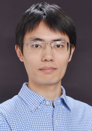 Yuezu Lv (吕跃祖)合作论文数School of Al, Beijing Institute of Technology5
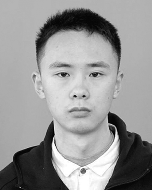 Linan Wang合作论文数3Jialing Zhou (周佳玲)合作论文数School of Automation, Nanjing University of Science and Technology3
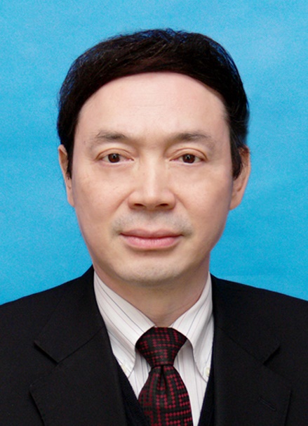 Zhishen Wu (吴智深)合作论文数School of Civil Engineering, Southeast University;Henan University of Technology3Weihao Sun合作论文数2
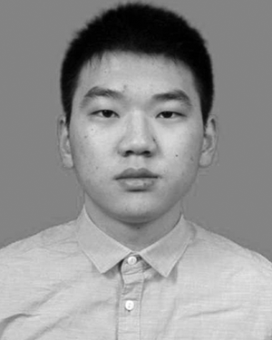 Jun Zhou合作论文数2
 Dan Zhao合作论文数2
 Xiao Fang合作论文数School of Mathematics, Southeast University, Nanjing, China2
 Junjie Fu (付俊杰)合作论文数Department of Systems Science, School of Mathematics, Southeast University2
 Wen Xiong (熊文)合作论文数School of Transportation, Southeast University2
 Gang Wu (吴刚)合作论文数School of Civil Engineering, Southeast University2
 Yuting Feng合作论文数1
 Xingquan Fu合作论文数1Shuwang Wang合作论文数1Hang Lu合作论文数1Xuanrui Xiong合作论文数1
 Mengfei Niu合作论文数1
 Liangming Chen合作论文数Harbin Inst Technol, Sch Astronaut, Harbin 150001, Peoples R China1
 Guanrong (Ron) Chen (陈关荣)合作论文数Department of Electrical Engineering, City University of Hong Kong1
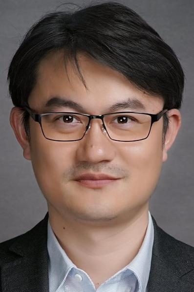 Lei He (何磊)合作论文数School of Civil Engineering, Southeast University1
 M. (Ming) Cao合作论文数Faculty of Science and Engineering, University of Groningen;Jantina Tammes School of Digital Society, Technology and AI, University of Groningen1
 Xiaozheng Jin (金小峥)合作论文数Faculty of Computer Science and Technology, Qilu University of Technology1
 Dezhi Zheng (郑德智)合作论文数School of Optics and Photonics, Beijing Institute of Technology;Advanced Research Institute of Multidisciplinary Sciences, Beijing Institute of Technology1




