Variational autoencoder (VAE) based hyperspectral anomaly detection (HAD) methods enable background samples to form statistically structured distributions by imposing probabilistic constraints in the latent space. However, most existing VAE-based approaches rely on a single latent distribution to model the background, which limits their ability to characterize complex background diversity. In addition, anomaly detection is typically based solely on reconstruction error, without explicitly considering deviations in the latent distribution, leading to insufficient discrimination between anomalies and background. Therefore, we propose a latent-space HAD method based on multi-Gaussian prototypes. Specifically, a Gaussian mixture model (GMM) is introduced into the latent space of the VAE to perform multi-prototype background modeling, where each prototype represents a distinct background distribution pattern. This strategy mitigates the problem of inaccurate modeling caused by overly simplified background distribution assumptions. In addition, to avoid prototype collapse caused by imbalanced competition among Gaussian components, a prototype competition modulation mechanism is designed. By adaptively adjusting the response of the dominant prototype, this mechanism promotes balanced participation among different prototypes, thereby improving the stability of latent-space modeling. Finally, an anomaly score is constructed by jointly considering reconstruction error and latent-space deviation, enabling anomaly characterization from both reconstruction and statistical perspectives. This design effectively improves the separability between anomalous targets and normal background samples. Experiments conducted on six hyperspectral datasets demonstrate that the proposed method achieves superior detection performance compared with nine state-of-the-art approaches. The results demonstrate the effectiveness of multi-Gaussian prototype modeling for improving the robustness and accuracy of HAD.
Hyperspectral Image (HSI) provides essential data support for fine-grained lithology classification. With the development of deep learning, methods combining convolutional neural networks and Transformers have gradually attracted attention from researchers. However, in complex geological scenarios, lithologic units exhibit multiscale structural characteristics, along with strong spectral similarity, complex spatial morphology, and fragmented boundary structures, which significantly hinder classification performance improvement. To address these challenges, this paper proposes a Direction-Augmented and Sparsity-Adaptive Network (DASNet). The proposed method jointly enhances multiscale structural representation, spectral–spatial modeling, and efficient global dependency learning, enabling unified representation of local geological structures and long-range global context. Specifically, a Multiscale Progressive Feature Extraction module is first developed to effectively extract and integrate spatial structural information and progressive spectral features across different receptive fields. Subsequently, a spectral and orthogonal-spatial attention module is designed to strengthen key spectral responses and directional spatial representations, thereby alleviating spectral confusion and improving the representation of irregular boundaries. Finally, a hybrid sparse self-adaptive transformer is proposed. By introducing a hybrid sparse attention mechanism, high-correlation feature interactions are modeled and global contextual information is preserved, thereby achieving efficient and robust feature representation. Experimental results demonstrate that DASNet consistently outperforms existing methods on multiple hyperspectral lithology datasets.
Mineral mapping is a significant focus in remote sensing research, which aims to fully utilize spectral data for identifying and describing the composition of surface minerals. To gain a deeper understanding of mineral distribution within the study area, fine-grained hyperspectral image classification (HSIC) has emerged as an important research challenge. In mineral scenes where mineral co-occurrence and severe spectral mixing are prevalent, variations in mineral abundances largely govern discriminability, making abundance information essential for improving the reliability of mineral identification. Motivated by these considerations, we develop a spatial-spectral component representation network for HSIC, called SSCRNet, which introduces an autoencoder-structured unmixing network to achieve complementary integration between abundance features and deep features extracted by the network. The SSCRNet enhances deep classification networks by introducing convolutional layers with different dilation rates, which enables the simultaneous capture of fine-grained mineral texture details and large-scale geological structural patterns in mineral areas. This design effectively improves the classification performance for complex surface types. Experimental results demonstrate that SSCRNet outperforms existing state-of-the-art approaches in classification performance and robustness for mineral mapping scenarios.
Spectral variability in complex environments brings a dual challenge to accurate hyperspectral unmixing: large intra-class and small inter-class differences. Most deep learning frameworks treat features uniformly and fail to distinguish highly similar endmembers, which easily confuses abundance estimation. To simultaneously tackle this dual challenge, integrating endmember bundle priors that effectively accommodate intra-class variations into deep networks has emerged as a promising solution. However, current methods face bottlenecks in both the extraction and utilization of endmember bundles. To this end, we propose a novel Prompt-Guided Transformer Network (PGT-Net). It accommodates intra-class variations while effectively amplifying subtle inter-class differences. First, addressing the redundancy and noise introduced by existing extraction methods that blindly pursue quantity, a Density-based Redundancy-aware Endmember Bundle Extraction (DR-EBE) algorithm is proposed. It utilizes density-guided clustering and spatial-spectral screening strategy to extract high-quality, low-redundancy endmember bundle priors. Second, our innovatively designed Prompt-Guided Endmember Transformer (PGET) converts these priors into endmember-specific prompt vectors. It performs targeted activation of specific features to capture and amplify subtle inter-class differences. Finally, a Spatial Complementary Integration Module (SCIM) is designed. It utilizes spatial complementarity to adaptively refine feature boundaries and performs cross-channel interactions to further break information isolation. Extensive experiments on multiple hyperspectral datasets show that PGT-Net significantly outperforms state-of-the-art unmixing algorithms. If the paper is accepted, the code will be made publicly available at https://github.com/UPCGIT/PGT-Net.
Nitrogen is one of the critical factors in water pollution and eutrophication, so applying the deep learning method in remote sensing inversion of nitrogen can provide basic information for environmental management. This paper proposes a two-step feature extraction method to solve the problem that the number of bands in water quality inversion is insufficient and the deep learning method cannot be fully exploited. Firstly, manual feature extraction is completed through the fusion between bands to obtain a set of high-latitude shallow factors, which make the features rich and diverse. Then, a one-dimensional convolutional residual network (ResNet-1D) is constructed, and the deep features are automatically extracted through convolution operations of the model, where the residual learning is used to reduce the training difficulty. The full connection is established through depth features. The comparison of models shows that the Mean Relative Error (MRE) is decreased by at least 10% in both test and validation datasets. Finally, the spatiotemporal distribution of total nitrogen concentration (TNC) in the coastal waters of Shandong is explored. In general, the spatial distribution is that the concentration near the coast is higher than the far. The temporal variation is that the monthly mean of the TNC is low in March, moderate in May and August, and high in October; the annual average value of TNC is 0.3mg/L, which has decreased slightly year by year since 2014.
A new approach is proposed to address the issues of insufficient identification range, incomplete appearance, poor accuracy, high artificial dependence, and low data sharing in the investigation of large-scale outcrop profiles of a large slope. UAV nap-of-the-object photography technology is used to capture outcrop profile images and a three-dimensional model is established with millimeter accuracy. Based on this, a network digital outcrop platform is developed using Web GIS technology to share the outcrop data. To reconstruct a local rock surface, a veneer should be built on the surface of the 3D model. There are some problems such as inaccurate veneer range and discontinuity veneer in the methods of Cesium built-in and boundary surface which are often used to build the veneer. This paper proposes a novel method to automatically determine the feature points of a rock profile in Web virtual scene by utilizing the relationship between geometric features of spatial scene and spatial distance measurement. These feature points are used as interpolation points to construct 3D Delaunay triangulation network to form a veneer on the surface of the 3D model, enabling the reconstruction of the rock profile in the Web virtual scene. The experiments show that the reconstructed rock range is correct, and the internal continuous results are clear. It effectively calibrates the strata range and provides auxiliary means and data support for the construction of geological data knowledge base.
本文提出了一种随机森林(random forest,RF)模型和Pearson相关系数相结合的RF-Pearson模型特征优选方法.以多时相Sentinel-2 影像为数据源,提取多时相多特征;利用RF-Pearson模型进行特征选择,筛选出特征重要性得分较高且相关性较小的特征作为优选特征,参与黄河三角洲湿地信息提取;最后将分类结果与多时相全特征和随机森林模型优选特征进行比较.实验表明:特征优选能够提高湿地信息的提取效果,基于 RF-Pearson 模型特征优选方法的分类精度最高,表明了特征优选方法的有效性以及特征优选在湿地分类方面的优势.
Autoencoders (AEs) are widely utilized in hyperspectral unmixing (HU) as an unsupervised learning model. In particular, convolutional AE networks are popular for processing multidimensional hyperspectral features. Nonetheless, the traditional convolutional AE network’s receptive field is constrained in the unmixing task, and establishing the connection between the local spatial neighborhood and the local spectrum fails to improve unmixing performance significantly. To address these limitations, a bilateral global attention network based on both spatial and spectral information is proposed. It enables the network to obtain respective feature dependencies in the two dimensions and achieve optimal fusion of both features. The network comprises two information extraction branches. The spatial information extraction branch uses the Swin Transformer block to acquire the global spatial attention of the overall image, while the spectral information extraction branch designates a simplified spectral channel attention mechanism to gain spectral attention weight maps. The network’s efficacy is demonstrated through a comparative study using a synthetic dataset and two real datasets. The code of this work is available at https://github.com/UPCGIT/SSABN .
Coastlines with different morphologies form boundaries between the land and ocean, and play a vital role in tourism, integrated coastal zone management, and marine engineering. Therefore, determining how to extract the coastline from satellite images quickly, accurately, and intelligently without manual intervention has become a hot topic. However, the instantaneous waterline extracted directly from the image must be corrected to the coastline using the tide survey station data. This process is challenging due to the scarcity of tide stations. Therefore, an improved instantaneous waterline extraction method was proposed in this paper with an integrated Otsu threshold method, a region-growing algorithm, Canny edge detection, and a morphology operator. Based on SAR feature extraction and screening, the multi-scale segmentation method and KNN classification algorithms were used to achieve object-oriented automatic classification. According to different types of ground features, the correction criteria were presented and used in correcting the instantaneous waterline in biological coasts and undeveloped silty coasts. As a result, the accurate extraction of the coastline was accomplished in the area of the Yellow River Delta. The coastline was compared with that extracted from the GF-1 optical image. The result shows that the deviation degree was less than the field distance represented by three pixels.
This study focuses on the coastal features, environments, and dynamics to accurately describe and regularly monitor the Qingdao shoreline in eastern China. It collects categorical ETM+ and OLI data from 2000, 2010, and 2019 on the mainland coastline and explores the characteristics and spatiotemporal differences across the past 19 years by using remote sensing and geographic information system (GIS) technologies. The results show that the length of the Qingdao coastline has increased continuously over the last two decades, for a total increase of 18.14 km. There are different natural and artificial coastlines that have undergone major changes. The human-induced deterioration of coastlines has gradually and substantially risen from 53.63% in 2000 to 68.40% in 2019, while the length of the natural coastlines has decreased dramatically. Jiaozhou Bay focuses on areas with significantly changing coastlines, and major changes have occurred in the west and east of the Qingdao coast. The coastline has largely expanded seaward because of the comprehensive impact of natural and anthropogenic factors. The leading factor in coastal evolution is coastal engineering constructions. In addition, the top three other construction activities are the restoration of the aquaculture pond, salt field, and harbor edifices. The driving force that triggered the shift in the coastline reveals significant temporal heterogeneity.
To identify the geostress adjustment process of Japanese earthquake in Bohai Strait and its surrounding area, based on the data of 10 shallow hydraulic fracturing drills in the axis of the channel acquired from 2012 to 2014, the dispersed point charts and regression formulas of each parameter with depth were established and calculated. The results showed that between 2010 and 2014, the horizontal differential stress first decreased and then increased, and the direction of stress first rotated clockwise and then counter-clockwise. Therefore, coseismic and postseismic displacement triggered by Japanese earthquake caused shallow extensional effect which lasted from 2011 to 2012 in research area, and shallow stress didn't return to the original level until 2013. During the period of shallow stress reduction, the fault zone of seismic hazard was reduced as the compressive strain energy was released, while during the period of sustained stability after stress recovery the NWW fault zone had the maximum seismic hazard than NNE. The results were of great significance for research on shallow stress accumulation caused by earthquake, fault activity and the construction of tunnel in Bohai Strait and its surrounding area.
To identify the difference of current geostress distribution and stress accumulation in surface layer and shallow surface layer of Bohai strait and surrounding area,the data of 5 shallow hydraulic fracturing drills along the axis of the channel and the other deep drilling data in surround area were collected. The dispersed point charts of stress varying with depth were established and the regression formulas of each parameter with depth were calculated. The research shows that , change with depth linearly and , , change with depth hyperbolically. , , change with depth almost linearly. The comparison of the regression formulae of surface and shallow layer show that the difference of regression formula of horizontal principal stress is significant,the difference of regression formula of lateral pressure coefficient is small and the difference of regression formula of ratio parameters is basically the same. These indicate that the surface stress data can be applied to the analysis of stress accumulation and seismic activity in the brittle crust. The combination of with is necessary to determine the energy accumulation at the points of in stress accumulation analysis. The comprehensive research on and lead to the conclusion that 19 surface points in Bohai strait and 86% shallow points in the surrounding district are in the middle-low level of stress accumulation,and the crustal stability is high. Some points in Beijing,Tianjing and Tangshan are in the state of high stress accumulation,and the crustal stability is low which need more attention. But these have little impact to the cross-sea corridor.
查明渤海海峡处现今地应力状态及断层活动状况,可为渤海海峡跨海通道建设提供科学依据.在通道中轴线上布设6个浅钻钻孔,进行了7个测点的空芯包体地应力测量工作.对测量数据分析后,认为海峡区最大水平主应力、最小水平主应力与垂直主应力均随深度的增加而线性增大;最大水平主应力大于垂直应力,区域内构造力处于主导地位;各测点处均有两个主应力位于近水平方向,其与水平面的夹角平均为7.8°;研究区内地应力各分量值之间相差不大,远远小于区内断层活动应力值的下限,研究区目前处于稳定状态.区域横向上看,海峡区南部地壳浅部的应力状态为σH>σh>σv,有利于逆断层活动,北部的应力状态为σH>σv>σv,有利于走滑断层活动;垂向上看,70 m以上的各点应力值受地形影响较大,-70~-130m处的各点处于挤压应力状态中.整个区域处于NE-NEE向的挤压应力场中,在区域应力场的作用下,郯庐断裂带运动状态为右旋压扭,蓬莱-威海断裂带为左旋压扭,黄河口-庙西北断裂带处于拉张走滑运动状态中.
In the building of 3S system which covered the Yellow River estuary area,we take the symbolization of basic geographic information and the drawing of cross section as examples to illustrate how to show the information involved in the procession.We discussed the methods used to make setup and use the digital Yellow River symbol database,at last we designed more than 280 land feature symbols related to the system.After transformed the cross section observation data based on coordinates into the data based on starting distances we can draw cross section maps which covered the research area in the period of 1953-2004.
在系列案件中,如果能预测案件发生的地点和时间,就可以合理安排警力,也可以采取富有针对性的案件侦破策略,提高刑事案件的侦破效率。探讨如何对这一问题进行数学建模,并基于ESR I公司的ArcEngine进行编程实现。
 Mingming Xu (许明明)合作论文数College of Oceanography and Space Informatics, China University of Petroleum8
 Hui Sheng (盛辉)合作论文数College of Oceanography and Space Informatics, China University of Petroleum7
 Shanwei Liu (刘善伟)合作论文数College of Oceanography and Space Informatics, China University of Petroleum7
 Muhammad Yasir合作论文数Coll Oceanog & Space Informat, China Univ Petr East China3
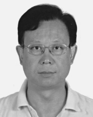 TieHu Zhao (赵铁虎)合作论文数3
 Xunhua Zhang (张训华)合作论文数Institute of Marine Science and Technology, Shandong University3
 Jianyong Cui (崔建勇)合作论文数College of Oceanography and Space Informatics, China University of Petroleum3
 Hong Fan (樊红)合作论文数1zhao jian合作论文数1
 Zhiru Yang合作论文数1Md Sakaouth Hossain合作论文数1LunJie Chang (昌伦杰)合作论文数1Jun Qi (齐君)合作论文数1
 Yanni Dong (董燕妮)合作论文数School of Resource and Environmental Sciences, Wuhan University1
 Bo Du (杜博)合作论文数School of Computer Science, Wuhan University1
 Zhongwei Li (李忠伟)合作论文数College of Oceanography and Space Informatics, China University of Petroleum1
 Renwei Ding (丁仁伟)合作论文数School of Information Engineering, Minzu University of China1
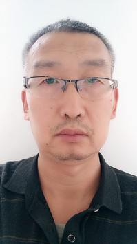 Jisong Zhang (张纪松)合作论文数College of Oceanography and Space Informatics, China University of Petroleum1Guoqing Liu (刘国庆)合作论文数1
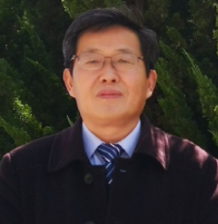 Jianhua Wan (万剑华)合作论文数College of Oceanography and Space Informatics, China University of Petroleum1
 Li Zhang (张丽)合作论文数Institute of Remote Sensing and Digital Earth, Chinese Academy of Sciences1GAO Xiaohui (高小惠)合作论文数1Jianwei Feng (冯建伟)合作论文数School of Geosciences, China University of Petroleum1




