Coastal wetlands are ecologically vital ecosystems that demand accurate and long-term land cover monitoring. The integration of deep learning with hyperspectral imaging enables detailed classification of coastal wetlands by extracting subtle spectral differences among land cover types. However, newly collected images often cannot be fully annotated in time, and they usually exhibit domain shifts from historical data. This impairs the transferability of models to new data. To address this challenge, we propose a novel framework named Brownian distance covariance prototype refinement-based cross-domain few-shot learning (BDCPR-FSL) to transfer knowledge from historical hyperspectral data to newly acquired images with limited annotations. Specifically, a spectral-aware Transformer based on spectral correlation coefficient is introduced to capture subtle spectral differences, particularly in coastal wetland scenes with low interclass separability. Moreover, Brownian distance covariance is employed to capture nonlinear and joint dependencies among features, which are often overlooked by conventional methods relying on marginal statistics. To mitigate prototype deviation caused by sample variability in coastal wetlands, a prototype refinement mechanism is applied to emphasize more representative samples. Furthermore, a domain alignment loss based on Wasserstein distance is incorporated to reduce distribution shifts between domains, while supervised contrastive learning is introduced to enhance class separability. Extensive experiments on multitemporal satellite hyperspectral images of coastal wetlands show that BDCPR-FSL achieves superior performance compared to existing methods.
Enhancing the flexibility of deep learning models for ship detection is essential to ensure reliable performance under challenging maritime environments. Existing UAV-based models often struggle with varying scenarios, environmental conditions, and ship orientations, limiting practical applicability. This study proposes a novel single-source generalization model for ship detection using UAV imagery. The model combines two key components: i) a domain-generalization training dataset generated through advanced 3D modeling and rendering, preserving structural and morphological ship characteristics while minimizing domain-specific features such as color and texture to extract geometric and spatial attributes as generalizable features; and ii) a one-stage deep neural detector designed for UAV imagery. The detector integrates hierarchical attentional contrastive learning to capture generalizable features across multiple scales and an adaptive morphological consistency loss to ensure stable shape and size representation. Experimental results demonstrate superior adaptability compared with state-of-the-art methods, achieving an mAP50 of 94.3 % across unseen harbors, coastal, and open-sea scenes, with an F1-score of 90.8 %. The model also maintains strong mAP50 performance under fog/rain (79.3 %) and low-light (79.9 %) conditions. Overall, the proposed framework offers a scalable, domain-generalized solution for UAV-based ship detection following a "train once, deploy anywhere" principle.
Crop segmentation employing satellite image time series (SITS) enables analysis of the temporo-spatial dynamics of crops. Although Transformer-based methods exhibit powerful temporo-spatial representation capabilities, frequent cloud cover in SITS still limits their ability to extract crop information from local temporo-spatial patterns. Furthermore, the extended temporal dimension of SITS exacerbates computational burdens. Herein, we present SegTS, an end-to-end SITS segmentation framework that combines local temporo-spatial modeling of subseries and global temporo-spatial modeling of overall series for accurate crop segmentation. For local modeling, we design TS-SAM, a Segment Anything Model (SAM)-based subseries encoding network that reorganises arbitrary-length SITS into subseries sets to learn local temporo-spatial patterns and filter cloud noise. It incorporates four key components: 1) a global-aware spectral compressor that aggregates key spectral information, 2) a regular subseries generator constrained by iterative or combinatorial rules to construct subseries sets, 3) a recurrent encoding mechanism with traceable temporal tags for subseries encoding, and 4) a dynamic compatible adapter that learns and adjusts temporo-spatial knowledge derived from SAM. For global modeling, we develop a dual-frequency temporo-spatial learning strategy. This strategy leverages SITS’s inductive biases and frequency decoupling to learn coarse-to-fine temporo-spatial semantics, reducing computational overhead while improving segmentation performance. Extensive experiments demonstrated that SegTS achieved MIoUs of 67.3% and 88.0% on the PASTIS and MTLCC datasets, respectively, outperforming the state-of-the-art TSViT by margins of 1.9% and 3.2%, with lower computational costs. Subseries modeling possesses a superior capability in learning local temporo-spatial patterns, offering potential applicability to diverse SITS data.
Solid waste detection in remote sensing images remains challenging because waste regions often exhibit heterogeneous appearances, irregular boundaries, substantial scale variations, weak visual saliency, and high similarity to surrounding land-cover types. To address these issues, this article proposes CDMNet, a solid waste detector integrating hierarchical frequency modeling, dynamic cross-scale fusion, and magnitude-aware refinement. In the backbone, resolution-specific complex spectral responses are learned for different channels and frequency positions to strengthen global contextual representation and attenuate redundant background responses. In the neck, a two-stage fusion strategy centered on the intermediate feature level promotes repeated interaction between spatial details and semantic information across scales. Magnitude-aware attention is further introduced at the deepest semantic stage to stabilize semantic responses associated with weakly salient and boundary-ambiguous waste regions. Experiments on two solid waste datasets show that CDMNet achieves mAP@50:95 of 56.4% and 37.4%. With 12.0 million parameters, the proposed model achieves a favorable balance between detection accuracy and model complexity. These results demonstrate the effectiveness of CDMNet for solid waste detection in complex remote sensing scenes.
The task of hyperspectral unmixing (HU) is inherently more complex than classification, as it requires separating mixed pixels into pure spectral components, demanding fine-grained spectral and spatial modeling. Traditional convolutional neural networks (CNNs), constrained by local receptive fields, struggle to capture the complex manifold structures and non-Euclidean relationships in hyperspectral images (HSIs). Graph convolutional networks (GCNs) offer a promising alternative by modeling long-range dependencies, but they often rely on static, superpixel-based graphs constructed during preprocessing, limiting their flexibility and accuracy. To address these limitations, we propose a differentiable clustering GCN (DCGCN) for HU. The model integrates spatial neighborhood information with dynamic graph structures, leveraging a differentiable clustering module (DCM) to automatically construct and update the graph during training. This enables adaptive learning of both local continuity and global structural dependencies in an end-to-end framework. To further support benchmarking, we introduce a challenging real-world dataset from the Yellow River Estuary Wetland, along with a reproducible data processing pipeline. By combining GF-5 hyperspectral and GF-6 high-resolution imagery, the dataset provides reliable reference endmembers and abundances without the need for field surveys. Extensive experiments on simulated and real datasets demonstrate that DCGCN outperforms or matches state-of-the-art methods in both accuracy and robustness. Code and dataset will be made publicly available at GitHub: https://github.com/UPCGIT/DCGCN
In hyperspectral anomaly detection (HAD), anomalous pixels typically exhibit a sparsely distributed spatial pattern. Existing deep models often generate backgrounds by reconstructing spectral vectors, yet fail to capture the inherent spatial characteristics of the image. To overcome the semantic and structural information loss caused by neglecting spatial features, we propose the granularity-inconsistent transformer (GIFormer) for unsupervised HAD. Specifically, the interaction between the spatial and spectral dimensions is leveraged to enhance the spatial-spectral feature representation of hyperspectral images, highlighting the differences between background and anomaly features. The GIFormer performs multilevel background reconstruction to detect anomalies. In the encoder, patch-level anomaly elimination masks are applied to reconstruct background features, where spatial correlations of anomalies are utilized to suppress anomalous patterns spanning multiple pixels. The decoder operates at the pixel level, using fine-grained receptive fields for global attention modeling, which enables the model to refine local details that may have been aggregated by the encoder in larger patches, ensuring the final reconstruction retains the intricate structure of the original hyperspectral data. Furthermore, adaptive weight loss is incorporated to guide network training. Extensive experimental results confirm the superior performance of GIFormer.
Due to the high spectral similarity among wetland vegetation types, their uneven spatial distribution, and irregular object boundaries, wetland remote sensing monitoring faces significant challenges. Time-series remote sensing imagery, with its rich spatial-spectral features and vegetation-specific phenological information, offers a new approach for accurate wetland vegetation classification. In recent years, 3-D convolutional neural network (3DCNN) has been progressively applied to temporal image classification tasks due to its capability to extract spatial-temporal local features. However, constrained by their limited local receptive fields, they struggle to capture global contextual information, which is one critical factor to classification performance. On the other hand, transformers have gained widespread adoption due to their powerful ability to model long-range dependencies. Therefore, a hybrid architecture combining 3DCNN with transformers can model global context on top of spatial-temporal local features, thereby improving classification performance. However, directly integrating a standard transformer with a 3DCNN results in excessively high computational complexity and makes it difficult to capture the key features of complex wetland scenes. To address this issue, this article proposes a lightweight-transformer architecture combined with a 3DCNN, named U-temporal-spatial-deformable network (U-TSDNet), which efficiently models spatial-temporal global dependencies on the basis of local spatial-temporal features. In addition, a channel-time attention module tailored for temporal images is designed, enhancing feature representation capabilities through adaptive weighting of key channels and key phenological time points. To further improve the model's ability to capture features of irregularly shaped objects, a deformable convolution is introduced. This structure dynamically adjusts the positions of convolution sampling points to achieve precise modeling of irregular geometric structures. The proposed method was tested on time-series Sentinel-2 data from the Yellow River Delta wetland. The experimental results demonstrate that U-TSDNet, with an overall accuracy of 96.76%, achieves superior classification performance compared with the existing mainstream methods.
Current approaches predominantly treat hyperspectral image (HSI) classification as a standard computer vision task, relying on static training paradigms that ignore HSI's unique physical attributes-specifically, severe spectral redundancy and high spatial correlation. This oversight leads to exorbitant computational costs. To break this bottleneck, we present the Progressive Adaptive Constrained Efficient (PACE) framework. As a plug-and-play scheme, PACE introduces dynamic training optimization, seamlessly integrating with various architectures without structural modifications. Specifically, PACE consists of three synergistic modules: First, the Spatial-Spectral Dual-Constraint Data Augmentation (SSDC-DA) module leverages spatial homogeneity and continuous spectral signatures to generate physically consistent pseudo-labeled samples, effectively addressing data scarcity. Second, the Progressive Gradient Descent Strategy (PGDS) implements a dynamic curriculum that progressively refines data sampling, substantially reducing computational redundancy. Third, the Input-Output Coupled Adaptive Focusing Mechanism (IOC-AFM) adaptively focuses optimization on reliable features, ensuring stable convergence. Extensive experiments across 11 representative HSI classification architectures on 4 benchmark datasets demonstrate that PACE consistently achieves OA improvements of 1.33%, 1.08%, 1.91%, and 0.92% on the SA, PU, WHU-LK, and HR-L datasets, respectively, alongside a total training time reduction of 35.92%, 21.39%, 22.14%, and 21.13% on these datasets, respectively, offering a practical and universal solution that effectively balances efficiency and accuracy in HSI classification.
Variational autoencoder (VAE) based hyperspectral anomaly detection (HAD) methods enable background samples to form statistically structured distributions by imposing probabilistic constraints in the latent space. However, most existing VAE-based approaches rely on a single latent distribution to model the background, which limits their ability to characterize complex background diversity. In addition, anomaly detection is typically based solely on reconstruction error, without explicitly considering deviations in the latent distribution, leading to insufficient discrimination between anomalies and background. Therefore, we propose a latent-space HAD method based on multi-Gaussian prototypes. Specifically, a Gaussian mixture model (GMM) is introduced into the latent space of the VAE to perform multi-prototype background modeling, where each prototype represents a distinct background distribution pattern. This strategy mitigates the problem of inaccurate modeling caused by overly simplified background distribution assumptions. In addition, to avoid prototype collapse caused by imbalanced competition among Gaussian components, a prototype competition modulation mechanism is designed. By adaptively adjusting the response of the dominant prototype, this mechanism promotes balanced participation among different prototypes, thereby improving the stability of latent-space modeling. Finally, an anomaly score is constructed by jointly considering reconstruction error and latent-space deviation, enabling anomaly characterization from both reconstruction and statistical perspectives. This design effectively improves the separability between anomalous targets and normal background samples. Experiments conducted on six hyperspectral datasets demonstrate that the proposed method achieves superior detection performance compared with nine state-of-the-art approaches. The results demonstrate the effectiveness of multi-Gaussian prototype modeling for improving the robustness and accuracy of HAD.
Tracking objects in synthetic aperture radar (SAR) imagery is critical for maritime surveillance, traffic monitoring, and security applications, but remains a major challenge due to speckle noise, sea clutter, and limited temporal continuity. Most existing tracking-by-detection methods process frames independently, often resulting in weak associations and frequent identity switches (IDs). To overcome these limitations, we propose TFST, a two-frame SAR ship tracking framework that integrates detection, feature encoding, and optimal assignment. In this way, the goal of this work is to address the current gaps in SAR ship tracking by strengthening cross-frame partnerships and reducing IDs through an integrated two-frame tracking framework. In our approach, a deep detector first processes consecutive frames to generate candidate bounding boxes. A lightweight feature extractor encodes both appearance and structural cues, while a matching module constructs a cost matrix that combines feature similarity and positional consistency. Gating is applied to remove infeasible associations, and the Hungarian algorithm is employed to achieve a globally optimal assignment. Quantitative evaluations performed on three widely known and publicly available SAR-Ship datasets (SSTD, SSDD, and SAR-Ship) further highlight the advantages of TFST. In terms of ship detection performance, TFST achieved an average mAP@50 improvement of 2.2% over the YOLOv12 baseline model on all three tested datasets. Regarding tracking results, the superiority of TFST over state-of-the-art multiobject trackers becomes even more evident. In fact, the proposed model achieved the highest multiple object tracking accuracy (MOTA) (86.9%) and the best IDF1 score (82.7%), thus outperforming strong baselines such as Siam-SORT (82.1% MOTA and 79.8% IDF1) and TrackFormer (80.7% MOTA and 78.7% IDF1). In conclusion, TFST demonstrated improved robustness, fewer ID switches, and higher tracking accuracy compared to baseline methods, underscoring its effectiveness in complex maritime environments.
Hyperspectral Image (HSI) provides essential data support for fine-grained lithology classification. With the development of deep learning, methods combining convolutional neural networks and Transformers have gradually attracted attention from researchers. However, in complex geological scenarios, lithologic units exhibit multiscale structural characteristics, along with strong spectral similarity, complex spatial morphology, and fragmented boundary structures, which significantly hinder classification performance improvement. To address these challenges, this paper proposes a Direction-Augmented and Sparsity-Adaptive Network (DASNet). The proposed method jointly enhances multiscale structural representation, spectral–spatial modeling, and efficient global dependency learning, enabling unified representation of local geological structures and long-range global context. Specifically, a Multiscale Progressive Feature Extraction module is first developed to effectively extract and integrate spatial structural information and progressive spectral features across different receptive fields. Subsequently, a spectral and orthogonal-spatial attention module is designed to strengthen key spectral responses and directional spatial representations, thereby alleviating spectral confusion and improving the representation of irregular boundaries. Finally, a hybrid sparse self-adaptive transformer is proposed. By introducing a hybrid sparse attention mechanism, high-correlation feature interactions are modeled and global contextual information is preserved, thereby achieving efficient and robust feature representation. Experimental results demonstrate that DASNet consistently outperforms existing methods on multiple hyperspectral lithology datasets.
Visual foundation models (VFMs) have attracted growing interest in recent years. However, a significant domain gap between natural and remote sensing imagery—particularly in terms of scale variation—remains a core challenge in remote sensing change detection (CD). In addition, many existing methods rely on single-level difference features and lack the ability to propagate change representations across network layers. To address these limitations, we propose IDRG-mSAM, a segment anything model (SAM)-based multiscale fine-tuning framework with interlayer difference representation and guidance, for remote sensing CD. Our approach first leverages the SAM as a general-purpose backbone, utilizing its strong capacity for dense prediction tasks. To bridge the domain gap and capture multiscale context, we introduce a multiscale adapter, which enhances feature expressiveness by modeling contextual dependencies at various spatial resolutions. Moreover, we design an Interlayer Difference Representation and Guidance Module to facilitate progressive interaction of bitemporal features. This module propagates difference cues across network depths, enhancing multilevel difference representation and improving the quality of bitemporal image features. Extensive experiments on three widely used benchmark datasets, LEVIR-CD, WHU-CD, and CLCD, demonstrate the effectiveness and robustness of our method, achieving consistently superior performance compared to state-of-the-art approaches.
Mineral mapping is a significant focus in remote sensing research, which aims to fully utilize spectral data for identifying and describing the composition of surface minerals. To gain a deeper understanding of mineral distribution within the study area, fine-grained hyperspectral image classification (HSIC) has emerged as an important research challenge. In mineral scenes where mineral co-occurrence and severe spectral mixing are prevalent, variations in mineral abundances largely govern discriminability, making abundance information essential for improving the reliability of mineral identification. Motivated by these considerations, we develop a spatial-spectral component representation network for HSIC, called SSCRNet, which introduces an autoencoder-structured unmixing network to achieve complementary integration between abundance features and deep features extracted by the network. The SSCRNet enhances deep classification networks by introducing convolutional layers with different dilation rates, which enables the simultaneous capture of fine-grained mineral texture details and large-scale geological structural patterns in mineral areas. This design effectively improves the classification performance for complex surface types. Experimental results demonstrate that SSCRNet outperforms existing state-of-the-art approaches in classification performance and robustness for mineral mapping scenarios.
Deep-learning-based hyperspectral binary change detection (CD) methods have achieved impressive performance. However, their effectiveness is often constrained by the high cost of obtaining labeled hyperspectral images (HSIs). A natural and intuitive idea is to use knowledge learned from domains with rich labels and transfer it to unlabeled domains. Nevertheless, domain discrepancies significantly reduce detection performance when direct cross-domain transfer is applied. To address this challenge, we propose a text-guided domain adaptation network (TGDAnet) for hyperspectral binary CD. The proposed method leverages generalized and specialized domain text information to guide the model in extracting robust and transferable change features. Furthermore, a contrastive-learning-based strategy is incorporated to design global and local loss functions, thereby enhancing the sensitivity of the model to subtle and fine-grained changes across domains. The experimental results across four binary CD tasks on four hyperspectral scenes demonstrate that the proposed method outperforms existing state-of-the-art techniques. The code can be available at https://github.com/Pozei/TGDAnet
Subpixel mapping (SPM) aims to solve the problem of mixed pixels in hyperspectral image (HSI) by obtaining classification maps with higher spatial resolution than the original images. Recently, SPM based on deep learning has attracted attention due to its ability to implicitly learn subpixel distribution rules. However, due to the spectral variation, it's difficult to obtain accurate mapping relationships only by HSI. Light detection and ranging (LiDAR) data can supplement the elevation information to help identify objects, but currently there are few studies on SPM combining HSI and LiDAR. How to use LiDAR to improve SPM accuracy is a challenging topic worth studying. Therefore, we propose a multisource feature embedding network (MsFE-Net) for SPM, where the high-resolution elevation information from LiDAR supplements subpixel spatial details to achieve accurate discrimination of similar ground objects. To fully explore the spatial information of varying scales and morphologies in LiDAR, the multi-granularity spatial identification module is proposed to learn the subpixel distribution pattern. Furthermore, aiming at the key challenge in handling spectral variation, the channel enhanced perception module is designed. The local and global context information of spectral dimension is deeply mined to better perceive the spectral differences. Since multisource SPM is a relatively new task and lacks experimental data, we have designed the dataset production process and produced three datasets. The advanced nature of MsFE-Net and the effectiveness of LiDAR are verified through experiments. The code and datasets are publicly available at https://github.com/UPCGIT/MsFE-Net after the article is accepted.
High-resolution pansharpening is important for enhancing spatial details while preserving spectral consistency in remote sensing images. However, fusing panchromatic and low-resolution multispectral images often involves a trade-off between spatial detail enhancement and spectral fidelity. To address this issue, we propose a novel pansharpening network based on multiscale adaptive detail injection and spectral group attention. Specifically, the proposed network includes an adaptive spatial detail injection module to extract multiscale panchromatic details and adaptively inject them into the multispectral feature space, and a deep feature extraction stage built on residual dense blocks with spectral group attention to model hierarchical spatial-spectral dependencies. Experimental results on the WV2 and WV3 datasets demonstrate that the proposed method outperforms existing state-of-the-art methods in terms of spatial detail preservation and spectral fidelity.
Synthetic aperture radar (SAR) has emerged as a vital technology for detecting oil spills, even in challenging weather conditions. Deep learning models have demonstrated significant potential in leveraging SAR images for oil spill detection, owing to their robust feature extraction capabilities. However, considering the diversity of oil spill target scales and the extraction of global and local information, there are still particular challenges in accurately extracting oil spill areas from SAR images. Additionally, polarimetric information can significantly enhance the separability of oil films and seawater. To overcome these challenges, a Multi-scale Alignment and Fusion U-Shape Transformer Network (MAF-UFormer) is proposed, which enhances feature representation by integrating multi-scale fusion and agent attention mechanisms. To evaluate the effectiveness of MAF-UFormer, we perform experiments on the publicly available Deep-SAR Oil Spill Detection (SOS) dataset. The results demonstrate that MAF-UFormer achieves F1-Scores of 87.51 % and 83.03 % on the Sentinel-1 and PALSAR subsets of SOS, respectively. To further validate the robustness of MAF-UFormer, we create a new dataset, the Sentinel-1 Oil Spill Detection Dataset Part 1 (S1OSD-1). Experiments on S1OSD-1 demonstrate MAF-UFormer's superior accuracy in oil spill detection, outperforming existing methods. Given SAR's capability to extract polarimetric features that aid in distinguishing oil spills from seawater, we enhance S1OSD-1 by incorporating polarimetric data to construct Part 2 (S1OSD-2). On S1OSD-2, MAF-UFormer achieves an additional 1.68 % improvement in F1-Score over S1OSD-1. These results highlight the potential of MAF-UFormer for oil spill detection, offering vital technical support for oil spill emergency response and marine environmental protection.
UAV hyperspectral remote sensing offers high-spatial-resolution observations for monitoring water quality and aquatic environments. However, sun glint contamination significantly distorts water-leaving reflectance and reduces the reliability of subsequent quantitative analyses, particularly under complex observation geometries. This issue limits the practical application of UAV hyperspectral imagery in water quality assessment and aquatic environmental monitoring, where accurate surface reflectance retrieval is critical. First, AS-CDM guided by Fresnel reflection principles is used to simulate realistic glint angle-of-incidence (AOI) patterns. These simulated glints are combined with glint-free water spectra to construct a physically consistent training dataset. Subsequently, GR-CDM is trained with spectral and characteristic band constraints to restore true water surface reflectance from glint-contaminated images. Experiments on four UAV hyperspectral datasets demonstrate that the proposed method outperforms conventional statistical, regression-based, and learning-based approaches. On simulated datasets, it achieves a PSNR of 57.18 and SSIM of 0.99, with notable improvements in spectral consistency and image contrast. Results on real datasets further confirm its robustness under varying glint intensities and environmental conditions. The proposed framework provides an effective and physically interpretable solution for glint removal, offering a reliable data foundation for UAV-based remote sensing applications, thereby improving the accuracy of water quality retrieval and supporting broader aquatic remote sensing applications.
Spectral variability in complex environments brings a dual challenge to accurate hyperspectral unmixing: large intra-class and small inter-class differences. Most deep learning frameworks treat features uniformly and fail to distinguish highly similar endmembers, which easily confuses abundance estimation. To simultaneously tackle this dual challenge, integrating endmember bundle priors that effectively accommodate intra-class variations into deep networks has emerged as a promising solution. However, current methods face bottlenecks in both the extraction and utilization of endmember bundles. To this end, we propose a novel Prompt-Guided Transformer Network (PGT-Net). It accommodates intra-class variations while effectively amplifying subtle inter-class differences. First, addressing the redundancy and noise introduced by existing extraction methods that blindly pursue quantity, a Density-based Redundancy-aware Endmember Bundle Extraction (DR-EBE) algorithm is proposed. It utilizes density-guided clustering and spatial-spectral screening strategy to extract high-quality, low-redundancy endmember bundle priors. Second, our innovatively designed Prompt-Guided Endmember Transformer (PGET) converts these priors into endmember-specific prompt vectors. It performs targeted activation of specific features to capture and amplify subtle inter-class differences. Finally, a Spatial Complementary Integration Module (SCIM) is designed. It utilizes spatial complementarity to adaptively refine feature boundaries and performs cross-channel interactions to further break information isolation. Extensive experiments on multiple hyperspectral datasets show that PGT-Net significantly outperforms state-of-the-art unmixing algorithms. If the paper is accepted, the code will be made publicly available at https://github.com/UPCGIT/PGT-Net.
 Shanwei Liu (刘善伟)合作论文数College of Oceanography and Space Informatics, China University of Petroleum75
 Hui Sheng (盛辉)合作论文数College of Oceanography and Space Informatics, China University of Petroleum55
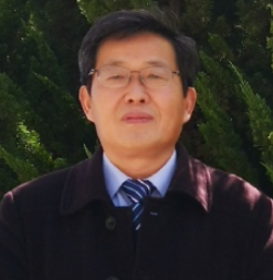 Jianhua Wan (万剑华)合作论文数College of Oceanography and Space Informatics, China University of Petroleum41
 Muhammad Yasir合作论文数Coll Oceanog & Space Informat, China Univ Petr East China18
 Zhongwei Li (李忠伟)合作论文数College of Oceanography and Space Informatics, China University of Petroleum18
 Jianyong Cui (崔建勇)合作论文数College of Oceanography and Space Informatics, China University of Petroleum17
 Bo Du (杜博)合作论文数School of Computer Science, Wuhan University15
 Leiquan Wang (王雷全)合作论文数College of Computer Science and Technology, China University of Petroleum15
 Shiqing Wei (魏世清)合作论文数College of Oceanography and Space Informatics, China University of Petroleum (East China)10
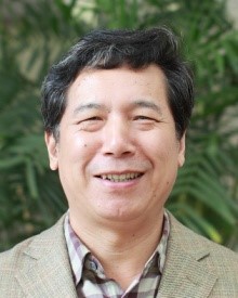 Liangpei Zhang (张良培)合作论文数State Key Laboratory of Information Engineering in Surveying, Mapping and Remote Sensing, Wuhan University9
 Hongxia Zheng (郑红霞)合作论文数College of Oceanography and Space Informatics, China University of Petroleum8
 Wang Dawei合作论文数7
 Zhiru Yang合作论文数7
 Chunlei Wu (吴春雷)合作论文数College of Computer Science and Technology, China University of Petroleum7
 Yanlong Chen (陈艳拢)合作论文数National Marine Environmental Monitoring Center6
 Yanni Dong (董燕妮)合作论文数Institute of Geophysics and Geomatics, China University of Geosciences6
 Zhe Zeng (曾喆)合作论文数College of Oceanography and Space Informatics, China University of Petroleum6
 Dongmei Song (宋冬梅)合作论文数College of Oceanography and Space Informatics, China University of Petroleum6
 Ziqi Xin合作论文数5
 Yabin Hu合作论文数Information Science and Technology College, Dalian Maritime University, Dalian, China5
 Yuxiang Zhang (张玉香)合作论文数Department of Earth Information Science and technology, School of Geophysics and Geomatics, China University of Geosciences5
 Xianci Wan (万献慈)合作论文数4
 Junfang Yang合作论文数4
 Chuanlong Ye合作论文数4
 Arife Tugsan Isiacik Colak合作论文数Inst Informat, Istanbul Tech Univ4Md Sakaouth Hossain合作论文数4
 Lefei Zhang (张乐飞)合作论文数School of Computer, Wuhan University4
 Yanguo Fan (樊彦国)合作论文数College of Oceanography and Space Informatics, China University of Petroleum4
 Guangbo Ren (任广波)合作论文数4
 Saied Pirasteh合作论文数3
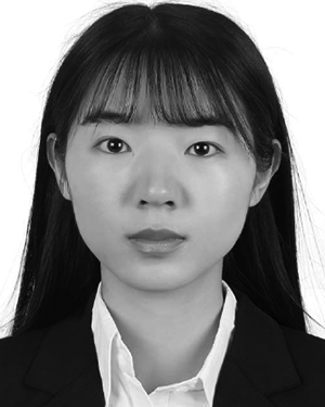 Guangyu Zhang合作论文数3
 Kinh Bac Dang合作论文数VNU University of Science, Vietnam National University3
 Bin Wang (王斌)合作论文数College of Oceanography and Space Informatics, China University of Petroleum3
 Tao Zhang (张韬)合作论文数Wuhan University;Seed, ByteDance3
 Jie Guo (过杰)合作论文数Yantai Institute of Coastal Zone Research, Chinese Academy of Sciences3
 Chuanping Qu (曲川萍)合作论文数2Weimin Kong合作论文数2
 Qimao Wang合作论文数2Ning Sun合作论文数2
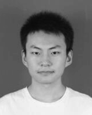 Wei-min CHEN (陈伟民)合作论文数2
 Jie Zhang (张杰)合作论文数College of Oceanography and Space Informatics, China University of Petroleum;First Institute of Oceanography, Ministry of Natural Resources2
 Wei Li (李伟)合作论文数School of Information and Electronics, Beijing Institute of Technology2
 Xiyuan Zhang (张曦元)合作论文数2
 Jin Zhou (周进)合作论文数School of Mathematics and Statistics, Wuhan University2
 Junan Lu (陆君安)合作论文数School of Mathematics and Statistics, Wuhan University2
 Shah Nazir合作论文数2
 Qamarul Islam合作论文数2
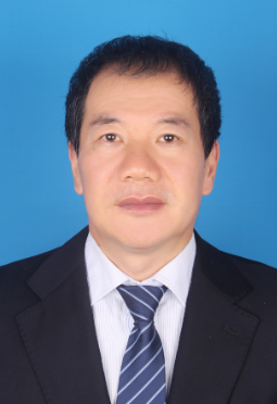 Mingwen Shao (邵明文)合作论文数Artificial Intelligence Research Institute, Shenzhen University of Advanced Technology2Hong Fan (樊红)合作论文数1




