Monitoring large-scale surface deformation using satellite radar data is crucial for advancing regional and continental-scale geodynamic observations. However, challenges arise when unifying deformation data from different tracks of the same satellite, primarily due to inconsistencies in reference baselines and variations in radar viewing angles. This study proposes an interferometric synthetic aperture radar (InSAR) deformation datum connection method with a fixed line-of-sight (LOS) direction. The method combines Bayesian inference with a Markov random field model and integrates InSAR and global navigation satellite system deformation measurements to unify deformation datums across multi-track SAR interferometric results using only a single orbit direction (ascending-only or descending-only), without requiring both ascending and descending data sets. In the simulation experiments, the root mean square error (RMSE) of the LOS displacement rate difference in the overlapping regions of adjacent-track SAR images decreased by 99%. Applying the developed methodology for InSAR observations of the 2023 Mw 7.8 Kahramanmaraş earthquake in Türkiye, the RMSE of displacement differences in the overlapping regions of adjacent tracks was reduced from 98 to 34 mm, demonstrating the effectiveness of the proposed unified datum approach.
Conventional multitemporal InSAR (MT-InSAR) requires temporal coherence persistence throughout the observation period, limiting its effectiveness in dynamic environments where urbanization causes frequent surface changes. We propose a lifecycle-aware multitemporal InSAR (LA-MTInSAR) framework that leverages optical imagery to synergistically monitor evolving infrastructure and its associated discontinuous coherent scatterers. The method integrates three components: 1) initializing scatterer lifecycles via detection of surface transition epochs using the pruned exact linear time (PELT) algorithm on Sentinel-2 time series; 2) refining the onset of radar signal stability through cascaded search to eliminate the time lag between optical changes and radar coherence establishment; and 3) reconstructing deformation fields via dynamic network construction and least squares QR (LSQR) sparse inversion. Applied to Hong Kong International Airport's (HKIAs) third runway reclamation, LA-MTInSAR corrects an average 42-day physical time lag and increases monitoring point density by 1.7 & times; overall and 28 & times; (416-11 669 points) in the reclamation zone, capturing subsidence rates of-80 mm/year. Validation against continuous global navigation satellite system (GNSS) observations at six sites yields RMSE values of 4.27-6.43 mm. By explicitly accounting for scatterer lifecycle heterogeneity, LA-MTInSAR extends time-series InSAR monitoring capability from static environments to actively evolving construction zones.
Interferometric synthetic aperture radar (InSAR) enables large-scale mapping of surface topography and deformation, whose reliability critically depends on accurate assessment of interferometric phase quality. Coherence, the conventional phase-quality indicator, is prone to systematic underestimation in the presence of strong phase gradients or dense fringe patterns and is sensitive to the choice of the sampling window, which may lead to a biased depiction of the underlying phase noise level. This paper proposes a phase-quality metric based on the premise that high-quality interferometric phase is better characterized by spatial correlation in the phase-gradient domain than by the spatial uniformity implicitly assumed by coherence. Local phase-gradient fields are modeled using low-order polynomials to account for deterministic trends, and phase noise is quantified from the fitting residuals. The resulting gradient-noise estimator is theoretically unbiased with respect to window size, thereby reducing dependence on spatial structure and scale. A monotonic relationship between residual statistics and the phase noise standard deviation is then established to construct a normalized and physically interpretable quality metric. Experiments on simulated interferograms and two real InSAR case studies demonstrate that the proposed metric consistently tracks phase noise variations, remains stable across different fringe densities, phase gradients, and window sizes, and provides more robust phase-quality maps for downstream InSAR processing. The proposed approach offers a practical alternative to coherence for phase-quality assessment and supports more reliable InSAR-derived geospatial products.
As a major city in eastern China, Suzhou faces significant challenges in metro construction due to its soft soil conditions, as excavations can induce differential settlement in nearby buildings. To assess such impacts, this article employs decade-scale (2009-2019) multitemporal InSAR using high-resolution TerraSAR-X imagery. A customized processing chain-integrating Persistent Scatterer and Small Baseline approaches with optimized phase unwrapping and thermal dilation correction-was applied to extract time-series deformation along Suzhou's metro network. The results show overall stability in central zones, with negligible subsidence within the historic moat area, yet reveal several localized subsidence bowls exceeding 15 mm/year in the suburbs. Time-series analysis correlates settlement of high-rise buildings (> 14 mm/year) with surface loading and soil consolidation. By integrating InSAR-derived displacements with building safety standards and metro engineering thresholds, a risk evaluation framework was developed. Its application to 49 279 structures identified 4 severely at-risk buildings (0.008%), 101 moderately at-risk buildings (0.205%), and 172 mildly at-risk buildings (0.349%). This article establishes a practical risk-assessment protocol and provides the first large-scale visualization of subsidence hazards along Suzhou's metro lines, offering valuable guidance for metro planning, operational safety, and infrastructure preservation.
Interferometric Synthetic Aperture Radar (InSAR) has emerged as a powerful tool for landslide hazard detection, yet topographic residuals arising from outdated Digital Elevation Models (DEMs), dynamic terrain changes, and unknown scatterer positions pose significant challenges. These residuals, scaled by perpendicular baselines, can introduce substantial biases in deformation rate estimates, leading to overlooked hazards in techniques such as Stacking, Small Baseline Subset (SBAS), and Persistent Scatterer (PS)/Distributed Scatterer (DS) InSAR.We present an enhanced Stacking methodology that eliminates topographic residual contributions through baseline normalization without directly estimating DEM errors. By leveraging the linear relationship between DEM error phase and spatial baseline, our approach performs phase normalization by baseline magnitude and applies sign-balancing transformations to ensure equal numbers of positive and negative perpendicular baselines. This preserves the simplicity, efficiency, and robustness of traditional Stacking while significantly improving deformation velocity estimation accuracy.Additionally, we discuss complementary strategies including near-zero baseline InSAR approaches through interferogram integer combination and non-parametric Independent Component Analysis (ICA) methods for enhanced topographic residual estimation under complex deformation scenarios.This work provides practical solutions for improving InSAR-based landslide hazard identification in dynamic terrain environments, with significant implications for geological disaster monitoring and early warning systems.
Time-series Interferometric Synthetic Aperture Radar(InSAR)has become an important remote sensing technique for bridge structural health monitoring due to its all-weather and day-and-night imaging capability,millimeter-level deformation measurement accuracy,and wide spatial coverage.Compared with conventional contact-based monitoring methods,time-series InSAR can provide dense deformation observations along large-scale bridge structures,thereby supporting the identification of abnormal displacement patterns and the evaluation of long-term structural stability.However,its application to long-span bridge monitoring remains challenging.Large bridges usually contain numerous expansion joints to accommodate thermal expansion,contraction,and structural movement.These joints introduce abrupt displacement changes between adjacent bridge segments,resulting in significant interferometric phase discontinuities.Meanwhile,bridge deformation is strongly affected by temperature variations,and thermal expansion or contraction may dominate the observed displacement signal.Under these conditions,the spatial continuity assumption required by conventional phase unwrapping algorithms is often violated,leading to unwrapping errors and unreliable deformation inversion,especially for large-scale bridge monitoring. To address these problems,this paper proposes an adaptive segmented unwrapping time-series InSAR algorithm for large-scale bridge deformation monitoring.The proposed method does not rely on predefined deformation models or prior information on expansion joint locations.Instead,phase discontinuities related to expansion joints are automatically identified by evaluating arc-based phase errors in the interferometric network.According to the detected discontinuity information,the coherent point network is adaptively partitioned into multiple structurally meaningful subnetworks.Within each subnetwork,suitable reference points are selected by considering the mechanical characteristics of bridge structures,which helps prevent error propagation across expansion joints and enables stable segmented phase unwrapping.The displacement time series of coherent points can then be independently recovered for each bridge segment,improving the robustness of deformation estimation under complex structural and thermal conditions. The proposed method was validated using 13 scenes of PAZ X-band SAR images acquired over the Hangzhou Bay Bridge,one of the longest cross-sea bridges in the world.Experimental results show that the proposed algorithm can effectively locate expansion joints and divide the bridge into reasonable monitoring segments.Compared with the conventional minimum cost flow(MCF)phase unwrapping algorithm,the proposed method exhibits better adaptability to phase discontinuities and achieves more stable unwrapping results under strong thermal deformation.The retrieved displacement time series further reveal that the overall deformation of the bridge is highly correlated with temperature variation,with a maximum correlation coefficient of 0.988.After removing the temperature-related displacement component,97.1%of coherent points show residual deformation rates lower than 2 mm/year,indicating that most bridge sections remained structurally stable during the observation period.Nevertheless,several localized sections exhibit potential non-thermal deformation signals and may require further inspection. These results demonstrate that the proposed adaptive segmented unwrapping strategy can effectively overcome the limitations of conventional phase unwrapping methods in bridge monitoring scenarios characterized by expansion joints and strong thermal effects.It provides a reliable framework for retrieving bridge displacement time series from high-resolution SAR data and improves the accuracy,robustness,and practical applicability of time-series InSAR for long-span bridge health monitoring.
Coherence magnitude is a key metric for assessing the similarity between two synthetic aperture radar (SAR) signals, playing a critical role in high-quality interferometric SAR (InSAR) phase processing and the analysis of Earth's surface characteristics. However, coherence estimation often suffers from positive bias due to limited independent samples, particularly in low-coherence regions. This study proposes a regularization-based approach to reduce coherence estimation bias, especially in areas with few homogeneous samples. By adaptively determining regularization parameters and prior coherence using nonlocal homogeneous pixel estimation, the method effectively minimizes bias while maintaining computational efficiency. Validated using Monte Carlo simulations and real data from 16 TerraSAR-X images of Shanghai, the proposed approach outperforms conventional techniques, achieving lower residual bias and lower estimation standard deviation (STD) across diverse scenes.
As an important Earth observation technology,Interferometric Synthetic Aperture Radar(InSAR)has been widely applied in surface deformation monitoring,such as urban subsidence,mining activities,and geological hazards,owing to its advantages of wide spatial coverage,millimeter-level precision,and long-term temporal observations.In recent years,its applications have extended to the safety monitoring of transportation infrastructure.Roads,railways,bridges,and airports are characterized by wide spatial distribution,linear and elongated structures,dynamic operation,and complex service environments,which pose high demands on conventional monitoring methods.InSAR provides a promising alternative solution.This study focuses on the applications of InSAR in transportation infrastructure monitoring by systematically reviewing research progress and development trends.First,based on current studies,typical applications of InSAR for different types of infrastructure,including roads,railways,bridges,and airports,are summarized to demonstrate its potential in subsidence monitoring,deformation identification,and structural safety assessment.Second,the major challenges of current InSAR applications are outlined by considering the particularities of transportation scenarios.These challenges include insufficient coherence due to weak scattering targets,discontinuous deformation of bridges and similar facilities that violate conventional models,and severe interference of atmospheric turbulence with millimeter-level monitoring precision.Several methodological improvements are discussed to address these challenges.These improvements include phase optimization,localized inversion with external constraints,atmospheric delay modeling,and integration with auxiliary datasets,which collectively enhance the reliability and applicability of InSAR results.Finally,the study incorporates representative application cases from the authors' team on various types of infrastructure,thereby highlighting the potential of time-series InSAR technology in this field and further outlining future research directions.The application of InSAR technology in transportation infrastructure monitoring has already demonstrated broad prospects;however,continuous methodological and application-oriented improvements are still required to support transportation safety management and risk mitigation adequately.
This study tests an integrated interferometric synthetic aperture radar (InSAR) strategy to map slow-moving landslides in the rugged terrain of Pakistan using Sentinel-1 descending orbit images from January 2017 to December 2022. In this integration, we combined the three persistent scatterers (PS) candidate selection criteria (i.e., spectral diversity, temporal variability, and phase stability) and processed them jointly for deformation modeling. The results obtained through this integration were compared with the standard interferometric approach which resulted in achieving a 2.3 times higher point density. The obtained average deformation velocities range from -60 mm/year to +60 mm/year, with a PS density of 65/sq. km, which also helped identify 2,000 unstable slopes of varying sizes up to 1 sq. km. The study also presents a pre-failure slope deformation trend of a failed slope, with precipitation as a potential contributing factor. The findings may enhance landslide risk management.
Accurate topographic phase removal in Differential InSAR (DInSAR) processing relies on Digital Elevation Models (DEMs), yet limitations in DEM accuracy and currency hinder precise surface displacement measurement. Although modern SAR satellites feature a relatively narrow orbit tube, the phases induced by DEM errors cannot be safely ignored especially in areas under rapid urbanization. Current Multi-Temporal InSAR (MT-InSAR) methods, which estimate DEM errors alongside deformation, suffer from potential biases due to inaccurate deformation models and high computational cost from per-point processing. We present here a novel detection-and-estimation strategy for efficient DEM error mitigation. Our key innovation is a phase gradient direction consistency (GDC) criterion, which provides a direct and intuitive visualization of pixels affected by DEM errors (PEEs)-a capability not previously available. This is a significant advancement as it allows targeted correction instead of exhaustive estimation. We further develop a generalizable framework for DEM error retrieval applicable to various scenarios. Validation with simulated and real-world data from urban and mountainous environments demonstrates effective separation of DEM errors from various spatiotemporal deformation signals. In addition, the proposed method achieves an order-of-magnitude improvement in processing efficiency compared to conventional approaches. By directly identifying and estimating DEM errors from wrapped phases, our approach streamlines deformation retrieval and is readily integrated into existing MT-InSAR workflows.
Tropospheric delays present a significant challenge to accurately mapping the Earth's surface movements using interferometric synthetic aperture radar (InSAR). These delays are typically divided into stratified and turbulent components. While efforts have been made to address the stratified component, effectively mitigating turbulence remains an ongoing challenge. In response, this study proposes a joint model that compasses both the deterministic components and stochastic elements to account for the phases raised by turbulent delays in full InSAR time series. In the joint model, the deformation phases are parameterized by time-domain polynomial, while the turbulent delays are treated as spatially correlated stochastic variables, defined by spatial variance-covariance functions. Least Squares Collocation (LSC) and Variance-Covariance Estimation (VCE) are employed to solve this joint model, enabling simultaneous estimation of modelled deformation and turbulent mixing from full InSAR time series. The rationale is rooted in the distinct temporal dependencies of deformation and turbulent delay. Its efficacy and versatility are demonstrated using simulated and Sentinel-1 data from Hong Kong International Airport (China) and the Southern Valley of California (USA). In simulations, the root mean square error (RMSE) of the differential delays decreased from 2.4 to 0.8 cm. In the Southern Valley, comparison with 70 GPS measurements showed a 73.7 % reduction in mean RMSE, from 1.9 to 0.5 cm. These results confirm the effectiveness of this approach in mitigating tropospheric turbulence delays in the time domain.
Interferometric Synthetic Aperture Radar (InSAR) has become an essential tool for monitoring surface deformation with high precision and wide spatial coverage. Among various InSAR techniques, the Stacking InSAR approach is widely used for geological hazard assessments due to its computational efficiency and robustness against decorrelation noise. However, Digital Elevation Model (DEM) errors remain a significant challenge, introducing spurious deformation signals and degrading deformation rate estimates. We present here a rigorous analysis of the impact of DEM errors on Stacking InSAR-derived deformation rates and introduce an enhanced method that effectively mitigates these errors. Unlike conventional correction techniques that require explicit DEM error estimation, the proposed method leverages perpendicular baseline averaging, eliminating DEM-induced biases while maintaining computational simplicity. The method is validated using both simulated and real Sentinel-1A datasets from two tracks, with results compared against conventional Stacking and Small Baseline Subset (SBAS) approaches. The findings demonstrate that the proposed method significantly improves deformation rate estimation by suppressing DEM-induced artifacts, thereby enhancing the reliability of InSAR applications in geological hazard monitoring and deformation assessment.
The application of multitemporal interferometric synthetic aperture radar (MTInSAR) technology in bridge structural health monitoring often encounters considerable challenges due to the intricate nature of bridge structures. Notably, the thermal expansion and contraction (TEC) of bridges can lead to prominent interferometric phase jumps at the expansion joints. When the magnitude of the phase jump exceeds $\pi $ , the continuity assumption required for phase unwrapping is no longer valid. Consequently, classical phase unwrapping methods fail to accurately retrieve bridge deformation. To address this limitation, we propose an adaptive MTInSAR method that can partition the bridge into independent segments and concurrently estimate deformation from multiple reference points. The algorithm first identifies expansion joint locations using a mean square error threshold. Subsequently, reference point selection and segmental phase unwrapping are performed to derive displacement time series of persistent scatterers (PSs), where the mechanical properties of the bridge structure are considered. We validate the effectiveness of the method using 23 TerraSAR-X (TSX) images of the Shanghai Yangtze River Bridge. The results demonstrate the successful detection of expansion joints and reliable phase unwrapping in PS subnetworks. Moreover, a comparative analysis with the classical minimum cost flow (MCF) method highlights the superior adaptability and reliability of the proposed approach. Finally, threshold values for triggering conditions when phase jumps occur are quantified. The proposed work will enhance the robust monitoring of bridge motions, safeguarding the structural health of bridges.
Phase linking technique has shown the ability to mitigate the decorrelation effect on the time series interferometric synthetic aperture radar (InSAR) data. By imposing the temporal phase-closure constraint, this technique reconstructs a consistent phase series from the complex sample coherence matrix (SCM). However, the bias of coherence estimates degrades the performance of phase linking, especially in near-zero coherence environments with limited spatial sample support. In this study, we present a methodology to enhance phase linking, with an emphasis on SCM refinement. The incentive behind this is to shrink the tapered SCM towards a scaled identity matrix by exploiting the inner correlation and coherence loss trend in SCM. This allows debiasing the SCM magnitude even in the presence of small sample size. We demonstrate the performance of this method by simulations and real case studies using Sentinel-1 data over Hawaii island. Results from comprehensive comparisons validate the effectiveness of coherence matrix estimation and the enhancement to phase linking in different coherence scenarios. The source code and sample dataset are available at https://www.mathworks.com/matlabcentral/fileexchange/169553-insar-phase-linking-enhancement-by-scm-refinement.
In permafrost regions, ground surface deformations induced by freezing and thawing threaten the integrity of the built environment. Mapping the surface displacement of the ground at a high spatial resolution is of practical importance for the construction and planning sectors. In central Yakutia (the Sakha Republic), the long-term trend displays a consistent mean annual air temperature (MAAT) increase from -9.6 % to -6.7 %, with pronounced temperature anomalies in the last decade. We processed Sentinel-1 Interferometric Synthetic Aperture Radar (InSAR) data from 2017 to 2021, acquired over the area of Yakutsk city. We performed phase optimization using adaptive coherence estimation to reduce the impact of vegetation. We then used StaMPS technology to generate surface deformation time series, allowing us to analyze the spatiotemporal distribution of seasonal deformation during freezing and thawing. The research findings indicate the boreal forest region in central Yakutia displays InSAR displacement signal in association with surface uplift caused by freezing of the active layer while urban area shows resilience against the melting permafrost.
The purpose of this study was to evaluate the psychometric properties of the Chinese version of the Revised Indebtedness Scale (IS-R-C) in mainland China. A total of 1057 university students participated in this study using a two-wave whole-group sampling method. Sample 1, consisting of 537 participants, was used for item analysis and exploratory factor analysis (EFA) of the Revised Indebtedness Scale (IS-R). Sample 2, comprising 520 participants, was used for confirmatory factor analysis (CFA), reliability analysis and gender invariance test. To assess criterion validity, the Social Avoidance and Distress Scale (SADS), the Renqing Questionnaire (RQQ) and the Subjective Well-being Scale (SWBS) were administered. The results of the item analysis and EFA indicated that the IS-R-C comprises 12 items, delineated into two dimensions: pressure to repay and requirements for interaction. CFA further substantiated this two-factor model for the IS-R-C (chi(2)/df = 4.24, RMSEA = 0.079, GFI = 0.94, NFI = 0.91, IFI = 0.93, TLI = 0.91, CFI = 0.93 and SRMR = 0.062). The total score of the IS-R-C exhibited a significant positive correlation with both the SADS score (r = 0.34, p < 0.001) and the RQQ score (r = 0.34, p < 0.001). Additionally, it demonstrated a negative correlation with the SWBS score (r = -0.09, p < 0.05). The Cronbach's alpha coefficient for the overall IS-R-C score was 0.88, indicating high internal consistency. The scale demonstrated a split-half reliability coefficient of 0.73 and a composite reliability coefficient of 0.91. The reliability coefficients for the two subscales were 0.77 and 0.87. Furthermore, the IS-R-C exhibited measurement invariance across gender identities. The IS-R-C demonstrates satisfactory psychometric properties, making it a suitable measure for studying indebtedness and related research in China.
Interferometric synthetic aperture radar (InSAR) has been widely applied in geoscience. As a fundamental parameter, coherence provides a quantitative measure of the interferometric phase quality and ground surface change between two SAR acquisitions. Unfortunately, the sample-estimated coherence is often biased due to the signal inhomogeneity and the bias of the estimator, especially when the numbers of SAR images and spatial samples are limited. In this study, we develop a hybrid method to improve the accuracy of coherence estimation. The effect due to heterogeneous pixels is suppressed by homogeneous pixel selection using Kullback-Leibler divergence. The bias caused by the sample magnitude estimator is mitigated through an iterative M-estimation. Experimental results from both simulation and real data tests demonstrate that the new method works well at texture-significant areas with insufficient SAR images.
ObjectiveThe purpose of this study was to evaluate the reliability and validity of the Chinese version of the Trait Gratitude to Nature Scale (TGNS) for Chinese college students.MethodsThe original English version of the TGNS was translated into Chinese. Subsequently, two samples consisting of 1,131 Chinese university students from Inner Mongolia Autonomous Region was recruited through online surveys to evaluate the psychometric properties of the Chinese version of the TGNS, including the discrimination, construct validity, criterion validity, reliability and gender invariance.ResultsThe Chinese version of the TGNS showed good psychometric properties. The item-total correlation coefficients of the scale ranged from 0.813 to 0.909. Exploratory factor analysis using data from Sample 1 (n = 617) demonstrated that the Chinese version of the TGNS has one factor. The confirmatory factor analysis using data from Sample 2 (n = 514) showed that the Chinese version of the TGNS has appropriate construct validity (χ2/df = 4.157, RMSEA = 0.078, TLI = 0.943 and CFI = 0.967). The significant correlation between the Chinese version of the TGNS and all the other criterion scale scores (p < 0.001) indicated that the Chinese version of the TGNS displays good criterion validity. The test–retest reliability was 0.914, using the sub-sample of Sample 2 (n = 127). The results of gender invariance test indicated that the Chinese version of the TGNS has entire equivalence between the two genders.ConclusionThe Chinese version of the TGNS has satisfactory psychometric properties in the Chinese cultural context and can be used as s a reliable and valid instrument to assess trait gratitude to nature.
Tropospheric delay is a major limiting factor in ground displacement retrieval using interferometric synthetic aperture radar (InSAR). Such delays are caused by the variations of pressure, temperature, and humidity of the troposphere, potentially leading to elevation-dependent phases in interferograms. The atmospheric heterogeneity makes the phase-elevation dependence vary in both space and time, posing challenges on empirical models that estimated the elevation-topography relationship in empirically predefined windows interferogram by interferogram. Moreover, the portion of the deformation that is correlated with topography can be mistaken as tropospheric delays and therefore degrade the performance of linear regression between the tropospheric phase and the elevation. The effectiveness of these methods is further limited by the requisite knowledge presumed of the user, particularly with regard to how to divide the scene and which observation model is suitable. These limitations make reliable isolation of tropospheric delay challenging. We present here a novel approach that combines tropospheric delay, deformation and possible topographic error to a joint model, enabling a precise separation of tropospheric delay. The rationale is rooted in the distinct temporal dependencies of these parameters. To avoid empirical setting of segmentation windows, we employ quadtree to adaptively control the spatial variability of tropospheric properties. We validate the proposed method at two volcanic areas, Bali and Hawaii, where tropospheric delay presents notable variability coupled with elevation-correlated deformation signals. Both ascending and descending Sentinel-1 data over the island of Bali show that the proposed method outperforms the conventional ones. The misfit standard deviation (STD) is reduced by similar to 50% at the island of Bali, where elevation-correlated deformation is simulated according to a predefined model. More impressively, at the island of Hawaii, the misfit STD between InSAR and ground truth (i.e., GPS displacements) decreases from 25.1 to 4.5 mm. The experimental results demonstrate that the proposed method is effective in reducing the spatially variable tropospheric delay while preserving the elevation-correlated deformation signal.
 Xin Li (李新)合作论文数Institute of Tibetan Plateau Research, Chinese Academy of Sciences;University of Chinese Academy of Sciences13
 Xiao-li Ding (丁曉利)合作论文数Department of Land Surveying and Geo-Information, The Hong Kong Polytechnic University;Research Institute for Land and Space, Academy for Interdiscipinary Research, The Hong Kong Polytechnic University13
 Lei Zhang (张磊)合作论文数Department of Computing, Faculty of Computer and Mathematical Sciences, The Hong Kong Polytechnic University12
 Zhong Lu (路中)合作论文数Roy M. Huffington Department of Earth Sciences, Southern Methodist University11
 Jicang Wu (伍吉仓)合作论文数College of Surveying and Geo-Informatics, Tongji University7
 Songbo Wu合作论文数Hong Kong Polytech Univ, Dept Land Surveying & Geoinformat, Hong Kong, Peoples R China5
 Jun Hu (胡俊)合作论文数Department of Surveying and Remote Sensing, School of Geosciences, Central South University3
 Bing Yan合作论文数2Wenhui Yuan合作论文数2
 Bochen Zhang (张博琛)合作论文数College of Civil and Transportation Engineering, Shenzhen University2
 Naeem Shahzad合作论文数Dept Land Surveying & Geoinformat, Hong Kong Polytech Univ2Bing-jie ZHANG (张冰洁)合作论文数2TongLin Jin (金童林)合作论文数2Xing Peng (彭星)合作论文数School of Geography and Information Engineering, China University of Geosciences2
 Weiming Cheng (程维明)合作论文数Institute of Geographic Sciences and Natural Resources Research, Chinese Academy of Sciences2
 Li Huang (黄立)合作论文数Wuhan Guide Infrared Co., Ltd.2
 Rou-Fei Chen合作论文数2Weihua Liu合作论文数1Minjie Shangguan合作论文数1Song Xinyou (宋鑫友)合作论文数1
 Yuanhui Zhu (朱远辉)合作论文数1Man Chung Chim合作论文数1Chuan-Jie Zhang合作论文数1Song Ruiqing (宋瑞庆)合作论文数1
 Weijia Ren合作论文数1Chien-Yu Chi合作论文数1
 Yanan Du合作论文数Guangzhou Univ, Sch Geog Sci, Guangzhou 510006, Peoples R China1Yongfeng Liu合作论文数1
 Jianwan Ji合作论文数1
 Hongguo Jia (贾洪果)合作论文数Faculty of Geosciences and Engineering, Southwest Jiaotong University1
 Lin Liu (柳林)合作论文数School of Geography and Remote Sensing, Guangzhou University;University of Cincinnati1
 Guojie Meng (孟国杰)合作论文数中国地震局地震预测研究所1
 Weiwei Wu合作论文数1
 Bin Zhang (张彬)合作论文数School of Engineering Technology, China Univerity Geosciences1
 Jinghua Gu (顾靖华)合作论文数State Key Laboratory of Estuarine and Coastal Research, East China Normal University1
 Jing Zhang (张晶)合作论文数Department of Psychology, Renmin University of China1
 Qian Sun (孙倩)合作论文数College Of Geographic Science, Hunan Normal University1
 Yangmao Wen (温扬茂)合作论文数School of Geodesy and Geomatics, Wuhan University1
 Yunzhong Shen (沈云中)合作论文数同济大学测绘与地理信息学院1
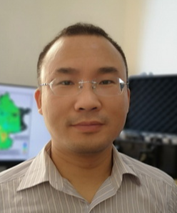 Guangcai Feng (冯光财)合作论文数School of Geosciences and Info-physics, Central South University1
 D. Perissin合作论文数Sch Civil Engn, Purdue Univ1
 Chisheng Wang (汪驰升)合作论文数School of Architecture & Urban Planning, Shenzhen University1
 Wenbin Xu (许文斌)合作论文数Laboratory of Volcano & Earthquake Research, Department of Geomatics, School of Geosciences and Info-physics, Central South University1
 Daqing Ge合作论文数1
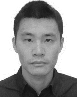 Jiang Mi (米江)合作论文数1
 Cuiping Kuang (匡翠萍)合作论文数College of Civil Engineering, Tongji University1
 Hyung-Sup Jung合作论文数Department of Earth System Sciences, Yonsei University1




