ABSTRACT Reliable estimates of abundance and habitat associations are critical for conserving low‐density species such as the Asian houbara (Chlamydotis macqueenii). Despite its vulnerable global status, robust estimates of houbara population size and habitat requirements remain scarce across much of its range. We combined multiple‐covariate distance sampling (MCDS) with habitat modeling (Random Forest, GAMs, and GLMs) to estimate density and identify habitat relationships of houbaras in central Iran. In spring 2022, 223 line‐transect surveys (1449 km) covering a 10,000 km2 area yielded 205 individuals across 67 detections. The best‐supported MCDS model included fine gravel cover (positive) and vegetation height (negative) as detectability covariates, though their effects were weak. This model estimated a density of 0.53 individuals/km2 (95% CI: 0.37–0.75), corresponding to ~5293 individuals (95% CI: 3778–7473). Estimates were nearly identical to those from the best conventional distance sampling (CDS) model, indicating that detectability covariates did not materially improve model accuracy. However, habitat models consistently identified fine gravel cover and vegetation height as the most influential predictors, underscoring their ecological relevance for habitat use. Results indicate an ongoing population decline relative to previous regional estimates, highlighting the need for continued monitoring. Integrating population estimation with habitat modeling provides a practical framework for improving conservation assessments of the Asian houbara and other ground‐dwelling birds in open habitats. Conservation actions should prioritize the protection and management of suitable habitats, supported by standardized survey protocols that improve population assessments and inform management decisions.
Accurately delineating bioclimatic zones is critical for sustainable resource management, biodiversity conservation, and addressing environmental challenges in semi-arid regions. While traditional deterministic methods for bioclimatic mapping have been widely applied, they are limited in their ability to explicitly represent uncertainty and variability, factors that are increasingly recognized as essential in environmental modeling. To address these limitations, this study integrates satellite-derived data with Bayesian Belief Networks (BBNs) to model and delineate bioclimatic zones in the semi-arid landscape of the Central Zagros Mountains, Iran. Key datasets from 2016, including the Digital Elevation Model (DEM), precipitation data from the Global Precipitation Measurement (GPM) mission, Normalized Difference Vegetation Index (NDVI), and MODIS land surface temperature (LST), were utilized, alongside the computation of the Temperature Vegetation Dryness Index (TVDI) from NDVI and LST. Sensitivity analysis revealed DEM as the most influential factor in bioclimatic zoning, outperforming other variables such as TVDI, NDVI, LST, and precipitation. The BBNs model, validated against the Pabot method, achieved robust performance metrics, with a Kappa coefficient of 0.63 and an Area Under the Curve (AUC) exceeding 0.8 for all identified zones, including arid-forest, semi-steppe, and high mountain regions. The BBNs model demonstrated versatile functionalities, including scenario analysis to forecast bioclimatic zones under varying environmental conditions and diagnostic analysis to identify the most probable scenarios leading to specific bioclimatic outcomes. This study introduces a robust probabilistic framework that integrates remote sensing data with BBNs, addressing the inherent limitations of deterministic approaches. Adaptable to diverse ecosystems, this approach provides a powerful tool for bioclimatic zone prediction, supporting informed decision-making, sustainable resource management, and biodiversity conservation efforts.
A preliminary assessment of genetic diversity is an essential step toward elucidating the evolutionary relationships and identifying valuable germplasm resources within Acanthophyllum species. In this study, genetic diversity was explored in different species of the genus Acanthophyllum using SCoT and SRAP molecular markers for the first time. A total of 71 accessions from seven Acanthophyllum species (A. bracteatum, A. glandulosum, A. korshinskyi, A. microcephalum, A. sordidum, A. spinosum, and A. squarrosum (were collected from natural habitats of Iran. The genetic diversity was analyzed using SCoT (12) and SRAP (20) molecular markers. Genetic diversity parameters, indices, and population differentiation were evaluated. Population structure was investigated using AMOVA, PCoA, UPGMA-based clustering, and Bayesian analysis (STRUCTURE).Both marker systems exhibited high informativeness, generating 200 (SCoT) and 242 (SRAP) fragments. Polymorphic information content (PIC = 0.37), Shannon's information index (I = 0.41), and average expected heterozygosity (He = 0.27) generated by SCoT primers were higher than those obtained from SRAP analysis (PIC = 0.34, I = 0.34, and He = 0.22). A. glandulosum, A. sordidum, and A. microcephalum displayed the highest levels of genetic diversity, while A. korshinskyi showed consistently low variation. The results of the STRUCTURE analysis indicated that the Acanthophyllum species could be grouped into four genetically distinct subpopulations. AMOVA indicated that most genetic variation (~ 86%) occurred within populations, a pattern supported by high gene flow estimates (Nm > 2.3), which reflects considerable genetic connectivity across geographic regions. Widespread admixture, especially in A. bracteatum, A. korshinskyi, and A. spinosum, points to historical hybridization events and shared ancestry.Both SCoT and SRAP markers proved highly efficient in revealing inter and intra-specific genetic diversity within the Acanthophyllum genus. These results provide a critical foundation for identifying the diversity of Acanthophyllum germplasm. They highlight A. glandulosum as a genetically rich resource, due to its high genetic diversity revealed by both marker systems, and identify A. korshinskyi as a conservation priority. Subsequent genome-wide studies are recommended to build upon these findings and to explore the adaptive genetic variation associated with environmental resilience.
ABSTRACT Astragalus verus Olivier, a species native to Iran, is experiencing dieback, particularly in the Zagros and Central Iran regions. This study examines whether dieback patterns are spatially non‐random and influenced by soil conditions. Twelve rangeland sites dominated by A. verus and showing signs of dieback were selected. At each site, a 100 m2 plot was randomly established to record the coordinates of all perennial species, focusing on live and dead A. verus individuals, followed by soil physicochemical analyses. Spatial patterns were evaluated using Ripley's K functions and nearest neighbor indices. Dieback showed positive correlations with sand content and electrical conductivity, and negative correlations with soil moisture, silt, and clay. While the overall plant community shifted from clumped to uniform spatial patterns with increasing spatial scale (distance from reference plants), the spatial distributions of live and dead A. verus individuals remained largely random, suggesting ecological independence. These findings indicated that A. verus mortality is likely driven by localized environmental stressors rather than density‐dependent interactions and highlight the value of spatial point pattern analysis for diagnosing species decline and guiding conservation in rangeland ecosystems.
Species Distribution Models (SDMs) are key tools in conservation science, relating species occurrence records to environmental variables to predict potential habitat distribution. This study aimed to identify suitable habitats for three species—Calligonum comosum, C. persicum, and C. bungei— that are valued for desert reclamation and sand stabilization by integrating remote sensing indices with SDMs and assessing the environmental factors influencing their distribution in the Gavkhouni sub-basin of Central Iran. The dataset comprised 33 environmental variables, including 14 remote sensing indices from Landsat 8 OLI–TIRS imagery, 15 soil physical and chemical characteristics, three topographic parameters, and one variable representing distance to sandy hills, along with 92 species occurrence points. Ten SDMs and an ensemble model were applied. The ensemble model outperformed all individual SDMs, achieving Area Under the Curve (AUC) values of 0.98–0.99 and True Skill Statistic (TSS) values of 0.97–0.99 for all three species. This study offers a novel contribution by simultaneously modeling multiple Calligonum species in an arid region using a comprehensive set of predictors, revealing the underexplored importance of soil variables in shaping their distribution. Sensitivity analyses indicated that distance to sandy hills, pOH, sulfate (SO₄²⁻), and pH were key predictors for C. comosum; Tasseled Cap Brightness Index, elevation, and soil calcium sulfate (CaSO₄) were most influential for C. persicum; and sodium, calcium carbonate (CaCO₃), and bicarbonate (HCO₃⁻) were primary determinants for C. bungei. Habitat suitability maps showed that 11% of the study area was suitable for Calligonum species, with high-suitability areas for C. comosum, C. persicum, and C. bungei covering approximately 375, 27, and 14 km², respectively. By identifying the key soil variables shaping the distribution of multiple Calligonum species, this study provides targeted guidance for managing soil health and monitoring critical properties, thereby supporting effective conservation planning and enhancing desert reclamation and sand stabilization in arid regions.
Accurate mapping of the spatial distribution of soil properties is essential for soil resource management and environmental protection. This study used 34 environmental variables derived from Landsat 8 images and a digital elevation model, alongside 96 surface soil samples (0–20 cm), to compare the performance of six modeling algorithms: generalized linear model (GLM), generalized additive model (GAM), random forests (RF), support vector machine (SVM), classification and regression trees (CART), and an ensemble model. The aim was to create accurate maps of soil properties, including electrical conductivity (EC), pH, pOH, carbonate, bicarbonate, Na, and Cl in an arid area located in the central plateau of Iran. Key environmental covariates included Principal Component Analysis (PCA) and Tasseled Cap (TC) transformations of Landsat images, Land Surface Temperature (LST), Temperature Vegetation Dryness Index (TVDI), vegetation indices, and salinity indices. Pearson correlation analysis was used to study relationships between soil variables and these covariates. Model performance was evaluated using mean absolute error (MAE), root-mean-square error (RMSE), and coefficient of determination (R2). The ensemble and random forest models provided the most reliable spatial distribution of soil properties. In contrast, GLM and GAM algorithms produced relatively poor estimates. Important predictors identified included PCA1, PCA2, Tasseled Cap Wetness (TCW), B5, B7, and elevation. This study demonstrates that machine learning algorithms, combined with freely available remote sensing data, can effectively model and map soil properties in arid and desert regions. The methodology offers a cost-effective approach for improving soil information at local and regional scales, particularly in data-poor areas like Iran. This strategy supports enhanced soil management and environmental protection efforts.
Conservation of endangered species is very important for maintaining native biodiversity. Management priorities, like climate change, is effective in the distribution of endangered species. To develop effective management and conservation strategies for the future, it is necessary to understand the current species potential distributions. However, for most species, few data are available on their current distributions, let alone on projected future distributions. Kelussia odoratissima Mozaffarian is an endemic perennial and medicinal forb species. The evaluation of K. odoratissima's conservation status places it within the Endangered (EN) category according to the IUCN classification. We demonstrated the benefits of Bayesian Belief Networks (BBNs) for predicting the distribution of endangered and medicinal K. odoratissima species using expert opinion. An influence diagram was developed to recognize the important factors influencing habitat suitability K. odoratissima, and it was populated with probabilities to produce a BBNs model. The behavior of the model was examined using sensitivity analysis. Environmental suitability, management condition, climate suitability, utilization time and levels were identified as the main variables influencing habitat suitability of K. odoratissima. The generated BBNs model had good accuracy because the ROC area under the curve was 0.918. We aim to demonstrate the ability of this approach to integrate field studies with expert knowledge, especially when empirical data are lacking. The BBNs model excels at illustrating species-habitat relationships and rapidly estimating habitat suitability, serving as a valuable tool for conservationists and decision-makers.
Digital Soil Mapping (DSM) techniques have advanced significantly in recent decades, helping to close critical gaps in soil data and knowledge. This study was conducted in the arid Gavkhouni sub-basin of Isfahan Province, central Iran, where environmental stresses such as salinity and water scarcity challenge sustainable land management. We employed 34 environmental covariates derived from Landsat 8 imagery and a digital elevation model, combined with 96 surface soil samples (0 to 20 cm depth), to assess the performance of six machine-learning models: Random Forest (RF), Classification and Regression Tree (CART), Support Vector Regression (SVR), Generalized Additive Model (GAM), Generalized Linear Model (GLM), and an ensemble approach. Unlike many previous studies that have focused on a single soil attribute with a limited set of predictors, our work adopts an integrated approach to map four salinity-related soil properties: Ca, CaCO3, CaSO4, and SO4. Predictor selection involved multicollinearity testing using the Variance Inflation Factor (VIF) and the Boruta algorithm. Model performance was assessed using tenfold cross-validation. The ensemble model performed best, achieving R2 values of 0.89 for Ca, 0.84 for CaCO3, 0.79 for SO4, and 0.73 for CaSO4. Elevation and the Temperature-Vegetation Dryness Index (TVDI) were the most influential predictors for Ca, while the Tasseled Cap Brightness (TCB) and Tasseled Cap Wetness (TCW) indices were most important for CaCO3. For CaSO4, Band 5 (B5) and TCB were the most effective, whereas SO4 predictions were driven by TCB along with Bands 5 and 7. These findings highlight the potential of remote sensing-based DSM to enhance soil monitoring in data-scarce, arid environments. The growing availability of free satellite data, such as Landsat, offers valuable opportunities to improve soil assessment and promote sustainable land management in resource-limited regions like Iran.
ABSTRACT Invasive plants pose a threat to production sustainability due to their detrimental effects on soil, food cycles, and hydrology. This study aimed to identify and analyze the effects of five invasive plant species on the rangelands of western Isfahan province, Iran. A random‐systematic sampling of vegetation cover and soil was conducted at four rangeland sites, and mean soil characteristics were compared using one‐way analysis of variance and Tukey's test. Parametric principal component analysis (PCA) and nonparametric multidimensional scaling (NMDS) analysis in CANOCO and PATN software were used to investigate the relationship between environmental factors and vegetation cover. Cluster analysis was employed for habitat grouping, and the Analytic Hierarchy Process (AHP) was utilized to analyze the risk of invasive plants. The analysis involved three main criteria, eight subcriteria, and five options. The compatibility ratio of each criterion was calculated using Expert Choice software to assess the accuracy of criteria weighting. Parametric ordination revealed significant correlations between the first and second principal components and mean annual precipitation, mean annual temperature, altitude, slope, nitrogen, and calcium. NMDS analysis revealed significant correlations between plant species and seven environmental variables in a three‐dimensional ordination space (p < 0.05). Among the target species, Eryngium billardieri showed a positive correlation with rainfall, altitude, slope, calcium, nitrogen, and a negative correlation with mean annual temperature, rock, and gravel. However, the relationship of other species with environmental factors was not significant. Notably, Cousinia bachtiarica, Eryngium billardieri, Phlomis persica, Euphorbia decipiense, and Poa bulbosa exhibited the most destructive effects, respectively. The study results can inform targeted efforts to protect rangeland ecosystems against invasive plants. Furthermore, the study method is applicable for assessing the risk of other plant species in semiarid ecosystems.
Understanding the factors influencing the distribution of plant species is crucial for enhancing the management of endangered ecosystems. This study investigated the response of Hedysarum criniferum Boiss, an endemic and endangered species to 25 environmental variables within its habitats with an area of 2.95×10⁵ km2 in arid and semi-arid rangelands of Iran. The purpose of this research is to identify the key environmental factors affecting the distribution and habitat preferences of H. criniferum for further conservation and restoration of the species. To predict the occurrence of H. criniferum and explore its relationship with environmental factors, we employed the best subset regression analysis, the hierarchical classification, and the extended Huisman-Olf-Fresco (eHOF) model. The results showed that four environmental variables, i.e., gravel content, pH, annual minimum temperature, and mean annual temperature showed significant correlations with the canopy cover of H. criniferum (P<0.05). The probability of H. criniferum occurrence increased with higher precipitation and elevation, while it decreased with higher mean annual temperature, annual minimum temperature, and gravel content. The species’ response curves and their optimal values, as assessed by the eHOF model, indicated that the response to mean annual temperature, ranging from 12°C to 16°C, was optimal at 13°C. The response to mean annual precipitation, within a range of 150–650 mm, was optimal at 650 mm. Elevation responses, spanning from 1546 to 2450 m, showed an optimum at 2450 m. Regarding soil characteristics, the response to gravel content, ranging from 13.0
Accommodating uncertainty stands as one of the most salient challenges in the development of soil erosion assessment tools. We presented a novel approach integrating the Modified Pacific Southwest Inter-Agency Committee (MPSIAC) model and Bayesian Belief Networks (BBNs) to assess soil erosion in a region of western Iran. The soil erosion status was reckoned based on the nine factors of MPSIAC. We utilized BBNs to produce a causal model for soil erosion, with output probabilities being validated through re-evaluation and sensitivity analysis. We identified erosion types, geological formations, run-off, soil erodibility, soil permeability, soil characteristics, and precipitation intensity as the main determinants of soil erosion. A significant, positive correlation existed between the erosion rate derived from MPSIAC and BBNs model in all land-use/covers over the work units. Overall, this study highlighted the potential of BBNs as a supportive tool for soil erosion prediction as well as a relatively simple and updatable soil erosion model for dealing with the diagnostic, scenario, and sensitivity analysis. Considering the increasing incidence of soil erosion, the BBNs model proposed in this study can be extended to a variety of ecosystems that are subject to soil erosion and changes in the probability of its causal factors.
Soil degradation poses serious environmental problems and requires quantitative assessment. This study aimed to investigate the soil properties in rangelands with different management conditions. Based on the assessment of soil erosion, vegetation cover, vegetation composition, and vegetation vigor, 56 sites were selected in rangelands with moderate, poor, and very poor conditions located in 15 grazing-free areas and one wildlife refuge region. Soil samples (0-10 cm layer) were collected from these sites through a systematic-random method to compare their physical and chemical properties. Results showed that soil organic carbon (OC) and total nitrogen content were significantly different between sites with different range conditions. The mean weight diameter of water-stable aggregates and structural stability index in moderate rangelands were 1.56 mm and 3.98%, respectively, and declined towards more degraded rangeland (i.e. 0.84 mm and 0.83%). Grazing-free rangelands exhibited a relatively larger OC deficit; hence specific management measures and control of grazing are required to enhance the quality of soil in these sites. This study highlighted the role of organic matter in preserving soil structural stability. Increasing protection level of rangelands and decreasing grazing pressure may preserve soil quality and combat desertification in these arid regions.
Modeling species distribution and predicting the effects of climate change on plant species decline are necessary in restoration programs. This study aimed to predict the occurrence and decline of Astragalus verus under climate change in Central Iran with an area of about 123,167 km(2). We recorded 12 and 71 sites for the dead and alive species using the stratified sampling method, respectively. The general circulation model of CCSM4 was applied at two timeframes of present and 2050 under two climate change scenarios of RCP2.6 and RCP8.5. Four environmental variables of annual mean temperature, the maximum temperature of the warmest month, the precipitation of the coldest quarter, and elevation were selected as the inputs of the nine statistical models. Results indicated that Random Forest model had the best performance in predicting climatic niche and decline of A. verus (AUC and TSS of 0.99) compared to the other models. The suitable habitat and decline for this species are 12.4% and 19.87% of the study area, respectively. With the estimated temperature rise of 3 degrees C under the CCSM4-RCP2.6 scenario, A. verus habitat will shrink by about 3.4% of the study area and will move toward higher elevations with colder temperatures in the future. Most changes in the suitability of the species will occur in the altitude range of 1800 to 2200 meters because the most temperature and precipitation variations will happen in this elevation stratum. The results can be used to prevent its rapid dieback or even restore vegetation cover in regions with similar conditions.
Context Combining field-based assessments with remote-sensing proxies of landscape patterns provides the opportunity to monitor terrestrial ecosystem health status in support of sustainable development goals (SDG). Objectives Linking qualitative field data with quantitative remote-sensing imagery to map terrestrial ecosystem health (SDG15.3.1 “land degradation neutrality”). Methods A field-based approach using the Interpreting Indicators of Rangeland-Health (IIRH) protocol was applied to classify terrestrial ecosystem health status at the watershed level as “healthy”, “at-risk”, and “unhealthy”. Quantitative complex landscape metrics derived from Landsat spaceborne data were used to explore whether similar health statuses can be retrieved on a broader scale. The assignment of terrestrial ecosystem health classes based on field and the remotely sensed metrics were tested using multivariate and cluster analysis methods. Results According to the IIRH assessments, soil surface loss, plant mortality, and invasive species were identified as important indicators of health. According to the quantitative landscape metrics, “healthy” sites had lower amounts of spectral heterogeneity, edge density, and resource leakage. We found a high agreement between health clusters based on field and remote-sensing data (NMI = 0.91) when using a combined approach of DBSCAN and k -means clustering together with non-metric multi-dimensional scaling (NMDS). Conclusions We provide an exemplary workflow on how to combine qualitative field data and quantitative remote-sensing data to assess SDGs indicators related to terrestrial ecosystem health. As we used a standardized method for field assessments together with publicly available satellite data, there is potential to test the generalizability and context-dependency of our approach in other arid and semi-arid rangelands.
The present study explored the habitat suitability for an endangered species, Hedysarum criniferum, in Iran using fuzzy logic. We measured 24 environmental variables including soil, climate, and physiographic variables of eight natural habitats of H. criniferum as the predictive variables and the percent cover of the species as the response variable. The most important environmental factors influencing species distribution and the species response curves were determined by principal component analysis (PCA) and the generalized linear model, respectively. The tolerance range and the optimal growth point of the studied species with respect to the environmental factors were specified, the ranges were divided into 11 classes by fuzzy value, and the fuzzy functions of the environmental factors were calculated. The species habitats were classified by the developed fuzzy model. Three regions with no H. criniferum occurrence were selected to determine their fuzzy suitability. The success in germination and shoot growth length of H. criniferum were used as the metrics of the habitat suitability in these regions. Based on the PCA, H. criniferum occurrence was most strongly affected by soil Mg, K, and Ca content, soil pH, wind speed, annual minimum temperature, slope, and altitude. The results revealed that the seedling length and germination percentage in the site with the fuzzy suitability of 0.6 differed from those in the two other sites with the fuzzy suitability of 0.5 and 0.3 significantly. The method used in this study can be employed in predicting optimal habitats for other endangered species in different ecosystems.
This research aimed at evaluating how different vegetation patch types and inter-patch zone affect soil properties/functions and ecological processes. Five main types of patches and one inter-patch zone were identified in an arid rangeland ecosystem in the Ghamishloo National Park and Wildlife refuge, central Iran. Next, twenty-nine soil samples were collected from the patches and the inter-patch to measure soil texture, pH, electrical conductivity (EC), total nitrogen (TN), available phosphorus, bulk density (BD), soil organic matter (SOM), particulate organic matter (POM), basal soil respiration (BSR), hot-water extractable carbohydrates (HWEC), and aggregate stability (as quantified by mean weight diameter, MWD, of water-stable aggregates). At each six patch types and inter-patch zone, eleven soil indicators were measured along three 30-m transects to estimate soil stability, infiltration, and nutrient cycling indices as proposed by the landscape function analysis method. Results indicated that SOM, TN, MWD, HWEC, BSR, POM, and silt content varied significantly between the patch and inter-patch types. Moreover, the difference between shrub patch and inter-patch zone was significant for infiltration and nutrient cycling indices but not for soil stability. Substantial input of organic carbon is required in the soils of inter-patch zone and forb patch type to achieve greater soil functioning. Patches of shrubs, shrub-forbs, and grasses improved soil quality and ecosystem functioning more efficiently than forbs and inter-patch zone; hence, preserving these patches is recommended for conservational solutions in arid fragile ecosystems. The results highlighted the importance of SOM in evaluating functional status of arid rangelands.
Investigating the relationships between vegetation dynamic and edaphic factors provide management insights into factors affecting the growth and establishment of plant species and vegetation communities in saline areas. The aim of this study was to assess the spatial variability of various vegetation communities in relation to edaphic factors in the Great Salt Desert, central Iran. Fifteen vegetation communities were identified using the physiognomy-floristic method. Coverage and density of vegetation communities were determined using the transect plot method. Forty soil samples were collected from major horizons of fifteen profiles in vegetation communities, and analyzed in terms of following soil physical and chemical characteristics: soil texture, soluble Na+ concentration, sodium adsorption ratio (SAR), electrical conductivity (EC), pH, organic matter content, soluble Mg2+ and Ca2+ concentrations, carbonate and gypsum contents, and spontaneously- and mechanically-dispersible clay contents. Redundancy analysis was used to investigate the relationships between vegetation dynamic and edaphic factors. The generalized linear method (GLM) was used to find the plant species response curves against edaphic factors. Results showed that plant species responded differently to edaphic factors, in which soluble sodium concentration, EC, SAR, gypsum content and soil texture were identified as the most discriminative edaphic factors. The studied plant species were also found to have different ecological requirements and tolerance to edaphic factors, in which Tamarix aphylla and Halocnemum strobilaceum were identified as the most salt-resistant species in the region. Furthermore, the presence of Artemisia sieberi was highly related to soil sand and gypsum contents. The results implied that exploring the plant species response curves against edaphic factors can assist managers to lay out more appropriate restoration plans in similar arid areas.
The scale of satellite images affects the recognition of landscape patterns and conditions. Therefore, this research focused on relationships between landscape fragmentation and function using multi-sensor imagery in semi-arid regions of Iran. Landscape function leakiness index (LI) and fragmentation metrics were calculated based on Sentinel-2, Landsat OLI, and MODIS data and compared using regression models and principal component analysis. Upscaled data were obtained based on changing the resolution of native Sentinel-2 from 10 to 30 m and 250 m. Results showed low (4%) and high (91%) fragmentation values in good and poor rangelands, respectively. The Sentinel-2 native LI index was the best indicator of vegetation cover (R2 = 0.99, p < 0.001) and fragmentation (R2 = 0.72, p < 0.05) and its upscaling to 30 m correlated better with fragmentation values than 250 m. The findings indicated that landscape functionality has reduced in the degraded areas because of increasing fragmentation and inter-patch spaces.
Rainfall is one of the most important environmental factors affecting the density and canopy cover percentage of plant species, erosion, and natural hazard status and its measurement is important for achieving appropriate water management. Satellite products have been introduced as an alternative method for ground-based measurements due to inaccessibility of some areas such as arid, semi-arid and mountainous areas and lack of temporal and spatial rainfall data. This study aimed to investigate the efficiency of PERSIANN and PERSIANN-CDR satellite products to measure monthly and annual rainfall in Chaharmahal and Bakhtiari province in time span of 2010 and 2016, using correlation coefficient, root means square error and relative bias. Results showed that PERSIANN-CDR yielded the highest correlation coefficient, lowest RMSE and lowest relative bias in both monthly and annual scales. Estimations of rainfall by both PERSIANN and PERSIANN-CDR products were more accurate in monthly scale compared to annual scale. The correlation coefficient of PERSIANN monthly and annual rainfall respectively were 0.833 and 0.465. These correlations for PERSIANN-CDR were 0.877 and 0.641, and statistically significant for monthly and annual rainfall data, respectively. Due to limited numbers of rainfall gauges and inappropriate distribution and their importance in watershed runoff studies, drought and vegetation studies, and using satellite rainfall products with high spatial and temporal coverage can be considered as a suitable data source in climate studies, especially in arid and semi-arid regions of Iran.
The semi-arid regions of central Iran have vastly undergone the manipulation and conversion of rangelands to dry farmlands. Soil hydraulic properties and pore characteristics may differ in various land-use/cover types. This study evaluated the effects of good and poor rangeland, dry farmland and abandoned farmland on the soil hydraulic properties and pore characteristics in a semi-arid region of central Iran. A completely randomized design was used to analyze the effects of land-use/cover on soil hydraulic properties and pore characteristics. Water infiltration into the soil at inlet matric suction (h) values of 2, 5, 10 and 15 cm was measured using a tension infiltrometer in different land-use/cover types with 18 replications. Wooding's analytical method was used to model the infiltration data and the best-fit values for Gardner's parameters of macroscopic capillary length (lambda(c)) and saturated hydraulic conductivity (K-s) were estimated. Pore characteristics were also estimated using the Watson and Luxmoore method. The results indicated that saturated and near-saturated hydraulic conductivity values [K-h] and lambda(c) were significantly influenced by the land-use/cover type. For h < 5 cm, good rangeland and dry farmland had the highest and lowest means of hydraulic conductivity, steady-state flux and sorptivity, respectively. The K values at h lower than 5 cm were found to be as follows: good rangeland > poor rangeland > abandoned farmland > dry farmland. Good rangeland had a greater number of large pore-size class (i.e., > 0.06 cm) and total porosity. Dry farmland and good rangeland had the lowest and highest proportions of large pore-size class (> 0.06 cm), respectively. Inappropriate management practices such as over-grazing of poor rangeland, cultivation and harvesting machinery stress and soil organic carbon decomposition in the dry farmland decreased the frequency of very large pore-size classes (i.e., > 0.15 cm). Although very large and large pores contributed to less than 1% of the soil volume, more than 50% of the total water flow would happen through these pore-size classes. Preserving rangelands in good condition can maintain soil structure and stability and would enhance water infiltration into the soil. These findings can be used by decision makers and land managers for holistic management in ecosystems of semi-arid areas.
 Mostafa Tarkesh合作论文数Dept Nat Resources, Isfahan Univ Technol26
 Mohammad Reza Jafari合作论文数16
 Mohammad Reza Mosaddeghi合作论文数College of Agriculture, Isfahan University of Technology8
 Fatemeh Hadian合作论文数7Mehdi Bassiri合作论文数6
 Azita Molaeinasab合作论文数5
 Mojdeh Safaei合作论文数5SayedHamid Matinkhah合作论文数4
 Ali Asghar Naghipour合作论文数Faculty of Natural Resources and Earth Sciences, Shahrekord University4
 Pejman Tahmasebi Kohyani合作论文数University of Wyoming,CIVIL & ARCHITECTURAL ENGINEERING4
 Hamid Reza Karimzadeh合作论文数3
 Ahmad Jalalian合作论文数College of Agriculture, Isfahan University of Technology3
 Kenneth D Clarke合作论文数2Asieh Sheikhzadeh合作论文数2
 Eftekhar Baranian Kabir合作论文数2Seyed Jamaleddin Khajeddin合作论文数2
 Abdolhossein Boali合作论文数2
 Saeid Pourmanafi合作论文数2
 Soleimani Mohsen合作论文数2
 Iravani Majid合作论文数2Sayed Jamaleddin Khajeddin合作论文数2
 Sima Fakheran合作论文数Faculty of Natural Resources, Isfahan University of Technology2
 Mahmoud-Reza Hemami合作论文数Faculty of Natural Resources, Isfahan University of Technology2
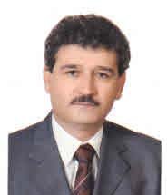 Norair Toomanian合作论文数College of Agriculture, Isfahan University of Technology2
 Sepehr Soltani合作论文数Department of Organ Transplantation, Shiraz University of Medical Sciences2Mohsen Ahmadi合作论文数1
 Hamed Sangoony合作论文数Invited Lecturer at Range and Watershed Management Department, Tarbat-e-Heydarieh University1
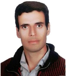 Habib Yazdanshenas合作论文数Tehran University1
 Mohammad Reza Vahabi合作论文数Dept Nat Resources, Isfahan Univ Technol1Pawanjeet Singh Datta合作论文数1
 Pooran Golkar合作论文数College of Agriculture, Shahid Bahonar University of Kerman1
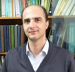 Jahangir Khajehali合作论文数Faculty of Bioscience Engineering, Ghent University1
 David Pothier合作论文数Departement des sciences du bois et de la foret, Faculte de foresterie, de geographie et de geomatique, Universite Laval1
 Mohammad Haji Jafari合作论文数Department of Rehabilitation of Arid and Mountainous Regions, University of Tehran1Hossein Azarnivand合作论文数Natural Resources Faculty, Tehran University1Atefeh Pirani合作论文数Central Herbarium of Tehran University, University of Tehran1
 Andre Große-Stoltenberg合作论文数Institute of Landscape Ecology, University of Münster1
 Hossein Arzani合作论文数Natural Resource Faculty, University of Tehran1
 Ali Tavili合作论文数Natural Resources Faculty, University of Tehran1
 Barbara Koch合作论文数Faculty of Environment and Natural Resources, University of Freiburg1
 Till Kleinebecker合作论文数Institute of Landscape Ecology, University of Münster1
 Carl Smith合作论文数School of Integrative Systems, The University of Queensland1




