Routing for autonomous vehicles with global traffic information and sufficient direct cooperation among vehicles has been widely studied to relieve traffic congestion in recent years. However, the assembly rate of Vehicle-to-Everything (V2X) equipment in practical traffic systems is currently and could be at a low level in near future. Accordingly, autonomous vehicles can only access localized traffic information, and direct cooperation among them cannot always be guaranteed. Thus, how to optimize the routing choices in such scenarios is worthy of particular attention. In this article, we propose a self-organized routing strategy based on deep reinforcement learning (DRL). Under the condition of limited traffic information, the proposed self-organized mechanism well organizes localized traffic conditions through vehicle-level routing decisions, which are able to achieve network-wide benefits gains. In the specified DRL, we propose a novel reward mechanism to harmonize indirect interactions among vehicles by jointly learning individual and overall efficiency, even if each vehicle is modified to make individual decisions independently, rather than only focusing on individual interests as in the greedy strategy. Numerical experiments demonstrate that the proposed self-organized strategy is promising to resolve the routing problem from the perspective of individual decision-making with limited traffic information.
Autonomous driving related researches require the analysis and usage of massive amounts of driving scenario data. Compared to raw data collected by sensors, scenario data provide a preliminary abstraction of driving tasks and processes, explicitly integrate information about the road environment and the dynamic and static attributes of traffic participants, making it easier to conduct task understanding and decision making. However, many existing driving scenario datasets have the following two problems. First, it is not clear which data fields need to be recorded for driving scenarios. The data storage formats and organization standards are inconsistent. Second, the datasets cannot establish driving scenario indexing effectively. Existing datasets are sparsely annotated and difficult to index, which is detrimental to data sampling and extraction for machine learning process, thus hindering efficient fusion and reuse. In this paper, we propose MetaScenario, a framework for driving scenario data. We describe driving scenarios and design the centralized and unified data framework for the storage, processing, and indexing of scenario data based on relational database. The concept of atom scenario is proposed and characterized using semantic graphs. We also annotate and classify behaviors and interactions of traffic participants in atom scenarios by extracting the spatiotemporal evolution of semantic information. The annotation facilitates the indexing and extraction of data. The scenario datasets are further evaluated via the data distribution and annotation statistics. MetaScenario can provide researchers with convenient tools for scenario data extraction and important analytical references.
Virtual simulation-based testing of autonomous vehicles (AVs) needs massive challenging corner cases to reach high testing accuracy. Current methods achieve this goal by finding testing scenarios with low sampling frequency in the empirical distribution. However, these methods neglect modeling heterogeneous driving behavior, which actually is crucial for finding corner cases. To fill this gap, we propose an interpretable and operable method for sampling corner cases. Firstly, we initialize a testing scenario and allocate testing tasks to AV. Then, to simulate the variability in driving behaviors, we design utility functions with several hyperparameters and generate aggressive, conservative, and normal driving strategies by adjusting hyperparameters. By changing the heterogeneous driving behavior of surrounding vehicles (SVs), we can sample the challenging corner cases in the scenario. Finally, we conduct a series of simulation experiments in a typical lane-changing scenario. The simulation results reveal that by adjusting the occurrence frequency of heterogeneous SVs in the testing scenario, more corner cases can be found in limited rounds of simulations.
We address the problem of optimally controlling Connected and Automated Vehicles (CAVs) arriving from four multi-lane roads at a signal-free intersection where they conflict in terms of safely crossing (including turns) with no collision. The objective is to jointly minimize the travel time and energy consumption of each CAV while ensuring safety. This problem was solved in prior work for single-lane roads. A direct extension to multiple lanes on each road is limited by the computational complexity required to obtain an explicit optimal control solution. Instead, we propose a general framework that first converts a multi-lane intersection problem into a decentralized optimal control problem for each CAV with less conservative safety constraints than prior work. We then employ a method combining optimal control and control barrier functions, which has been shown to efficiently track tractable unconstrained optimal CAV trajectories while also guaranteeing the satisfaction of all constraints. Simulation examples are included to show the effectiveness of the proposed framework under symmetric and asymmetric intersection geometries and different CAV sequencing policies.
The properties of cooperative driving strategies for planning and controlling Connected and Automated Vehicles (CAVs) at intersections range from some that achieve highly efficient coordination performance to others whose implementation is computationally fast. This paper comprehensively compares the performance of four representative strategies in terms of travel time, energy consumption, computation time, and fairness under different conditions, including the geometric configuration of intersections, asymmetry in traffic arrival rates, and the relative magnitude of these rates. Our simulation-based study has led to the following conclusions: 1) The Monte Carlo Tree Search (MCTS)-based strategy achieves the best traffic efficiency and has great performance in fuel consumption; 2) MCTS and Dynamic Resequencing (DR) strategies both perform well in all metrics of interest. If the computation budget is adequate, the MCTS strategy is recommended; otherwise, the DR strategy is preferable; 3) An asymmetric intersection has a noticeable impact on the strategies, whereas the influence of the arrival rates can be neglected. When the geometric shape is asymmetrical, the modified First-In-First-Out (FIFO) strategy significantly outperforms the FIFO strategy and works well when the traffic demand is moderate, but their performances are similar in other situations; and 4) Improving traffic efficiency sometimes comes at the cost of fairness, but the DR and MCTS strategies can be adjusted to realize a better trade-off between various performance metrics by appropriately designing their objective functions.
Reducing conservatism while ensuring safety poses great difficulties for real-time trajectory planning in uncertain and cluttered environments. If we view trajectory planning as an optimization problem, the non-convex collision avoidance constraints with uncertain obstacles make trajectory planning challenging and time-consuming. Disjunctive chance constraint-based methods have been one of the most popular stochastic tools for this problem, for they can provide a tighter bound and lead to less conservative trajectories compared with other methods. However, previous work on disjunctive chance constraint-based trajectory planning adopts mixed-integer programming which has exponential complexity. Different from existing work, we propose a new optimization-based trajectory planning method with chance constraints, which turns uncertain obstacles into bounding boxes with tight upper bound collision avoidance constraints. Then, with a proposed time-varying convex feasible sets (TVCFS) algorithm, the original non-convex optimization problem is transferred into a series of convex problems, which can meet real-time requirements. Since the planned trajectory may be dynamically infeasible, we consider vehicle kinematics and formulate an optimal control problem to further smooth the planned trajectory and obtain desired control inputs. Simulation tests demonstrate the effectiveness of the proposed method.
In this paper, we propose a new cooperative driving strategy for connected and automated vehicles (CAVs) at unsignalized intersections. Based on the tree representation of the solution space for the passing order, we combine Monte Carlo tree search (MCTS) and some heuristic rules to find a nearly global-optimal passing order (leaf node) within a very short planning time. Testing results show that this new strategy can keep a good tradeoff between performance and computation flexibility.
This paper studies the cooperative driving of connected and automated vehicles (CAVs) at conflict areas (e.g., non-signalized intersections and ramping regions). Due to safety concerns, most existing studies prohibit lane change since this may cause lateral collisions when coordination is not appropriately performed. However, in many traffic scenarios (e.g., work zones), vehicles must change lanes. To solve this problem, we categorize the potential collision into two kinds and thus establish a bi-level planning problem. The right-of-way of vehicles for the critical conflict zone is considered in the upper-level, and the right-of-way of vehicles during lane changes is then resolved in the lower-level. The solutions of the upper-level problem are represented in tree space, and a near-optimal solution is searched for by combining Monte Carlo Tree Search (MCTS) with some heuristic rules within a very short planning time. The proposed strategy is suitable for not only the shortest delay objective but also other objectives (e.g., energy-saving). Numerical examples show that the proposed strategy leads to good traffic performance in real-time.
There are generally two kinds of traffic control strategies to relieve traffic congestion in lane-drop bottlenecks: variable speed limits (VSL) control and lane-changing (LC) control. However, VSL has limited or even no effect due to many mandatory LC maneuvers near bottlenecks, while LC fails to reduce traffic congestion when traffic demand is high. Although a few control methods combine VSL and LC, they do not consider the interaction between VSL and LC, which rules out many potentially good alternatives. We instead propose an integrated VSL and LC control method under a connected and automated vehicle (CAV) environment, which can consider the interaction and simultaneously find the values of LC numbers and speed limits to maximize traffic efficiency. Our control is in the framework of the model predictive control (MPC), which consists of prediction, optimization, and implementation. We adopt an improved multi-class cell transmission model (CTM) for traffic state prediction, then use the genetic algorithm (GA) for optimization which optimizes traffic network performance, and implement our control method in the SUMO platform. Simulation results demonstrate that our control method greatly improves the capacity of the road and is robust to different traffic demands and scenarios. Our control outperforms no control and VSL-only control in travel time and exhaust emissions, which reduces total travel time by 23.86% to 44.62% and exhaust emissions by 10.29% to 48.19%.
In general, there are two kinds of cooperative driving strategies, planning-based strategy, and ad hoc negotiation-based strategy, for connected and automated vehicles merging problems. The planning-based strategy aims to find the globally optimal passing order, but it is time-consuming when the number of considered vehicles is large. In contrast, the ad hoc negotiation-based strategy runs fast, but it always finds a locally optimal solution. In this paper, we propose a grouping-based cooperative driving strategy to make a good tradeoff between computation time and coordination performance. The key idea is to fix the passing orders for some vehicles whose inter-vehicle headways are small enough (e.g., smaller than the pre-selected grouping threshold). From the viewpoint of optimization, this method reduces the size of the solution space. Then, two analyses are given to explain why this kind of strategy is good and how to determine suitable values for the strategy parameters. A series of simulation experiments are carried out to validate that the proposed strategy can yield a satisfied coordination performance with less computation time and is promising to be used in practice.
In general, the cooperative driving problems for Connected and Automated Vehicles (CAVs) consist of two parts: determine the desired arrival times and motion planning. However, most of the existing works don't take positioning errors into account. To improve the ability of handling the positioning errors, this paper formulates motion planning as an optimization problem and adds collision avoidance constraints into the optimization problem. Then, an analytical solution of the constructed optimization problem is derived so that it can be solved quickly in practice. A series of simulation tests show that this method is superior to a common-used method in terms of safety and energy consumption. As long as the appropriate safety distance is chosen, the proposed method can make CAVs operate safely against a certain degree of positioning errors.
With the rapid development in vehicular communication technologies, cooperative driving of intelligent vehicles can provide promising efficiency, safety and sustainability to the intelligent transportation systems. In this paper, a centralized cooperative intersection control (CCIC) approach is proposed for the non-signalized intersections under automated vehicle environment. The cooperative intersection control problem is converted to a nonlinear constrained programming problem considering vehicle delay, fuel consumption, emission and driver comfort level. Furthermore, a simulation-based case study is carried out on a four-legged, two-lane non-signalized intersection under different traffic volume scenarios to compare CCIC with the actuated intersection control (AIC) system. The results indicate that the CCIC approach shows significant potential improvements on the traffic efficiency (i.e., nearly 14% of traffic flow increase, nearly 90% of travelling time saving), emission (nearly 60% of CO2 reduction) and driver comfort level (nearly 2% of comfort level increase).
With the advance of intelligent vehicle infrastructure cooperation systems (i-VICS), many traffic parameters can be inferred given data from the OBU (On Board Unit of i-VICS)-equipped vehicles to calculate some information used in the modern urban traffic management. As a typical application, the estimation of investigated queue length at isolated intersections is proposed in the paper. Firstly, the queue length estimation at isolated intersections is explored to be transformed into the problem of deriving the number of queued vehicles. Two models, the improved and advanced interpolation methods, are then introduced to the condition of single cycle and multiple cycles, respectively. The microscopic simulation software VISSIM is adopted to evaluate the effect of the derived models. Its analysis shows that, under the condition of single cycle, the mean absolute error (MAE) of the improved interpolation method is less than 2 vehicles when the equipped rate of i-VICS OBU is higher than 50% and the maximum MAE with 30% equipped rate will be no more than 4 vehicles. On the other hand, under the condition of multiple cycles, the MAE of the advanced interpolation method with very low OBU-equipped rates will be less than 6 vehicles. Finally, numerical results of proposed approach have shown the relations of MAE with the volume-to-capacity ratio and the OBU-equipped rate.
Based on the real-time traffic information available recently from the popular travelling service systems like AutoNavi in China, data driven analytics is introduced in this paper to explore implicit factors stressing the traffic congestion in urban areas. Some primary and high schools in the selected areas in Beijing are taken into account to discover the impacts of their locations on the traffic congestion around. The traffic data is extracted from AutoNavi and grouped on links to represent the traffic status in the period of rush hours. The indexes for traffic congestion and its tendency are then defined to describe the convergence and divergence of traffic congestion as well as the degrees of impact and changing gradient. Finally, the visualized analysis is introduced to demonstrate the contributions of all schools to traffic congestion in the selected area. Some suggestions to the governmental administration about how to improve the traffic situation around schools are also discussed.
With the development of V2V and V2I technologies, vehicles can cooperate to perform more efficiently and safely in the intelligent transportation systems. Centralized cooperative intersection control (CCIC) uses V2X communication technology to guide automated vehicles passing the intersection more efficiently, sustainably, safely and comfortably. This paper focuses on the impact of CCIC on traffic flow characteristics. It uses VISSIM to study the impacts of intelligent vehicles equipped with On-Board Unit (OBU) for CCIC on traffic flow. The temporal-spatial trajectory diagrams show a significant improvement of traffic flow efficiency compared with the actuated intersection control (AIC) system. Moreover, CCIC can also reduce the emission and enhance the driver comfort level. In addition, the impacts of the penetration rate of OBU for CCIC are emphasized and investigated. The results show that vehicles with penetration rate of OBU for CCIC larger than about 60% shows promising potential in the intersection control systems than AIC.
In this paper an activity recognition algorithm based on multi-feature fuzzy cluster is designed to find out more details of the activities so as to achieve an accurate classification among them. Firstly, it is proved that distribution of feature vectors vary from activity to activity. And then, a multi-feature extraction algorithm is designed to extract the feature vectors of each activity which makes up a standard activity class. Finally, an activity recognition algorithm based on similarity measurement is brought up and the misjudgment rate turns out to be acceptable, which proves that this algorithm is accurate and highly feasible.
Wearable sensors-based human activity recognition introduces many useful applications and services in health care, rehabilitation training, elderly monitoring and many other areas of human interaction. Existing works in this field mainly focus on recognizing activities by using traditional features extracted from Fourier transform (FT) or wavelet transform (WT). However, these signal processing approaches are suitable for a linear signal but not for a nonlinear signal. In this paper, we investigate the characteristics of the Hilbert-Huang transform (HHT) for dealing with activity data with properties such as nonlinearity and non-stationarity. A multi-features extraction method based on HHT is then proposed to improve the effect of activity recognition. The extracted multi-features include instantaneous amplitude (IA) and instantaneous frequency (IF) by means of empirical mode decomposition (EMD), as well as instantaneous energy density (IE) and marginal spectrum (MS) derived from Hilbert spectral analysis. Experimental studies are performed to verify the proposed approach by using the PAMAP2 dataset from the University of California, Irvine for wearable sensors-based activity recognition. Moreover, the effect of combining multi-features vs. a single-feature are investigated and discussed in the scenario of a dependent subject. The experimental results show that multi-features combination can further improve the performance measures. Finally, we test the effect of multi-features combination in the scenario of an independent subject. Our experimental results show that we achieve four performance indexes: recall, precision, F-measure, and accuracy to 0.9337, 0.9417, 0.9353, and 0.9377 respectively, which are all better than the achievements of related works.
 Yi Zhang (张毅)合作论文数Department of Automation, Tsinghua University13
 Jianming Hu (胡坚明)合作论文数Department of Automation, Tsinghua University4
 Jishiyu Ding合作论文数3
 Christos G. Cassandras合作论文数Center for Information & Systems Engineering, College of Engineering, Boston University;Division of Systems Engineering, College of Engineering, Boston University;Center for Intelligent and Networked Systems, Department of Automation, Tsinghua University3
 Danya Yao (姚丹亚)合作论文数3
 Jiawei Zhang合作论文数Department of Automation, Tsinghua University2
 Yuqing Guo合作论文数Dept Automat, Tsinghua Univ2
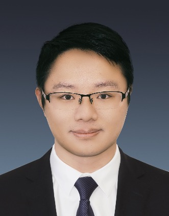 Shuo Feng (封硕)合作论文数Department of Automation, Tsinghua University2
 Cheng Chang合作论文数1
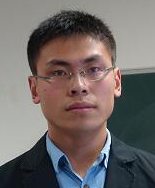 Wei Xiao合作论文数Computer Science and Artificial Intelligence Laboratory, Massachusetts Institute of Technology1
 Jingwei Ge合作论文数1
 Huaxin Pei (裴华鑫)合作论文数Department of Automation, Tsinghua University1
 Kuifeng Su合作论文数Tencent, Autonomous Driving Lab, Beijing, Peoples R China1
 Xiangbin Wu合作论文数Intel Lab China, Beijing, Peoples R China1
 Wangli Lin合作论文数1Jue Wang (王珏)合作论文数Institute of Molecular Medicine, Peking University1
 Wang Zezhong合作论文数North China Electr. Power Univ.;c;North China Electr. Power Univ.1
 Yi Chai (柴毅)合作论文数School of Automation, Chongqing University1
 Haibo Hu (胡海波)合作论文数School of Big Data & Software Engineering, Chongqing University;Key Laboratory of Dependable Service Computing in Cyber Physical Society Ministry of Education, Chongqing University1
 Long Chen (陈龙)合作论文数University of Chinese Academy of Sciences;Institute of Automation, Chinese Academy of Sciences1
 Weixia Li合作论文数1
 Dongpu Cao合作论文数Waterloo Cognitive Autonomous Driving Lab, University of Waterloo1
 Ping Wang (王平)合作论文数Intelligent Computing and Sensing Laboratory, Peking University;National Engineering Research Center for Software Engineering, Peking University1
 Gansha Wu (吴甘沙)合作论文数Uisee Technology (Bejing) Co Ltd1
 Nanning Zheng (郑南宁)合作论文数Institute of Artificial Intelligence and Robotics, College of Artificial Intelligence, Xi'an Jiaotong University1
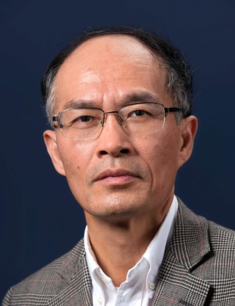 Feiyue Wang (王飞跃)合作论文数The State Key Laboratory for Management and Control of Complex Systems, Institute of Automation, Chinese Academy of Sciences;University of Chinese Academy of Sciences1
 Yuelong Su合作论文数1Junqing Wei合作论文数1




