In this work an object class recognition method is presented. The method uses local image features and follows the part based detection approach. It fuses intensity and depth information in a probabilistic framework. The depth of each local feature is used to weight the probability of finding the object at a given scale. To train the system for an object class only a database of annotated with bounding boxes images is required, thus automatizing the extension of the system to different object classes. We apply our method in the problem of detecting vehicles captured from a moving platform. The experiments in a data-set of stereo images captured in an urban environment show a significant improvement in performance when using both information modalities.
Robust analysis of dynamic scenes in urban traffic environments is needed to estimate and predict collision ri sk level during vehicle driving. The risk estimation relies on monitoring of the traffic environment of the vehicle by means of on-board lidars and a stereo camera. The collision risks are considerd as stochastic variables. Hidden Markov Model and Gaussian process are used to estimate and predict collision risks and the likely behaviors of multiple dynamic agents in road scen es. The proposed approach to risk estimation is tested in a virtual environment with human-driven vehicles and during a highway driving. The obtained results have proven the feasibility of our approach to assist the driver in avoiding potentially dangerous situations.
Fusion of telemetric and visual data from traffic scenes helps exploit synergies between different on-board sensors, which monitor the environment around the ego-vehicle. This paper outlines our approach to sensor data fusion, detection and tracking of objects in a dynamic environment. The approach uses a Bayesian Occupancy Filter to obtain a spatio-temporal grid representation of the traffic scene. We have implemented the approach on our experimental platform on a Lexus car. The data is obtained in traffic scenes typical of urban driving, with multiple road participants. The data fusion results in a model of the dynamic environment of the ego-vehicle. The model serves for the subsequent analysis and interpretation of the traffic scene to enable collision risk estimation for improving the safety of driving.
The article deals with the analysis and interpretation of dynamic scenes typical of urban driving. The key objective is to assess risks of collision for the ego-vehicle. We describe our concept and methods, which we have integrated and tested on our experimental platform on a Lexus car and a driving simulator. The on-board sensors deliver visual, telemetric and inertial data for environment monitoring. The sensor fusion uses our Bayesian Occupancy Filter for a spatio-temporal grid representation of the traffic scene. The underlying probabilistic approach is capable of dealing with uncertainties when modeling the environment as well as detecting and tracking dynamic objects. The collision risks are estimated as stochastic variables and are predicted for a short period ahead with the use of Hidden Markov Models and Gaussian processes. The software implementation takes advantage of our methods, which allow for parallel computation. Our tests have proven the relevance and feasibility of our approach for improving the safety of car driving.
The ArosDyn project aims to develop embedded software for robust analysis of dynamic scenes in urban traffic environments, in order to estimate and predict collision risks during car driving. The on-board telemetric sensors (lidars) and visual sensors (stereo camera) are used to monitor the environment around the car. The algorithms make use of Bayesian fusion of heterogenous sensor data. The key objective is to process sensor data for robust detection and tracking of multiple moving objects for estimating and predicting collision risks in real time, in order to help avoid potentially dangerous situations.
The ArosDyn project aims to develop an embedded software for robust analysis of dynamic scenes in urban environment during car driving. The software is based on Bayesian fusion of data from telemetric sensors (lidars) an d visual sensors (stereo camera). The key objective is to proc ess the dynamic scenes in real time to detect and track multiple moving objects, in order to estimate and predict risks of collision while driving.
providing various services by gathering, managing, and supplying information via distributed communication, sensing, and actuation.Various applications of such robotic systems have been proposed and studied, e.g.life support (
The development of an advanced safety vehicle (ASV) has primary importance for automobile manufactures and customers. The safety measures of modern vehicles involve active and passive safety. Active safety devices provide the driver with warning signals or aaect the vehicle's motion in order to prevent an accident. Passive safety devices help to avoid injuires and post-collision hazards if an accident occurs. The main features of the ASV concept are illustrated by state-of-the-art examples, the development trends are discussed.
This paper deals with a novel motion control approach for a car-like vehicle evolving in a structured, dynamic and partially known environment. The overall architecture of the control system is presented. We focus on two modules: the Global Trajectory Planner (GTP) and the Mannuvre Execution (ME). The key idea of the approach is to plan and carry out sensor-guided mannuvres. A nominal trajectory is generated, based on monitoring the environment and a prediction of its evolution. In order to take into account unforeseen events, the motion control is carried out within the reactive scheme. The automatic vehicle adapts its nominal trajectory to avoid obstacles in a reactive way. Since replanning is time consuming, local trajectories associated with generic mannuvres and based on perceptive information are planned and followed by ME. The approach developed allows to obtain the smooth motion of the vehicle. Experimental results obtained with our automatic car-like vehicle are presented for two kinds of mannuvres : a lane following/changing and an autonomous parallel parking. Praxit ele programme on urban public transport 1994-1997], and the Inco-Copernicus ERBIC15CT960702 project \Multi-agent robot systems for industrial applications in the transport domain" 1997-1999]. This paper deals with a novel motion control approach for a car-like vehicle evolving in a structured, dynamic and partially known environment. The overall architecture of the control system is presented. We focus on two modules: the Global Trajectory Planner (GTP) and the Mannuvre Execution (ME). The key idea of the approach is to plan and carry out sensor-guided mannuvres. A nominal trajectory is generated, based on monitoring the environment and a prediction of its evolution. In order to take into account unforeseen events, the motion control is carried out within the reactive scheme. The automatic vehicle adapts its nominal trajectory to avoid obstacles in a reactive way. Since replanning is time consuming, local trajectories associated with generic mannuvres and based on perceptive information are planned and followed by ME. The approach developed allows to obtain the smooth motion of the vehicle. Experimental results obtained with our automatic car-like vehicle are presented for two kinds of mannuvres : a lane follow-ing/changing and an autonomous parallel parking.
The optical guidance of robots spans the research topics of robotics, computer vision, communication and real-time control. The proposed method aims to improve the accuracy of guidance along a desired route in an environment that is unknown to the robot. The key idea is to indicate the numerical coordinates of target positions by means of projecting a laser light onto the ground. In contrast with other guidance methods, which communicate the target position numerically, using optical commands avoids the need to maintain the coordinate transformation between the robot’s system and that of the environmental model (“world” reference coordinates). The image processing and communication ensure that the robot accurately follows the route indicated by laser beacons, and self-localization becomes less relevant for guidance. The experimental results have proved the effectiveness of this method.
Planning control commands of the steering angle and velocity for autonomous parking maneuvers is addressed. Our approach makes use of conformity between the control commands and resulting shape of the path. The path shape required for a parking maneuver is evaluated from the environmental model. The corresponding control commands are selected and parameterized to provide motion within the available space. They are executed by the car servo-systems which drive the vehicle into the parking place. The approach is tested on a CyCab automated vehicle. The experimental results on a perpendicular parking maneuver are described, and the experiments illustrated by video.
The paper discusses a new hybrid navigation strategy for mobile robots operating in indoor environment using the Information Assistant (IA) system and the Optical Pointer (OP). For intelligent navigation, the robots need a static and global information describing a topological map such as positional relation from any starting position to any goal position for making a path plan as well as dynamic and local information including local map, obstacles, traffic information for navigation control. We propose a method for managing the information. The robot has only rough path information to the goal, and the IAs, which are small communication devices installed in the environment, manage real environment information, locally. The OP is used for guidance of a robot in the junctions such as crossing, which communicates with mobile robots through IA and indicates their target positions by means of a light projection from a laser pointer onto the ground. The mobile robot allows it and run after the laser light beacon and reaches the destination. The robot can navigate to the goal efficiently by using these systems.
Planning control commands of the steering angle and velocity for autonomous parking maneuvers is addressed. Our approach makes use of conformity between the control commands and resulting shape of the path. The path shape required for a parking maneuver is evaluated from the environmental model. The corresponding control commands are selected and parameterized to provide motion within the available space. The commands are executed by the car servo-systems which drive the vehicle into the parking place. The approach is implemented and tested on a CyCab automated vehicle. The results on a perpendicular parking maneuver are described, and the experiments illustrated by video.
Planning control commands of the steering angle and velocity for autonomous parking maneuvers is addressed. Our approach makes use of conformity between the control commands and resulting shape of the path. The path shape required for a parking maneuver is evaluated from the environmental model. The corresponding control commands are selected and parameterized to provide motion within the available space. The commands are executed by the car servo-systems which drive the vehicle into the parking place. The approach is implemented and tested on a CyCab automated vehicle. The results on a perpendicular parking maneuver are described, and the experiments illustrated by video.
A laser system for autonomous guidance of robots is presented. This system operates with an environmental model, communicates with the robots and indicates their routes by means of light projection from a laser pointer onto the ground. Image processing and communication with the guidance system allows the robot to detect the laser light beacon on the ground and estimate its relative coordinates. The guidance system subsequently indicates target positions along a desired route. The concept of the system, its kinematic models and operation are considered. The implementation and experimental results are described.
This paper describes our research work towards the development of an optical guidance system for multiple mobile robots in an indoor environment. The guidance system operates with an environmental model, communicates with mobile robots and indicates their target positions by means of a light projection from a laser pointer onto the ground. Processing the image data from a CCD color camera mounted on the mobile robot allows it to detect the laser light beacon on the ground and estimate its relative coordinates. The robot's control system ensures the accurate motion of the robot to the indicated target position. The guidance system subsequently indicates target positions corresponding to a desired route for a specified mobile robot in the fleet. The concept of the optical guidance system, its implementation and experimental results are discussed
 Christian Laugier合作论文数LIG Laboratory14
 Hajime Asama合作论文数Asama Laboratory, Department of Precision Engineering, University of Tokyo9
 Mathias Perrollaz合作论文数INRIA Grenoble7
 Yong Mao合作论文数5
 Christian Laugier合作论文数Universite Grenoble Alpes4
 John-David Yoder合作论文数Department of Mechanical Engineering, Ohio Northern University4Amaury Nègre合作论文数GIPSA-LabGIPSA4
 Christopher Tay合作论文数4
 Thierry Fraichard合作论文数INRIA3Va Yakubovich合作论文数2
 Sergei V. Gusev合作论文数2
 Daisuke Kurabayashi合作论文数Dept Mech & Control Engn, Tokyo Inst Technol2Tsuyoshi Suzuki合作论文数2
 Ilya Anatolyevich Makarov合作论文数2
 Kuniaki Kawabata合作论文数Naraha Center for Remote Control Technology Development, Japan Atomic Energy Agency;Collaborative Laboratries for Advanced Decommissioning Sciences, Japan Atomic Energy Agency;Center for Engineering, The University of Tokyo;Kagawa University;Keio University2Alexis Scheuer合作论文数2K. Mekhnacha合作论文数2A. Scheuer合作论文数1Trung-Dung Vu合作论文数1Gabriel Othmezouri合作论文数1hiromichi yanagihara合作论文数1thiago bellardi合作论文数1
 A. Cristofaro合作论文数1alejandro dizan vasquez govea合作论文数1I. Endo合作论文数1
 Olivier Aycard合作论文数ε-motion, GRAVIR-UJF-INRIA-INP Grenoble1
 Agostino Martinelli合作论文数INRIA Rhone Alpes1
 Philippe Garnier合作论文数1
 Teruo Fujii (藤井輝夫)合作论文数Applied Microfluidic Systems Lab, Institute of Industrial Science, University of Tokyo1
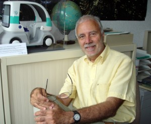 Michel Parent合作论文数IMARA1Ulrich Rembold合作论文数1Taiki Uehara合作论文数1Ph. Garnier合作论文数1
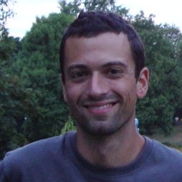 Alessandro Renzaglia合作论文数Rome U. & INFN, Rome1
 Alexandros Makris合作论文数Institute for Informatics and Telecommunications, University of Athens1L. I. Matioukhina合作论文数1U. M. Nassal合作论文数Institute for Real-Time Computer Systems and Robotics;University of Karlsruhe1
 Anne Spalanzani合作论文数Pierre-Mendès-France University;INRIA1
 Qadeer Baig合作论文数1
 Stéphanie Lefevre合作论文数Mercedes Benz R&D center in California1Martin Damm合作论文数1




