The Kahdelan area in the SW of Sarab is situated in the northern part of the Urumieh–Dokhtar geotectonic zone and Tarom-Hashtjin metallogenic zone. Some of the most important porphyry Cu ± Mo ± Au mineralizations in Iran occur along the NW–SE trending Urumieh–Dokhtar volcano-plutonic belt, lying between the Sanandaj–Sirjan zone and Central Iran. The Urumieh–Dokhtar magmatic arc, extends over a strike length of about 2000 km from northwest to southeast and is characterized by subduction-related calc-alkaline rocks. Due to extensive Tertiary magmatism and extensive alterations, this zone is one of the remarkable Cu-bearing regions in Iran. Therefore, many studies, regarding different aspects of the area, have been carried out by the Geological Survey of Iran as well as some private companies. Differentiating fertile and barren intrusive bodies could be important factors in reducing exploration expenses, and it is possible to identify susceptible areas by using geochemical data. Thus, the main purpose of the present study is to evaluate the granitoid rocks of the Kahdelan area as the possible potential for Cu-mineralization based on mineralogical and geochemical evidence.Regional GeologyThe main intrusions of the Kahdelan area are Oligocene granitoid bodies composed of syenite, quartz syenite, and monzosyenite with light color and granular texture. Syenites are the most dominant plutonic rocks and quartz-syenites are the main host of Cu-mineralization. These intrusive bodies intruded the Upper Eocene pyroclastic and volcanic rocks which gave rise to alteration and mineralization occurrences in the area. Volcanic rocks are composed of basalt, basaltic-andesite, andesite, and trachyte mainly with porphyritic texture.Materials and Methods The present study evaluates the copper mineralization potential of the Kahdelan area for the first time. The represented information can be divided into three parts: 1) ore mineralogy and mineralogy of the Kahdelan’s rocks; 2) the investigating data related to I-type and magnetite series, and 3) the relationship between the obtained mineralogical and geochemical data with Cu-mineralization in the area to compare with porphyry copper deposits along the Urumieh–Dokhtar magmatic arc.Results and Discussion The dominant alteration zones in the area under study are argillic, phyllic, carbonatization, silicification, and hematitization. The primary ore minerals are magnetite, chalcopyrite, and bornite which are generally replaced by secondary minerals including chalcocite, covellite, and malachite. The ore textures are predominantly disseminated, open space-filling, replacement, and brecciated. Gangues (carbonate and quartz minerals) textures are crystalline, open space-filling, cementation of brecciated zones, and colloform.The volcanic rocks of the Kahdelan area are calk-alkaline to shoshonitic and the granitoids are shoshonitic affinity and I-Type nature (magnetite series). In the area of study, sinking solutions washed away most of the pyrites and left behind empty pyrite molds and iron oxides and hydroxides along with different amounts of malachite and neotocite. As the chondrite-normalized REE diagrams display the studied granitoids are enriched in LREEs and fairly depleted in LREEs relative to HREEs The enrichment of LILE elements and depletion of HFSE elements are features similar to those of the fertile granitoids. The rate of decline of the slope in the diagram is similar to that of the copper porphyry deposits also slightly negative Eu anomalies of these granitoids are similar to fertile granitoids (Karimpour et al., 2021). The (La/Yb)n and Eu/Eu* are used in evaluating the oxidation state and investigating the depth changes of parent magma of granitoids. The (La/Yb)n anomalies vary from 4.05-23.17, and Eu/Eu* anomalies vary from 0.32-2.65 with an average of 0.8 that are different from copper porphyry deposits.Based on spider diagrams, the depletion of titanium could be related to the low oxygen fugacity in subduction zones. The Pb and U enrichment point to the role of the earth’s crust in the petrogenesis of these rocks. P depletion could be the consequence of apatite crystallization from the parent magma.Based on the relationship between geochemical data as well as mineralization, three diagrams have been used to distinguish fertile granitoids. The Eu/Eu* versus (La/Yb)n diagram (Karimpour et al., 2021) shows that Kahdelan’s granitoids have a reduced nature. The SiO2-K2O diagram (Peccerillo and Taylor, 1976) points out that the intrusive and the volcanic rocks of Kahdalan are characterized by the much less SiO2 amount compared to fertile granitoids in SNJMB (Saveh-Nain-Jiroft Magmatic Belt) (Karimpour et al., 2021). On A/NK versus A/CNK diagram (Meinert, 1995) the granitoids under study are close to fertile copper porphyry deposits.ConclusionOn the basis of mineralogical and geochemical data, Kahdelan’s intrusive rocks are I-type and magnetite series. The tectonomagmatic setting of the rocks under study lies within Volcanic Arc Granites (VAG), active continental margins, and arc systems. On A/NK versus A/CNK diagram, these granitoids are close to fertile copper porphyry deposits. Quartz syenites are the main mineralization hosts. Based on geochemical data, the average Cu content is 3492.76 ppm in a total of 170 samples collected all over the area and up to 230534 ppm Cu in mineralized Quartz syenites veinlets. Mineralogical, geochemical, and alteration data in combination with fertile–barren discrimination diagrams indicate that the granitoids of the Kahdelan area can be evaluated as the possible potential for Cu mineralization.AcknowledgmentsThis research was supported by Iran Minerals Production and Supply Co (IMPASCO). Our grateful thanks are also extended to the Iran Mineral Processing Research Center laboratories (IMPRC) chief and technicians who provide analytical data for this research. Finally, the authors also would like to thank the Editor-in-Chief and the insightful comments offered by anonymous reviewers for the critical and constructive comments which significantly contributed to the improvement of the manuscript.
Introduction The Western Alborz - Lesser Caucasus metallogenic belt includes important Cu and Cu-Au skarn, porphyry and epithermal deposits of Tertiary age in Iran, Turkey and Armenia (Karimzadeh Somarin and Moayyed, 2002; Karimzadeh Somarin, 2004). Important deposits such as Sungun and Masjed Daghi have been situated in this zone in Iran (Ghorbani, 2011). Some researchers have called this zone in the north-western part of the Iranian Copper belt Arasbaran Copper belt (Hassanpour et al., 2010). The Mazraeh deposit is located 20 km north of Ahar city between geographical longitudes '47 ° 00 and 47 ° 08', and latitudes 38 ° 40 '. In addition, 38 ° 36' is a part of Arasbaran Copper Belt in the Kaleyber’s 1:100000 geological map. In recent years, it has become possible to study subsurface samples in this deposit to a depth of 300 meters and provide the opportunity for extensive study of mineralogy and geochemistry of this deposit by conducting systematic exploratory drillings by the National Copper Corporation. Considering the relatively high amounts of gold in cores obtained from drill holes, the study of relationship between gold mineralization and other metals in this deposit has become important for assessing the mineral potential of this deposit. Better understanding of the mechanisms of mineralization in this deposit is useful for its comparison with other similar deposits and better exploratory design for exploration of similar undiscovered deposits in this region. Nowadays, the origin of mineralizing fluids can be discussed with higher certainty with advances in experimental methods including isotopic analysis, fluid inclusion and REE studies (Bowman, 1998). We can obtain valuable information about the origin of fluids causing skarn ore deposits by studying the REE ratios in rock samples. The study of stable isotopes also provides valuable information on temperature of mineralization and physicochemical conditions of mineralizing fluids. Contrary to old beliefs that mineralizing fluids originated from magma in all deposits, the study of stable isotopes has shown that water from other sources can also play an important role in the formation of many deposits (Meinert, 1995). Previous studies have proved that both magmatic and meteoric water have been important in the formation and genesis of many skarn deposits (Taylor and Oneil, 1977). In this paper, we tried to use data from sulfur isotopic studies and the geochemistry of trace and rare earth elements to determine the source and type of fluids affecting mineralization in the Mazraeh skarn deposit. Materials and methods In order to investigate and identify the fluids effective in the process of skarn mineralization, 22 samples (20 samples from the mineralized zone and 2 samples from the intrusive body) were sent to the Binaloud laboratory for ICP-MS analysis. The results were used in geochemical diagrams. For isotopic studies, samples were taken from different parts of the mineralized skarn. 10 samples of sulfides (pyrite and chalcopyrite) were selected to study sulfur stable isotopes. After crushing the samples, the sulfides were separated under a binocular microscope from waste gangue and they were powdered in agate pounder to obtain a concentrate of mineral sulfide. Purity of the sulfides as higher than 95% and weight of the samples was 100 to 150 mg. Isotopic measurements were performed by a mass spectrometer at Ottawa University, Canada. The type of sulfides and their isotope values based on isotopic standard of the CDT are reported in Table 2. Results The results of geochemical studies of rare earth elements indicate the combined effects of magmatic and meteoric water in mineralized fluids in the Mazraeh deposit. Accordingly, magmatic fluids have influenced the mineralizing fluids in the early stages of mineralization. However, the effect of meteoric water on mineralizing fluid in the process of fluid dilution and precipitation of sulfide minerals during the retrograde alteration stage has been more effective in the main and final stages of mineralization. The results of sulfur isotope analysis indicated that sulfur in mineralized fluids has originated from magmatic sources. Also, isotopic thermometry shows temperature of 369 ° C for sulfide mineralization. This temperature indicates the beginning stage of sulfide mineralization in progressive alteration stage. Acknowledgement The financial support for this research, which is part of the Ph.D. thesis of the first author, has been conducted by the research and development affairs of the National Iranian Copper Industry Company (Sarcheshmeh). We thank the management of research and development affairs and the staff of the National Copper Company in Ahar and Varzeqan for their cooperation in sampling.
Tertiary acidic to intermediate volcanic activities and the role of fault zones in Sarbisheh area have provided suitable conditions for the formation of bentonite, especially in pyroclastic deposits. Southeast Gondakan, Kalateh Pedaran, Golab, Golestan, Asfich, Hasan Kolangi, and Kangan bentonites in 1/100000 geological map of Sarbisheh were selected as the case study. Satellite image processing shows argillic alteration with the presence of montmorillonite. Field and XRD studies approved satellite image processing and bentonite formation in the studied areas. Montmorillonite, anorthite, and cristobalite are the main minerals in these bentonites. Based on available data, Hasan Kolangi, Asfich and Golestan bentonites are Na-Ca, Ca-Na, and Ca-type respectively. Parental rocks of studied bentonites are acidic to intermediate lavas (rhyodacite-dacite to andesite) and pyroclastic rocks (tuff-breccia) that had affected by medium to high-grade alteration. Calculation of geochemical changes in bentonitic zones indicated the decrease of silica, Na, and K and increase of Ca.
Bahramtaj Pb-Zn deposit is located about 90 km NW of Yazd, central Iran. The area has been located in Central Iran geotectonic zone and hosted in dolomitic limestone of Paleozoic age. The purpose of this research is to investigate Zincian-dolomite as one of the important effects of the alteration process. Zincian-dolomite as a non-sulfide zinc mineral is characterized by a different amount of Zn, as well as lower amounts of Pb,Cu, and rarely Cd. Characterization of Zn-bearing dolomite, using differential thermal analysis, shows a drop in temperature of the first endothermic reaction of dolomite decomposition with increasing Zn contents in dolomite. The substitution of dolomite by zincian-dolomite supergene is known as a part of a multi-stage mineralization process in Bahramtaj, which begins with the development of the zincian-dolomite process and continues with the dolomitization of the previous dolomites, and finally results formation of zinc non-sulfide minerals such as smithsonite and hemomorphite. Keyword: Zincian dolomite; Pb-Zn mineralization; Bahramtaj; Yazd; Central Iran. Corresponding author, Tel: 09126702051, Fax: 02634762272, E-mail: k_gholizadeh@sbu.ac.ir D ow nl oa de d fr om ij cm .ir a t 2 :5 8 + 04 30 o n S un da y Ju ne 2 8t h 20 20 [ D O I: 10 .2 92 52 /ij cm .2 7. 4. 92 5 ]
Introduction Using stream sediment geochemical exploration has been considered as a useful approach to explore the good potentials for many years. Problems might come up in the course of implementing resolving which may requires the use of more recent findings or auxiliary methods. One of the areas which has faced special problems during the conducting geochemical exploration is the Orzooiyeh region on the border of Kerman and Hormozgan provinces. Stream sediment exploration was carried out in the area in the scale of 1: 100,000. This region includes two different geological zones that are the Sanandaj-Sirjan in the northern part and the Zagros in the southern part. During the statistical analysis and method of eliminating the effects of the upstream rock it was determined that most of the element of chromium’s anomalies are in compliance with the Bakhtiari and Aghajari units which are lacking in the economic importance in the chromium ore. Current geochemical exploration methods often extract the anomalies based on classical statistical methods (Yazdi, 2002). In these methods, the range of the anomaly is just determined based on simple numerical calculations and except for grade, any of the other parameters do not have a significant role in determining the anomaly areas. However, procedures such as fuzzy logic, neural system, regression and hierarchical analysis process enable the users to involve more parameters in data processing (Oh and Lee, 2010; Kumar and Hassan, 2013; Carranza, 2008). For instance, using special algorithms has made parameters such as lithology and tectonic, geophysics and geochemistry effective in processing and determining the anomaly zones, and ranking each of the affective parameters in the anomaly based on their importance, and eventually achieving the maps and valuable anomaly areas possible (Bonham-carter, 1994; Carranza, 2008). This study was conducted to identify the significant anomalies zones using AHP and GIS techniques. Materials and methods AHP (Analytical Hierarchy Process) is the most comprehensive system designed for multi-criteria decision-making. This method was offered firstly by Sati in 1980, and has carried out numerous applications in different sciences until now. This technique also shows the consistency and inconsistency of the decision that is the outstanding benefit of this technique in multi-criteria decision-making and has been proposed for complex and fuzzy problems based on human brain analysis, and consists of three stages: basic, involving the creation of a hierarchy, determining priorities and logical consistency (Macharis et al., 2004). In AHP, the factors are compared with each other in pairs and the highest weight is given to the layer that makes the maximum impact on determining the goal (Carranza, 2008). So in this research, after the detection of the effective factors in determining the anomaly areas in the study area, the factors have been weighed for prioritizing the criteria in their order of importance and the paired comparison matrix is formed based on the characteristics of the area and comparative studies for criteria and sub-criteria. After the formation of paired comparison matrices using approximate arithmetic average, the relative weight of parameters was calculated. Then, the researcher carried out the various stages of preparing and the extracting data layer deals with each of these factors in the GIS environment and finally the layers were integrated with each other and the entire range of the anomaly was ranked based on appropriate models. Results The results of calculating the final weight criteria show that among the study groups, groups Geochemistry .0.45, lithology 0.45 and tectonic 0.1, respectively, are more significant. The ratio of consistency between these groups is 0.02 and is acceptable and the map prepared by the integration of these groups in the GIS environment according to calculated weights shows that a significant proportion of the false anomalies in the region have been eliminated, and the chromium anomalies associated with ophiolites and peridotites of the region show their best. Therefore, this method can be used for providing the mineral prospecting map that the abandoned mines located in the upstream of anomaly areas confirmed the efficiency of this method in the determination of the anomaly areas. Discussion In the present study, the hierarchical process analysis method was utilized to eliminate the false anomalies caused by small and non-significant placer deposits related to the detrital formations in the region. The effective factors in determining the anomaly zones were determined and the final map was constructed by integrating groups, lithology, elemental geochemistry and tectonics that is, the anomaly zones map was drawn in the GIS environment. The results show that the region anomalies are related to ophiolite and ultrabasic and a little bit the region detrital. Therefore, a significant percentage of false anomalies associated with the regional detrital of the area was eliminated by this method and the real anomalies showed their best. This discussion indicates the efficacy of the method of AHP and GIS technique, and they can be considered to be effective methods to reduce the impact of Singenetic factors and naturally to eliminate false anomalies. References Bonham-Carter, G.F., 1994. Geographic Information Systems for Geoscientists: Mod-eling with GIS. Pergamon Press, Oxford, UK, 398 pp. Carranza, E.J.M., 2008. Geochemical anomaly and mineral prospectivity mapping in GIS. Elsevier, Amsterdam, Netherlands, 368 pp. Kumar, S. and Hassan, M., 2013. Selection of a Landfill Site for Solid Waste Management: An Application of AHP and Spatial Analyst Tool. Journal of the Indian Society of Remote Sensing, 41(1): 45–56. Macharis, C., Springael, J., Brucker, K.D. and Verbeke, A., 2004. PROMETHEE and AHP: the design of operational synergies in multicriteria analysis. Strengthening PROMETHEE with ideas of AHP. European Journal of Operational Research, 153(2): 307–317. Oh, H.J. and Lee, S., 2010. Application of Artificial Neural Network for Gold–Silver Deposits Potential Mapping: A Case Study of Korea. Nonrenewable Resource, 19(2): 103–124. Yazdi, M., 2002. Conventional methods in geochemical exploration. Shahid Beheshti University, Tehran, 180 pp. (in Persian)
Investigation of Mazraeh Skarn mineralization, North of Ahar, with an emphasis on fluid inclusion studies
Ahmadabad Pb-Zn ore deposit is located in the mineral area of Bahabad in Central Iran Zone. This ore deposit like other metallogenic areas in Bahabad is found in Triassic carbonate rocks. Carbonate rocks in Shotori formation have the highest frequency in the regional sequence stratigraphy. This formation is composed of TRSh1, TRSh2, TRSh3 and TRSh4 units. The TRSh3 unit hosts minerals in ore deposit Ahmadabad. Microcrystalline particles are the main constituent of these rocks. The most important minerals in this ore deposit include calamine Celestine, Cerussite and Wulfenite. The comparison of normalized ore patterns and carbonate sequence indicates that they have a specified genetic relationship. Here the TRSh2 unit is more similar to minerals.
The several-hundred-m-thick Eocene-Oligocene volcanic units in the Urmia-Dokhtar magmatic arc in northwestern Central Iran host stratabound and fault-controlled copper mineralization. The Kuh-Pang deposit (2.8 Mt at 1.65 wt% Cu, 0.52 g/t Au, 34 g/t Ag) has vein-style copper mineralization, with primary Cu-sulfides of chalcopyrite, bornite, chalcocite and digenite, and supergene Cu-sulfides of chalcocite, covellite, malachite and azurite, in a tectonic hydrothermal breccia zone within rhyodacite and andesite flows. The mineralization is accompanied by a variety of alterations including silicic, carbonate, argillic and advanced argillic within a broad-scale propylitic halo. The main ore formation is related to hydrothermal breccias, and has a close association with silicic and argillic alterations. Sulfides formed during hydrothermal alteration, as indicated by: 1) the occurrence of disseminated sulfides in the groundmass of hydrothermally altered rocks, 2) the co-precipitation of sulfides and alteration minerals (e.g., kaolinite, alunite) in the cement of hydrothermal breccias, and 3) the occurrence of sulfides filling fissures and voids of hydrothermally altered rocks (vuggy quartz). The main mineralization stages include: (i) pre-ore stage with pyrite and arsenopyrite, (ii) main ore-stage with chalcopyrite, bornite, chalcocite I and digenite, and (iii) late-ore and supergene enrichment stage with chalcocite II and covellite. Electron microprobe analyses of pyrite show that As, Cu and Co are the most abundant minor elements. Back-scatter electron imaging of pyrite shows zoning features that closely reflect variations in the AO ratio. High Cu concentration in pyrite is probably related to the presence of sub-micrometer particles and aggregates of chalcopyrite or other Cu-bearing sulfide minerals. Silver is preferentially enriched in supergene chalcocite and covellite. The mineral assemblage indicates a trend from intermediate to high sulfidation state, and arsenopyrite geothermornetry defines temperatures for the pre-ore sulfides ranging from 250 to 370 degrees C. The sulfur isotope composition of pre-ore pyrite and arsenopyrite shows a delta S-34 range of 1 to 3 parts per thousand, indicating a magmatic sulfur-source. The copper sulfides have lower delta S-34 values (-9 to -3 parts per thousand), indicating that the ore-forming fluids gradually became SO42- -enriched and relatively oxidized during Cu mineralization. The tectono-magmatic setting, mineral assemblage and hydrothermal alteration, including advanced argillic and silicic zones, suggest that the Kuh-Pang copper deposit is a high sulfidation epithermal deposit in a volcanic arc terrain. (C) 2017 Elsevier B.V. All rights reserved.
Introduction The Garmab copper deposit is located northeast of Qaen (South Khorasan province) in the1:100,000 scale map of Abiz in the eastern tectonic zone of Iran. It is hosted by Late Paleocene-Eocene lava flows consisting mainly of andesite, trachy¬andesite, andesite-basalt and basalt lavas, as well as pyroclastic rocks, including tuffs and ignimbrites. The Lut Block has undergone intense magmatic activitywith a variety of geochemical characteristics due to changing tectonic conditions (e.g., compression during subduction followed by tensional conditions; Karimpour et al., 2012; Zarrinkoub et al., 2012). The Lut Block has a great potential for the discovery of new mineral deposits, like the Mahrabad and Khonik porphyry copper-gold deposits (Malekzadeh shafarodi, 2009), the Dehsalam porphyry copper deposit (Arjmandzadeh, 2011), high sulfidation epithermal gold deposits such as Chah Shalghami (Karimpour, 2005) and IOCG deposits such as Kuh-E-Zar and Qaleh Zari (Mazlomi et al., 2008). Materials and methods After field studies of the Garmab area, 32 thin sections and 21 polished sections were prepared for petrological and mineralogical studies.In addition, 10 least-altered and fractured samples of volcanic rocks were selected for geochemical studies. Major oxides were determined using XRF analyses at the Zarazma laboratory. Induced polarization and resistivity geophysical data were collected and correlated with geological and alteration maps. The geophysical datawere collectedfrom 420 individual points, using a dipole-dipole arrangement along five profiles separated 60m apart.This covered the study area entirely. After a change in the mineralization trend was observed,additional profileswere designed, twoon bearings of 25º and three on 75º. Results The Garmab volcanic rocks exhibit typical geochemical characteristics of subduction zone magmas including strong enrichment in LILE and depletion in HFSE. Based on the discrimination plot of Irvine and Baragar (1971), all samples belong to the calc-alkaline series, and based on the TAS diagram of Cox et al., 1979, the volcanic ore host rocks of Garmab range from andesite to basaltic andesite to trachyandesite. Hydrothermal alteration, associated with deposition of copper sulfide mineralization, occursmostly along the fault zones. .Mineralization also occurs disseminated and as veinlets, restricted to uppermost parts of the volcanic sequences. The deposit has the form of a layer of supergene enrichment characterized principally by chalcocite as the main ore mineral accompanied by digenite, covellite, bornite and chalcopyrite. The locationof the anomalies has been determined from their medium chargeability and low to medium resistivity values. This can be attributed to the presence of sulfide minerals in the mineralized zones. The average sulfide mineral grain size was determined using the results of time constant parameter. Since the results of raw data do not indicate accurate information about the depth and geometry of mineralization, smooth inverse modeling was applied to determine probable zones and vertical and horizontal extension of mineralization.Geophysical studies show that zones of mineralization are small and scattered. Acknowledgements This research was made possible by the help of the Zarnab exploration consultant engineers and Kani Kavan Samangan. References Arjmandzadeh, R., 2011. Studies of mineralization, geochemistry and tectonic setting in the Dehsalam and Chahshlghmy mining indexes, Lut Block, East Iran. Ph.D. Thesis, Ferdowsi University of Mashhad, Mashhad, Iran, 369 pp (in Persian with English abstract). Cox, K.G., Bell, J.D. and Pankhurst, R.G., 1979.The interpretation of igneous rocks. George, Allen and Unwin, London, 449 pp. Irvine, T.N. and Baragar, W.R.A., 1971. A guide to the classification of the common volcanic rocks. Journal of Earth Sciences, 8 (2): 235-458. Karimpour, M.H., 2005. Quartz-alunite and quartz pitted alteration zones (high sulfidation) of the upper zone of porphyry copper systems in Chah Shalghami area, South Khorasan. 13th Congress of Crystallography and Mineralogy, Bahonar University of Kerman, Kerman, Iran. Karimpour, M.H., Malekzadeh shafarodi, A., Farmer, L. and Stern, S., 2012. petrogenesis of granitoids, age assessment method zircon U-Pb, Sr- Nd isotope geochemistry and mineralization Tertiary important event in the Lut Block, East Iran. Journal of Economic Geology, 1(4): 1-27 (in Persian with English abstract). Malekzadeh shafarodi, A., 2009. Geology, mineralization, alteration, geochemistry, interpretation of geophysical data, microthermometry, isotope studies and determination of the origin of the mineralization of Mahrabad and khonik, South Khorasan province. Ph.D. Thesis, Ferdowsi University of Mashhad, Mashhad, Iran, 600 pp. Mazlomi, A. R., Karimpour, M.H., Rassa, I., Rahimi, B. and Vosoughi Abedini, M., 2008. Kuh-E-Zar Gold Deposit in Torbat-e-Heydaryeh New Model of Gold Mineralization. Iranian Journal of Crystallography and Mineralogy, 3(16): 364-376 (in Persian with English abstract) Zarrinkoub, M.H., Pang, K.N., Chung, S.L., Khatib, M.M., Mohammadi, S.S., Chiu, H.Y. and Lee, H.Y., 2012. Zircon U–Pb age and geochemical constraints on the origin of the Birjand ophiolite, Sistan suture zone, eastern Iran. Lithos. 154(1): 392–405.
The chemical analysis of 129 groundwater samples in the Kadkan area, Khorasan-e-Razavi Province, NE of Iran was evaluated to determine the hydrochemical processes, assessment of groundwater quality for irrigation purposes, corrosiveness, and scaling potential of the groundwater. Accordingly, the suitability of groundwater for irrigation was evaluated based on the sodium adsorption ratio, residual sodium carbonate, sodium percent, salinity hazard, and US Salinity Laboratory hazard diagram. Based on the electrical conductivity and sodium adsorption ratio, the dominant classes are C3-S1, C3-S2, C2-S1, and C4-S2. According to the Wilcox plot, about 50 % of the samples fall in the "Excellent to Good" and "Good to Permissible" classes. Besides, the Langelier saturation index, Ryznar stability index (RSI), LarsonSkold index, and Puckorius scaling index were evaluated for assessing the corrosiveness and scaling potential of the groundwater. Corrosiveness and scaling indices stated that the majority of samples are classified into "Aggressive" and "Very Aggressive" category. In addition, chloride and sulfate interfere in 90% of the samples. Assessment of hydrochemical characteristics indicates Na-Mg-Cl as the predominant hydrochemical type. Spatial distribution of hydrochemical parameters indicates that hydrochemical processes are influenced by geology and hydrogeology of Kadkan aquifer. The Gibbs plots gave an indication that groundwater chemistry in this area may have acquired the chemistry mainly from evaporation and mineral precipitation. Grouping the samples based on Q-mode hierarchical cluster analysis helped to more separation of similar samples. The R-mode HCA grouped analyzed parameters into two groups based on similarity of hydrochemical characteristics. As a result, the samples collected in northern and southern parts of the study area show the best quality (i.e., lowest salinity) for some purposes such as irrigation and drinking.
Deterministic modeling of the geological domains is often restricted to the uncertainty assessment. Using stochastic modeling can be considered as an effective solution in order to overcome this restriction. It can also be effectively used for evaluation of ore bodies. Sequential indicator simulation as a stochastic modeling method is a widely used technique to characterize the categorical variables such as facies, rock types, alterations, and mineralized zones. Inverting the categorical variables to indicators proposes the global and local variability of the variable under study by descriptive and spatial statistics. In this study, this approach has been applied to a set of experimental data acquired from Daralu ore deposit located in southern part of the Urumieh–Dokhtar magmatic arc, south of Kerman province, SE Iran. Kerman province hosts several porphyry copper deposits in which calculation of probabilistic description of four normally presented mineralized zones (hypogene, supergene, oxide, and leached zones) for evaluation of relevant ore bodies would be advisable.
Hydrochemical investigations were carried out in the Kadkan area, northeastern Iran, to assess the chemical composition of groundwater. A total of 131 groundwater samples were collected and analyzed for major cations and anions. The domination of cations and anions was in the order of Na+ > Ca2+ > Mg2+ > K+ for cations and Cl− > SO4 2− > HCO3 − > CO3 2− in anions. The groundwater is under-saturated with respect to anhydrate, aragonite, calcite, dolomite, gypsum, and CO2. In this investigation, multivariate statistical techniques were used to identify and understand hydrochemical association and processes leading to the variability of groundwater quality. Factor analysis was applied to all groundwater samples and 11 variables. This analysis revealed that three main factors affecting the groundwater chemistry can be distinguished in this plain. Factor 1 includes the major ions in aqueous solution and accounts for 51.68 % of the total variance. Factor 2 accounts for 15.39 % of total variance and includes the parameters pH, Ca, and CO3 in the plain, suggesting that the geology of some parts of the area is primarily limestone. Factor 3 includes the parameters Mg and HCO3 and accounts for 11.63 % of the total variance. These parameters have a geological source. The hydrochemical processes of groundwater in the Kadkan aquifer are mainly influenced by the major ions, degree of dissolution of NaCl-bearing minerals, and geology.
The aim of this research is discrimination of the hydrothermal alterations related to copper mineralization in the Daralu deposit, which is located in the south of Kerman, SE Iran. The rocks of the surrounding area consist of Eocene volcanics and Oligocene–Miocene intrusive bodies. The main mineralization has occurred in a granodiorite porphyry intrusion and to some extent in the nearby volcanic and pyroclastic rocks. Some methods such as band ratio, principal component analysis (PCA), and supervised classification methods like spectral angle mapper (SAM), spectral feature fitting (SFF), and linear spectral unmixing (LSU) were carried out on Advanced Spaceborne Thermal Emission and Reflection Radiometer (ASTER) and Enhanced Thematic Mapper Plus (ETM+) satellite images in order to detect propylitic, phyllic, and argillic alterations. In addition, potassic alteration was studied by LSU using region of interest (ROI) method for resampling on the basis of the field studies. LSU procedure displayed the best matching with the reality in comparison with the field observations at the Daralu deposit. Two major fault systems with NW-SE and NE-SW trends were determined by remote sensing using linear enhance and sharpen filter by visible near-infrared (VNIR) in ASTER bands. Propylitic, argillic, and phyllic alterations show the same directions with the major faults of the area.
The Haftcheshmeh porphyry copper deposit in Alborz–Arasbaran Magmatic Belt (AAMB) of northwestern Iran is hosted by I-type granitoids of calcalkaline series of Eocene to Miocene age. The mineralization consists of chalcopyrite, molybdenite, rare amounts of covellite, pyrite, and magnetite that are commonly found in silicified veins of the potassic–sericitic alteration zones in the host quartzdiorite, quartzmonzonite, and granodiorite porphyries. The obtained fluid inclusion data (TmCO2 − 57.5 to − 60.5 °C) in ore-quartz veins shows enrichment in CO2. The coexistence of Cu-sulfide daughter crystals together with halite crystals and the CO2-bearing fluid inclusions suggest the presence of two immiscible fluids: a high salinity, CO2-rich magmatic fluid with high metal contents (31.1 and 48.4 wt.% NaCl equivalent, (Th) 169 to 500 °C), and a low salinity fluid (0.88 and 11.1 wt.% NaCl equivalent, (Th) 242 to 418 °C), whereas the presence of liquid and gaseous CO2 implies fluid immiscibility. Measured first melting temperatures of − 21 to − 40 °C in fluid inclusions of the ore-quartz veins at Haftcheshmeh deposit are below the eutectic point of NaCl–H2O indicating the presence of bivalent cations including the copper salt CuCl2.4H2O in the ore solution. The salinity of the magmatic fluids in the A-type quartz veins (31.8 to 43.1 wt.% NaCl equivalent) is close to the salinities in the D-type quartz veins (31.1 to 48.4 wt.% NaCl equivalent), and the homogenization temperatures of (LV) inclusions in the A-type quartz veins (242 to 327 °C) are only slightly lower than in the D-type quartz veins (261 to 387 °C). These data together with the very close homogenization temperatures of (VL) inclusions in the A-type (302 to 418 °C) and the D-type quartz veins (300 to 395 °C) suggest similar ore fluid sources for both quartz vein types. The δ18O values of the ore-quartz veins showing a typical magmatic fluid and suggests that the early fluid inclusions were of magmatic origin. It is envisaged that CO2 degassing in the primary magma at Haftcheshmeh could have led to separation of the vapor phase and destabilization of the metal transporting complexes and the ore formation.
Acta Geologica Sinica - English EditionVolume 88, Issue s2 p. 829-830 Meeting Abstracts Gold Distribution in Pyrite of the Senjedeh Gold Deposit, Muteh Mining District, NW of Iran Zahra Nourian Ramsheh, Corresponding Author Zahra Nourian Ramsheh Faculty of earth sciences, Shahid Beheshti University, Tehran, IranCorresponding author. E-mail: zn5562@yahoo.comSearch for more papers by this authorJingwen MAO, Jingwen MAO Institute of Mineral Resources, Chinese Academy of Geological Sciences, Beijing, ChinaSearch for more papers by this authorMohammad Yazdi, Mohammad Yazdi Faculty of earth sciences, Shahid Beheshti University, Tehran, IranSearch for more papers by this authorJunfeng XIANG, Junfeng XIANG Institute of Mineral Resources, Chinese Academy of Geological Sciences, Beijing, ChinaSearch for more papers by this authorIraj Rasa, Iraj Rasa Faculty of earth sciences, Shahid Beheshti University, Tehran, IranSearch for more papers by this authorFariborz Masoudi, Fariborz Masoudi Faculty of earth sciences, Shahid Beheshti University, Tehran, IranSearch for more papers by this author Zahra Nourian Ramsheh, Corresponding Author Zahra Nourian Ramsheh Faculty of earth sciences, Shahid Beheshti University, Tehran, IranCorresponding author. E-mail: zn5562@yahoo.comSearch for more papers by this authorJingwen MAO, Jingwen MAO Institute of Mineral Resources, Chinese Academy of Geological Sciences, Beijing, ChinaSearch for more papers by this authorMohammad Yazdi, Mohammad Yazdi Faculty of earth sciences, Shahid Beheshti University, Tehran, IranSearch for more papers by this authorJunfeng XIANG, Junfeng XIANG Institute of Mineral Resources, Chinese Academy of Geological Sciences, Beijing, ChinaSearch for more papers by this authorIraj Rasa, Iraj Rasa Faculty of earth sciences, Shahid Beheshti University, Tehran, IranSearch for more papers by this authorFariborz Masoudi, Fariborz Masoudi Faculty of earth sciences, Shahid Beheshti University, Tehran, IranSearch for more papers by this author First published: 29 December 2014 https://doi.org/10.1111/1755-6724.12375_73Citations: 1Read the full textAboutPDF ToolsRequest permissionExport citationAdd to favoritesTrack citation ShareShare Give accessShare full text accessShare full-text accessPlease review our Terms and Conditions of Use and check box below to share full-text version of article.I have read and accept the Wiley Online Library Terms and Conditions of UseShareable LinkUse the link below to share a full-text version of this article with your friends and colleagues. Learn more.Copy URL Share a linkShare onFacebookTwitterLinkedInRedditWechat No abstract is available for this article.Citing Literature Volume88, Issues2Special Issue: Meeting Abstracts: The 14th Quadrennial International Association on the Genesis of Ore Deposits Symposium. August 19–22, 2014, Kunming, ChinaDecember 2014Pages 829-830 RelatedInformation
The study of oxygen and carbon isotopic ratios has gained importance to determine the origin of ore-bearing fluids, carbon origin, and also to determine the formation temperature of non-sulfide Pb and Zn minerals. In order to determine the origin of fluids and carbon existing in Zn carbonate minerals in Chah-Talkh deposit, initially the amounts of δ18OSMOW and δ13CPDB changes in various zinc minerals in important deposits in Iran and the world were studied, and then by comparing these values in Chah-Talkh deposit with those of other deposits, the origin of fluids responsible for ore forming, carbon, and formation temperature of Chah-Talkh deposit was determined. The range of δ18OSMOW changes in smithsonite mineral in non-sulfide lead and zinc deposits varies from 18.3 to 31.6 ‰, and δ18OSMOW in hydrozincite mineral varies from 7.8 to 27 ‰. Due to the impossibility of smithsonite sampling from Chah-Talkh deposit (due to it being fine-grained and dispersed), hydrozincite minerals which have high isotopic similarities with smithsonite are used for the isotopic analysis of carbon and oxygen. The range of δ18OSMOW changes in hydrozincite mineral of Chah-Talkh deposit varies from 7.8 to 15.15 ‰, which places in the domain of metamorphic water. The extensiveness of δ18OSMOW changes in Chah-Talkh indicates the role of at least two fluids in the formation of non-sulfide minerals. The obtained formation temperature of non-sulfide minerals (hydrozincite) in Chah-Talkh deposit is 70 to 100 °C, which indicates the role of metamorphic fluids in the formation of deposit. Complete weathering of sulfide minerals to a depth of 134 m confirms the role of rising metamorphic fluids in the formation of non-sulfide minerals. The δ13CPDB values of Chah-Talkh deposit are set in the range of atmospheric CO2 and carbonate rocks, in which the existence of atmospheric CO2 indicates the role of atmospheric fluids, and the existence of carbonate carbon rock indicates of the role of metamorphic fluids in the precipitation of non-sulfide Zn minerals.
Determination of the vertical distribution of geochemical elemental concentrations is of fundamental importance in mineral exploration. In this paper, eight mineralized boreholes from the Nowchun Cu-Mo porphyry deposit, SE Iran, were used to identify of the vertical distribution directional properties of Cu and Mo values using number-size (N-S) fractal model. The vertical distributions of Cu and Mo in the mineralized boreholes show a positively skewed distribution in the former and a multimodal distribution in the latter types. Elemental threshold values for the mineralized boreholes were computed by fractal model and compared with the statistical methods based on the data obtained from chemical analysis of samples. Elemental distributions are not normal in these boreholes and their median equal to Cu and Mo thresholds. The results of N-S fractal analysis reveal that Cu and Mo values in mineralized boreholes are multifractals in nature. There are at least three geochemical populations for Cu and Mo in the boreholes and Cu and Mo thresholds have ranges between 0.07%-0.3% and 50-200 ppm, respectively. The results obtained by N-S fractal model were compared with geological observations in the boreholes. Major Cu and Mo enrichment correlated by monzonitic rocks and high amounts of observed Cu and Mo ores (Chalcopyrite and molybdenite) in the boreholes.
 Mohammad Yazdi合作论文数Macquarie University12
 Mohammad Lotfi合作论文数Geological Survey of Iran6
 Peyman Afzal合作论文数Department of Mining Engineering, South Tehran Branch, Azad University;Tunnel Sadd Ariana Company;Pars Hoorakhsh;Hampa Behineh Consultant Co.;Parsi Kan Kav Co.5
 nematolah rashidnejad omran合作论文数3Mohammad Hadi Nezampour合作论文数3mehdi karimi合作论文数3Lili Daneshvar Saein合作论文数Dept Geol, Payame Noor Univ3
 Parviz Moarefvand合作论文数Department of mining and metallurgy, Amirkabir University of Technology3
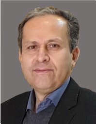 Fariborz Masoudi合作论文数Faculty of Earth Sciences, Shahid Beheshti University3
 Farhad Ehya合作论文数3Mohammad Reza Jafari合作论文数2Mansour Vosoughi Abedini合作论文数2Mehrdad Behzadi合作论文数2bokharaei somaye合作论文数2
 Behnam Sadeghi合作论文数2mona sojdehee合作论文数2
 Nima Nezafati合作论文数Dept Archaeomet, German Min Museum2
 Mohammad Maanijou合作论文数Corresponding author.2Mostafa Esmaeili-Vardanjani合作论文数2
 Morteza Momenzadeh合作论文数2
 Kaveh Pazand合作论文数Department of Mining Engineering, Science and Research Branch, Islamic Azad University2Ahmad Khakzad合作论文数2Mehrdad Barati合作论文数1
 Somayeh Samiee合作论文数1
 Mansour Adelpour合作论文数1seyed saeed Mohammadi合作论文数1
 Zahra Noorian Ramsheh合作论文数1
 Akram Ostadhosseini合作论文数1
 Mansour Ghorbani合作论文数1a r mazloumi bajestani合作论文数1
 Nasser Madani合作论文数School of Mining and Geosciences, Nazarbayev University1
 Nakhaei Malihe合作论文数Department of Mining Engineering, Birjand University of Technology1Reyhane Lotfi合作论文数1
 Shahrokh Rajabpour合作论文数Inst Geol Econ Aplicada GEA, Univ Concepcion1Ying Ma合作论文数1Yazdi Mohammad Hossein合作论文数1
 Vahab Amiri合作论文数1
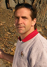 David Lentz合作论文数Department of Earth Sciences, Faculty of Science, University of New Brunswick1
 Darvishzadeh Ali合作论文数1
 Bernd Lehmann合作论文数Lagerstätten und Rohstoffe, Technische Universität Clausthal1
 Shaoyong Jiang (蒋少涌)合作论文数School of Earth Resources, China University of Geosciences1
 Ali Amiri合作论文数1
 Mohammad Hashem Emami合作论文数1
 Gregor Borg合作论文数1
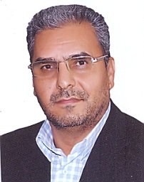 M. Farmahini Farahani合作论文数Department of Mechanical Engineering, Tarbiat Modares University1
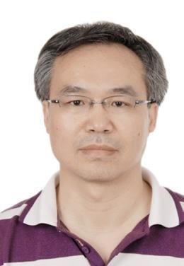 Junfeng Xiang (向俊锋)合作论文数Institute of Chemistry, Chinese Academy of Sciences1
 Hooshang Asadi合作论文数Isfahan University of Technology1N. Rashidnejad Omran合作论文数1




