In this paper, we present a first-of-its-kind method to determine clear and repeatable guidelines for single-shot camera intrinsic calibration using multiple checkerboards. With the help of a simulator, we found the position and rotation intervals that allow optimal corner detector performance. With these intervals defined, we generated thousands of multiple checkerboard poses and evaluated them using ground truth values, in order to obtain configurations that lead to accurate camera intrinsic parameters. We used these results to define guidelines to create multiple checkerboard setups. We tested and verified the robustness of the guidelines in the simulator, and additionally in the real world with cameras with different focal lengths and distortion profiles, which help generalize our findings. Finally, we used a 3D LiDAR (Light Detection and Ranging) to project and confirm the quality of the intrinsic parameters projection. We found it possible to obtain accurate intrinsic parameters for 3D applications, with at least seven checkerboard setups in a single image that follow our positioning guidelines.
In this work, we present a detailed comparison of ten different 3D LiDAR sensors for the tasks of mapping and vehicle localization, using as common reference the Normal Distributions Transform (NDT) algorithm implemented in the self-driving open source platform Autoware. LiDAR data used in this study is a subset of our LiDAR Benchmarking and Reference (LIBRE) dataset, captured independently from each sensor, from a vehicle driven on public urban roads multiple times, at different times of the day. In this study, we analyze the performance and characteristics of each LiDAR for the tasks of (1) 3D mapping including an assessment map quality based on mean map entropy, and (2) 6-DOF localization using a ground truth reference map.
Automated vehicle technology has recently become reliant on 3D LiDAR sensing for perception tasks such as mapping, localization and object detection. This has led to a rapid growth in the LiDAR manufacturing industry with several competing makers releasing new sensors regularly. With this increased variety of LiDARs, each with different properties such as number of laser emitters, resolution, field-of-view, and price tags, a more in-depth comparison of their characteristics and performance is required. This work compares 10 commonly used 3D LiDARs, establishing several metrics to assess their performance. Various outstanding issues with specific LiDARs were qualitatively identified. The accuracy and precision of individual LiDAR beams and accumulated point clouds are evaluated in a controlled environment at distances from 5 to 180 meters. Reflective targets were used to characterize intensity patterns and quantify the impact of surface reflectivity on accuracy and precision. A vehicle and pedestrian mannequin were also used as additional targets of interest. A thorough assessment of these LiDARs is given with their potential applicability for automated driving tasks. The data collected in these experiments and analysis tools are all shared openly.
In this work, we present a detailed comparison of ten different 3D LiDAR sensors, covering a range of manufacturers, models, and laser configurations, for the tasks of mapping and vehicle localization, using as common reference the Normal Distributions Transform (NDT) algorithm implemented in the self-driving open source platform Autoware. LiDAR data used in this study is a subset of our LiDAR Benchmarking and Reference (LIBRE) dataset, captured independently from each sensor, from a vehicle driven on public urban roads multiple times, at different times of the day. In this study, we analyze the performance and characteristics of each LiDAR for the tasks of (1) 3D mapping including an assessment map quality based on mean map entropy, and (2) 6-DOF localization using a ground truth reference map.
Automated driving systems (ADSs) promise a safe, comfortable and efficient driving experience. However, fatalities involving vehicles equipped with ADSs are on the rise. The full potential of ADSs cannot be realized unless the robustness of state-of-the-art is improved further. This paper discusses unsolved problems and surveys the technical aspect of automated driving. Studies regarding present challenges, high-level system architectures, emerging methodologies and core functions including localization, mapping, perception, planning, and human machine interfaces, were thoroughly reviewed. Furthermore, many state-of-the-art algorithms were implemented and compared on our own platform in a real-world driving setting. The paper concludes with an overview of available datasets and tools for ADS development.
In this work, we present a detailed comparison of ten different 3D LiDAR sensors, covering a range of manufacturers, models, and laser configurations, for the tasks of mapping and vehicle localization, using as common reference the Normal Distributions Transform (NDT) algorithm implemented in the self-driving open source platform Autoware. LiDAR data used in this study is a subset of our LiDAR Benchmarking and Reference (LIBRE) dataset, captured independently from each sensor, from a vehicle driven on public urban roads multiple times, at different times of the day. In this study, we analyze the performance and characteristics of each LiDAR for the tasks of (1) 3D mapping including an assessment map quality based on mean map entropy, and (2) 6-DOF localization using a ground truth reference map.
In this work, we present LIBRE: LiDAR Benchmarking and Reference, a first-of-its-kind dataset featuring 10 different LiDAR sensors, covering a range of manufacturers, models, and laser configurations. Data captured independently from each sensor includes three different environments and configurations: static targets, where objects were placed at known distances and measured from a fixed position within a controlled environment; adverse weather, where static obstacles were measured from a moving vehicle, captured in a weather chamber where LiDARs were exposed to different conditions (fog, rain, strong light); and finally, dynamic traffic, where dynamic objects were captured from a vehicle driven on public urban roads, multiple times at different times of the day, and including supporting sensors such as cameras, infrared imaging, and odometry devices. LIBRE will contribute to the research community to (1) provide a means for a fair comparison of currently available LiDARs, and (2) facilitate the improvement of existing self-driving vehicles and robotics-related software, in terms of development and tuning of LiDAR-based perception algorithms.
Advanced driver assistance and automated driving systems rely on risk estimation modules to predict and avoid dangerous situations. Current methods use expensive sensor setups and complex processing pipeline, limiting their availability and robustness. To address these issues, we introduce a novel deep learning based action recognition framework for classifying dangerous lane change behavior in short video clips captured by a monocular camera. We designed a deep spatiotemporal classification network that uses pre-trained state-of-the-art instance segmentation network Mask R-CNN as its spatial feature extractor for this task. The Long-Short Term Memory (LSTM) and shallower final classification layers of the proposed method were trained on a semi-naturalistic lane change dataset with annotated risk labels. A comprehensive comparison of state-of-the-art feature extractors was carried out to find the best network layout and training strategy. The best result, with a 0.937 AUC score, was obtained with the proposed network. Our code and trained models are available open-source.
Supervised learning methods for object detection on 3D lidar point cloud have recently emerged. Image-based algorithms, naively adapted to this new sensing modality, were shown to be somewhat effective. However, the data structure of point cloud differs significantly from images, and approaches taking this into consideration must be developed. In this research, we demonstrate how point sparsity, which depends on range from the lidar, complicates the training of lidar-based detection model. We use an expected point sparsity metric to filter the KITTI dataset and improve the overall quality of the training labels. We perform in-depth ablation studies which show how much an optimized training dataset can improve 3D lidar object detection models. Finally, we show that including range information directly in the network input, as a indicator for expected point sparsity, also improves detection capabilities.
Navigation in social environments, in the absence of traffic rules, is the difficult task at the core of the annual Tsukuba Challenge. In this context, a better understanding of the soft rules that influence social dynamics is key to improve robot navigation. Prior research attempts to model social behavior through microscopic interactions, but the resulting emergent behavior depends heavily on the initial conditions, in particular the macroscopic setting. As such, data-driven studies of pedestrian behavior in a fixed environment may provide key insight into this macroscopic aspect, but appropriate data is scarcely available. To support this stream of research, we release an open-source dataset of dynamic object trajectories localized in a map of 2017 Tsukuba Challenge environment. A data collection platform equipped with lidar, camera, IMU, and odometry repeatedly navigated the challenge's course, recording observations of passersby. Using a background map, we localized ourselves in the environment, removed the static background from the point cloud data, clustered the remaining points into dynamic objects and tracked their movements over time. In this work, we present the Tsukuba Challenge Dynamic Object Tracks dataset, which features nearly 10,000 trajectories of pedestrians, cyclists, and other dynamic agents, in particular autonomous robots. We provide a 3D map of the environment used as global frame for all trajectories. For each trajectory, we provide at regular time intervals an estimated position, velocity, heading, and rotational velocity, as well as bounding boxes for the objects and segmented lidar point clouds. As additional contribution, we provide a discussion which focuses on some discernible macroscopic patterns in the data.
Autonomous mobile robot navigation in real unmodified outdoor areas frequented by people on their business, children playing, fast running bicycles, and even robots, remains a difficult challenge. For eleven years, the Tsukuba Challenge Real World Robot Challenge (RWRC) has brought together robots, researchers, companies, government, and ordinary citizens, under the same outdoor space to push forward the limits of autonomous mobile robots. For the Tsukuba Challenge 2017 participation, our team proposed to study the problem of sensors-to-actuators navigation (also called End-to-End), this is, having the robot to navigate towards the destination on a complex path, not only moving straight but also turning at intersections. End-to-End (E2E) navigation was implemented using a convolutional neural network (CNN): the robot learns how to go straight, turn left, and turn right, using camera images and trajectory data. E2E network training and evaluation was performed at Nagoya University, on similar outdoor conditions to that of Tsukuba Challenge 2017 (TC2017). Even thought E2E was trained on a different environment and conditions, the robot successfully followed the designated trajectory in the TC2017 course. Learning how to follow the road no matter the environment is of the key attributes of E2E based navigation. Our E2E does not perform obstacle avoidance and can be affected by illumination and seasonal changes. Therefore, to improve safety and add fault tolerance measures, we developed an E2E navigation approach with model-based system as backup. The model-based system is based on our open source autonomous vehicle software adapted to use on a mobile robot. In this work we describe our approach, implementation, experiences and main contributions.
Automatic and Featureless Sim(3) Calibration of Planar Lidars to Egomotion Sensors Jacob Lambert Master of Applied Science Graduate Department of Aerospace Science and Engineering University of Toronto 2017 This thesis aims at generalizing the process of extrinsically calibrating two rigidly attached sensors on a mobile robot. Recent work in this area is revisited and its theory extended to the problem of recovering the Sim(3) transformation between a planar lidar and a monocular camera, where the scale of the camera trajectory is not known a priori. An efficient algorithm with only a single tuning parameter is implemented and studied. The robustness of the approach is tested on realistic simulations in multiple environments, as well as on data collected from a handheld sensor rig. Results show that, given a non-degenerate trajectory and a sufficient number of lidar measurements, the calibration procedure achieves millimetre-scale and sub-degree accuracy. Moreover, the method relaxes the need for specific scene geometry, fiducial markers, and overlapping sensor fields of view.
This paper explores the use of an entropy-based technique for point cloud reconstruction with the goal of calibrating a lidar to a sensor capable of providing egomotion information. We extend recent work in this area to the problem of recovering the Sim(3) transformation between a 2D lidar and a rigidly attached monocular camera, where the scale of the camera trajectory is not known a priori. We demonstrate the robustness of our approach on realistic simulations in multiple environments, as well as on data collected from a hand-held sensor rig. Given a non-degenerate trajectory and a sufficient number of lidar measurements, our calibration procedure achieves millimetre-scale and sub-degree accuracy. Moreover, our method relaxes the need for specific scene geometry, fiducial markers, or overlapping sensor fields of view, which had previously limited similar techniques.
Accurate and consistent ego motion estimation is a critical component of autonomous navigation. For this task, the combination of visual and inertial sensors is an inexpensive, compact, and complementary hardware suite that can be used on many types of vehicles. In this work, we compare two modern approaches to ego motion estimation: the Multi-State Constraint Kalman Filter (MSCKF) and the Sliding Window Filter (SWF). Both filters use an Inertial Measurement Unit (IMU) to estimate the motion of a vehicle and then correct this estimate with observations of salient features from a monocular camera. While the SWF estimates feature positions as part of the filter state itself, the MSCKF optimizes feature positions in a separate procedure without including them in the filter state. We present experimental characterizations and comparisons of the MSCKF and SWF on data from a moving hand-held sensor rig, as well as several traverses from the KITTI dataset. In particular, we compare the accuracy and consistency of the two filters, and analyze the effect of feature track length and feature density on the performance of each filter. In general, our results show the SWF to be more accurate and less sensitive to tuning parameters than the MSCKF. However, the MSCKF is computationally cheaper, has good consistency properties, and improves in accuracy as more features are tracked.
In the coming decade the availability of satellite data from Earth Observation (EO) platforms will exhibit a significant growth. The dataflow of the Sentinel 1-5 series will be much larger than the one of their preceding satellite missions. In addition, ESA develops a continuous series of Earth Explorer satellite missions. As geophysical validation of these EO data remains a high priority, ESA has initiated a project to develop a Generic Environment for Calibration/validation Analysis (GECA), which is considered to become the next generation validation data centre. The evolution part of GECA is in the interoperability between various validation data centres, offering several functionalities facilitating validation analysis with full traceability. One of these functions is the collocation engine which matches satellite data to correlative data and provides the option to download selected sub sets. It will also be possible to compare satellite and correlative data using ‘best practice’ analysis functions. Figure 1. Example of GOMOS ozone profile validation results in an intercomparison with ground-based lidar data (picture credits: RIVM). Similar results can be found in [1].
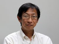 Kazuya Takeda合作论文数Green Mobility Collaborative Research Center, Nagoya University10
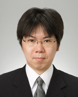 Eijiro Takeuchi合作论文数Nagoya University8
 Alexander Carballo合作论文数Department of Electrical, Electronic and Computer Engineering, Faculty of Engineering, Gifu University;Institutes of Innovation for Future Society, Nagoya University8
 Patiphon Narksri合作论文数Grad Sch Informat, Nagoya Univ7
 David Wong合作论文数Grad Sch Informat Sci, Nagoya Univ5
 Kato Shinpei (加藤真平)合作论文数TIER IV;Graduate School of Information Science and Technology, University of Tokyo5
 Abraham Monrroy合作论文数4
 Yuki Kitsukawa合作论文数Nagoya University4
 Lee Clement合作论文数University of Toronto3
 Jonathan Kelly合作论文数Institute for Aerospace Studies, University of Toronto3
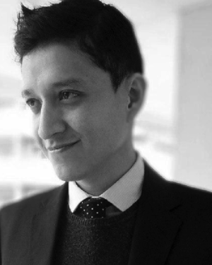 Abraham Monrroy Cano合作论文数2
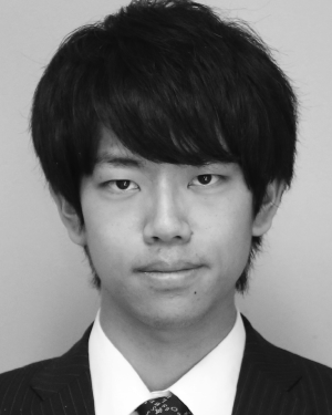 Shunya Seiya合作论文数2
 Ekim Yurtsever合作论文数2
 Matthew Giamou合作论文数University of Toronto2
 Luis Yoichi Morales Saiki合作论文数Nagoya University,Institute of Innovation for Future Society2
 Naoki Akai (赤井直紀)合作论文数Nagoya University2Sander Niemeijer合作论文数1Yasjka Meijer合作论文数1
 Hatem Darweesh合作论文数Grad Sch Informat, Nagoya Univ1
 Yongkang Liu合作论文数Toyota North America R&D Labs1
 John H. L. Hansen合作论文数Department of Electrical Engineering, Erik Jonsson School of Engineering and Computer Science, The University of Texas at Dallas;Center for Robust Speech Systems, The University of Texas at Dallas;Department of Electrical and Computer Engineering, University of Colorado at Boulder1
 Chiyomi Miyajima (宮島千代美)合作论文数Department of Information Systems, School of Informatics, Daido University1
 Rob Koopman合作论文数ESRIN, ESA1Gary K. Corlett合作论文数1Ankie Piters合作论文数1
 Thorsten Fehr合作论文数European Space Research Institute;European Space Agency1
 Masato Edahiro合作论文数nagoya university1
 Valentin Peretroukhin合作论文数University of Toronto1




